Why Churchill Island Marine National Park stands out
The marine park is best known for its exceptional significance as a migratory bird habitat within the East Asian-Australasian Flyway. The sheltered waters and intertidal mudflats of Western Port provide crucial feeding and roosting sites for whimbrels and bar-tailed godwits during their annual migrations. The extensive seagrass meadows that dominate the marine park's seabed support one of the most productive and biodiverse marine ecosystems in Victoria, serving as important foraging grounds for black swans and acting as nursery areas for many commercially and ecologically significant fish species.
Churchill Island Marine National Park history and protected-area timeline
Churchill Island Marine National Park was established on 16 November 2002 as part of Victoria's expanding network of marine protected areas. The creation of this marine park reflected a growing recognition of the ecological importance of Western Port's coastal waters and the need to protect critical habitats within the bay. The establishment came during a period when Victoria was developing its marine protected area system under the National Parks Act, with several new marine national parks being declared to represent the diversity of Victoria's marine environments. Western Port had already gained international recognition through its Ramsar designation, which highlighted the significance of its wetland and shallow water habitats for migratory birds and marine life. The marine park status provided additional regulatory protections for the waters surrounding Churchill Island, complementing the terrestrial conservation values already present on the island itself.
Churchill Island Marine National Park landscape and geographic character
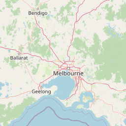
The marine park occupies a distinctive position within Western Port, a large shallow bay on Victoria's southern coast characterized by gentle tidal ranges and extensive shallow subtidal areas. The seabed within the park is dominated by seagrass meadows, primarily Posidonia and Zostera species, which create extensive underwater meadows across the gently sloping coastal margin. The coastline alternates between sandy beaches and rocky sections, with Churchill Island itself being a low-lying island with limited elevation. The waters of Western Port are relatively sheltered from open ocean swells due to the surrounding landforms, creating calm conditions that support the seagrass communities and allow for the accumulation of fine sediments that form the mudflats important for wading birds. The park's landscape is one of subtle transitions between land and sea, with tidal influences exposing wide areas of seabed during low tide and submerging them during high tide, creating a dynamic and ever-changing visual character.
Churchill Island Marine National Park ecosystems, habitats, and plant life
The marine park protects one of Victoria's most important seagrass-dominated marine environments. Seagrass meadows form the structural and ecological foundation of this marine ecosystem, providing habitat, food, and shelter for an extraordinary diversity of marine organisms. The seagrass beds support dense communities of invertebrates that in turn feed fish, birds, and marine mammals. The water column above the seagrass harbors numerous fish species that use the meadows as nursery areas, while the surface waters provide foraging territory for black swans that feed on seagrass and associated aquatic vegetation. The intertidal mudflats and sandflats become exposed at low tide, creating extensive feeding areas for shorebirds that probe the soft sediments for invertebrates. The combination of protected bay waters, extensive seagrass, and productive intertidal zones makes this one of the most ecologically significant marine areas in Victoria's coastal estate.
Churchill Island Marine National Park wildlife and species highlights
The wildlife of Churchill Island Marine National Park is characterized by the presence of both resident species and seasonal visitors, particularly migratory birds that transform the area during their passage. The marine park is internationally recognized for its importance to migratory waders, with whimbrels and bar-tailed godwits being the most notable species that use the area as a stopover or destination during their migrations along the East Asian-Australasian Flyway. These birds travel enormous distances between their breeding grounds in the northern hemisphere and southern hemisphere wintering areas, relying on coastal wetlands like Western Port for rest and refueling. Black swans are a prominent resident bird species, grazing on seagrass meadows and using the sheltered waters as breeding and feeding habitat. The fish community within the marine park is diverse, with many species utilizing the seagrass habitats as nursery grounds. The protected waters also support various seabirds that forage in the bay, and the broader Western Port ecosystem includes dolphins and seals that occasionally venture into the area.
Churchill Island Marine National Park conservation status and protection priorities
The conservation significance of Churchill Island Marine National Park stems from its inclusion in the Western Port Ramsar site, which obligates Australia to maintain the ecological character of this wetland system under the Ramsar Convention. The marine park status provides statutory protection for the marine environment, regulating activities that could otherwise degrade water quality, disturb wildlife, or damage seagrass habitats. The protection of seagrass meadows is particularly important given their sensitivity to water quality changes and their critical role in supporting marine biodiversity. The marine park also contributes to Victoria's marine protected area network, ensuring that representative examples of the state's marine environments are preserved for conservation purposes. The migratory bird values have driven international attention on Western Port, as species like whimbrels and bar-tailed godwits depend on this coastline as part of a chain of coastal wetlands stretching from Australia to Arctic breeding grounds.
Top sights and standout views in Churchill Island Marine National Park
Churchill Island Marine National Park stands out for its dual significance as a Ramsar-listed wetland and a Victorian marine national park. The marine park protects critical seagrass habitats that support black swans and diverse fish communities within Western Port. It serves as a vital stopover and wintering site for migratory shorebirds, particularly whimbrels and bar-tailed godwits traveling the East Asian-Australasian Flyway. The park encompasses the coastal waters around Churchill Island, connecting to Phillip Island via a bridge and creating a seamless marine protected area along this distinctive stretch of Victoria's coast.
Best time to visit Churchill Island Marine National Park
The marine park can be appreciated throughout the year, though the experience varies with the seasons. Migratory waders are most abundant during the southern hemisphere spring and summer months from approximately September to March, when whimbrels and bar-tailed godwits are present in the bay. Birdwatching opportunities are enhanced during low tide when the intertidal mudflats become exposed and birds concentrate in the feeding areas. The summer months generally offer warmer conditions for boat-based exploration of the marine park area. Winter brings different bird species to the bay and can offer rewarding wildlife viewing, though conditions may be cooler. The seagrass meadows and underwater environment remain a constant presence regardless of season, though water clarity can vary with weather conditions.