
Waterfalls
Park geography
Detailed terrain analysis including plateau elevations, stream systems, and geological features.
Geographic Profile and Mapped Boundaries of Coolah Tops National Park in New South Wales
Examine the structured geography of Coolah Tops National Park, an upland protected area spanning over 162 square kilometers in New South Wales. This profile details the park boundary span, river systems, and documented natural landmarks, including waterfalls, peaks, and forest-covered plateaus across the regional landscape.
Related tags
Greater glider habitatEucalyptus forestWaterfallsLiverpool RangePlateau landscape
Elevated forest wilderness on the Liverpool Range
Coolah Tops National Park
Coolah Tops National Park is a protected wilderness area in northern New South Wales, Australia, situated on the Liverpool Range approximately 258 kilometres northwest of Sydney and 30 kilometres east of the town of Coolah. The park occupies a dissected plateau environment characterized by steep escarpments, cascading waterfalls, and extensive forested slopes that contrast sharply with the surrounding Liverpool Plains below. Established on 5 July 1996 under the management of the New South Wales National Parks and Wildlife Service, the park represents a significant conservation area within the region, protecting a diverse array of Australian temperate forest ecosystems and providing habitat for several notable species, including one of the largest populations of greater gliders in the country. The park's elevated position offers sweeping panoramic views across the plains, while its deep valleys and remote character create a distinctive highland wilderness experience distinct from the more commonly visited coastal and sub-alpine reserves of eastern Australia.
- Location
- Australia
- Park type
- National park
- Established
- 1996
Location overview
Regional boundaries and country relationships within the Australian landscape
Coolah Tops National Park Geographic Location and Regional Setting
Coolah Tops National Park is situated within the state of New South Wales in Australia. Understanding these regional memberships helps establish its place in the national conservation network.
- Countries
- Australia
- Regions
- New South Wales
- Primary location
- New South Wales
Boundary and coordinates
Spatial limits and geographic footprint spanning 162 square kilometers
Mapped Boundaries and Geographic Extent of Coolah Tops National Park
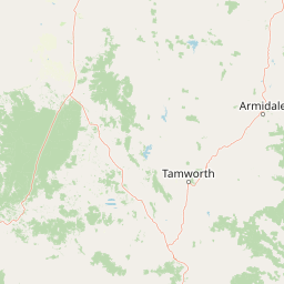
Mapped boundary lines display the spatial layout and protected limits of Coolah Tops National Park. Accompanying data highlights the estimated area of 162.433 square kilometers along with calculated coordinates and geographic spans.
- Boundary area
- 162.4 km²
- Boundary perimeter
- 146.2 km
- Northernmost point
- 31.6672° S
- Southernmost point
- 31.8643° S
- Easternmost point
- 150.2724° E
- Westernmost point
- 149.9758° E
- Geographic centre
- 31.7601° S, 150.095° E
- North–south span
- 21.9 km
- East–west span
- 28.1 km
Terrain and natural features
Upland terrain classifications and recorded natural features
Coolah Tops National Park Terrain and Named Natural Features
Upland terrain classifications and mountain park designations define the protected landscape geography. Recorded natural feature cards detail streams, waterfalls, and peaks located within the boundaries.
Selected named natural features
Streams
Lorimer Creek
Streams
Werieds Nook Gully
Waterfalls
Coxs Creek Falls
Streams
Branch Creek
Streams
Half Moon Creek
Environmental setting
Upland terrain, temperate forests, and major water features across the protected landscape
Coolah Tops National Park Environmental Classification and Physical Setting Atlas
Recorded landscape features, habitat types, and relief classifications provide complementary ways to read the physical setting of Coolah Tops National Park. Individual categories connect directly to related protected area records and atlas destinations throughout the region.
- Relief
- Upland
- Water
- Major water bodies
- Forest cover
- Partial forest
Landscape features
Mountains · Plateau · Cliffs · Forest · Grassland · Rivers · Waterfalls
Habitat types
Temperate broadleaf forest · Grassland
Park atlas
Discover adjacent protected landscapes and trace geographic connections beyond Coolah Tops' unique plateau environment.
Explore Related National Parks and Protected Areas Near Coolah Tops National Park
After exploring Coolah Tops National Park, continue your discovery of national parks and protected areas throughout New South Wales. Compare diverse regional landscapes, conservation priorities, and geographic features to gain broader context on Australia's inland protected lands.
National parkNew South Wales
22 km away#1 closest
South

Towarri National Park: A Mapped Protected Area within New South Wales Geography
Explore its geographic boundaries and landscape context.
Towarri National Park serves as a vital protected area, offering distinct insights into the regional geography of New South Wales. This entry focuses on its mapped boundaries and protected landscape characteristics, providing a structured point for atlas-based discovery and geographic understanding of this Australian national park. Examine its unique position within the broader natural terrain.
- Area
- 36.39 km²
- Established
- 1998
- IUCN
- II
- Access
- Access unknown
National parkNew South Wales
37 km away#2 closest
South
Goulburn River National Park: New South Wales National Park with River Ecosystems and Heritage
Explore mapped protected lands and regional geography.
Goulburn River National Park offers a significant protected landscape within New South Wales, Australia, celebrated for its expansive Goulburn River frontage and diverse natural terrain. This national park is pivotal for understanding regional geography, featuring sandstone geological formations and serving as a critical habitat for endangered species, including the regent honeyeater. Its extensive river corridor also protects numerous Aboriginal heritage sites, contributing a rich layer of cultural significance to its conservation value. MoriAtlas helps users explore the mapped boundaries and environmental context of this vital protected area.
- Area
- 722.96 km²
- Established
- 1983
- IUCN
- II
- Relief
- Mixed relief
National parkNew South Wales
57 km away#3 closest
South
Wollemi National Park: Mapping Australia's Protected Natural Landscape in New South Wales
Detailed geographic context and protected area exploration.
Wollemi National Park is a critical component of New South Wales' protected natural areas, offering rich opportunities for geographic discovery. This national park provides a distinct focus for understanding the mapped terrain and regional landscape context of Australia. Explore its position within New South Wales, uncovering the details that define its unique protected status and natural geography for dedicated atlas exploration.
- Area
- 5,017.03 km²
- Established
- 1979
- IUCN
- Ib
- Relief
- Mountain
National parkNew South Wales
69 km away#4 closest
Northwest
Garrawilla National Park: New South Wales Protected Woodland Ecosystems & Regional Geography
Explore mapped boundaries and native vegetation in this inland Australian national park.
Garrawilla National Park represents a significant protected landscape in New South Wales, Australia, dedicated to conserving semi-arid woodland terrain and characteristic native grass communities. Established to safeguard these vital ecosystems, the park offers insights into the natural heritage of the Central West region's geography. Users can explore its specific geographic footprint and understand its contribution to the preservation of inland Australian vegetation, providing a clear picture of its protected area identity.
- Area
- 9.37 km²
- Established
- 2005
- IUCN
- II
- Scope
- Terrestrial
Nature reserveNew South Wales
About 70 km away#5 closest
South
Munghorn Gap Nature Reserve: A Detailed Atlas of Protected Sandstone Landscapes in New South Wales
Transition zone geography on the Great Dividing Range
Munghorn Gap Nature Reserve represents a unique geographic crossing point on the Great Dividing Range. This protected area features dramatic pagoda-like sandstone formations, diverse eucalypt forests, and critical bird habitats that sustain a wide range of species across a rugged and weathered mountain landscape.
- Area
- 59.34 km²
- Established
- 1961
- IUCN
- Ia
- Relief
- Mountain
National parkAustralia
About 83 km away#6 closest
Southwest
Yarrobil National Park: Australia's Protected Landscape for Geographic Discovery
Explore its national park designation and mapped regional context.
Yarrobil National Park stands as a distinct protected landscape within Australia, identified as a national park. Its geographic significance lies in its contribution to the nation's atlas of conservation areas. This page focuses on providing a clear understanding of the park's identity, its environmental setting, and how its mapped boundaries fit into the broader regional geography of Australia, enabling structured exploration for enthusiasts of protected areas and natural landscapes.
- Area
- 13.22 km²
- Established
- 2005
- IUCN
- II
- Relief
- Upland
National parkOrana
93 km away#7 closest
Northwest
Warrumbungle National Park: Detailed National Park Protected Landscape Atlas Entry
Mapped geography and protected boundaries within Orana, Australia.
Warrumbungle National Park is an Australian national park that serves as a prime example of a protected landscape for atlas-based geographic exploration. This entry provides detailed context on its mapped boundaries and regional terrain, anchoring it within the Orana area. Users can engage with its specific geographic identity, understanding its role as a distinct natural area within Australia's broader conservation atlas and mapped park network.
- Area
- 233.11 km²
- Established
- 1953
- IUCN
- II
- Visitors
- 35K annual
National parkNew South Wales
94 km away#8 closest
East
Ben Halls Gap National Park: Ancient Eucalyptus Forest Protected Landscape in New South Wales
Explore mapped boundaries of old-growth woodland terrain.
Ben Halls Gap National Park represents an ecologically vital strict nature reserve within New South Wales, Australia. It is distinguished by its extensive ancient eucalyptus forests, which are among the most ecologically significant old-growth woodland environments in eastern Australia. Managed primarily for conservation and research, the park's rugged terrain provides a critical habitat refuge and a key reference ecosystem for understanding undisturbed woodland dynamics and biodiversity.
- Area
- 30.18 km²
- Established
- 1995
- IUCN
- Ia
- Scope
- Terrestrial
MoriAtlas Explorer
Continue Exploring Coolah Tops National Park's Protected Landscape and Regional Geography
Deepen your understanding of Coolah Tops National Park's unique geographic setting and its significance as a protected landscape. Examine its position within New South Wales and discover the mapped features and ecological context that define this important conservation area. Further exploration reveals the distinct atlas value of this highland wilderness and its role in regional protected lands.
Browse next
Global natural geography
Explore related park routes
Explore MoriAtlas Global ParksBrowse All MoriAtlas ParksGlobal Park Map DiscoveryMoriAtlas: Browse All CountriesBrowse All MoriAtlas ContinentsNational Park Environment AtlasGrand Canyon National Park AtlasYellowstone National Park AtlasYosemite National Park Atlas and GeographySerengeti National Park AtlasGalápagos National Park Protected LandscapeBanff National Park Geography and AtlasKruger National Park Atlas EntryUluṟu-Kata Tjuṯa National Park AtlasExplore Uluru-Kata Tjuta National Park GeographyPlitvice Lakes National Park AtlasFiordland National Park Protected LandscapeGreat Smoky Mountains National Park AtlasAfghanistan National Parks and Protected AreasAlbania National Parks and Protected AreasAlgeria National Parks and Protected AreasAmerican Samoa National Parks and Protected AreasAndorra National Parks and Protected AreasAngola National Parks and Protected AreasAntarctica National Parks and Protected AreasAntigua and Barbuda Park List