Mori Atlas logo
National parkCozia National Park

Atlas exploration of Romania's protected areas and natural terrain.

Cozia National Park: Mapped Protected Landscape in Vâlcea County, Romania

(Parcul Național Cozia)

Cozia National Park represents a significant protected landscape within Vâlcea County, Romania. As a national park, its mapped boundaries and geographic setting offer a valuable point of study for understanding the region's natural terrain. MoriAtlas provides tools to explore the park's context within the broader Romanian atlas, highlighting its role as a key protected area for geographic discovery.

Karst LandscapeOld-Growth ForestsSouthern CarpathiansPrimeval Beech ForestsMountain ConservationNatura 2000
Stylized illustration of a mountainous landscape with waterfall, river, forested hills, and a paraglider in the sky

Cozia National Park

National park

Park overview

Structured park overview, official facts, and landscape profile for Cozia National Park

Cozia National Park park facts, protected area profile, and essential visitor context
Review the core facts for Cozia National Park, including designation, size, terrain, visitor scale, habitats, and operating context in one park-focused overview.

About Cozia National Park

Cozia National Park represents a mountainous protected area of substantial geological and ecological significance within the Southern Carpathians of Romania. The park spans the administrative territories of several localities including Brezoi, Călimănești, Racovița, Perișani, Sălătrucel, and Berislăvești, all within Vâlcea County. The landscape is dominated by the Cozia Massif, a prominent mountain formation that rises prominently above the Olt River valley, creating dramatic scenery characterized by steep limestone cliffs, deep gorges, and distinctive karst formations. The park occupies a transition zone between the southeastern Lotru Mountains and the eastern Căpățânii Mountains, positioning it at a biogeographically important junction within the Carpathian range. Beyond its natural values, the park region contains significant cultural heritage including the Cozia Monastery, a medieval religious complex dating to the 14th century, and numerous other historical churches and archaeological sites scattered throughout the surrounding area. The protected area was formally established through Law Number 5 of March 2000, with its boundaries subsequently clarified through government decisions in 2003, and it functions as both a nature preserve and a landscape of historical importance to the region.

Quick facts and research context for Cozia National Park

Cozia National Park covers 17,100 hectares in Vâlcea County, Romania, within the Southern Carpathians mountain range. The park was proposed in 1966 and formally designated in 2000, protecting a landscape of karst peaks, limestone ridges, caves, and river valleys. It lies along the middle course of the Olt River and includes portions of the Lotru Mountains, Căpățânii Mountains, and Cozia Massif. The park contains multiple Natura 2000 habitat types and was recognized in 2017 when two old-growth forests were inscribed as part of the Primeval Beech Forests of the Carpathians and Other Regions of Europe UNESCO World Heritage site.

Park context

Deeper park guide and search-rich context for Cozia National Park

Cozia National Park history, landscape, wildlife, and travel context
Explore Cozia National Park through its history, landscape character, ecosystems, wildlife, conservation priorities, cultural context, and seasonal travel timing in a structured park guide built for atlas discovery and search intent.

Why Cozia National Park stands out

Cozia National Park is best known for its dramatic karst landscape featuring sharp peaks, tower karst, and needle karst formations that create a distinctive mountainous silhouette. The park protects extensive old-growth beech forests that achieved international recognition in 2017 when they were inscribed into the Primeval Beech Forests of the Carpathians and Other Regions of Europe World Heritage site. The Cozia Massif itself forms a central geological landmark, while the Olt River corridor provides additional landscape diversity. The combination of geological significance, primeval forest preservation, and the presence of major Carpathian wildlife species including brown bear, wolf, and Eurasian lynx establishes the park as a notable conservation area within Romania's protected area network.

A paraglider in flight over a mountainous landscape with rocky peaks, green valleys, and a blue sky with scattered clouds
Paraglider flying over mountainous landscape of Cozia National Park

Cozia National Park history and protected-area timeline

The formal protection history of Cozia National Park began with an initial proposal in 1966, making it one of the earlier conservation concepts considered within Romania's post-war protected area planning. However, the legal designation as a national park came nearly three decades later through Law Number 5 of March 6, 2000, which was published in the Romanian Official Paper on April 12, 2000. This legislation formally established the park and defined its protected status within Romania's system of natural protected areas. In 2003, Government Decision 230 of March 4 further clarified and restabilished the park's boundaries and total area, completing the institutional framework for its management. The park's conservation significance received international recognition in 2017 when two old-growth forest areas within the park were inscribed as component sites of the Primeval Beech Forests of the Carpathians and Other Regions of Europe, a transboundary World Heritage site spanning multiple European countries. This designation acknowledged the exceptional ecological value of the park's ancient beech forests and their role in preserving Carpathian biodiversity.

Cozia National Park landscape and geographic character

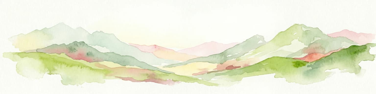
The landscape of Cozia National Park is defined by dramatic karst topography set within the broader context of the Southern Carpathians. The terrain features sharp peaks, tower karst formations, needle karst structures, and limestone ridges that create a rugged and visually distinctive mountain environment. The park encompasses the Cozia Massif as its central geological feature, a mountain block that rises prominently above the surrounding terrain. Deep gorges cut through the limestone, while numerous caves provide additional geological interest. The Olt River flows through the middle portion of the park, creating a river corridor that adds valley landscapes to the otherwise mountainous terrain. The combination of forested slopes, meadow areas, and grassland creates visual diversity across the park's extent. The karst landscape is particularly significant geologically, with the limestone formations supporting specialized habitats and contributing to the park's overall geological diversity.

Cozia National Park ecosystems, habitats, and plant life

The ecological character of Cozia National Park reflects the diversity of habitats found within the Southern Carpathians. The park contains an exceptional range of habitat types protected under European conservation frameworks, including alluvial forests dominated by alder and ash, Dacian beech forests of various types, oak-hornbeam forests, steep slope forests of lime and maple, acidophilic spruce forests of the montane zone, alpine and boreal shrublands, boreal and alpine meadows on siliceous substrate, species-rich montane Nardus meadows, riverbank herbaceous vegetation, and calcareous rock slopes with specialized chasmophytic plant communities. This habitat diversity supports a correspondingly rich flora and fauna. The park is part of the Cozia Natura 2000 site, designated under the European Union's Habitats Directive to protect significant species and habitats. In 2017, two old-growth forest areas within the park were inscribed into the Primeval Beech Forests of the Carpathians and Other Regions of Europe World Heritage site, acknowledging the outstanding universal value of these ancient forest ecosystems.

Cozia National Park wildlife and species highlights

Cozia National Park supports significant wildlife populations characteristic of the Southern Carpathians, with the park's diverse habitats providing refuge for numerous species. The mammal fauna includes several large carnivores that define the Carpathian ecosystem: brown bear, wolf, and Eurasian lynx, all species of major conservation concern in Europe. Bats are also represented, including the common myotis, greater horseshoe bat, and barbastelle, the latter being a species particularly associated with old forest habitats. The park supports amphibian populations including the yellow-bellied toad and great crested newt, both protected under European law. Fish species present include the southern barbel, bullhead, and Danube spiny loach, each adapted to the park's riverine environments. The invertebrate fauna is particularly notable, featuring species such as the stag beetle, the great oak longhorn beetle, and Morimus funereus, a species associated with ancient deciduous forests. An endemic cricket species, Isophya harzi, is specifically associated with the Cozia area, highlighting the park's importance for specialized and localized biodiversity.

Cozia National Park conservation status and protection priorities

Cozia National Park serves as a critical conservation area within Romania's protected areas network and the broader Carpathian ecological corridor. The park's inclusion in the Natura 2000 network connects it to Europe'span-European conservation framework, providing additional protection under the EU Habitats Directive. The 2017 inscription of two old-growth beech forest areas into the Primeval Beech Forests of the Carpathians and Other Regions of Europe World Heritage site represents the park's most significant international conservation recognition, acknowledging these forests as having outstanding universal value. These ancient beech forests exemplify ecological processes of forest dynamics and provide habitat for specialized species. The park also protects the Pădurea Călinești-Brezoi natural reservation, a 200-hectare area of geomorphological, floristic, and landscape importance known for its Brezoi conglomerates. Multiple habitat types within the park are of Community importance under European conservation policy, reflecting the area's role in maintaining Carpathian biodiversity.

Cozia National Park cultural meaning and human context

The Cozia National Park region contains meaningful cultural heritage that intertwines with the natural landscape. The Cozia Monastery, located in Căciulata and dating to the 14th century, represents the most significant historical site within the broader park area. This medieval monastery complex, dedicated to the Holy Trinity, is recognized as a historical monument and exemplifies the long human presence in this mountain landscape. The Turnu Monastery in Păușa, constructed during the 15th and 16th centuries, and the Ostrov Monastery church in Călimănești from 1520-1521 further illustrate the region's religious heritage. Several historic churches constructed between the 15th and 19th centuries are found throughout the surrounding area, including the All Saints church in Proieni and the St. Nicholas church in Racovița. Archaeological sites near Racovița include a Roman castrum from the 2nd-3rd century and Bronze Age settlements, while the Rădăcinești area contains Roman thermae and additional archaeological remains. The cultural layer demonstrates centuries of human presence in this mountain valley region, with religious establishments often positioned in visually prominent or ecologically distinct locations.

Top sights and standout views in Cozia National Park

The highlights of Cozia National Park center on its combination of dramatic karst scenery, primeval forest preservation, and significant biodiversity. The Cozia Massif provides a striking visual anchor, while the karst landscape with its peaks, towers, and caves offers geological interest. The old-growth beech forests, now part of a World Heritage site, represent exceptional ecological value and provide habitat for species dependent on ancient forest conditions. Large mammals including brown bear, wolf, and lynx roam the park's forested slopes, maintaining the ecological character of the Carpathian mountain ecosystem. The Olt River corridor adds landscape diversity and supports riverine habitats. The presence of the endemic cricket Isophya harzi demonstrates the park's importance for localized biodiversity. Cultural heritage sites including medieval monasteries and churches add historical depth to the visitor experience.

Best time to visit Cozia National Park

The best time to visit Cozia National Park depends on the type of experience sought. The summer months of June through August offer the most accessible conditions for hiking and exploring the park's trails, with warm temperatures and full vegetation creating vibrant landscape colors. Autumn brings the opportunity to witness the park's beech forests in their fall coloration, a particularly striking sight given the trees' primeval character. Spring allows observation of the park's flora as flowering plants bloom across meadows and forest clearings. Winter visits offer a different perspective of the karst landscape, though trail conditions may be more challenging. The park can be accessed via National Road DN7 connecting Râmnicu Vâlcea to Tălmaciu, with the nearest urban center being Brezoi. The surrounding area also offers spa and wellness facilities at Călimănești-Căciulata, allowing visitors to combine nature exploration with relaxation activities.

Park location guide

Geography guide, regional context, and park location map for Cozia National Park

Cozia National Park park geography, regions, and map view in Romania
Understand where Cozia National Park sits in Romania through a broader geographic reading of the surrounding landscape, nearby location context, and its mapped position within the national park landscape.

How Cozia National Park fits into Romania

Romania is a unitary semi-presidential republic located in Southeast and Central Europe. It borders Ukraine, Hungary, Serbia, Bulgaria, Moldova, and the Black Sea. The country has a population of approximately 19 million and covers an area of 238,397 km². Bucharest is the capital and largest city. Romania joined the European Union in 2007.

Wider geography shaping Cozia National Park in Romania

Romania lies on the lower course of the Danube River, north of the Balkan Peninsula, and on the northwestern shore of the Black Sea. The terrain is varied, featuring the Carpathian Mountains in the center, the Transylvanian Plateau, the Moldavian Plateau, and plains along the Danube and in the south. The country has a diverse landscape that includes forests, meadows, and wetland areas.

Map view of Cozia National Park

Use this park location map to pinpoint Cozia National Park in Romania, understand its exact geographic position, and read its mapped placement within the surrounding landscape more clearly.

Pigeon | © OpenStreetMap contributors

Location context for Cozia National Park

Vâlcea County

Detailed views of its distinctive karst topography, World Heritage beech forests, and diverse natural habitats.

Cozia National Park Imagery: Explore its Mountainous Karst Landscapes and Primeval Forests
Explore the visual character of Cozia National Park through a curated collection of imagery, showcasing its dramatic karst landscapes, towering peaks, and extensive old-growth beech forests. These photographs offer valuable insight into the park's unique topography, diverse habitats, and overall protected-area environment within Romania's Southern Carpathians.

A paraglider in flight over a mountainous landscape with rocky peaks, green valleys, and a blue sky with scattered clouds

River with bridge spanning across it, surrounded by green hills and trees under a partly cloudy sky

Park atlas

Compare protected areas across Vâlcea County and the Southern Carpathians, expanding from Cozia National Park's dramatic karst terrain.

Explore National Parks Near Cozia National Park, Tracing Carpathian Protected Landscapes
Continue your exploration of Romanian protected areas by browsing national parks and reserves situated near Cozia National Park, covering diverse mountain and forest landscapes within Vâlcea County and the Southern Carpathians. Compare the karst topography, primeval beech forests, and river valleys of adjacent conservation landscapes, gaining a wider understanding of regional protected geography.
National parkVâlcea County

Buila-Vânturarița National Park: Romania's National Park in Vâlcea County Geography

Mapped protected landscape within Vâlcea County.

Delve into the specifics of Buila-Vânturarița National Park, a designated national park in Vâlcea County, Romania. This detailed entry focuses on its protected landscape identity and geographic placement, offering precise mapped boundary information relevant for atlas exploration. Understand how this national park contributes to the regional geography and protected area network, providing a foundational element for structured discovery of Romania's natural environments.

Area
41.86 km²
Established
2005
IUCN
II
Relief
Mountain
Watercolor illustration of a landscape with mountains, trees, and a river
Protected landscapeSibiu County

Cindrel Natural Park: Protected Landscape within Sibiu County's Regional Geography

Mapped natural landscapes and protected area context.

Delve into the protected landscape of Cindrel Natural Park, situated in Sibiu County, Romania. This page offers a detailed geographic perspective, highlighting the park's mapped boundaries and its role within the broader natural terrain of the Southern Carpathians. Understand the structured atlas data that defines Cindrel Natural Park and its regional significance for protected land discovery.

Area
98.73 km²
Established
2000
IUCN
V
Relief
Mountain
Protected landscapeSibiu County

Dumbrava Sibiului Natural Park: Protected Landscape Atlas and Geographic Discovery

Explore the mapped natural terrain and regional context.

Dumbrava Sibiului Natural Park is a designated protected landscape offering a unique lens into Romania's natural geography. This entry provides detailed atlas-level information on the park's protected boundaries and its setting within Sibiu County, part of the historic Transylvania region. Understand the park's landscape character and its role in the regional geography through structured map data.

Area
9.93 km²
Established
2000
IUCN
V
Relief
Lowland
National parkGorj County

Defileul Jiului National Park: Romania's Protected National Park Landscape in Gorj County

Explore maps, geography, and protected area context.

Defileul Jiului National Park is a vital protected natural area situated in Gorj County, Romania. This MoriAtlas page serves as a detailed entry point for understanding the park's specific geography, its mapped perimeters, and its significance within the regional landscape atlas. Discover the park's topographic features and its relationship to the surrounding terrain of the Southern Carpathians, providing essential context for geographic exploration.

Area
111.27 km²
Established
2005
IUCN
II
Relief
Mountain
National park

Piatra Craiului National Park: Protected Landscape Atlas and Geographic Context

Explore Romania's unique national park and its mapped terrain.

Navigate the protected geography of Piatra Craiului National Park, a key national park entity. This page details its mapped boundaries and situates its natural landscape within Romania's regional geography, offering a structured point of discovery for geographic atlas enthusiasts. Understand the park's identity as a protected natural area and its contribution to the mapped terrain of the region.

Area
147.66 km²
Established
2000
IUCN
II
Relief
Mountain
Protected landscapeHunedoara County

Grădiștea Muncelului-Cioclovina Natural Park: Protected Landscape in Hunedoara County Atlas

Explore protected area geography and mapped boundaries.

Gain a structured understanding of Grădiștea Muncelului-Cioclovina Natural Park, a significant protected landscape located in Romania's Hunedoara County. This resource details its geographic position and mapped protected area extent, providing essential context for atlas exploration and regional landscape analysis. It serves as a focused entry point for understanding the park's unique geographic identity within its natural setting.

Area
381.84 km²
Established
2000
IUCN
V
Relief
Mountain
Protected landscape

Bucegi Natural Park: Protected Landscape Mapping and Regional Geographic Overview

Explore its mapped boundaries and natural terrain.

As a protected landscape in Romania, Bucegi Natural Park offers a distinct focus for geographic study and atlas exploration. This detail page provides access to its mapped protected boundaries, helping users understand its specific location and regional context. Discover how this natural area contributes to the broader understanding of protected lands within the national geography. MoriAtlas enables a clear view of Bucegi Natural Park's landscape characteristics and its place within a mapped system of natural reserves.

Area
0.327 km²
Established
2000
IUCN
V
Relief
Mountain
Watercolor illustration of a mountain range with forests, a lake, and distant hills under a light sky
National parkHunedoara County

Retezat National Park National Park: Protected Landscape and Regional Geography

Mapped boundaries and landscape context in Hunedoara County.

Retezat National Park is a key protected area featured within MoriAtlas, offering structured geographic data and map-based insights. This national park's protected landscape is situated in Hunedoara County, Romania, contributing significantly to the regional topography and natural context of the Southern Carpathians. Explore its mapped boundaries and understand its role as a distinct natural entity.

Area
380.47 km²
Established
1935
IUCN
II
Relief
Mountain

Common questions about visiting, size, designation, and location context for Cozia National Park

Cozia National Park FAQs for park facts, access, geography, and protected area context
Find quick answers about Cozia National Park, including protected-area facts, park geography, trail and visitor context, and how the park fits into its surrounding country and regional landscape.
MoriAtlas Explorer

Continue Your Protected Areas Search Across the Global Atlas

Deepen your exploration by continuing the structured search for national parks and protected areas worldwide. Utilize the comprehensive filtering capabilities to compare different conservation landscapes and refine your understanding of global park geography. Discover more about the distribution and characteristics of protected natural areas.

Global natural geography