
Mori Atlas logo
Natural monumentCreux du Van et Gorges de l’Areuse

Examining the folded limestone geography and glacial landforms of the western Jura Mountains

Creux du Van et Gorges de l’Areuse: A Protected Natural Monument and Jura Landmark

(BLN-Gebiet 1004, Creux du Van et Gorges de l'Areuse)

The Creux du Van et Gorges de l’Areuse natural monument showcases an extraordinary convergence of tectonic and glacial processes within the Swiss Jura. Visitors can map the dramatic half-moon rock amphitheater of the Creux du Van alongside the deeply incised river passages of the Areuse, which cut through the limestone anticlines of Neuchâtel. This protected landscape offers a detailed look at the geological story of the region, from its karst plateaus and traditional alpine pastures to the sheer cliffs carved by ancient ice.

Jura MountainsFolded Jurariver gorgerock amphitheatergeological heritagekarst landscape
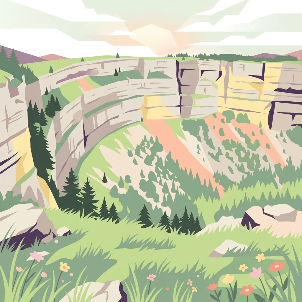
A digital illustration of a sweeping, semi-circular natural rock amphitheater with green slopes and scattered coniferous trees under a soft, light-filled sky.

Creux du Van et Gorges de l’Areuse

Natural monument

Park overview

Structured park overview, official facts, and landscape profile for Creux du Van et Gorges de l'Areuse

Creux du Van et Gorges de l'Areuse park facts, protected area profile, and essential visitor context

Review the core facts for Creux du Van et Gorges de l'Areuse, including designation, size, terrain, visitor scale, habitats, and operating context in one park-focused overview.

About Creux du Van et Gorges de l'Areuse

Creux du Van et Gorges de l'Areuse refers to a defined inventory landscape, not a single administrative park, located in the heart of the western Swiss Jura. Recognized since the early federal landscape inventories as object 1004, it spans approximately 2,121 hectares across a transition zone between the Cantons of Neuchâtel and Vaud, northwest of Lake Neuchâtel. The inventory perimeter was drawn to capture not only the two headline landmarks named in the title, but also the broader geological and ecological context that gives them meaning: the forested flanks of the Areuse valley, the broad karst summit of the Soliat, and the connecting ridges of the highest Jura chain in the region.

Geomorphologically, the site is a textbook of Folded Jura geology. The Areuse River cuts perpendicularly across the Soliat to Mont Racine anticline, slicing through layered Jurassic limestones and marls and exposing both white and brown Jurassic strata in the walls of the gorge. As the river descends from the Val de Travers near Noiraigue to its mouth at Lake Neuchâtel, it passes through a series of tight, canyon-like sections and small cascades, many of which were made accessible in the 19th century by paths and bridges that still draw visitors today. Above the valley, a much younger process played out during the Pleistocene, when a small Jura glacier exploited an already weakened section of the south flank, carved a hollow, and left behind the bowl-shaped Creux du Van, whose near-vertical walls now enclose a half-kilometer-wide arena flanked by moraines and rockfall debris.

Ecologically and culturally, the landscape is equally layered. The cliffs and surrounding rock zones host Alpine ibex, reintroduced in 1965, as well as a rich assemblage of mountain flora adapted to thin karst soils. The Soliat plateau above the amphitheater carries a traditional mosaic of small woodlands, open alpine pastures, and dry meadows divided by dry stone walls, a craftsmanship inscribed on UNESCO's list of intangible cultural heritage. The Creux du Van area was already being set aside as early as 1876, when the Club jurassien bought land from the parish of Saint-Aubin and declared it a nature reserve, one of the earliest such designations in Switzerland. The larger area has been under cantonal hunting protection since around 1960. Today the site is among the most visited natural attractions in the Jura-Trois-Lacs region, and ongoing debates about trail placement, visitor platforms, and grazing pressure have made it a touchstone for conservation discussions in the western Jura.

Quick facts and research context for Creux du Van et Gorges de l'Areuse

Creux du Van et Gorges de l'Areuse is a Swiss federal BLN landscape inventory site, registered as object 1004 under the Federal Inventory of Landscapes and Natural Monuments of National Significance. The protected area covers approximately 2,121 hectares across the Cantons of Neuchâtel and Vaud, in the western Jura northwest of Lake Neuchâtel. The site groups two principal geological landmarks, the Creux du Van rock amphitheater and the Gorges de l'Areuse, within a broader karst landscape of alpine pastures, mixed forest, and the Soliat plateau. Protection history reaches back to 1876, when the Club jurassien purchased land around the Creux du Van and declared it one of Switzerland's first nature reserves; the larger area has been under cantonal hunting ban since around 1960, and ibex were reintroduced here in 1965.

Protection and recognition

Review documented terrestrial protection metrics and official conservation status details.

Creux du Van et Gorges de l’Areuse Protection Status and Conservation Scope

Terrestrial protection status data for Creux du Van et Gorges de l’Areuse outlines the established management scope and conservation parameters. Recorded records provide structured insight into administrative frameworks governing this protected natural landscape.

Protection details

Protection scope
Terrestrial
Transboundary protection
No
Park context

Deeper park guide and search-rich context for Creux du Van et Gorges de l'Areuse

Creux du Van et Gorges de l'Areuse history, landscape, wildlife, and travel context

Explore Creux du Van et Gorges de l'Areuse through its history, landscape character, ecosystems, wildlife, conservation priorities, cultural context, and seasonal travel timing in a structured park guide built for atlas discovery and search intent.

Why Creux du Van et Gorges de l'Areuse stands out

The site is best known for two contrasting geological showpieces within a short distance of each other: the Creux du Van, a half-kilometer-wide, deeply curved rock amphitheater carved jointly by a small Jura glacier and karst weathering, and the Gorges de l'Areuse, a network of narrow river canyons and cascades that the Areuse has eroded through folded Jurassic limestone as it descends from the Val de Travers toward Lake Neuchâtel. Beyond these landmarks, the area is recognized for combining an intact Jura river landscape with high karst plateaus, traditional alpine pastures ringed by dry stone walls, and a long-documented population of reintroduced Alpine ibex. Its inclusion in the federal BLN inventory and its role as one of the first formally protected landscapes in Switzerland give the site a particular identity within Jura regional geography.
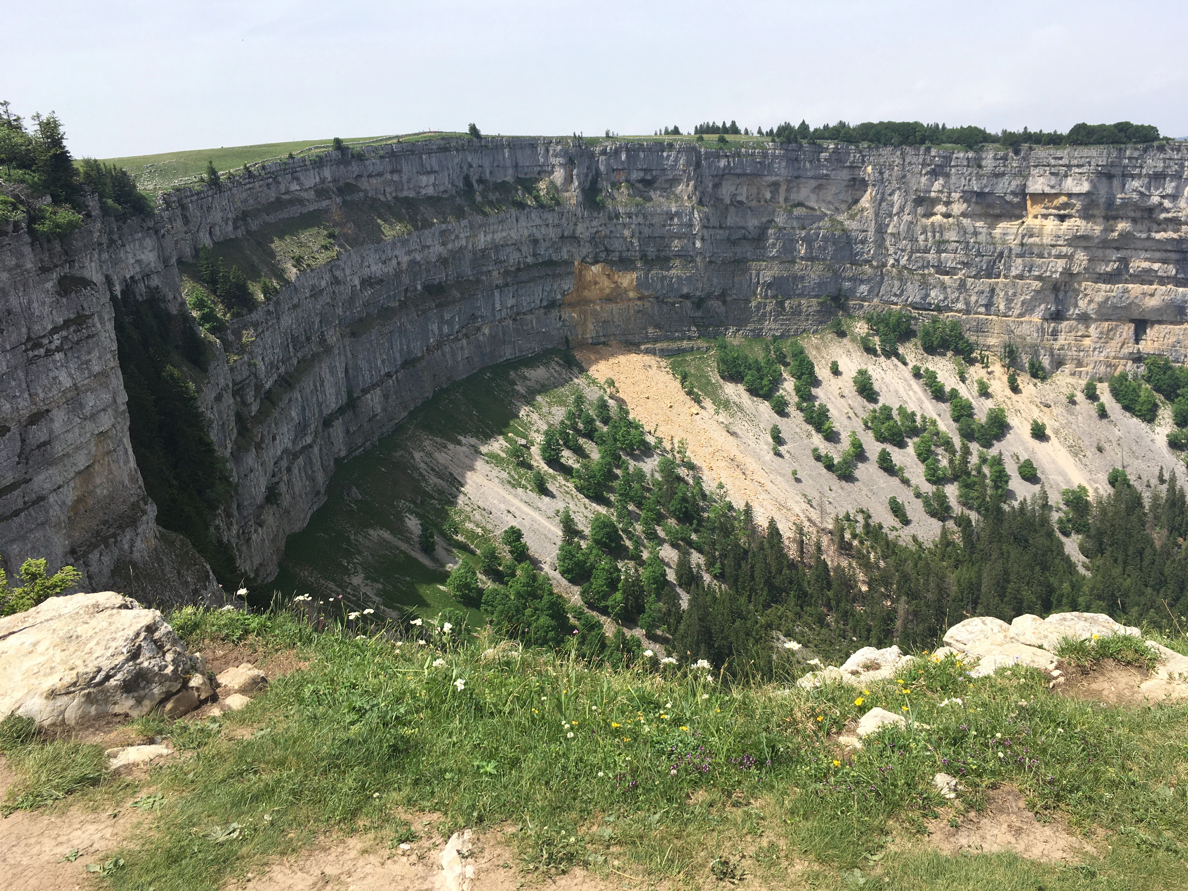
A wide view of the limestone amphitheatre known as Creux du Van, featuring massive vertical cliffs and a steep, wooded talus slope leading down into a valley.
The dramatic rock amphitheatre of Creux du Van in the Swiss Jura mountains.

Creux du Van et Gorges de l'Areuse history and protected-area timeline

The history of Creux du Van et Gorges de l'Areuse as a protected landscape extends well back into the 19th century, predating most of Switzerland's modern nature conservation framework. In 1876, the Club jurassien, a regional natural history society, purchased a tract of land around the Creux du Van from the parish of Saint-Aubin and formally declared it a nature reserve. At the time this was one of the earliest protected landscape designations anywhere in Switzerland, reflecting the unusual aesthetic and scientific value of the rock arena.

During the 20th century, the area's recognition expanded through the federal BLN inventory of landscapes and natural monuments of national significance, which formalized the broader zone of roughly 2,100 hectares as inventory object 1004. In 1960, the Creux du Van landscape was placed under a cantonal hunting ban, extending protection to the wildlife of the area. In 1965, a colony of Alpine ibex, the species now closely associated with the cliffs of the amphitheater, was reintroduced to the site as part of broader Swiss and trans-Alpine ibex recovery efforts.

In recent decades, the site has also become a stage for ongoing conservation debate. Tourism promotion has brought large numbers of visitors to the Creux du Van, contributing to pressure on the fragile dry grasslands on the surrounding slopes. Pasture management, footpath erosion, and proposed infrastructure such as a visitor platform near 2013 have generated sustained dialogue between cantonal authorities, conservation organizations, and tourism promoters. These tensions, rather than undermining the landscape's protected status, have reinforced its role as a reference case for landscape management in the Jura.

Creux du Van et Gorges de l'Areuse landscape and geographic character

The landscape of Creux du Van et Gorges de l'Areuse is defined by the contrast between an enclosed rock amphitheater and a deeply incised river valley, set within the broader context of an anticline-cored ridge of the Folded Jura. The central axis of the area is the Areuse valley, through which the river descends from the Val de Travers to Lake Neuchâtel. The river's long geological work has cut a transverse gorge through the Soliat to Mont Racine anticline, producing a series of narrow, canyon-like passages and small cascades along a substantial elevation drop. Several of these gorges were fitted in the 19th century with footpaths, retaining walls, check dams, and small bridges that still carry visitors today.

Above the gorge, the morphology shifts dramatically. The Creux du Van forms a roughly 1.2 kilometer wide, half-moon shaped rock arena at the head of a small side valley. Its walls rise to about 500 meters and enclose a sloping bowl of moraine deposits, scree, and the historic Ferme Robert settlement. South-west of the arena, the Soliat summit forms a small, gently undulating karst plateau, only modestly higher than the surrounding ridges, covered by a mix of small woodlands and open alpine pasture dissected by dry stone walls. To the north and east, the BLN perimeter extends along the forested flanks of the Areuse valley down toward Noiraigue and Boidry, capturing the geological and ecological context of both principal landmarks.

The combination of a river-cut transverse gorge, a glacially carved rock bowl, karst high plateaus, and traditional agricultural terraces gives the site an unusually compact showcase of Jura landforms within a relatively small perimeter.

Creux du Van et Gorges de l'Areuse ecosystems, habitats, and plant life

Ecologically, Creux du Van et Gorges de l'Areuse spans several contrasting habitat zones. The cliffs and rock faces around the Creux du Van and along the gorge walls provide specialized refuge for rupicolous species, while the karst plateaus above support a mosaic of small coniferous and mixed woodlands interspersed with dry grasslands and alpine pasture. The combination of thin, free-draining limestone soils, sharp topographic relief, and varied exposure creates particularly favorable conditions for species-rich mountain flora.

The river landscape of the Areuse adds aquatic and riparian habitat to the inventory. Although the riverbed has in places been modified by retaining walls and small barrages, and part of the flow is diverted for hydropower, the larger corridor retains characteristics of a natural Jura river system, with cascades, shaded cliff channels, and forested slopes above.

Above the treeline of the karst pastures, the dry, sun-exposed grasslands around the Creux du Van host particularly valuable dry meadow communities, though heavy visitor pressure and grazing have visibly degraded parts of these communities. The interplay of cliffs, woodland, dry pasture, and gorge ecosystems within a single connected landscape is a defining ecological feature of the BLN area.

Creux du Van et Gorges de l'Areuse wildlife and species highlights

The wildlife profile of Creux du Van et Gorges de l'Areuse is anchored above all by its colony of Alpine ibex, reintroduced in 1965 after the species had been eliminated from the Jura range. The steep, exposed rock walls of the Creux du Van offer ideal refuge terrain for the animals, and the ibex have become one of the most reliable wildlife sightings in the landscape, frequently observed on ledges high above the arena floor.

The cliffs and rock zones also support typical Jura rupicolous fauna adapted to steep limestone terrain, while the surrounding forests, gorges, and pasture mosaic harbor more generalist Jura species, including deer and a range of smaller mammals, raptors, and forest birds. The river corridor of the Areuse contributes riparian and aquatic fauna, including fish species in the river itself.

Because much of the area has been under cantonal hunting ban since around 1960, the wildlife of the broader BLN perimeter benefits from a level of protection that is unusual for a Jura landscape of this accessibility. The ibex population is by far the most emblematic species and continues to play a central role in the landscape's identity as a wildlife destination.

Creux du Van et Gorges de l'Areuse conservation status and protection priorities

Conservation significance is central to the identity of Creux du Van et Gorges de l'Areuse. The site is one of the oldest formally protected natural areas in Switzerland: the rock arena of the Creux du Van was declared a nature reserve in 1876 by the Club jurassien, decades before most modern Swiss conservation instruments. The wider 2,121 hectare landscape was later recognized as object 1004 of the Federal Inventory of Landscapes and Natural Monuments of National Significance, the BLN, formally embedding it in Switzerland's principal federal landscape protection framework.

The protection strategy is layered. Cantonal rules put the Creux du Van landscape under a hunting ban in 1960; the ibex reintroduction of 1965 transformed the cliffs into a flagship site for the species' recovery in the Jura; and the BLN objectives define clear targets for preserving the natural landscape, the geological landforms of the Creux du Van, the surrounding forest and biotope complexes, and the river landscape of the Areuse, while still allowing traditional agriculture and tourism uses adapted to the site's character.

Contemporary conservation debates focus on managing lasting visitor pressure. Heavy footfall in the Creux du Van area has visibly damaged the dry grasslands and trail network, and grazing patterns, infrastructure proposals such as a visitor platform around 2013, and the balance between regional tourism promotion and ecological protection have become recurring themes. These discussions have positioned the landscape as a reference case for integrated landscape management in the western Jura.

Creux du Van et Gorges de l'Areuse cultural meaning and human context

The cultural context of Creux du Van et Gorges de l'Areuse is closely tied to the long history of pasture farming on the karst plateau of the Soliat, which overlooks the rock arena. The summit and its approaches are organized as alpine pastures, partitioned by dry stone walls built using a traditional craft that UNESCO has inscribed on its list of intangible cultural heritage. The presence of historic mountain inns on the Soliat, the old Ferme Robert within the Creux du Van itself, and early 19th-century trail and bridge construction in the Gorges de l'Areuse all reflect centuries of human use of the landscape, oriented around agriculture, livestock, and increasingly tourism rather than permanent settlement.

The naming itself carries cultural weight: the site is named in the Franco-Provençal dialect of the western Jura, where 'creux' refers to a deeply incised place or hollow, and 'van' to the rock itself, rather than to the animal. Early 19th and 20th century naturalists and mountaineers, including members of the Club jurassien and later academic geologists working on the Neuchâtel Jura, established the area as a reference landscape for regional natural history. Today the site is also a cultural symbol of the broader Jura-Trois-Lacs tourism region.

Top sights and standout views in Creux du Van et Gorges de l'Areuse

Creux du Van et Gorges de l'Areuse is notable for packing together, within one federal BLN landscape, two of the Jura's most photographed natural landmarks: the half-moon, glacier-carved Creux du Van rock arena, and the deep transverse gorge of the Areuse, with its succession of narrow canyons, cascades, and 19th-century footbridges. The site also stands out for the unusual depth of its protection history, with one of Switzerland's earliest nature reserves, a 1960 hunting ban, and a long-running ibex reintroduction program that has made its cliffs a flagship for Alpine wildlife in the Jura.

For visitors and researchers alike, the linear combination of an alpine river gorge, a karst high pasture with traditional dry stone walls, and an enclosed rock amphitheater puts a wide cross-section of Folded Jura landscapes within relatively easy reach.

Best time to visit Creux du Van et Gorges de l'Areuse

Because the value of the landscape rests on geology, scale, and the interplay of cliffs, forest, and pasture, the experience of Creux du Van et Gorges de l'Areuse changes substantially with the seasons. Spring brings high water in the Areuse and especially dramatic cascades in the gorge, alongside fresh green growth in the broadleaf forests of the valley flanks. Summer offers the most accessible conditions for hiking the full Creux du Van circuit, viewing ibex on the cliffs, and visiting the Soliat pastures, though this is also when visitor numbers peak and trail erosion around the arena is at its most visible. Autumn colors the beech and conifer stands of the valley slopes and brings quieter conditions, while winter can transform the rock walls and pastures into a severe, quieter landscape, with occasional snow enhancing the vertical drama of the cliffs. In every season, the best experience combines the open vista at the top of the Creux du Van with the enclosed atmosphere of the gorge below.


Monthly climate preview

Long term representative temperature and precipitation averages for Neuchâtel

Creux du Van et Gorges de l’Areuse Climate Normals and Annual Weather Patterns

Historical data profiles the measured annual temperature spread and daily precipitation rhythm recorded at a representative elevation of 782 meters. Examining the complete monthly climatology dataset reveals full thermal variations across all twelve calendar periods.
Annual mean8 °C
-1 °C17 °C
Jan-1°
Feb
Mar
Apr
May12°
Jun15°
Jul17°
Aug17°
Sep13°
Oct
Nov
Dec
Warmest month
July

17.4 °C

Coolest month
January

-1.2 °C

Wettest month
May

3.9 mm/day

Driest month
February

2.5 mm/day

Park location guide

Geography guide, regional context, and park location map for Creux du Van et Gorges de l'Areuse

Creux du Van et Gorges de l'Areuse park geography, regions, and map view in Switzerland

Understand where Creux du Van et Gorges de l'Areuse sits in Switzerland through a broader geographic reading of the surrounding landscape, nearby location context, and its mapped position within the national park landscape.

How Creux du Van et Gorges de l'Areuse fits into Switzerland

Switzerland is a landlocked federal republic in Central Europe comprising 26 cantons, with Bern as the federal city and Zurich as the largest city. The country features the Swiss Alps, Swiss Plateau, and Jura Mountains, with German, French, Italian, and Romansh as official languages. It is noted for its political neutrality, direct democracy traditions, and strong economy.

Wider geography shaping Creux du Van et Gorges de l'Areuse in Switzerland

Switzerland is located in Central Europe at the intersection of Western and Southern Europe. It is bordered by Germany to the north, France to the west, Austria and Liechtenstein to the east, and Italy to the south. The country is geographically divided among the Swiss Alps (covering most of the territory), the Swiss Plateau (where most of the population resides), and the Jura Mountains. Switzerland is landlocked.

Map view of Creux du Van et Gorges de l'Areuse

Use this park location map to pinpoint Creux du Van et Gorges de l'Areuse in Switzerland, understand its exact geographic position, and read its mapped placement within the surrounding landscape more clearly.

Pigeon | © OpenStreetMap contributors

Location context for Creux du Van et Gorges de l'Areuse

NeuchâtelVaud

Visualizing the geological terrain, rock amphitheaters, and river gorges of the Swiss Jura

Creux du Van et Gorges de l’Areuse Photos and Protected Landscape Scenery

Visual records illustrate the dramatic topography of Creux du Van et Gorges de l’Areuse, highlighting sheer limestone walls and carved river canyons. Photographic documentation reveals the distinct habitats and protected terrain defining the regional geography.

A wide view of the limestone amphitheatre known as Creux du Van, featuring massive vertical cliffs and a steep, wooded talus slope leading down into a valley.

Park atlas

Compare surrounding protected landscapes and neighboring regional terrain

Parks Near Creux du Van et Gorges de l’Areuse for Regional Discovery

Browsing other protected areas near Creux du Van et Gorges de l’Areuse reveals broader geological patterns across the western Swiss Jura. Comparing adjacent mountain reserves provides essential context for regional conservation and alpine geography.
Wildlife reserveBourgogne-Franche-Comté
About 23 km away#1 closest

Southwest

Tourbières et lacs de la montagne jurassienne: Mapping High-Altitude Wetlands and Glacial Landscapes

A vast protected wildlife reserve in the Bourgogne-Franche-Comté region

Covering more than 12,000 hectares, this wildlife reserve forms a crucial conservation benchmark for peatland and glacial lake systems in the Jura Massif. The landscape encompasses deep combes, broad plateaus, and clear-water basins like Lac de Saint-Point, providing a vital habitat mosaic for diverse flora and fauna across the French highlands.

Area
121.56 km²
Established
2021
Relief
Mountain
Climate
Temperate
A pale, abstract watercolor painting showing rolling green hills and distant mountain ridgelines on a white background.
Nature reserveCanton of Bern
About 30 km away#2 closest

Northeast

Combe Grède Nature Reserve: Geological Gorge and Protected Mountain Landscape in Bern

Folded Jura limestone terrain and biodiversity hotspots.

The Combe Grède nature reserve presents a striking half-cluse gorge carved into Cretaceous limestone. This protected area within the Canton of Bern showcases an instructive geological sequence, ancient pine stands, and diverse mountain habitats that span from shaded cliffs to alpine pastures.

Area
12 km²
Established
1932
Relief
Mountain
Climate
Temperate
A horizontal watercolor illustration depicting rolling green hills, a winding lake shore, and distant mountains in a soft, muted palette.
Protected landscapeCanton of Bern
About 33 km away#3 closest

Northeast

Linkes Bielerseeufer Protected Landscape: Map and Regional Geography in Canton of Bern

Protected Jura lakeshore and vineyard terrain

Investigate the precise boundaries and varied micro-landscape of Linkes Bielerseeufer. This protected area showcases a dramatic rise from Lake Biel into the Jura range, encompassing karst topography, historic dry-stone terraces, and diverse forest ecosystems within the Canton of Bern.

Area
7.079 km²
Relief
Mountain
Climate
Temperate
Access
Easy access
A watercolor illustration of a river landscape with a gentle bend, shoreline greenery, and distant low hills, rendered with soft, faded edges.
Protected landscapeCanton of Bern
About 37 km away#4 closest

East

Stausee Niederried Protected Landscape: A Geographic Map and Atlas of Swiss Floodplains

Mapped alluvial terrain and sandstone cliffs in the Canton of Bern.

Stausee Niederried functions as a vital protected landscape, blending a historic hydroelectric reservoir with a four-kilometer riverine floodplain. The area is characterized by high geomorphic contrast, ranging from the vast Runtigenfluh molasse cliff to critical riparian marshes and orchid-rich pine forests. This entry provides a structured look at the park boundaries, geological features, and the wider fluvial mosaic found near the confluence of the Aare and the Saane.

Area
2.97 km²
Established
1991
IUCN
V
Relief
Mixed relief
Watercolor painting of a green forested landscape with rolling hills under a soft pink and yellow sunrise sky.
Nature reserveJura
About 42 km away#5 closest

Northeast

Franches-Montagnes Nature Reserve: A Detailed Atlas of Jura Plateau and Peat Bog Geography

Protected karst limestone landscapes and highland pasture geography.

The Franches-Montagnes nature reserve spans a unique high plateau in the Swiss Jura, characterized by its complex karst substrate and iconic raised bog systems like the Etang de la Gruère. This protected area supports a mosaic of traditional wooded pastures and wetlands, serving as a primary site for understanding the intersection of human pastoral heritage and sensitive highland ecology.

Area
39.57 km²
Established
1977
Relief
Upland
Climate
Temperate
A watercolor illustration of a landscape with green forest, wetland grasses, and pale mountains in the background, set against a clean white background.
Nature reserveBourgogne-Franche-Comté
About 46 km away#6 closest

West

Réserve naturelle régionale des tourbières de Frasne-Bouverans Protected Landscape Atlas

Peatland mosaic geography in the Drugeon valley of Bourgogne-Franche-Comté

Trace the boundaries and ecological features of this significant regional nature reserve. Spanning the Forbonnet massif and the wider Drugeon basin, the area features a dense concentration of raised bogs, woodlands, and mire habitats defined by complex glacial geology.

Area
2.926 km²
Established
1986
IUCN
IV
Visitors
17.5K annual
A pale, soft-focus watercolor illustration depicting a limestone cliff landscape with gentle rolling hills and light vegetation.
Nature reserveBourgogne-Franche-Comté
About 47 km away#7 closest

North

Réserve naturelle régionale du Crêt des Roches: Protected Landscape and Geography Atlas

Lomont range limestone corniche and regional nature reserve map

Situated southeast of Pont-de-Roide-Vermondans, this regional nature reserve preserves a compact forty-three hectare area of Jurassic limestone cliffs and mesophilic forests. The site provides a critical reference point for studying Mediterranean-margin flora, including rare relict plant populations, and stands as a major topographical observation corridor for autumn bird migrations in eastern France.

Area
0.434 km²
Established
2009
IUCN
IV
Relief
Upland
A soft watercolor painting of a mountain landscape with rolling hills, pine forests, and a meadow in light green and muted earth tones.
Regional parkCanton of Bern
About 50 km away#8 closest

East

Regionaler Naturpark Gantrisch: Protected Terrain and Map Exploration in Canton of Bern

A diverse transition zone from glacial moraines to high mountain ridges.

Spanning over 400 square kilometers, Regionaler Naturpark Gantrisch offers a unique look at the Swiss landscape. Its boundaries encompass everything from low-lying agricultural valleys and historic castles to the steep, forested gorges of the Sense and Schwarzwasser rivers and the high-altitude vistas of the southern Gantrisch mountain range.

Area
414 km²
Established
2012
Relief
Mountain
Climate
Alpine

Common questions about visiting, size, designation, and location context for Creux du Van et Gorges de l'Areuse

Creux du Van et Gorges de l'Areuse FAQs for park facts, access, geography, and protected area context

Find quick answers about Creux du Van et Gorges de l'Areuse, including protected-area facts, park geography, trail and visitor context, and how the park fits into its surrounding country and regional landscape.
MoriAtlas Explorer

Continue Your Protected Areas Search Across the Global Atlas

Deepen your exploration by continuing the structured search for national parks and protected areas worldwide. Utilize the comprehensive filtering capabilities to compare different conservation landscapes and refine your understanding of global park geography. Discover more about the distribution and characteristics of protected natural areas.

Global natural geography