Mori Atlas logo
Protected areaCuenca Alimentadora del Distrito Nacional de Riego 043 Estado de Nayarit

A sprawling watershed reserve across the Sierra Madre Occidental and volcanic mountain ridges

Cuenca Alimentadora del Distrito Nacional de Riego 043 Estado de Nayarit: Protected Area Geography

Spanning over 2.3 million hectares across five Mexican states, this protected area serves as a critical watershed for the Pacific basin. It encompasses a complex mosaic of pine and oak forests, high-elevation grasslands, and dry forest corridors situated along the rugged mountain ridges of the southern Sierra Madre Occidental and the western Trans-Mexican Volcanic Belt. By integrating forest conservation with essential resource management, the reserve remains a cornerstone for maintaining regional hydrology and diverse montane habitats.

watershed reserveSierra Madre Occidentalpine-oak forestnatural resources protection areaIUCN Category VITrans-Mexican Volcanic Belt

Cuenca Alimentadora del Distrito Nacional de Riego 043 Estado de Nayarit

Protected area

Park overview

Structured park overview, official facts, and landscape profile for Cuenca Alimentadora del Distrito Nacional de Riego 043 Estado de Nayarit

Cuenca Alimentadora del Distrito Nacional de Riego 043 Estado de Nayarit park facts, protected area profile, and essential visitor context

Review the core facts for Cuenca Alimentadora del Distrito Nacional de Riego 043 Estado de Nayarit, including designation, size, terrain, visitor scale, habitats, and operating context in one park-focused overview.

About Cuenca Alimentadora del Distrito Nacional de Riego 043 Estado de Nayarit

Cuenca Alimentadora del Distrito Nacional de Riego 043 Estado de Nayarit is one of the most extensive protected natural areas in Mexico, reflecting the country's early recognition of the link between forest cover and the long-term productivity of agricultural lands downstream. Its designation as a watershed reserve for Irrigation District 043 underscores its primary management focus: maintaining the hydrological function of forested mountains that feed rivers relied upon by Nayarit's agricultural economy. The reserve's reach across five states illustrates how a single drainage basin can connect distinct regional geographies within Mexico's central highlands.

Geographically, the protected area occupies a transitional zone between two of Mexico's major physiographic provinces. Its northern and western portions lie within the southern Sierra Madre Occidental, a long chain of north to south oriented ridges and deep canyons that has shaped regional climate, vegetation, and human settlement for centuries. Toward the south, the reserve extends into the westernmost reaches of the Trans-Mexican Volcanic Belt, introducing volcanic landscapes and additional ecological gradients. This dual geological inheritance gives the area remarkable topographic diversity, from high pine-covered ridges to deeply incised river valleys and elevated plateaus.

Ecologically, the reserve is defined by its extensive pine, oak, and pine-oak forests, which vary with elevation, rainfall patterns, and soil conditions. Multiple pine and oak species, alongside junipers, manzanillo, cypress, and other woody plants, form the backbone of these forests. In the river valleys that open toward the Pacific, dry forest vegetation extends inland from the coastal plains, while on the plateaus to the north and east, matorral, or dry shrubland, predominates. This mosaic of forest types creates habitat for a wide range of fauna, including wild turkey, white-tailed deer, collared peccary, puma, coyote, various small mammals, reptiles, and numerous bird species. The presence of large felids such as jaguar, ocelot, and jaguarundi highlights the reserve's continuing importance for species that require extensive, well-connected wildlands.

As a Natural Resources Protection Area, the Cuenca Alimentadora del Distrito Nacional de Riego 043 operates under an IUCN Category VI framework, which emphasizes sustainable use of natural resources alongside conservation. This dual mandate is consistent with the reserve's origins: it was first designated as a protected forest area and watershed in 1949 and was redesignated under the modern Mexican protected area system in 2002. The long history of formal protection, combined with the reserve's immense size and ecological complexity, makes it a cornerstone of Mexico's strategy for safeguarding forested watersheds in the country's western highlands.

Quick facts and research context for Cuenca Alimentadora del Distrito Nacional de Riego 043 Estado de Nayarit

Cuenca Alimentadora del Distrito Nacional de Riego 043 Estado de Nayarit is a federally designated Natural Resources Protection Area in west-central Mexico, administered by the National Commission of Natural Protected Areas. The protected area spans more than 2.3 million hectares across southern Durango, northern Jalisco, eastern Nayarit, southern Zacatecas, and western Aguascalientes. It sits across the southern Sierra Madre Occidental and the westernmost edge of the Trans-Mexican Volcanic Belt, encompassing numerous mountain ranges and broad river valleys that drain into the Pacific via the Río Grande de Santiago system. The reserve was originally established as a protected forest area and watershed in 1949 and was redesignated under its current category in 2002.

Protection and recognition

Documented terrestrial protection history and designation records established in 2002

Cuenca Alimentadora del Distrito Nacional de Riego 043 Estado de Nayarit Protection Status

Terrestrial protection status and designation records for Cuenca Alimentadora del Distrito Nacional de Riego 043 Estado de Nayarit establish its formal baseline from 2002. Structured conservation tracking details the established management scope and documented international recognition frameworks for this landscape.

Protection details

Protection scope
Terrestrial
Designated year
2002
Park context

Deeper park guide and search-rich context for Cuenca Alimentadora del Distrito Nacional de Riego 043 Estado de Nayarit

Cuenca Alimentadora del Distrito Nacional de Riego 043 Estado de Nayarit history, landscape, wildlife, and travel context

Explore Cuenca Alimentadora del Distrito Nacional de Riego 043 Estado de Nayarit through its history, landscape character, ecosystems, wildlife, conservation priorities, cultural context, and seasonal travel timing in a structured park guide built for atlas discovery and search intent.

Why Cuenca Alimentadora del Distrito Nacional de Riego 043 Estado de Nayarit stands out

The protected area is best known for its role as a vast Pacific watershed reserve, safeguarding the headwaters and forested catchments that supply Irrigation District 043 in the state of Nayarit. Spanning the rugged mountain ridges of the southern Sierra Madre Occidental, it protects extensive pine and oak forests, including rare and endemic conifer and oak species, alongside dry forest corridors that climb up the western river valleys. Beyond its hydrological importance, the reserve is notable for the size and fragmentation of its protected footprint. Rather than forming a single continuous block, the area is a patchwork of forest parcels on mountain ridges, including the Sierra Pajaritos, Sierra los Huicholes, Sierra Morones, and Sierra Fría, interspersed with valleys shaped by major rivers such as the San Pedro Mezquital, Huaynamota, Bolaños, Juchipila, and Verde. This combination of large-scale watershed function and exceptionally diverse montane habitat gives the reserve its distinctive identity among Mexico's natural protected areas.
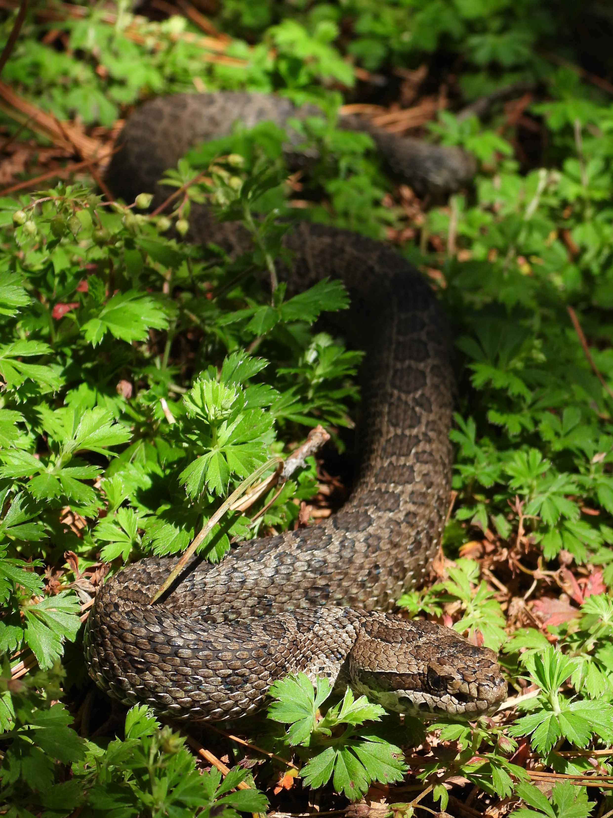
A brown rattlesnake with a patterned, camouflaging scale texture coiled in green, leafy ground vegetation.
A Trans-volcanic rattlesnake resting among low-lying greenery.

Cuenca Alimentadora del Distrito Nacional de Riego 043 Estado de Nayarit history and protected-area timeline

The area now known as Cuenca Alimentadora del Distrito Nacional de Riego 043 Estado de Nayarit has a protection history that stretches back more than seven decades. In August 1949, the region was formally designated as a protected forest area and watershed, reflecting an early Mexican policy emphasis on maintaining forest cover as a means of securing water supply for downstream agriculture, especially the irrigation districts of the Pacific lowlands.

In 2002, this long-standing designation was updated under Mexico's modern natural protected areas framework, and the area was reclassified as a Natural Resources Protection Area. This redesignation aligned the reserve with the country's contemporary system of protected area categories, administered by the National Commission of Natural Protected Areas. The transition toward an IUCN Category VI designation also signaled a broader management approach that explicitly integrates the sustainable use of natural resources with conservation objectives, particularly in watersheds that underpin regional agriculture.

Cuenca Alimentadora del Distrito Nacional de Riego 043 Estado de Nayarit landscape and geographic character

The landscape of Cuenca Alimentadora del Distrito Nacional de Riego 043 Estado de Nayarit is defined by the rugged topography of west-central Mexico. The reserve stretches across the southern Sierra Madre Occidental, where long mountain ridges run generally north to south, creating a succession of elevated crests separated by deep valleys. Major ranges within or adjacent to the reserve include the Sierra Pajaritos, Sierra los Huicholes, and Sierra Morones, with the Sierra Fría marking its eastern edge between the Juchipila and Verde rivers.

Rivers have played a central role in shaping the reserve's terrain. The San Pedro Mezquital River and several major southward-flowing tributaries of the Río Grande de Santiago, including the Huaynamota, Atengo, Bolaños, Juchipila, and Verde, cut broad valleys through the protected area. Toward the south, the reserve also includes portions of the westernmost Trans-Mexican Volcanic Belt, where the landscape between the Río Grande de Santiago and the Ameca River introduces volcanic features alongside the older Sierra Madre Occidental terrain. The result is a mosaic of high ridges, deep canyons, valley floors, and elevated plateaus, all contributing to a varied and visually striking protected landscape.

Cuenca Alimentadora del Distrito Nacional de Riego 043 Estado de Nayarit ecosystems, habitats, and plant life

Ecologically, the reserve is dominated by pine, oak, and mixed pine-oak forests and woodlands characteristic of the Sierra Madre Occidental. Canopy composition shifts with altitude, rainfall, and soil type, but pines and oaks remain the defining structural elements, joined by manzanillo (Arbutus species), juniper, Mexican cypress, Douglas-fir varieties, and other woody plants. Numerous pine and oak species occur across the reserve, including several limited-range and endemic taxa, giving the forests significant botanical value.

Outside the pine-oak zone, vegetation follows patterns of moisture and elevation. Dry forest extends inland from the Pacific coastal plain up the river valleys, introducing more drought-tolerant species into the reserve. On the plateaus and drier slopes to the north and east, matorral, or dry shrubland, becomes the prevailing cover. Montane grasslands appear on canyon slopes, and formerly logged areas often regenerate into dense manzanillo thickets. This combination of forests, dry shrublands, and grasslands creates an unusually rich environmental gradient within a single protected area.

Cuenca Alimentadora del Distrito Nacional de Riego 043 Estado de Nayarit wildlife and species highlights

The reserve's extensive and varied habitat supports a diverse fauna typical of west-central Mexico's mountain and valley systems. Among the larger mammals, white-tailed deer, collared peccary, puma, and coyote are widespread, while the presence of jaguar, ocelot, and jaguarundi underscores the reserve's continued significance for wide-ranging felids that depend on large, connected wildlands. Neotropical otters occur along the river systems that traverse the area, and smaller mammals such as wild turkey, jackrabbits, cottontails, and various bats contribute to the broader mammal community.

Birdlife is rich and varied, ranging from raptors such as the golden eagle and the spotted owl to ground-dwelling species like Montezuma quail and northern bobwhite. Doves and pigeons, including white-winged dove and mourning dove, are common, and waterbirds such as northern shoveler, cinnamon teal, and gadwall use the area's wetlands and rivers. Reptiles include rattlesnakes, night snakes, and the black spiny-tailed iguana, while amphibians and fish such as the Pacific molly inhabit aquatic habitats. The combination of forest, dry shrubland, canyon slopes, and river corridors gives the wildlife community a layered structure that changes with elevation and seasonal conditions.

Cuenca Alimentadora del Distrito Nacional de Riego 043 Estado de Nayarit conservation status and protection priorities

The central conservation significance of Cuenca Alimentadora del Distrito Nacional de Riego 043 Estado de Nayarit lies in its function as a forested watershed reserve covering an enormous and ecologically diverse territory. Its designation is fundamentally oriented around safeguarding the hydrological regime of rivers that ultimately support Irrigation District 043 in the state of Nayarit, anchoring the region's agricultural productivity in the long-term health of upstream forests.

Beyond water provision, the reserve plays a major role in conserving extensive pine, oak, and pine-oak forest ecosystems, including populations of endemic and limited-range pine and oak species. Its mosaic of forest, dry shrubland, montane grassland, and riparian habitats supports wide-ranging species such as jaguar, puma, and ocelot, as well as more localized flora and fauna. Operating under an IUCN Category VI model, the area balances conservation with sustainable use of natural resources, making it one of the most expansive examples of integrated forest and watershed protection in Mexico.

Cuenca Alimentadora del Distrito Nacional de Riego 043 Estado de Nayarit cultural meaning and human context

The rugged mountains and deep valleys traversed by this reserve have long been home to rural communities whose livelihoods depend on forestry, livestock grazing, and small-scale agriculture. Centuries of interaction between people and landscape have shaped forest composition and regeneration patterns, leaving visible traces in the distribution of logged areas, secondary growth of manzanillo thickets, and patterns of land use around settlements.

The naming of the reserve as the watershed feeder for Irrigation District 043 also reflects a broader national narrative in which forest conservation is understood as inseparable from the productivity and cultural identity of agricultural regions downstream. This interplay between mountain landscapes and lowland farming traditions is a defining feature of west-central Mexico and informs the management approach of the protected area.

Top sights and standout views in Cuenca Alimentadora del Distrito Nacional de Riego 043 Estado de Nayarit

Cuenca Alimentadora del Distrito Nacional de Riego 043 Estado de Nayarit stands out for its exceptional scale, covering more than 2.3 million hectares across five Mexican states and encompassing some of the country's most significant montane forest landscapes. Its placement across the southern Sierra Madre Occidental and the western Trans-Mexican Volcanic Belt gives it a dual geological identity, while the mosaic of protected parcels on mountain ridges, separated by river valleys, makes it a uniquely patchy but ecologically coherent reserve.

Particularly strong features include the extensive pine and oak forests with rare and endemic conifer and oak species, the dry forest corridors that climb the western river valleys, and the presence of large mammals such as jaguar, puma, ocelot, and white-tailed deer. Combined with its long protection history as a watershed reserve, these qualities make the protected area a cornerstone of forest and water conservation in west-central Mexico.

Best time to visit Cuenca Alimentadora del Distrito Nacional de Riego 043 Estado de Nayarit

The climate of west-central Mexico's mountain systems is strongly seasonal, with a pronounced dry season and a wetter period that drives vegetation cycles and wildlife activity. Visiting during or shortly after the rainy season, when forests are greener, river flows are stronger, and bird activity is typically higher, can enhance both landscape beauty and chances of encountering wildlife. Cooler temperatures at higher elevations make the mountain portions of the reserve more comfortable outside the hottest months, while the dry season offers clearer views across valleys and ridges.

For those interested in forest ecology, periods that follow winter rains can be especially rewarding, as understory plants and grasses respond quickly to moisture. Birdwatching tends to be productive during transitional seasons when migrants mix with resident species, though specific conditions vary across the reserve's broad elevation range.

Monthly climate preview

Long term annual temperature ranges and monthly precipitation patterns sampled from representative park coordinates

Cuenca Alimentadora del Distrito Nacional de Riego 043 Estado de Nayarit Climate and Average Temperatures

Representative coordinate records show measured temperature variation alongside recorded monthly precipitation cycles across the conservation terrain. Examining the complete twelve month climate normals provides deeper quantitative context for regional meteorological patterns.
Annual mean20 °C
16 °C24 °C
Jan16°
Feb17°
Mar19°
Apr21°
May23°
Jun24°
Jul22°
Aug22°
Sep21°
Oct20°
Nov18°
Dec16°
Warmest month
June

23.7 °C

Coolest month
January

15.9 °C

Wettest month
August

8.3 mm/day

Driest month
April

0.1 mm/day

Park location guide

Geography guide, regional context, and park location map for Cuenca Alimentadora del Distrito Nacional de Riego 043 Estado de Nayarit

Cuenca Alimentadora del Distrito Nacional de Riego 043 Estado de Nayarit park geography, regions, and map view in Mexico

Understand where Cuenca Alimentadora del Distrito Nacional de Riego 043 Estado de Nayarit sits in Mexico through a broader geographic reading of the surrounding landscape, nearby location context, and its mapped position within the national park landscape.

How Cuenca Alimentadora del Distrito Nacional de Riego 043 Estado de Nayarit fits into Mexico

Mexico, officially the United Mexican States, is a country in North America spanning the Sierra Madre mountain ranges, coastal plains, and tropical regions. It borders the United States to the north, Guatemala and Belize to the southeast, and has coastlines along the Pacific Ocean, Gulf of Mexico, and Caribbean Sea. With a population exceeding 130 million, Mexico is home to one of the world's most significant concentrations of Indigenous languages alongside Spanish.

Wider geography shaping Cuenca Alimentadora del Distrito Nacional de Riego 043 Estado de Nayarit in Mexico

Mexico occupies a land area of 1,972,550 km2, making it the thirteenth-largest country in the world. The terrain is highly diverse, featuring the Sierra Madre Occidental and Sierra Madre Oriental mountain ranges, the Mexican Plateau, coastal lowlands along the Pacific and Gulf/Caribbean margins, and the Yucatan Peninsula. The country spans multiple climate zones from desert in the north to tropical rainforest in the south.

Map view of Cuenca Alimentadora del Distrito Nacional de Riego 043 Estado de Nayarit

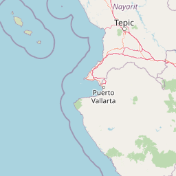
Use this park location map to pinpoint Cuenca Alimentadora del Distrito Nacional de Riego 043 Estado de Nayarit in Mexico, understand its exact geographic position, and read its mapped placement within the surrounding landscape more clearly.

Pigeon | © OpenStreetMap contributors

Location context for Cuenca Alimentadora del Distrito Nacional de Riego 043 Estado de Nayarit

AguascalientesDurangoJaliscoNayaritZacatecas

Visualizing mountain ridges, pine-oak forests, and protected watershed terrain

Cuenca Alimentadora del Distrito Nacional de Riego 043 Estado de Nayarit Photos, Landscapes, and Scenery

Examine original photography documenting the rugged terrain, forest canopies, and watershed valleys across Cuenca Alimentadora del Distrito Nacional de Riego 043 Estado de Nayarit. Photographic records provide a clear visual record of montane habitats, remote protected ridges, and diverse ecosystems spanning multiple states.

A brown rattlesnake with a patterned, camouflaging scale texture coiled in green, leafy ground vegetation.

Park atlas

Compare surrounding protected areas, mountain ranges, and watershed reserves across the region.

Parks Near Cuenca Alimentadora del Distrito Nacional de Riego 043 Estado de Nayarit

Browse other protected natural areas and montane forest reserves located near Cuenca Alimentadora del Distrito Nacional de Riego 043 Estado de Nayarit. Comparing adjacent regional geography helps reveal broader ecological patterns across the southern Sierra Madre Occidental.
Biosphere reserveNayarit
About 64 km away#1 closest

Southwest

Sierra de San Juan Biosphere Reserve: Geographic Overview and Protected Area Mapping

Volcanic terrain and forest ecosystems in Nayarit, Mexico

Explore the volcanic landforms and layered forest communities of Sierra de San Juan Biosphere Reserve. This protected area in Nayarit spans distinct ecological zones from dry coastal lowlands to mountain cloud forests, providing essential habitat and unique biodiversity at the convergence of major Mexican mountain systems.

Area
198.01 km²
Established
2003
Relief
Mountain
Scope
Terrestrial
National parkNayarit
About 146 km away#2 closest

West

Isla Isabel National Park: Protected Island Landscape within Nayarit's Geography

Explore its mapped boundaries and distinct geography.

Isla Isabel National Park represents a crucial protected area within the broader geographic framework of Nayarit. This national park offers a focused lens for exploring a unique island landscape, its specific mapped boundaries, and its place within the regional atlas. Understanding its ecological and geographic context is key to appreciating this distinct natural landscape.

Area
1.94 km²
Established
1980
IUCN
II
A horizontal watercolor painting depicting a soft-focus landscape with rolling green hills, patches of forest, and light golden hues representing meadows or dry terrain.
Biosphere reserveJalisco
About 161 km away#3 closest

Southeast

La Primavera Biosphere Reserve: Mapping Volcanic Landscapes and Protected Watersheds

Ecological geography and forest distribution in Jalisco, Mexico

Centering on the Sierra la Primavera volcanic complex, this biosphere reserve functions as an essential green corridor and water catchment zone. The terrain consists of a complex mosaic of vegetation types, including pine-oak forests and relict cloud forest patches across high-elevation ridges. Discover the structural role of these protected lands in moderating the climate and supporting biodiversity in the Guadalajara metropolitan region.

Area
305 km²
Established
2000
IUCN
VI
Relief
Mountain
A watercolor painting showing a panoramic view of rolling hills and a light forest in a park setting.
Protected areaZapopan
About 161 km away#4 closest

Southeast

Bosque el Nixticuil Protected Area: Mapping the Urban Forest Landscape in Zapopan

Volcanic terrain and watershed protection in Jalisco

Bosque el Nixticuil represents a key case of community-led urban conservation. Covering roughly 1,860 hectares in the municipality of Zapopan, this area protects a rare old-growth oak and pine ecosystem from metropolitan development. The park encompasses diverse topographic features including shallow canyons and plains, serving as a vital ecological anchor for the surrounding Río Blanco basin.

Area
18.6 km²
Established
2008
Visitors
3.2M annual
Relief
Mixed relief
National parkNayarit
About 170 km away#5 closest

Southwest

Islas Marietas National Park: National Park Protected Landscape and Geographic Context

Explore its mapped boundaries and natural terrain in Nayarit.

Discover the distinct protected landscape of Islas Marietas National Park, a vital national park situated in the Nayarit region of Mexico. This entry facilitates a detailed exploration of its mapped geography and protected area status, offering a specific focus on the park's natural terrain and its significance within the broader atlas of conservation lands. Understand the unique context provided by its location and designation for comprehensive geographic discovery.

IUCN
II
Visitors
127.4K annual
Climate
Tropical
Access
Moderate access
Wildlife reserveJalisco
About 176 km away#6 closest

South

Sierra de Quila: Protected Mountain Geography and Forested Wildlife Reserve in Western Jalisco

Mapped terrain, watershed boundaries, and high-altitude forest ecosystems

Sierra de Quila stands as a prominent protected mountain range in western Jalisco, offering a unique mosaic of pine, oak, and mesophilic cloud forests. This wildlife reserve serves as a essential natural anchor for regional biodiversity and watershed protection, with its rugged canyons and dramatic elevation changes providing a distinct geographical profile within the broader Mexican landscape.

Area
151.92 km²
Established
1982
Relief
Mountain
Climate
Temperate
A horizontal watercolor illustration depicting rolling green hills and distant muted mountain ranges.
Nature reserveJalisco
About 176 km away#7 closest

Southeast

Barranca de Oblatos: Protected Canyon Nature Reserve and Geographical Landmark in Jalisco

Urban-adjacent nature reserve and protected river corridor

Barranca de Oblatos is a striking geological feature and nature reserve that anchors the biodiversity of the Guadalajara metropolitan region. Featuring a deep canyon system carved by the Rio Grande de Santiago, this protected area holds a complex mosaic of tropical deciduous forests and historical landmarks within its dramatic vertical walls. Explore the landscape context and natural boundaries that define this essential western Mexican wilderness area.

Area
11.37 km²
Established
1997
Relief
Highland
Climate
Subtropical
Protected areaAguascalientes
About 204 km away#8 closest

East

Cuenca Alimentadora del Distrito Nacional de Riego 01 Pabellón Protected Area Overview

Highland watershed and Sierra Fría landscape geography

Spanning two distinct blocks in the Sierra Fría, this reserve protects a vital ecological mosaic of matorral shrublands and pine oak forests. As a central watershed, it serves both as a habitat for golden eagles and pumas and as a source for regional irrigation, representing a key managed landscape in the Mexican highlands.

Area
977 km²
Established
2002
IUCN
VI
Relief
Mountain

Common questions about visiting, size, designation, and location context for Cuenca Alimentadora del Distrito Nacional de Riego 043 Estado de Nayarit

Cuenca Alimentadora del Distrito Nacional de Riego 043 Estado de Nayarit FAQs for park facts, access, geography, and protected area context

Find quick answers about Cuenca Alimentadora del Distrito Nacional de Riego 043 Estado de Nayarit, including protected-area facts, park geography, trail and visitor context, and how the park fits into its surrounding country and regional landscape.
MoriAtlas Explorer

Continue Your Protected Areas Search Across the Global Atlas

Deepen your exploration by continuing the structured search for national parks and protected areas worldwide. Utilize the comprehensive filtering capabilities to compare different conservation landscapes and refine your understanding of global park geography. Discover more about the distribution and characteristics of protected natural areas.

Global natural geography