Mori Atlas logo
National parkCumbres de Majalca National Park

Detailed map context and atlas exploration for this national park in Mexico.

Cumbres de Majalca National Park: Protected Landscape and Regional Geography in Chihuahua

(Parque Nacional Cumbres de Majalca)

Cumbres de Majalca National Park stands as a significant protected area within the geography of Chihuahua, Mexico. This page offers an in-depth look at the park's identity as a national park, focusing on its mapped boundaries and its role within the regional landscape. Understand its place in the atlas through structured geographic data and insights into its protected territory.

Mexico national parksVolcanic rock formationsPine forestsSierra Madre OccidentalBlack bear habitatChihuahua state

Cumbres de Majalca National Park

National park

Park overview

Structured park overview, official facts, and landscape profile for Cumbres de Majalca National Park

Cumbres de Majalca National Park park facts, protected area profile, and essential visitor context
Review the core facts for Cumbres de Majalca National Park, including designation, size, terrain, visitor scale, habitats, and operating context in one park-focused overview.

About Cumbres de Majalca National Park

Cumbres de Majalca National Park occupies a distinctive position in northern Mexico's protected area network as a mountainous refuge within the otherwise semi-arid Chihuahuan Desert landscape. The park sits in the Sierra de Majalca, a mountain range that forms part of the great Sierra Madre Occidental that runs down western Mexico. The volcanic origins of these mountains have produced a landscape characterized by dramatic rock formations, with huge volcanic boulders sculpted into strange and photogenic shapes by centuries of exposure to wind and rain. The park serves as an important ecological corridor and refuge for species adapted to higher-elevation conditions in a region where such habitats are limited. Located just 88 kilometers from Chihuahua city, the park functions as a natural escape for residents of the state capital, offering mountain recreation, camping, and nature observation opportunities that contrast sharply with the desert surroundings. The park's establishment in 1939 represents an early effort in Mexico's conservation history, predating many other national parks in the country.

Quick facts and research context for Cumbres de Majalca National Park

Cumbres de Majalca National Park lies in central Chihuahua within the Sierra de Majalca mountain range, part of the Sierra Madre Occidental system. The park was created in 1939 to protect endemic flora and fauna and encompasses both pine-oak forest zones at higher elevations and semi-arid steppe vegetation at lower elevations. The Sacramento River originates in these mountains and flows toward Chihuahua city, joining the Chuvíscar River. The park features dramatic volcanic rock formations shaped by erosion, with peaks including Cerro Las Escobas, Cerro La Puerta, Cerro Los Almíceres, and Cerro del Agua. It is notable as one of the few areas in Mexico where black bears are found, and the park contains more than 550 documented plant and animal species, including several in protected status.

Park context

Deeper park guide and search-rich context for Cumbres de Majalca National Park

Cumbres de Majalca National Park history, landscape, wildlife, and travel context
Explore Cumbres de Majalca National Park through its history, landscape character, ecosystems, wildlife, conservation priorities, cultural context, and seasonal travel timing in a structured park guide built for atlas discovery and search intent.

Why Cumbres de Majalca National Park stands out

Cumbres de Majalca is best known for its spectacular volcanic rock formations, sculpted into remarkable shapes by wind and water erosion over millennia. The peñón (rock formation) known as El Cuadrado stands as an iconic geological feature of the park. The park is also renowned as one of the few places in northern Mexico where the American black bear maintains a population, making it significant for large mammal conservation in the region. Additionally, the park's location within the Sierra Madre Occidental provides a rare example of mid-elevation coniferous forest ecosystem in the Chihuahuan Desert region.

Cumbres de Majalca National Park history and protected-area timeline

Cumbres de Majalca National Park was established by federal decree on September 1, 1939, making it one of the older protected areas in Mexico. The park was created specifically to preserve the natural habitat for endemic flora and fauna in this mountainous region of Chihuahua. Following its designation during the mid-twentieth century, the park underwent active reforestation efforts focused on establishing coniferous species, particularly various pine species suited to the high-elevation environment. The creation of the park reflected growing awareness in Mexico during the early twentieth century of the need to protect unique natural areas, and the park remains governed by the Secretariat of the Environment and Natural Resources. The original decree designated 4,772 hectares for protection, a boundary that has been maintained to preserve the ecological integrity of the Sierra de Majalca ecosystem.

Cumbres de Majalca National Park landscape and geographic character

The landscape of Cumbres de Majalca National Park is defined by its volcanic mountain terrain within the Sierra de Majalca, a subrange of the Sierra Madre Occidental. The mountains of the park, while not the highest in Chihuahua, rise dramatically from the surrounding semi-arid plains, with peaks reaching approximately 2,600 meters above sea level. The dominant geological feature is the prevalence of volcanic rocks that have been extensively eroded into extraordinary formations. These eroded volcanic boulders create a landscape of towering rocks, dramatic spires, and unusual shapes that distinguish the park visually. The park lies within the Transition Bavícora-Bustillos zone, characterized by numerous small elevated valleys surrounded by volcanic peaks. Key elevations within the park include Cerro Las Escobas, Cerro La Puerta, Cerro Los Almíceres, and Cerro del Agua. The Sacramento River has its origin in the Sierra de Majalca, flowing eastward toward Chihuahua city before joining the Chuvíscar River.

Cumbres de Majalca National Park ecosystems, habitats, and plant life

The ecological character of Cumbres de Majalca reflects a transition between two distinct climate zones and vegetation types. At higher elevations, the park supports coniferous forest dominated by species including Pinus leiophylla (Chihuahua pine), Pinus cembroides (Mexican pinyon), Pinus engelmannii (Encelmann pine), and several Abies (fir) species. These pine forests extend from the highest elevations down into the transition zone between mountains and steppe. At lower elevations, the landscape shifts to semi-arid steppe characterized by grasslands and xerophytic shrubs, with various Juniperus species appearing in the transition zone. The park is situated within a fragile ecosystem that supports remarkable biodiversity given the surrounding desert environment, with more than 550 plant and animal species documented within the park boundaries according to Mexico's National Biodiversity Information System.

Cumbres de Majalca National Park wildlife and species highlights

Cumbres de Majalca harbors a notable mammalian fauna that includes species typical of Mexican mountainous forests. The American black bear represents the most significant conservation priority, as the park is one of the few areas in northern Mexico where this species persists. Other mammals present include cougar, white-tailed deer, eastern cottontail, North American porcupine, bobcat, and coyote. The avian community features species associated with forest and cliff habitats, including peregrine falcon, golden eagle, wild turkey, common pheasant, Arizona woodpecker, Strickland's woodpecker, and ladder-backed woodpecker. At lower elevations, reptile diversity includes the northern Mexican pine snake and various small lizards. The park supports species that face conservation concerns, with eight species documented as being within some category of risk under Mexico's official environmental norm NOM-059.

Cumbres de Majalca National Park conservation status and protection priorities

Cumbres de Majalca National Park holds significant conservation value for several reasons. The park protects one of the few remaining habitats in northern Mexico for the American black bear, a species that has experienced range contraction throughout the country. The protected area also preserves representative examples of the Sierra Madre Occidental's transition-zone ecosystems, which are limited in extent regionally. The park's establishment in 1939 reflects early Mexican conservation efforts, and its continued protection preserves geological and ecological values that would otherwise face pressure from human activities. The presence of eight species within risk categories under Mexican environmental legislation underscores the park's role in biodiversity preservation. Additionally, the park functions as a watershed protection area for the Sacramento River, which provides water resources for the Chihuahua metropolitan area.

Cumbres de Majalca National Park cultural meaning and human context

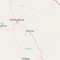
Cumbres de Majalca serves as a recreational escape for residents of Chihuahua city and surrounding communities, functioning as a traditional weekend destination for families seeking mountain relief from the desert heat. The park area has been used historically by local communities, and ejidos (communal agricultural lands) within and adjacent to the park provide basic visitor services. The landscape holds cultural significance for local populations who have inhabited the region for generations, with the mountain environment providing resources and identity. The access route from Chihuahua follows a historic corridor connecting the state capital with Ciudad Juárez along the Pan-American Highway (Mexico 45), a fundamental transportation axis in northern Mexico.

Top sights and standout views in Cumbres de Majalca National Park

The park's most compelling highlight is its dramatic volcanic rock formations, particularly the iconic Peñón de El Cuadrado, which stands as a symbol of the park's geological character. The presence of black bears in a relatively accessible mountain setting offers wildlife observation opportunities uncommon in northern Mexico. The network of 53 kilometers of trails provides access for hiking and mountain biking through varied terrain and vegetation zones. The contrast between the high-elevation pine forest environment and the surrounding Chihuahuan Desert creates a distinctive ecological experience for visitors. The park also offers developed camping areas, including the Cañón de Las Hadas with sanitary facilities and stone tables, along with rental cabins for visitors.

Best time to visit Cumbres de Majalca National Park

The park can be visited year-round, though the experience varies significantly by season. Summer months bring warmer temperatures, particularly in the lower elevations where temperatures can exceed 35 degrees Celsius, but the higher elevations remain pleasant. The summer rainy season occurs from June through September, with August typically receiving the most precipitation, creating lush green conditions but also occasional access limitations. Winter conditions at higher elevations feature cold temperatures that can drop below minus 10 degrees Celsius, with frequent snowstorms particularly toward the end of the season, averaging 112 days annually with sub-zero temperatures. The transition seasons of spring and fall offer milder conditions and provide excellent opportunities for hiking and wildlife observation. For most visitors, the period from March through May and from September through November offers the most comfortable conditions for outdoor activities.

Park location guide

Geography guide, regional context, and park location map for Cumbres de Majalca National Park

Cumbres de Majalca National Park park geography, regions, and map view in Mexico
Understand where Cumbres de Majalca National Park sits in Mexico through a broader geographic reading of the surrounding landscape, nearby location context, and its mapped position within the national park landscape.

How Cumbres de Majalca National Park fits into Mexico

Mexico, officially the United Mexican States, is a country in North America spanning the Sierra Madre mountain ranges, coastal plains, and tropical regions. It borders the United States to the north, Guatemala and Belize to the southeast, and has coastlines along the Pacific Ocean, Gulf of Mexico, and Caribbean Sea. With a population exceeding 130 million, Mexico is home to one of the world's most significant concentrations of Indigenous languages alongside Spanish.

Wider geography shaping Cumbres de Majalca National Park in Mexico

Mexico occupies a land area of 1,972,550 km2, making it the thirteenth-largest country in the world. The terrain is highly diverse, featuring the Sierra Madre Occidental and Sierra Madre Oriental mountain ranges, the Mexican Plateau, coastal lowlands along the Pacific and Gulf/Caribbean margins, and the Yucatan Peninsula. The country spans multiple climate zones from desert in the north to tropical rainforest in the south.

Map view of Cumbres de Majalca National Park

Use this park location map to pinpoint Cumbres de Majalca National Park in Mexico, understand its exact geographic position, and read its mapped placement within the surrounding landscape more clearly.

Pigeon | © OpenStreetMap contributors

Location context for Cumbres de Majalca National Park

Chihuahua
Park atlas

Trace the geographic spread of protected landscapes, comparing mountain terrain, pine forests, and unique volcanic formations in the surrounding region.

Explore Nearby National Parks and Protected Areas from Cumbres de Majalca National Park
Browse national parks and protected areas near Cumbres de Majalca National Park, extending your geographic discovery across Mexico's mountain and high-desert landscapes. Comparing these protected areas provides atlas context, revealing regional patterns of volcanic terrain, pine forests, and critical wildlife habitats in Northern Mexico.
National parkOcampo Municipality

Basaseachic Falls National Park: National Park Geography and Mapped Boundaries

Explore protected lands within Ocampo Municipality.

Basaseachic Falls National Park serves as a key protected area within Ocampo Municipality, Mexico. This page provides detailed geographic information and mapped boundaries, essential for understanding its landscape context and its significance as a national park. Dive into the atlas-style data to appreciate the park's protected terrain and its contribution to the regional geography, offering a factual discovery experience.

Area
58.03 km²
Established
1981
IUCN
II
Relief
Mountain
National parkBrewster County

Big Bend National Park: National Park, Mapped Protected Landscape, and Regional Geography

Explore Brewster County's protected natural terrain.

Big Bend National Park is a prominent national park defined by its protected landscape and geographic features within Brewster County. This destination provides users with detailed atlas-style information, focusing on the park's mapped boundaries and its contribution to the understanding of regional natural geography. Delve into the specific context of this protected area to enhance your geographic discovery.

Area
3,242.19 km²
Established
1944
IUCN
II
Visitors
568.1K annual
National parkCulberson County

Guadalupe Mountains National Park: Mapped Boundaries and Protected Landscape Identity

Explore the geography and terrain of this Texas national park.

Guadalupe Mountains National Park is a key protected area within Culberson County, West Texas. This national park offers a distinct geographic focus, allowing for detailed exploration of its mapped boundaries and the unique natural landscapes that define its protected status. Understanding its place within the Trans-Pecos region provides valuable context for regional geography and atlas-based discovery of conservation lands in Texas.

Area
349.51 km²
Established
1972
IUCN
II
Visitors
206.4K annual
National parkEddy County

Carlsbad Caverns National Park: Detailed Protected Area and Landscape Exploration

View mapped terrain and geographic context for this Eddy County national park.

Gain a deep understanding of Carlsbad Caverns National Park through its specific geographic features and protected landscape identity. This entry provides foundational atlas-level information on the park's mapped boundaries and its role as a designated national park within the broader regional geography of Eddy County. It is designed to offer precise context for users focused on understanding the specific natural terrain and conservation geography of this important protected area, facilitating structured discovery.

Area
189.26 km²
Established
1930
IUCN
II
Visitors
410.8K annual
National parkNew Mexico

White Sands National Park: National Park with Unique Dune Landscape in New Mexico

Explore its protected boundaries and desert geography.

White Sands National Park is a protected national park renowned for its stunning gypsum dunes, offering a unique landscape within New Mexico's geography. This page provides detailed information on its mapped protected area, serving as a valuable resource for understanding the park's specific geographic context and its identity as a significant protected natural landscape.

Area
601.3 km²
Established
2019
IUCN
V
Visitors
729.1K annual
National parkPima County

Saguaro National Park: Discover Its Protected Landscape Geography and Mapped Boundaries

Explore the natural terrain and regional context of this national park.

Saguaro National Park offers a focused exploration of a specific protected landscape, highlighting its unique geographic features and mapped boundaries within Pima County. This detail page provides an atlas perspective, allowing for a deep dive into the park's natural terrain and its regional significance. Understand the protected area's identity and its place within the wider geographical context.

Area
371.16 km²
Established
1994
IUCN
II
Visitors
946.4K annual
National parkBaja California Sur

Bahía de Loreto National Park: National Park Protected Landscape and Geographic Identity

Explore its mapped boundaries and regional context.

Bahía de Loreto National Park offers a distinct focus on its protected natural landscape and geographic features within Baja California Sur. This destination provides detailed mapping and regional context, enabling a focused exploration of its boundaries and natural environment. It is ideal for users seeking to understand the specific protected area identity and its geographical placement as part of a broader atlas of conservation landscapes.

Area
2,065.81 km²
Established
1996
IUCN
II
Relief
Mixed relief
National parkSombrerete Municipality

Sierra de Órganos National Park National Park: Mapped Protected Landscape Details

Explore geographic context and park boundaries within Sombrerete Municipality.

Sierra de Órganos National Park stands as a vital national park, offering a unique opportunity for geographic and atlas-based discovery. This dedicated entry focuses on its protected landscape identity, providing detailed insights into its mapped boundaries and its place within the regional geography of Sombrerete Municipality. Understand the park's role as a protected natural area through structured data and landscape context, essential for comprehensive geographic exploration.

Area
11.25 km²
Established
2000
IUCN
II
Relief
Mountain

Common questions about visiting, size, designation, and location context for Cumbres de Majalca National Park

Cumbres de Majalca National Park FAQs for park facts, access, geography, and protected area context
Find quick answers about Cumbres de Majalca National Park, including protected-area facts, park geography, trail and visitor context, and how the park fits into its surrounding country and regional landscape.
MoriAtlas Explorer

Continue Your Protected Areas Search Across the Global Atlas

Deepen your exploration by continuing the structured search for national parks and protected areas worldwide. Utilize the comprehensive filtering capabilities to compare different conservation landscapes and refine your understanding of global park geography. Discover more about the distribution and characteristics of protected natural areas.

Global natural geography