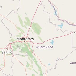
Why Cumbres de Monterrey National Park stands out
Cumbres de Monterrey is best known for its dramatic mountain landscapes within the Sierra Madre Oriental, featuring the iconic Cerro de la Silla peak that dominates the Monterrey skyline. The park contains exceptional karst cave systems including the Grutas de García, one of Mexico's largest and most impressive cave networks, and Pozo del Gavilán, the only known cenote in northern Mexico. Its spectacular waterfalls, particularly Cascada Cola de Caballo with its distinctive horsetail-shaped cascade, rank among the most photographed natural landmarks in northeastern Mexico. The park also preserves extensive pine-oak forests and serves as a critical ecological corridor connecting desert and temperate forest ecosystems.
Cumbres de Monterrey National Park history and protected-area timeline
Cumbres de Monterrey National Park was established on November 24, 1939, by decree of President Lázaro Cárdenas, representing a landmark commitment to nature conservation in Mexico. The park was created specifically in response to the growing urbanization pressures from the expanding city of Monterrey, which threatened the region's unique native ecosystems and biodiversity. At its establishment, the park encompassed 246,500 hectares, making it the largest area ever declared a national park in Mexico at that time, demonstrating the ambitious scale of early Mexican conservation efforts. The region has a rich human history dating back thousands of years, with numerous indigenous paintings and stone carvings throughout the park providing evidence of ancient human habitation. Prior to Spanish colonization, various Chichimeca groups inhabited the area and maintained resistance to European rule for many years. The city of Monterrey itself was founded as the first European settlement in the region on September 20, 1596. A significant boundary adjustment occurred on November 17, 2000, when the park's area was reduced to 177,395.95 hectares through a redelimitation decree, reflecting ongoing challenges between conservation priorities and development pressures in the rapidly growing region.
Cumbres de Monterrey National Park landscape and geographic character
The landscape of Cumbres de Monterrey National Park exemplifies the dramatic topography of Mexico's Sierra Madre Oriental, characterized by rugged mountain terrain, deep canyons, and spectacular geological formations. The park's terrain was formed through the folding of marine-based sedimentary strata during the Eocene epoch as part of the Laramide orogeny, with the main sedimentary rock dating from the Cretaceous period. The highest peaks within the park include Copete de las Águilas at 2,260 meters, M Este at 2,020 meters, La Antenna at 2,015 meters, La Ventana at 1,955 meters, Cerro de la Silla at 1,820 meters, and Pinar at 1,515 meters above sea level. The park features extensive karst topography with vast cave systems, subterranean rivers, and aquifers that have developed over millions of years. The Grutas de García represents one of Mexico's most significant cave systems, containing marine fossils within its oceanic sedimentary rock formations and having remained hidden until its discovery in 1843. The landscape includes numerous canyons, with Cañón de la Huasteca being the most famous, featuring prehistoric glyphs created by ancient inhabitants on its walls. The park contains abundant surface and subterranean water systems, with notable waterfalls including Cascada Cola de Caballo and Cascada de Chipitín.
Cumbres de Monterrey National Park ecosystems, habitats, and plant life
The nature of Cumbres de Monterrey National Park displays remarkable ecological diversity due to the park's varied elevation zones and resulting microclimates, supporting one of the most diverse ecosystems in northern Mexico. The park contains multiple distinct climate types according to the Köppen classification, ranging from desert conditions in lower elevations to humid subtropical and oceanic climates at higher elevations. The vegetation changes dramatically with elevation, from desert scrub and thornforest in lower regions to temperate pine-oak forests in higher zones. The southern portion of the park features grasslands and temperate conifer forests dominated by species of pine, oak, and walnut. Agave, Dasylirion, and Rhus species are found throughout many areas of the park. The forest composition includes numerous species of spruce, yucca, Douglas fir, fir, oak, and pine, creating complex and layered forest communities. This ecological diversity supports the park's status as a critical habitat corridor connecting desert and tropical ecosystems.
Cumbres de Monterrey National Park wildlife and species highlights
The wildlife of Cumbres de Monterrey National Park is exceptionally diverse, with the park home to over 3,460 documented species of plants and animals, including 104 species listed under Mexican conservation protection categories. The park supports approximately 22 mammal species and 450 bird species, representing both tropical and temperate fauna due to the park's position at the ecological boundary between northern desert and tropical systems. Notable mammalian species include black bear, white-tailed deer, collared peccary, gray fox, puma, jaguar, and bobcat. The avifauna includes peregrine falcon, red-tailed hawk, northern harrier, and the endangered maroon-fronted parrot. The park contains significant fish diversity in its streams and rivers, though many species are endangered. Three endemic fish species have been identified in the park: Cyprinella rutila, Dionda melanops, and Moxostoma albidum. Several Cyprinodon species remain present but many face extinction risks, highlighting the conservation significance of aquatic habitats within the park.
Cumbres de Monterrey National Park conservation status and protection priorities
Cumbres de Monterrey National Park holds significant conservation importance as one of the largest and most ecologically diverse protected areas in northern Mexico, preserving critical habitats within the Sierra Madre Oriental. The park was specifically established to protect native flora and fauna from the pressures of metropolitan growth in the Monterrey region, a purpose that remains relevant as the city continues to expand. The park contains over 100 species listed under Mexico's NOM-059 official protection categories, demonstrating its role as a refuge for threatened and endangered species. The park's karst aquifer systems provide essential water resources for the Monterrey metropolitan area, making watershed protection a critical component of the park's conservation value. Management programs have been developed by Mexico's Secretariat of Environment and Natural Resources, with a management plan updated in 2006. The park functions as an ecological corridor connecting diverse ecosystems and serves as a natural buffer against urban development pressures.
Cumbres de Monterrey National Park cultural meaning and human context
The cultural context of Cumbres de Monterrey National Park reflects thousands of years of human presence in the Sierra Madre Oriental region. Archaeological evidence in the form of rock paintings and stone carvings distributed throughout the park demonstrates that indigenous peoples inhabited this area long before European contact. Prior to the Spanish colonial period, various groups of Chichimeca peoples occupied the region and frequently united in resistance to Spanish domination. The founding of Monterrey on September 20, 1596, marked the beginning of European settlement in the area, establishing a settlement pattern that would eventually create the pressure leading to the park's creation in 1939. The region holds particular cultural significance for northeastern Mexico, with the landscape featuring prominently in local identity and heritage. The park also encompasses areas used by agrarian communities such as Potrero Redondo, demonstrating ongoing human relationships with the land.
Top sights and standout views in Cumbres de Monterrey National Park
Cumbres de Monterrey National Park offers exceptional natural highlights including the iconic Cerro de la Silla peak forming part of Monterrey's celebrated skyline, the spectacular Cascada Cola de Caballo waterfall with its 25-meter horsetail cascade, and the extensive Grutas de García cave system featuring marine fossil deposits. The park's diverse elevation gradients support multiple ecosystems from desert scrub to temperate pine-oak forests, while its karst landscapes contain Pozo del Gavilán, the only known cenote in northern Mexico. Outdoor enthusiasts can explore numerous hiking trails, with the Chipinque ecological reserve providing accessible entry to park ecosystems. The Cañón de la Huasteca features prehistoric glyphs thousands of years old, combining natural and cultural significance. The park's role as a watershed supplying water to the Monterrey metropolitan area adds ecological importance to its scenic beauty.
Best time to visit Cumbres de Monterrey National Park
The best time to visit Cumbres de Monterrey National Park depends on preferred activities and tolerance for varying conditions. Higher elevations experience temperate climates with occasional winter snowfall, while summer months bring hot conditions throughout the park. The winter months from December through February typically offer clearer skies and more comfortable hiking temperatures in the mid-elevation zones, though higher trails may be cold. Spring and fall provide moderate temperatures and represent popular periods for wildlife observation and hiking. The rainy season from June through September brings increased water flow to waterfalls, making Cascada Cola de Caballo particularly impressive, though afternoon thunderstorms are common. Visitors seeking to avoid peak heat should plan morning activities during summer months, while those interested in birdwatching may find the spring migration periods especially rewarding.