
Streams
Park geography
Detailed spatial analysis of park boundaries, fluvial terrain, and environmental features
Comprehensive Geographic and Landscape Profile of Danube-Auen National Park in Lower Austria
Examine the technical geography and spatial layout of Danube-Auen National Park, covering its 93 square kilometer protected footprint in Lower Austria. This profile maps the riverine network, forest coverage, and wetland distribution across the park landscape to provide a structured spatial view of the region.
Related tags
floodplainriparian forestwetlandsriver ecosystemCentral Europe
Austria's largest remaining Danube floodplain and one of Middle Europe's most significant riparian ecosystems
Danube-Auen National Park
Danube-Auen National Park is Austria's premier floodplain protection area, spanning 93 square kilometers along the Danube River just downstream from Vienna. The park encompasses one of the largest remaining intact riparian landscapes in Middle Europe, protecting a complex mosaic of lowland forests, wetlands, meadows, and side channels that characterize the historic Danube floodplain. Established in 1996 following intense public protests against a hydroelectric dam project, the park represents a remarkable conservation victory and serves as a critical habitat for Europe's endangered riparian ecosystems. The park stretches across both Vienna and Lower Austria, covering areas from the Vienna suburbs through the eastern border regions near the Slovak border, with the administrative center located at Schloss Orth, a historic castle that now serves as the visitor center.
- Location
- Austria
- Park type
- National park
- Established
- 1996
- Area
- 93 km²
Location overview
National park location records within the Lower Austria region
Geographic Profile of Danube-Auen National Park in Austria
Danube-Auen National Park is located within Austria, situated in the Lower Austria region. Geographic data confirms this inland protected territory operates as a single-country, landlocked reserve.
- Countries
- Austria
- Regions
- Lower Austria
- Primary location
- Lower Austria
- Geographic setting
- Inland
Boundary and coordinates
Mapping ninety-three square kilometers of protected regional landscape.
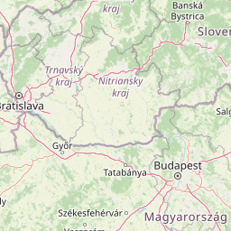
Danube-Auen National Park Geographic Boundary Map and Spatial Extent
Interactive boundary mapping provides clear spatial context for the protected area. Derived measurements detail the total ninety-three square kilometer area, coordinate limits, and geographic span.
- Boundary area
- 96.3 km²
- Boundary perimeter
- 134.3 km
- Northernmost point
- 48.2035° N
- Southernmost point
- 48.1099° N
- Easternmost point
- 16.9783° E
- Westernmost point
- 16.4698° E
- Geographic centre
- 48.145° N, 16.7153° E
- North–south span
- 10.4 km
- East–west span
- 37.8 km
Terrain and natural features
Stored Lowland Relief Classifications and Recorded Geographic Entities
Danube-Auen National Park Terrain and Named Natural Features
Recorded terrain classifications indicate a lowland relief profile alongside multiple rivers, streams, and islands located within the protected area. Linked feature cards supply names, types, measurements, and spatial relationships for each mapped natural entity.
Selected named natural features
Beaches
Hainburger Schotterbank
Rivers
Danube
Islands
Schwalbeninsel
Islands
Thurnhaufen
Streams
Tiergartenarm
Environmental setting
Temperate lowland terrain, riverine forests, and major wetland habitats
Danube-Auen National Park Environmental Classifications and Physical Setting
Recorded landscape features, habitat types, and climate classifications provide structured ways to examine the physical setting of Danube-Auen National Park. Associated attribute records connect these stored categories directly to relevant atlas destinations and regional geography.
- Relief
- Lowland
- Climate
- Temperate
- Water
- Major water bodies
- Forest cover
- Dense forest cover
- Seasonality
- Year-round
Landscape features
Rivers · Forest · Wetland · Grassland
Habitat types
Temperate broadleaf forest · Wetland · Riverine habitat · Grassland
Park atlas
Uncover nearby national parks and protected landscapes, comparing regional riverine ecosystems and floodplain habitats.
Discover Related National Parks and Protected Areas Surrounding Danube-Auen National Park
After exploring Danube-Auen National Park, continue your journey by browsing other national parks and protected areas that share similar riverine ecosystems or geographic proximity in Lower Austria. This allows for a deeper understanding of regional conservation efforts and helps compare the unique characteristics of nearby floodplain landscapes.
Nature reserveVienna
Mapped location lies within the park boundary#1 closest
West

Lobau Nature Reserve: Mapping the Protected Danube Floodplain Landscapes of Vienna
Riparian forests, oxbow lakes, and historic wetland ecosystems.
Lobau preserves the ecological memory of the Danube through a landscape of slow-moving water bodies and dense forest stands. Situated within Vienna, this protected area features a distinct topography of dry gravel terraces, reedy ponds, and riparian corridors, offering significant insights into the region's natural history and riverine geography.
- Area
- 22 km²
- Established
- 1905
- Relief
- Lowland
- Climate
- Temperate
Nature reserveLower Austria
About 2.4 km away#2 closest
Southeast
Hundsheimer Berg Nature Reserve: Protected Landscapes of the Lower Austrian Carpathians
Mapped dry steppe, karst topography, and pannonian forest habitats
Rising abruptly from the Danube lowlands, Hundsheimer Berg preserves a compact range of crystalline and limestone hills. This nature reserve provides vital insights into the pannonian biogeographic region, featuring a diverse mosaic of rocky slopes and dry grasslands that support a high concentration of rare insects and plants.
- Area
- 1.66 km²
- Established
- 1965
- IUCN
- IV
- Relief
- Mountain
Nature reserveLower Austria
About 2.4 km away#3 closest
Southeast
Spitzerberg Nature Reserve: Geography and Protected Landscapes of Lower Austria
A vital conservation site featuring arid rock steppes and limestone slopes.
Located in the province of Lower Austria, Spitzerberg serves as a essential nature reserve protecting a rare concentration of Pannonian dry habitats. The site is defined by its steep-sided hill structure, rocky limestone outcrops, and thin soils that support a variety of specialized plant and animal species adapted to this arid environment.
- Area
- 226 km²
- Established
- 1981
- IUCN
- IV
- Relief
- Upland
National parkBurgenland
22 km away#4 closest
South
Neusiedler See-Seewinkel National Park: Protected Steppe Lake Landscape in Burgenland
Explore mapped wetland geography and birdwatching significance.
Neusiedler See-Seewinkel National Park showcases a rare steppe lake environment and extensive wetland habitats at the eastern edge of Austria, within the Burgenland region. This protected area is globally recognized for its exceptional avian diversity and the unique ecological mosaic formed by reed beds, salt marshes, and seasonal pools. Explore its mapped boundaries and distinctive Pannonian geography for a deep understanding of this vital European protected landscape.
- Area
- 97 km²
- Established
- 1993
- IUCN
- II
- Relief
- Lowland
Nature reserveAustria
About 31 km away#5 closest
South
Lake Neusiedl: Protected Nature Reserve and Pannonian Steppe Geography in Austria
An endorheic lake system and critical wetland sanctuary.
Lake Neusiedl is a distinct nature reserve representing a rare European steppe lake environment. Its geography includes a vast ring of Phragmites reed beds, saline wetlands, and surrounding lowlands that form a vital migratory corridor. The lake serves as a cornerstone for protected landscapes in Austria, blending natural marshland dynamics with a deeply storied cultural history.
- Area
- 315 km²
- Established
- 1993
- Relief
- Lowland
- Climate
- Temperate
National parkGyőr-Moson-Sopron
41 km away#6 closest
South

Fertő-Hanság National Park: Central European Wetland and Salt Lake Protected Area
Mapped Geographic Boundaries and Landscape Context
Fertő-Hanság National Park, situated in Győr-Moson-Sopron, Hungary, is a vital protected landscape renowned for its shallow salt lake and expansive marshlands. This page provides an atlas-focused discovery of its protected area, highlighting the unique interplay of reed beds and alkaline grasslands. Understand the park's geographic setting and its role as a significant wetland ecosystem for bird populations and specialized flora.
- Area
- 235.88 km²
- Established
- 1991
- IUCN
- II
- Relief
- Lowland
Protected landscapeLower Austria
About 43 km away#7 closest
West
Vienna Woods: Protected Landscape, Forested Highlands, and Alpine Foothill Geography
Natural terrain and protected boundaries in Lower Austria
The Vienna Woods encompass a distinct geographic region where sandstone ridges meet limestone formations. This protected landscape provides a dense network of forest habitats, river gorges, and significant peaks overlooking the Danube. Its structure traces the edge of the Alps, offering a rich study in regional geology, elevation gradients, and the intersection of natural wilderness with the surrounding basin environment.
- Area
- 1,056.45 km²
- Established
- 1987
- Relief
- Mountain
- Climate
- Temperate
Nature reserveLower Austria
About 49 km away#8 closest
Southwest
Hohe Wand Nature Park: Mapped Geography and Protected Landscapes in Lower Austria
A limestone plateau mountain at the Alpine-Pannonian transition
Located in Lower Austria, Hohe Wand Nature Park encompasses a distinct limestone plateau and dramatic southeastern cliffs. Its protected status reflects the convergence of Alpine and Pannonian geography, offering a unique opportunity to study karst geology, exposed cliff habitats, and the transition zone between high mountain ranges and the Vienna Basin lowlands.
- Relief
- Mountain
- Climate
- Temperate
- Access
- Easy access
- Scope
- Terrestrial
MoriAtlas Explorer
Continue Exploring Danube-Auen National Park's Mapped Floodplain Geography
Discover deeper insights into the protected landscape of Danube-Auen National Park, a significant component of Austria's natural heritage. Continue your atlas exploration to understand its mapped boundaries, the ecological significance of its riparian ecosystems, and its place within the regional geography. This park provides a rich context for appreciating the dynamics of protected natural terrain and conservation efforts in Central Europe.
Browse next
Global natural geography
Explore related park routes
Explore MoriAtlas Global ParksBrowse All MoriAtlas ParksGlobal Park Map DiscoveryMoriAtlas: Browse All CountriesBrowse All MoriAtlas ContinentsNational Park Environment AtlasGrand Canyon National Park AtlasYellowstone National Park AtlasYosemite National Park Atlas and GeographySerengeti National Park AtlasGalápagos National Park Protected LandscapeBanff National Park Geography and AtlasKruger National Park Atlas EntryUluṟu-Kata Tjuṯa National Park AtlasExplore Uluru-Kata Tjuta National Park GeographyPlitvice Lakes National Park AtlasFiordland National Park Protected LandscapeGreat Smoky Mountains National Park AtlasAfghanistan National Parks and Protected AreasAlbania National Parks and Protected AreasAlgeria National Parks and Protected AreasAmerican Samoa National Parks and Protected AreasAndorra National Parks and Protected AreasAngola National Parks and Protected AreasAntarctica National Parks and Protected AreasAntigua and Barbuda Park List