Mori Atlas logo
National parkDanube-Drava National Park

Mapping Hungary's largest floodplain forest and vital river corridors for biodiversity

Danube-Drava National Park: Protected Riverine Landscape, Floodplain Ecosystems, and Atlas Context

(Duna–Dráva Nemzeti Park)

Danube-Drava National Park represents Hungary's most significant riverine protected area, an extensive mosaic of marshes, oxbow lakes, and riparian woodlands shaped by the Danube and Drava rivers. Established as a National Park in 1996, this vast wetland complex, spanning approximately 490 square kilometres, serves as a critical hub for biodiversity and water quality across Central Europe. Its nearly 190 square kilometres of Ramsar-designated wetlands underscore its international ecological importance, making it a key destination for understanding protected river landscapes within the broader European atlas.

wetlandsriparian foresttransboundary protected area Ramsar sitebirdwatchingfloodplain ecosystem
Illustration of a canyon with waterfall, river, and surrounding landscape including mountains, trees, and grass

Danube-Drava National Park

National park

Park overview

Structured park overview, official facts, and landscape profile for Danube-Drava National Park

Danube-Drava National Park park facts, protected area profile, and essential visitor context
Review the core facts for Danube-Drava National Park, including designation, size, terrain, visitor scale, habitats, and operating context in one park-focused overview.

About Danube-Drava National Park

Danube-Drava National Park protects one of the most ecologically significant river corridor ecosystems in Central Europe. The park occupies the floodplain zones where the Danube and Drava rivers have shaped the landscape over millennia, creating a complex environment of wetlands, channels, oxbow lakes, and gallery forests that remain functionally connected to natural hydrological cycles. This dynamic landscape absorbs seasonal floodwaters, filters nutrients, and provides critical habitat for species adapted to the rhythms of riverine ecosystems.

The park's territory encompasses several distinct management units, each preserving different aspects of the floodplain character. The Gemenc area in the east represents the heart of the park, containing the largest floodplain forest in Hungary with extensive willow and poplar stands that provide refuge for red deer populations of international renown. The Béda-Karapancsa region along the Danube contains valuable riparian forests and fish-rich channels, while the Dráva plain preserves the Hungarian floodplain of that river with its characteristic oxbow lakes and gallery woodlands.

The Barcsi-ősborókás in the western part of the park represents a different ecological character—a sandy area with juniper grassland and soft-water habitats that developed through historical deforestation and grazing. This unit provides important habitat for species adapted to drier conditions within the otherwise wetland-dominated park. The Lankóci-erdő contains rare plant species including the marsh lily and serves as a wintering area for common cranes.

Beyond its ecological significance, the park supports local communities through nature-based tourism and recreation. The nearby towns of Baja and Mohács, along with smaller villages like Kölked and Homorúd, draw upon the park for tourism and outdoor recreation that contributes to regional economic sustainability.

Quick facts and research context for Danube-Drava National Park

Danube-Drava National Park occupies roughly 490 km² of floodplain habitat in southwest Hungary, making it the country's largest riverine protected area. The park was established in 1996 through the integration of previously protected zones and now forms part of a transboundary biosphere reserve spanning five countries. Nearly 190 km² of its territory hold Ramsar wetland designation, recognizing the area's international importance for waterbird conservation. The park features a dynamic landscape of marshes, oxbow lakes, river channels, and gallery forests that follow the Danube and Drava rivers. Key wildlife includes European significance populations of black stork and white-tailed eagle, with the latter exhibiting the highest breeding pair density on the continental mainland. The park supports seven invertebrate species endemic to Hungary and more than 400 protected plant and animal species.

Park context

Deeper park guide and search-rich context for Danube-Drava National Park

Danube-Drava National Park history, landscape, wildlife, and travel context
Explore Danube-Drava National Park through its history, landscape character, ecosystems, wildlife, conservation priorities, cultural context, and seasonal travel timing in a structured park guide built for atlas discovery and search intent.

Why Danube-Drava National Park stands out

Danube-Drava National Park is best known as the core Hungarian component of Europe's largest riverine protected area, the transboundary Mura-Drava-Danube biosphere reserve spanning five countries. The park protects the country's most extensive floodplain forest ecosystem, characterized by the Gemenc forest, a 30-kilometre-long by 7-kilometre-wide stretch of riparian woodland that represents the largest contiguous floodplain forest in Hungary. The park is renowned for its exceptional bird populations, particularly the white-tailed eagle, which reaches its highest breeding density anywhere in continental Europe within these wetlands. The area is also famous for supporting significant populations of black stork, diverse heron and egret species, and seasonal concentrations of over 250,000 migratory waterfowl. The endangered ship sturgeon and sterlet inhabit the Danube channels within the park, representing some of the last strongholds for these ancient fish species in Central Europe.

Two deer running in a grassy field with trees in the background
Deer running in Gemenc Forest within Danube-Drava National Park

Danube-Drava National Park history and protected-area timeline

Danube-Drava National Park was established in 1996, created through the consolidation of previously protected areas within the Danube and Drava floodplains. The park's formation reflected growing recognition of the ecological significance of Hungary's river corridor wetlands and the need for coordinated protection across the floodplain landscape. Initial planning in the early 1990s had envisioned a transboundary park jointly managed with former Yugoslavia, but political changes in that country following the dissolution of the Soviet bloc necessitated establishing the protected area on Hungarian territory alone.

The park was founded during a period of expanding environmental consciousness in Central Europe, coinciding with the development of modern conservation frameworks across the region. The establishment built upon earlier protective designations including the Gemenc Landscape Protection Area created in 1977 and the Béda-Karapancsa Landscape Protection Area established in 1989. These earlier designations had recognized the exceptional nature values of specific floodplain areas within the broader river corridor.

A significant milestone in the park's history came on September 15, 2021, when Danube-Drava National Park was designated as one of the core protected areas of the Transboundary UNESCO Biosphere Reserve "Mura-Drava-Danube." This designation linked Hungary's park with existing biosphere reserves in Croatia and Hungary (2012), Serbia (2017), Slovenia (2018), and Austria (2019), creating a unified five-country protected area spanning almost one million hectares along over 700 kilometres of river corridors. This achievement represented decades of international cooperation toward protecting one of Europe's most significant riverine ecosystems.

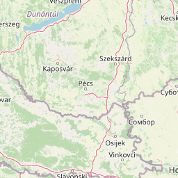
Danube-Drava National Park landscape and geographic character

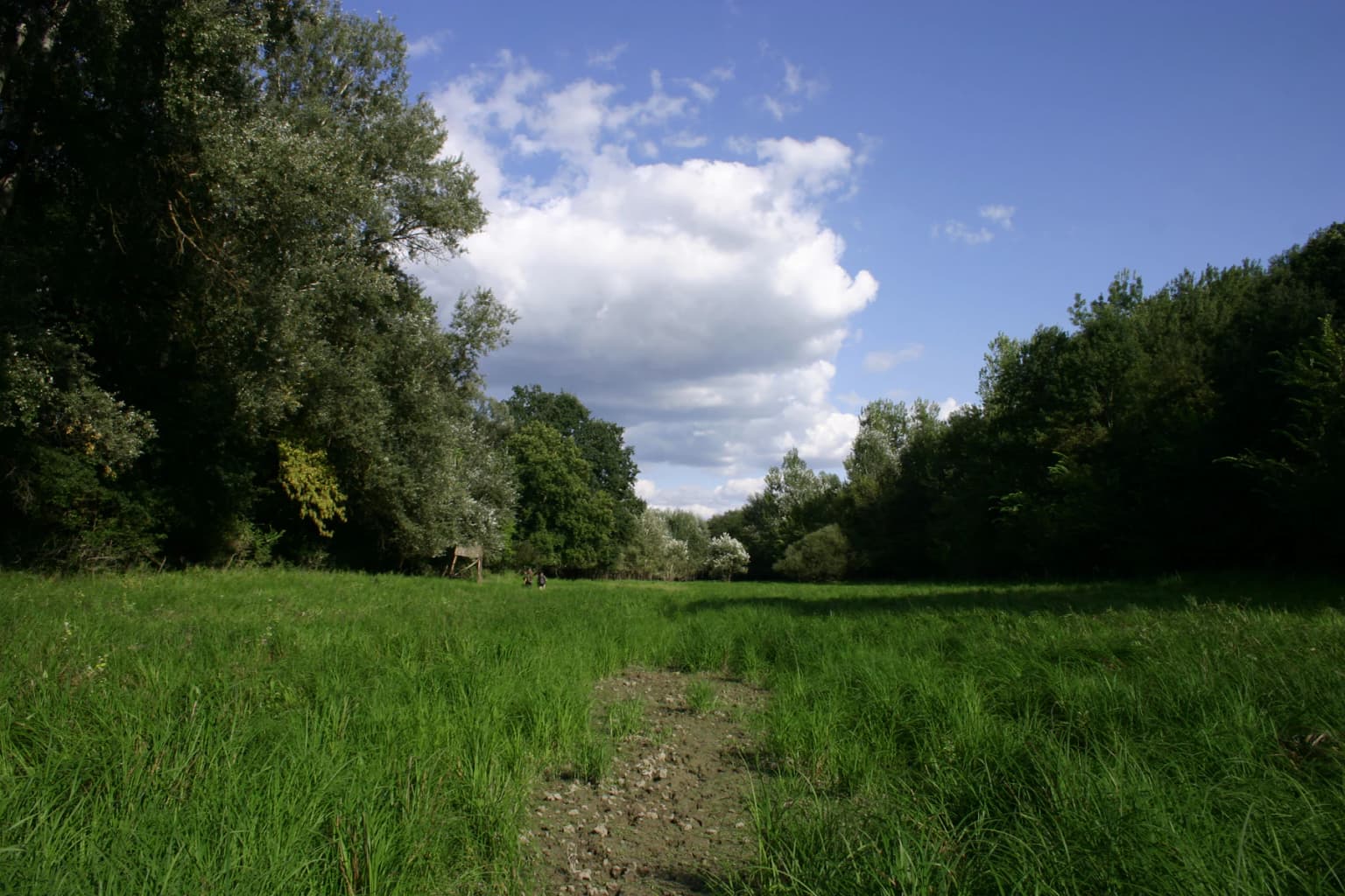
The landscape of Danube-Drava National Park is defined by the dynamic interplay between two major European rivers and the floodplain environments they create. The terrain is fundamentally flat, shaped by fluvial processes that have deposited sediments across the Hungarian plain over thousands of years. The park lies in the transition zone between the rolling hills of the Transdanubian Uplands—where the Mecsek and Villányi hills rise as isolated mountain masses—and the vast lowlands created by the Danube and Drava rivers.

Within the park boundaries, the landscape consists of a complex mosaic of marshland, floodplain forest, oxbow lakes, river channels, and open water. The Gemenc forest, the largest floodplain forest in Hungary, stretches approximately 30 kilometres along the Danube floodplain with a width of roughly 7 kilometres. This area features galleries of white willow in lower-lying areas and poplar stands on slightly higher ground, with dense undergrowth of hawthorn and blackberry creating nearly impenetrable thickets that provide ideal cover for large mammals.

The Béda-Karapancsa area contains the Karapancsa fishponds, important artificial wetlands within the natural floodplain system. The Dráva floodplain preserves a wider Hungarian river corridor, typically 10 to 15 kilometres wide, containing numerous oxbow lakes and gallery forest corridors. The Barcsi-ősborókás in the western sector provides topographic contrast—a sandy landscape with gentle dunes and heath vegetation that represents an older, drier landscape surface contrasting with the river-deposited floodplain soils.

Dirt path through green grass leading into forested area under blue sky with scattered clouds
Grassy meadow and forested path in Gemenc, Danube-Drava National Park

Danube-Drava National Park ecosystems, habitats, and plant life

The nature of Danube-Drava National Park centers on its remarkable wetland ecosystems, which support extraordinary biodiversity across multiple taxonomic groups. The floodplain environment creates diverse habitat conditions, from permanent water bodies to seasonally flooded marshes, from dense riparian forest to open reed beds, each supporting distinct ecological communities. The park's Ramsar designation recognizes the international significance of these wetlands for waterbird conservation and biodiversity preservation.

The vegetation patterns reflect the hydrological regime, with willow communities dominating areas frequently flooded and poplar stands on higher ground that remains dry for longer periods. The floodplain forests contain the black hawthorn, a species endemic to the park's territory, along with numerous other protected plant species exceeding 400 taxa across the broader protected area. The Drava caddis fly represents one of seven invertebrate species found only within Hungarian territory of the park.

The transboundary Mura-Drava-Danube network creates a habitat corridor of continental significance, connecting wetland ecosystems across five countries and facilitating species movement across what would otherwise be isolated protected fragments. This connectivity proves particularly important for migratory waterfowl and fish species that depend on river corridors for seasonal movements. The park's position within this larger network enhances its conservation value beyond what the Hungarian territory alone would provide.

Danube-Drava National Park wildlife and species highlights

The wildlife of Danube-Drava National Park reflects the exceptional ecological diversity of its wetland habitats. The park is renowned for its raptor populations, with the white-tailed eagle reaching its highest breeding density anywhere in continental Europe within these floodplain forests. Black stork populations are also of European significance, with the park providing critical nesting and foraging habitat for these striking wetland birds. Over 250,000 migratory waterfowl pass through the area annually, while over a quarter of a million waterbirds nest within the broader transboundary reserve.

The fish fauna of the Danube channels includes two endangered sturgeon species—the ship sturgeon and sterlet—representing some of the last remaining populations of these ancient fish in European river systems. The oxbow lakes and channels support diverse fish communities including sterlet, Danube salmon, and numerous cyprinid species that form the base of the wetland food web.

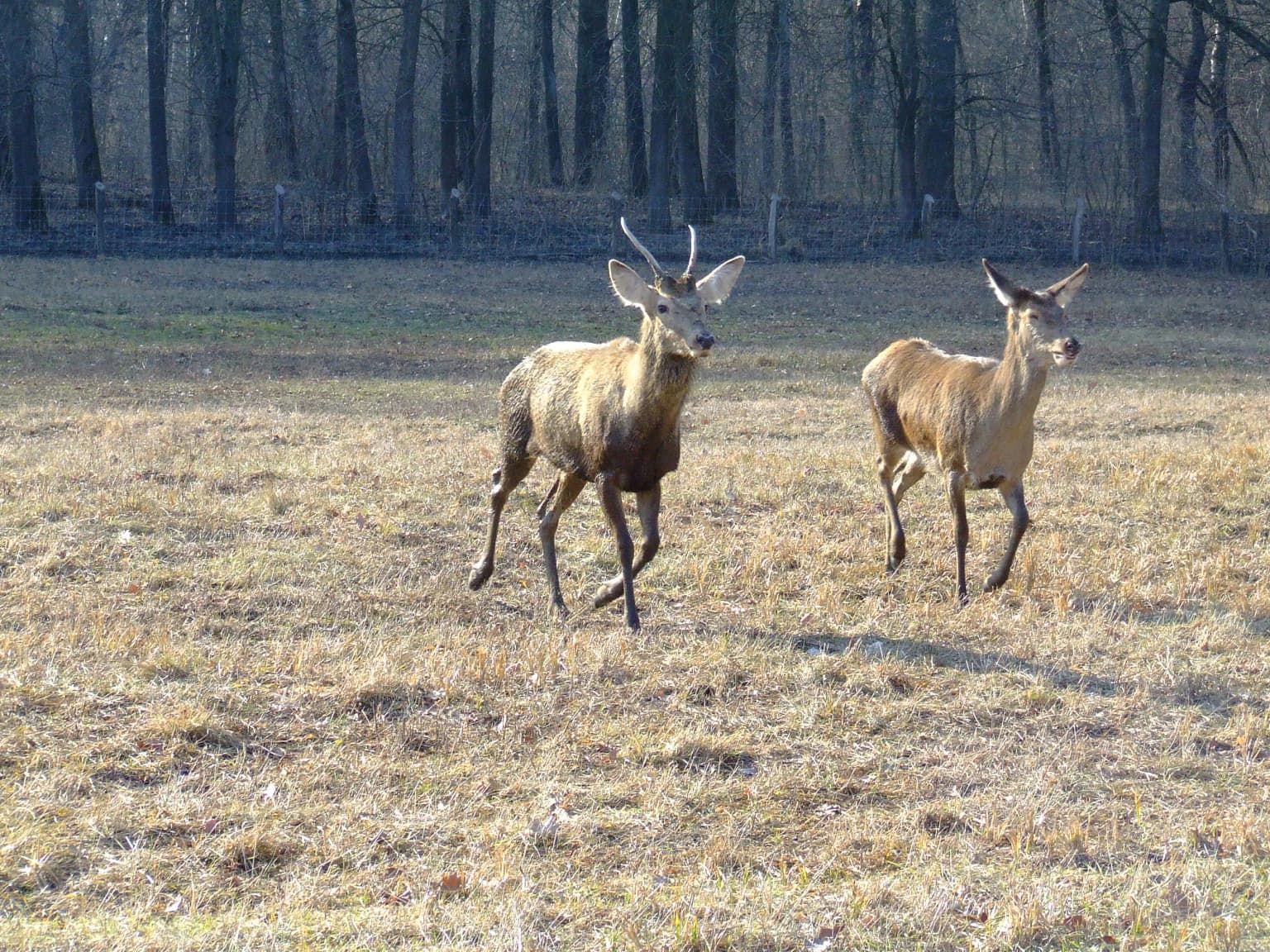
Mammal populations include large vertebrates adapted to wetland conditions. The Eurasian beaver has re-colonized the floodplain following reintroduction programs across Central Europe, while the Eurasian otter remains a secretive but widespread inhabitant of the water bodies and riparian corridors. The floodplain forests support populations of red deer that produce some of the finest trophy specimens in Hungary, along with roe deer and wild boar. The park also provides habitat for predators including the rare European otter, wildcat, and marten species within the forest corridors.

The avifauna extends beyond the flagship raptors to include diverse heron and egret populations, with great egret, little egret, and squacco heron nesting in significant colonies. The

Danube-Drava National Park conservation status and protection priorities

Danube-Drava National Park represents a cornerstone of European wetland conservation, serving as the Hungarian core zone of the transboundary Mura-Drava-Danube Biosphere Reserve that constitutes Europe's largest riverine protected area. The park's Ramsar designation highlights its international significance, with nearly 190 square kilometres of wetland recognized under the Convention on Wetlands of International Importance. This designation reflects the park's critical role in supporting waterbird populations of continental importance, particularly the white-tailed eagle that reaches its highest breeding density on the European mainland within these floodplains.

The transboundary designation in September 2021 unified five national biosphere reserves into a single cooperative framework spanning Austria, Croatia, Hungary, Serbia, and Slovenia. This achievement represents decades of international collaboration and creates a protected network of almost one million hectares along over 700 kilometres of river corridors. The connectivity provided by this network proves essential for migratory species and represents a model for transboundary conservation in Europe.

The conservation significance extends to rare and endemic species. Seven invertebrate species found nowhere else in Hungary inhabit the park, including the Drava caddis fly. The floodplain forests contain the black hawthorn as an endemic plant species. The endangered ship sturgeon and sterlet rely on the Danube channels within the park as crucial habitat. These species require coordinated conservation action that transcends national boundaries, making the transboundary framework essential for their long-term survival.

Danube-Drava National Park cultural meaning and human context

The landscape of Danube-Drava National Park has been shaped by human activity for millennia, with floodplain communities developing alongside the rivers that define the region's character. The nearby towns of Baja and Mohács have historical connections to the riverine environment, with Mohács particularly significant in Hungarian history as the site of a major 1526 battle. The villages within and adjacent to the park—including Kölked, Homorúd, Hercegszántó, and Újmohács—maintain connections to traditional land uses that have shaped the floodplain landscape.

The Gemenci forest within the park contains the Gemenci State Forest Railway, a narrow-gauge railway originally built for forest management that now operates as a heritage railway with steam-powered nostalgic trains. This railway represents the historical connection between the floodplain forests and human economic activity, providing visitor access to otherwise inaccessible areas of the floodplain and offering insight into traditional forestry practices.

The park supports local livelihoods through nature-based tourism and recreation, with the floodplain environment providing opportunities for hiking, birdwatching, and experiencing wetland landscapes that have defined the region's character. The conservation of the floodplain ecosystem also maintains traditional flood regulation functions that protect downstream communities and agricultural lands.

Top sights and standout views in Danube-Drava National Park

The park protects Europe's largest transboundary riverine protected area, the Mura-Drava-Danube biosphere reserve spanning five countries. It contains Hungary's largest floodplain forest at Gemenc, a 30-kilometre stretch of riparian woodland supporting exceptional red deer populations. The white-tailed eagle reaches its highest breeding density in continental Europe within these wetlands, making the park a flagship site for raptor conservation. Nearly 190 square kilometres hold Ramsar wetland designation, while seven invertebrate species are endemic to the park's territory. The endangered ship sturgeon and sterlet inhabit the Danube channels, representing significant populations of these ancient fish species in Central Europe.

Best time to visit Danube-Drava National Park

The Danube-Drava floodplain offers distinct experiences across seasons, each with particular highlights for visitors. Spring brings the peak of waterbird migration, with large numbers of waterfowl passing through the wetlands and breeding activity intensifying among the heron and egret colonies. The flooding season during spring creates dynamic wetland conditions as the rivers fill their floodplain channels, transforming the landscape into an expansive water environment that attracts wildlife watchers. Summer offers warm conditions for exploring the forest trails and provides excellent opportunities for observing adult raptors and their fledglings, though mid-summer heat can make midday outdoor activity challenging. Autumn presents another significant migration period as waterfowl begin their southward movement, with large flocks congregating on the floodplain wetlands before departure. The autumn flood pulses also create excellent conditions for observing fish activity in the channels, including the endangered sturgeon species. Winter reveals a different character, with reduced visitor numbers and the possibility of observing species like the white-tailed eagle at their most visible as they hunt in the more open, leafless landscape. Each season offers distinct photographic opportunities and wildlife viewing experiences within this dynamic riverine environment.

Park location guide

Geography guide, regional context, and park location map for Danube-Drava National Park

Danube-Drava National Park park geography, regions, and map view in Hungary
Understand where Danube-Drava National Park sits in Hungary through a broader geographic reading of the surrounding landscape, nearby location context, and its mapped position within the national park landscape.

How Danube-Drava National Park fits into Hungary

Hungary is a landlocked Central European country occupying the Carpathian Basin, also known as the Pannonian Basin. It borders Slovakia, Ukraine, Romania, Serbia, Croatia, Slovenia, and Austria. Budapest serves as both the capital and largest city. The population is predominantly ethnic Hungarians (Magyars), with Hungarian as the official language.

Wider geography shaping Danube-Drava National Park in Hungary

Hungary occupies the Carpathian Basin in Central Europe, a large lowland plain surrounded by the Carpathian Mountains. It is bordered by Slovakia to the north, Ukraine to the northeast, Romania to the east and southeast, Serbia to the south, Croatia and Slovenia to the southwest, and Austria to the west. The Danube River flows through the country, providing its primary drainage.

Map view of Danube-Drava National Park

Use this park location map to pinpoint Danube-Drava National Park in Hungary, understand its exact geographic position, and read its mapped placement within the surrounding landscape more clearly.

Pigeon | © OpenStreetMap contributors

Visually trace the dynamic floodplain ecosystems, vast riparian forests, and diverse wetland habitats shaped by the Danube and Drava rivers.

Danube-Drava National Park Photos: Explore Hungary's Premier Riverine Protected Area Landscapes
Examine the distinct visual identity of Danube-Drava National Park through an extensive collection of park imagery. These photographs offer valuable geographic context, revealing the unique character of its marshlands, oxbow lakes, and the vital floodplain environments that comprise this significant Central European protected area.

Two deer running in a grassy field with trees in the background

A grassy field with tall green vegetation and scattered yellow flowers, bordered by a dense line of trees under a partly cloudy sky

Dirt path through green grass leading into forested area under blue sky with scattered clouds

Park atlas

Map the surrounding protected areas, riverine ecosystems, and unique landscapes that complement Danube-Drava National Park's conservation scope.

Compare National Parks and Protected Areas Near Danube-Drava National Park
After exploring Danube-Drava National Park, browse other protected areas within the vast Mura-Drava-Danube Biosphere Reserve and surrounding Central European riverine landscapes. Compare diverse wetland ecosystems and trace connected conservation efforts across a significant transboundary region, enhancing your geographic understanding.
Watercolor illustration of a winding river through grassy fields with wildflowers and distant hills
Protected landscape

Subotička Peščara Protected Landscape: A Mapped Inland Dune System in Serbia

Explore unique Pannonian Plain geography and rare habitats.

Subotička Peščara Protected Landscape offers a deep dive into an exceptional inland dune ecosystem, a key feature of Serbia's Pannonian Plain geography. This protected area's mapped terrain includes a mosaic of forest, steppe, and wetland habitats, supporting rare flora and fauna. Discover the unique contours of this aeolian landscape and its significance within the regional geographic context.

Area
53.7 km²
Established
2002
Relief
Lowland
Climate
Temperate
Protected areaSerbia

Lake Palić Protected Area: Serbia's Mapped Landscape and Regional Geography Exploration

Understand the protected landscape and park boundaries of Lake Palić.

Delve into the specifics of Lake Palić, a designated protected area in Serbia. This resource offers a deep dive into the park's mapped landscape, helping to illustrate its protected boundaries and geographic significance. Gain a clear understanding of its regional context and its contribution to the atlas of protected natural areas within Serbia.

Watercolor illustration of a river flowing through wetland vegetation with distant hills under a light sky
Protected landscapeOsijek-Baranja County

Kopački Rit Protected Landscape: A Key European Wetland Ecosystem in Osijek-Baranja County

Mapped natural terrain and protected landscape geography.

Delve into the protected landscape of Kopački Rit, a pivotal European wetland situated within Osijek-Baranja County, Croatia. This page offers a detailed look at its dynamic floodplain ecosystem, mapped water channels, marshes, and riparian forests, highlighting its importance for biodiversity and regional geography. Understand the park's extensive protected boundaries and its place in the broader continental atlas.

Area
177 km²
Established
1976
IUCN
V
Relief
Lowland
National park

Balaton Uplands National Park: Mapped Volcanic Terrain and Protected Landscape Atlas

Explore Hungary's protected volcanic landscape and its regional geography.

Balaton Uplands National Park presents a compelling study in volcanic geography, showcasing dramatic 'witness mountains' and diverse terrains. As a protected national park in Hungary, it offers rich opportunities for atlas-style exploration of its mapped boundaries, unique basalt formations, and significant wetland areas. Discover the distinct geological narrative and landscape context of this protected region, providing a clear point of reference for understanding Hungary's natural heritage through structured geographic data.

Area
569.97 km²
Established
1997
Relief
Highland
Climate
Temperate
Watercolor painting of a mountain landscape featuring a river, hills, and vegetation
Nature reservePožega-Slavonia County

Papuk Nature Park: Explore Croatia's Foremost Geopark and Mountain Landscape

Mapped protected area with significant geological heritage in Slavonia.

Papuk Nature Park stands as a cornerstone of geological discovery in Croatia, celebrated as the nation's first UNESCO Global Geopark. Within Požega-Slavonia County, its mountainous terrain features dramatic ridgelines, ancient rock formations like Sokoline stijene, and extensive forests. This protected area offers a unique landscape context for atlas-driven exploration, detailing its mapped boundaries and its critical role in preserving Slavonia's highland geography and geological heritage.

Established
1999
Relief
Highland
Climate
Temperate
Access
Moderate access
Protected area

Jegrička Nature Park: Mapped Protected Area with Riverine Wetland Ecosystems

Explore the geography and protected landscape of Jegrička Nature Park.

Jegrička Nature Park is a designated protected area recognized for its significant riverine wetland character within the Pannonian Plain of northern Serbia. The park's landscape is defined by the meandering Jegrička river, extensive marshlands, and riparian vegetation, serving as crucial freshwater habitat for diverse waterfowl and migratory bird populations. This page offers detailed geographic context and atlas-level exploration of its protected boundaries and ecological importance within Eastern Europe's broader natural heritage.

Relief
Lowland
Scope
Mixed
Water
Major water bodies
National parkPest County

Danube-Ipoly National Park: Protected Landscape and Geographic Atlas

Mapping Hungary's diverse terrain and protected natural areas.

Delve into Danube-Ipoly National Park, a significant protected area renowned for its extraordinary ecological diversity. This page explores the park's distinct landscapes, from the volcanic formations of the Börzsöny Mountains to the deep karst cave systems of the Pilis, set against the backdrop of the Danube and Ipoly river floodplains. Understand its geographic placement within Pest County and its role as a vital protected landscape for conservation and atlas-based discovery.

Area
603.14 km²
Established
1997
Relief
Mixed relief
Climate
Temperate
Watercolor illustration of a river flowing through a valley with mountains in the background
National parkBékés County

Körös-Maros National Park: National Park Identity and Békés County Landscape Context

Explore its mapped protected areas, wetlands, and steppe grasslands.

Körös-Maros National Park is a designated national park located in Békés County, Hungary, recognized for its expansive wetland ecosystems and steppe grassland habitats. This protected area plays a critical role in the geography of the Southern Great Plain, serving as a vital migration corridor for diverse bird populations. Users can explore the park's distinct landscape features, mapped protected boundaries, and its significance as a hub for avian conservation.

Area
501.34 km²
Established
1997
Relief
Lowland
Climate
Temperate

Common questions about visiting, size, designation, and location context for Danube-Drava National Park

Danube-Drava National Park FAQs for park facts, access, geography, and protected area context
Find quick answers about Danube-Drava National Park, including protected-area facts, park geography, trail and visitor context, and how the park fits into its surrounding country and regional landscape.
MoriAtlas Explorer

Continue Your Protected Areas Search Across the Global Atlas

Deepen your exploration by continuing the structured search for national parks and protected areas worldwide. Utilize the comprehensive filtering capabilities to compare different conservation landscapes and refine your understanding of global park geography. Discover more about the distribution and characteristics of protected natural areas.

Global natural geography