Why Deng Deng National Park stands out
Deng Deng National Park is most significantly known for harboring the northernmost known population of the critically endangered western lowland gorilla. This makes the park globally important for gorilla conservation, as the species faces severe threats across its range. Beyond the gorillas, the park supports substantial populations of other flagship species including African forest elephants, chimpanzees, hippopotamus, and the giant pangolin, all of which contribute to the park's conservation significance within Central Africa.
Deng Deng National Park history and protected-area timeline
Deng Deng National Park was officially designated as a national park in 2010, representing a relatively recent addition to Cameroon's protected area system. The establishment of the park coincided with broader conservation initiatives in the region, including the development of the Lom Pangar Dam and reservoir project. The creation of the protected area was intended to safeguard the significant biodiversity values of the forest-savanna mosaic in eastern Cameroon, particularly the populations of large mammals that inhabit the region. The park's relatively recent designation means that management frameworks and conservation programs continue to develop as authorities work to address the challenges of protecting wildlife in a region where human activities and natural resource pressures are ongoing concerns.
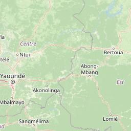
Deng Deng National Park landscape and geographic character
The terrain of Deng Deng National Park encompasses the characteristic landscape of the Northern Congolian forest-savanna mosaic, where discrete forest patches scattered across a savanna matrix create a distinctive visual and ecological character. The Sanaga River flows through or adjacent to the park, providing a permanent water source that supports riparian vegetation and wildlife throughout the year. The eastern boundary of the park lies in close proximity to the Lom Pangar Reservoir, a large hydroelectric impoundment that has altered the regional hydrology. The landscape supports a mix of forest types including semi-deciduous forest in the more protected valleys and savanna grassland on the broader plains, with the varied topography supporting this patchwork of habitats.
Deng Deng National Park ecosystems, habitats, and plant life
The ecoregional context of Deng Deng National Park places it within the Northern Congolian forest-savanna mosaic, a transition zone between the Congo Basin rainforests to the south and the savanna zones of Central Africa. This mosaic structure creates a diverse ecological setting where species from both forest and savanna environments can occur. The forest patches provide refuge for forest-dependent species while the savanna areas support species adapted to more open habitats. The Sanaga River corridor adds an additional habitat dimension, supporting riparian forests and aquatic environments that differ from the surrounding terrestrial habitats.
Deng Deng National Park wildlife and species highlights
The wildlife community of Deng Deng National Park is particularly notable for its population of western lowland gorillas, which represent the northernmost known population of this critically endangered subspecies. These gorillas inhabit the forest patches within the park and face significant conservation challenges across their range. The park also supports populations of chimpanzees, the other great ape species found in Cameroon, which share the forest habitat with the gorillas. African forest elephants traverse the landscape, while hippopotamus occupy the river habitats. The giant pangolin, a specialized ant-eating mammal, and the yellow-backed duiker, a forest-dwelling antelope, round out the notable mammalian fauna. This assemblage of large mammals gives the park significant conservation value within the Central African region.
Deng Deng National Park conservation status and protection priorities
Deng Deng National Park holds significant conservation importance due to its role in protecting populations of critically endangered western lowland gorillas. The northernmost location of this population within the park makes it strategically important for gorilla conservation efforts across their range. The presence of other threatened species including African forest elephants and chimpanzees adds to the conservation significance of the area. The park's designation as a Category II protected area provides a framework for habitat protection and species management, though challenges remain in addressing the threats that face wildlife populations in the region.
Top sights and standout views in Deng Deng National Park
Deng Deng National Park's defining highlight is its population of critically endangered western lowland gorillas, the northernmost known population of this imperiled great ape. The park's position within the forest-savanna mosaic creates a visually distinctive landscape where forest and savanna intermingle along the Sanaga River corridor. The presence of multiple flagship species including elephants, chimpanzees, and hippopotamus adds to the park's ecological significance, making it an important area for Central African biodiversity conservation.