Peaks
Maude Peak
1,220 m

Mapped boundaries, terrain analysis, and landscape features within the 341.7 square kilometer park.
This geographic profile details the physical characteristics of Egmont National Park, which covers 341.7 square kilometers within the Taranaki region of New Zealand. The mapped area includes diverse mountain terrain ranging from 100 meters to 2518 meters in elevation, featuring volcanic landscapes, forest cover, and a series of waterfalls and peaks.
Related tags
A volcanic wilderness of sacred peaks and temperate rainforests on New Zealand's North Island
Egmont National Park is a distinguished protected area in the Taranaki region of New Zealand's North Island, centered around the iconic volcanic cone of Mount Taranaki. Established as a forest reserve in 1881 and officially designated a national park in 1900, it stands as New Zealand's second-oldest national park, preceded only by Tongariro. The park encompasses approximately 34,200 hectares surrounding three volcanic peaks: the active stratovolcano of Mount Taranaki, and the extinct Pouākai and Kaitake ranges. Unlike most other New Zealand national parks, Egmont is uniquely encircled by productive agricultural farmland, giving it a distinctive circular shape when viewed from above. The park protects a remarkable range of ecosystems from coastal forest through temperate rainforest to subalpine and alpine zones, reflecting the dramatic climatic gradients created by the mountain's influence on moisture-bearing winds.
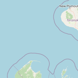
Regional placement and coastal classification in New Zealand
Analyzing the 341.7 square kilometer spatial extent and coordinate limits
Mountain relief metrics, peaks, ridges, and recorded natural features
Peaks
1,220 m
Streams
Peaks
1,224 m
Viewpoints
Streams
Streams
Temperate climate zones, dominant forest cover, and mountain relief profiles.
Mountains · Valleys · Forest · Wetland · Lakes · Rivers · Coast · Volcano · Cave
Temperate broadleaf forest · Montane forest · Alpine meadow · Shrubland · Wetland · Riverine habitat · Lacustrine habitat
Map the surrounding Taranaki region, trace connected protected landscapes, and compare other New Zealand national parks.

Northeast

Mapping the ecological sanctuary and reef geography in the New Plymouth District.
Gain insights into the geography of Parininihi Marine Reserve, a protected marine environment north-east of New Plymouth. This record outlines the reserve's structural features, from the iconic White Cliffs coastline to the complex underwater canyons and pinnacles of the Pariokariwa Reef. Learn about the seafloor terrain and the ecological distribution of invertebrate colonies and fish populations that define this crucial New Zealand marine reserve.
Southeast
Explore the mapped boundaries and natural terrain of this national park.
Whanganui National Park offers a unique blend of natural wilderness and significant cultural history, centered on the Whanganui River valley. This protected area safeguards one of New Zealand's most extensive lowland forest ecosystems, providing vital habitat and showcasing a landscape deeply intertwined with Māori traditions and historical settlement. Understanding its geographical setting and mapped protected boundaries reveals its importance as a distinct national park.
East
Explore mapped terrain, active volcanoes, and unique dual World Heritage values.
Tongariro National Park, situated in New Zealand's North Island, is a globally significant protected area celebrated for its dramatic volcanic landscapes and profound cultural heritage. As the nation's oldest national park, it features three active volcanoes: Mount Ruapehu, Mount Ngauruhoe, and Mount Tongariro, set within a diverse terrain that includes forests, alpine zones, and the Rangipo Desert. Its dual World Heritage status underscores its importance for both natural attributes and its sacred cultural landscape, offering rich opportunities for geographic and atlas exploration.
Northeast
Regional geography and mapped native forest boundaries
Pureora Forest Park represents a significant protected area in the central North Island of New Zealand, defined by its towering podocarp giants and complex volcanic terrain. The park serves as a prime example of an intact rainforest ecosystem, featuring dense broadleaf canopies, deep river valleys, and significant remnants of ancient forest history. Its geography, shaped by both geological upheaval and centuries of growth, provides an essential record of the natural heritage preserved across the Waikato and Manawatu-Whanganui regions.

East
Remote backcountry wilderness within the Manawatu-Whanganui Region
Spanning the high country of the Rangitikei District, Kaimanawa Forest Park offers a vast, forested wilderness experience distinct from the surrounding volcanic cones. This atlas entry details the park's structural role as a protected conservation area, tracing its boundaries across rugged mountain ridges and deep valleys that define the heart of New Zealand's central North Island landscape.
North
Geological tuff ring remnant and significant seabird sanctuary
Kārewa / Gannet Island serves as a crucial wildlife sanctuary and volcanic marker on the Waikato coast. This ancient tuff ring fragment rises from the seafloor to host an extensive gannet breeding population, offering a concentrated study of offshore geological and biological isolation within New Zealand's protected area network.
South
Maritime sanctuary and ecological refuge in Marlborough Region
Stephens Island (New Zealand) acts as a rugged, compact island refuge in the Cook Strait, defined by steep terrain rising to 283 metres. As a critical nature reserve managed by Ngāti Koata and the Department of Conservation, this site offers profound insights into isolated island ecosystems, evolutionary endemic species, and the geological processes of the Maitai Group.

Northeast
Volcanic summits and native podocarp forest boundaries
Gain a deeper understanding of Pirongia Forest Park through its complex volcanic geology and dense native vegetation. This resource outlines the park's fragmented ridges, limestone stream systems, and its role as a biogeographic bridge within the Waikato landscape of New Zealand.
Delve deeper into the geographic identity of Egmont National Park by examining its precise mapped boundaries and the unique volcanic terrain that defines this New Zealand landmark. Understanding its position within the broader regional geography offers a richer perspective on protected landscapes and their natural features. Continue your exploration of this iconic park to uncover its distinct ecosystem context and importance.