
Mori Atlas logo
Nature reserveElafonisi

Explore the unique coastal terrain, sand dune systems, and limestone geography of this island reserve.

Elafonisi Protected Nature Reserve: Geographic Atlas and Landscape Character of Crete

Elafonisi serves as a vital nature reserve located off the southwestern coast of Crete. This landscape is defined by its distinct combination of shifting sand dunes, phrygana scrub, and rocky limestone outcrops that create a protected coastal habitat within the Libyan Sea. Our geographic atlas details the spatial boundaries and environmental features that define this significant Mediterranean conservation area, providing insight into the landforms that shape its connection to the mainland through a shallow tidal channel.

Mediterranean coastislandpink sand beachescoastal dunesphrygana scrubjuniper woodland
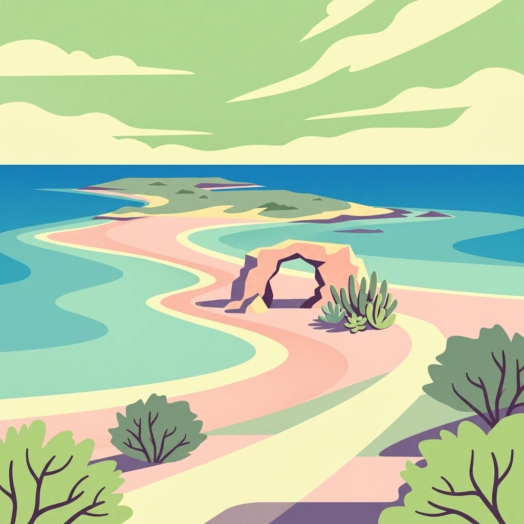
A colorful digital illustration depicting a coastal landscape with pink sand beaches, turquoise water, a natural rock arch, and low scrubby vegetation under a soft sky.

Elafonisi

Nature reserve

Park overview

Structured park overview, official facts, and landscape profile for Elafonisi

Elafonisi park facts, protected area profile, and essential visitor context

Review the core facts for Elafonisi, including designation, size, terrain, visitor scale, habitats, and operating context in one park-focused overview.

About Elafonisi

Elafonisi is one of the most recognizable natural landmarks of southwestern Crete, a small island and protected nature reserve set just offshore where the Libyan Sea meets the rocky southwestern corner of the island. Although it lies only a short distance from the mainland, its combination of pink-tinted sands, shallow turquoise water, and ecological sensitivity has made it both a celebrated coastal landscape and a carefully managed conservation area.

Administratively Elafonisi belongs to the municipality of Kissamos in the Chania regional unit of the Crete region. It is a low, roughly rectangular island around 1.5 kilometers long and generally between 150 and 300 meters wide, reaching its highest point of about 39 meters at the western end. The western part of the island is built of harder Gavrovo-Tripolis limestone, forming rocky, vegetated slopes, while the eastern section is lower and sandier, made up of softer sandstones capped by a belt of coastal dunes. Opposite the island lies an alluvial coastal plain on the Cretan mainland, and the two are separated by a shallow channel only about 150 meters wide.

The island's protection forms an important part of its identity. Elafonisi is designated as a protected natural refuge, classified as a landscape of outstanding natural beauty, and is included, along with the facing mainland shore, in the Natura 2000 network. This status reflects the unusual concentration of habitats packed into such a small area: sand dunes with their specialised flora, phrygana and juniper communities on the central and rocky sectors, halophytic vegetation along the shore, and areas of phryganic scrub on the older dunes. The plant list includes several species of biogeographical interest, including the Cretan endemic Androcymbium rechingeri and Centaurea pumilio, alongside the dune grass Ammophila arenaria, sea daffodils, juniper shrubs such as Juniperus oxycedrus subsp. macrocarpa, and a range of Mediterranean coastal species such as Crithmum maritimum, Euphorbia dendroides, and Capparis orientalis.

Wildlife on and around the island is distinctive for a site of its size. Elafonisi is a nesting site for Mediterranean storm petrels and supports other seabirds such as yellow-legged gulls. Mediterranean monk seals are recorded in nearby waters, and the island itself is inhabited by Cretan wildcats, European badgers, and reptile species native to the Aegean. The combination of dune, scrub, cliff, and sea creates a compact mosaic of habitats rarely found together in such a small area in the Mediterranean.

The site carries significant historical and cultural meaning as well. In 1824, on Easter Sunday, hundreds of Greek refugees, mostly women and children fleeing Ottoman forces in the Greek War of Independence, were killed on the island while waiting for transport to the Ionian Islands. A commemorative plaque marks the location. In 1907 the passenger steamer Imperatrix of the Austrian Lloyd line ran into trouble nearby in strong northwest winds; 38 people died attempting to reach shore in a lifeboat and were buried on the island, where a large wooden cross still stands. The wreck of the Imperatrix is said to lie in front of the island's cliffs and led to the construction of a lighthouse on the island's hilltop, which was later destroyed during the Second World War by occupying German forces.

Quick facts and research context for Elafonisi

Elafonisi sits in the Libyan Sea off the southwestern corner of Crete, in the municipality of Kissamos and the Chania regional unit. It is a small island of roughly rectangular shape, about 1.5 kilometers long with a maximum width near 500 meters, and a maximum elevation around 39 meters at its western end.

Geologically it is split between a higher western headland of Gavrovo-Tripolis limestones and a lower eastern section built of sandstones capped by coastal dunes. The island is officially a protected nature reserve and forms part of a Natura 2000 area together with the opposite Cretan shoreline. It is uninhabited, with a recorded population of zero at the 2001 census.

Protection and recognition

Examine the documented conservation scope and international recognition facts for Elafonisi.

Elafonisi Protection Status and Official Designation Records

Elafonisi features a mixed protection scope outlining its formal conservation boundaries and management context. Review official designation records to understand the documented administrative framework governing the area.

Protection details

Protection scope
Mixed
Transboundary protection
No
Park context

Deeper park guide and search-rich context for Elafonisi

Elafonisi history, landscape, wildlife, and travel context

Explore Elafonisi through its history, landscape character, ecosystems, wildlife, conservation priorities, cultural context, and seasonal travel timing in a structured park guide built for atlas discovery and search intent.

Why Elafonisi stands out

Elafonisi is best known for its pink sand beaches, where fine-grained, pale sand blends with vivid pink tones produced by fragments of pigmented microorganisms and certain red-shelled marine organisms that live nearby. The combination of warm, shallow turquoise water, soft shifting dunes, and an island that can be reached on foot through the sea gives the place a singular and widely recognized visual identity. Equally important is its protected ecological character: a small but unusually rich coastal landscape combining sand dunes, juniper stands, phrygana scrub, rocky limestone shores, and endemic plant species, all within a Natura 2000 site.
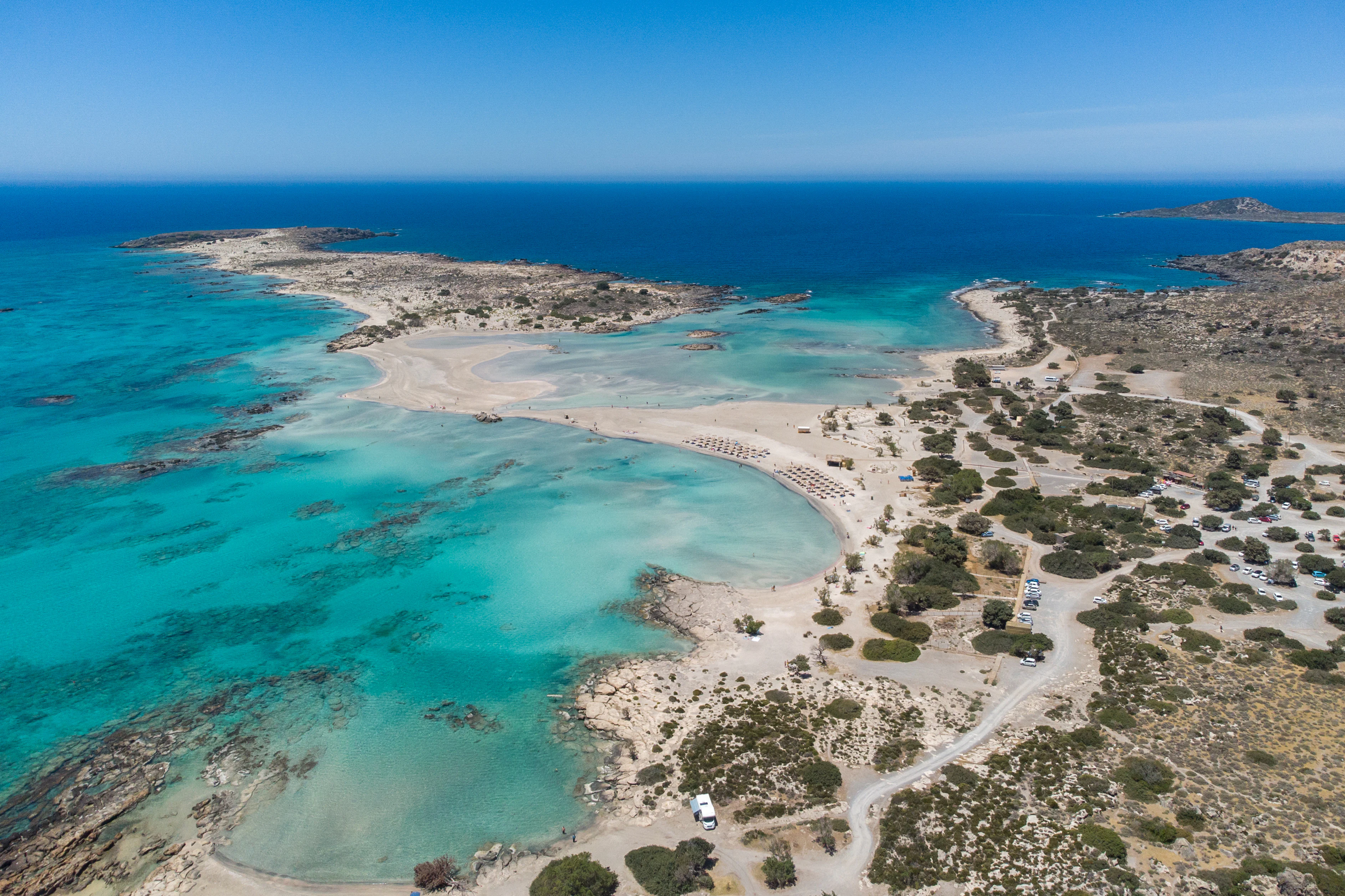
Aerial perspective looking over the turquoise shallow waters, sandbanks, and rugged scrubland of Elafonisi beach in Crete.
Aerial view of Elafonisi beach, showing the characteristic shallow turquoise lagoons and sandy coastline.

Elafonisi history and protected-area timeline

Elafonisi's modern identity as a protected natural area is relatively recent, but the island carries a layered history of human contact stretching back to antiquity. In ancient times it was known as part of the Musagores Nisoi, the islands sacred to Apollo Musagetes, leader of the Muses, where the Greeks believed the music of the Muses could calm a troubled sea. A sanctuary of Ino stood on the opposite mainland coast, and a small chapel dedicated to Saint Irene now stands near the site of the old lighthouse on the island itself.

The nineteenth century brought one of the most tragic pages in the island's recorded past. On Easter Sunday, 18 April 1824, during the Greek War of Independence, several hundred Greek civilians, mostly women, children, and the elderly, had taken refuge on Elafonisi together with about forty armed men, hoping to find a ship to carry them to the Ionian Islands. Ottoman forces camped on the mainland beach opposite, and one of their horses walked across the shallow channel, revealing the hidden group. Sources describe between roughly 640 and 850 people on the island; most were killed and the surviving captives were sold into slavery in Egypt. A plaque at the island's highest point commemorates the event.

In the early twentieth century the island became associated with a major maritime disaster. On 22 February 1907 the Österreichischer Lloyd passenger steamer Imperatrix came to grief in heavy northwest winds near Elafonisi; 38 people perished in a lifeboat trying to land and were buried on the island, where a large wooden cross still commemorates them. The wreck of the Imperatrix lies offshore in front of the island's cliffs, and the disaster was the reason a lighthouse was built on an island hilltop, subsequently destroyed during the Second World War by occupying German forces.

In the modern era Elafonisi has become one of the most visited natural sites of western Crete, earning recognition as a Natura 2000 site and a designated landscape of outstanding natural beauty. Increased visitor pressure has led to localized environmental stress, with trampling of dune vegetation and disturbance of nesting birds, along with the addition of temporary tourist infrastructure on the facing mainland.

Elafonisi landscape and geographic character

Elafonisi's landscape is shaped by the contrast between two very different halves of a very small island. The western end is higher and more rugged, rising to about 39 meters and built on limestones of the Gavrovo-Tripolis series. Here the terrain is rocky, with low cliffs and stony slopes, supporting a mixture of phrygana scrub and small trees typical of the southern Aegean coast.

The eastern half of the island is lower and markedly softer, formed of sandstones covered by an extensive belt of sand dunes. These dunes separate the island's interior from its beaches and are themselves a defining feature of the scenery: pale ridges of sand, partially fixed by vegetation, with halophytic plants clinging to the shifting substrate. Sandy beaches ring much of the island, especially on its sheltered sides, and these are the stretches where the famous pink sand is most visible.

Between Elafonisi and the Cretan mainland lies an alluvial coastal plain, and the island is separated from it by a shallow, narrow channel only around 150 meters wide. In calm weather this channel is so shallow that visitors can wade across it on foot to reach the island, an unusual geographic feature that gives the site a strong sense of separateness without true isolation from the mainland coast.
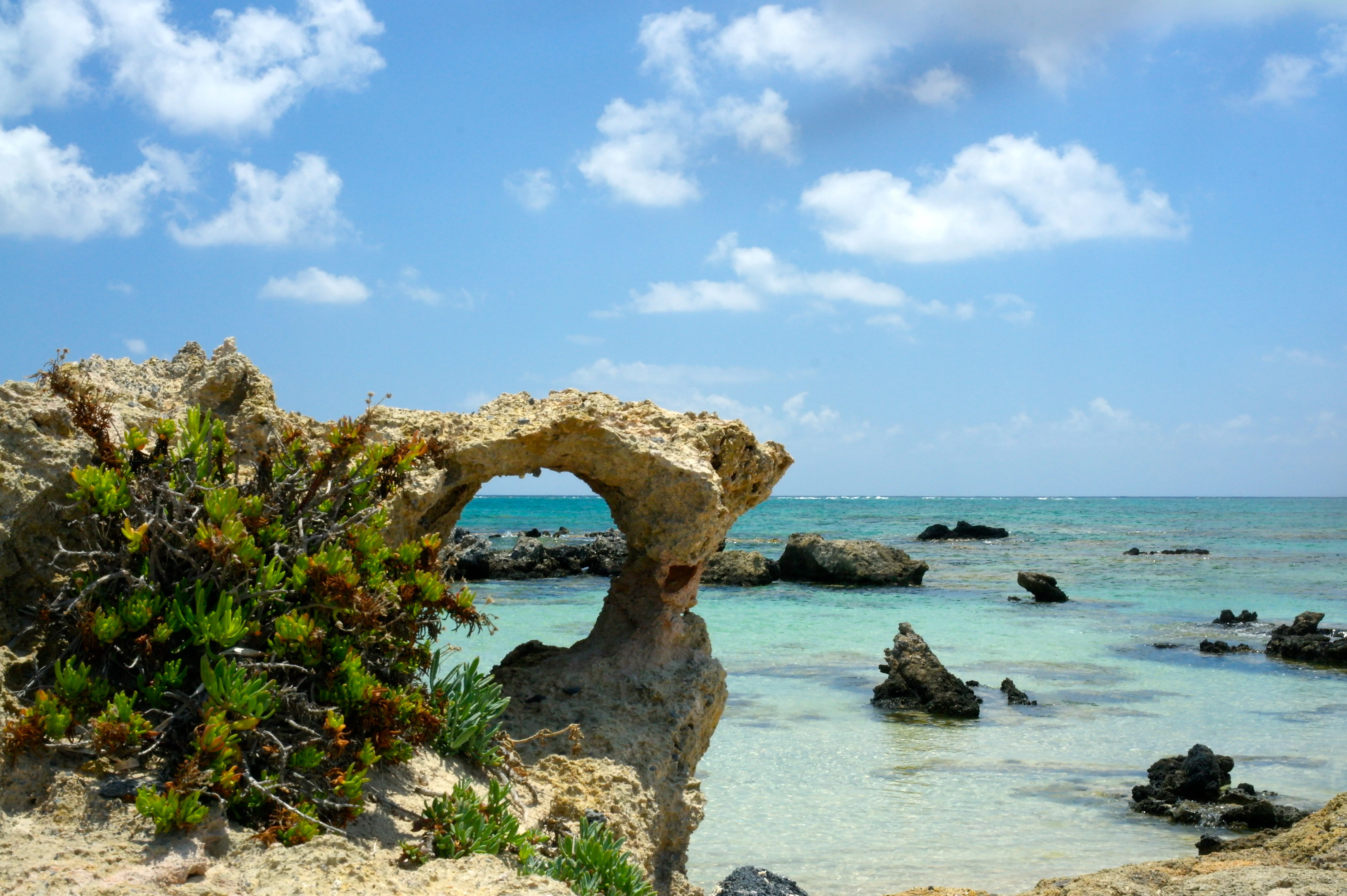
A weathered rock arch stands on a rocky coastline overlooking shallow turquoise sea water under a blue sky with scattered clouds.
A natural rock formation frames the turquoise waters at Elafonisi, a protected area in Crete.

Elafonisi ecosystems, habitats, and plant life

Ecologically, Elafonisi is unusually rich for an island of its size, packing a wide cross-section of Mediterranean coastal habitats into a very compact area. The island functions as a protected natural refuge and is part of a Natura 2000 site that also includes the facing Cretan mainland.

Sand dunes are a centerpiece of the island's natural character. The dunes are stabilized in part by the dune grass Ammophila arenaria and feature stands of sea daffodils and juniper (Juniperus oxycedrus subsp. macrocarpa), along with characteristic sand-loving species such as Anthyllis hermanniae, Silene sedoides, Lotus creticus subsp. cytisoides, Ipomoea stolonifera, Orobanche versicolor, and Plantago squarrosa. On the rocky western sector a different suite of Mediterranean coastal plants takes over, including Atriplex halimus, Crithmum maritimum, Inula crithmoides, Capparis orientalis, Euphorbia dendroides, and Ficus carica, while the older dunes toward the center carry phryganic communities of kefalothymaro, asprothymaro, and agrio malotyra.

Several plants of biogeographical significance grow on Elafonisi, notably the Cretan endemics Androcymbium rechingeri and Centaurea pumilio, reflecting its position at the edge of one of the Mediterranean's centres of endemism. Dune, cliff, phrygana, juniper stands, and shoreline halophytic vegetation combine here in a single mosaic that is well represented, though increasingly vulnerable to the pressures of heavy visitor use.
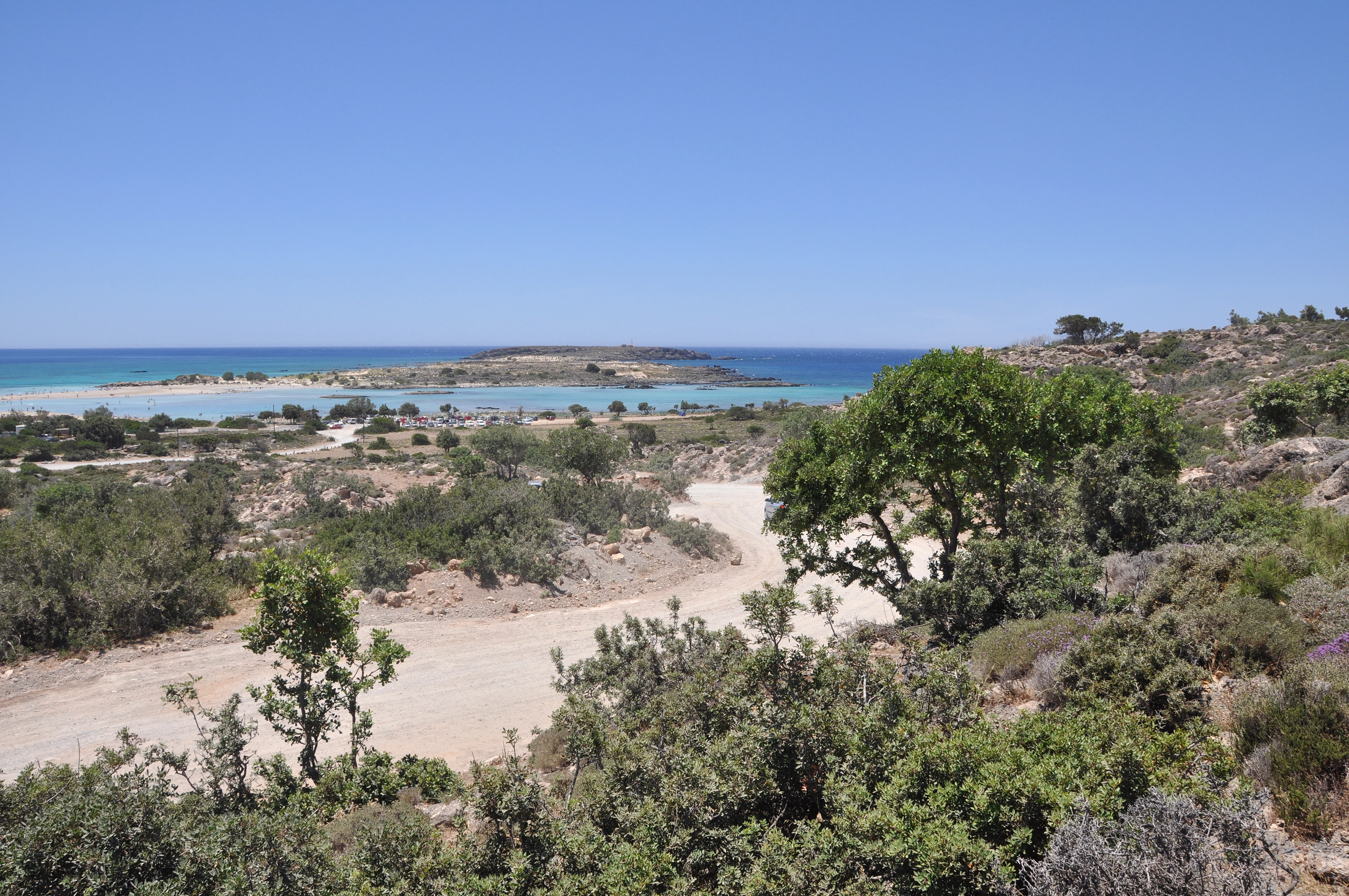
A sunny coastal landscape in Crete showing a dirt path leading toward a sandy beach, shallow turquoise water, and a small island in the distance under a clear blue sky.
A wide view overlooking the coastal terrain and turquoise waters of Elafonisi in Crete.

Elafonisi wildlife and species highlights

The wildlife of Elafonisi is shaped by its coastal character and its relative freedom from permanent human habitation. The island is recognized as a breeding site for Mediterranean storm petrels, while yellow-legged gulls are among the more conspicuous seabirds in surrounding waters. Mediterranean monk seals have been recorded in the area, an important indicator of the marine habitat's ecological quality.

On land, the island supports a typical cross-section of small-island Mediterranean mammals and reptiles. Cretan wildcats and European badgers are present, alongside reptile species native to the southern Aegean, including Erhard's wall lizard (Podarcis erhardii) and the shot-snouted nose-horned viper (Vipera ammodytes), together with other snake species such as the Montpellier snake. The compact mix of dune, scrub, rocky cliff, and shoreline environments allows a relatively high diversity of small vertebrates to coexist on a very small land area.
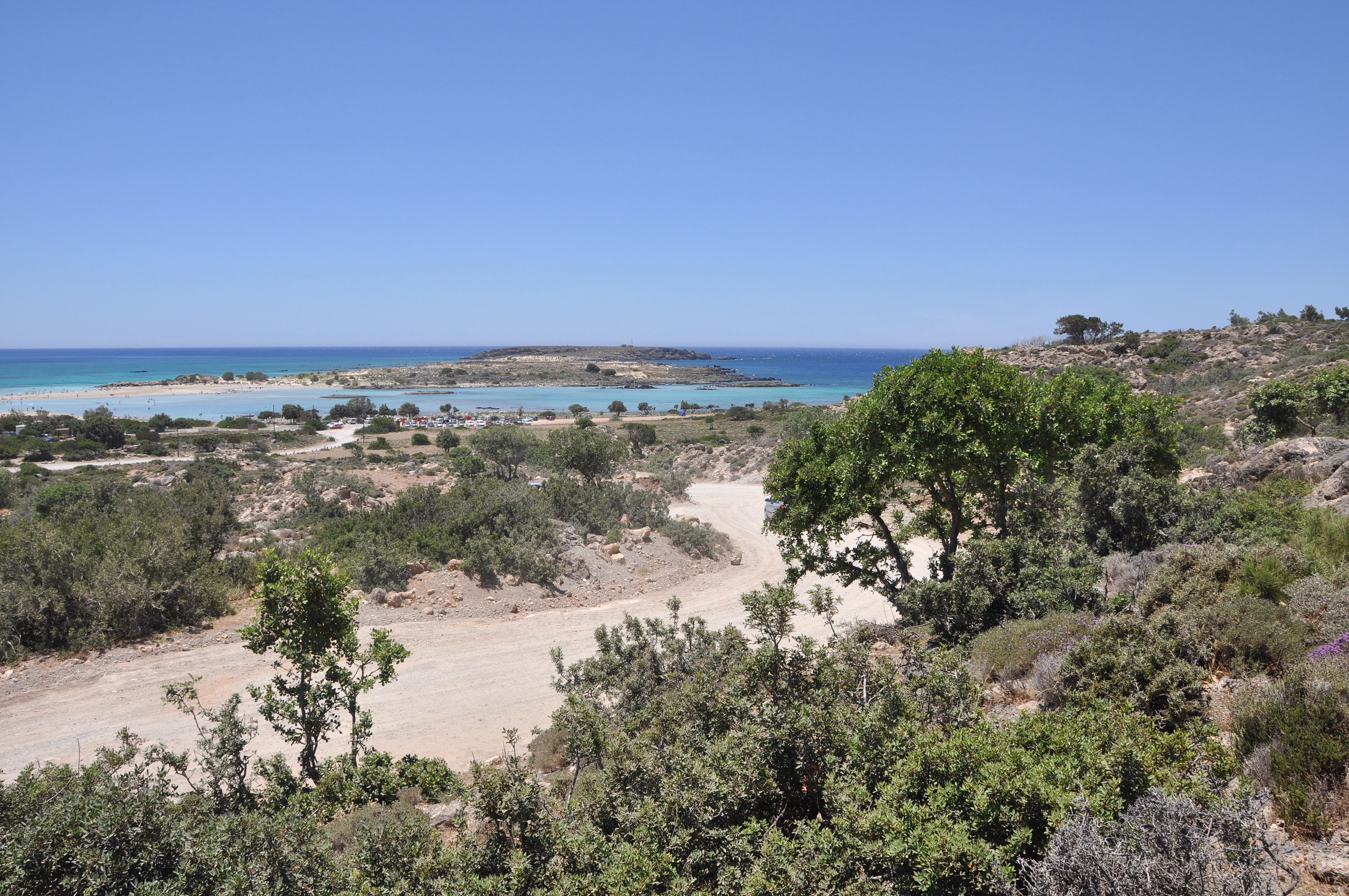
A landscape view from a slight elevation showing a dirt road winding through low coastal vegetation toward a shallow turquoise bay and a small island on the horizon under a clear blue sky.
A wide view overlooking the coastal scrubland and the turquoise waters surrounding Elafonisi Island in Crete.

Elafonisi conservation status and protection priorities

Elafonisi's status as a protected natural refuge and a Natura 2000 site, together with its formal classification as a landscape of outstanding natural beauty alongside the opposite mainland coast, places it among the most formally protected coastal sites of western Crete. The designations recognize the global and regional importance of its dune, phrygana, and rocky-habitat mosaic, its endemic plant species such as Androcymbium rechingeri and Centaurea pumilio, and the presence of sensitive breeding seabirds such as Mediterranean storm petrels.

Conservation concern at Elafonisi centers on the tension between its ecological sensitivity and its very high popularity as a visitor destination. Trampling of dune vegetation and disturbance of ground-nesting birds have been recorded, along with visual encroachment from temporary beach infrastructure placed for visitors on the opposite mainland. The degradation of the natural environment on the island itself has so far remained relatively limited by comparison with some similar Mediterranean sites, but the combination of strong seasonal visitor pressure, fragile dune vegetation, and breeding birds in a small protected area means the site requires continuing active management to retain its ecological character.

Elafonisi cultural meaning and human context

Elafonisi carries a layered cultural identity that stretches from antiquity to the modern Greek state. In the ancient world the island belonged to the Musagores Nisoi, the islands sacred to Apollo Musagetes, leader of the Muses, while the facing mainland shore hosted a sanctuary of Ino; together they formed a religious pair tied to maritime protection and the calming of rough seas. A small chapel dedicated to Saint Irene now stands near the site of the old lighthouse on the island itself, continuing the tradition of maritime devotional sites.

The island is also closely linked to modern Greek historical memory. The 1824 Easter massacre during the Greek War of Independence, in which several hundred Greek refugees, mostly women and children, were killed on the island by Ottoman forces, remains a significant local and national memorial occasion, marked by the plaque on the island's highest point. The 1907 Imperatrix disaster, in which 38 people drowned and were buried on the island, is commemorated by the large wooden cross still standing there. On the nearby mainland, the 17th-century Chrysoskalitissa Monastery, about five kilometers from Elafonisi, anchors the area's monastic landscape alongside the coastal scenery.
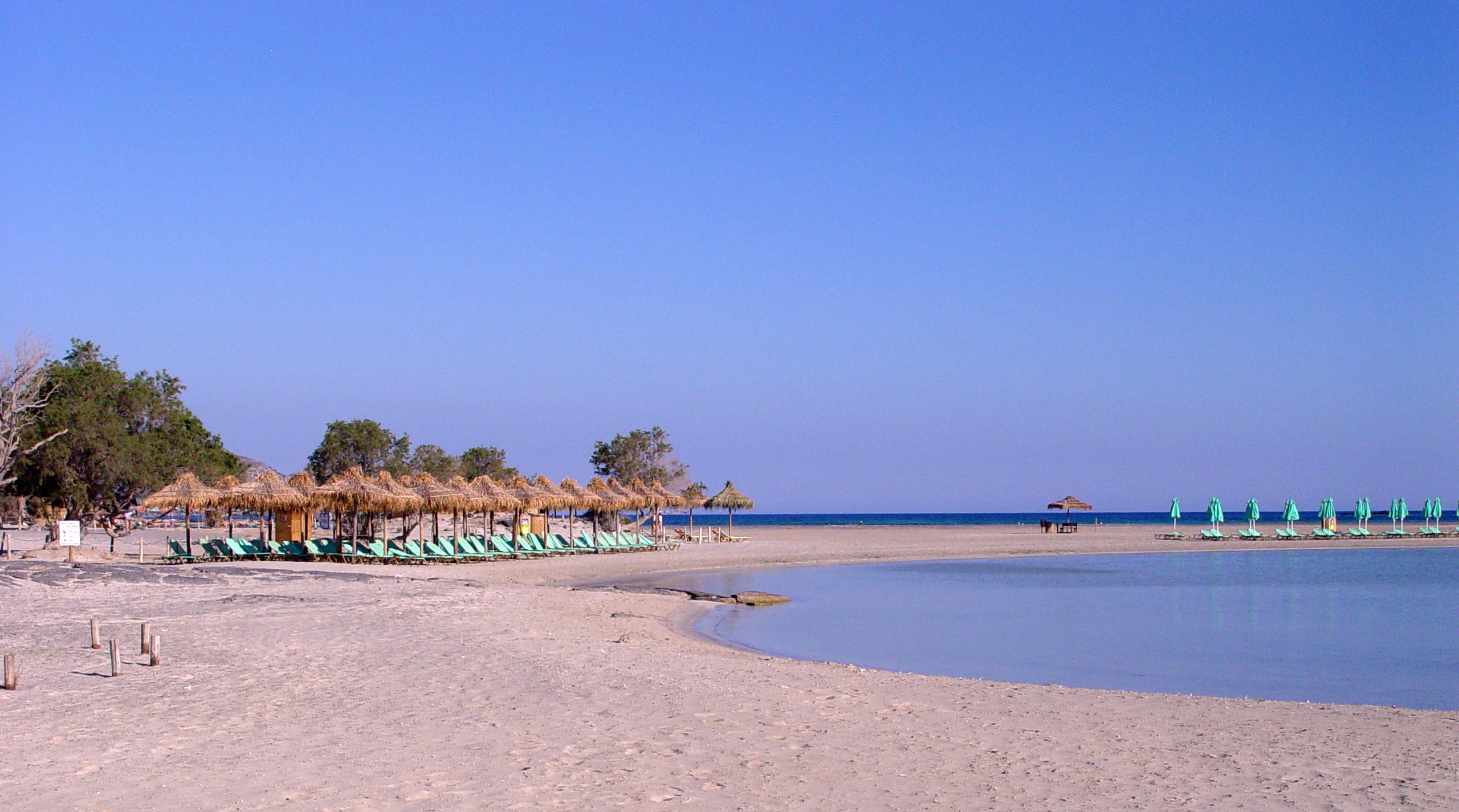
A wide-angle, eye-level shot of a sandy beach with rows of thatch umbrellas and lounge chairs, bordering a calm, shallow turquoise-blue lagoon under a clear, bright blue sky.
A wide view of the sandy shore and shallow blue waters of Elafonisi beach.

Top sights and standout views in Elafonisi

Elafonisi's strongest points of distinction come from the unusual combination of scenery, ecology, and history in a single very small space. The pink sand beaches, tinted by pigmented microorganisms and certain red-shelled marine organisms, are the site's most visible signature and the reason many travelers first encounter it.

Beneath this celebrated shoreline, however, lies a genuine coastal conservation landscape: an island of sand dunes, juniper, phrygana, and rocky limestone that hosts endemic Cretan plants and Mediterranean storm petrel breeding colonies, all bound together within a Natura 2000 framework. Layered on top of this is a striking historical record, from ancient sanctuary sites to the 1824 Easter tragedy and the 1907 wreck of the Imperatrix, making Elafonisi a place where natural beauty, ecological sensitivity, and shared Mediterranean memory all meet in a single small island.

Best time to visit Elafonisi

Elafonisi experiences a typical Mediterranean climate, with mild, wet winters and hot, dry summers. Late spring, roughly from May into early June, often combines warm sea temperatures with relatively low visitor density, making it a time when the dune vegetation, juniper stands, and flowering phrygana are active and the pink sands stand against clear water.

Late summer and early autumn, from late August through October, bring the warmest and calmest sea conditions, which also mean the shallow channel between the island and the mainland is most easily crossed on foot. Midsummer is the peak visitation period, when temporary beach infrastructure on the facing coast is busiest and pressure on dune vegetation and nesting birds is highest. Winter and early spring tend to be quieter, with stronger winds and cooler water, but offer a more tranquil view of the landscape and its wildlife.
Monthly climate preview

Long-term representative monthly temperature and precipitation data for Elafonisi

Elafonisi Climate Normals and Annual Temperature Rhythm

Representative coordinate measurements reveal the multi-year average temperature progression and monthly precipitation amounts recorded across Elafonisi. Examining the complete twelve-month statistical profile clarifies the full range of historical climate conditions documented at this location.
Annual mean18 °C
11 °C26 °C
Jan11°
Feb11°
Mar13°
Apr15°
May19°
Jun23°
Jul26°
Aug26°
Sep23°
Oct20°
Nov16°
Dec13°
Warmest month
August

25.9 °C

Coolest month
February

11.3 °C

Wettest month
December

3.7 mm/day

Driest month
July

0.1 mm/day

Park location guide

Geography guide, regional context, and park location map for Elafonisi

Elafonisi park geography, regions, and map view in Greece

Understand where Elafonisi sits in Greece through a broader geographic reading of the surrounding landscape, nearby location context, and its mapped position within the national park landscape.

How Elafonisi fits into Greece

Greece, officially the Hellenic Republic, is a country in Southeast Europe occupying the southern Balkans. It borders Albania, North Macedonia, Bulgaria, and Turkey, with coastlines on the Aegean, Ionian, and Mediterranean seas. The country has over 10 million people and is renowned for its ancient Greek heritage, philosophy, democracy, and the Olympic Games.

Wider geography shaping Elafonisi in Greece

Greece occupies the southern tip of the Balkan peninsula in Southeast Europe. It shares land borders with Albania to the northwest, North Macedonia and Bulgaria to the north, and Turkey to the east. The Aegean Sea lies to the east of the mainland, the Ionian Sea to the west, and the Sea of Crete and Mediterranean Sea to the south. The country spans thousands of islands across nine traditional geographic regions and has the longest coastline in the Mediterranean basin.

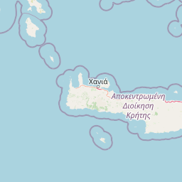
Map view of Elafonisi

Use this park location map to pinpoint Elafonisi in Greece, understand its exact geographic position, and read its mapped placement within the surrounding landscape more clearly.

Pigeon | © OpenStreetMap contributors

Location context for Elafonisi

Crete

Explore detailed imagery of pink sand beaches, sand dunes, and limestone terrain.

Elafonisi Photos and Scenery: Visualizing the Protected Coastal Landscapes

Visual records capture the distinctive geography of Elafonisi, including fragile coastal dune systems, phrygana scrub, and shallow turquoise lagoons. Photographic documentation reveals the intricate balance between protected habitats and open Mediterranean shorelines.

Aerial perspective looking over the turquoise shallow waters, sandbanks, and rugged scrubland of Elafonisi beach in Crete.

An aerial view of the Elafonisi nature reserve in Crete, showing shallow turquoise water meeting a sandy beach and rocky, scrub-covered land.

A weathered rock arch stands on a rocky coastline overlooking shallow turquoise sea water under a blue sky with scattered clouds.

A sunny coastal landscape in Crete showing a dirt path leading toward a sandy beach, shallow turquoise water, and a small island in the distance under a clear blue sky.

A landscape view from a slight elevation showing a dirt road winding through low coastal vegetation toward a shallow turquoise bay and a small island on the horizon under a clear blue sky.

A wide beach scene at Elafonisi featuring rows of straw parasols and sun loungers lining the light-colored sand against a calm, shallow sea.

A wide-angle, eye-level shot of a sandy beach with rows of thatch umbrellas and lounge chairs, bordering a calm, shallow turquoise-blue lagoon under a clear, bright blue sky.

Park atlas

Compare regional park geography and connected Mediterranean nature reserves

Explore Parks Near Elafonisi and Surrounding Protected Coastal Landscapes

Browse nearby national parks and protected areas to expand your geographic comparison beyond Elafonisi. Regional park records provide wider context on coastal dunes, limestone terrain, and protected Mediterranean habitats.
A watercolor painting showing a panoramic landscape with green hills, distant mountains, and water, set against a plain white background.
National parkGreece
About 39 km away#1 closest

East

Samaria National Park: Geological Landscape and Protected Area Atlas in Crete, Greece

Mapping the dramatic White Mountain canyon and coastal descent

Samaria National Park stands as a major protected landmark in Greece, defined by a tectonic gorge that bisects the White Mountains. This atlas entry covers the park boundary, the distinct vertical limestone cliffs of the Iron Gates, and the transition from mountain plateau to the Mediterranean coastline.

Area
4.848 km²
Established
1962
Relief
Mountain
Climate
Mediterranean
A soft watercolor illustration of green rolling hills and flat land against a pale, hazy background, representing a coastal island environment.
Nature reserveCrete
About 47 km away#2 closest

Northeast

Agioi Theodoroi Nature Reserve: Protected Island Landscapes off the Coast of Crete

A vital wildlife sanctuary and historical island terrain

The nature reserve of Agioi Theodoroi comprises two small, rocky islands off the northwestern shore of Crete. Known for a long-established population of the rare kri-kri wild goat and breeding colonies of Eleonora's falcons, these islets maintain strict conservation status. Explore the mapped boundaries of this unique protected area and its significance within the coastal geography of the Chania region.

Area
0.697 km²
Established
1930
Relief
Upland
Climate
Mediterranean
A horizontal watercolor painting showing soft, rolling mountains and sparse desert-like shrubbery in shades of light green, pale pink, and yellow.
Biosphere reserveCrete
About 120 km away#3 closest

East

Psiloritis Natural Park: Protected Karstic Mountains and Cultural Landscapes in Crete

Geological exploration and regional mountain geography

Psiloritis Natural Park encompasses the central massif of Crete, featuring the famous Mount Ida range. Its protected territory serves as an essential site for understanding karstic geology, from deep underground cave systems to high-altitude steppes. The region perfectly highlights the intersection between large-scale tectonic history and the long-standing human traditions that shape the mountainous interior of the island.

Area
1,159 km²
Established
2001
Relief
Mountain
Climate
Mediterranean
A horizontal watercolor painting depicting a pale blue coastal landscape with low green vegetation in the foreground and soft mountainous ridges in the distance.
Protected areaLasithi
About 204 km away#4 closest

East

Chrysi Protected Area: Mapping the Juniper Forests and Beaches of Lasithi, Greece

A coastal island sanctuary in the Libyan Sea

Chrysi presents a distinct landscape characterized by a mature juniper forest and golden-sand beaches. Situated within the Lasithi regional unit, this island remains a primary example of a protected Mediterranean woodland environment, preserving a unique set of coastal terrain, shallow sea ecosystems, and archaeological history on a small geographic footprint.

Area
4.743 km²
Relief
Lowland
Climate
Mediterranean
Access
Easy access
A watercolor painting of a rolling mountainous landscape in Crete, featuring soft green hills, wildflowers, and pale mountain outlines against a light sky.
Biosphere reserveCrete
About 241 km away#5 closest

East

Sitia Nature Park: Geographic Atlas of Crete's Eastern Protected Mountain Landscapes

Mapping gorges, karst caves, and the eastern Cretan coastline.

Sitia Nature Park represents a vast protected territory across eastern Crete, characterized by its complex mountain spine and profound geological formations. This atlas entry provides geographic insights into the park's canyon systems, including the Valley of the Dead, and the karst caves that define its UNESCO Global Geopark status and regional natural terrain.

Established
2015
Relief
Mountain
Climate
Mediterranean
Access
Moderate access
A horizontal watercolor illustration showing soft, stylized green and pink layers representing rolling hills and distant land over a light foreground of scrubby vegetation.
Protected areaLasithi
About 241 km away#6 closest

East

Dionysades Protected Area: An Atlas Guide to the Islands of Northeastern Crete

Geography and protected island landscapes in Lasithi

The Dionysades archipelago comprises four rocky islets isolated in the shallow waters of the northeastern Cretan shelf. This protected area functions as a key seabird stronghold in the Aegean, characterized by its dramatic maritime silhouette, deep-water surroundings, and significant cultural history reaching back to classical antiquity.

Area
5.25 km²
Relief
Upland
Climate
Mediterranean
Access
Remote access
National parkCrete
About 248 km away#7 closest

East

Vai Aesthetic Forest National Park: Geographic and Protected Landscape Overview

Coastal palm woodland and regional Cretan geography

Investigate the landscape composition of Vai Aesthetic Forest, a protected national park in northeastern Crete. This site preserves a rare Mediterranean wetland ecosystem and a significant population of endemic date palms, offering deep insights into the region's geological and ecological heritage within the Sitia UNESCO Global Geopark framework.

Area
0.2 km²
Established
1985
Relief
Lowland
Climate
Mediterranean
National parkGreece
About 268 km away#8 closest

North

Sounio National Park: Protected Coastal Geography and Mediterranean Terrain in Greece

A rugged maritime landscape on the Attica headland

Sounio National Park occupies the dramatic southernmost tip of the Attica peninsula in Greece. The protected area features vertical limestone cliffs, scrub-covered coastal hills, and a strategic headland overlooking the Aegean. This atlas entry provides a detailed look at the park boundaries, surrounding maritime geography, and the unique integration of classical heritage sites within an exposed Mediterranean conservation zone.

Area
0.75 km²
Established
1974
Relief
Upland
Climate
Mediterranean

Common questions about visiting, size, designation, and location context for Elafonisi

Elafonisi FAQs for park facts, access, geography, and protected area context

Find quick answers about Elafonisi, including protected-area facts, park geography, trail and visitor context, and how the park fits into its surrounding country and regional landscape.
MoriAtlas Explorer

Continue Your Protected Areas Search Across the Global Atlas

Deepen your exploration by continuing the structured search for national parks and protected areas worldwide. Utilize the comprehensive filtering capabilities to compare different conservation landscapes and refine your understanding of global park geography. Discover more about the distribution and characteristics of protected natural areas.

Global natural geography