
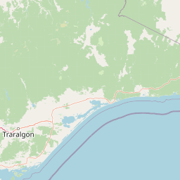
Streams
Park geography
Structured upland terrain analysis, watershed networks and protected boundary measurements
Comprehensive Geographic Profile and Mapped Boundaries of Errinundra National Park, Australia
This geographic profile examines the physical landscape and structural characteristics of Errinundra National Park. Data includes the 268.75 square kilometer protected area, regional elevation relief, and the network of rivers and saddles defined within its borders, such as the Brodribb and Errinundra Rivers.
Related tags
Cool Temperate RainforestOld-Growth ForestVictoriaGippslandNational Park
Victoria's largest cool temperate rainforest reserve and old-growth forest wilderness
Errinundra National Park
Errinundra National Park is a protected wilderness area in the Gippsland region of Victoria, Australia, preserving the largest remaining cool temperate rainforest in the state. The 26,875-hectare park is centred on the Errinundra Plateau, a southwards extension of the Monaro Tablelands of New South Wales, situated approximately 373 kilometres east of Melbourne via the Princes Highway. The park protects extensive old-growth forest ecosystems that represent some of south-eastern Australia's most significant remaining temperate woodland and rainforest habitats. This conservation area is renowned for its biodiversity, harbouring numerous rare and threatened plant and animal species within its mountainous terrain and diverse vegetation communities.
- Location
- Australia
- Park type
- National park
- Established
- 1988
- Area
- 268.8 km²
Location overview
Analyzing country boundaries and high-level regional status
Geographic Location of Errinundra National Park within Australia
Errinundra National Park is located entirely within Australia. Land-based positioning means the park is classified as a non-coastal, inland terrestrial protected area contained within a single national territory.
- Countries
- Australia
- Primary location
- Australia
- Geographic setting
- Inland
Boundary and coordinates
Analyzing the 268.75 square kilometer area and spatial footprint
Geographic Boundary Map and Spatial Limits of Errinundra National Park
The mapped boundary outline provides clear spatial context, tracing the park's regional layout and geographic limits. Accompanying datasets outline estimated area, coordinate spans, and geographic center points.
- Boundary area
- 431.6 km²
- Boundary perimeter
- 285.2 km
- Northernmost point
- 37.1992° S
- Southernmost point
- 37.55° S
- Easternmost point
- 149.0298° E
- Westernmost point
- 148.6844° E
- Geographic centre
- 37.3544° S, 148.8357° E
- North–south span
- 38.9 km
- East–west span
- 30.6 km
Terrain and natural features
Upland terrain classifications and recorded river networks within the park
Errinundra National Park Terrain and Named Natural Features
Errinundra National Park encompasses upland terrain classifications featuring multiple recorded rivers, peaks, and mountain ranges. Linked feature cards supply names, types, and spatial relationships for these distinct natural features.
Selected named natural features
Rivers
Goolengook River
Rivers
Arte River
Peaks
Cobb Hill
Rivers
Bonang River North Branch
Rivers
Errinundra River
Environmental setting
Temperate climate, dominant forest cover, and upland plateau relief
Errinundra National Park Environmental Classifications and Physical Setting
Recorded habitat types and landscape features offer complementary ways to read the physical setting of Errinundra National Park. Stored classifications connect recorded categories to relevant protected area destinations across the regional atlas.
- Relief
- Upland
- Climate
- Temperate
- Water
- Major water bodies
- Forest cover
- Dense forest cover
- Seasonality
- Strongly seasonal
Landscape features
Plateau · Forest · Wetland
Habitat types
Temperate broadleaf forest · Montane forest · Wetland
Park atlas
Trace the regional spread of conservation landscapes and compare protected areas across Victoria's diverse terrain.
Explore Related National Parks and Protected Landscapes Near Errinundra National Park
Explore additional national parks and protected areas near Errinundra National Park, tracing similar old-growth forest and cool temperate rainforest ecosystems across Victoria's diverse Gippsland region. Compare these conservation landscapes by their distinct geographic features and protected-area designations to enhance your atlas-based discovery.
National parkAustralia
0 km away#1 closest
West

Snowy River National Park: A Deep Gorge Protected Landscape in Victoria, AU
Explore mapped terrain and vital alpine wilderness boundaries.
Snowy River National Park showcases Victoria's rugged natural geography with its dramatic mountain terrain and the spectacular Little River Gorge, the state's deepest. This national park, classified as a wilderness area for much of its expanse, protects critical habitats and diverse ecosystems across its mapped boundaries. Its significance as a protected landscape within the Australian Alps National Parks makes it a key destination for understanding regional geography and conservation efforts.
- Area
- 987 km²
- Established
- 1979
- IUCN
- II
- Relief
- Mountain
National parkAustralia
7.9 km away#2 closest
South
Lind National Park: Historic Protected Landscape in East Gippsland, Victoria
Explore mapped boundaries and forested terrain within this early national park.
Lind National Park, established in 1925, is a key protected area in Victoria, Australia, preserving the characteristic forested landscapes of East Gippsland. Spanning 1,370 hectares, it offers a tangible connection to the state's early conservation efforts. The park's terrain is defined by temperate forest, characteristic of eastern Victoria's undulating geography, providing a clear example of protected woodland adjacent to the Princes Highway corridor. Its historical designation underscores its importance in the region's network of natural reserves and mapped landscapes.
- Area
- 13.7 km²
- Established
- 1925
- IUCN
- II
- Visitors
- 3.5K annual
National parkAustralia
16 km away#3 closest
West
Alpine National Park: Victoria's Expansive National Park in the Great Dividing Range
Mapping significant alpine, subalpine, and mountain wilderness landscapes.
Alpine National Park represents Victoria's largest protected area, safeguarding critical alpine and subalpine environments across the Great Dividing Range. This national park encompasses vast mountainous terrain, including Victoria's highest peaks like Mount Bogong, and the expansive Bogong High Plains known for their unique grassland and woodland ecosystems. The park's protected landscape offers rich opportunities for geographic discovery and understanding its place within Australia's significant mountain wilderness regions.
- Area
- 6,474 km²
- Established
- 1989
- IUCN
- II
- Relief
- Mountain
National parkAustralia
17 km away#4 closest
East
Coopracambra National Park: Remote Mountainous Protected Landscape in Victoria
Explore its transboundary wilderness role and tall forest terrain.
Coopracambra National Park stands as a significant protected landscape in Victoria, Australia, renowned for its rugged mountainous terrain and extensive tall eucalypt forests. This remote national park serves as the crucial Victorian component of a vast transboundary wilderness corridor, linking protected areas across the state border into New South Wales. Its geographic identity is shaped by prominent peaks such as Mount Coopracambra and the unique Black-Allan Line boundary, offering users a detailed atlas view of its conservation significance and natural features within south-eastern Australia.
- Area
- 388 km²
- Established
- 1988
- IUCN
- II
- Relief
- Mountain
National parkNew South Wales
22 km away#5 closest
Northeast
South East Forests National Park: New South Wales National Park Atlas Entry
Mapped landscape and protected area geography.
This canonical MoriAtlas entry for South East Forests National Park provides essential geographic context and details about its status as a national park. Understand the mapped boundaries of this protected landscape within New South Wales, supporting discovery through its regional setting and natural terrain. The focus remains on atlas-style exploration of its geographic identity and conservation significance, devoid of visitor logistics or travel advice.
- Area
- 1,151.77 km²
- Established
- 1997
- IUCN
- II
- Relief
- Highland

National parkNew South Wales
22 km away#6 closest
North
Kosciuszko National Park: Australia's Highest Alpine Terrain and Mapped Protected Landscape
Discover unique glacial landscapes and geographic context in New South Wales.
Kosciuszko National Park represents the pinnacle of Australia's alpine geography, preserving the continent's only true alpine ecosystems. This extensive national park in New South Wales features dramatic glacial landforms, including its namesake Mount Kosciuszko, Australia's highest peak. Users can explore the park's mapped boundaries, surrounding natural terrain, and unique landscape features for a comprehensive understanding of this significant protected area.
- Area
- 6,900 km²
- Established
- 1944
- IUCN
- II
- Visitors
- 3.3M annual
National parkAustralia
24 km away#7 closest
East
Croajingolong National Park: A UNESCO World Biosphere Reserve with Dramatic Coastal Geography
Explore Victoria's protected wilderness, mapped coastlines, and diverse ecosystems.
Croajingolong National Park is a key protected area in Victoria, Australia, recognized globally as a UNESCO World Biosphere Reserve. This vast national park offers a detailed look at coastal wilderness, characterized by its extensive sandy beaches, rugged rocky headlands, dynamic dunes, and rich heathland ecosystems. Its position along the Tasman Sea coastline provides significant geographic context, forming a vital part of southeastern Australia's protected landscapes and offering unique opportunities for atlas-driven exploration of its mapped terrain and biodiversity.
- Area
- 883.55 km²
- Established
- 1979
- IUCN
- II
- Relief
- Mixed relief
National parkAustralia
40 km away#8 closest
Southeast
Alfred National Park: Southernmost Warm Temperate Rainforest Atlas and Protected Landscape
Explore a unique biogeographic boundary and diverse rainforest ecosystem.
Alfred National Park stands as a vital protected area, renowned for harboring Australia's southernmost warm temperate rainforest. Located in Victoria's East Gippsland region, this national park is a significant ecological meeting point, where plant communities from subtropical, temperate, and arid zones converge. The park's mapped landscape features a dense, jungle-like environment dominated by Lilly Pilly, tree ferns, and epiphytes, offering a distinct contrast to the typical eucalyptus woodlands of the area and highlighting its unique floristic character.
- Area
- 30.5 km²
- Established
- 1925
- IUCN
- II
- Climate
- Temperate
MoriAtlas Explorer
Continue exploring the mapped geography of Errinundra National Park and its Australian context
Discover more about Errinundra National Park's protected landscape and its place within Australia's geographic atlas. This platform facilitates a deeper understanding of the park's mapped boundaries, natural terrain, and its significance as a protected area. By continuing, you can refine your exploration of Australia's protected lands and regional park geography.
Browse next
Global natural geography
Explore related park routes
Explore MoriAtlas Global ParksBrowse All MoriAtlas ParksGlobal Park Map DiscoveryMoriAtlas: Browse All CountriesBrowse All MoriAtlas ContinentsNational Park Environment AtlasGrand Canyon National Park AtlasYellowstone National Park AtlasYosemite National Park Atlas and GeographySerengeti National Park AtlasGalápagos National Park Protected LandscapeBanff National Park Geography and AtlasKruger National Park Atlas EntryUluṟu-Kata Tjuṯa National Park AtlasExplore Uluru-Kata Tjuta National Park GeographyPlitvice Lakes National Park AtlasFiordland National Park Protected LandscapeGreat Smoky Mountains National Park AtlasAfghanistan National Parks and Protected AreasAlbania National Parks and Protected AreasAlgeria National Parks and Protected AreasAmerican Samoa National Parks and Protected AreasAndorra National Parks and Protected AreasAngola National Parks and Protected AreasAntarctica National Parks and Protected AreasAntigua and Barbuda Park List