
Mori Atlas logo
Protected areaFuresø

A deep freshwater ecosystem shaped by Ice Age meltwater and protected within the Mølleå river system.

Furesø Protected Area: Exploring the Glacial Geography and Wetland Landscapes of North Zealand

Furesø stands as the deepest lake in Denmark, occupying a dramatic tunnel valley formed by glacial meltwater at the end of the last Ice Age. This protected area in North Zealand features a complex mosaic of woodland, alder swamps, and managed wetlands like Vaserne. The mapped boundaries encompass diverse habitats that serve as vital bird protection zones and reference points for freshwater ecology near Copenhagen.

LakeFreshwater lakeNatura 2000 siteBird protection areaWetlandsAlder swamp
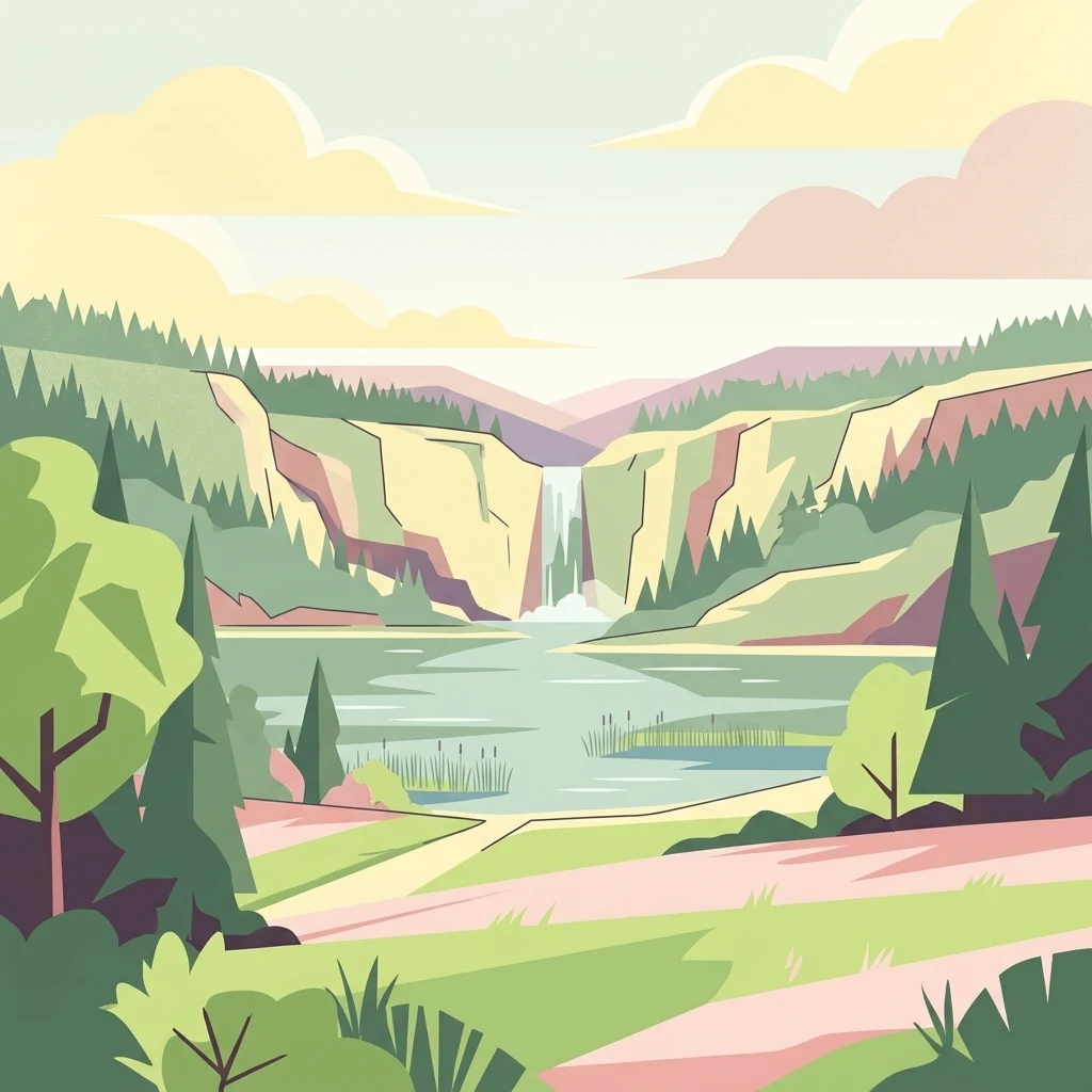
A flat-style digital illustration showing a lake with a waterfall cascading from a rocky cliff in the background, framed by pine trees and green meadows.

Furesø

Protected area

Park overview

Structured park overview, official facts, and landscape profile for Furesø

Furesø park facts, protected area profile, and essential visitor context

Review the core facts for Furesø, including designation, size, terrain, visitor scale, habitats, and operating context in one park-focused overview.

About Furesø

Furesø occupies a distinctive position among Danish lakes, both because of its physical depth and because of its proximity to one of the country's most heavily populated regions. Located in North Zealand, it lies just outside Copenhagen and forms part of an extended string of lakes connected by the Mølleå watercourse. This hydrological setting, combined with the lake's glacial origins, gives it a combination of ecological depth and accessible landscape experience unusual for a lake this close to a major capital.

Geologically, Furesø sits within a tunnel valley system formed at the end of the last Ice Age, when meltwater under pressure scoured deep channels into the underlying terrain. The lake today is divided between a deeper main basin, with an average depth significantly greater than the rest, and the much shallower Store Kalv area. This varied bathymetry creates different underwater habitats and contributes to the lake's ecological character.

Furesø is integrated into a wider regional nature protection framework. It is part of the European Natura 2000 network, classified as a nutrient-rich lake habitat and recognized as both a habitat area and a bird protection area. Several adjoining zones along the shoreline, including Vaserne, Næsset, Frederiksdal, and Stavnsholt, are protected in their own right. Together these designations reflect both the lake's ecological value and the layered conservation effort applied to its surroundings.

The lake is also a living cultural landscape. Throughout the 19th and 20th centuries, it has served as a beloved setting for Danish landscape painters and writers. Eckersberg's 1833 painting from the Kongevejen viewpoint is among the most cited images of Furesø, and Christian Winther's lyrical appeal to a bird to fly over the lake has become a familiar literary reference. Today the lake continues to function simultaneously as a natural area, a protected ecological site, and a recreational resource for the surrounding communities.

Quick facts and research context for Furesø

Furesø is Denmark's deepest lake and the largest water body in the Mølleå system, lying in North Zealand within easy reach of Copenhagen. Its surface area is approximately 940 hectares, and the lake is divided into a deeper main basin and the shallower Store Kalv area. The lake is owned by the Danish Ministry of the Environment and is part of the Natura 2000 network, with surrounding wetlands and shoreline areas carrying additional protection. It combines ecological importance, cultural history, and direct recreational access to one of Scandinavia's most populous urban regions.

Protection and recognition

Documented management scope and official designation facts for Furesø

Furesø Protection Status and Terrestrial Conservation Records

Furesø brings together documented terrestrial protection status and conservation management records for detailed geographic analysis. Official designation histories and recognition details provide a clear baseline for evaluating regional environmental governance.

Protection details

Protection scope
Terrestrial
Transboundary protection
No
Park context

Deeper park guide and search-rich context for Furesø

Furesø history, landscape, wildlife, and travel context

Explore Furesø through its history, landscape character, ecosystems, wildlife, conservation priorities, cultural context, and seasonal travel timing in a structured park guide built for atlas discovery and search intent.

Why Furesø stands out

Furesø is especially known as Denmark's deepest lake and for its remarkable glacial origin, set within a tunnel valley system carved by meltwater at the end of the last Ice Age. It is also recognized for the rich wetland mosaic along its northern shore at Vaserne, where peat cuttings, alder swamps, and meadows support varied birdlife including a notable presence of nightingales. Beyond its natural profile, Furesø is known in Danish cultural history as a recurring subject of painting and poetry, most famously in C.W. Eckersberg's 1833 view from Kongevejen and Christian Winther's verse appealing to a bird to fly over its waters.
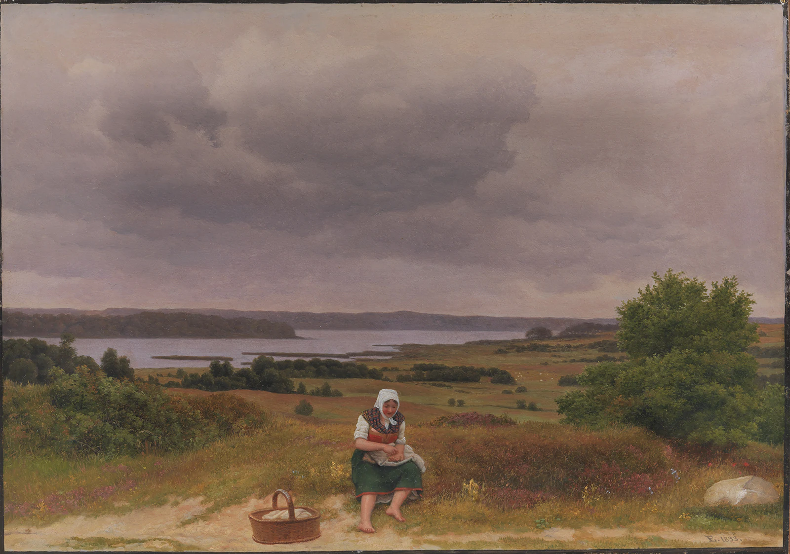
An oil painting of a woman sitting on a grassy hillside overlooking a wide lake under a cloudy sky.
An 1833 painting by C.W. Eckersberg depicting a view from Kongevejen over Lake Fure.

Furesø history and protected-area timeline

Furesø was formed at the end of the last Ice Age, when glacial meltwater carved an extensive tunnel valley system into the landscape of North Zealand some 10,000 to 12,000 years ago. At that time, water flow was directed opposite to today's pattern, since the ice edge stood to the west, and the powerful currents cut deep channels that later filled with water to become the lake. The surrounding forest, originally composed largely of Scots pine and birch, gave the lake its earliest known name, Fuursø, derived from an old term for Scots pine.

During the 19th century, Furesø became a focus of freshwater biology, with researchers such as O.F. Müller and later Wesenberg-Lund and C.V. Otterstrøm producing internationally recognized studies of the lake. By the early 20th century, however, the discharge of wastewater into the lake had begun to alter its character, raising nutrient levels and disturbing the balance between predatory and non-predatory fish.

The situation began to improve from the 1970s onward as wastewater discharges were sharply reduced. By 2002, nutrient loading had been brought back to levels comparable to those of around 1910. Aiming for the very clean conditions of approximately 1900, when Furesø was considered one of Northern Europe's purest lakes, a major lake restoration project was launched in 2003 and completed in 2006, funded by the EU, Frederiksborg County, and Farum Municipality. The lake continues to be monitored for emerging contaminants such as PFAS, reflecting its ongoing role as a reference site for Danish freshwater research.

Furesø landscape and geographic character

Furesø sits within a broad tunnel valley system, the legacy of powerful glacial meltwater flows that carved deep, irregular channels into the landscape at the close of the Ice Age. The lake basin itself is split between a deep main basin, with an average depth well over ten meters and a floor marked by dramatic underwater slopes, and the shallower Store Kalv area to the west, which averages only a few meters in depth. This contrast between deep and shallow zones shapes both the visual impression of the shoreline and the character of the lake's underwater environment.

Around the lake, the terrain shifts between woodland, wetland, and meadow. Along the northern shore stretches Vaserne, a mosaic of wet meadows, peatlands, and alder swamps where Second World War-era peat diggings now form pools that blend back into the natural landscape. The southern end near Frederiksdal offers a more open setting, where a sandy beach area and the remains of a medieval fortification, known as Hjortholm Voldsted, sit close to the water.

The lake is enclosed by forested ridges and gentle moraine hills typical of North Zealand, and the combination of small islands, soft shorelines, and woodland edges gives Furesø a layered, varied appearance that changes noticeably between its different stretches. Within this accessible natural setting just outside Copenhagen, Furesø feels far removed from the surrounding urban areas, even though it lies only a short distance from the city center.
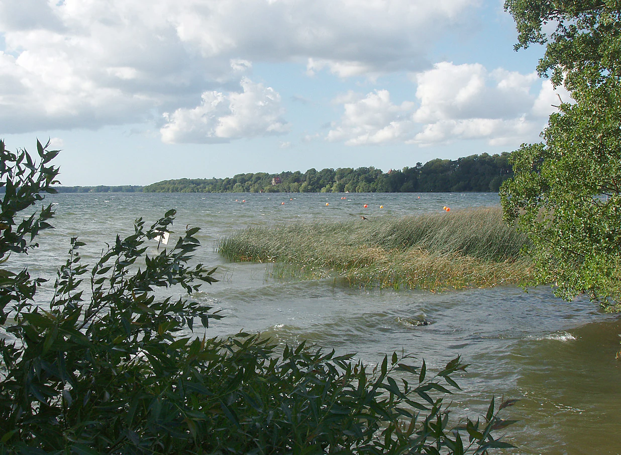
A wide view of a large lake with wavy water and reeds along the shore, framed by foliage in the foreground and a forested shoreline in the distance under a cloudy sky.
A scenic view of Furesø, the deepest lake in Denmark.

Furesø ecosystems, habitats, and plant life

Furesø represents one of the most ecologically significant freshwater bodies in North Zealand, both as a habitat and as part of a wider protected landscape. As a Natura 2000 site classified under the protected nutrient-rich lake type, it stands at the center of conservation efforts aimed at preserving the lake's water quality and biological communities.

The lake's ecological profile is heavily shaped by the contrast between its two basins. The deeper main basin supports cold-water species and a more stable thermal environment, while the much shallower Store Kalv favors different plant and invertebrate communities. The surrounding wetlands, particularly the Vaserne area to the north, greatly extend this ecological richness by adding wet meadows, peatlands, and alder swamp systems that serve as transitional zones between the lake and the surrounding forest.

The restoration project completed in 2006 targeted the lake's nutrient balance, particularly elevated phosphorus levels in the sediment, in an effort to bring its ecological condition closer to the cleaner reference state of around 1900. Combining reduced wastewater discharge with active management has allowed Furesø to recover much of its ecological integrity, although ongoing monitoring addresses both nutrient dynamics and emerging pollutants such as PFAS.

Furesø wildlife and species highlights

Furesø supports a varied birdlife, particularly along its northern shore in the Vaserne area, where the mixture of peat diggings, alder swamps, and meadows produces a rich mosaic of habitats. The area is particularly known for its population of nightingales, whose song has become associated with the wetland landscape around the lake. Waterbirds and wetland species more broadly make use of the lake's diverse shoreline environments, ranging from open water to sheltered reedy edges.

The lake's fish community includes the species typical of North European lowland lakes, with anglers reporting catches of pike, roach, perch, pikeperch, and bream. This fish fauna reflects both the lake's natural productivity and historical changes in the balance between predatory and non-predatory species caused by nutrient loading during the 20th century. Eel may not be landed, indicating ongoing management attention to the conservation status of certain migratory species.

More broadly, Furesø serves as a habitat reservoir within a heavily populated region, providing breeding and feeding grounds for many bird and fish species that would otherwise be poorly represented in such a densely inhabited part of Denmark.

Furesø conservation status and protection priorities

Furesø is part of the European Natura 2000 network and is recognized as both a designated habitat area and a bird protection area. This status reflects its value as one of Denmark's deepest and ecologically significant lakes and helps frame ongoing national and regional conservation efforts. Several specific areas surrounding the lake are additionally protected, including the wetland mosaic of Vaserne to the north, the Næsset area, the zone near Frederiksdal, and the area around Stavnsholt.

Conservation management of the lake has been shaped by its environmental history. The lake, once considered one of Northern Europe's purest around 1900, experienced nutrient enrichment from 20th-century wastewater discharges, prompting a long-term effort to restore its ecological balance. Wastewater reductions from the 1970s onward eventually reached concentrations comparable to those of around 1910, and the major restoration project of 2003 to 2006 targeted the internal phosphorus load in the sediment to push the lake further toward its historical baseline.

Today, Furesø is considered a notable conservation reference site within North Zealand, combining lake-level habitat protection with the defense of surrounding terrestrial wetland and forest zones. Ongoing concerns, including PFAS contamination and broader water-quality monitoring, show that its conservation management remains an active, evolving process rather than a static designation.

Furesø cultural meaning and human context

Furesø has been a recurring presence in Danish cultural life for nearly two centuries. Its prominence in landscape painting is anchored by C.W. Eckersberg's 1833 oil study of the view over the lake from Kongevejen, but many other Danish painters have also used the lake and its surroundings as motifs, including Anton Eduard Kieldrup, whose study of the lake is held by the National Gallery of Denmark.

In Danish literature, the lake is perhaps most famously referenced in Christian Winther's poem, which opens with the well-known line calling on a bird to fly over the waters of Furesø. The lake also appears in two poems by Hans Vilhelm Kaalund, reflecting how the site became a familiar symbol within 19th-century Danish poetry. The remains of the medieval fortification at Hjortholm Voldsted near Frederiksdal add a layer of older human history to the cultural landscape of the lake.

In modern times, Furesø continues to function as a local cultural anchor for the surrounding municipalities, supporting sailing, rowing, canoeing, and swimming, and serving as a gathering point for residents of Furesø Municipality, Lyngby-Taarbæk, and Rudersdal.

Top sights and standout views in Furesø

Few lakes in Denmark combine the same depth, ecological range, and cultural history as Furesø. Its standing as the country's deepest lake, its origin in a glacial tunnel valley, and its identification as a Natura 2000 habitat and bird protection area place it among the most environmentally significant freshwater sites in eastern Denmark. Add the protected wetland mosaic of Vaserne, known especially for its nightingales, and the lake becomes a true ecological reference within walking distance of Copenhagen.

Culturally, Furesø is anchored in the Danish imagination through Eckersberg's 1833 Kongevejen view and Christian Winther's poetry, while locally the lake supports an active outdoor culture of sailing, rowing, swimming, and angling. Together these features give Furesø a layered identity that links deep geological history, careful modern conservation, and two centuries of cultural memory.

Best time to visit Furesø

Furesø is a year-round natural and recreational site, but the warmer months from late spring through early autumn offer the most varied outdoor experience on and around the lake. Summer is the traditional sailing season, when the historic Baadfarten ferries operate and rowing clubs, sailing clubs, and canoe rentals are active. The beaches at Frederiksdal and Furesøbad are most attractive during these warmer months.

Spring and early summer are particularly rewarding for visitors interested in birdlife, especially in the Vaserne wetland zone along the northern shore, where nightingales and other wetland species are most audible and visible during their breeding season. Autumn brings quieter conditions and more colorful forest scenery along the surrounding ridges, while winter offers a calmer, more contemplative atmosphere suited to walking the shoreline paths and observing waterfowl on the lake itself.
Monthly climate preview

Long-term monthly temperature averages and precipitation patterns for Furesø

Furesø Climate Normals, Annual Temperature and Precipitation Rhythm

Representative coordinate records show measured monthly temperature variations and precipitation distributions across the conservation landscape. Examining the full twelve-month profile reveals detailed long-term averages for annual planning and geographic comparison.
Annual mean9 °C
1 °C18 °C
Jan
Feb
Mar
Apr
May11°
Jun15°
Jul18°
Aug17°
Sep14°
Oct
Nov
Dec
Warmest month
July

17.5 °C

Coolest month
February

0.6 °C

Wettest month
August

2.6 mm/day

Driest month
April

1.4 mm/day

Park location guide

Geography guide, regional context, and park location map for Furesø

Furesø park geography, regions, and map view in Denmark

Understand where Furesø sits in Denmark through a broader geographic reading of the surrounding landscape, nearby location context, and its mapped position within the national park landscape.

How Furesø fits into Denmark

Denmark is a constitutional monarchy and Nordic country in Northern Europe. It is the southernmost of the Scandinavian countries, bordering Germany to the south, Norway to the north, and Sweden to the southwest. The country consists of the Jutland peninsula and an archipelago of islands, with Copenhagen as its capital and largest city. Denmark has a population of over 6 million and is characterized by flat, arable land, sandy coasts, and a temperate climate.

Wider geography shaping Furesø in Denmark

Denmark occupies the Jutland peninsula and roughly 406 islands in Northern Europe. It is situated between the North Sea to the west and the Baltic Sea to the east. The country borders Germany to the south and is connected to Sweden via the Øresund Bridge. Denmark is predominantly flat terrain with low elevation, the highest point being Møllehøj at 170.86 meters.

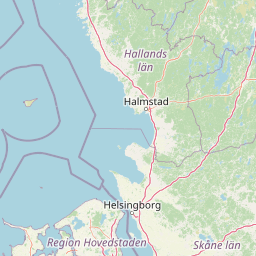
Map view of Furesø

Use this park location map to pinpoint Furesø in Denmark, understand its exact geographic position, and read its mapped placement within the surrounding landscape more clearly.

Pigeon | © OpenStreetMap contributors

Location context for Furesø

North Zealand

Examine protected wetland habitats, glacial terrain, and shoreline scenery across the regional park environment.

Furesø Photos and Landscape Scenery: Visual Exploration of Denmark's Deepest Lake

Visual records capture the distinctive glacial tunnel valley, forested ridges, and protected wetland mosaics defining the Furesø protected area. Photographic documentation allows researchers and visitors to examine shoreline habitats, underwater basin contrasts, and regional terrain characteristics in detail.

An oil painting of a woman sitting on a grassy hillside overlooking a wide lake under a cloudy sky.

A wide, calm lake surrounded by dense green forests under a bright, overcast sky.

A wide view of a large lake with wavy water and reeds along the shore, framed by foliage in the foreground and a forested shoreline in the distance under a cloudy sky.

Park atlas

Compare regional geography and surrounding natural habitats

Explore Parks Near Furesø and Connected Protected Landscapes

Browse other parks near Furesø to discover related wetland ecosystems and glacial terrain across the surrounding region. Expanding the park comparison reveals connected protected areas and broader geographical patterns in northern Zealand.
A pale watercolor painting depicting a marshy landscape with rolling green hills, tall grasses in the foreground, and a calm body of water, rendered in soft pastel tones.
Protected areaDenmark
About 5.6 km away#1 closest

South

Smør- og Fedtmosen: Glacial Tunnel Valley and Protected Mire Geography in Denmark

A key hydrological watershed site and managed meadow reserve

Examine the topographic features of Smør- og Fedtmosen, where groundwater-fed mires and dead-ice depressions create a distinct wetland system. This protected area showcases a transition from saturated reed beds to grazed meadows, illustrating the intersection of long-term conservation and the natural geography of a former tunnel valley.

Area
1.5 km²
Established
1943
Relief
Lowland
Scope
Terrestrial
Nature reserveGentofte Kommune
About 8.9 km away#2 closest

Southeast

Brobæk Mose Nature Reserve: Protected Wetland and Glacial Geography in Gentofte Kommune

Mapped wetland habitat and natural terrain analysis.

Brobæk Mose serves as a primary example of a spring-fed wetland within the glacial landscapes of Gentofte Kommune. The area preserves rich fens and developing natural forest, offering a clear view of post-glacial valley geography and protected ecological zones surrounded by the Copenhagen suburban environment.

Established
1988
Water
Major water bodies
A watercolor illustration of a soft rolling landscape with green forests, gentle hills in shades of yellow and pink, and a winding waterway.
Protected landscapeDenmark
About 12 km away#3 closest

West

Naturpark Mølleåen: A Protected Glacial Landscape and Tunnel Valley Map in Denmark

Glacial landforms and conserved nature corridors near Copenhagen

Naturpark Mølleåen spans fifty square kilometers of protected forests, lake districts, and ice-margin ridges in northern Zealand. This glacial terrain represents a nationally recognized geological area, offering a rare density of tunnel valleys and meltwater channels that serve as an essential ecological refuge within the broader Danish landscape.

Area
50 km²
Established
1942
Relief
Upland
Climate
Temperate
A horizontal watercolor painting depicting a soft, light-filled meadow landscape with scattered trees, low vegetation, and patches of water.
Nature reserveCopenhagen
About 20 km away#4 closest

Southeast

Amager Fælled Nature Reserve: Mapping Copenhagen's Distinctive Protected Landscape

Explore pioneer plant habitats and coastal meadow geography

Amager Fælled functions as a 223-hectare nature reserve that borders the urban development of Copenhagen. The landscape offers a study in contrasts, featuring thin drought-prone soils, historical military and landfill substrates, and protected coastal meadow strips. This site remains a vital geographical reference for understanding urban-edge conservation and the long-term layering of human land use.

Area
2.23 km²
Established
1992
Relief
Lowland
Climate
Temperate
Watercolor illustration of green hills, a body of water, and vegetation
National parkDenmark
About 26 km away#5 closest

Northwest

Kongernes Nordsjælland National Park: Protected Landscape Geography and Map Context

Explore North Zealand's protected natural terrain.

Delve into the protected landscape of Kongernes Nordsjælland National Park, a significant national park in Denmark's North Zealand region. This section provides a structured overview of its mapped boundaries and geographic setting, allowing for a detailed atlas-style discovery of its natural terrain. Understand how this protected area contributes to the region's conservation landscape and mapped geography.

IUCN
II
Nature reserveSolrød Kommune
About 34 km away#6 closest

South

Staunings Ø Nature Reserve: Exploring the Coastal Geomorphology of Solrød Kommune

A mapped barrier spit and wetland habitat on the eastern Zealand shoreline.

Staunings Ø functions as a textbook example of a coastal sand bar accretion in the shallow waters of Køge Bugt. This nature reserve protects a vital sequence of dunes, lagoons, and reedbeds that provide a clear view of coastal succession. Located near the urban edge of Solrød Kommune, it serves as a key site for understanding the interaction between natural coastal landforms and maritime environments in eastern Denmark.

Area
0.6 km²
Established
1999
Relief
Lowland
Climate
Temperate
Nature reserveFaxe Municipality
About 53 km away#7 closest

Southwest

Bagholt Mose: Protected Peatland Mosaic and Fen Geography in Faxe Municipality, Denmark

A high-value Natura 2000 protected wetland and bog habitat.

Bagholt Mose is a significant nature reserve situated within the Munkeskov forest of southern Zealand. The landscape features a distinct combination of historical peat cuttings and raised bog remnants, which together form a rare mosaic of nutrient-poor and calcareous fen communities that support an exceptional diversity of lowland bog flora.

Area
0.17 km²
Established
1985
Relief
Lowland
Scope
Terrestrial
National parkSweden
About 53 km away#8 closest

Northeast

Söderåsen National Park: A Protected Ridge Landscape in Southern Sweden's Geography

Mapped protected area with varied terrain and dense forest cover.

Delve into the protected landscape of Söderåsen National Park, a national park in Southern Sweden distinguished by its unique ridge topography, steep slopes, and extensive forests. This site serves as a key point for atlas-based exploration of natural terrain and regional geography, offering a clear view of its mapped boundaries and ecological significance within the Southern Swedish highlands. Understand the character of this protected area and its place in the broader mapped landscape.

Established
2001
IUCN
II
Scope
Terrestrial

Common questions about visiting, size, designation, and location context for Furesø

Furesø FAQs for park facts, access, geography, and protected area context

Find quick answers about Furesø, including protected-area facts, park geography, trail and visitor context, and how the park fits into its surrounding country and regional landscape.
MoriAtlas Explorer

Continue Your Protected Areas Search Across the Global Atlas

Deepen your exploration by continuing the structured search for national parks and protected areas worldwide. Utilize the comprehensive filtering capabilities to compare different conservation landscapes and refine your understanding of global park geography. Discover more about the distribution and characteristics of protected natural areas.

Global natural geography