Mori Atlas logo
National parkGandang Dewata National Park

Discover the mapped boundaries and geographic identity of this Indonesian national park.

Gandang Dewata National Park: Protected Landscape and Regional Geography in West Sulawesi

(Taman Nasional Gandang Dewata)

Gandang Dewata National Park represents a significant protected national park within the geography of West Sulawesi, Indonesia. This dedicated page provides an atlas-focused exploration of its protected landscape, detailing its geographic setting and mapped boundaries. Understand the park's role in regional conservation and its contribution to the broader natural atlas of Indonesia through structured geographic data.

National ParkIndonesiaSulawesiWest SulawesiMountain LandscapeEndemic Species

Gandang Dewata National Park

National park

Park overview

Structured park overview, official facts, and landscape profile for Gandang Dewata National Park

Gandang Dewata National Park park facts, protected area profile, and essential visitor context
Review the core facts for Gandang Dewata National Park, including designation, size, terrain, visitor scale, habitats, and operating context in one park-focused overview.

About Gandang Dewata National Park

Gandang Dewata National Park represents one of Sulawesi's most significant conservation achievements of recent decades. Located in the mountainous heart of West Sulawesi, the park protects a landscape of extraordinary ecological and cultural importance. The Tanete Gandangdewata mountain range forms the ecological core of the park, with its highest peaks reaching elevations exceeding 3,000 meters and offering spectacular alpine scenery atypical of Indonesian national parks. The region has long been protected by local communities who recognize the spiritual significance of these mountains, and this traditional stewardship helped preserve the area's biodiversity through the establishment of formal protection in 2016. The park forms part of a network of protected areas across Sulawesi that collectively safeguard the island's remarkable endemic fauna, which has evolved in isolation due to Sulawesi's position at the center of Wallacea, the biogeographic transition zone between Asian and Australian fauna.

Quick facts and research context for Gandang Dewata National Park

Gandang Dewata National Park spans approximately 79,342 hectares in the mountainous interior of West Sulawesi, Indonesia. The core protected area centers on the Quarles Range, with Tanete Gandangdewata as the highest peak at 3,074 meters above sea level. The broader mountain complex covers 214,201 hectares and is considered sacred by local communities who have long protected its forests. The park was established in 2016 by the Indonesian Ministry of Environment and Forestry following research by the Indonesian Institute of Sciences that documented significant endemic biodiversity, including several newly discovered species.

Park context

Deeper park guide and search-rich context for Gandang Dewata National Park

Gandang Dewata National Park history, landscape, wildlife, and travel context
Explore Gandang Dewata National Park through its history, landscape character, ecosystems, wildlife, conservation priorities, cultural context, and seasonal travel timing in a structured park guide built for atlas discovery and search intent.

Why Gandang Dewata National Park stands out

Gandang Dewata National Park is best known for its sacred mountain landscape and exceptional endemism. The twin peaks of Tanete Gandangdewata, rising dramatically above the Sulawesi interior, form a spiritual and geographic landmark for the region. The park protects critical habitat for Sulawesi's unique Wallacean fauna, including the endangered lowland anoa (dwarf buffalo), one of the island's most iconic endemic species, and the sugar glider. The mountain range's isolation has allowed evolutionary processes to produce a distinctive suite of species found nowhere else on Earth, with approximately 31% of Sulawesi's bird species being endemic to the island.

Gandang Dewata National Park history and protected-area timeline

Gandang Dewata National Park was officially established in 2016 when the Indonesian Ministry of Environment and Forestry designated 189,208.17 hectares of the mountain range as Indonesia's 53rd national park. This designation followed scientific research conducted by the Indonesian Institute of Sciences (LIPI) in 2013, which documented the area's exceptional biodiversity and identified it as a priority for conservation. The park's establishment represented a culmination of growing recognition that Sulawesi's remaining pristine forests required formal protection to ensure the survival of endemic species. The mountain range had previously existed as a de facto conservation area due to its sacred status among local Mamasa communities, who maintained traditional practices that limited destructive land use in the highland areas.

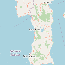
Gandang Dewata National Park landscape and geographic character

The landscape of Gandang Dewata National Park is dominated by the rugged Quarles Range, a mountain system that rises steeply from the surrounding lowlands of West Sulawesi. The Tanete Gandangdewata peaks, standing at 3,037 meters (northern peak) and 2,966 meters (southern peak), form the most prominent features of the park, their distinctive rounded profiles visible for kilometers across the Sulawesi interior. Puncak Mistis peak reaches 3,037 meters northeast of the main Tanete formation. The mountain landscape includes dramatic ridgelines, steep valleys, and rocky outcrops that create diverse microhabitats throughout the park. The area surrounding the peaks features a transition from lower montane forests through cloud forest zones to alpine grasslands at the highest elevations, with the overall mountain complex covering 214,201 hectares.

Gandang Dewata National Park ecosystems, habitats, and plant life

The ecological significance of Gandang Dewata National Park stems from its location within Wallacea, the biogeographic region between the Asian and Australian continental shelves that harbors species found nowhere else on Earth. The park protects intact forest ecosystems that represent Sulawesi's remaining pristine montane and subalpine environments. Research by the Indonesian Institute of Sciences documented diverse flora and fauna, including several species new to science requiring conservation attention. The mountain's elevation gradient creates multiple habitat zones, from tropical lowland forest through montane forest to cloud forest and alpine vegetation, supporting a diversity of plant communities. The isolation of Sulawesi's mountains has driven evolutionary divergence, producing unique species assemblages that cannot be found in any other location globally.

Gandang Dewata National Park wildlife and species highlights

Gandang Dewata National Park provides crucial habitat for several notable endemic species. The lowland or Sulawesi anoa (Bubalus depressicornis), a dwarf buffalo considered one of Sulawesi's most endangered mammals, inhabits the park's forest environments. The sugar glider, a small nocturnal gliding possum, is among the park's more commonly encountered mammals, adapted to moving through the forest canopy. Sulawesi's exceptional bird endemism is represented within the park, with research confirming the presence of endemic bird species and suggesting additional species discoveries. The park contributes to Sulawesi's remarkable pattern where approximately 31% of the island's bird species are found nowhere else, a level of endemism rivaled only by few regions globally. Other endemic species protected in Sulawesi's national parks include the maleo bird, babirusa, and various tarsier species.

Gandang Dewata National Park conservation status and protection priorities

The establishment of Gandang Dewata National Park in 2016 marked a significant advancement in Indonesia's protected area network and Sulawesi's conservation framework. The park was designated to safeguard the mountain range's high biodiversity, which includes documented endemic bird species and newly discovered taxa requiring protection. The conservation value of the area is enhanced by the traditional protection afforded to the mountains by local Mamasa communities who regard Tanete as sacred. The park forms part of a complementary system of eight national parks across Sulawesi that collectively protect the island's diverse ecosystems, from marine environments to montane forests, representing one of Indonesia's most biodiverse regions.

Gandang Dewata National Park cultural meaning and human context

The Tanete Gandangdewata mountain range holds deep spiritual significance for the local Mamasa people, who have long considered the mountains sacred. This cultural reverence has contributed to the preservation of the forest ecosystems, as traditional practices have limited destructive activities in the sensitive highland areas. The name 'Gandang Dewata' reflects this spiritual dimension, combining the Mamasa word 'gandang' (drum) with the Sanskrit 'dewata' (God), describing how the rounded peak resembles a divine drum when viewed from a distance. This integration of conservation with cultural values provides a model for sustainable protection that blends modern conservation science with traditional stewardship practices.

Top sights and standout views in Gandang Dewata National Park

The highlights of Gandang Dewata National Park include the spectacular mountain climbing experience to the twin peaks of Tanete Gandangdewata, which offer multi-day trekking routes to summits exceeding 3,000 meters. The park contains several notable attractions including Bata Waterfall, Buttuada Waterfall, Samababo Waterfall, Hernon Hill, Mambuliling Peak, and Talepom Bulam Peak. The sacred mountain landscape provides a unique combination of spiritual and natural significance, while the presence of endemic species like the Sulawesi anoa and diverse birdlife offers exceptional wildlife viewing opportunities. The park represents one of Indonesia's newest and most significant conservation areas, protecting the last remaining pristine forests of West Sulawesi.

Best time to visit Gandang Dewata National Park

The optimal time to visit Gandang Dewata National Park aligns with Indonesia's dry season, typically from April to October, when precipitation is reduced and trail conditions are more favorable for mountain climbing and trekking. The higher elevations of the mountain range can experience cooler temperatures and increased cloud cover, particularly in the mornings and evenings. Visitors planning summit attempts should account for the tropical mountain environment and prepare for variable weather conditions. The park's relatively recent establishment means that infrastructure remains limited, requiring visitors to be self-sufficient and prepared for basic facilities.

Park location guide

Geography guide, regional context, and park location map for Gandang Dewata National Park

Gandang Dewata National Park park geography, regions, and map view in Indonesia
Understand where Gandang Dewata National Park sits in Indonesia through a broader geographic reading of the surrounding landscape, nearby location context, and its mapped position within the national park landscape.

How Gandang Dewata National Park fits into Indonesia

Indonesia is a vast archipelagic nation in Southeast Asia and Oceania, spanning over 17,000 islands between the Indian and Pacific Oceans. As the world's fourth-most populous country with 288 million people, it features extraordinary cultural and biological diversity, withJavanese and Sundanese being the largest ethnic groups. The country gained independence from the Netherlands in 1945 and operates as a unitary presidential republic.

Wider geography shaping Gandang Dewata National Park in Indonesia

Indonesia is situated in Southeast Asia and Oceania, spanning the equatorial region between the Indian Ocean to the west and the Pacific Ocean to the east. The archipelago includes major islands such as Sumatra, Java, Sulawesi, and parts of Borneo and New Guinea. It borders Papua New Guinea, Timor-Leste, and Malaysia by land, with extensive maritime boundaries throughout the region.

Map view of Gandang Dewata National Park

Use this park location map to pinpoint Gandang Dewata National Park in Indonesia, understand its exact geographic position, and read its mapped placement within the surrounding landscape more clearly.

Pigeon | © OpenStreetMap contributors

Location context for Gandang Dewata National Park

Mamasa RegencyWest Sulawesi
Park atlas

Compare Gandang Dewata with other protected landscapes across the West Sulawesi region and wider Wallacea.

Discover Other National Parks and Protected Areas Near Gandang Dewata National Park
Continue your exploration from Gandang Dewata National Park by browsing other protected areas and national parks across the diverse West Sulawesi region. Compare mountain ecosystems and unique Wallacean biodiversity within their broader geographic context, identifying related conservation landscapes for deeper discovery.
National parkCentral Sulawesi

Lore Lindu National Park: Central Sulawesi's Protected Landscape and Atlas Anchor

Explore its endemic species, megalithic sites, and rich geography.

Lore Lindu National Park stands as a critical protected area within Central Sulawesi, Indonesia, recognized for its exceptional endemic biodiversity and profound archaeological importance. This national park features a dramatic geographic setting, rising from lowland forests to montane ecosystems and encompassing ancient megalithic structures within its protected landscape. Understanding Lore Lindu National Park through its mapped boundaries and unique regional geography offers deep insights into conservation and cultural heritage, providing a focal point for atlas-based discovery.

Area
2,180 km²
Established
1982
IUCN
II
Visitors
2K annual
National parkSouth Sulawesi

Bantimurung-Bulusaraung National Park: National Park Protected Landscape Identity and Geographic Setting

Mapped boundaries and regional atlas context for this South Sulawesi park.

Bantimurung-Bulusaraung National Park is an important protected area in South Sulawesi, Indonesia, designated as a national park. This entry provides a focused look at its geographic scope, mapped outlines, and the characteristics that define it as a protected landscape. Understanding this park's specific terrain and regional setting is key to appreciating its role within the broader atlas of natural areas and conservation efforts.

Area
437 km²
Established
2004
IUCN
II
Visitors
600K annual
National parkSouth East Sulawesi

Rawa Aopa Watumohai National Park: Geographic Atlas and Protected Landscape Overview

Explore Rawa Aopa Watumohai National Park's mapped boundaries.

Gain a clear understanding of Rawa Aopa Watumohai National Park, a designated national park in South East Sulawesi. This entry offers insight into its protected landscape identity, mapped geographic features, and its specific location within the regional atlas. It serves as a focused point for comprehending the park's protected area context and its contribution to Indonesian natural geography.

Area
1,050 km²
Established
1989
IUCN
II
Relief
Mixed relief
National parkTojo Una-Una Regency

Kepulauan Togean National Park: Protected Marine Atlas and Island Landscape Geography

Explore Tojo Una-Una Regency's vital coral reef ecosystems and mapped island geography.

Kepulauan Togean National Park is a critically important marine protected area located within the Tojo Una-Una Regency of Indonesia. This national park is celebrated globally for its position at the center of the Coral Triangle, housing the most diverse array of coral species found anywhere on Earth. The park's landscape is defined by an archipelago of islands featuring a complex interplay of coral reefs, seagrass beds, and mangrove forests, creating a rich tapestry of marine habitats. Its geographic location also makes it a significant biogeographical crossroads, influencing the distribution of marine fauna between Asian and Australian regions.

Area
3,626 km²
Established
2004
IUCN
II
Relief
Lowland
National parkEast Kalimantan

Kutai National Park: Protected Area Details and East Kalimantan Geography

Explore the mapped boundaries and regional landscape context.

Kutai National Park, a designated national park in Indonesia's East Kalimantan region, offers rich opportunities for geographic discovery. This resource focuses on the park's protected area status, its distinct landscape characteristics, and its mapped distribution within the broader regional geography. Gain a structured understanding of Kutai National Park's environmental significance and its contribution to conservation landscapes through detailed map context and geographic analysis.

Area
1,986 km²
Established
1982
IUCN
II
Relief
Lowland
National parkSulawesi

Bogani Nani Wartabone National Park: A National Park Within Sulawesi's Geographic Atlas

Explore mapped protected landscape and regional terrain.

Bogani Nani Wartabone National Park represents a vital protected area within Sulawesi, Indonesia. This dedicated page provides an atlas-oriented view, focusing on its distinct landscape character, geographic placement, and mapped boundaries. Understand the park's role as a conservation landscape and how its terrain contributes to the regional geography, forming a crucial component of mapped natural areas.

Area
2,871.15 km²
Established
1991
IUCN
II
Climate
Tropical
National parkEast Nusa Tenggara

Komodo National Park: National Park Protected Landscape Atlas Entry

Mapped boundaries and regional geography for this Indonesian protected area.

Delve into the atlas representation of Komodo National Park, an essential protected landscape within the East Nusa Tenggara region of Indonesia. This entry highlights the park's mapped boundaries and its distinctive geographic setting. Understand the park's role as a national park and its contribution to the structured exploration of protected areas and natural landscapes across the Lesser Sunda Islands.

Area
1,733 km²
Established
1980
IUCN
II
Visitors
45K annual
National parkCentral Kalimantan

Sabangau National Park: Central Kalimantan's Mapped Protected Landscape

Discover protected area boundaries and regional geography.

Sabangau National Park stands as a notable protected area within the expansive Central Kalimantan region of Indonesia. This national park offers a focused point for exploring specific mapped boundaries and understanding its unique position within the broader geographic tapestry of Borneo. Users can investigate the park's landscape context and its identity as a distinct protected territory, contributing to a structured understanding of Indonesia's natural areas.

Area
5,687 km²
Established
2004
IUCN
II
Relief
Lowland

Common questions about visiting, size, designation, and location context for Gandang Dewata National Park

Gandang Dewata National Park FAQs for park facts, access, geography, and protected area context
Find quick answers about Gandang Dewata National Park, including protected-area facts, park geography, trail and visitor context, and how the park fits into its surrounding country and regional landscape.
MoriAtlas Explorer

Continue Your Protected Areas Search Across the Global Atlas

Deepen your exploration by continuing the structured search for national parks and protected areas worldwide. Utilize the comprehensive filtering capabilities to compare different conservation landscapes and refine your understanding of global park geography. Discover more about the distribution and characteristics of protected natural areas.

Global natural geography