

Mori Atlas logo
National parkParque nacional General Juan Pablo Peñaloza

Mapping the paramo ecosystems, glacial lakes, and mountain headwaters of the Merida region

Parque nacional General Juan Pablo Peñaloza: Protected Highland Landscapes of the Venezuelan Andes

(Parque Nacional General Juan Pablo Peñaloza)

Parque nacional General Juan Pablo Peñaloza spans a rugged altitudinal gradient across the Venezuelan Andes, rising from dense montane forests to the high-altitude paramo summits of Pico El Púlpito. This protected area acts as a vital hydrological catchment for the Uribante-Caparo river system. The landscape is defined by more than 130 glacial and periglacial lakes scattered across broad plateaus, providing a critical refuge for endemic flora and highland fauna.

paramohigh-altitudeandes mountainsglacial lakespériglaciar lakesheadwaters
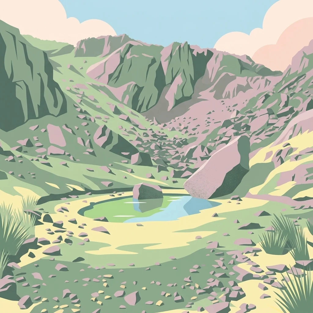
A stylized illustration showing a rocky mountain valley with a small blue-green lake in the center, surrounded by scattered rocks, sparse grassy vegetation, and pastel-colored mountain peaks in the background under a light blue sky with pinkish clouds.

Parque nacional General Juan Pablo Peñaloza

National park

Park overview

Structured park overview, official facts, and landscape profile for General Juan Pablo Peñaloza National Park

General Juan Pablo Peñaloza National Park park facts, protected area profile, and essential visitor context

Review the core facts for General Juan Pablo Peñaloza National Park, including designation, size, terrain, visitor scale, habitats, and operating context in one park-focused overview.

About General Juan Pablo Peñaloza National Park

General Juan Pablo Peñaloza National Park is one of the defining páramo reserves of the Venezuelan Andes, covering roughly 752 square kilometers of mountain territory that spans both Mérida and Táchira states. Established in 1989 and managed by INPARQUES, the park protects a connected mosaic of páramo plateaus and high-mountain ecosystems northwest of the Táchira Depression, including the Páramo del Batallón, Páramo La Negra, Páramo El Zumbador, and the Las Coloradas highland area.

The park's elevation profile stretches from about 1,800 meters in montane forest belts to 3,942 meters at Pico El Púlpito, the highest peak in Táchira state, producing a steep ecological gradient across a short distance. This vertical range gives the reserve a layered landscape, with forested valleys and ridges below giving way to open páramo grasslands, boggy highland plains, and rocky periglacial terrain above. Glacial influence is visible in the dramatic relief, with steep slopes and rounded summits shaped by past glaciation. Scattered across the upper páramo are more than 130 lakes of different sizes, from larger features such as Laguna Blanca, Laguna Grande, and Laguna de Río Bobo to smaller unnamed ponds that remain uncatalogued.

From a broader perspective, the park stands out for its hydrological importance. The páramo wetlands and high-altitude catchments inside the reserve feed a network of rivers including the Uribante, Escalante, La Grita, Mocotíes, El Molino, Torbes, Orope, Umuquena, Bobo, and Pereño, as well as Quebrada Grande. Together these waterways supply the Uribante-Caparo hydroelectric complex, a major energy-generation infrastructure for Venezuela, and support agricultural and urban communities in the surrounding states. The park is therefore not only an ecological reserve but also a key upstream water-source area whose protection has tangible regional consequences for energy generation and water supply.

Ecologically, the reserve spans a sequence of vegetation zones, from lower mountain forests through humid and very humid montane forests to sub-Andean pluvial páramo at the highest elevations. This diversity supports a wide range of Andean wildlife, making the park an important refuge for species that depend on intact páramo and montane forest habitat. The combination of dramatic scenery, hydrological function, fragmented glacial lakes, and rich páramo biodiversity defines the park's identity within Venezuela's network of Andean protected areas.

Quick facts and research context for General Juan Pablo Peñaloza National Park

General Juan Pablo Peñaloza National Park lies in the northwestern Venezuelan Andes, occupying territory in both Mérida and Táchira states and bordering the northwest edge of the Táchira Depression. Established in 1989 and administered by INPARQUES, it is classified as a national park under IUCN Category II and encompasses approximately 752 square kilometers of protected land.

The park is defined above all by its páramo and high-mountain terrain, including the Páramo del Batallón, Páramo La Negra, Páramo El Zumbador, and Las Coloradas. From these highlands, multiple rivers originate and feed into the Uribante-Caparo hydroelectric complex, giving the reserve significant water-supply importance for the region.

Protection and recognition

Examine documented terrestrial conservation frameworks and official recognition records for this protected area.

Parque Nacional General Juan Pablo Peñaloza Protection Status and Designated Management Scope

Terrestrial protection status and documented conservation frameworks define the administrative scope of Parque Nacional General Juan Pablo Peñaloza. Structured records outline official designation history and international recognition parameters without assuming external management outcomes.

Protection details

Protection scope
Terrestrial
Transboundary protection
No
Park context

Deeper park guide and search-rich context for General Juan Pablo Peñaloza National Park

General Juan Pablo Peñaloza National Park history, landscape, wildlife, and travel context

Explore General Juan Pablo Peñaloza National Park through its history, landscape character, ecosystems, wildlife, conservation priorities, cultural context, and seasonal travel timing in a structured park guide built for atlas discovery and search intent.

Why General Juan Pablo Peñaloza National Park stands out

General Juan Pablo Peñaloza National Park is best known for its extensive páramo landscape, a high-altitude neotropical ecosystem found primarily in the northern Andes, with elevations that climb from 1,800 meters to the 3,942-meter summit of Pico El Púlpito. The park is also distinguished by its wealth of glacial and periglacial features, including more than 130 periglacial lakes such as Laguna Blanca, Laguna Grande, Laguna Las Verdes, and Laguna Las Negras, which form the scenic and hydrological backbone of the reserve. Its designation as a headwater area for several major rivers feeding the Uribante-Caparo hydroelectric complex adds a critical water-resource dimension to its conservation significance.
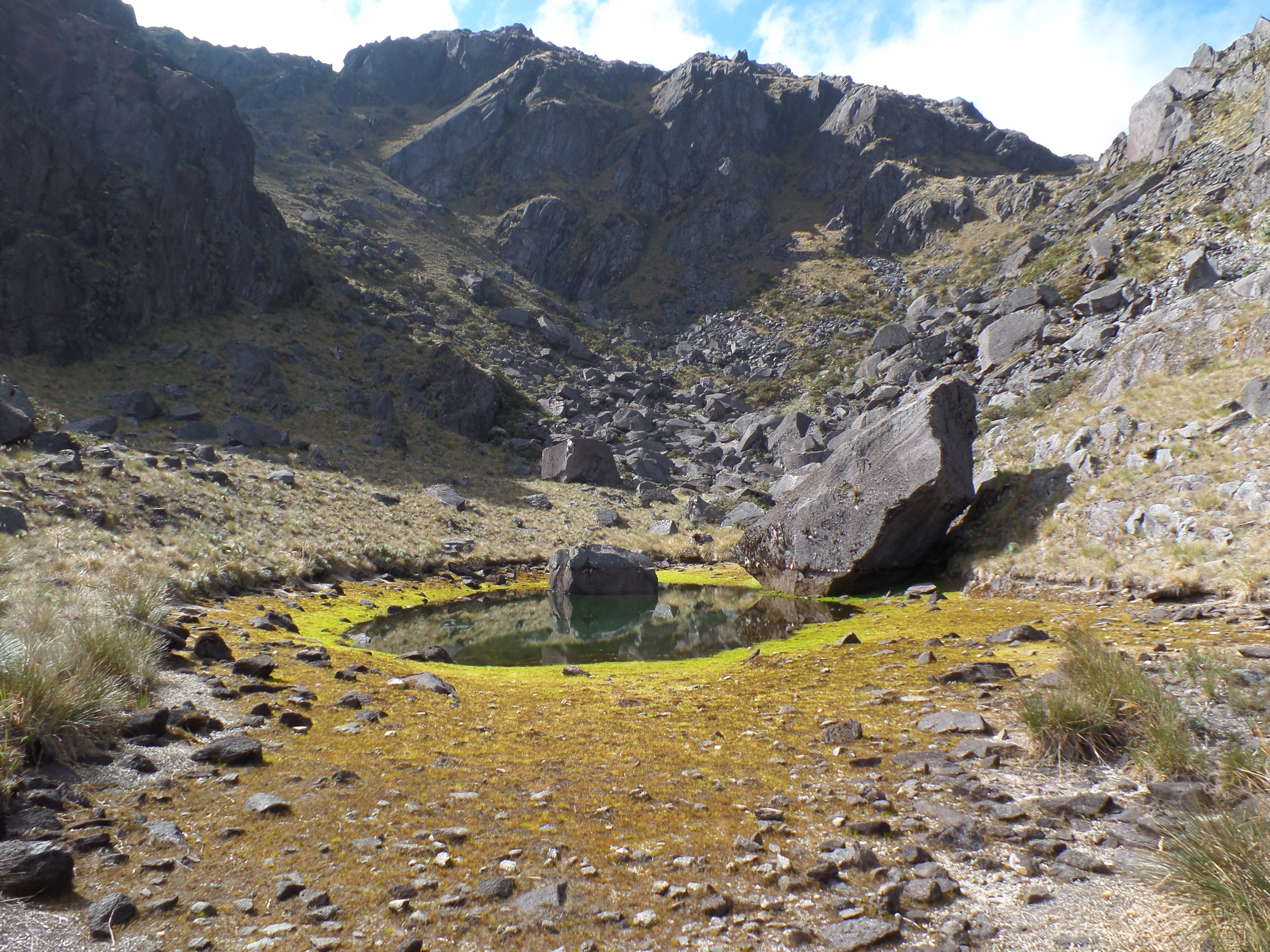
A small rocky lagoon with green algae around its edges and a large boulder in the center, situated in a rocky mountain valley with steep slopes and sparse vegetation under a partly cloudy sky.
Small alpine lagoon with a central boulder surrounded by green algae, set in a rocky paramo valley with steep mountain slopes rising in the background.

General Juan Pablo Peñaloza National Park history and protected-area timeline

General Juan Pablo Peñaloza National Park was officially established on 18 January 1989, becoming one of the later additions to Venezuela's system of páramo-focused reserves. Its creation reflected growing awareness during the late twentieth century of the ecological and hydrological importance of the northern Andean páramos, particularly in their role as headwater catchments for major rivers.

The park's name honors General Juan Pablo Peñaloza, linking the reserve to Venezuelan historical memory, while its administration has remained under INPARQUES, the national body responsible for managing Venezuela's parks and protected areas. From the time of its designation, the park's defining rationale has been the protection of both the páramo ecosystem and the water resources originating from it, including the rivers feeding the Uribante-Caparo hydroelectric complex. The park's history since then has been shaped by the ongoing challenges of preserving fragile highland ecosystems from human pressures in surrounding valleys, though this is not documented in detail in the available source material.

General Juan Pablo Peñaloza National Park landscape and geographic character

The landscape of General Juan Pablo Peñaloza National Park is shaped by the rugged topography of the northern Andes, with a series of interconnected mountain chains that rise sharply from forested lower slopes to exposed páramo summits. Elevations span from roughly 1,800 meters up to 3,942 meters at Pico El Púlpito, the highest point in Táchira state. The terrain is markedly uneven, with steep slopes and pronounced gradients in many sectors, and the high country still bears the imprint of past glaciation, visible in its rounded ridges and periglacial features.

The páramo plateaus that give the park its name form the upper tier of the landscape. Major sections such as Páramo del Batallón, Páramo La Negra, and Páramo El Zumbador create broad expanses of open highland dotted with rocky outcrops and shallow wetlands. The Las Coloradas area around Cerro Colorado adds further variety to this mosaic.

Distributed across the upper elevations are more than 130 periglacial lakes of varied size, Origin dating to glacial and periglacial processes. Among the most prominent are Laguna Blanca, Laguna Grande, Laguna Las Verdes, Laguna Las Negras, Laguna de Río Bobo (also known as Laguna Babum), Hoyada Grande, and Laguna La Piedra, alongside many smaller and less formally catalogued waterbodies. These lakes, combined with the surrounding páramo wetlands, collect and slowly release water, feeding a network of rivers that drains the park's slopes.

General Juan Pablo Peñaloza National Park ecosystems, habitats, and plant life

The park's nature profile reflects the ecological transition from montane forests to high-altitude páramo, producing a layered sequence of vegetation zones along its elevational gradient. On the lower mountain slopes, montane forests give way to humid and very humid montane forests, which in turn transition into pluvial montano and, at the highest elevations, the sub-Andean pluvial páramo.

In the páramo zone, the vegetation is dominated by characteristic high-altitude species. Frailejón species including palito, quitasol, saisai, and birabirón de páramo are widespread. Just below the páramo boundary, the landscape features pino aparrado, a low, twisted conifer adapted to harsh mountain conditions, as well as palo de hierro and other highland shrubs and trees, forming an ecological transition between forest and open páramo.

The altitudinal gradient and the diversity of plant communities support a correspondingly rich fauna, including mammals such as the Andean bear (oso frontino), the mountain tapir (danta de montaña), the páramo guache, an endemic carnivorous mammal of the Andes, the Andean paca (lapa andina paramera), porcupines, and squirrels. Birdlife is abundant across the park's varied habitats, with ducks and dozens of other bird species present at different elevations. Among smaller fauna, the park hosts at least two endemic butterfly species of the brachypterous butterfly group, underscoring the reserve's relevance for less conspicuous but ecologically specialized organisms.

General Juan Pablo Peñaloza National Park wildlife and species highlights

The wildlife of General Juan Pablo Peñaloza National Park reflects the strong ecological gradient of the Venezuelan Andes, spanning montane forest mammals, páramo-adapted species, and highland birdlife. Among the most charismatic species present is the Andean bear (oso frontino), a wide-ranging umbrella species whose presence signals relatively intact habitat, alongside the mountain tapir (danta), another large Andean mammal of high conservation concern.

The park also hosts the páramo guache (Nasuella olivacea), a small carnivorous mammal endemic to the Andes, reinforcing the area's importance for highland endemism. Other mammals recorded include the Andean paca, the porcupine, and various squirrel species that occupy different vegetation belts from forest to páramo.

Birdlife is diverse across the park's elevations, with waterbirds such as ducks frequenting the lakes and wetlands of the páramo and a broader community of dozens of other bird species filling the montane forests and open highland zones. Smaller fauna, including spiders and a wide range of insects, forms a key part of the páramo food web and contributes to overall biodiversity, while the park also hosts at least two endemic páramo butterfly species in the brachypterous group, highlighting its value for highly localized invertebrate endemism. In addition to wild species, feral cattle and horses that have escaped from surrounding farms also survive in parts of the park, adding a less naturalized but visible element to the mammal community.

General Juan Pablo Peñaloza National Park conservation status and protection priorities

General Juan Pablo Peñaloza National Park was established in 1989 as a national park under IUCN Category II, conferring a high level of formal protection on its territory and placing its management under INPARQUES. The reserve covers approximately 752 square kilometers of Andean landscape where both ecological integrity and hydrological function are central to its conservation rationale.

The park's conservation importance lies partly in its role as a refuge for Andean páramo, one of the most threatened high-altitude ecosystems in the world due to its narrow altitudinal range, sensitivity to climate change, and historical pressures from agriculture and burning. By safeguarding a connected cluster of páramos that includes Páramo del Batallón, Páramo La Negra, and Páramo El Zumbador, the reserve helps preserve ecological processes that are increasingly rare in modified landscapes.

A second conservation dimension is hydrological. The park contains the headwaters of multiple rivers, including the Uribante, Escalante, La Grita, Mocotíes, Torbes, and others, which drain into the Uribante-Caparo hydroelectric complex. Protecting the páramo wetlands and periglacial lakes therefore contributes directly to maintaining water quality, streamflow regulation, and the reliable operation of a major energy infrastructure for Venezuela, giving the reserve a tangible role in regional water security. Combined with its value for Andean endemics such as the páramo guache and endemic páramo butterflies, the park functions as both a biodiversity refuge and a strategic upstream water-supply area.

Top sights and standout views in General Juan Pablo Peñaloza National Park

The park stands out for the combination of extensive high-altitude páramo landscapes, a network of more than 130 glacial and periglacial lakes, and a vertical gradient that compresses several ecological zones into a relatively compact area. Pico El Púlpito, the highest point in Táchira state at 3,942 meters, anchors the park's high country and offers a defining summit landmark.

Equally notable is the park's hydrological role. From its páramo heart originate rivers that feed the Uribante-Caparo hydroelectric complex, giving the reserve practical importance beyond its scenic and ecological value. Together with its population of Andean wildlife, including the Andean bear, the mountain tapir, and the endemic páramo guache, the park forms a high-value component of Venezuela's Andean conservation network.

Best time to visit General Juan Pablo Peñaloza National Park

The park's high-altitude páramo setting means that weather and visibility conditions vary significantly across the year. The dry season generally offers clearer skies, firmer trails, and more reliably viewable lakes and ridgelines, while the wetter months typically bring more cloud cover, wetter ground, and lusher páramo vegetation. Given the elevations involved, including areas well above 3,000 meters, conditions can remain cool to cold throughout the year, and visitors should be prepared for strong high-altitude weather at any time. Specific seasonal windows are not documented in the available source material, so broad high-altitude preparation is the most reliable guidance.
Monthly climate preview

Long-term temperature and precipitation measurements for this protected area coordinate

Parque nacional General Juan Pablo Peñaloza Climate Normals and Weather by Month

Representative coordinates record measured monthly temperature ranges between 17.7 degrees Celsius and 19.59 degrees Celsius alongside variable precipitation rates spanning 1.12 to 4.64 millimeters per day. Examining the complete twelve-month climate profile reveals full baseline variations across the designated park geography.
Annual mean19 °C
18 °C20 °C
Jan18°
Feb19°
Mar20°
Apr20°
May19°
Jun18°
Jul18°
Aug18°
Sep18°
Oct18°
Nov18°
Dec18°
Warmest month
April

19.6 °C

Coolest month
July

17.7 °C

Wettest month
June

4.6 mm/day

Driest month
January

1.1 mm/day

Park location guide

Geography guide, regional context, and park location map for General Juan Pablo Peñaloza National Park

General Juan Pablo Peñaloza National Park park geography, regions, and map view in Venezuela

Understand where General Juan Pablo Peñaloza National Park sits in Venezuela through a broader geographic reading of the surrounding landscape, nearby location context, and its mapped position within the national park landscape.

How General Juan Pablo Peñaloza National Park fits into Venezuela

Venezuela is a country in northern South America with coastline along the Caribbean Sea and Atlantic Ocean. It borders Colombia, Brazil, Guyana, and Trinidad and Tobago. The country has an area of approximately 916,445 km² and a population of about 31.8 million. Caracas is the capital and largest city. Venezuela consists of 23 states and the Capital District.

Wider geography shaping General Juan Pablo Peñaloza National Park in Venezuela

Venezuela is located on the northern coast of South America. The continental territory is bordered by the Caribbean Sea and Atlantic Ocean to the north, Colombia to the west, Brazil to the south, and Guyana to the east. Trinidad and Tobago lies to the northeast. The country includes various islands and islets in the Caribbean Sea known as the Federal Dependencies.

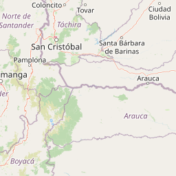
Map view of General Juan Pablo Peñaloza National Park

Use this park location map to pinpoint General Juan Pablo Peñaloza National Park in Venezuela, understand its exact geographic position, and read its mapped placement within the surrounding landscape more clearly.

Pigeon | © OpenStreetMap contributors

Location context for General Juan Pablo Peñaloza National Park

MéridaTáchira

Visual exploration of high altitude paramo terrain, glacial lakes, and montane forest habitats

Parque nacional General Juan Pablo Peñaloza Photos, Landscapes, and Scenery

Visual records reveal the rugged topography and high altitude paramo ecosystems of Parque nacional General Juan Pablo Peñaloza. Photographic documentation highlights glacial lake formations, steep elevation gradients, and protected montane forest environments.

A small rocky lagoon with green algae around its edges and a large boulder in the center, situated in a rocky mountain valley with steep slopes and sparse vegetation under a partly cloudy sky.

Park atlas

Compare surrounding highland landscapes, montane forests, and regional conservation zones.

Parks Near Parque nacional General Juan Pablo Peñaloza and Related Andean Protected Areas

Continue geographic discovery by comparing protected areas near Parque nacional General Juan Pablo Peñaloza with other high-altitude Andean reserves. Examining adjacent mountain terrain and regional park distribution reveals broader ecological patterns across the northern cordillera.
National parkVenezuela
About 0 km away#1 closest

South

General Juan Pablo Peñaloza National Park: Venezuela National Park Atlas Entry

Mapped boundaries and regional geographic context for a protected natural area.

Explore General Juan Pablo Peñaloza National Park, a key protected area designated as a national park in Venezuela. This detailed entry focuses on its landscape identity, mapped boundaries, and its contribution to Venezuela's broader regional geography. Understand the park's significance as a protected natural area and its atlas context for in-depth geographic study.

Area
752 km²
Established
1989
Relief
Mountain
Climate
Alpine
National parkTáchira State
About 35 km away#2 closest

Southwest

Chorro El Indio National Park: Protected National Park in Táchira State's Geography

Explore mapped boundaries and regional landscape context.

Chorro El Indio National Park serves as a key protected landscape within Táchira State, Venezuela. This national park offers users detailed insights into its specific geographic setting, mapped park boundaries, and the natural terrain it encompasses. Understanding Chorro El Indio National Park through the MoriAtlas platform provides a foundation for exploring regional protected areas and their ecological significance.

Area
170 km²
Established
1989
IUCN
II
Relief
Mountain
National parkApure State
About 55 km away#3 closest

South

Río Viejo San Camilo National Park: National Park in Apure State, Venezuela

Explore its protected landscape and regional geography.

Understand Río Viejo San Camilo National Park as a protected entity within Venezuela's Apure State. This page offers insights into its geographic context, mapped boundaries, and significance as a national park. Dive into the atlas-driven discovery of its natural landscape, providing essential details for geographic understanding and comparison within regional protected areas.

Area
800 km²
Established
1993
IUCN
II
Relief
Upland
National parkTáchira State
About 56 km away#4 closest

Southwest

El Tamá National Park: A National Park in Venezuela's Táchira State for Geographic Discovery

Mapped protected area boundaries and regional landscape context.

El Tamá National Park serves as a primary point of interest for understanding Venezuela's protected lands. Located within Táchira State, this national park offers a distinct geographic profile for atlas exploration. Users can investigate the park's mapped features and its position within the regional natural landscape, gaining insight into its role as a conservation area and a component of Venezuela's broader geography.

Area
1,390 km²
Established
1978
IUCN
II
Relief
Mountain
Natural monumentMérida
About 60 km away#5 closest

Northeast

Monumento natural Meseta la Galera: Protected Andean Plateau and Geography Map

Analyzing the fluvial terrain and forest landscape of Tovar, Merida.

Monumento natural Meseta la Galera serves as a vital geographic landmark near Tovar, Merida. This protected natural monument preserves a rare flat topped plateau rising over the Mocoties River valley. Examine the structured map context of this 95 hectare forest refuge and its defined topographical boundaries within the Andean mountain foothills.

Area
0.95 km²
Established
1992
IUCN
III
Relief
Highland
A soft watercolor painting of a calm lake surrounded by lush green vegetation with distant, hazy mountains under a pale sky.
Natural monumentMérida
About 84 km away#6 closest

Northeast

Laguna de Urao Natural Monument: Geographic Profile and Protected Andean Landscape

Saline tectonic lake located in the Mérida region of Venezuela

Laguna de Urao is a singular protected natural feature of tectonic origin situated in the semi-arid Andean landscape of Mérida. Known for the accumulation of the urao mineral, this saline water body serves as an important geographic landmark that anchors the cultural and geological identity of the local surroundings.

Established
1979
Relief
Upland
Water
Major water bodies
National parkNorte de Santander
About 85 km away#7 closest

Southwest

Tamá National Natural Park: Colombia's Protected Landscape and Regional Geography

Explore mapped natural features and protected area context.

Delve into the protected landscape of Tamá National Natural Park, a key national park situated in Colombia's Norte de Santander region. This resource provides an atlas-style overview of the park's geographic setting, emphasizing its mapped boundaries and its role within the broader regional geography. Understand the inherent natural context and protected status of this significant Colombian conservation area through detailed landscape information.

Area
480 km²
Established
1977
IUCN
II
Relief
Mountain
National parkVenezuela
About 87 km away#8 closest

Northeast

Sierra La Culata National Park: Protected Landscape Atlas of the Venezuelan Andes

Explore the páramo ecosystems and mapped terrain of this Venezuelan national park.

Sierra La Culata National Park offers a profound look into the unique geography of the Venezuelan Andes. This protected national park is characterized by its expansive páramo ecosystems, dramatic mountain peaks, and glacial lagoons, creating a distinctive high-altitude wilderness. Use this atlas-focused entry to understand the park's mapped boundaries and its significant role within the region's natural landscape context.

Area
2,004 km²
Established
1989
IUCN
II
Relief
Mountain

Common questions about visiting, size, designation, and location context for General Juan Pablo Peñaloza National Park

General Juan Pablo Peñaloza National Park FAQs for park facts, access, geography, and protected area context

Find quick answers about General Juan Pablo Peñaloza National Park, including protected-area facts, park geography, trail and visitor context, and how the park fits into its surrounding country and regional landscape.
MoriAtlas Explorer

Continue Your Protected Areas Search Across the Global Atlas

Deepen your exploration by continuing the structured search for national parks and protected areas worldwide. Utilize the comprehensive filtering capabilities to compare different conservation landscapes and refine your understanding of global park geography. Discover more about the distribution and characteristics of protected natural areas.

Global natural geography
