Why Gloucester Island National Park stands out
Gloucester Island National Park is best known for its seasonal birdwatching opportunities, particularly from October through April when thousands of migratory wading birds pass through the area. The park's coastal island setting provides important habitat for diverse bird species during their trans-equatorial migrations. The park is also notable for being a relatively accessible island protected area visible from the Queensland mainland, offering a distinct island conservation experience within reasonable proximity to the coastal town of Bowen.
Gloucester Island National Park history and protected-area timeline
Gloucester Island has historical significance in Australian coastal exploration. British explorer James Cook encountered the island during his 1770 voyage along the Queensland coast and erroneously applied the name Cape Gloucester to what he observed. The name was subsequently transferred by the Admiralty's hydrographer to the cape on the mainland immediately south of the island, which retains the Cape Gloucester designation to this day. This naming history reflects the common cartographic practice of the era where coastal features observed from sea were sometimes misattributed or had their names adjusted as geographic knowledge of the coastline improved. The island's identification as a distinct geographical feature predates its formal protection as a national park by over two centuries.
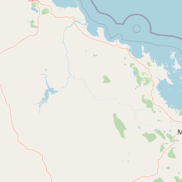
Gloucester Island National Park landscape and geographic character
The landscape of Gloucester Island National Park is characterized by low-lying coastal terrain averaging 34 meters in elevation, representing the remnant landscape of a continental island off the Queensland coast. The park encompasses the main island mass as well as components of neighboring islands within its protected boundaries. The coastal setting provides a mix of shoreline environments, beach areas, and inland vegetation zones characteristic of tropical island ecosystems in this region. The relatively flat topography contrasts with the mountainous mainland peaks visible from the island, creating a distinctive island silhouette against the Queensland sky.
Gloucester Island National Park ecosystems, habitats, and plant life
As a coastal island protected area in tropical Queensland, Gloucester Island supports vegetation communities adapted to island and coastal conditions. The park contributes to the network of protected areas along the Queensland coast that help maintain ecological connectivity for species moving between mainland and island habitats. The island's position within the broader Coral Sea region places it within one of Australia's most biodiverse marine and coastal environments. Protected area status ensures the maintenance of the island's natural values against development pressures and provides management frameworks for the ongoing conservation of its ecological communities.
Gloucester Island National Park wildlife and species highlights
The wildlife significance of Gloucester Island National Park is centered primarily on its role as a seasonal habitat for migratory bird species. From October to April, thousands of migrating birds transit through the area, with wading birds being particularly prominent. This seasonal phenomenon connects the island to the East Asian Australasian Flyway, one of the major migratory bird routes in the world. The park provides important resting and feeding habitat for these trans-equatorial migrants as they move between their breeding grounds in the northern hemisphere and non-breeding areas in Australia. The combination of coastal shoreline habitat and island environments creates suitable conditions for diverse birdlife during the migration season.
Gloucester Island National Park conservation status and protection priorities
Gloucester Island National Park contributes to Queensland's protected area network by preserving a coastal island ecosystem that might otherwise face development pressure. The park's IUCN Category II designation reflects its national park status and the formal recognition of its conservation values. Conservation of the island's coastal habitats supports broader ecosystem health in the region, while the protection of migratory bird habitat aligns with international conservation commitments. The Queensland Parks and Wildlife Service manages the park with responsibilities for maintaining natural values while providing for appropriate visitor experiences.
Gloucester Island National Park cultural meaning and human context
The cultural context of Gloucester Island includes its role in early European exploration of the Queensland coast. James Cook's 1770 encounter with the island and the subsequent naming transfer to the mainland Cape Gloucester represents a historical layer of colonial geographic naming. The island's relationship to the modern town of Bowen, which lies on the mainland coast to the south, creates a cultural and visual connection between the protected island and the regional community. While the park does not encompass specific documented indigenous cultural heritage in this source material, the broader Queensland coast has deep indigenous cultural connections spanning millennia.
Top sights and standout views in Gloucester Island National Park
The primary highlight of Gloucester Island National Park is its exceptional seasonal birdwatching opportunity, with thousands of migratory waders present from October to April each year. The park offers a rare island-based protected area experience within view of the Queensland mainland, making it distinctive among the state's national parks. The historical significance of Cook's encounter and the naming transfer adds a layer of exploration history to the park's identity. The park's low-lying island landscape provides a contrast to the mountainous terrain typical of many Australian national parks, offering a different type of protected area character.
Best time to visit Gloucester Island National Park
The best time to visit Gloucester Island National Park is during the birdwatching season from October to April, when thousands of migratory birds can be observed. The austral spring and summer months coincide with the peak migration period, making this the most biologically active time to experience the park. Visitors interested in birdwatching should plan their visit during these months to take advantage of the seasonal wildlife spectacle that the park is known for.