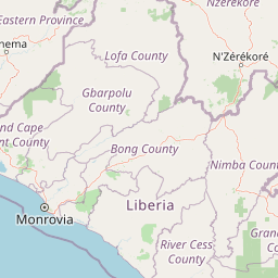
Discover the mapped geographic boundaries and regional context of this significant protected area.
Gola Forest National Park serves as a key protected landscape within Liberia, representing a vital component of West Africa's natural geography. This detailed atlas entry focuses on understanding the park's protected boundaries and its specific place within the mapped terrain of Liberia. Explore the geographic significance and the unique context of this national park, offering a structured foundation for understanding its landscape.
Gola Forest National Park
National park
Structured park overview, official facts, and landscape profile for Gola Forest National Park
Geography guide, regional context, and park location map for Gola Forest National Park
Liberia is a West African country on the Atlantic coast, bordered by Sierra Leone, Guinea, and Ivory Coast. Founded as an American Colonization Society settlement in 1822, it became Africa's first independent republic in 1847. The country has a population of approximately 5.4 million and uses both the US dollar and Liberian dollar as currency.
Liberia occupies the West African Atlantic coast, stretching from Sierra Leone in the northwest to Ivory Coast in the east. The country features a coastal plain that rises to a rolling plateau and mountainous regions in the northeast. Several rivers, including the Mano and St. John rivers, flow across the territory. The climate is tropical with distinct wet and dry seasons.
Common questions about visiting, size, designation, and location context for Gola Forest National Park
Deepen your exploration by continuing the structured search for national parks and protected areas worldwide. Utilize the comprehensive filtering capabilities to compare different conservation landscapes and refine your understanding of global park geography. Discover more about the distribution and characteristics of protected natural areas.