
Mori Atlas logo
Wildlife reserveGoravan Sands Sanctuary

Mapping the relict habitats, endemic plant species, and arid terrain of the Urtz ridge

Goravan Sands Sanctuary: A Protected Sandy Semi-Desert Landscape in Ararat Province, Armenia

(Goravan Sands State Nature Sanctuary)

Goravan Sands Sanctuary serves as a vital protected nature area, safeguarding the most extensive residual sandy semi-desert ecosystem remaining in Armenia. Situated on the piedmont slopes of the Urtz mountain range, this reserve features an ash-grey landscape characterized by a mosaic of psammophilic sand plains, limestone outcrops, and clay semi-desert fringes. The area provides a critical refuge for endemic vascular plants and rare reptile species, maintaining an ecologically significant link to the region's ancient geological history.

sandy semi-desertrelict habitatendemic plantsIUCN Red List speciesArmenian Red List speciesdryland ecosystem
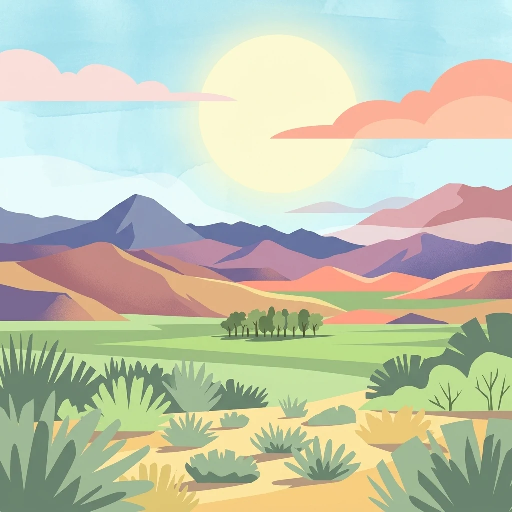
Stylized digital illustration of a desert landscape with scrub vegetation in the foreground, a grassy plain in the middle ground, and layered purple and orange mountains under a bright sun.

Goravan Sands Sanctuary

Wildlife reserve

Park overview

Structured park overview, official facts, and landscape profile for Goravan Sands Sanctuary

Goravan Sands Sanctuary park facts, protected area profile, and essential visitor context

Review the core facts for Goravan Sands Sanctuary, including designation, size, terrain, visitor scale, habitats, and operating context in one park-focused overview.

About Goravan Sands Sanctuary

Goravan Sands Sanctuary sits at the meeting point of arid mountain slope and relict sand plain, a landscape that feels more at home on a Caspian shore than in the interior of the South Caucasus. Established in 1959 to safeguard what remains of Armenia's sandy semi-desert, the reserve has evolved into a microcosm of dryland ecology, where psammophile, xerophyte, and phryganoid communities coexist across only a few square kilometers.

The core of the protected area is a series of grey sandy patches resting on Pleistocene alluvial deposits and Paleozoic limestone bedrock, including the Ararat travertine. Tectonic uplift, water erosion, and wind shaping have combined to leave behind a mosaic of habitats: open sand, rocky outcrops, tertiary clay depressions, and humid pockets where small ephemeral springs survive. The closest body of water is the intermittent Vedi River, usually dry by midsummer, but within the reserve itself a few narrow seepage lines create localized green oases.

The sanctuary is part of Armenia's Yerevan floristic region and holds a special position within the country's species conservation framework. Its vascular plant list of roughly 160 species is disproportionately rich in rare and endangered taxa, and its vertebrate fauna, although modest in overall species count, includes several lizards, tortoises, and a finch that are otherwise under threat across the region. For researchers and conservation planners, Goravan is a small but irreplaceable reference site for understanding what relict sandy ecosystems of the Caucasus once looked like and what is now left of them.

Quick facts and research context for Goravan Sands Sanctuary

Goravan Sands Sanctuary is a state nature reserve in Armenia's Ararat Province, on the lower slopes of the Urtz ridge near the village of Goravan. It was established in 1959 by the Armenian Soviet Republic to protect the largest known residual of sandy semi-desert in the country, an unusual ash-grey relict habitat believed to be of ancient lacustrine or marine origin.

Administratively the reserve was re-clarified in 2007 when its regulations were confirmed, and a 100-meter-wide protection zone was added to limit harmful economic activity nearby. Its flora includes around 160 vascular plant species, with a notable share of Armenian and Caucasus endemics; its vertebrate fauna includes roughly 33 to 36 species, several of which are listed in the Armenian Red List and one in the IUCN Red List.

Protection and recognition

Terrestrial conservation scope, designation year 2011, and official records

Goravan Sands Sanctuary Protection Status and Designated Area History

Goravan Sands Sanctuary maintains a documented terrestrial protection status established in 2011. Official records outline the designation timeline and management scope without additional international recognition sources.

Protection details

Protection scope
Terrestrial
Designated year
2011
Transboundary protection
No
Park context

Deeper park guide and search-rich context for Goravan Sands Sanctuary

Goravan Sands Sanctuary history, landscape, wildlife, and travel context

Explore Goravan Sands Sanctuary through its history, landscape character, ecosystems, wildlife, conservation priorities, cultural context, and seasonal travel timing in a structured park guide built for atlas discovery and search intent.

Why Goravan Sands Sanctuary stands out

The sanctuary is best known for being the only place in Armenia where the relict phog shrub Calligonum polygonoides grows, a leafless, sand-stabilizing species also tied ecologically to an endemic Caucasian butterfly. It is likewise recognized as the richest area in Armenia for rare and endangered vascular plants when measured against the Yerevan floristic region. Beyond its botanical importance, Goravan Sands is valued for preserving a relict sandy semi-desert ecosystem within an arid, cold-winter climate zone. The presence of psammophilic plants, specialized sand lizards, and an unusually diverse invertebrate fauna, including 12 beetle species endemic to Armenia, makes it a reference site for South Caucasus sandy-desert ecology.
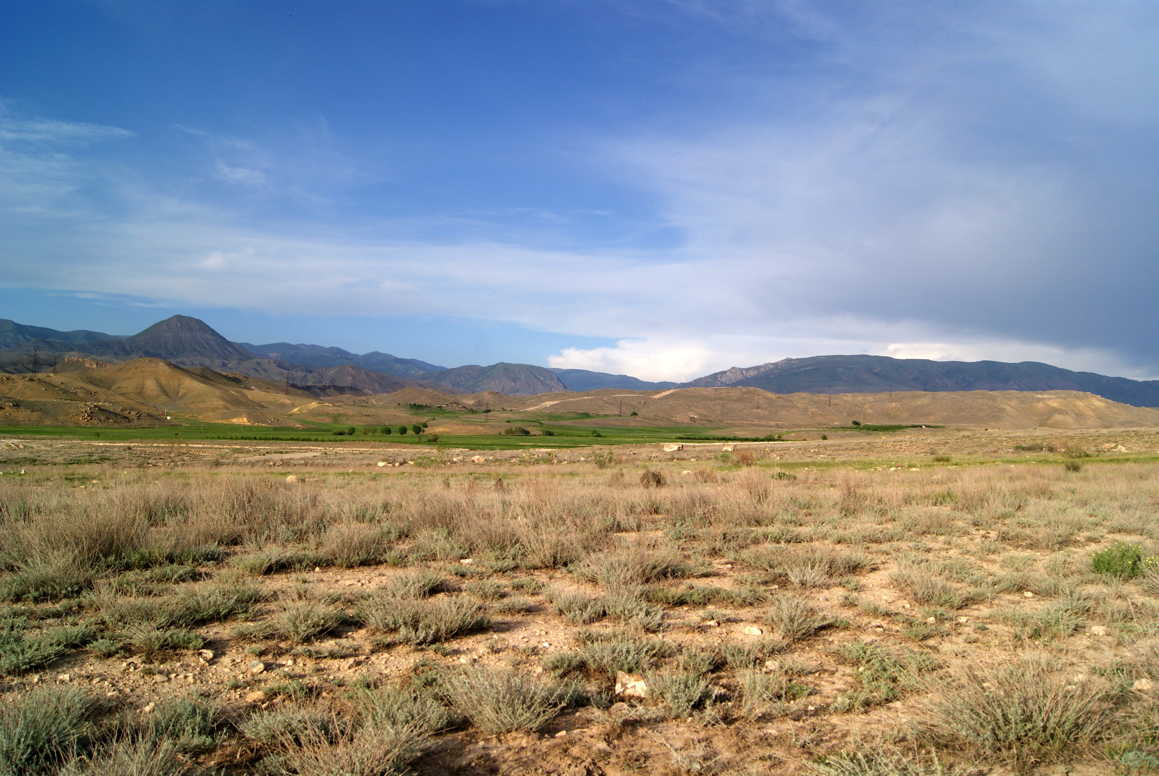
A wide, eye-level landscape shot of a dry, sandy semi-desert terrain with sparse shrubs and grasses in the foreground, leading to green fields and a mountain range under a blue sky with light clouds.
A wide view of the arid landscape and sandy terrain at Goravan Sands Sanctuary in Armenia.

Goravan Sands Sanctuary history and protected-area timeline

The Goravan Sands Sanctuary was created in 1959 by decision of the Council of Ministers of the Armenian Soviet Republic, with the explicit goal of conserving the sandy semi-desert adjacent to the village of Goravan in the Ararat plain. The original decree described a 200-hectare reserve between approximately 900 and 950 meters of elevation, but the boundaries were never mapped precisely and later field surveys have revealed that the actual sandy habitat is patchier and totals closer to 175 hectares across more than ten fragments.

For decades the reserve existed largely on paper, without a formal administration or effective on-the-ground control. During the 1990s and 2000s the territory was subject to widespread grazing, sand and travertine mining, garbage dumping, military vehicle use, and small-scale agriculture, alongside unregulated collection of plants and animals, with documented damage to several Red List species.

In 2007 the Government of Armenia confirmed a new set of regulations for the sanctuary and, without changing its protected status, transferred its administration to the Khosrov Forest State Reserve under the Ministry of Nature Protection in order to strengthen conservation and restoration work. In 2011 a formal description of the sanctuary's boundaries and a schematic map were approved, bringing the long-running boundary dispute closer to resolution and reducing the official area to roughly 95 to 96 hectares of clearly protected land, with a wider buffer zone of additional protection around it.

Goravan Sands Sanctuary landscape and geographic character

The landscape of Goravan Sands Sanctuary is unusually varied for such a compact area. The reserve lies on the northwestern, mostly dry slopes of the Urtz mountain ridge, where sandy Pleistocene alluvial deposits sit atop Paleozoic limestone, including the local Ararat travertine. Over time, tectonic movements, water erosion, and wind action have produced the mosaic that visitors and researchers see today.

The single most striking physical feature is a broad, ash-grey sandy plain that resembles an ancient shoreline, even though the reserve is now more than 100 kilometers from any large body of water. Diatomite layers embedded in the sand point to a lacustrine or marine past. To the north and west, the sandy habitats meet the orchards, fields, and cemetery of the village of Goravan, while to the south and east the sands blend gradually with dry, slender limestone ridges;

Scattered limestone outcrops and their rocky shells protect the soil from rapid drying and provide shelter for plants and larger animals, creating a phryganoid vegetation cap of tough, drought-resistant shrubs. The tertiary clay semi-desert forms a narrower, less biodiverse fringe around the rocky zones. A few ephemeral springs at the bottoms of the deepest limestone canyons provide the only surface water within the reserve, sustaining small patches of tamarisk and other moisture-loving vegetation that function as green oases inside an otherwise dry landscape.
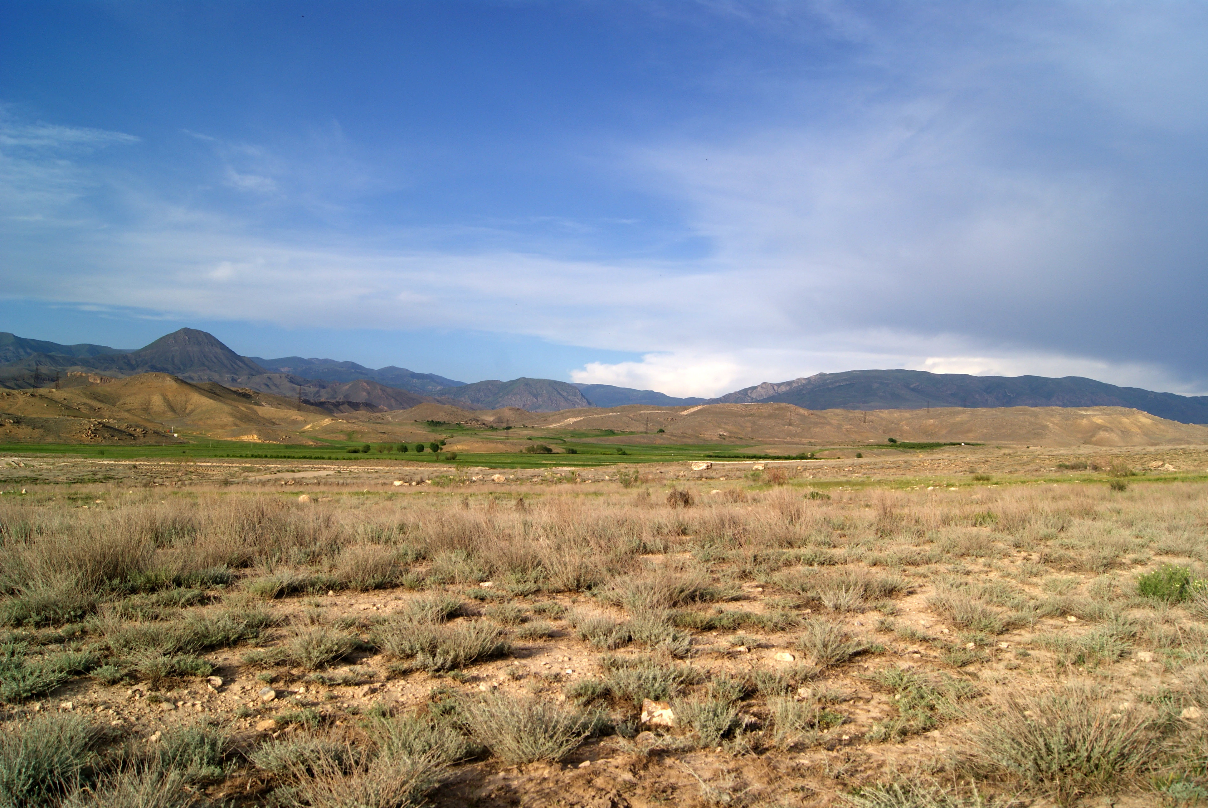
An arid, desert-like landscape with sparse, low-growing vegetation and rolling hills under a blue sky with scattered clouds.
A view of the sandy landscape and arid plains of Goravan Sands Sanctuary.

Goravan Sands Sanctuary ecosystems, habitats, and plant life

Ecologically, Goravan Sands Sanctuary is best understood as a tight mosaic of arid and semi-arid habitats compressed into a small space, which together support an unusually high concentration of rare and endemic species for Armenia.

The sandy semi-desert is the reason the reserve was created in the first place. It supports psammophilic, or sand-loving, plants such as the relict phog Calligonum polygonoides, milfoil Achillea tenuifolia, Bassia prostrata, Noaea mucronata, Euphorbia marschalliana, Astragalus paradoxus, Ziziphora tenuior, and Ceratocarpus arenarius. Many of these species are tightly tied to the physical properties of the sand, including its depth and grain composition, and disappear where the substrate changes.

The Artemisia semi-desert on surrounding plains contributes cold- and drought-resistant generalist species, frequently forming associations of Artemisia fragrans with different saltworts of the Salsola genus. Limestone outcrops host phryganoid shrubs including Pallas's buckthorn, white-hair cherry Prunus incana, and dragon-head sage Salvia dracocephaloides. Humid microhabitats along intermittent water lines support Tamarix species and a few amphibians and striped lizards that depend on moisture.

The flora as a whole includes approximately 160 vascular plant species across some 125 genera and 39 families, with twelve or more Red List species and several Caucasus endemics. Among the most notable endemics tied to the reserve are Scorzonera gorovanica and Acantholimon araxanum, while Fritillaria gibbosa and Tulipa biflora are emblematic spring ephemeroids of the sandy soils.
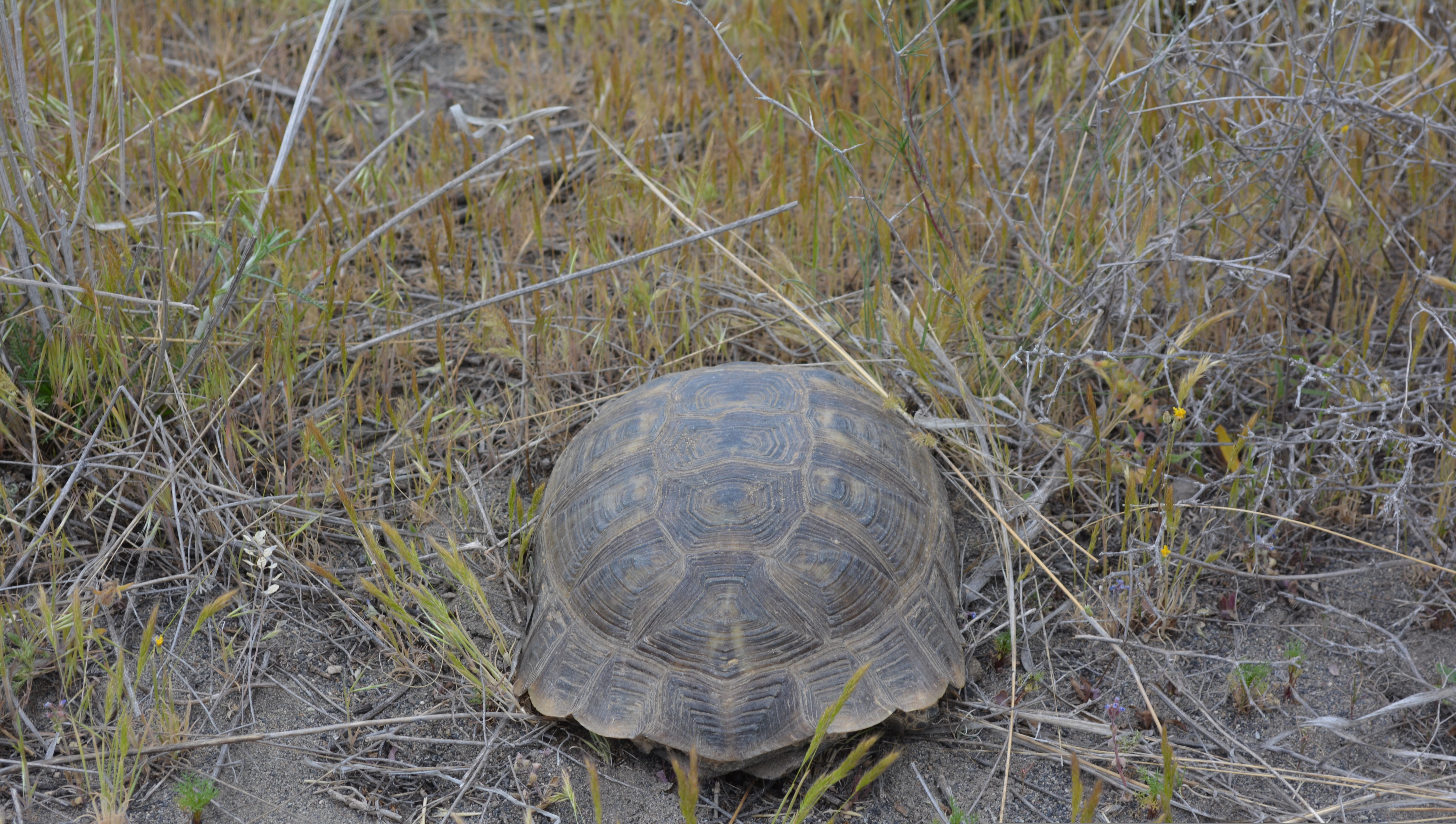
A brown tortoise with a patterned shell resting on dry, sandy ground with sparse grasses.
A Mediterranean spur-thighed tortoise, commonly found within the semidesert habitat of Goravan Sands Sanctuary.

Goravan Sands Sanctuary wildlife and species highlights

Animal life at Goravan reflects the same pattern seen in the flora: relatively few species overall, but a high proportion of specialists and Red List entries. The documented vertebrate fauna includes roughly 33 to 36 species spanning about two dozen families, with reptiles the best-studied group at thirteen or more species across twelve genera and seven families.

Several reptiles are tightly bound to specific habitats within the reserve. Caucasian agamas, golden grass skinks, and Schneider's skinks rely on rock outcrops for shelter against predators and heat; Strauch's racerunner is a habitat generalist that moves across rocks, sand, clay, and brown soils; and two smaller sand specialists, Horvath's sun-watcher lizard and the Transcaucasian racerunner, are restricted almost entirely to the sandy habitats. The snake-eyed lizard uses stony ground, while the Caucasus emerald lizard is found mainly near streambeds and disturbed, urban-edge habitats.

Mammals include fox, which use the rocky outcrops for permanent dens, and Dahl's jird, a gerbil with a very limited range. The Armenian tortoise is a widespread presence on rocky slopes and sandy areas. Among birds, the trumpeter finch stands out as a rare species of the reserve's arid scrub.

Invertebrate diversity is rich and is dominated by insects. The sanctuary hosts roughly seven hundred invertebrate species; beetles alone account for about two hundred, of which twelve are endemic to Armenia, including species such as the Ararat ground beetle Zuphium araxidis and the Caucasian pharaoh beetle Pharaonus caucasicus, the latter ecologically linked to the phog shrub. Orthoptera, butterflies, and mollusks are also documented, though not yet fully summarized in the published literature.
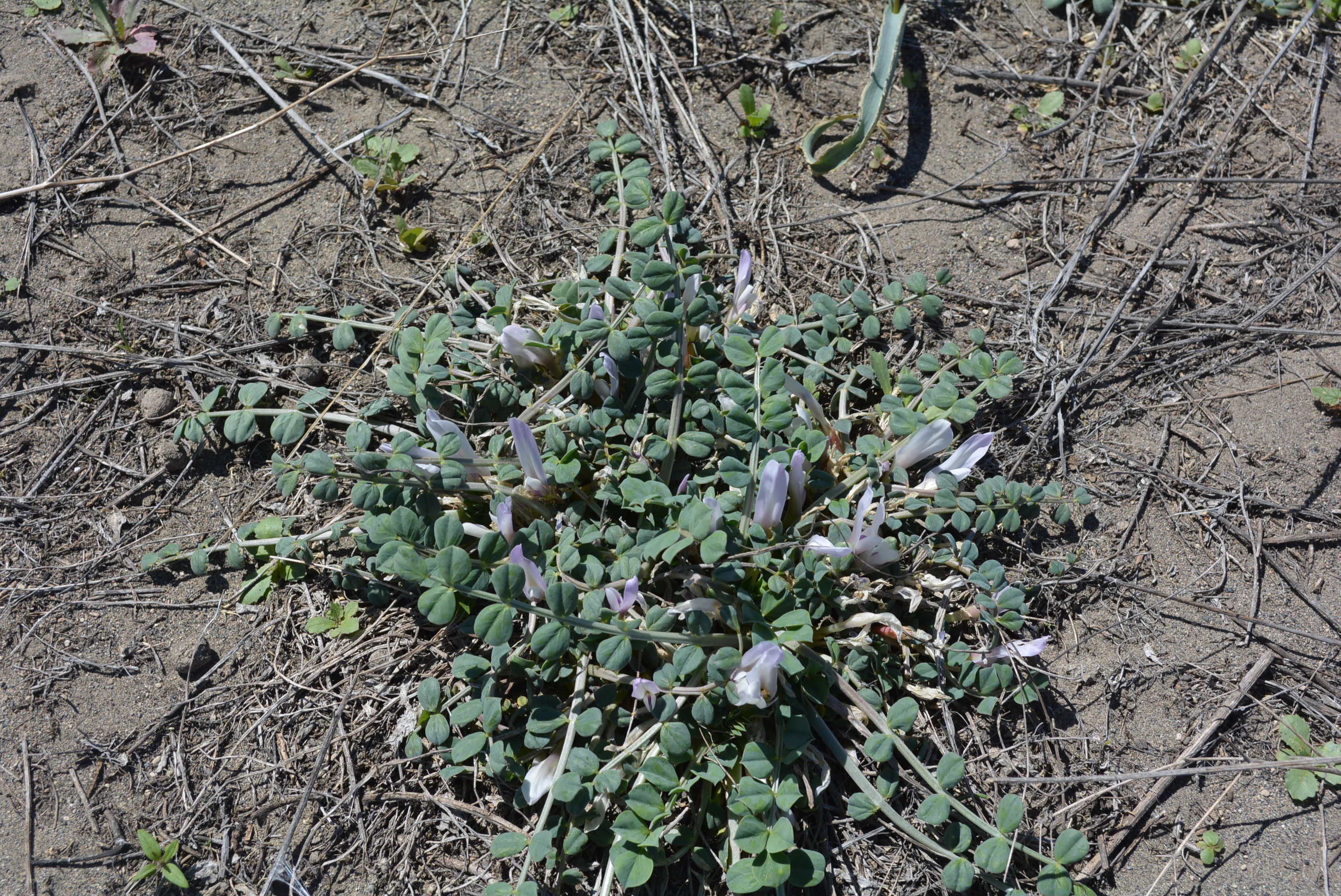
A low-growing plant with small green leaflets and pale, light-purple tubular flowers, situated on sandy, dry ground.
Astragalus paradoxus growing in the sandy soil of Goravan Sands Sanctuary.

Goravan Sands Sanctuary conservation status and protection priorities

Goravan Sands Sanctuary matters for conservation well beyond its modest size because it preserves one of the last intact sandy semi-desert ecosystems of the South Caucasus and concentrates an exceptionally high share of Armenia's rare plant species into a tiny footprint. It is listed among areas of national priority in the Biodiversity of the Caucasus Ecoregion and recognized by WWF as part of the Caucasus Biodiversity Hotspot.

The reserve's conservation profile is, however, a study in tension. Field surveys across 1998 to 2008 showed that, in the absence of on-site management, overgrazing, sand and travertine mining, dumping, military vehicle activity, agriculture, and unregulated collection of plants and animals had all occurred within and around the reserve. Each of these pressures degrades a specific slice of habitat: sand mining hits psammophilic plants and sand lizards, travertine mining destroys rockland shelter for reptiles and bulbs, overgrazing damages sandy ephemeroids and crushes juvenile tortoises.

The 2007 transfer of the sanctuary into the management structure of the Khosrov Forest State Reserve and the 2011 definition of a 100-meter-wide protection zone around the core area represent meaningful steps toward recovery. Continued redefinition of boundaries, restoration of sandy habitat, and active control of grazing and collection are widely seen as essential if Goravan's relict phog populations and the species that depend on them are to survive in the long term.

Goravan Sands Sanctuary cultural meaning and human context

The village whose name the sanctuary carries, Goravan, is the anchor community for the landscape and also the main source of historic pressure on it. Local residents have long harvested branches and roots of the phog shrub for fuel, grazed domestic goats and sheep across the sandy plains, and gathered wild foods such as Achillea tenuifolia milfoil, wild onions of the Allium genus, Scorzonera roots, and aromatic Lamiaceae and Apiaceae species. These traditional uses are part of why the area was protected, but they also explain several of the conservation challenges the reserve still faces.

Beyond the practical ties to the village, the reserve holds cultural value as one of the few surviving witnesses to an older natural heritage of the Ararat plain. The presence of relict species like Calligonum polygonoides gives the area a significance that goes beyond its small size, anchoring local identity to a landscape with deep ecological memory.
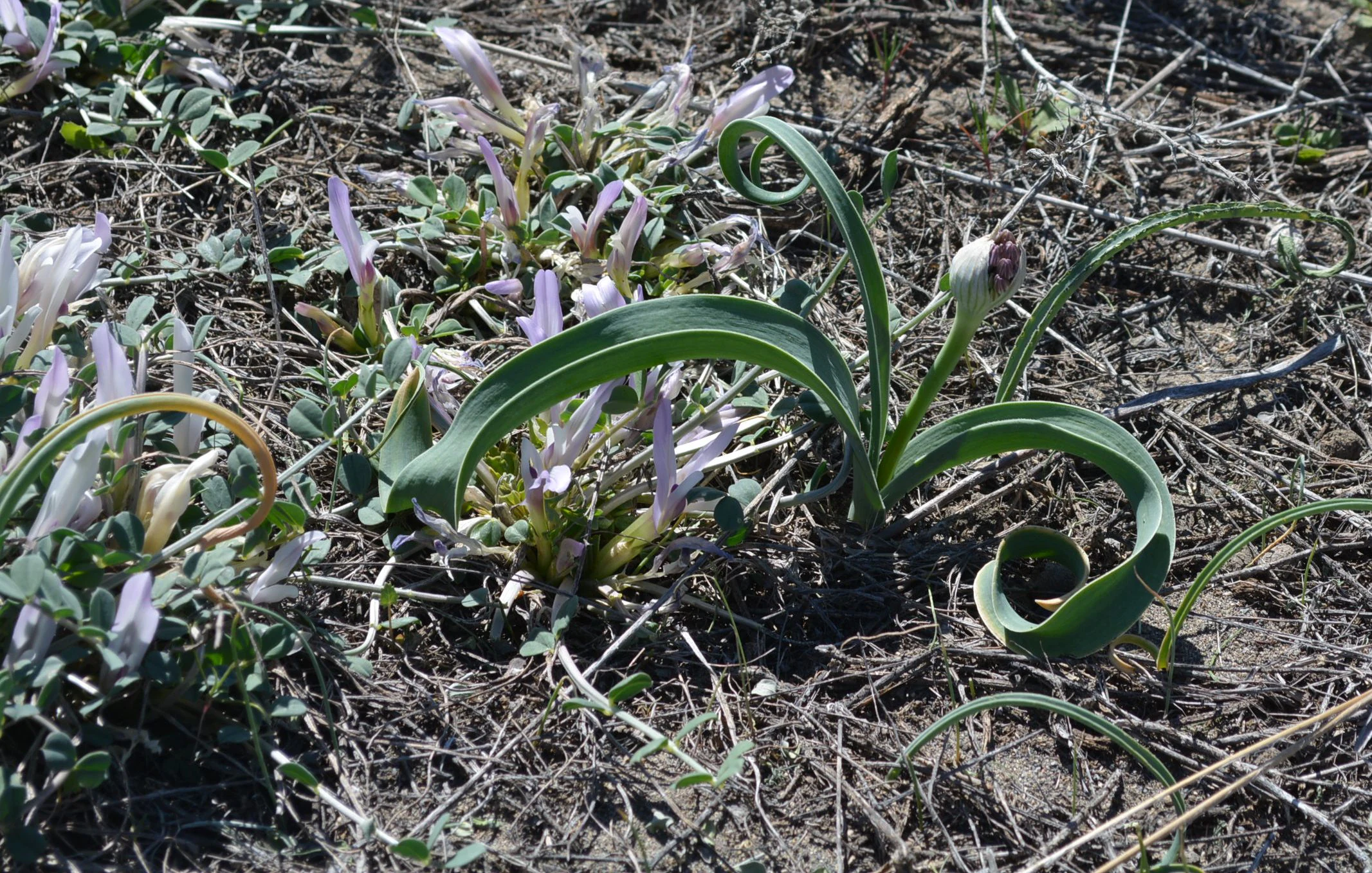
Close-up view of wild plants with green curled leaves and pale purple flowers growing from sandy ground.
Wild plants growing in the sandy soil of Goravan Sands Sanctuary.

Top sights and standout views in Goravan Sands Sanctuary

Standout qualities of Goravan Sands Sanctuary include its role as the only Armenian habitat of the relict phog shrub Calligonum polygonoides; the unusually dense concentration of rare and endemic vascular plants for such a small reserve; the layered mosaic of sandy, rocky, clay, and humid microhabitats within walking distance of each other; the rich reptile community, with thirteen or more species concentrated on arid slopes; and the abundance of endemic invertebrates, particularly twelve beetle species found nowhere else in Armenia.

Best time to visit Goravan Sands Sanctuary

The climate of the Goravan Sands Sanctuary is arid, with cold winters and hot, dry summers; air temperatures can swing from roughly minus twenty-five degrees Celsius in the harshest winter cold to over forty degrees Celsius at the summer peak. Late spring, roughly from April to mid-May, brings the brief wildflower window, when ephemeroids such as Fritillaria gibbosa and Tulipa biflora flower among dry grasses and Artemisia, and reptiles, including the Armenian tortoise, become active after winter.

Early to mid-autumn, after the worst of the summer heat, is similarly rewarding. In both seasons visitors are likely to see more active wildlife than in midsummer, when heat and dryness limit activity, or in winter, when the sandy landscape is snow-dusted and animal movement is reduced. Any visit should keep in mind that the area is exposed, with little shade and no surface water inside the reserve.
Monthly climate preview

Long-term average monthly temperature ranges and precipitation patterns for Ararat Province

Goravan Sands Sanctuary Climate Normals, Annual Temperature and Precipitation Rhythm

Goravan Sands Sanctuary exhibits measured annual temperature extremes ranging from sub-zero winter minimums to warm summer maximums alongside consistent monthly precipitation records. Examining the complete twelve-month climate profile reveals detailed shifts in long-term temperature and moisture normals across the protected area coordinate.
Annual mean8 °C
-6 °C21 °C
Jan-6°
Feb-4°
Mar
Apr
May12°
Jun17°
Jul21°
Aug21°
Sep16°
Oct
Nov
Dec-4°
Warmest month
July

20.9 °C

Coolest month
January

-5.7 °C

Wettest month
May

1.5 mm/day

Driest month
December

0.4 mm/day

Park location guide

Geography guide, regional context, and park location map for Goravan Sands Sanctuary

Goravan Sands Sanctuary park geography, regions, and map view in Armenia

Understand where Goravan Sands Sanctuary sits in Armenia through a broader geographic reading of the surrounding landscape, nearby location context, and its mapped position within the national park landscape.

How Goravan Sands Sanctuary fits into Armenia

Armenia is a landlocked nation in the South Caucasus region of West Asia, located in the Armenian highlands. It shares borders with Turkey to the west, Georgia to the north, Azerbaijan to the east, and Iran and the Nakhchivan exclave to the south. Yerevan is the capital and largest city. Armenia was the first country to adopt Christianity as its official religion in AD 301 and maintains the Armenian Apostolic Church as its primary religious institution.

Wider geography shaping Goravan Sands Sanctuary in Armenia

Armenia is situated in the South Caucasus region of West Asia, occupying the Armenian highlands. It is bordered by Turkey to the west, Georgia to the north, Azerbaijan to the east, and Iran and the Nakhchivan Autonomous Republic to the south. The country is landlocked, though it historically had access to the Caspian Sea.

Map view of Goravan Sands Sanctuary

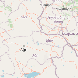
Use this park location map to pinpoint Goravan Sands Sanctuary in Armenia, understand its exact geographic position, and read its mapped placement within the surrounding landscape more clearly.

Pigeon | © OpenStreetMap contributors

Location context for Goravan Sands Sanctuary

Ararat Province

Exploring the ash-grey sandy plains, limestone ridges, and rare desert habitats through field imagery.

Goravan Sands Sanctuary Landscape Photography and Scenery Visual Guide

Visual documentation of Goravan Sands Sanctuary reveals the striking ash-grey sandy plains, limestone outcrops, and relict vegetation that define this protected dryland ecosystem. Examining these protected-area photographs helps observers understand the varied terrain, specialized habitats, and unique botanical character preserved within the Armenian landscape.

A wide, eye-level landscape shot of a dry, sandy semi-desert terrain with sparse shrubs and grasses in the foreground, leading to green fields and a mountain range under a blue sky with light clouds.

A pale blue butterfly with dark spots and orange accents on its wings, perched on thin, thorny desert twigs.

An arid, desert-like landscape with sparse, low-growing vegetation and rolling hills under a blue sky with scattered clouds.

A brown tortoise with a patterned shell resting on dry, sandy ground with sparse grasses.

A low-growing plant with small green leaflets and pale, light-purple tubular flowers, situated on sandy, dry ground.

A close-up photograph of a thorny desert shrub, likely Acantholimon, featuring thin, needle-like branches and numerous tiny developing buds.

Close-up view of wild plants with green curled leaves and pale purple flowers growing from sandy ground.

Park atlas

Compare surrounding regional geography and adjacent protected areas

Parks Near Goravan Sands Sanctuary and Related Protected Landscapes

Browse other parks near Goravan Sands Sanctuary to discover connected arid ecosystems and regional conservation lands in the South Caucasus. Comparing adjacent protected areas reveals broader patterns in dryland geography, relict habitats, and regional terrain.
A horizontal watercolor painting depicting rolling green hills, distant mountains, and sparse vegetation.
Nature reserveArarat Province
About 13 km away#1 closest

Northeast

Khosrov Forest State Reserve: Mapping Armenia's Historic Nature Reserve and Mountain Geography

Explore ancient juniper forests and rugged canyon terrain in Ararat Province.

Khosrov Forest State Reserve is a critical protected landscape in Armenia defined by its remarkable elevational gradient. From semi-desert lowlands to high mountain meadows, the reserve encompasses unique Tertiary relict forests and river-cut gorges. This resource maps the park's boundaries and provides a clear geographic overview of its diverse ecosystems and cultural heritage within the Ararat Province.

Area
232.13 km²
Established
1958
IUCN
Ia
Relief
Mountain
Nature reserveArmenia
About 31 km away#2 closest

North

Erebuni State Reserve: Protected Nature Reserve and Botanical Landmark in Armenia

Transitional mountain-steppe and semi-desert botanical geography

Erebuni State Reserve functions as a critical protected area for the conservation of wild wheat genetic resources in the South Caucasus. Located on the edge of the Armenian capital, the reserve protects a mosaic of grass-dominated slopes that capture the precise shift from arid lowlands to higher altitude steppe terrain, providing an essential focus for regional botanical study.

Area
1.2 km²
Established
1981
IUCN
Ia
Relief
Upland
National parkGegharkunik Province
About 54 km away#3 closest

Northeast

Sevan National Park: High-Altitude Lake and Protected Landscape in Gegharkunik

Explore map context, park boundaries, and regional geography.

Sevan National Park is a vital protected area located in Armenia's Gegharkunik Province, primarily safeguarding the remarkable high-altitude Lake Sevan. Established to protect this significant freshwater ecosystem, the park encompasses diverse surrounding landscapes including wetlands, forests, and steppes. Users exploring this canonical park detail page can delve into its geographic setting within the Armenian highlands, understand its importance as a protected landscape, and access structured data relevant to its unique natural environment. This MoriAtlas entry offers a focused lens on the park's conservation status and its contribution to regional geography.

Area
342 km²
Established
1978
IUCN
II
Relief
Highland
National parkTavush Province
About 86 km away#4 closest

North

Dilijan National Park: Mapped Protected Landscape and Forested Terrain in Tavush Province

Explore ancient deciduous forests and medieval sites within this protected area.

Dilijan National Park offers a unique atlas perspective on Armenia's natural and cultural heritage. This protected landscape in Tavush Province is dominated by vast, ancient deciduous forests, including rare yew groves, making it a vital conservation area. Its mountainous terrain, carved by rivers and dotted with medieval monasteries like Haghartsin and Goshavank, provides a rich context for geographic discovery. Users can explore the park's mapped boundaries and understand its significance as a preserved woodland ecosystem within the Caucasus region through its detailed geographic information.

Area
240 km²
Established
2002
IUCN
II
Relief
Mixed relief
Nature reserveAzerbaijan
About 111 km away#5 closest

East

Gara-Gel State Reserve: Mapping the Protected Volcanic Landscapes of Azerbaijan

High-altitude nature reserve with glacial and volcanic crater geography.

Gara-Gel State Reserve represents a concentrated protected area built around Lake Ishigli-Gara-Gel. Situated at nearly 2,700 meters, this site showcases the convergence of volcanic geology and mountain botany. The landscape features meadows and steep slopes that define the character of this protected highland basin, offering significant insight into the transitional ecosystems found within the broader Karabakh plateau.

Area
2.4 km²
Established
1987
Relief
Mountain
Climate
Alpine
Watercolor illustration of a mountainous landscape with green fields, a river, and a sunset sky
National parkOrdubad District
About 132 km away#6 closest

Southeast

Zangezur National Park: National Park and Protected Mountain Wilderness in Ordubad District

Explore dramatic glacial terrain and the highest Lesser Caucasus peaks.

Zangezur National Park encompasses a significant portion of the Zangezur mountain range, presenting a striking high-altitude protected landscape within Ordubad District, Azerbaijan. Its geography is characterized by rugged alpine features, extensive glacial formations, and dramatic elevation changes culminating in the Gemiqaya summit. This park serves as a vital refuge for diverse ecosystems and is distinguished by its role in preserving the highest mountain terrain in Azerbaijan's Lesser Caucasus, offering a unique focal point for geographic and protected-area exploration.

Area
427.97 km²
Established
2003
IUCN
II
Relief
Mountain
Watercolor illustration of a lake surrounded by greenery with mountains in the background
National parkAzerbaijan
About 148 km away#7 closest

Northeast

Göygöl National Park: Iconic Alpine Lakes and Protected Caucasus Forest Landscape

Explore Azerbaijan's most visited national park and its rich geographic context.

Göygöl National Park is a key protected area in Azerbaijan, renowned for the crystal-clear alpine Lake Göygöl and its surrounding dense forests within the Lesser Caucasus mountains. This national park showcases over 420 plant species, significant wildlife populations, and dramatic mountainous terrain, making it a prime destination for understanding regional landscape diversity and protected land value. Use MoriAtlas to explore its mapped boundaries and connect it to the broader geographic context of Azerbaijan.

Area
127.55 km²
Established
2008
IUCN
II
Relief
Mountain
Watercolor illustration of rolling green fields, a lake, and distant hills under a sunset sky
National parkShirak Province
About 153 km away#8 closest

Northwest

Lake Arpi National Park: High-Altitude Wetland Protected Landscape in Shirak Province

Mapped boundaries of an important South Caucasus conservation area.

Lake Arpi National Park offers a unique window into high-altitude wetland ecosystems on the Shirak and Javakheti plateau, located at roughly 2000 meters above sea level. Established as a national park in 2009, it protects critical habitats, including the central Lake Arpi, and serves as a vital sanctuary for numerous bird species. This protected area is distinguished by its alpine meadows, significant bird populations, and its distinct geographic setting within Armenia's northwestern region, providing rich context for atlas-based exploration of protected lands.

Area
250 km²
Established
2009
IUCN
II
Relief
Mountain

Common questions about visiting, size, designation, and location context for Goravan Sands Sanctuary

Goravan Sands Sanctuary FAQs for park facts, access, geography, and protected area context

Find quick answers about Goravan Sands Sanctuary, including protected-area facts, park geography, trail and visitor context, and how the park fits into its surrounding country and regional landscape.
MoriAtlas Explorer

Continue Your Protected Areas Search Across the Global Atlas

Deepen your exploration by continuing the structured search for national parks and protected areas worldwide. Utilize the comprehensive filtering capabilities to compare different conservation landscapes and refine your understanding of global park geography. Discover more about the distribution and characteristics of protected natural areas.

Global natural geography