Mori Atlas logo
National parkZangezur National Park

Discover the dramatic glacial terrain and highest peaks of the Lesser Caucasus within Azerbaijan.

Zangezur National Park: High-Altitude Protected Landscape in Ordubad District

(Zangezur National Park of Azerbaijan named after Academic Hasan Aliyev)

Zangezur National Park represents a significant protected landscape within the Ordubad District, anchoring the highest elevations of Azerbaijan's Lesser Caucasus range. This national park is defined by its rugged alpine terrain, featuring dramatic glacial formations, steep cliff faces, and deep valleys carved by numerous waterways originating from its summit snowmelt. The park's unique geographic context extends from its lower valley floors to the imposing Gemiqaya peak at 3,906 meters, showcasing a rich tapestry of ecosystems that support rare species and distinct natural heritage, making it a key area for atlas-based geographic discovery.

mountain parksPersian leopard habitatLesser Caucasusalpine landscapesprotected areaNakhchivan Autonomous Republic

Zangezur National Park

National park

Park overview

Structured park overview, official facts, and landscape profile for Zangezur National Park

Zangezur National Park park facts, protected area profile, and essential visitor context
Review the core facts for Zangezur National Park, including designation, size, terrain, visitor scale, habitats, and operating context in one park-focused overview.

About Zangezur National Park

Zangezur National Park represents one of Azerbaijan's most significant protected wilderness areas, situated in the remote and mountainous Nakhchivan Autonomous Republic at the southern edge of the country. The park was originally established as Ordubad National Park in 2003 covering 12,131 hectares and was significantly expanded in 2009 to its current size of 42,797 hectares, taking in additional territory from Shahbuz, Culfa, and Ordubad districts. The park encompasses the Zangezur mountain range, a spectacular branch of the Lesser Caucasus that forms a natural barrier between the Nakhchivan exclave and the rest of Azerbaijan. The landscape is dominated by rugged terrain including steep cliff faces, narrow ridgelines, deep river valleys, and extensive areas of exposed bedrock and eroded rocks. The highest peaks reach elevations exceeding 3,900 meters, with Gemiqaya standing at 3,906 meters as the tallest mountain in the Azerbaijani portion of the Lesser Caucasus. The park's elevation range and varied topography create multiple distinct ecological zones, from montane forest and shrubland at lower elevations through alpine meadows to barren rocky terrain at the highest reaches. The region experiences extreme temperature variations between seasons, with bitter winters and relatively warm summers, and precipitation patterns that vary significantly across the park's extent.

Quick facts and research context for Zangezur National Park

Zangezur National Park covers 42,797 hectares in the Zangezur region of Nakhchivan Autonomous Republic. The park is administered by Azerbaijan's Ministry of Ecology and Natural Resources. Average elevation within the park is approximately 1,692 meters, with the highest peak Gemiqaya reaching 3,906 meters. The park encompasses parts of Ordubad, Culfa, and Shahbuz districts. The area is characterized by an extreme continental climate with winter temperatures dropping to -30°C and summer temperatures ranging from 10°C to 25°C. Annual precipitation varies between 300 and 800 millimeters, with water supplied by multiple river systems including Gilanchay, Vanadchay, and Ordubadchay.

Park context

Deeper park guide and search-rich context for Zangezur National Park

Zangezur National Park history, landscape, wildlife, and travel context
Explore Zangezur National Park through its history, landscape character, ecosystems, wildlife, conservation priorities, cultural context, and seasonal travel timing in a structured park guide built for atlas discovery and search intent.

Why Zangezur National Park stands out

Zangezur National Park is best known for its dramatic high-altitude mountain landscape within the Zangezur range, which contains the highest summits of the Lesser Caucasus in Azerbaijan. The park protects critical habitat for the Persian leopard, one of the rarest large cats in the region, as well as populations of bezoar ibex and Caucasian mouflon. The area is distinguished by its complex glacial topography, including the distinctive Gemiqaya peak and the rugged Soyuq Mountain section. The park also preserves significant populations of rare plants, with 39 species listed in Azerbaijan's Red Book of protected species.

Zangezur National Park history and protected-area timeline

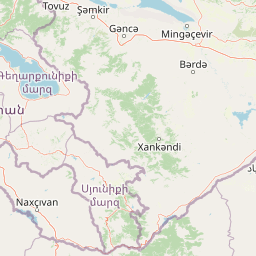
Zangezur National Park was established on June 16, 2003, originally designated as Ordubad National Park and covering an area of 12,131 hectares within Ordubad District of the Nakhchivan Autonomous Republic. The park was named after Academic Hasan Aliyev, a prominent Azerbaijani scientist and naturalist. On November 25, 2009, the park underwent significant expansion, growing to 42,797 hectares and being officially renamed Zangezur National Park. The expansion incorporated additional territories from Shahbuz, Culfa, and Ordubad districts, substantially increasing the park's ecological and geographic scope. Along with the national park, the adjacent Ordubad State Nature Reserve covers 27,870 hectares, creating a combined protected area complex. The park is managed by Azerbaijan's Ministry of Ecology and Natural Resources. Access to the park has historically been restricted, requiring special authorization from government authorities.

Zangezur National Park landscape and geographic character

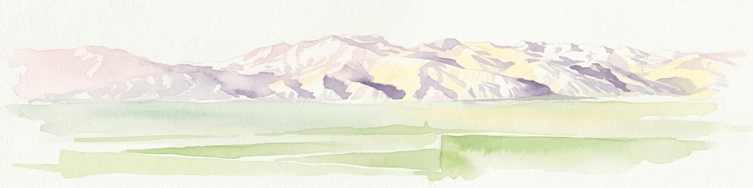
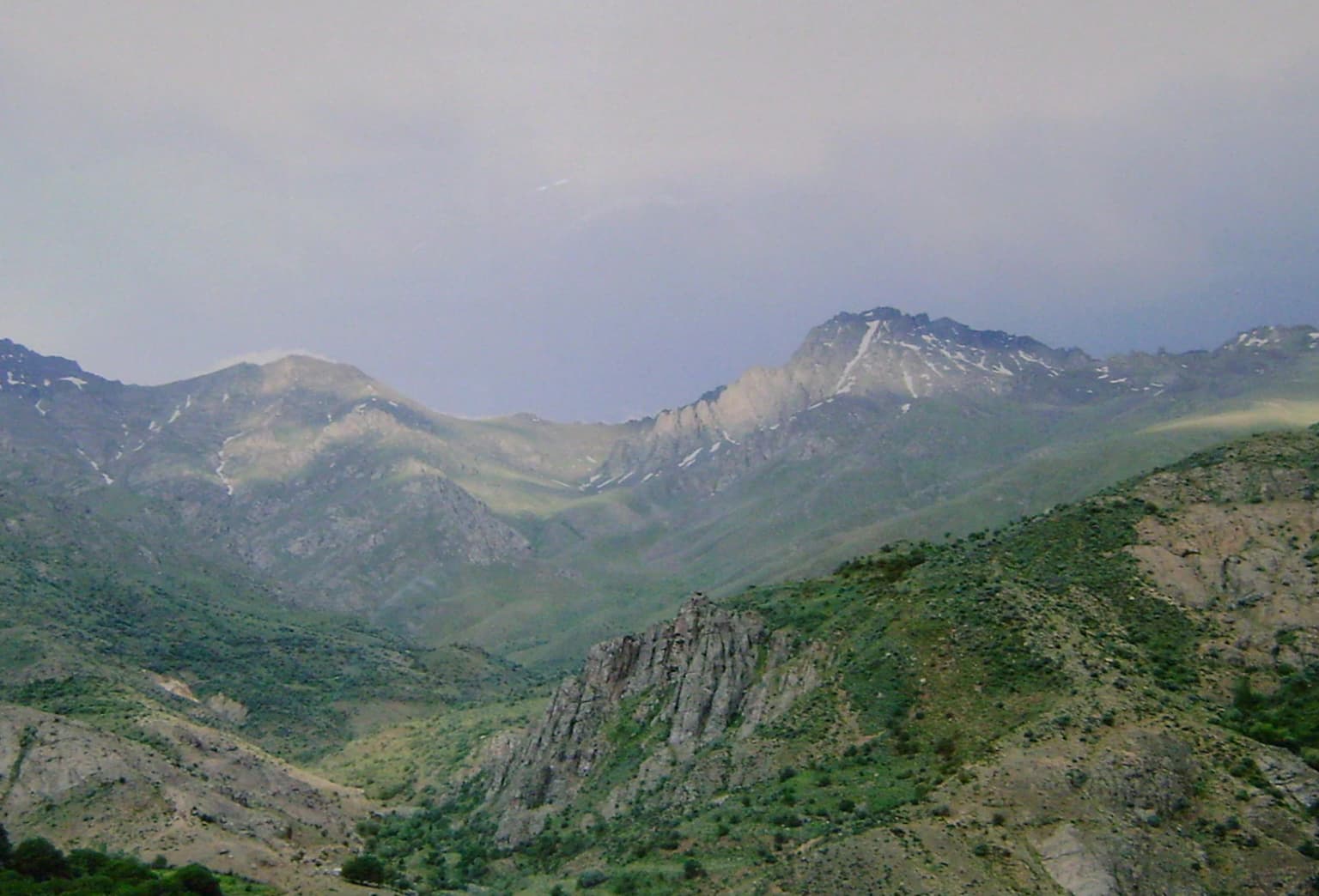
The landscape of Zangezur National Park is defined by the spectacular Zangezur mountain range, a rugged branch of the Lesser Caucasus that rises dramatically from the surrounding terrain. The park encompasses some of the most mountainous terrain in Azerbaijan, with the Zangezur range reaching higher elevations than any other part of the Lesser Caucasus within the country. The dominant feature is Gemiqaya, a massive peak standing at 3,906 meters, which is the highest point in the Azerbaijani Lesser Caucasus. The park also includes the southern portion of the Soyuq Mountain, a complex area with elevations between 2,000 and 3,000 meters featuring dramatic cliff faces, narrow water divides, and extensive areas of eroded bedrock. The terrain descends steeply both to the south and west over distances of approximately 12 kilometers. Ancient glacial features are prominent throughout the landscape, with glacial relief becoming more pronounced at higher elevations. Deep river valleys dissect the mountain mass, carved by the park's numerous waterways including Gilanchay, Vanadchay, Duylunchay, Aylishchay, Ganzachay, Ordubadchay, and other streams that originate from springs, rainfall, and snowmelt.

Zangezur National Park ecosystems, habitats, and plant life

The nature of Zangezur National Park reflects the complex ecological conditions created by its elevation range, varied topography, and geographic position at the boundary between different biogeographic zones. The park's vegetation follows distinct altitudinal patterns, with mountain forest soils, meadow soils, and alpine grassland communities distributed across different elevations. The dominant soil types include gray soils, meadow-gray soils, alluvial-meadow soils, mountain-forest soils, and mountain-meadow soils. The flora of the park includes numerous rare and endemic species, with 39 plant species protected under Azerbaijan's Red Book. Notable species include Iris elegantissima, Himantoglossum formosum, and Ferula glabrum. The overall Nakhchivan Autonomous Republic supports a rich flora with 110 species of rare and endemic higher plants, of which 77 occur within the boundaries of Zangezur National Park and the adjacent Ordubad State Nature Reserve. The park's position in the Zangezur range creates ecological conditions that support species from both the Caucasus and the Irano-Anatolian biogeographic regions.

Zangezur National Park wildlife and species highlights

Zangezur National Park supports exceptional biodiversity, particularly in its mammal and bird communities. The park is home to 58 documented animal species, including 35 vertebrates and 23 insect species. The mammalian fauna includes several rare and endangered species of significant conservation importance. The Persian leopard, one of the rarest large cats in the world, inhabits the park's mountainous terrain. The bezoar ibex and Caucasian mouflon are both present in significant numbers, representing important populations of these emblematic mountain ungulates. Overall, 32 species and subspecies of mammals found in Nakhchivan occur within the park's boundaries, out of 62 species known from the autonomous republic. The park supports at least 12 species of carnivorous mammals including leopard, wolf, jackal, fox, striped hyena, badger, and wild cat. The bird fauna is exceptionally rich with 217 species and subspecies recorded in the region, including the white-tailed eagle, golden eagle, bearded vulture, great bustard, little bustard, and various raptors. Fifteen of these bird species are protected under Azerbaijan's Red Book.

Zangezur National Park conservation status and protection priorities

Zangezur National Park plays a critical role in Azerbaijan's conservation framework, protecting some of the country's most significant mountain ecosystems and key populations of endangered species. The park was established not only to conserve individual species but to preserve the entire ecological complex of the Zangezur region, with its distinctive climate, relief, and biodiversity. The protected area serves as a crucial refuge for the Persian leopard, a species listed as endangered and representing one of the rarest large mammals in the Caucasus region. The park's high-altitude habitats also protect viable populations of bezoar ibex and Caucasian mouflon, both species of conservation concern. With 39 plant species and 15 bird species protected under Azerbaijan's Red Book, the park contributes significantly to national conservation goals. The presence of the adjacent Ordubad State Nature Reserve creates a larger protected area complex that enhances ecological connectivity and conservation effectiveness in this mountainous region.

Zangezur National Park cultural meaning and human context

Zangezur National Park is located in the historical Zangezur region, which has been an important part of Armenian and Azerbaijani cultural geography. The park's territory spans across three districts of the Nakhchivan Autonomous Republic: Ordubad, Culfa, and Shahbuz. The region has a long human history tied to its mountainous landscape, though the park itself focuses on wilderness conservation. The park was named after Academic Hasan Aliyev, reflecting the Soviet-era and post-Soviet practice of honoring scientists and political figures through geographic naming. The town of Ordubad, one of the nearest population centers to the park, has historical significance as a historic trade center along routes connecting Persia and the Caucasus.

Top sights and standout views in Zangezur National Park

The most distinctive highlights of Zangezur National Park include its status as home to the highest peaks of the Azerbaijani Lesser Caucasus, with Gemiqaya at 3,906 meters representing the pinnacle of the country's mountain landscape outside the Greater Caucasus. The park provides critical protection for the Persian leopard, an endangered predator whose presence indicates the ecological health of the mountain ecosystem. The dramatic glacial topography, with its ancient ice-carved valleys, steep cliffs, and exposed rock faces, creates one of Azerbaijan's most visually spectacular landscapes. The exceptional bird diversity, with species like the bearded vulture and various eagles, makes the park significant for ornithological conservation. The combination of high-altitude wilderness, rare species, and dramatic mountain scenery makes Zangezur one of Azerbaijan's most distinctive protected areas.

Best time to visit Zangezur National Park

The best time to visit Zangezur National Park would be during the summer months, from June through August, when temperatures are most moderate and the high-altitude terrain is most accessible. During this period, temperatures in the lower elevations range from 10°C to 25°C, though conditions at higher elevations remain significantly cooler. The summer months also offer the most stable weather for mountain exploration and wildlife observation. However, it should be noted that access to the park has historically been highly restricted, requiring special authorization from Azerbaijan's Ministry of Ecology and Natural Resources well in advance of any planned visit. The park's extreme continental climate makes winter visits impractical, with temperatures potentially dropping to -30°C in January. Spring and autumn offer transitional conditions but may present challenges related to weather variability.

Park location guide

Geography guide, regional context, and park location map for Zangezur National Park

Zangezur National Park park geography, regions, and map view in Azerbaijan
Understand where Zangezur National Park sits in Azerbaijan through a broader geographic reading of the surrounding landscape, nearby location context, and its mapped position within the national park landscape.

How Zangezur National Park fits into Azerbaijan

Azerbaijan is a unitary semi-presidential republic and one of six independent Turkic states. It declared independence from the Soviet Union in 1991 after nearly seven decades of Soviet rule. The country occupies 86,600 km² and has a population of approximately 10.3 million. It is known for its strategic location at the crossroads of Europe and Asia, its oil industry heritage, and its diverse cultural influences from Persian, Russian, and Turkic traditions.

Wider geography shaping Zangezur National Park in Azerbaijan

Azerbaijan occupies the eastern portion of the Caucasus region, situated between the Caspian Sea to the east and the Greater Caucasus mountains to the north. The terrain is diverse, featuring lowlands along the Caspian coast, mountainous areas in the north and west, and semi-desert plains in the central regions. The Kura and Aras rivers are major waterways draining into the Caspian Sea.

Map view of Zangezur National Park

Use this park location map to pinpoint Zangezur National Park in Azerbaijan, understand its exact geographic position, and read its mapped placement within the surrounding landscape more clearly.

Pigeon | © OpenStreetMap contributors

Location context for Zangezur National Park

Nakhchivan Autonomous RepublicOrdubad District
Park atlas

Compare contiguous mountain parks and diverse protected landscapes within Azerbaijan's Lesser Caucasus.

Explore Nearby National Parks and Protected Areas Beyond Zangezur National Park
After exploring Zangezur National Park's alpine terrain and Persian leopard habitat, continue your discovery by browsing other national parks and protected areas in the surrounding Lesser Caucasus region. This geographic overview allows for concrete comparison of diverse mountain ecosystems, glacial landscapes, and high-altitude conservation zones across Azerbaijan and its adjacent territories.
National parkSyunik Province

Arevik National Park: Syunik Province's Protected Mountain Landscape and Biodiversity Atlas

Explore mapped boundaries, terrain, and ecosystems.

Arevik National Park offers a detailed look into the geography and protected landscape of Armenia's Syunik Province. This park is defined by the rugged Zangezur mountains and its remarkable vertical ecological zoning, transitioning from semi-desert to alpine environments. Examine its mapped terrain, significant butterfly and bird habitats, and the presence of key mammal species, providing a comprehensive atlas-style understanding of this protected area's natural identity.

Area
344 km²
Established
2009
IUCN
II
Relief
Mountain
National parkGegharkunik Province

Sevan National Park: High-Altitude Lake and Protected Landscape in Gegharkunik

Explore map context, park boundaries, and regional geography.

Sevan National Park is a vital protected area located in Armenia's Gegharkunik Province, primarily safeguarding the remarkable high-altitude Lake Sevan. Established to protect this significant freshwater ecosystem, the park encompasses diverse surrounding landscapes including wetlands, forests, and steppes. Users exploring this canonical park detail page can delve into its geographic setting within the Armenian highlands, understand its importance as a protected landscape, and access structured data relevant to its unique natural environment. This MoriAtlas entry offers a focused lens on the park's conservation status and its contribution to regional geography.

Area
342 km²
Established
1978
IUCN
II
Relief
Highland
National parkAzerbaijan

Göygöl National Park: Iconic Alpine Lakes and Protected Caucasus Forest Landscape

Explore Azerbaijan's most visited national park and its rich geographic context.

Göygöl National Park is a key protected area in Azerbaijan, renowned for the crystal-clear alpine Lake Göygöl and its surrounding dense forests within the Lesser Caucasus mountains. This national park showcases over 420 plant species, significant wildlife populations, and dramatic mountainous terrain, making it a prime destination for understanding regional landscape diversity and protected land value. Use MoriAtlas to explore its mapped boundaries and connect it to the broader geographic context of Azerbaijan.

Area
127.55 km²
Established
2008
Relief
Mountain
Climate
Temperate
National parkAzerbaijan

Ag-Gel National Park

Azerbaijan Protected Wetland & Bird Sanctuary

Ag-Gel National Park is a protected wetland significant for migratory birds. Its landscape features a complex lake system and extensive reed beds, making it a vital conservation area in the Caspian region.

Area
179.24 km²
Established
2003
Relief
Lowland
Climate
Arid
National parkTavush Province

Dilijan National Park: Mapped Protected Landscape and Forested Terrain in Tavush Province

Explore ancient deciduous forests and medieval sites within this protected area.

Dilijan National Park offers a unique atlas perspective on Armenia's natural and cultural heritage. This protected landscape in Tavush Province is dominated by vast, ancient deciduous forests, including rare yew groves, making it a vital conservation area. Its mountainous terrain, carved by rivers and dotted with medieval monasteries like Haghartsin and Goshavank, provides a rich context for geographic discovery. Users can explore the park's mapped boundaries and understand its significance as a preserved woodland ecosystem within the Caucasus region through its detailed geographic information.

Area
240 km²
Established
2002
IUCN
II
Relief
Mixed relief
Watercolor painting showing green hills, a river, and distant purple and orange mountains
National parkDedoplistsqaro Municipality

Vashlovani National Park: Georgia's Unique Lowland Desert and Badland Protected Landscape

Discover distinct semi-arid terrain and rare forest ecosystems.

Vashlovani National Park in Dedoplistsqaro Municipality represents a significant protected area preserving Georgia's rare lowland desert and semi-arid steppe ecosystems. This national park is characterized by its striking badland topography, known as the "Sharp Walls," wild pistachio forests, and riparian habitats along the Alazani River. Its unique geographic setting, far removed from Georgia's typical mountainous landscapes, makes Vashlovani a crucial site for understanding regional biodiversity and conservation within the Caucasus.

Area
442.51 km²
Established
1935
IUCN
II
Relief
Lowland
Watercolor painting showing rolling green hills, a body of water, and distant mountains
National parkLankaran Rayon

Hirkan National Park: Ancient Hyrcanian Forest Protected Area in Lankaran Rayon

Explore mapped boundaries and unique regional geography.

Hirkan National Park stands as a significant protected area in Azerbaijan, renowned for its extensive old-growth Hyrcanian forests. This national park offers a unique window into ancient temperate rainforest ecosystems, featuring remarkable vertical forest zonation and a high concentration of endemic species within the Talysh Mountains and Lankaran Lowland. Its designation as part of the UNESCO World Heritage Hyrcanian Forests underscores its global importance for conservation and atlas-based geographic exploration of unique, relic landscapes.

Area
403.58 km²
Established
2004
Relief
Mixed relief
Climate
Subtropical
National parkHakkari Province

Hakkari Cilo-Sat Mountains National Park: Glacial Terrain and Regional Geography Atlas

Mapped protected boundaries in Hakkari Province's high alpine environment.

Delve into the geography and protected landscape of Hakkari Cilo-Sat Mountains National Park. This page provides a structured atlas view of its dramatic glacial valleys, alpine lakes, and high peaks within Hakkari Province. Understand the mapped extent and unique topographic features of this newly designated national park, ideal for exploring Turkey's remote mountain ecosystems.

Area
275 km²
Established
2020
Relief
Mountain
Climate
Temperate

Common questions about visiting, size, designation, and location context for Zangezur National Park

Zangezur National Park FAQs for park facts, access, geography, and protected area context
Find quick answers about Zangezur National Park, including protected-area facts, park geography, trail and visitor context, and how the park fits into its surrounding country and regional landscape.
MoriAtlas Explorer

Continue Your Protected Areas Search Across the Global Atlas

Deepen your exploration by continuing the structured search for national parks and protected areas worldwide. Utilize the comprehensive filtering capabilities to compare different conservation landscapes and refine your understanding of global park geography. Discover more about the distribution and characteristics of protected natural areas.

Global natural geography