Mori Atlas logo
National parkGreat Himalayan National Park

Explore the dramatic elevation range and biodiversity of this key protected area in Himachal Pradesh.

Great Himalayan National Park: National Park Atlas and Mapped Protected Landscape

Great Himalayan National Park represents a significant protected landscape in the heart of Himachal Pradesh, India, offering unparalleled opportunities for geographic discovery. Spanning an immense elevation gradient from 1,500 to 6,000 meters, this national park showcases a vertical transition of ecosystems, from subtropical forests to alpine meadows and glacial terrain. Its location within the Western Himalayas, at the junction of major biogeographic realms, results in exceptional biodiversity, making it a vital component of any atlas exploring the region's natural heritage.

UNESCO World Heritage SiteHimalayan MountainsNational ParkProtected AreaAlpine MeadowsTemperate Forests

Great Himalayan National Park

National park

Park overview

Structured park overview, official facts, and landscape profile for Great Himalayan National Park

Great Himalayan National Park park facts, protected area profile, and essential visitor context

Review the core facts for Great Himalayan National Park, including designation, size, terrain, visitor scale, habitats, and operating context in one park-focused overview.

About Great Himalayan National Park

The Great Himalayan National Park represents one of India's most significant conservation achievements in the Himalayan region. Located in the mountainous heart of Himachal Pradesh, the park protects a spectacular landscape where massive Himalayan peaks give way to deep river valleys, alpine meadows, and dense forests. The park's establishment in 1984 marked the culmination of nearly two decades of survey and planning work, and its subsequent designation as a national park in 1999 brought formal protection to an area of extraordinary ecological value. The park's global significance was formally recognized in 2014 when it became India's first mountain national park to achieve UNESCO World Heritage status, acknowledged for its outstanding value in conserving biodiversity. The park's management has notably involved local communities through eco-development committees, creating a collaborative approach to conservation that addresses the traditional relationship between local populations and the mountain environment. With elevations ranging from 1,500 to 6,000 meters, the park encompasses multiple distinct ecological zones, each supporting characteristic flora and fauna that reflect the complex biogeographic history of the Himalayan range.

Quick facts and research context for Great Himalayan National Park

The Great Himalayan National Park is situated in the Banjar sub-division of Kullu district in Himachal Pradesh, spanning 1,171 square kilometers of pristine Himalayan terrain. Established in 1984 and designated a UNESCO World Heritage Site in 2014, the park protects an exceptional diversity of habitats across its 4,500-meter elevation range, from subtropical forests to alpine meadows and glacial zones. The protected area supports 31 mammal species, 181 bird species, and numerous other fauna, with notable species including the snow leopard, Himalayan brown bear, blue sheep, and musk deer. All wildlife within the park receives protection under Schedule I of the Indian Wildlife Protection Act of 1972, reflecting the site's national conservation significance.

Protection and recognition

Verifying terrestrial management scope and official heritage designations in the Himalayas

Official Protection Status and UNESCO Recognition of Great Himalayan National Park

Designated in 2014, Great Himalayan National Park represents a major terrestrial protected area with recognized global conservation value. Verified records trace the official protection status and UNESCO World Heritage designation of the spectacular high-altitude sanctuary.

International recognition

Protection details

Protection scope
Terrestrial
Designated year
2014
Transboundary protection
No
Park context

Deeper park guide and search-rich context for Great Himalayan National Park

Great Himalayan National Park history, landscape, wildlife, and travel context

Explore Great Himalayan National Park through its history, landscape character, ecosystems, wildlife, conservation priorities, cultural context, and seasonal travel timing in a structured park guide built for atlas discovery and search intent.

Why Great Himalayan National Park stands out

The Great Himalayan National Park is especially known for its remarkable population of snow leopards, which inhabit the high-elevation regions above 3,500 meters along with other iconic species including the Himalayan brown bear, blue sheep, Himalayan tahr, and musk deer. The park's extraordinary biodiversity stems from its unique position at the westernmost extension of the Sino-Japanese biogeographic region, where species from both the Indomalayan and Palearctic realms overlap. The park is also renowned for its trekking opportunities through pristine valleys that showcase the full spectrum of Himalayan ecosystems, from dense coniferous forests to alpine meadows carpeted with wildflowers. The successful integration of local communities into conservation through village eco-development committees has made GHNP a model for community-based wildlife protection in the Himalayas.

Great Himalayan National Park history and protected-area timeline

The creation of the Great Himalayan National Park unfolded over twenty years from initial conception to formal establishment. The process began with preliminary surveys of the watersheds of Tirthan, Sainj, and Jiwanal in the Banjar area of Kullu district in 1980, followed by continued survey work in 1983. In 1984, the Himachal Pradesh government formally expressed its intention to create the national park, setting in motion the institutional process that would eventually bring the protected area into existence. The settlement of rights for local communities within the proposed park boundaries began in 1988, a critical step that would ultimately enable the park's formal declaration. The 1990s brought significant developments including World Bank funding for a Biodiversity Conservation project between 1994 and 1999, during which sixteen village eco-development committees were established to involve local communities in conservation efforts. The park was formally instated as India's newest national park in 1999, with compensation awarded to communities previously holding traditional forest rights. The subsequent decade saw the park emerge as a candidate for international recognition, with an application to nominate GHNP as a UNESCO World Heritage Site submitted in 2011. After an IUCN evaluation visit in 2012 and a period on a referral list in 2013, the park was finally awarded World Heritage Natural Site status in 2014 at the 38th World Heritage Committee meeting in Doha, Qatar.

Great Himalayan National Park landscape and geographic character

The Great Himalayan National Park encompasses a spectacular array of Himalayan landforms characterized by dramatic elevation changes, steep mountain slopes, and deeply carved river valleys. The terrain rises from approximately 1,500 meters in the lower valleys to peaks exceeding 6,000 meters, creating a vertical landscape that supports distinct ecological zones from subtropical forests at lower elevations through temperate and subalpine zones to alpine meadows and permanent snow and ice at the highest reaches. The park lies within the Greater Himalayan range, a mountain system formed through the collision of the Indian subcontinent with the Eurasian landmass, a geological process that continues today through plate tectonics and continues to shape the landscape. River valleys including Tirthan, Sainj, and Jiwanal dissect the mountains, creating corridors of habitat that allow species to move between different elevation zones. The western part of the park contains several small villages whose traditional agricultural landscapes create a mosaic with the wild terrain of the protected area. Alpine meadows in the high elevations provide seasonal grazing grounds and critical habitat for mountain ungulates, while the lower valleys support dense forests of pine, spruce, and horse chestnut.

Great Himalayan National Park ecosystems, habitats, and plant life

The ecological diversity of the Great Himalayan National Park reflects its extraordinary position at the biogeographic crossroads of two major realms. At the junction of the Indomalayan realm to the south and the Palearctic realm to the north, the park represents the westernmost extension of the Sino-Japanese Region, where temperate forest flora and fauna reach their western limits. The park's 4,100-meter elevation range creates a succession of distinct habitat zones, each supporting characteristic plant and animal communities. The subalpine zone proves to be the richest in species diversity, followed by the alpine zone and upper temperate zones. The park's relatively undisturbed condition means that visitors can observe forests and alpine meadows in something approaching their original state, a rarity in the heavily impacted Western Himalayas. The vegetation transitions from the lofty pines and spruces of the lower valleys through the great spreading horse chestnuts of the temperate zones to the dense cushions and prostrate branches of alpine herbs and junipers in the high elevations. While some areas have been modified by grazing, the overall integrity of the park's ecosystems remains high, providing vital habitat for species adapted to these diverse conditions.

Great Himalayan National Park wildlife and species highlights

The Great Himalayan National Park provides critical habitat for more than 375 faunal species, representing an extraordinary concentration of Himalayan biodiversity. The mammal fauna includes at least 31 species, with the high-elevation habitat above 3,500 meters supporting populations of blue sheep, snow leopard, Himalayan brown bear, Himalayan tahr, and musk deer. The snow leopard, an elusive apex predator of the high Himalayas, represents one of the park's most prized species, while the Himalayan brown bear occupies the alpine zones as the largest carnivore in the region. The bird fauna is exceptionally diverse, with 181 species documented within the park, representing a significant proportion of Himalayan avifauna. The reptile, amphibian, and invertebrate communities also contribute to the park's biodiversity, with 3 reptiles, 9 amphibians, 11 annelids, 17 mollusks, and 127 insects recorded. Most Himalayan fauna within the park receives the highest level of protection under Schedule I of the Indian Wildlife Protection Act of 1972, reflecting the conservation significance of these species. Autumn, from September to November, offers the best wildlife viewing opportunities as animals descend from high elevations to lower terrain during their seasonal migration.

Great Himalayan National Park conservation status and protection priorities

The Great Himalayan National Park's designation as a UNESCO World Heritage Site in 2014 recognizes its outstanding significance for biodiversity conservation within the global protected area network. The park's conservation value stems from its role as a habitat for numerous species of high conservation concern, many of which are listed under Schedule I of the Indian Wildlife Protection Act, providing them the strongest legal protection available. The park's position at the biogeographic junction of the Indomalayan and Palearctic realms makes it a critical area for preserving species from both realms and maintaining the ecological processes that allow gene flow between these biogeographic regions. The management approach at GHNP has notably emphasized community involvement, with sixteen village eco-development committees established during the 1994-1999 World Bank Biodiversity Conservation project to share responsibility for management with local populations. This collaborative model recognizes that effective conservation in mountain ecosystems requires addressing the traditional relationships between local communities and the landscape. The Himachal Pradesh government has also maintained a state-wide hunting ban for more than a decade, reinforcing protection for wildlife within the park and surrounding areas.

Great Himalayan National Park cultural meaning and human context

The Great Himalayan National Park exists within a landscape shaped by centuries of human habitation and traditional land use by local communities. Several small villages in the western part of the park maintain agricultural practices that create a cultural landscape interspersed with the protected wilderness. The settlement of rights of local communities, which began in 1988 and continued through the 1990s, represents a critical aspect of the park's establishment, recognizing that conservation in inhabited mountain landscapes must address the needs and traditional practices of local populations. The establishment of village eco-development committees during the 1994-1999 conservation project created mechanisms for local communities to participate in biodiversity protection while maintaining their relationship with the mountain environment. These committees represent an approach to conservation that acknowledges the historical connection between Himalayan communities and the landscapes they inhabit, moving beyond strictly exclusionary protected area models toward more collaborative conservation frameworks.

Top sights and standout views in Great Himalayan National Park

The Great Himalayan National Park offers visitors the opportunity to experience one of the most biologically significant mountain landscapes in Asia within a protected area that successfully balances conservation with community involvement. The high-elevation trekking routes through the park's valleys provide access to habitats where snow leopards, brown bears, and blue sheep can be observed in their natural environment, with autumn offering the best sighting opportunities as animals descend to lower elevations. The park's elevation gradient allows visitors to traverse multiple ecological zones in a single trek, from subtropical forests through temperate pine and spruce communities to alpine meadows and eventually glacial terrain. The UNESCO World Heritage designation in 2014 acknowledged the park's global significance for biodiversity conservation, making it a destination of international importance for nature enthusiasts, researchers, and conservation professionals alike. The successful integration of local communities into management through eco-development committees offers a model for sustainable conservation in mountain environments.

Best time to visit Great Himalayan National Park

The best time to visit the Great Himalayan National Park depends on the experiences visitors seek, with different seasons offering distinct advantages for exploring this high-altitude Himalayan landscape. Autumn, from September through November, generally offers the most favorable conditions for wildlife viewing, as animals begin their seasonal migration from high elevations down to lower terrain, increasing the likelihood of sightings of species like blue sheep, snow leopard, and Himalayan brown bear. The post-monsoon period typically brings clear skies and stable weather, making it ideal for trekking and photography. Summer months from May to June provide warm conditions at lower elevations and offer access to alpine meadows in full bloom, though high-elevation passes may still hold snow. Winter visits are challenging due to heavy snowfall that closes many trails, but the park's winter landscape offers a different perspective for experienced mountaineers. Visitors should obtain permits from the GHNP office at Sai Ropa and should be prepared for the physical demands of trekking at high elevations where weather conditions can change rapidly.
Park guides

Essential planning questions answered for high-elevation terrain navigation

Great Himalayan National Park Focused Guide Preview for Mountain Exploration

Focused briefings help travelers examine complex park geography by addressing specific logistical and seasonal questions. Published reference material covers optimal timing considerations regarding spring blooms and autumn wildlife viewing.
Monthly climate preview

Decadal weather by month profiles and precipitation patterns in Himachal Pradesh

Great Himalayan National Park Average Temperature and Climate Normals

Long-term climatology at the representative elevation of 2571 meters reveals cold winters with mean temperatures near freezing and summers peaking above seventeen degrees Celsius. Accessing the complete twelve-month profile details the annual rhythm of precipitation and temperature across the protected terrain of Himachal Pradesh.
Annual mean10 °C
0 °C17 °C
Jan
Feb
Mar
Apr11°
May15°
Jun17°
Jul17°
Aug16°
Sep14°
Oct10°
Nov
Dec
Warmest month
June

17.4 °C

Coolest month
January

0.5 °C

Wettest month
August

8.3 mm/day

Driest month
November

0.3 mm/day

Park location guide

Geography guide, regional context, and park location map for Great Himalayan National Park

Great Himalayan National Park park geography, regions, and map view in India

Understand where Great Himalayan National Park sits in India through a broader geographic reading of the surrounding landscape, nearby location context, and its mapped position within the national park landscape.

How Great Himalayan National Park fits into India

India is a South Asian country bordered by the Indian Ocean, Arabian Sea, and Bay of Bengal. It shares land borders with Pakistan, China, Nepal, Bhutan, Bangladesh, and Myanmar. The country has a population of over 1.4 billion people and operates as a federal parliamentary republic with its capital in New Delhi.

Wider geography shaping Great Himalayan National Park in India

India occupies the Indian subcontinent in South Asia, bordered by the Arabian Sea to the southwest, the Bay of Bengal to the southeast, and the Indian Ocean to the south. It shares land borders with Pakistan to the west, China, Nepal, and Bhutan to the north, and Bangladesh and Myanmar to the east. The territory also includes the Andaman and Nicobar Islands in the Indian Ocean.

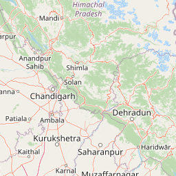
Map view of Great Himalayan National Park

Use this park location map to pinpoint Great Himalayan National Park in India, understand its exact geographic position, and read its mapped placement within the surrounding landscape more clearly.

Pigeon | © OpenStreetMap contributors

Location context for Great Himalayan National Park

Himachal Pradesh
Recorded earthquake history

Examine Historical Seismic Data for Great Himalayan National Park

Investigate the history of recorded seismic events associated with the region surrounding Great Himalayan National Park. This catalogue offers a structured view of past earthquake activity, providing researchers and visitors with essential geographic data to better understand the seismic landscape of this UNESCO-recognized territory.

Great Himalayan National Park Earthquake History

Catalogued events

36 events

Strongest magnitude

Magnitude 5

Most recent event

Aug 9, 2024

This history includes earthquakes recorded inside the park or within 50 km of its borders

Park atlas

Explore adjacent mountain protected landscapes and compare the diverse ecosystems of India's Himalayan region.

Discover Other National Parks and Protected Areas Near Great Himalayan National Park

Continue your exploration from Great Himalayan National Park by browsing other national parks and protected areas across the Western Himalayas. Compare diverse mountain ecosystems, high-altitude terrain, and conservation efforts within this geologically active, biodiverse region, tracing how connected landscapes protect iconic species.
Watercolor illustration showing mountains, a tree, and a landscape with green and pink tones
National parkHimachal Pradesh
About 7.8 km away#1 closest

North

Khirganga National Park: Himachal Pradesh National Park Geographic Atlas

Mapped protected area and regional landscape context.

Investigate Khirganga National Park, a designated national park situated within the vast mountain geography of Himachal Pradesh. This atlas-focused entry provides critical details on the park's protected landscape identity, its mapped boundaries, and its significance within the broader regional context of northern India's Western Himalayas. Understand the park's geographic position for detailed landscape exploration.

Area
710 km²
Established
2010
IUCN
II
Relief
Mountain
National parkHimachal Pradesh
About 11 km away#2 closest

Northeast

Pin Valley National Park: Remote Himalayan Cold Desert National Park in Himachal Pradesh

Explore its dramatic terrain and unique protected landscape in Spiti Valley.

Pin Valley National Park is a significant protected area covering roughly 675 square kilometers of the cold desert region in Himachal Pradesh, India. Established as a national park, it showcases a remote and rugged Himalayan landscape, characterized by its stark beauty, sparse vegetation, and extreme temperatures typical of high-altitude deserts. The park's geography spans dramatic mountain terrain, steep cliffs, and deep valleys, forming a vital habitat for endangered species and contributing to the unique ecological profile of the Cold Desert Biosphere Reserve.

Area
675 km²
Established
1987
IUCN
II
Relief
Mountain
National parkIndia
About 34 km away#3 closest

North

Inderkilla National Park: Detailed Protected Landscape and Geographic Atlas Entry

Mapping the natural terrain and protected boundaries across India.

Delve into the protected landscape of Inderkilla National Park, a designated national park located in India. This entry provides essential geographic context, focusing on the park's mapped boundaries and its role within the country's protected areas atlas. Understand the specific natural terrain and regional landscape character that defines Inderkilla National Park for detailed geographic exploration.

Area
46.1 km²
Established
2010
Relief
Mountain
Climate
Alpine
Wildlife reserveHimachal Pradesh
About 59 km away#4 closest

North

Chandratal Wildlife Sanctuary: Geography and Protected Landscape Analysis

High-altitude Himalayan wildlife reserve and wetland

Examine the geomorphology of Chandratal Wildlife Sanctuary, home to one of India's most significant high-altitude lake systems. This detailed record highlights the sanctuary's role in conserving cold-arid alpine environments, from its glacial cirque and mountain scree to the seasonal wildflower carpets of the Western Himalaya.

Relief
Mountain
Climate
Alpine
Access
Moderate access
Scope
Terrestrial
National parkUttarkashi District
About 85 km away#5 closest

Southeast

Govind Pashu Vihar National Park: Exploring India's Uttarkashi District Protected Landscape

Mapped protected area boundaries and regional geographic context.

Investigate Govind Pashu Vihar National Park, a key protected area in Uttarkashi District, India. This resource provides essential information on its designation as a national park, focusing on its geographic spread, mapped landscape features, and its placement within the regional atlas for comprehensive discovery. Understand the distinctiveness of this protected land's terrain and its role in conservation geography.

Area
958 km²
Established
1955
IUCN
II
Relief
Mountain
Wildlife reservePunjab
103 km away#6 closest

West

Nangal Wildlife Sanctuary: A Protected Wetland Refuge in the Punjab Foothills

Mapped riparian landscapes and reservoir habitats in the Sutlej River basin

Located within the Shivalik foothills, Nangal Wildlife Sanctuary preserves a unique man-made reservoir ecosystem. This record details the park's protected boundaries, riparian vegetation, and its role as a essential wetland habitat for regional migratory waterbirds and threatened species in the Punjab river landscape.

Area
1.16 km²
Established
2009
IUCN
IV
Relief
Upland
Wildlife reserveHimachal Pradesh
About 114 km away#7 closest

South

Renuka Sanctuary: Protected Wildlife Reserve and Ramsar Wetland Site in Himachal Pradesh

Ecological catchment and forest basin in the low Himalayan hills

Renuka Sanctuary is a dedicated wildlife reserve in Himachal Pradesh defined by the expansive Renuka Lake and its surrounding dry deciduous forest cover. This Ramsar wetland area protects the critical catchment zone of the state's largest natural lake, offering a unique intersection of conservation land and culturally significant natural terrain.

Area
4.028 km²
Water
Major water bodies
Protected landscapeLadakh
About 116 km away#8 closest

Northeast

Tso Moriri Protected Landscape: Ladakh Geography and Trans Himalayan Lake Atlas

High altitude wetland and cold desert plateau study

Trace the boundaries and ecological features of Tso Moriri, a major Ramsar site set within the high altitude cold desert of the Ladakh region. The landscape encompasses glacial streams, vast marshy deltas, and open steppe terrain that supports diverse wildlife and traditional pastoral land use.

Area
120 km²
Established
2002
Relief
Mountain
Climate
Arid

Common questions about visiting, size, designation, and location context for Great Himalayan National Park

Great Himalayan National Park FAQs for park facts, access, geography, and protected area context

Find quick answers about Great Himalayan National Park, including protected-area facts, park geography, trail and visitor context, and how the park fits into its surrounding country and regional landscape.
MoriAtlas Explorer

Continue Your Protected Areas Search Across the Global Atlas

Deepen your exploration by continuing the structured search for national parks and protected areas worldwide. Utilize the comprehensive filtering capabilities to compare different conservation landscapes and refine your understanding of global park geography. Discover more about the distribution and characteristics of protected natural areas.

Global natural geography