

Mori Atlas logo
National parkGreat Otway National Park

Explore the mapped boundaries and diverse terrain of this coastal national park in Victoria, Australia.

Great Otway National Park: Protected Landscape, Map Context, and Regional Geography

Great Otway National Park stands as a significant protected landscape within Australia's atlas, offering a unique intersection of rugged coastal terrain and ancient temperate rainforests. Situated in Victoria's Otway Ranges, this national park preserves a crucial section of a low coastal mountain chain that descends towards the Southern Ocean. Users can explore the park's detailed mapped boundaries, understand its regional geographic context, and discover the diverse natural landscapes it encompasses, from fern-filled gullies and dramatic waterfalls to its prominent role in preserving unique Australian ecosystems.

Temperate RainforestCoastal RangesWaterfallNational ParkVictoriaIUCN Category II

Great Otway National Park

National park

Park overview

Structured park overview, official facts, and landscape profile for Great Otway National Park

Great Otway National Park park facts, protected area profile, and essential visitor context
Review the core facts for Great Otway National Park, including designation, size, terrain, visitor scale, habitats, and operating context in one park-focused overview.

About Great Otway National Park

Great Otway National Park occupies a significant stretch of Victoria's southern coastline and immediately adjacent hinterland, protecting the Otway Ranges, a forested mountain system that represents one of the most intact coastal forest ecosystems in southeastern Australia. The park's creation in 2004 and official gazettal in December 2005 marked the culmination of a community campaign to consolidate multiple state forests and reserves into a single coherent protected area. The ranges themselves are ancient, formed from sediments laid down in a shallow sea during the early Cretaceous period and subsequently uplifted and dissected by millions of years of erosion. The park's landscape encompasses a remarkable diversity of terrain, from the exposed heathlands and rocky outcrops of the ridgelines to the deep, shaded valleys where Antarctic beech and tree ferns create a characteristically moody rainforest atmosphere. The coastline features dramatic cliffs, sandy beaches, and the powerful surf of the Southern Ocean, providing stark contrast to the sheltered forest interior. Walking trails throughout the park offer access to waterfalls, scenic lookouts, and the iconic treetop experiences of the Otway Fly Treetop Walk. The park's management by Parks Victoria balances conservation of its ecological values with visitor access and interpretation, ensuring that the natural and cultural significance of the Otway Ranges continues to be protected for future generations.

Quick facts and research context for Great Otway National Park

Great Otway National Park covers 1,031 square kilometres along the southern coast of Victoria, protecting the Otway Ranges, a low coastal mountain system that features Mount Cowley as its highest peak at 670 metres. The park was formally established in December 2005 through the merger of multiple protected areas and is managed by Parks Victoria. It contains three designated camping areas at Johanna, Aire River, and Blanket Bay. The park is recognized as an Important Bird Area by BirdLife International due to its populations of rufous bristlebirds, striated fieldwrens, and pink robins. The adjacent Cape Otway Lighthouse is a popular tourist attraction. The region experiences a cool oceanic climate with extreme winter rainfall, averaging over 1,900 millimetres annually and holding the record for the most precipitation days in mainland Australia.

Park context

Deeper park guide and search-rich context for Great Otway National Park

Great Otway National Park history, landscape, wildlife, and travel context
Explore Great Otway National Park through its history, landscape character, ecosystems, wildlife, conservation priorities, cultural context, and seasonal travel timing in a structured park guide built for atlas discovery and search intent.

Why Great Otway National Park stands out

Great Otway National Park is best known for its dramatic contrast between coastline and forest, where towering waterfalls plunge into fern-filled valleys and the Otway Ranges support one of Australia's most significant cool temperate rainforest ecosystems. The park contains numerous waterfalls including Beauchamp Falls, Hopetoun Falls, and Stevenson Falls, all accessible via walking tracks that wind through myrtle beech and tree fern gullies. Its bioluminescent glow worm populations, particularly the species Arachnocampa otwayensis, create a distinctive night-time attraction along stream banks and in sheltered gullies. The park's coastal sections provide opportunities to observe migrating southern right whales and humpback whales, while the hinterland supports significant koala populations, particularly around the Aire River campground. The combination of old-growth forest remnants, diverse fungal communities, and the dramatic Otway coastline makes this park a distinctive protected area in the Australian national park system.

Great Otway National Park history and protected-area timeline

The history of Great Otway National Park is deeply intertwined with the broader story of European settlement and resource exploitation in Victoria's southwest. Commercial logging began in the Otway Ranges during the 1880s, accelerating dramatically as road and railway infrastructure improved throughout the region. The logging industry peaked in 1961, by which time the Otway Ranges had been almost entirely stripped of their old-growth forest, with significant land degradation resulting from the intensive extraction. The forest that stands today represents a relatively young second-growth ecosystem, highlighting the lengthy timeframes required to restore the towering trees and ecological complexity characteristic of the original old-growth forests. The region has also experienced several major bushfires that have shaped its ecology, including the devastating Ash Wednesday fires of 1983 that swept through southeastern Australia and burned through the park's predecessor reserves. The movement to create a unified national park in the Otway Ranges gained momentum through the efforts of the local community and the Otway Ranges Environment Network, who advocated for the combination of Otway National Park, Angahook-Lorne State Park, Carlisle State Park, Melba Gully State Park, areas of Otway State Forest, and various Crown Land reserves into a single protected area. This campaign succeeded in 2004, and the park was officially gazetted on 11 December 2005.

Great Otway National Park landscape and geographic character

The landscape of Great Otway National Park encompasses a remarkable variety of terrain within its 1,031 square kilometre expanse. The Otway Ranges form a low coastal mountain chain running parallel to Victoria's southern coastline, with Mount Cowley rising to 670 metres as the highest point within the park. The ranges are characterized by steep, V-shaped valleys carved by numerous streams and rivers that flow southward to the Southern Ocean. The park protects both the coastal margin and the interior mountain environment, creating a landscape of striking contrasts. Coastal sections feature dramatic sea cliffs, sandy beaches such as those at Johanna and Blanket Bay, and exposed headlands that bear the full force of Southern Ocean weather systems. Inland, the terrain becomes increasingly rugged, with deep gullies shadowed by dense vegetation and numerous waterfalls feeding streams that have carved through the soft sedimentary rock. The park includes Lake Elizabeth, a lake formed in 1952 when a landslide blocked the West Barwon River, creating a distinctive feature in the western section of the park. The underlying geology of the Otway Ranges consists primarily of Cretaceous sediments, with older granitic and metamorphic rocks appearing in some areas, all of which contribute to the nutrient-poor soils that characterize the region.

Great Otway National Park ecosystems, habitats, and plant life

The nature of Great Otway National Park is defined by its position in one of the wettest temperate regions of mainland Australia, supporting cool temperate rainforest, wet sclerophyll forest, and heathland communities that together form a complex and ecologically significant mosaic. The Otway Ranges experience a cool oceanic climate with extreme winter rainfall, recording over 1,900 millimetres of precipitation annually and the highest number of precipitation days in Australia, with 219.4 days of measurable rainfall per year. This moisture supports the development of cool temperate rainforest in the deepest valleys, where myrtle beech, Southern阻断山毛榉, and dense tree fern understory create a characteristically dark and atmospheric environment. The wet sclerophyll forests that blanket the slopes feature messmate, mountain ash, and brittle gum, with a diverse moss and lichen flora that thrives in the consistently humid conditions. The park's fungal diversity is exceptional, with 278 species documented in the Atlas of Living Australia, though this number represents only a fraction of the total fungal community. These fungi perform essential ecological roles as primary recyclers of organic matter and as mycorrhizal partners with the majority of plant species in the park. Notable species include the bioluminescent ghost fungus that glows pale green at night and the distinctive rosette fungus that appears in funnel-shaped formations at the base of trees.

Great Otway National Park wildlife and species highlights

Great Otway National Park supports a diverse array of wildlife, with particular significance attached to its koala populations, marine mammals, and birds. The park and specifically the Aire River campground are home to substantial koala populations, which thrive in the eucalyptus forests that dominate the park's more accessible areas. The coastal waters adjacent to the park provide habitat for migrating whales, with southern right whales and southern humpback whales commonly observed from the coastline during their seasonal migrations, along with resident populations of bottlenose dolphins. The park has been identified by BirdLife International as an Important Bird Area, recognizing its significance for populations of several endemic Australian bird species, including the rufous bristlebird, striated fieldwrens, and pink robins. The dense understory and ground layer of the forest provides habitat for a variety of smaller mammals, reptiles, and invertebrates, while the nocturnal fauna includes several species of possum and the enigmatic platypus in the park's streams. The glow worm displays, particularly visible at Angahook-Lorne State Park, Beauchamp Falls, Hopetoun Falls, Stevenson Falls, and Melba Gully, represent a distinctive wildlife spectacle that draws visitors to the park after dark.

Great Otway National Park conservation status and protection priorities

Great Otway National Park represents a significant conservation outcome in Victoria's protected area network, consolidating multiple former reserves and state forest into a single coherent protected landscape. The park protects one of the most important remaining blocks of coastal forest in southeastern Australia, including remnants of old-growth forest that survived the intensive logging period of the mid-twentieth century. The recognition of the park as an Important Bird Area by BirdLife International highlights its significance for forest-dependent bird species, particularly the populations of rufous bristlebirds, striated fieldwrens, and pink robins that breed and feed within its boundaries. The park's fungal communities, while poorly documented compared to plant and vertebrate diversity, play critical roles in ecosystem function through decomposition and mycorrhizal relationships. Local community groups, including the Southern Otways Landcare Network, have been actively involved in fungal survey work and education, contributing to the broader understanding of this often-overlooked component of biodiversity. The ongoing management challenge involves balancing visitor access with the need to protect sensitive ecosystems, particularly in areas with high conservation value such as the cool temperate rainforest gullies and the coastal habitats that support migrating whales.

Great Otway National Park cultural meaning and human context

The Great Otway National Park exists within a landscape that has been shaped by both natural processes and human activity over thousands of years. While the park itself does not feature prominently in documented indigenous heritage records, the broader Otway region was historically inhabited by Aboriginal peoples who utilized the coastal and forest resources of the area. The European history of the Otway Ranges is characterized by resource extraction, particularly the extensive logging operations that began in the 1880s and reached their peak in the early 1960s, fundamentally altering the character of the forest. The adjacent Cape Otway Lighthouse, established in 1846, stands as a significant cultural landmark in the region and remains an operating lighthouse that offers tours to visitors. The park's name derives from the Otway Ranges, which in turn is thought to derive from an early pastoral run in the area. The consolidation of the park from multiple former reserves reflects a broader shift in conservation philosophy toward landscape-scale protection that considers ecological connectivity rather than isolated reserves.

Top sights and standout views in Great Otway National Park

Great Otway National Park offers a distinctive combination of natural features that make it one of Victoria's most rewarding protected areas to explore. The waterfall walks to Beauchamp Falls, Hopetoun Falls, and Stevenson Falls showcase the park's ability to channel seasonal rainfall into dramatic cascades that drop through fern-filled gullies. The Otway Fly Treetop Walk provides an elevated perspective through the forest canopy, offering visitors a unique vantage point to appreciate the scale and complexity of the temperate rainforest. The park's bioluminescent glow worm displays, particularly at locations like Melba Gully, create a memorable night-time experience as the larvae of fungus gnats emit their characteristic blue-green glow along stream banks and sheltered tracks. The coastal sections provide opportunities for beach walks and whale watching during the migration season, while the camping areas at Johanna, Aire River, and Blanket Bay offer accessible base camps for exploring the park's interior. The combination of coastline, forest, waterfalls, and wildlife, all within a short drive of Melbourne, makes Great Otway National Park a accessible yet wild experience.

Best time to visit Great Otway National Park

The Great Otway National Park can be visited year-round, though each season offers distinctly different experiences and conditions. The wet winter months from June through August bring the waterfalls to their most impressive flow as the Otway Ranges receive the majority of their annual rainfall, creating spectacular displays at the park's numerous cascades. However, heavy rainfall can make some tracks muddy and difficult, and the short daylight hours limit time for exploration. Summer and early autumn, from December through March, typically offer more stable weather conditions with longer days ideal for walking and camping, though this is also the peak visitor season. The cooler temperatures of autumn provide comfortable conditions for extended walks through the forest, and the park's famous glow worms are visible throughout the year but are often most spectacular during the darker winter months when nights are longer. Visitors interested in whale watching should aim for the migration seasons, with southern right whales typically passing the coast from May to October, while humpback whales migrate through from May to November. Regardless of season, visitors should come prepared for changeable weather, as the Otway Ranges are known for their rapid shifts between sunshine and rain.
Park location guide

Geography guide, regional context, and park location map for Great Otway National Park

Great Otway National Park park geography, regions, and map view in Australia
Understand where Great Otway National Park sits in Australia through a broader geographic reading of the surrounding landscape, nearby location context, and its mapped position within the national park landscape.

How Great Otway National Park fits into Australia

Australia is a constitutional monarchy and federal parliamentary democracy comprising six states and ten territories. With a population of nearly 28 million, it is one of the world's most urbanised countries, with most people concentrated on the eastern seaboard. The country has a high Human Development Index and is known for its cultural diversity, ancient Aboriginal heritage, and unique wildlife.

Wider geography shaping Great Otway National Park in Australia

Australia occupies the entire Australian continent, the island of Tasmania, and numerous smaller islands. It is the world's flattest and driest inhabited continent, featuring vast deserts in the interior (the Outback), tropical rainforests along the eastern coast, and a coastline bordering the Indian and Pacific Oceans.

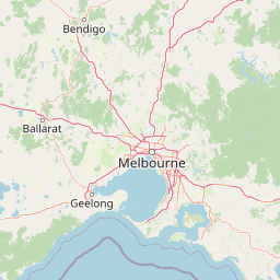
Map view of Great Otway National Park

Use this park location map to pinpoint Great Otway National Park in Australia, understand its exact geographic position, and read its mapped placement within the surrounding landscape more clearly.

Pigeon | © OpenStreetMap contributors
Park atlas

Explore the diverse coastal and temperate rainforest protected landscapes within Victoria's Otway Ranges region.

Discover Nearby National Parks and Protected Areas Surrounding Great Otway National Park
Continue your protected area exploration after Great Otway National Park by comparing other national parks and reserves across Victoria's varied coastal and hinterland geography. Trace the regional spread of diverse conservation landscapes, from rugged shorelines to ancient rainforests, using detailed atlas views and park facts.
Marine protected area

Twelve Apostles Marine National Park: Protected Landscape and Marine Atlas Exploration

Mapping iconic rock stacks and underwater reef geography.

Twelve Apostles Marine National Park, located on Victoria's south coast, is a key marine protected area renowned for its striking limestone rock stacks and the diverse underwater ecosystems they shelter. This park offers a unique opportunity for atlas exploration, detailing the mapped boundaries and the fascinating marine geography from cliff faces to submerged reefs. Understand the protected landscape and its integral role within Australia's coastal conservation network.

Area
75 km²
Established
2002
IUCN
II
Climate
Temperate
National park

Port Campbell National Park: Iconic Limestone Cliffs and Coastal Protected Area

Explore the mapped geography of Victoria's dramatic Shipwreck Coast.

Port Campbell National Park, a prominent national park in Victoria, Australia, offers an unparalleled atlas exploration of coastal geology. Its landscape is defined by towering limestone cliffs, iconic offshore rock stacks such as the Twelve Apostles, and numerous natural arches and blowholes sculpted by the Southern Ocean. This protected area provides critical geographic context for the Shipwreck Coast's dramatic terrain and serves as a focal point for understanding Australia's dynamic natural heritage.

Area
17.5 km²
Established
1964
IUCN
II
Visitors
2M annual
National park

Point Addis Marine National Park: Victoria's Protected Coastal Atlas

Mapped marine park and coastal landscape context.

Point Addis Marine National Park is a significant protected marine area situated along the renowned Surf Coast of Victoria, Australia. This park safeguards the coastal waters and shoreline around iconic locations like Bells Beach, preserving vital marine habitats including extensive rocky reefs and kelp forests. Its geography is defined by dramatic sandstone cliffs and the influence of the Southern Ocean, making it a crucial site for understanding temperate marine ecosystems within a popular recreational region. Discover its mapped boundaries and ecological significance for regional geography.

Area
46 km²
Established
2002
IUCN
II
Climate
Temperate
National park

Mornington Peninsula National Park: Victoria's Coastal Protected Landscape and Map Atlas

Explore dramatic cliff-top terrain, sandy beaches, and native bushland.

Mornington Peninsula National Park is a protected natural area defined by its spectacular coastal geography in Victoria, Australia. The park features striking cliff-top vistas, extensive sandy beaches, and sculpted dunes that showcase the dynamic forces shaping Australia's coastline. Its mapped boundaries protect a vital landscape including areas like Greens Bush, offering a glimpse into the region's native vegetation and geological formations for those interested in detailed geographic context and protected area exploration.

Area
26.86 km²
Established
1995
IUCN
II
Relief
Mixed relief
National park

Organ Pipes National Park: Victoria National Park Featuring Columnar Basalt and Volcanic Geology

Explore unique mapped terrain and ancient protected landscapes near Melbourne.

Organ Pipes National Park stands as a crucial protected area in Victoria, Australia, celebrated for its exceptional columnar basalt formations and deep geological heritage. This national park preserves a striking landscape where ancient Silurian marine sediments meet relatively recent Pleistocene volcanic basalt, offering a profound glimpse into regional geography and land formation. Discover the park's mapped boundaries, the dramatic geological features along Jacksons Creek, and the ecological restoration efforts that highlight its value as a natural monument.

Area
1.21 km²
Established
1972
IUCN
III
Visitors
50K annual
National park

Budj Bim National Park: Ancient Volcanic Landscapes and World Heritage Protected Area

Explore the unique geography of Budj Bim National Park's crater lakes and lava tubes.

Budj Bim National Park offers an exceptional exploration of volcanic geography and ancient human ingenuity. This protected area features a dramatic landscape dominated by volcanic cones, lava tubes, and the picturesque Lake Surprise crater lake. Its significance is amplified by the presence of sophisticated Aboriginal aquaculture systems, developed thousands of years ago by the Gunditjmara people, which have contributed to its UNESCO World Heritage status. Discover the mapped terrain and protected land context of this geologically and culturally rich Australian national park.

Area
54.7 km²
Established
1960
IUCN
II
Relief
Mixed relief
National park

French Island National Park: Protected Island National Park with Coastal Wetland Habitats

Explore mapped boundaries and diverse terrain of this unique park.

French Island National Park preserves a vital island ecosystem in Victoria, Australia, featuring extensive mangrove forests, salt marshes, and open woodland. As one of Australia's most accessible island national parks, it offers a distinctive wilderness experience primarily reached by boat, showcasing coastal conservation and unique wetland habitats. The park's geography is defined by its low-lying terrain and tidal influences, creating a rich environment for mapped landscape exploration.

Area
111 km²
Established
1998
IUCN
II
Relief
Lowland
National park

Churchill National Park: Remnant Woodland and Industrial Heritage in Victoria, Australia

Mapped protected area with notable bird diversity and historical quarry sites.

Churchill National Park offers a unique glimpse into Victoria's remnant woodland ecosystems and early twentieth-century industrial history. As a national park, it protects critical habitats for a variety of bird species and preserves the landscape features of historical quarrying operations, including the Scoresby Tramway ruins. The park's mapped geography and accessible walking tracks, like the Channel Track, provide opportunities for exploration and understanding its role as a protected natural and historical asset near Melbourne.

Area
2.71 km²
Established
1941
IUCN
II
Relief
Upland

Common questions about visiting, size, designation, and location context for Great Otway National Park

Great Otway National Park FAQs for park facts, access, geography, and protected area context
Find quick answers about Great Otway National Park, including protected-area facts, park geography, trail and visitor context, and how the park fits into its surrounding country and regional landscape.
MoriAtlas Explorer

Continue Your Protected Areas Search Across the Global Atlas

Deepen your exploration by continuing the structured search for national parks and protected areas worldwide. Utilize the comprehensive filtering capabilities to compare different conservation landscapes and refine your understanding of global park geography. Discover more about the distribution and characteristics of protected natural areas.

Global natural geography