Mori Atlas logo
Nature reserveRéserve naturelle nationale de la grotte de Gravelle

Mapping the ecological importance of limestone cave habitats within the Bourgogne-Franche-Comté region

Réserve naturelle nationale de la grotte de Gravelle: A Vital Protected Underground Landscape

The Réserve naturelle nationale de la grotte de Gravelle stands as a crucial protected area in the Jura department, functioning as a vital sanctuary for diverse bat colonies. Situated within the limestone foothills near Macornay, the site protects an intricate subterranean environment that serves as a seasonal maternity and hibernation roost. This geography reveals the critical balance between fragile underground ecosystems and the broader conservation networks across eastern France.

cavesubterranean habitatbatschiropteraSchreiber's bent-winged batnational nature reserve

Réserve naturelle nationale de la grotte de Gravelle

Nature reserve

Park overview

Structured park overview, official facts, and landscape profile for Grotte de Gravelle National Nature Reserve

Grotte de Gravelle National Nature Reserve park facts, protected area profile, and essential visitor context

Review the core facts for Grotte de Gravelle National Nature Reserve, including designation, size, terrain, visitor scale, habitats, and operating context in one park-focused overview.

About Grotte de Gravelle National Nature Reserve

The Grotte de Gravelle National Nature Reserve is a very small but highly specialized protected area in the Jura department of France, dedicated to the conservation of cave-dwelling bats and their fragile subterranean habitat. Although the surface footprint is modest, the cave system at the heart of the reserve carries an ecological weight that extends well beyond its administrative boundary.

The cave opens at the foot of a small Bajocian limestone cliff, along the departmental road between Macornay and Geruge, above the valley of the Savignard, a tributary of the Sorne river. The setting places the reserve at the interface between the Revermont natural region and the Petite Montagne du Jura, an area characterized by wooded hillsides and limestone outcrops. The entrance to the cave is a wide porch about three meters high and five meters wide, facing northeast, and leads into an extensive dry, clay-floored gallery. After roughly ninety meters the gallery reaches a large rubble slope; climbing it gives access to the upper chamber, sometimes called the bat room.

From an ecological standpoint, the reserve is essentially a bat sanctuary. It lies within a coherent network of protected underground sites supporting bat populations across eastern France, extending into the broader Jura massif and well beyond. Eleven bat species have been recorded at the site, representing roughly a third of all bat species known in France. This diversity, combined with the cave's role as a major maternity and hibernation site, gives the reserve an importance that far exceeds its small size.

The protected status is intentional. Caves are delicate environments, and even minor disruptions to temperature, humidity, airflow, or acoustic conditions can be harmful, particularly during sensitive periods such as hibernation and birthing. For this reason, the Grotte de Gravelle is closed to the general public, and management focuses on monitoring, protection of colonies, and coordinated conservation with other cave sites in the network. The reserve stands as a clear example of how a tiny, focused protected area can have an outsized impact on the survival of vulnerable species.

Quick facts and research context for Grotte de Gravelle National Nature Reserve

The Grotte de Gravelle National Nature Reserve lies in the Jura department of eastern France, in the commune of Macornay near Lons-le-Saunier. It was created by decree on 15 December 1992 and designated with the national nature reserve code RNN110.

The site covers approximately 1.37 hectares and protects a single natural cave carved into Bajocian-age Jurassic limestone at an elevation of between 325 and 362 meters. Management is handled by the CPEPESC Franche-Comté. While the cave itself is the core of the reserve, the site is part of a broader network of protected underground bat habitats across eastern France, with international importance for the conservation of Schreiber's bent-winged bat.

Protection and recognition

Documented terrestrial protection scope and official designation records

Réserve naturelle nationale de la grotte de Gravelle Protection Status

Terrestrial protection status records for Réserve naturelle nationale de la grotte de Gravelle outline the documented management scope and official designation details. Designated data entries track the recorded protected area framework without assuming external recognition sources.

Protection details

Protection scope
Terrestrial
WDPA ID
62708
Park context

Deeper park guide and search-rich context for Grotte de Gravelle National Nature Reserve

Grotte de Gravelle National Nature Reserve history, landscape, wildlife, and travel context

Explore Grotte de Gravelle National Nature Reserve through its history, landscape character, ecosystems, wildlife, conservation priorities, cultural context, and seasonal travel timing in a structured park guide built for atlas discovery and search intent.

Why Grotte de Gravelle National Nature Reserve stands out

The reserve is best known for its role in protecting one of the most important underground bat sites in eastern France, especially for Schreiber's bent-winged bat, a highly cave-dependent species that completes its entire annual life cycle in subterranean environments. The cave functions as a seasonal maternity and hibernation roost for colonies that can reach several hundred individuals during the summer birthing period. It is also recognized as part of an interconnected network of bat caves across the Jura massif and surrounding regions. Bats show strong fidelity to a system of roosts throughout their annual cycle, so protecting a site like the Grotte de Gravelle helps preserve the wider ecological network that cave-dwelling bat populations depend on for survival.
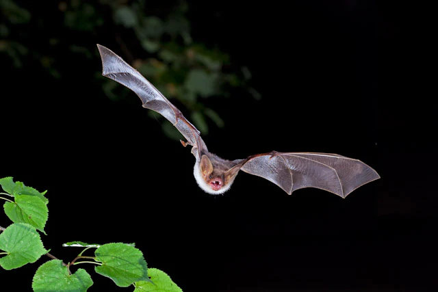
A Greater mouse-eared bat flying against a black background, with green leaves visible in the bottom left corner.
A Greater mouse-eared bat in flight, a key species protected within the reserve.

Grotte de Gravelle National Nature Reserve history and protected-area timeline

Naturalists first began studying the Grotte de Gravelle in 1948, when the Swiss naturalist Robert Hainard was among those examining the cave and its fauna. During this early period the site was already recognized for its importance to bats, and ringing operations were carried out, marking roughly 23,000 individuals over time, including about 15,000 Schreiber's bent-winged bats. These early studies provided some of the first detailed insights into the movements and behavior of cave-dwelling bats in the Jura region.

Beginning in 1986, members of the CPEPESC took over long-term monitoring of the site, continuing the scientific work initiated decades earlier. Their efforts built a case for formal protection, and on 15 December 1992, a decree created the Grotte de Gravelle National Nature Reserve. The management body was formally designated on 16 August 1993, and in that same year a protective perimeter fence was installed around the site to limit disturbance.

The reserve's early management plan covered the period 2006 to 2010, reflecting an ongoing commitment to structured oversight of the cave environment. Throughout its short history as a protected area, the reserve has functioned both as a scientific observation site for cave-dwelling bats and as a key node within the broader network of protected underground habitats in eastern France.

Grotte de Gravelle National Nature Reserve landscape and geographic character

The reserve lies in a transitional zone between the Revermont and the Petite Montagne du Jura, two natural regions of the southern Jura characterized by limestone terrain, forested slopes, and river valleys. The cave itself opens at the foot of a small cliff formed from Bajocian-age Jurassic limestone, one of the marker geological formations of the region.

Above-ground, the reserve sits in a forested setting at elevations between 325 and 362 meters, on the southern edge of the village of Macornay, overlooking the valley of the Savignard stream. The wider landscape around the reserve is shaped by the alternating pattern of woodland and limestone outcrops typical of the southern Jura foothills.

The cave landscape is defined by contrast: a wide northeast-facing entrance porch, about three meters high and five meters wide, gives way to an extensive dry gallery floored with clay. After roughly ninety meters the passage reaches a massive rubble slope, which leads upward to a higher chamber known informally as the bat room. Inside the cave, temperatures stay cool year-round, ranging from about two to nine degrees Celsius depending on the chamber and the season, creating stable conditions that are critical for bat hibernation and summer roosting.
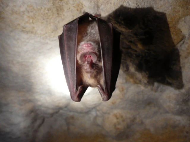
A Greater Horseshoe Bat hanging upside down, wrapped in its wings against a textured cave wall.
A Greater Horseshoe Bat roosting in the Grotte de Gravelle.

Grotte de Gravelle National Nature Reserve ecosystems, habitats, and plant life

Although the surface area of the reserve is tiny and no protected plant species are present within its perimeter, the natural value of the site lies almost entirely below ground. Ecologically, two main units have been defined: the forested sectors surrounding the cave entrance and the underground cavity itself, including its entrance, galleries, and chambers.

The cave belongs to a coherent network of protected underground sites that support bat populations across eastern France, with extensions across the Jura massif and beyond. This network reflects the dependence of cave-dwelling bats on multiple connected roosts during their annual cycle, including hibernation sites, transition sites, and maternity colonies. The Grotte de Gravelle plays an important part in this system, particularly during the summer birthing period.

Above ground, the forested setting provides a quieter, sheltered landscape around the cave mouth, helping maintain the microclimate at the entrance. The wooded surroundings also form a buffer against human activity and weather extremes, both of which can affect the stability of conditions inside the cave.

Grotte de Gravelle National Nature Reserve wildlife and species highlights

Bats are the heart of the reserve's wildlife interest. The cave is home to species from two major bat families: the Vespertilionidae and the Rhinolophidae. Three species are particularly important summer residents, using the cave as a maternity site: Schreiber's bent-winged bat, the greater mouse-eared bat, and the lesser mouse-eared bat.

Other species are present more occasionally, including the greater horseshoe bat, the lesser horseshoe bat, and Daubenton's bat, which can be encountered at the site in some seasons. In total, eleven bat species have been recorded at the reserve, out of around thirty-four known across France, giving the cave an unusually high bat diversity for its size. Summer birthing colonies have averaged around 360 individuals across the years from 2000 to 2006, and aggregations can sometimes exceed a thousand bats.

Schreiber's bent-winged bat is the headline species. It is fully cave-dependent, spending its entire annual cycle in natural or artificial underground environments, and it shows strong site fidelity across a network of roosts used for hibernation, transition, and reproduction. Monitoring and ringing work since 1948 has shown that bats return to the same network of caves year after year, underscoring the international importance of the reserve for this species. The cave fauna almost certainly includes other invertebrates as well, many of which remain to be formally surveyed.

Grotte de Gravelle National Nature Reserve conservation status and protection priorities

The reserve exists because the cave environment is exceptionally fragile and because bat populations are highly vulnerable to disturbance. Caves function as critical hibernation and maternity habitats for bats, and even small changes in temperature, humidity, airflow, noise, or light can affect survival or cause colonies to abandon a site. Public access is therefore prohibited, and management focuses on limiting disturbance rather than encouraging visitation.

The protection effort at the Grotte de Gravelle is part of a broader conservation strategy for cave-dwelling bats across eastern France. Because bats rely on multiple roost sites throughout the year, the loss or degradation of any single cave can disrupt an entire regional population. By safeguarding this cave and its colonies, the reserve contributes to the resilience of that wider ecological network.

The reserve is recognized at the international level for the conservation of Schreiber's bent-winged bat, a species whose annual cycle is entirely dependent on underground environments. It is also recognized within the French ZNIEFF inventory as Type I site number 0028 0004, known as the Grotte de Gravelle at Macornay, reinforcing its ecological significance beyond its small administrative footprint.

Top sights and standout views in Grotte de Gravelle National Nature Reserve

The Grotte de Gravelle National Nature Reserve stands out as a rare example of a national nature reserve dedicated almost entirely to an underground ecosystem. Its small surface area contrasts sharply with its ecological importance, particularly as a maternity and hibernation site for bat colonies, including internationally significant populations of Schreiber's bent-winged bat.

Its place within a network of protected bat caves across eastern France, combined with decades of scientific research dating back to 1948, gives the reserve both scientific and conservation value well beyond its borders. The site's strict no-access policy reflects the broader philosophy that protecting fragile subterranean environments sometimes means protecting them from visitors entirely.
Monthly climate preview

Long-term representative coordinate measurements of monthly temperature and precipitation.

Réserve naturelle nationale de la grotte de Gravelle Climate Normals And Temperature Rhythms

Representative coordinate records reveal a measured annual rhythm of monthly average temperatures and precipitation values spanning twelve recorded periods. Detailed monthly climate profiles provide expanded analytical context for the protected terrain.
Annual mean9 °C
0 °C19 °C
Jan
Feb
Mar
Apr
May13°
Jun16°
Jul19°
Aug19°
Sep14°
Oct10°
Nov
Dec
Warmest month
July

18.6 °C

Coolest month
January

0.1 °C

Wettest month
December

3.9 mm/day

Driest month
March

2.8 mm/day

Park location guide

Geography guide, regional context, and park location map for Grotte de Gravelle National Nature Reserve

Grotte de Gravelle National Nature Reserve park geography, regions, and map view in France

Understand where Grotte de Gravelle National Nature Reserve sits in France through a broader geographic reading of the surrounding landscape, nearby location context, and its mapped position within the national park landscape.

How Grotte de Gravelle National Nature Reserve fits into France

France is a unitary semi-presidential republic and one of the world's largest economies. It borders Belgium, Luxembourg, Germany, Switzerland, Italy, Monaco, Andorra, and Spain, with a maritime border to the United Kingdom. The country is known for its cultural influence, art, cuisine, and political history spanning centuries.

Wider geography shaping Grotte de Gravelle National Nature Reserve in France

France is located in Western Europe. Metropolitan France extends from the Rhine to the Atlantic Ocean and from the Mediterranean Sea to the English Channel and North Sea. The country borders Belgium, Luxembourg, Germany, Switzerland, Italy, Monaco, Andorra, Spain, and has a maritime border with the United Kingdom.

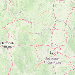
Map view of Grotte de Gravelle National Nature Reserve

Use this park location map to pinpoint Grotte de Gravelle National Nature Reserve in France, understand its exact geographic position, and read its mapped placement within the surrounding landscape more clearly.

Pigeon | © OpenStreetMap contributors

Location context for Grotte de Gravelle National Nature Reserve

Bourgogne-Franche-Comté

Visual reference guide to limestone terrain, subterranean habitats, and protected Jura environments

Réserve naturelle nationale de la grotte de Gravelle Landscape and Scenery Photography

Visual documentation captures the limestone cliffs, forested slopes, and subterranean chambers that define Réserve naturelle nationale de la grotte de Gravelle. Photographic records help researchers and naturalists examine the protected landscape and fragile underground habitats without disturbing local wildlife.

A Greater mouse-eared bat flying against a black background, with green leaves visible in the bottom left corner.

A small brown Daubenton's bat with folded wings resting on a textured light-colored stone surface.

A Greater Horseshoe Bat hanging upside down, wrapped in its wings against a textured cave wall.

Park atlas

Compare adjacent limestone reserves and connected subterranean habitats across the Jura foothills

Parks Near Réserve naturelle nationale de la grotte de Gravelle and Regional Protected Areas

Browsing other protected areas near Réserve naturelle nationale de la grotte de Gravelle reveals connected ecological networks across the Jura limestone terrain. Comparing adjacent regional landscapes provides essential geographical context for understanding underground wildlife habitats in eastern France.
A soft watercolor illustration depicting rolling green hills, gentle slopes, and small clusters of trees against a light, neutral background.
Nature reserveBourgogne-Franche-Comté
About 2.1 km away#1 closest

North

Réserve naturelle régionale de la côte de Mancy: Protected Landscapes and Geography

Limestone escarpments and calcareous grasslands in eastern France

Delve into the geography of Réserve naturelle régionale de la côte de Mancy, a 49-hectare nature reserve in the Jura department. This site features Jurassic limestone cliffs, thin calcareous soils, and scrubby woodlands, documenting a rich intersection of habitats that preserve rare reptiles and diverse butterfly populations within the Revermont.

Area
0.492 km²
Established
2010
IUCN
IV
Relief
Upland
A horizontal watercolor painting depicting a soft, impressionistic landscape with rolling green hills, pale yellow fields, and a sparse line of trees against a white background.
Nature reserveBourgogne-Franche-Comté
About 26 km away#2 closest

Northeast

Réserve naturelle régionale des grottes de la côte de la Baume, Jura Regional Nature Reserve

Karst caves and cliff-slope forest geography in France

Located in the Bourgogne-Franche-Comté region, this nature reserve protects a vital network of karst caves and unmanaged scree-slope ash forests. The site represents a specialized conservation effort centered on cliff-side habitats and underground sanctuaries within the Jura limestone landscape.

Area
0.054 km²
Established
2017
IUCN
IV
Relief
Upland
Wildlife reserveBourgogne-Franche-Comté
About 26 km away#3 closest

East

Tourbières et lacs de la montagne jurassienne: Mapping High-Altitude Wetlands and Glacial Landscapes

A vast protected wildlife reserve in the Bourgogne-Franche-Comté region

Covering more than 12,000 hectares, this wildlife reserve forms a crucial conservation benchmark for peatland and glacial lake systems in the Jura Massif. The landscape encompasses deep combes, broad plateaus, and clear-water basins like Lac de Saint-Point, providing a vital habitat mosaic for diverse flora and fauna across the French highlands.

Area
121.56 km²
Established
2021
Relief
Mountain
Climate
Temperate
A horizontal watercolor painting depicting a soft, layered landscape with distant hills, gentle slopes, and clusters of evergreen trees in shades of green and purple.
Nature reserveBourgogne-Franche-Comté
About 28 km away#4 closest

Southeast

Réserve naturelle régionale des tourbières du bief du Nanchez: Protected Jura Mountain Peatlands

Mapping bog systems and wet grassland geography in Eastern France

Located in the Jura department, this regional nature reserve preserves forty-nine hectares of vital peatland, including diverse mire communities and forested slopes. The site provides a critical look at montane landscape restoration, documenting significant bog flora and complex hydrological patterns along the Combe du Nanchez valley floor.

Area
0.488 km²
Established
2021
IUCN
IV
Relief
Upland
Nature reserveAuvergne-Rhône-Alpes
About 42 km away#5 closest

South

Réserve naturelle régionale du récif fossile de Marchon - Christian Gourrat Geological Site

A protected Jurassic fossil reef in the Auvergne-Rhône-Alpes region

Located in the Ain department, this small nature reserve is scientifically renowned for its Kimmeridgian reef outcrop. The site protects a fossilized coral and rudist assemblage within the forêt de Marchon, offering a quiet, forested setting for studying France's ancient marine geological history.

Area
0.001 km²
Established
2015
IUCN
IV
Scope
Terrestrial
A horizontal watercolor painting showing a soft, misty landscape with coniferous trees, grassy wetlands, and rolling hills in the background, executed in a muted color palette.
Nature reserveBourgogne-Franche-Comté
About 48 km away#6 closest

East

Réserve naturelle régionale de la Seigne des Barbouillons Protected Landscape Atlas

Geography and wetland boundaries in the Jura plateau of France

The Réserve naturelle régionale de la Seigne des Barbouillons protects a characteristic raised bog ecosystem in the Mignovillard commune. This compact area serves as a vital reference point for understanding the distribution of sphagnum mires and specialized butterfly habitats across the Jura plateau, illustrating the contrast between protected peatlands and their surrounding agricultural environment.

Area
0.346 km²
Established
2014
IUCN
IV
Relief
Upland
A soft, panoramic watercolor illustration of rolling hills, mountains, and trees in pastel shades of green, yellow, and pink.
Nature reserveAuvergne-Rhône-Alpes
About 52 km away#7 closest

South

Réserve naturelle nationale de la grotte de Hautecourt: Jura Mountain Cave Geography

Protected subterranean landscapes in the Ain department of France.

This nature reserve protects a complex underground environment characterized by a vertical 36-meter cave system and rich invertebrate biodiversity. Located on the flank of Mont Rosset in the Auvergne-Rhône-Alpes region, the area provides a crucial habitat that balances delicate subterranean passages with surface limestone ridges and dry grassland ecosystems.

Area
0.102 km²
Established
1980
IUCN
IV
A watercolor illustration of a landscape with green forest, wetland grasses, and pale mountains in the background, set against a clean white background.
Nature reserveBourgogne-Franche-Comté
About 54 km away#8 closest

Northeast

Réserve naturelle régionale des tourbières de Frasne-Bouverans Protected Landscape Atlas

Peatland mosaic geography in the Drugeon valley of Bourgogne-Franche-Comté

Trace the boundaries and ecological features of this significant regional nature reserve. Spanning the Forbonnet massif and the wider Drugeon basin, the area features a dense concentration of raised bogs, woodlands, and mire habitats defined by complex glacial geology.

Area
2.926 km²
Established
1986
IUCN
IV
Visitors
17.5K annual

Common questions about visiting, size, designation, and location context for Grotte de Gravelle National Nature Reserve

Grotte de Gravelle National Nature Reserve FAQs for park facts, access, geography, and protected area context

Find quick answers about Grotte de Gravelle National Nature Reserve, including protected-area facts, park geography, trail and visitor context, and how the park fits into its surrounding country and regional landscape.
MoriAtlas Explorer

Continue Your Protected Areas Search Across the Global Atlas

Deepen your exploration by continuing the structured search for national parks and protected areas worldwide. Utilize the comprehensive filtering capabilities to compare different conservation landscapes and refine your understanding of global park geography. Discover more about the distribution and characteristics of protected natural areas.

Global natural geography