

Mori Atlas logo
Wildlife reserveHato El Frío

An expansive mosaic of seasonal floodplains, gallery forests, and riverine habitats in the heart of Venezuela

Hato El Frío Wildlife Reserve: Mapping the Protected Savanna and Wetland Landscapes of Apure

Hato El Frío stands as a core protected landscape within the Venezuelan llanos, encompassing vast stretches of seasonally flooded savanna and dense gallery forests. The reserve functions as an essential ecological refuge within the Orinoco watershed, where the terrain undergoes dramatic cycles between arid grasslands and expansive floodplains. Through this atlas entry, observe the geographic boundaries and environmental structure of this historic working ranch that preserves one of South America's most intact wetland systems.

llanoswetlandsseasonal floodplainsavannagallery forestOrinoco basin
A flat-style digital illustration depicting a waterfall cascading from rugged mountains into a river flowing through a forested valley.

Hato El Frío

Wildlife reserve

Park overview

Structured park overview, official facts, and landscape profile for Hato El Frío

Hato El Frío park facts, protected area profile, and essential visitor context

Review the core facts for Hato El Frío, including designation, size, terrain, visitor scale, habitats, and operating context in one park-focused overview.

About Hato El Frío

Hato El Frío is one of the largest and most ecologically significant private-turned-public estates in Venezuela’s Los Llanos, the vast lowland plain that sweeps west and south of the Orinoco River. Situated in Apure State, the heart of the Venezuelan llanos, the property encompasses an enormous block of seasonally flooded savanna, slow-moving rivers, shallow lagoons, and corridors of gallery forest. Together, these habitats form a complete functioning llanos ecosystem, from open grasslands used by grazing wildlife to gallery forests along waterways where trees, birds, and mammals concentrate during the wet season.

The estate’s identity is built on the unusual pairing of a centuries-old cattle ranching tradition with active scientific research and conservation. The land was originally granted to General José Antonio Páez in 1824 following Venezuela’s war of independence, and it has remained under various private hands ever since. Continuous ranching use is credited with preventing the conversion of the savanna to agriculture, leaving the natural landscape largely intact when compared to many surrounding areas. Scientific study of the property began in 1977 with the creation of the El Frío Biological Station, which has supported decades of research, documentaries, and conservation programs.

Environmental recognition grew through the 1980s. In 1987 a major captive breeding effort for the critically endangered Orinoco caiman was launched here, and in 1989 the Venezuelan government formally designated the area as a fauna reserve and protected fishing zone around the Caño Guaritico. In 2007 a larger Biosphere Reserve proposal, “Apuroquia,” was presented to UNESCO with Hato El Frío at its core. In 2009 the estate was expropriated by the Venezuelan state under ecological, historical, and scientific arguments, and it has since operated as a state-owned ecotourism center.

Today, Hato El Frío represents one of the clearest surviving examples of the traditional llanos landscape: a working ranch sitting on top of a living wetland, where cowboys, cattle, caimans, and migratory birds share the same open horizon. Its importance spans ecological, scientific, historical, and cultural dimensions, and it remains one of the most visited natural destinations in the Venezuelan plains.

Quick facts and research context for Hato El Frío

Hato El Frío lies in the Los Llanos region of Apure, the most southwestern llanos state of Venezuela, within the Muñoz Municipality. The property covers roughly 60,000 hectares of floodable savanna, wetland, and gallery forest in the Orinoco basin. It is both a working cattle estate and a formally recognized wildlife refuge, having been designated a fauna reserve and protected fishing zone in 1989. It is one of the longest-running sites for Orinoco caiman conservation in South America.

Protection and recognition

Documented management scope and formal designation records established in 1989

Hato El Frío Protection Status and Terrestrial Designation History

Terrestrial conservation records for Hato El Frío outline the formal designation history established in 1989 without international recognition sources. Structured protection parameters clarify the management scope and designation timeline maintained for this protected area.

Protection details

Protection scope
Terrestrial
Designated year
1989
Transboundary protection
No
Park context

Deeper park guide and search-rich context for Hato El Frío

Hato El Frío history, landscape, wildlife, and travel context

Explore Hato El Frío through its history, landscape character, ecosystems, wildlife, conservation priorities, cultural context, and seasonal travel timing in a structured park guide built for atlas discovery and search intent.

Why Hato El Frío stands out

Hato El Frío is best known for its expansive wetlands that shelter some of the highest concentrations of Orinoco caiman in the region, along with large populations of capybara and the iconic green anaconda of the llanos. It is equally recognized for its intact seasonal savanna ecosystem, where wet and dry seasons reshape the same landscape into two dramatically different worlds. The estate’s long combination of cattle ranching and conservation has made it a benchmark example of how traditional llanos land use and wildlife protection can coexist.
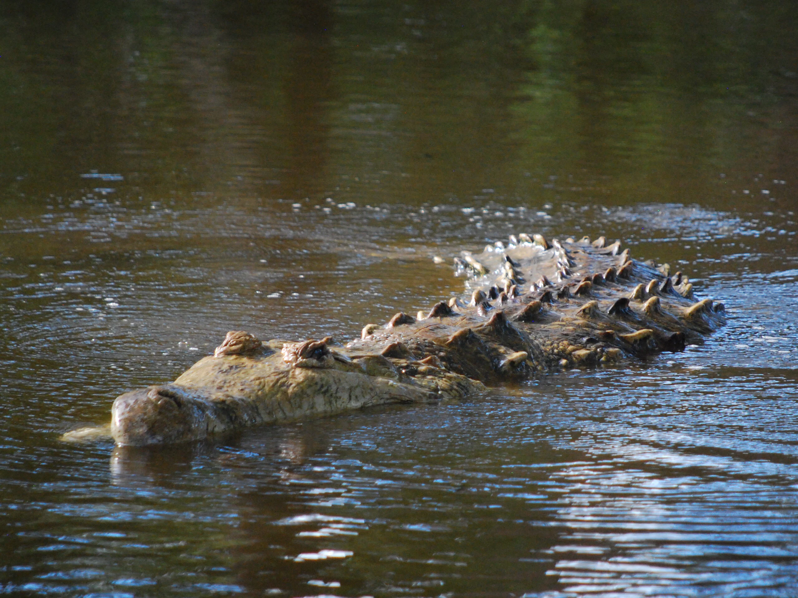
A large Orinoco crocodile with prominent dorsal scales partially submerged in dark, calm water.
An Orinoco crocodile swimming in the waters of the Hato El Frio biological station.

Hato El Frío history and protected-area timeline

Hato El Frío has a history that weaves together Venezuelan independence, frontier ranching culture, and modern biodiversity conservation. After Venezuela’s war of independence against Spain, General Simón Bolívar granted the estate to General José Antonio Páez in 1824 as recognition for Páez’s decisive role in the victory. Páez himself referenced the property in his 1878 autobiography, describing how he retired to his “hato del Frío.” The estate later passed to Bárbara Nieves, who had been Páez’s partner and bore him four children, and changed hands several times across the nineteenth and twentieth centuries.

For most of its history, Hato El Frío was a working cattle ranch, and it was the cattle economy, rather than formal protection, that preserved the surrounding savanna from agricultural conversion. In 1911 the property was acquired by the poet Samuel Darío Maldonado, which marked a period in which literary and cultural figures became associated with the estate. The most transformative modern chapter began in 1977 with the creation of the El Frío Biological Station, which converted part of the ranch into a base for scientific studies, films, publications, and conservation programs.

In 1987 researchers began a program to save the endangered Orinoco caiman by raising and releasing thousands of captive-bred juveniles, an effort that contributed substantially to the species’ regional recovery. In 1989, responding to lobbying from scientists and conservationists, the Venezuelan government formally established the Hato El Frío Fauna Reserve and Fishing Refuge around Caño Guaritico. In December 2007 a broader “Apuroquia” Biosphere Reserve initiative was presented to UNESCO with Hato El Frío as its centerpiece. In March 2009 the estate was expropriated by the Venezuelan state for its ecological, historical, and scientific importance, and it is now administered as a state-owned ecotourism center.

Hato El Frío landscape and geographic character

Hato El Frío occupies a wide, flat stretch of the Venezuelan llanos, where the land is largely defined by water rather than relief. The terrain consists of broad, sweeping plains cut by slow rivers, branching streams, shallow lagoons, and seasonal wetlands that expand and contract with the rains. During the dry season the land hardens into open grassland, while the rainy season transforms the same terrain into a vast shallow floodplain dotted with islands of higher ground and crossings where livestock and wildlife swim between banks.

Along the waterways, narrow strips of gallery forest break the seemingly endless savanna, creating dense green corridors of trees that shade the rivers and serve as refuges for animals during the wet months. The contrast between the open horizon of the llanos and these wooded river edges defines much of the estate’s scenic character. The land is part of the greater Orinoco watershed, and the low gradient means that small changes in water level reshape enormous areas, producing a landscape in constant seasonal reinvention.
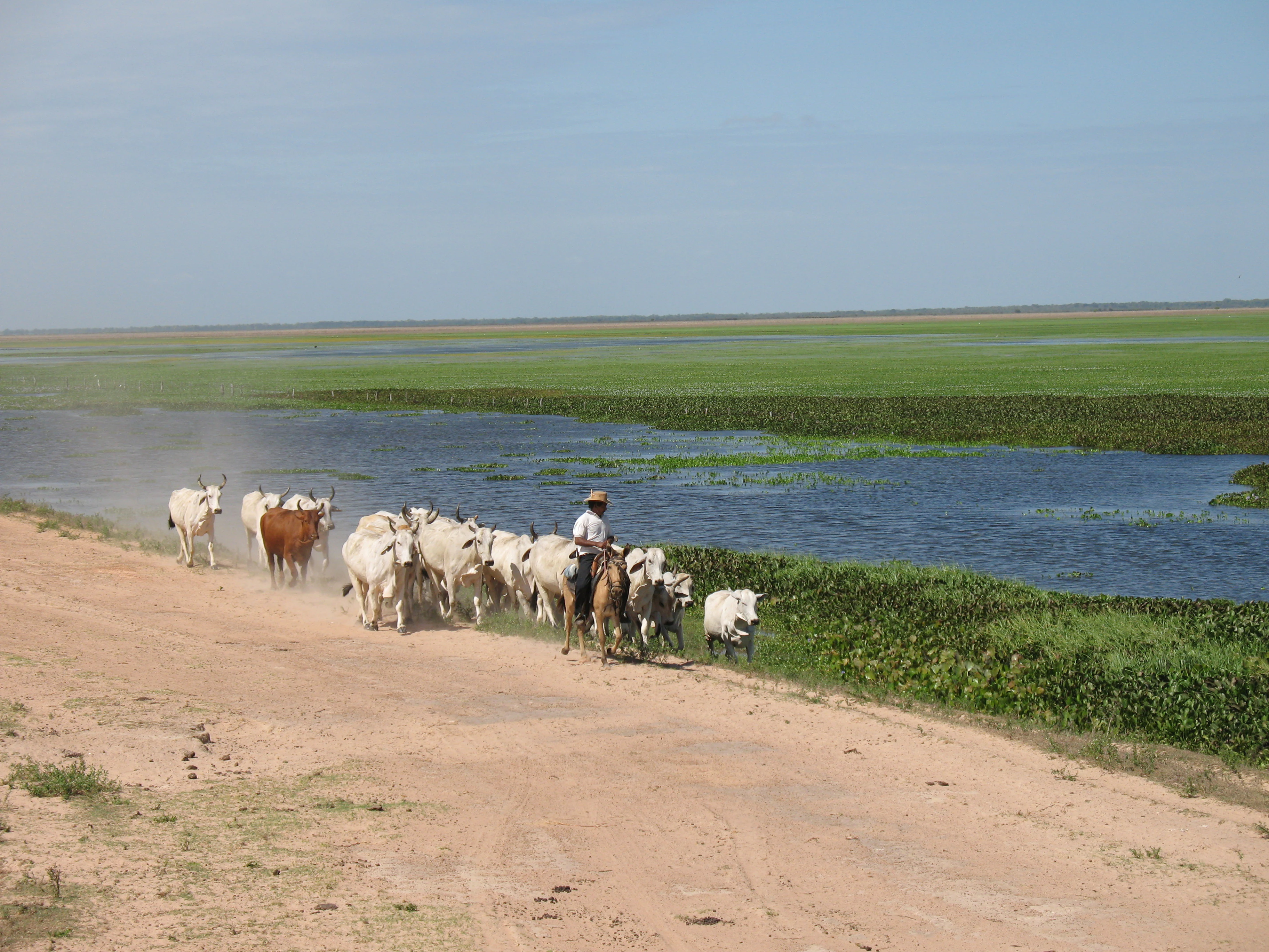
A llanero on horseback drives a small herd of white and brown cattle along a dusty, unpaved road running parallel to a lush, water-filled wetland landscape.
A llanero, or Venezuelan cowboy, herding cattle along a dirt track in the Hato El Frio wetlands.

Hato El Frío ecosystems, habitats, and plant life

The ecosystems of Hato El Frío represent a textbook example of the Venezuelan llanos, where savanna, wetland, and gallery forest form a tightly linked ecological system. The herbaceous savannas dominate the dry season landscape, supporting grazing herbivores and ground-nesting birds that depend on the open horizon. As the rains arrive, shallow water spreads across the plains, linking streams, lagoons, and seasonal ponds into a connected floodplain that is highly productive for fish, amphibians, reptiles, and waterbirds.

Gallery forests along the rivers introduce a vertical layer absent from the open plains, with tall trees, shaded edges, and a richer understory that shelters different species from the surrounding savanna. Together, these vegetation types sustain a broad biodiversity profile that includes hundreds of plant species, a substantial share of which are aquatic, and a wide range of mammals, birds, reptiles, amphibians, and fish. The combination of dry-season grassland and wet-season wetland gives the estate two distinct ecological phases within a single year, each supporting different communities of plants and animals.

Hato El Frío wildlife and species highlights

Hato El Frío is renowned for its abundant and charismatic megafauna. The estate is one of the last strongholds of the Orinoco caiman, a critically endangered crocodilian whose populations crashed during the twentieth century. The Orinoco caiman breeding program launched here in 1987 has been central to the species’ recovery, with thousands of captive-bred juveniles released over the years. Equally emblematic is the capybara, the world’s largest rodent, which forms large herds along the wetlands and is among the most visible mammals on the property.

The llanos are also classic habitat for the green anaconda, the world’s heaviest snake, and the property is considered one of the better places in the region to observe this species in the wild. Mammal diversity is significant, with more than sixty mammal species recorded, including all five of the region’s cats: jaguar, puma, ocelot, jaguarundi, and margay. Birdlife is exceptionally rich, with hundreds of bird species recorded across the savanna, wetland, and forest habitats, ranging from wading birds and waterfowl in the inundated season to raptors and open-country specialists in the dry months. Reptiles, amphibians, and fish complete the picture, with the rivers and lagoons sustaining a large and varied aquatic fauna tied to the seasonal flood pulse.

Hato El Frío conservation status and protection priorities

Hato El Frío has played an outsized role in conservation in the Venezuelan llanos, both through formal designation and through decades of on-the-ground programs. Its establishment as a protected area in 1989 as a fauna reserve and fishing refuge around Caño Guaritico recognized the estate’s importance for aquatic species and for the broader llanos ecosystem. The El Frío Biological Station, founded in 1977, has anchored scientific research, ecological monitoring, and environmental education at the site for decades.

The most internationally visible program has been the rescue and captive breeding of the Orinoco caiman, an effort that has released thousands of individuals into surrounding wetlands and helped stabilize a species that had been pushed toward extinction. The estate’s combination of cattle ranching and wildlife conservation has also been cited as a model for integrating productive land use with habitat preservation on a regional scale. The proposal to UNESCO in 2007 for the larger “Apuroquia” Biosphere Reserve placed Hato El Frío at the center of an effort to extend that conservation model across a wider landscape of the Apure llanos.

Hato El Frío cultural meaning and human context

Hato El Frío is deeply embedded in the cultural identity of the Venezuelan llanos. The llanero cowboy culture is central to the estate’s daily life, with cattle work shaping both the landscape and the rhythms of the people who live there. The property’s historical link to General José Antonio Páez, one of the most important figures of post-independence Venezuela, gives it a place in the country’s national memory that sits alongside its natural significance. Literary figures have also been associated with the estate, including the twentieth-century poet Samuel Darío Maldonado, a former owner. Together, these layers of independence-era history, llanero working culture, and modern ecourism give Hato El Frío a cultural depth that matches its ecological profile.

Top sights and standout views in Hato El Frío

Hato El Frío’s biggest highlight is the chance to see a full llanos ecosystem within a single property: open savanna in the dry season, an enormous shallow floodplain in the wet season, and gallery forests along the rivers. Wildlife encounters with Orinoco caimans, capybaras, and green anacondas during boat and jeep excursions are a defining experience of any visit. The estate’s historical link to Bolívar and Páez adds a layer of national heritage rarely found alongside a working wildlife reserve.

Best time to visit Hato El Frío

The character of a visit to Hato El Frío changes dramatically between the dry and wet seasons, and the most rewarding experience depends on what a traveler wants to see. During the dry season, the savanna becomes open and accessible, cattle work is in full swing, and large concentrations of wildlife gather around the shrinking water bodies, making it ideal for observing mammals and birds on dry ground. During the rainy season, the plains turn into a vast shallow wetland, waterfowl and aquatic species become exceptionally abundant, and boat-based excursions through flooded savanna become possible. Choosing between these two seasons is essentially choosing between two different visions of the same landscape.

Monthly climate preview

Long term monthly averages for temperature and precipitation patterns across the protected landscape

Hato El Frío Climate Normals and Annual Temperature Rhythm

Historical data records sustained monthly temperature variations alongside shifting precipitation totals across the representative coordinate. Exploring the complete monthly profile reveals detailed baseline figures for long term climatic analysis.
Annual mean28 °C
26 °C32 °C
Jan30°
Feb31°
Mar32°
Apr30°
May28°
Jun27°
Jul26°
Aug26°
Sep27°
Oct27°
Nov27°
Dec28°
Warmest month
March

31.6 °C

Coolest month
July

26 °C

Wettest month
July

9.4 mm/day

Driest month
January

0.2 mm/day

Park location guide

Geography guide, regional context, and park location map for Hato El Frío

Hato El Frío park geography, regions, and map view in Venezuela

Understand where Hato El Frío sits in Venezuela through a broader geographic reading of the surrounding landscape, nearby location context, and its mapped position within the national park landscape.

How Hato El Frío fits into Venezuela

Venezuela is a country in northern South America with coastline along the Caribbean Sea and Atlantic Ocean. It borders Colombia, Brazil, Guyana, and Trinidad and Tobago. The country has an area of approximately 916,445 km² and a population of about 31.8 million. Caracas is the capital and largest city. Venezuela consists of 23 states and the Capital District.

Wider geography shaping Hato El Frío in Venezuela

Venezuela is located on the northern coast of South America. The continental territory is bordered by the Caribbean Sea and Atlantic Ocean to the north, Colombia to the west, Brazil to the south, and Guyana to the east. Trinidad and Tobago lies to the northeast. The country includes various islands and islets in the Caribbean Sea known as the Federal Dependencies.

Map view of Hato El Frío

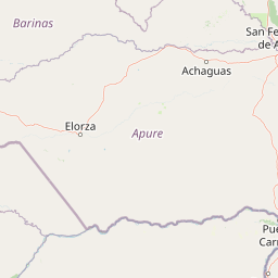
Use this park location map to pinpoint Hato El Frío in Venezuela, understand its exact geographic position, and read its mapped placement within the surrounding landscape more clearly.

Pigeon | © OpenStreetMap contributors

Location context for Hato El Frío

Apure

Explore the visual character of seasonal wetlands, savanna terrain, and gallery forests.

Hato El Frío Photos and Landscape Scenery: Visualizing the Llanos Ecosystem

Visual records reveal the shifting terrain and seasonal floodplains that define the natural character of Hato El Frío. Examining these photographs helps observers understand the protected habitats and wildlife refuges across the Venezuelan llanos.

A large Orinoco crocodile with prominent dorsal scales partially submerged in dark, calm water.

A vibrant orange sunset reflects across the calm, mirror-like surface of a vast lagoon in the Apure wetlands.

A llanero on horseback drives a small herd of white and brown cattle along a dusty, unpaved road running parallel to a lush, water-filled wetland landscape.

Park atlas

Compare regional wetland habitats and connected savanna ecosystems across the llanos

Other Parks Near Hato El Frío and Protected Landscapes in the Surrounding Region

Browsing other parks near Hato El Frío reveals broader ecological connections across the expansive wetland and seasonal savanna terrain of the llanos. Evaluating adjacent protected areas provides essential regional context for understanding wildlife corridors and watershed geography.
A soft watercolor painting showing a panoramic view of green grassy hills, scattered trees, and a calm water surface reflecting a pale dawn or sunset sky.
Wildlife reserveApure
About 75 km away#1 closest

Southwest

Hato El Cedral Wildlife Reserve and Apure Regional Wetland Landscape Geography

Mapping the seasonal plains and riverine corridors of the Venezuelan Llanos.

Hato El Cedral encompasses a vast mosaic of savanna, gallery forest, and seasonally flooded wetlands within the Apure state of Venezuela. This wildlife reserve functions as a critical sanctuary for biodiversity, characterized by its dramatic shifts between dry-season grasslands and wet-season lagoons. Our atlas view provides a detailed context for understanding the reserve's protected boundaries, its river-driven ecosystem, and its unique role in the geography of the Venezuelan Llanos.

Area
530 km²
Established
1987
Relief
Lowland
Climate
Tropical
National parkApure State
About 181 km away#2 closest

Southeast

Santos Luzardo National Park: Exploring Venezuela's Protected Landscape Geography

National park mapped boundaries and regional natural terrain.

This detailed entry for Santos Luzardo National Park focuses on its role as a national park and its contribution to the geographic atlas of Venezuela. It highlights the park's protected landscape, mapped terrain, and its specific setting within Apure State. Engage with concrete details that illuminate the park's protected status and its natural geographic features, perfect for atlas-driven exploration and understanding protected areas.

Area
5,844 km²
Established
1988
IUCN
II
Relief
Lowland
National parkGuárico
About 201 km away#3 closest

East

Aguaro-Guariquito National Park: Protected Landscape and Geographic Mapping

Explore its Guárico regional setting and mapped park boundaries.

Aguaro-Guariquito National Park stands as a vital protected natural area within the Guárico region of Venezuela. This entry offers an atlas-centric view, focusing on the park's mapped boundaries and its role as a national park. Delve into its geographic identity and the context it provides for understanding protected landscapes in the area.

Area
5,857 km²
Established
1974
IUCN
II
Relief
Lowland
National parkVenezuela
About 210 km away#4 closest

Northwest

El Guache National Park: Venezuela's Protected Andean Foothill National Park

Map exploration of vital river basins and natural landscapes.

El Guache National Park is a protected national park in Venezuela, safeguarding the headwaters of five key rivers. Its landscape comprises mountainous terrain within the Andean foothills, crucial for watershed protection and regional biodiversity. This entry provides detailed geographic context, allowing for an atlas-style exploration of the park's mapped boundaries and its role as a vital protected area.

Area
122 km²
Established
1992
IUCN
II
Relief
Mountain
National parkVenezuela
About 217 km away#5 closest

Northwest

General Cruz Carrillo en Guaramacal National Park: Venezuela's National Park Landscape

Mapped protected areas and regional geography.

Delve into the protected landscape of General Cruz Carrillo en Guaramacal National Park, a national park situated in Venezuela. This page provides essential geographic context, focusing on the park's mapped boundaries and its role as a protected natural area. Understand its place within the regional geography and discover its unique landscape characteristics, offering a foundation for detailed atlas exploration.

Watercolor painting showing green hills, a river, and distant mountains under a light sky
National parkVenezuela
About 218 km away#6 closest

West

Sierra Nevada National Park: Venezuela's Majestic Alpine Protected Landscape and Park Boundaries

Explore the highest peaks and glacial terrain of this Venezuelan national park.

Delve into Sierra Nevada National Park, a premier protected area situated in the high Venezuelan Andes. This national park protects a vast expanse of dramatic alpine terrain, including Pico Bolívar and numerous glacial valleys. Understand its mapped boundaries and the unique paramo and cloud forest ecosystems that define this significant natural landscape within Venezuela, offering rich context for atlas-style geographic discovery.

Area
2,764.46 km²
Established
1952
IUCN
II
Relief
Mountain
Watercolor painting of a lake surrounded by soft green hills and coniferous trees with a pale pink sky.
National parkTrujillo
About 218 km away#7 closest

Northwest

Parque nacional Guaramacal: Mapped Protected Landscapes and Andean Mountain Geography

Defining the boundaries and ecological terrain of the Ramal de Guaramacal.

Parque nacional Guaramacal captures a remarkable ecological transition in a compact space, rising from sub-Andean forests to summits above 3,000 meters. This record outlines the park geography, covering the steep ridgelines, glacial lake basins, and the endemic-rich cloud forest zones that define this significant Venezuelan protected area.

Area
215 km²
Established
1988
IUCN
II
Relief
Mountain
National parkLara State
About 222 km away#8 closest

Northwest

Yacambú National Park National Park: Protected Cloud Forest Landscape in Lara State

Mapped terrain and significant orchid diversity in Venezuela's Andean foothills.

Yacambú National Park is a significant national park in Venezuela's Lara State, protecting crucial humid cloud forest ecosystems in the Andean foothills. The park's terrain is defined by the mountainous topography of the Portuguesa Mountain Range, supporting a rich diversity of flora, including numerous orchid species. Its role in watershed protection for nearby regions underscores its importance as a conserved natural landscape with vital ecological functions.

Area
146 km²
Established
1962
IUCN
II
Relief
Mountain

Common questions about visiting, size, designation, and location context for Hato El Frío

Hato El Frío FAQs for park facts, access, geography, and protected area context

Find quick answers about Hato El Frío, including protected-area facts, park geography, trail and visitor context, and how the park fits into its surrounding country and regional landscape.
MoriAtlas Explorer

Continue Your Protected Areas Search Across the Global Atlas

Deepen your exploration by continuing the structured search for national parks and protected areas worldwide. Utilize the comprehensive filtering capabilities to compare different conservation landscapes and refine your understanding of global park geography. Discover more about the distribution and characteristics of protected natural areas.

Global natural geography