

Mori Atlas logo
Biosphere reserveHattah-Kulkyne and Murray-Kulkyne Biosphere Reserve

Examining the mosaic of seasonal wetlands, ancient dune fields, and riverine woodlands in Victoria.

Hattah-Kulkyne and Murray-Kulkyne Biosphere Reserve: A Semi-Arid Landscape and Protected Area Atlas

The Hattah-Kulkyne and Murray-Kulkyne Biosphere Reserve represents a significant protected area in northwestern Victoria, distinguished by its semi-arid climate and complex inland terrain. This reserve integrates riverine corridors along the Murray River with expansive mallee woodlands and saline flats. By mapping these interconnected ecosystems, users can understand the distinct landforms that define this UNESCO-recognized region, including its seasonal lake networks and ancient Pleistocene sand ridges.

semi-arid landscapemallee woodlandriverine habitatsaline flatsseasonal wetlandsbiosphere reserve
A flat-style digital illustration of a river winding between trees and rocky hills, with a small waterfall in the distance and a soft sun in the sky.

Hattah-Kulkyne and Murray-Kulkyne Biosphere Reserve

Biosphere reserve

Park overview

Structured park overview, official facts, and landscape profile for Hattah-Kulkyne and Murray-Kulkyne Biosphere Reserve

Hattah-Kulkyne and Murray-Kulkyne Biosphere Reserve park facts, protected area profile, and essential visitor context

Review the core facts for Hattah-Kulkyne and Murray-Kulkyne Biosphere Reserve, including designation, size, terrain, visitor scale, habitats, and operating context in one park-focused overview.

About Hattah-Kulkyne and Murray-Kulkyne Biosphere Reserve

The Hattah-Kulkyne and Murray-Kulkyne Biosphere Reserve sits in the far northwest of Victoria, in a transition zone between the Murray River floodplain and the broader semi-arid mallee country of inland southeastern Australia. Although the reserve has an official administrative footprint of roughly 515 square kilometers, much of its identity is defined by contrasts: riverine corridors with seasonal water, dense mallee and savanna woodlands on sandy rises, and broad, sparsely vegetated saline flats where deep-rooted shrubs dominate.

UNESCO's own description of the reserve highlights three defining habitats. Riverine woodlands follow the floodplain of the Murray River and its associated creeks, creating green corridors through the otherwise dry country. Savanna woodlands of mallee eucalypts spread across the sand-ridge landscapes, while saline shrublands cover extensive flats where gypsum-rich soils limit plant growth to a tough, salt-adapted flora. These three habitats are interlinked through the floodplain system, and the wetlands that lie within the reserve depend on pulses of river flow rather than permanent water.

Because of its semi-arid climate and the seasonal nature of the Murray's overflow into the Hattah lakes, the reserve has a strongly variable character. In dry years the lakes can shrink to bare claypans; in wetter years, when the Murray delivers significant flows downstream, they refill and attract waterbirds in large numbers. This alternation between dry and inundated conditions is a defining feature of the reserve and shapes both its ecology and its appeal for visitors.

As a United Nations biosphere reserve, the area is recognized not only for its natural values but also for its role in demonstrating how semi-arid landscapes with highly variable water regimes can be managed as a coherent protected system. The combination of an established national park with adjacent reserves gives the biosphere a layered structure of protection, allowing core conservation areas to sit alongside broader landscape-scale management.

Quick facts and research context for Hattah-Kulkyne and Murray-Kulkyne Biosphere Reserve

The Hattah-Kulkyne and Murray-Kulkyne Biosphere Reserve covers roughly 515 square kilometers in the state of Victoria, southeast of Mildura. It combines Hattah-Kulkyne National Park with Murray-Kulkyne Park under a single UNESCO biosphere designation, established in 1981, and is managed by Parks Victoria. The reserve lies on the southern bank of the Murray River in a semi-arid region where saline flats, dune fields, and floodplains shape the land, and the lakes and wetlands fill only intermittently after major river flows.

Protection and recognition

Documented terrestrial protection scope and conservation frameworks

Hattah-Kulkyne and Murray-Kulkyne Biosphere Reserve Protection Status

Examination of Hattah-Kulkyne and Murray-Kulkyne Biosphere Reserve reveals documented terrestrial protection parameters and management scope. Verification details outline official conservation frameworks and international recognition standing.

Protection details

Protection scope
Terrestrial
Transboundary protection
No
Park context

Deeper park guide and search-rich context for Hattah-Kulkyne and Murray-Kulkyne Biosphere Reserve

Hattah-Kulkyne and Murray-Kulkyne Biosphere Reserve history, landscape, wildlife, and travel context

Explore Hattah-Kulkyne and Murray-Kulkyne Biosphere Reserve through its history, landscape character, ecosystems, wildlife, conservation priorities, cultural context, and seasonal travel timing in a structured park guide built for atlas discovery and search intent.

Why Hattah-Kulkyne and Murray-Kulkyne Biosphere Reserve stands out

The reserve is best known for its semi-arid mosaic of mallee and riverine woodland, its chain of seasonal Hattah lakes along the Murray River floodplain, and its extensive saline flats and ancient sand ridges. It also represents one of Victoria's key examples of how intermittent riverine wetlands can support diverse woodland and shrubland habitats in an otherwise dry landscape.
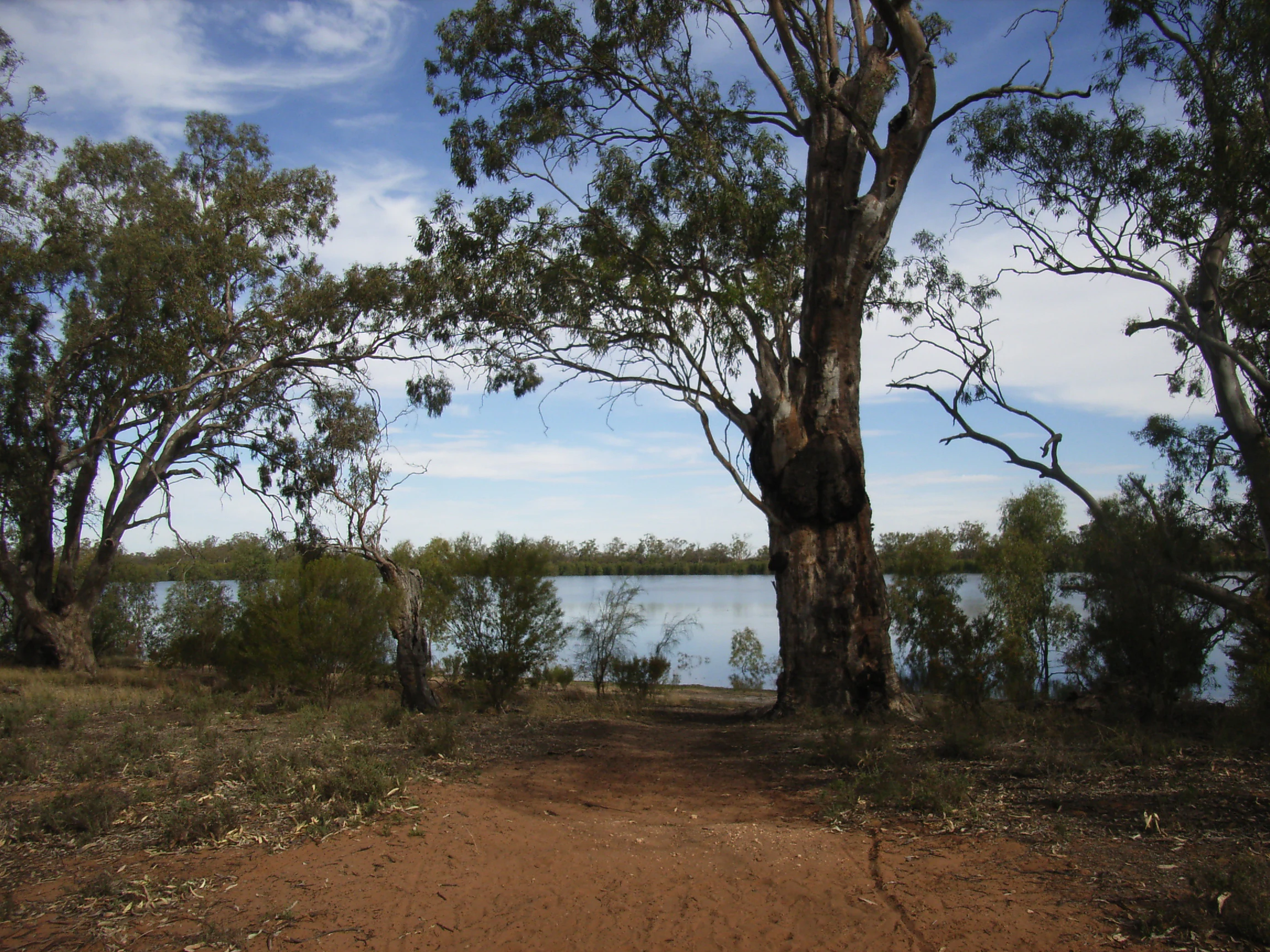
A calm lake viewed from a dirt clearing surrounded by large eucalyptus trees with gnarled trunks.
A view of Hattah Lake surrounded by river red gum trees.

Hattah-Kulkyne and Murray-Kulkyne Biosphere Reserve history and protected-area timeline

The protection of the landscapes now contained within the biosphere reserve stretches back more than a century. As early as 1915, a sanctuary was established to protect the natural beauty of the Hattah lakes themselves, recognizing their scenic and ecological value long before the surrounding country was formally reserved.

Early advocacy for broader protection came from local naturalists. Ornithologist Les Chandler, working with the Reverend C. L. Lang, founded the Sunraysia Naturalists' Club in 1949, an organization that later became the Sunraysia Naturalists' Research Trust. Chandler held successive roles as President, Vice-president, Secretary, Treasurer, and Editor of the club. Through campaigning and documentation, the group pushed for the Hattah-Kulkyne area to be formally declared a national park, a goal achieved in 1960.

The biosphere reserve itself was formally established in 1981. Its creation extended the protected status of the original Hattah-Kulkyne National Park to include adjacent Murray-Kulkyne Park, placing both under a single internationally recognized designation. Management responsibility rests with Parks Victoria, the state authority responsible for Victoria's parks network.

Hattah-Kulkyne and Murray-Kulkyne Biosphere Reserve landscape and geographic character

The reserve lies within a classic inland Australian semi-arid landscape shaped by river action, wind, and salt accumulation. The dominant landforms are threefold: saline flats underlain by shallow soils and gypsum, dune fields that preserve relics of ancient Pleistocene sand ridges, and floodplains built up from regular alluvial deposition along the Murray River system.

The saline flats form some of the most visually striking open ground in the reserve. Their pale surfaces and sparse, low shrub cover stand in sharp contrast to the denser mallee vegetation that grows on the sandier rises. The dune fields, with their long parallel sand ridges, give the landscape a distinctive corrugated texture and a reminder of the drier climatic phases that shaped the region during the Pleistocene. Between these features, the floodplains form the lower, flatter ground through which seasonal waters spread after high flows on the Murray.

The result is a mosaic of open flats, vegetated dunes, and tree-lined watercourses. Even where water is absent, the landforms themselves carry strong visual character, and the seasonal filling of the lakes and creeks transforms the reserve from a predominantly dry landscape into one of scattered wetlands bordered by flowering mallee.

Hattah-Kulkyne and Murray-Kulkyne Biosphere Reserve ecosystems, habitats, and plant life

Ecologically, the biosphere reserve is anchored by the interplay of its three main habitats. Riverine woodlands line the Murray and its connecting waterways, providing patches of taller, denser vegetation in a landscape that is otherwise dominated by drought-adapted species. These corridors act as biological pathways through the arid country, supporting both resident and migratory fauna.

Mallee savanna woodlands cover the sandy rises and dune country. The mallee eucalypts that give their name to this habitat are multi-stemmed, low trees adapted to low rainfall, nutrient-poor soils, and frequent fire. Underneath them grows an understory of hardy shrubs and grasses. This woodland type is emblematic of semi-arid southeastern Australia and represents a significant proportion of the reserve's vegetation.

The third main habitat, saline shrubland, occupies the flats where gypsum-rich, shallow soils limit plant productivity. Saltbushes and other chenopod shrubs dominate these areas, producing a distinctly different plant community from the woodlands. The contrast between these three habitats, separated by relatively short distances and connected by floodplain corridors, gives the reserve unusually high local ecological variety for an inland semi-arid setting.

Hattah-Kulkyne and Murray-Kulkyne Biosphere Reserve wildlife and species highlights

The reserve's habitat diversity supports a correspondingly varied fauna, with the seasonal Hattah lakes and Murray floodplain playing an outsized role. While the lakes may dry to claypans in some years, after significant Murray flows they refill and become habitat for waterbirds, including species that travel widely in response to inland wet conditions. This pulsation between dry and flooded states shapes the reserve's birdlife, drawing in waterfowl and waders during peak inundation while allowing dry-country species to thrive in intervening years.

The mallee woodlands and sand-ridge country host bird species typical of semi-arid eucalyptus vegetation, including woodland-dependent parrots, honeyeaters, and other small passerines adapted to dense mallee thickets. These areas also support reptiles and small mammals characteristic of arid-zone mallee, many of which depend on the shelter of the multi-stemmed mallee trees and the leaf-litter they shed.

Along the riverine corridors, the reserve gains an additional fauna associated with red gum and box woodlands, including species that depend on tree hollows and on the structural complexity of mature riverine forest. The overall wildlife profile is therefore driven less by individual species counts than by the reserve's capacity to support three distinct faunal communities, one tied to each of the main habitat types.

Hattah-Kulkyne and Murray-Kulkyne Biosphere Reserve conservation status and protection priorities

The Hattah-Kulkyne and Murray-Kulkyne Biosphere Reserve carries conservation significance at multiple levels. Domestically, the area has been protected in stages: the Hattah lakes were first placed under sanctuary protection in 1915, the broader Hattah-Kulkyne region achieved national park status in 1960, and the biosphere reserve was formally established in 1981.

Internationally, the reserve's UNESCO biosphere designation acknowledges its value as a representative example of semi-arid southeastern Australian ecosystems. UNESCO's own characterization emphasizes the importance of the three-habitat mosaic of riverine woodland, mallee savanna, and saline shrubland, as well as the unusual condition of Murray-related wetlands that fill only intermittently.

For conservation, the importance of the reserve lies in part in the integrity of its arid-zone woodland and saline communities, which have declined elsewhere in southern Australia under land-use pressure. Equally important is the role of the floodplain as a refuge for waterbirds during high-flow years, a function that depends heavily on the broader health of the Murray River system. Parks Victoria's management role links the reserve to the wider network of protected areas in Victoria and to management strategies for the Murray River corridor.

Hattah-Kulkyne and Murray-Kulkyne Biosphere Reserve cultural meaning and human context

The reserve's cultural story is closely tied to the local naturalist tradition of the Sunraysia region. The mid-twentieth-century campaign led by Les Chandler and the Sunraysia Naturalists' Club, later reorganized as the Sunraysia Naturalists' Research Trust, was instrumental in pushing for national park status for the Hattah-Kulkyne landscape. Their advocacy, sustained across multiple leadership roles and decades of documentation, is part of the reserve's heritage as a community-protected area.

The Hattah lakes themselves have an older cultural identity within the region, having been recognized for their scenic value as early as 1915. While the source material does not detail Aboriginal cultural connections to the area, its location along the Murray River places it in a landscape long associated with traditional use and movement along the river corridor.

Top sights and standout views in Hattah-Kulkyne and Murray-Kulkyne Biosphere Reserve

The reserve's strongest points of distinction are its three-habitat mosaic of riverine woodland, mallee savanna, and saline shrubland, and the seasonal behavior of its Hattah lakes. These features combine a genuinely arid inland setting with a network of river-linked wetlands, and they sit within a UNESCO-recognized biosphere framework that links national park and adjacent reserve lands under a single management concept.

Best time to visit Hattah-Kulkyne and Murray-Kulkyne Biosphere Reserve

Because the reserve is semi-arid and the lakes depend on irregular Murray River flows, the character of a visit changes sharply with seasonal conditions. Cooler months of the Australian late autumn, winter, and early spring generally offer milder temperatures for exploring the mallee woodlands and dune country, while also covering the period when many flora and bird species are most active. After major river flows, particularly when floodwaters reach the Hattah lakes, the reserve's wetlands fill and draw waterbirds in large numbers, transforming the landscape into one of scattered lakes among the mallee; this is generally the most rewarding window for waterbird observation, although such filling events are inherently irregular rather than scheduled.
Monthly climate preview

Long-term monthly temperature and precipitation data recorded across representative coordinates

Hattah-Kulkyne and Murray-Kulkyne Biosphere Reserve Climate Normals and Annual Weather Patterns

Representative baseline measurements reveal an arid annual rhythm marked by high summer heat and consistently low precipitation across all twelve months. Examining the complete monthly climate normals provides deeper context for long-term temperature swings and seasonal moisture distribution.
Annual mean18 °C
9 °C27 °C
Jan27°
Feb26°
Mar22°
Apr18°
May13°
Jun10°
Jul
Aug11°
Sep14°
Oct18°
Nov21°
Dec24°
Warmest month
January

26.6 °C

Coolest month
July

9.5 °C

Wettest month
November

1.1 mm/day

Driest month
March

0.5 mm/day

Park location guide

Geography guide, regional context, and park location map for Hattah-Kulkyne and Murray-Kulkyne Biosphere Reserve

Hattah-Kulkyne and Murray-Kulkyne Biosphere Reserve park geography, regions, and map view in Australia

Understand where Hattah-Kulkyne and Murray-Kulkyne Biosphere Reserve sits in Australia through a broader geographic reading of the surrounding landscape, nearby location context, and its mapped position within the national park landscape.

How Hattah-Kulkyne and Murray-Kulkyne Biosphere Reserve fits into Australia

Australia is a constitutional monarchy and federal parliamentary democracy comprising six states and ten territories. With a population of nearly 28 million, it is one of the world's most urbanised countries, with most people concentrated on the eastern seaboard. The country has a high Human Development Index and is known for its cultural diversity, ancient Aboriginal heritage, and unique wildlife.

Wider geography shaping Hattah-Kulkyne and Murray-Kulkyne Biosphere Reserve in Australia

Australia occupies the entire Australian continent, the island of Tasmania, and numerous smaller islands. It is the world's flattest and driest inhabited continent, featuring vast deserts in the interior (the Outback), tropical rainforests along the eastern coast, and a coastline bordering the Indian and Pacific Oceans.

Map view of Hattah-Kulkyne and Murray-Kulkyne Biosphere Reserve

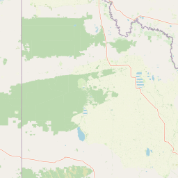
Use this park location map to pinpoint Hattah-Kulkyne and Murray-Kulkyne Biosphere Reserve in Australia, understand its exact geographic position, and read its mapped placement within the surrounding landscape more clearly.

Pigeon | © OpenStreetMap contributors

Location context for Hattah-Kulkyne and Murray-Kulkyne Biosphere Reserve

Victoria

Visualizing the semi-arid terrain, mallee woodlands, and seasonal river wetlands.

Hattah-Kulkyne and Murray-Kulkyne Biosphere Reserve Photos and Landscapes

Visual documentation reveals the distinctive terrain, mallee woodlands, and saline flats that define the protected landscape. Examining photographic records provides clear insight into the remote habitats and seasonal wetlands found across the region.

A calm lake viewed from a dirt clearing surrounded by large eucalyptus trees with gnarled trunks.

Park atlas

Discover related protected areas and regional landscapes across northwestern Victoria.

Explore Parks Near Hattah-Kulkyne and Murray-Kulkyne Biosphere Reserve

Compare nearby national parks and protected landscapes that share the semi-arid mallee and riverine corridor characteristics of Hattah-Kulkyne and Murray-Kulkyne Biosphere Reserve. Broaden your geographic understanding of the surrounding region through connected conservation areas and diverse inland habitats.
National parkAustralia
About 23 km away#1 closest

South

Hattah-Kulkyne National Park: Victoria's Ramsar Wetland National Park & Mallee Landscape

Explore its mapped protected area and semi-arid regional geography.

Delve into Hattah-Kulkyne National Park, a substantial protected area in northwestern Victoria, Australia, defined by its striking red-earth terrain and sprawling mallee woodlands. This national park is renowned for its dynamic seasonal lake system, a key component of the Murray River basin's wetland geography. The park's status as a Ramsar-designated wetland highlights its ecological importance, providing critical habitat within a distinct semi-arid environment. Discover the unique atlas-scale landscape character and protected land context of this significant Australian natural area.

Area
480 km²
Established
1960
IUCN
II
Relief
Lowland
Biosphere reserveNew South Wales
About 25 km away#2 closest

Northwest

Barkindji Biosphere Reserve: Geography and Protected Landscapes in New South Wales

Mapping riverine wetlands and semi-arid dune systems

Barkindji Biosphere Reserve sits within the Murray-Darling Basin, creating a critical conservation area that spans river floodplains, sand plains, and semi-arid forest. This protected entity documents the transition between aquatic river environments and inland dryland terrain, highlighting complex soil and habitat variability across its vast, managed regional footprint.

Area
1,918.23 km²
Established
2005
Visitors
133 annual
Relief
Mixed relief
National parkAustralia
About 28 km away#3 closest

Southwest

Murray-Sunset National Park: Iconic Pink Lakes and Mallee Wilderness in Victoria's Semi-Arid Interior

Explore its unique landscape, mapped boundaries, and regional geography.

Murray-Sunset National Park offers a compelling glimpse into Australia's semi-arid heart, featuring a dramatic landscape of salt lakes, gypsum plains, extensive sand dunes, and dense mallee woodlands. This vast protected area is renowned for the vibrant pink hue of its salt lakes, a phenomenon created by microscopic algae that flourishes in the hypersaline conditions during warmer months. The park's rich biodiversity and unique ecosystem make it a significant conservation asset, providing crucial habitat for numerous species adapted to this challenging yet beautiful environment.

Area
6,330 km²
Established
1991
IUCN
II
Relief
Lowland
National parkNew South Wales
About 30 km away#4 closest

Northeast

Mallee Cliffs National Park: Protected Landscape and Geographic Atlas Entry

Explore its mapped boundaries and regional New South Wales context.

Mallee Cliffs National Park is presented here as a distinct protected landscape, offering specific insights for atlas and geographic discovery. This entry details the park's national park designation and its position within New South Wales, highlighting its mapped boundaries and the surrounding regional geography. It provides the foundational geographic context needed to understand Mallee Cliffs National Park's presence within the broader landscape of protected areas, inviting detailed exploration for those interested in mapped natural terrain.

Area
579.69 km²
Established
1977
IUCN
II
Relief
Lowland
National parkNew South Wales
About 82 km away#5 closest

Northeast

Mungo National Park: Protected Landscape Atlas and Geographic Context

Explore mapped boundaries and regional terrain within New South Wales.

Mungo National Park offers a distinct focus for atlas exploration, presenting itself as a key protected landscape within the state of New South Wales, Australia. This entry details the park's geographic positioning and mapped boundaries, allowing for a clear understanding of its terrain and regional context. Engage with the park's identity as a protected area, uncovering the specifics of its natural landscape for a richer geographic discovery experience.

Area
1,109.67 km²
Established
1979
IUCN
II
Relief
Lowland
National parkAustralia
About 105 km away#6 closest

South

Wyperfeld National Park: Mapping Victoria's Vast Mallee Semi-Arid Wilderness and Sandhill Landscapes

Discover the unique geography and protected terrain of this significant Australian national park.

Wyperfeld National Park in Victoria, Australia, is a prime example of a vast semi-arid wilderness landscape. It is best known for its extensive sandhill formations, referred to as 'snowdrifts,' which punctuate the otherwise flat terrain. The park also protects a significant ephemeral lake system and is a stronghold for the mallee ecosystem, offering a unique context for understanding dryland conservation and mapped natural areas. Its protected status highlights its importance within the broader geographic context of Australia's protected landscapes.

Area
3,570 km²
Established
1921
IUCN
II
Relief
Lowland
National parkNew South Wales
About 114 km away#7 closest

East

Yanga National Park National Park: Mapped Boundaries and Regional Geographic Context in New South Wales

Protected landscape atlas entry for New South Wales.

Examine Yanga National Park, a dedicated national park situated in New South Wales, Australia. This entry provides essential details for atlas-based discovery, focusing on its mapped boundaries, protected area status, and integration into the regional geography. Understanding Yanga National Park contributes to a broader comprehension of protected lands and their distribution, offering a clear geographic perspective on conservation efforts within New South Wales for users seeking structured landscape data.

Area
667.34 km²
Established
2007
IUCN
II
Relief
Lowland
Nature reserveNew South Wales
About 139 km away#8 closest

Northwest

Scotia Sanctuary: Protected Nature Reserve and Mallee Landscape Geography in New South Wales

Arid zone conservation and dune-swale mapping.

Scotia Sanctuary serves as a primary example of arid-zone conservation in south-western New South Wales. This reserve protects vast tracts of intact eucalypt mallee shrubland and sheoak woodland, set across a distinctive landscape of parallel sand dunes and calcareous swales. Its geographic position within the Murray-Darling Depression makes it a critical site for understanding the intersection of land management, habitat restoration, and regional ecological patterns.

Area
650 km²
Established
1994
Relief
Lowland
Climate
Arid

Common questions about visiting, size, designation, and location context for Hattah-Kulkyne and Murray-Kulkyne Biosphere Reserve

Hattah-Kulkyne and Murray-Kulkyne Biosphere Reserve FAQs for park facts, access, geography, and protected area context

Find quick answers about Hattah-Kulkyne and Murray-Kulkyne Biosphere Reserve, including protected-area facts, park geography, trail and visitor context, and how the park fits into its surrounding country and regional landscape.
MoriAtlas Explorer

Continue Your Protected Areas Search Across the Global Atlas

Deepen your exploration by continuing the structured search for national parks and protected areas worldwide. Utilize the comprehensive filtering capabilities to compare different conservation landscapes and refine your understanding of global park geography. Discover more about the distribution and characteristics of protected natural areas.

Global natural geography