Mori Atlas logo
Park earthquake history

Historical catalogue of seismic events recorded within the geographic vicinity of the High Tauern range

Recorded Earthquake History and Seismic Activity Near Hohe Tauern National Park in Austria

This repository provides a detailed record of seismic events historically documented within the proximity of Hohe Tauern National Park. Each entry includes specific event parameters such as timing, magnitude, and focal depth to provide a structured geographic context of activity surrounding this alpine protected area. These records serve as a research-oriented catalogue, offering insight into regional seismic history based on documented epicentre proximity to the mountain landscapes of the Austrian High Tauern.

Related tags

Alpine MountainsGlacial LandscapeNational ParkAustriaHigh Altitude

Austria's largest alpine protected area and the nature reserve of the Alps

Hohe Tauern National Park

Hohe Tauern National Park is Austria's premier protected mountain landscape and the largest national park in the country as well as the largest nature reserve in the entire Alps. The park protects the High Tauern mountain range, which forms the geographic heart of the Central Eastern Alps and contains Austria's highest mountains. The park spans the three Austrian states of Carinthia, Salzburg, and Tyrol, with a small portion extending into the Italian province of South Tyrol. Established through a declaration signed in 1971 at Heiligenblut, the park represents a landmark conservation initiative that protects dramatic alpine landscapes, glaciers, waterfalls, and unique ecological habitats across one of Europe's most significant mountain regions.

Location
Austria
Park type
National park
Hohe Tauern National Park Geography

Search Hohe Tauern National Park events by depth, date, and distance

Investigate recorded earthquakes around Hohe Tauern National Park

For Hohe Tauern National Park, earthquake reports are organised by epicentre and calculated distance from the Austrian alpine and glacial landscape rather than presumed boundary occurrence. The collection combines chronology, magnitude, depth, locality wording, separation, and source access for factual comparison without claims about glacier impacts, mountain causation, or future seismic activity.

Sort by
Magnitude
Location

This page describes catalogued earthquakes associated with the park by epicentre location and distance. It does not establish causation, assess current danger, or predict future earthquakes.

No earthquake records match the current filters

Park atlas

Continue beyond Hohe Tauern National Park earthquake data

Explore additional parks after Hohe Tauern National Park

From the Hohe Tauern National Park earthquake history, users can continue to other protected places beyond Austria’s high Alpine and glacial landscape. This is a discovery pathway rather than a claim of similarity: linked parks need not share mountain terrain, national-park designation, location, geology, earthquake observations, data density, seismic significance, hazard conditions, or risk.
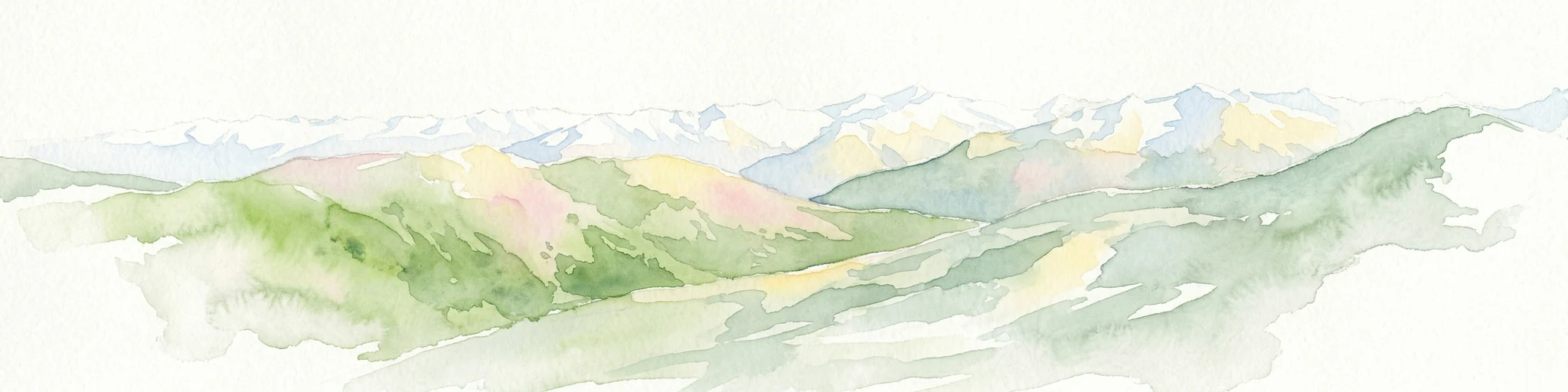
Watercolor painting showing mountain ranges with green, yellow, and pink hues, depicting layered peaks and cloud formations
National parkAustria
Mapped location lies within the park boundary#1 closest

Northeast

Hohe Tauern National Park: Alpine Geography and Protected Landscape Atlas

High-altitude mountain terrain and glacial systems in Austria

Hohe Tauern serves as a primary protected area within the Austrian Alps, showcasing a vast sequence of glacial valleys, sharp mountain massifs, and high-alpine tundra. This exploration details the park's physical boundaries and its significance in preserving diverse ecological gradients and wilderness core zones across the Central Eastern Alps.

Area
1,806 km²
Established
1981
IUCN
II
Relief
Mountain
A watercolor painting showing a wide, panoramic view of rolling, grassy mountain slopes with soft pastel colors and small evergreen trees.
Protected landscapeCarinthia
About 27 km away#2 closest

East

Nock Mountains National Park: Mapping the Rounded Alpine Summits and Glacial Terrain of Carinthia

A protected alpine landscape and UNESCO Biosphere Reserve in the Austrian Alps

Discover the geographic character of Nock Mountains National Park, where the Gurktal Alps transition into sweeping, grass-covered dome summits. This protected area offers a look at a unique Tertiary land surface that survived the last Ice Age, supporting a mosaic of larch forests, alpine pastures, and high-altitude lakes that define the regional geography of southern Austria.

Area
184 km²
Established
1987
IUCN
V
Relief
Mountain
Watercolor illustration showing mountain ranges, forests, and a river under a light sky.
National parkBavaria
28 km away#3 closest

North

Berchtesgaden National Park: Protected Landscape and Regional Geographic Context in Bavaria

Mapped natural terrain and protected area exploration.

Berchtesgaden National Park represents a crucial protected landscape situated in Bavaria, Germany. This entry provides detailed information focused on its protected area status, unique geographic setting, and mapped natural terrain. It serves as a gateway to understanding the park's specific identity within the regional atlas of Germany, offering insights into its boundaries and its significance as a curated natural landscape for discovery.

Area
210 km²
Established
1978
IUCN
II
Relief
Mountain
A pale, minimalist watercolor illustration of layered mountain silhouettes in the background and a green, forested foreground.
Nature reserveTyrol
About 35 km away#4 closest

Northwest

Kaiser Mountains Nature Reserve: Alpine Limestone Landscapes and Regional Geography in Tyrol

A comprehensive look at the Wilder Kaiser and Zahmer Kaiser ridges

The Kaiser Mountains stand as a monumental feature within the Northern Limestone Alps. This nature reserve offers a unique geographic profile, from sheer, pale Wetterstein limestone walls to broad alpine pastures and pine-covered ridges. Its radial drainage patterns and self-contained massif structure provide an essential case study for understanding the diverse mountain terrain that defines the heart of the Austrian Tyrol.

Area
102 km²
Established
1963
Relief
Mountain
Climate
Alpine
Nature reserveGermany
About 52 km away#5 closest

North

Naturwald Kraxenbach: Protected Montane Forest and Alpine Landscape Geography in Bavaria

A comprehensive look at a protected Bavarian mountain reserve

Naturwald Kraxenbach offers a deep dive into the montane ecosystems of the German-Austrian border. This nature reserve protects over 200-year-old forest stands and distinct holly habitats within the steep valleys of the Chiemgauer Alps, providing an essential study of natural forest development in a historical forestry region.

Area
18.01 km²
Established
2020
Relief
Mountain
Climate
Alpine
Watercolor illustration of a river flowing through a forested valley with mountains in the background
National parkSlovenia
61 km away#6 closest

Southeast

Triglav National Park: A Mapped Alpine Protected Landscape in Slovenia

Julian Alps geography, glacial lakes, and karst terrain.

Triglav National Park is Slovenia's premier protected area, covering 880 square kilometers of the Julian Alps. This page details its dramatic alpine geography, including Mount Triglav, glacial valleys, and significant karst features. Understand the mapped boundaries and landscape context of this national park, a key entry in the MoriAtlas geographic discovery resource for understanding protected lands.

Area
880 km²
Established
1981
IUCN
II
Visitors
1.6M annual
Watercolor illustration showing a mountainous landscape with a waterfall, green hills, and layered colors
National parkProvince of Belluno
64 km away#7 closest

Southwest

Dolomiti Bellunesi National Park: National Park, Province of Belluno Protected Landscape

Explore mapped boundaries and regional geography

This entry details Dolomiti Bellunesi National Park, a distinct national park situated within the Province of Belluno. It provides essential geographic context and protected landscape information, enabling users to understand the park's boundaries and its role within the regional terrain. Dive into the mapped features and discover the atlas-driven details of this significant Italian protected area.

Area
32 km²
Established
1988
IUCN
II
Relief
Mountain
A soft watercolor illustration showing a panoramic view of mountain ridgelines in muted green, blue, and faint pink tones against a white background.
Nature reserveSalzkammergut
About 66 km away#8 closest

Northeast

Loser Plateau Nature Reserve: Alpine Karst Geography in the Salzkammergut Mountain Range

Protected high alpine plateau and extensive karst systems

The Loser Plateau is a distinctive high-altitude nature reserve in the Salzkammergut region of Austria. This protected area features expansive limestone pavements, complex karst sinkholes, and massive mountain crags that dominate the skyline above Lake Altaussee. It provides a unique window into high alpine geology, showcasing fossil-rich layers and an intricate network of documented cave systems that rank among the most significant in the Eastern Alps.

Area
12 km²
Relief
Mountain
Climate
Alpine
Access
Easy access
MoriAtlas Explorer

Continue Exploring the Mapped Landscapes of Hohe Tauern National Park

Deepen your understanding of this significant protected area by examining its mountain geography, glacial features, and vertical terrain through the MoriAtlas mapping system. Gain a clearer perspective on how these protected boundaries define the natural character of the Austrian Alps.

Global natural geography