Mori Atlas logo
National parkHolosiiv National Nature Park

Detailed mapping and atlas exploration of a significant national park in Ukraine.

Holosiiv National Nature Park: Ukraine's Protected Landscape and Geographic Context

(Natsionalnyi pryrodnyi park "Holosiivskyi")

Holosiiv National Nature Park stands as a key protected area within Ukraine, offering a unique focus for geographic discovery and atlas-based exploration. This page serves as the authoritative entry point to understanding the park's designated boundaries, its natural landscape character, and its precise position within the broader geography of Ukraine. MoriAtlas provides structured insights to help users visualize and comprehend the park's mapped context and its role as a protected natural entity.

Urban forestNational parkKyivForest-steppe ecosystemWetlandsHistorical sites

Holosiiv National Nature Park

National park

Park overview

Structured park overview, official facts, and landscape profile for Holosiiv National Nature Park

Holosiiv National Nature Park park facts, protected area profile, and essential visitor context
Review the core facts for Holosiiv National Nature Park, including designation, size, terrain, visitor scale, habitats, and operating context in one park-focused overview.

About Holosiiv National Nature Park

Holosiiv National Nature Park represents a unique conservation achievement in Ukraine, protecting a substantial forest ecosystem that has persisted within the expanding boundaries of Kyiv for centuries. The park consists of several spatially disconnected forest tracts located in the Holosiivskyi District of the city, surrounded by urban neighborhoods including Demiivka, Teremky, Feofaniia, and Pyrohiv. The area was historically associated with the Kyiv Pechersk Lavra, with the name Holosiiv appearing in records as early as 1541. The forest was significantly shaped in the early 17th century when Peter Mohyla, founder of the Holosiivskyi skit, ordered tree planting on previously treeless land. The park was formally established in 2007 under President Viktor Yushchenko and expanded in 2014 to include additional forest areas from the Sviatoshyn Forest Park Farm, bringing the total protected area to encompass significant tracts of Kyiv's remaining forested land.

Quick facts and research context for Holosiiv National Nature Park

Holosiiv National Nature Park covers 4,525.52 hectares in southern Kyiv, with forest occupying over 90 percent of the territory. The park is managed by Ukraine's Ministry of Ecology and Natural Resources and holds IUCN Category II protection status. It contains 650 species of vascular plants, 181 vertebrate species, and significant populations of protected species including 35 species listed in Ukraine's Red Book. The area has historical significance dating to 1541 and contains monasteries, the Main Astronomical Observatory, and fragments of the Kyiv Fortified Area from the 1920s-1930s.

Park context

Deeper park guide and search-rich context for Holosiiv National Nature Park

Holosiiv National Nature Park history, landscape, wildlife, and travel context
Explore Holosiiv National Nature Park through its history, landscape character, ecosystems, wildlife, conservation priorities, cultural context, and seasonal travel timing in a structured park guide built for atlas discovery and search intent.

Why Holosiiv National Nature Park stands out

Holosiiv National Nature Park is best known as an extensive forest preserve embedded within a major urban environment, providing Kyiv residents with access to natural ecosystems within city limits. The park is distinguished by its concentration of protected species, with notable populations of European green lizard, greater spotted eagle, white-backed woodpecker, and multiple bat species. The park contains historically significant sites including the Holy Trinity Monastery, Holy Protection Monastery, and the 19th-century Main Astronomical Observatory of the National Academy of Sciences of Ukraine.

Holosiiv National Nature Park history and protected-area timeline

The history of Holosiiv National Nature Park traces to the early 16th century when the area was described as a picturesque and cozy landscape. The name's origin is debated, with some sources connecting it to tree planting in the early 17th century while others note more ancient references to forested land and the farm Hulasiyivskyy. The area became associated with the Kyiv Pechersk Lavra in 1541, and by 1617 a khutir (farmstead) named Holosiiv existed there. Following Soviet-era religious persecutions, monastic lands were repurposed for the local agrarian institute, which became part of the Kyiv Polytechnic Institute and later evolved into the National University of Life and Environmental Sciences of Ukraine. During the 1950s-1960s, portions of the Holosiiv Woods were developed for the Expocenter of Ukraine and Rylskyi Holosiiv City Park. The park was officially created on August 27, 2007, through Decree No. 794 signed by President Viktor Yushchenko. On May 1, 2014, the park's borders were expanded to incorporate 6,462.62 hectares of forests from the Sviatoshyn Forest Park Farm.

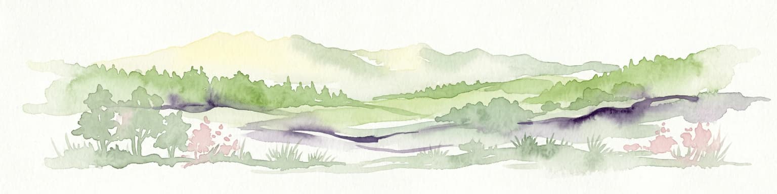
Holosiiv National Nature Park landscape and geographic character

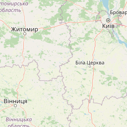
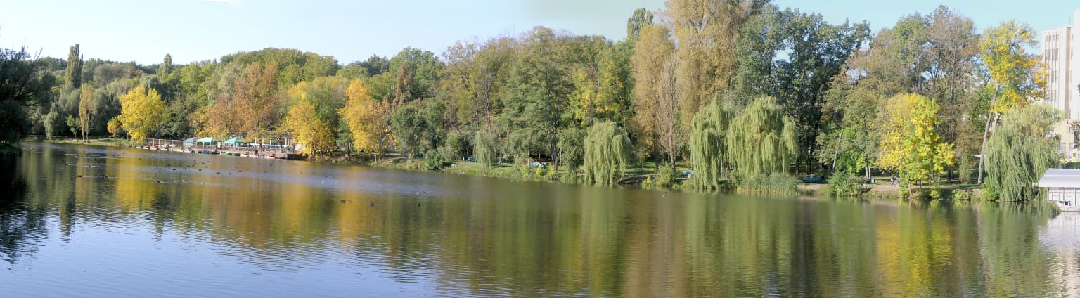
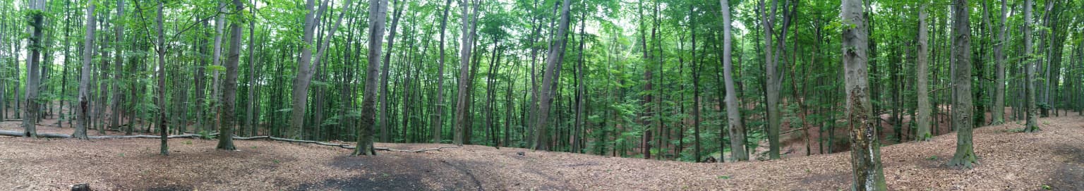
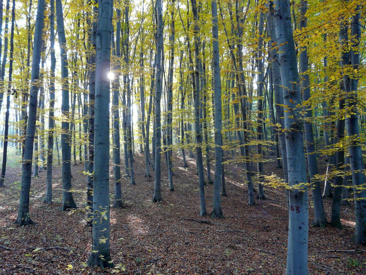
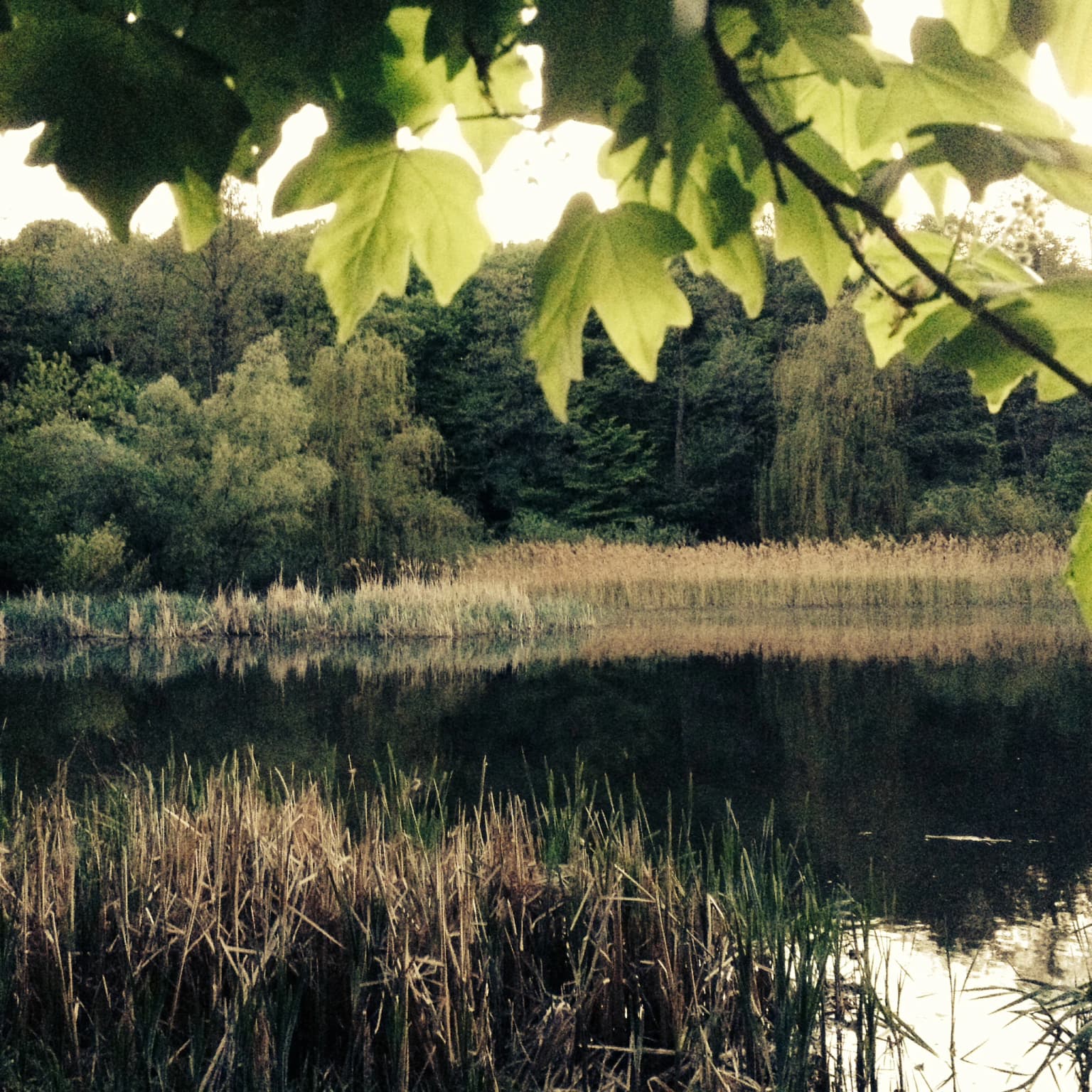
The landscape of Holosiiv National Nature Park is defined by its position on the Kyiv Hills, a series of elevated terrain formations that rise above the surrounding Dnieper River lowlands. The park encompasses multiple disconnected forest tracts covering more than 90 percent of its 4,525-hectare territory, representing one of the largest remaining forest areas within Kyiv's city limits. The terrain includes gentle slopes, valleys, and ridgelines characteristic of the lowland hill system. Wetlands cover approximately 66 hectares while open water bodies account for nearly 46 hectares, including the Orikhuvatskyi, Kytaivskyi, and Didorivskyi ponds that create colorful cascades through the forest. The park is traversed by watercourses including the Didorivsky and Kytaivsky streams, with the Didorivsky watercourse near the Mytkin pound containing a holy bathing house visited by religious pilgrims.

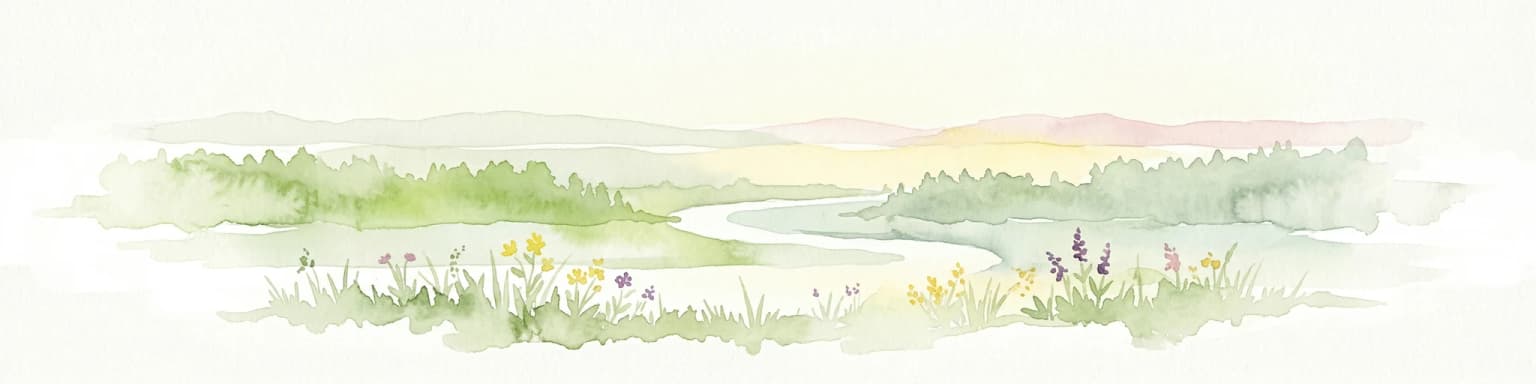
Holosiiv National Nature Park ecosystems, habitats, and plant life

The ecological character of Holosiiv National Nature Park reflects its position at the junction of two major European ecoregions: the Central European mixed forests to the west and the East European forest steppe to the east. This transitional position creates diverse habitat conditions supporting rich biodiversity. The park's forest ecosystem is complemented by wetland areas and pond systems that add ecological variety. The humid continental climate with warm summers (Köppen Dfb) supports extensive deciduous and mixed forest vegetation. The flora includes 650 species of vascular plants, 118 species of moss, and more than 60 species of fungi, with numerous species holding protected status under national and international conventions.

Holosiiv National Nature Park wildlife and species highlights

The wildlife communities of Holosiiv National Nature Park are remarkably diverse for an urban-proximate protected area. The park supports 181 vertebrate species including 100 bird species, 44 mammal species, 21 fish species, 10 amphibian species, and 6 reptile species. Invertebrate diversity is equally impressive with 190 insect species and 31 terrestrial mollusc species documented. The park provides critical habitat for numerous protected species including the European green lizard, smooth snake, short-toed snake eagle, greater spotted eagle, stock dove, white-backed woodpecker, and multiple bat species including the common pipistrelle, soprano pipistrelle, and Daubenton's bat. Among the notable invertebrates are the stag beetle, musk beetle, swallowtail butterfly, and clouded Apollo, all protected under Ukrainian and international conservation frameworks.

Holosiiv National Nature Park conservation status and protection priorities

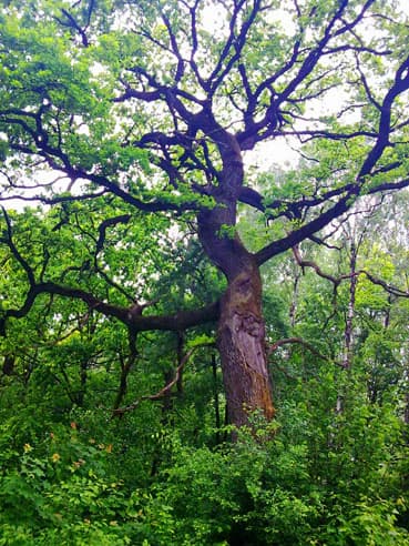
Holosiiv National Nature Park holds significant conservation importance at both national and international levels. The park protects 35 species listed in Ukraine's Red Book, including 20 vertebrate and 15 invertebrate species. International protection extends to 9 species on the IUCN Red List, 93 species in Annex II of the Berne Convention, 11 species under CITES, and 46 species in various Bonn Convention agreements protecting migratory species. Five vascular plant species are listed in Annex I of the Berne Convention, and one plant species appears on the European Regional Red List. The park's biodiversity significance is further underscored by 29 regionally rare plant species and the presence of age-old oak trees including the oak of Peter Mohyla and oaks of glory that represent centuries of forest continuity.

Holosiiv National Nature Park cultural meaning and human context

The cultural landscape of Holosiiv National Nature Park reflects centuries of human interaction with the forest environment. The area contains important religious heritage sites including the Holy Trinity Monastery (Kytaivska desert with ancient caves) dating to the 18th and 20th centuries, and the Holy Protection Monastery (Deserts Holosiivska) founded in the 17th century and rebuilt in the late 20th and early 21st centuries. The southwestern portion of the park developed into the Feofaniia neighborhood, historically a settlement of the St. Michael Kyiv Monastery. Scientific heritage is represented by the Main Astronomical Observatory of the National Academy of Sciences of Ukraine, with buildings constructed between 1841-1845, and the agricultural academy complex built in 1925-1931 that now houses the National University of Life and Environmental Sciences of Ukraine. The park also contains remnants of the Kyiv Fortified Area, a massive 85-kilometer fortification system built during 1929-1935, with seven pillboxes located within the park boundaries.

Top sights and standout views in Holosiiv National Nature Park

Holosiiv National Nature Park combines urban accessibility with substantial ecological and cultural value. The park offers over 4,500 hectares of protected forest, making it one of the largest urban forest preserves in Europe. Visitors can explore historical monasteries, the 19th-century astronomical observatory, and remnants of 20th-century fortifications alongside natural ecosystems. The park's biodiversity is exceptional, with documented populations of 35 Red Book species and numerous internationally protected animals including raptors, woodpeckers, and bats. The ancient oak trees, including the oak of Peter Mohyla, represent living monuments to the forest's historical continuity.

Best time to visit Holosiiv National Nature Park

The best time to visit Holosiiv National Nature Park spans from late spring through early autumn when the forest is most accessible and visually appealing. The park can be visited year-round, though winter months offer a different experience with snow-covered landscapes and fewer visitors. Summer provides lush green foliage and warm conditions suitable for walking the ecological trails, while autumn brings colorful foliage and mushroom season. The humid continental climate means summers are warm with comfortable temperatures for outdoor exploration, while winters are cold with snow cover typical from December through February.

Park location guide

Geography guide, regional context, and park location map for Holosiiv National Nature Park

Holosiiv National Nature Park park geography, regions, and map view in Ukraine
Understand where Holosiiv National Nature Park sits in Ukraine through a broader geographic reading of the surrounding landscape, nearby location context, and its mapped position within the national park landscape.

How Holosiiv National Nature Park fits into Ukraine

Ukraine is a sovereign nation in Eastern Europe, bordered by Russia, Belarus, Poland, Slovakia, Hungary, Romania, Moldova, and the Black Sea. It is the second-largest country in Europe by area. Kyiv is the capital and largest city, followed by Kharkiv, Odesa, and Dnipro. The official language is Ukrainian. Ukraine has a population of approximately 32.9 million and operates as a unitary semi-presidential republic.

Wider geography shaping Holosiiv National Nature Park in Ukraine

Ukraine occupies 603,628 km² in Eastern Europe, making it the second-largest country in Europe. It shares borders with Russia, Belarus, Poland, Slovakia, Hungary, Romania, and Moldova. The country has a southern coastline along the Black Sea and Sea of Azov. The terrain includes plains, steppes, and the Carpathian Mountains in the west.

Map view of Holosiiv National Nature Park

Use this park location map to pinpoint Holosiiv National Nature Park in Ukraine, understand its exact geographic position, and read its mapped placement within the surrounding landscape more clearly.

Pigeon | © OpenStreetMap contributors

Location context for Holosiiv National Nature Park

Holosiivskyi DistrictKyiv
Park atlas

Trace the Geographic Spread of Ukraine's Protected Areas and Compare Nearby Forest Ecosystems

Explore National Parks Near Holosiiv National Nature Park, Ukraine: Discover Related Protected Landscapes
After exploring Holosiiv National Nature Park's urban forest and wetlands, continue your atlas discovery by browsing other national parks and protected areas across Ukraine. Compare diverse protected landscapes, including forest-steppe regions and critical ecological interfaces, to understand the broader conservation geography of Eastern Europe.
Watercolor illustration of a river landscape with green hills, reeds, and water lilies
National park

Zalissia National Nature Park: Protected Forest Atlas and Regional Geography

Mapping Ukraine's temperate hardwood and pine forest ecosystems.

Delve into Zalissia National Nature Park, a significant protected landscape in Ukraine renowned for its vast temperate hardwood forests and ancient pine stands. This atlas entry details the park's mapped boundaries, its position within the Desna River floodplain, and the unique geographic context of its forest ecosystems. Understanding Zalissia National Nature Park offers insight into the conservation of northern Ukraine's natural heritage and its place in the broader regional geography.

Area
148 km²
Established
2009
IUCN
II
Relief
Lowland
National parkKyiv Oblast

Bile Ozero National Nature Park: Detailed National Park Atlas and Geography

Explore protected landscape boundaries in Kyiv Oblast.

Delve into Bile Ozero National Nature Park, a prominent national park situated in Kyiv Oblast, Ukraine. This entry provides a focused atlas-style exploration of the park's protected area status and its precise geographic positioning. Understand the mapped contours of this natural landscape and its regional context, essential for comprehensive geographic discovery on MoriAtlas.

Area
70.14 km²
Established
2009
IUCN
II
Scope
Terrestrial
National parkUkraine

Ichnia National Nature Park: A Protected Landscape with Geographic Identity in Ukraine

Explore the mapped boundaries and regional natural context of this national park.

Ichnia National Nature Park represents a significant protected landscape within Ukraine, providing users with a focused entry point for geographic discovery. This page details its designation as a national park, highlighting its mapped features and regional setting. It serves as a foundational resource for understanding the park's specific landscape character and its contribution to the broader atlas of Ukraine's protected natural areas, offering detailed geographic context for further exploration.

Area
97 km²
Established
2004
IUCN
II
Relief
Lowland
National parkPoltava Oblast

Pyriatyn National Nature Park: Detailed Atlas View of Ukrainian River Valley Protected Landscapes

Explore Poltava Oblast's unique wetland and floodplain ecosystems.

Pyriatyn National Nature Park provides an exceptional case study of a complete river valley ecosystem within Ukraine's Poltava Oblast. This protected area showcases a distinct topographic sequence, transitioning from upland terraces to extensive floodplain wetlands and the meandering Udai River. Discover the park's significant role in conserving boreal plant species at their southern range limits and its importance as a mapped natural landscape for geographic atlas exploration.

Area
120 km²
Established
2009
IUCN
II
Relief
Lowland
National parkChernihiv Oblast

Mezyn National Nature Park: Protected Area with Paleolithic Heritage in Chernihiv Oblast

Explore ancient forests, river wetlands, and prehistoric landscapes.

Mezyn National Nature Park in Chernihiv Oblast, Ukraine, represents a significant protected area where natural landscapes meet profound archaeological discoveries. This national park encompasses diverse terrain, from the expansive Desna River floodplain dotted with oxbow lakes to ancient oak forests and rolling upland areas shaped by glacial activity. It is particularly noted for the Mezyn Paleolithic site, offering insights into Ice Age human life with remarkable artifacts and bone dwellings, making it a unique destination for atlas-driven discovery of protected lands and prehistoric geography.

Area
310 km²
Established
2004
IUCN
II
Relief
Lowland
Watercolor depiction of a river flowing through wetlands with green vegetation, trees, and distant hills under a soft sky
National parkPoltava Oblast

Lower Sula National Nature Park: Protected Wetlands and River Floodplain Atlas Explorer

Mapped boundaries and geography of this Ukrainian national park.

Discover the detailed geography and protected landscape features of Lower Sula National Nature Park, located in Poltava Oblast, Ukraine. This page provides an atlas-level view of its critical wetland habitats, including marshes and shallow lakes, which are vital for waterfowl and fish spawning. Explore the park's unique position within the Sula River floodplain and its ecological significance as a national nature park, offering rich context for geographic study.

Area
186 km²
Established
2010
IUCN
II
Relief
Lowland
National parkMykolaiv Oblast

Bug Gard National Nature Park: Mapped Protected Landscape in Mykolaiv Oblast

Explore National Park Geography and Boundaries

Delve into Bug Gard National Nature Park, a designated national park situated in Mykolaiv Oblast, Ukraine. This detailed view highlights the park's protected landscape, offering insights into its geographic distribution and mapped boundaries. Understand its place within the regional terrain and access structured information for atlas-based exploration of this significant natural area.

Area
61.38 km²
Established
2009
IUCN
II
Relief
Mixed relief
Watercolor painting showing a lake surrounded by trees with distant hills under a colorful sky
National parkUkraine

Lower Polissia National Nature Park: Ukraine's Mapped Protected Wetland Landscape

National Park in Ukraine's Polissia region.

The Lower Polissia National Nature Park is a crucial protected area covering 8,762 hectares in western Ukraine. This park offers a detailed geographic profile, showcasing its extensive wetland habitats, forest complexes, and the Horyn, Viliia, and Hnylyi Rih river valleys. As a key component of the Polissia landscape zone, the park provides essential context for understanding the protected natural terrain and regional ecology of Eastern Europe through structured map exploration.

Area
87.62 km²
Established
2013
IUCN
II
Relief
Lowland

Common questions about visiting, size, designation, and location context for Holosiiv National Nature Park

Holosiiv National Nature Park FAQs for park facts, access, geography, and protected area context
Find quick answers about Holosiiv National Nature Park, including protected-area facts, park geography, trail and visitor context, and how the park fits into its surrounding country and regional landscape.
MoriAtlas Explorer

Continue Your Protected Areas Search Across the Global Atlas

Deepen your exploration by continuing the structured search for national parks and protected areas worldwide. Utilize the comprehensive filtering capabilities to compare different conservation landscapes and refine your understanding of global park geography. Discover more about the distribution and characteristics of protected natural areas.

Global natural geography