Mori Atlas logo
Nature reserveIle aux Aigrettes

Discover the unique coral limestone geography and dry forest ecosystems of this vital islet

Ile aux Aigrettes Nature Reserve: A Rare Coastal Protected Landscape in Mauritius

Ile aux Aigrettes serves as a crucial nature reserve located in the Grand Port bay of Mauritius, standing out as a low-lying coral limestone islet distinct from the volcanic mainland. This protected landscape preserves the last remaining fragment of native dry coastal forest, providing a sanctuary for endemic flora and fauna that have disappeared elsewhere. Through its ongoing restoration work and ecological rewilding, the islet functions as a significant site for understanding island conservation and the resilience of fragile maritime environments.

islandcoral isletdry coastal forestendemic floraendemic wildlifenature reserve

Ile aux Aigrettes

Nature reserve

Park overview

Structured park overview, official facts, and landscape profile for Île aux Aigrettes

Île aux Aigrettes park facts, protected area profile, and essential visitor context

Review the core facts for Île aux Aigrettes, including designation, size, terrain, visitor scale, habitats, and operating context in one park-focused overview.

About Île aux Aigrettes

Île aux Aigrettes occupies a special place among Mauritius's protected natural sites, despite being far smaller in scale than the country's more famous landscapes. Sitting just offshore from the south-east coast in the sheltered waters of Grand Port bay, the islet is close enough to be easily reached from the town of Mahebourg yet ecologically distinct from the mainland. Where Mauritius's interior is dominated by volcanic peaks, sugarcane lands, and rugged coastline shaped by basaltic rock, Île aux Aigrettes is a low, flat coral-limestone platform rising only slightly above the lagoon.

Ecologically, the islet's importance is enormous relative to its size. It holds the only large surviving remnant of Mauritius Dry Coastal Forest, an ecosystem historically shaped by strong winds, salt spray, seasonal drought, and shallow soils over coral rock. Before human settlement and the spread of invasive species, this dry coastal forest would have been a common fringe community along much of Mauritius's coastline. Today, after centuries of clearing, logging, and the introduction of pigs, monkeys and competing plants, almost all of that habitat has been lost from the mainland. The forests of Île aux Aigrettes therefore offer a rare reference point for understanding what Mauritius's coastal vegetation once looked like and what might be restored on a larger scale.

The reserve is also unusual for combining active scientific research, species reintroductions, and public visitation on a single small site. Guided walks introduce visitors to rare native plants, reintroduced birds such as the pink pigeon and Mauritius fody, brightly coloured day geckos, and the giant Aldabra tortoises that now serve as the island's principal ecosystem engineers. For conservation biologists working in the Indian Ocean islands, the islet has become both a model and a cautionary example: a place demonstrating how a critically reduced ecosystem can be managed, but also a reminder of how much has already been lost.

Quick facts and research context for Île aux Aigrettes

Île aux Aigrettes is a low-lying coral islet of roughly 27 hectares situated about 850 metres off the south-east coast of Mauritius, opposite the town of Mahebourg. Unlike the basaltic mainland, the islet is formed from raised coral-limestone, a geology that supports its distinctive dry coastal forest ecosystem.

Declared a nature reserve in 1965, the islet conserves the last remaining fragment of Mauritius Dry Coastal Forest, a vegetation type that once covered much greater areas of the region before habitat loss and invasive species. The reserve functions simultaneously as a protected ecosystem, a base for ecological research, and a visitor site for both tourists and Mauritian school and community groups.

Protection and recognition

Explore documented protection status and conservation management scope for Ile aux Aigrettes.

Ile aux Aigrettes Protection Status and Terrestrial Conservation Records

Conservation records for Ile aux Aigrettes detail terrestrial protection parameters and documented management scope without external designations. Structured parameters outline the verified protection standing and administrative framework governing the territory.

Protection details

Protection scope
Terrestrial
Transboundary protection
No
Park context

Deeper park guide and search-rich context for Île aux Aigrettes

Île aux Aigrettes history, landscape, wildlife, and travel context

Explore Île aux Aigrettes through its history, landscape character, ecosystems, wildlife, conservation priorities, cultural context, and seasonal travel timing in a structured park guide built for atlas discovery and search intent.

Why Île aux Aigrettes stands out

Île aux Aigrettes is best known as the home of the last surviving fragment of Mauritius Dry Coastal Forest, a habitat type that has otherwise been lost from the main island. This dense concentration of rare endemic flora and fauna, including reptiles, endemic birds and native ebony trees, has given the islet an outsized ecological significance compared with its small physical size. It is also recognised for its restoration initiatives, particularly the use of introduced Aldabra giant tortoises to mimic the ecological function of the extinct Mauritian giant tortoises. These tortoises help regenerate the forest by browsing vegetation and dispersing seeds, an unusual and highly visible example of rewilding on a tiny island.
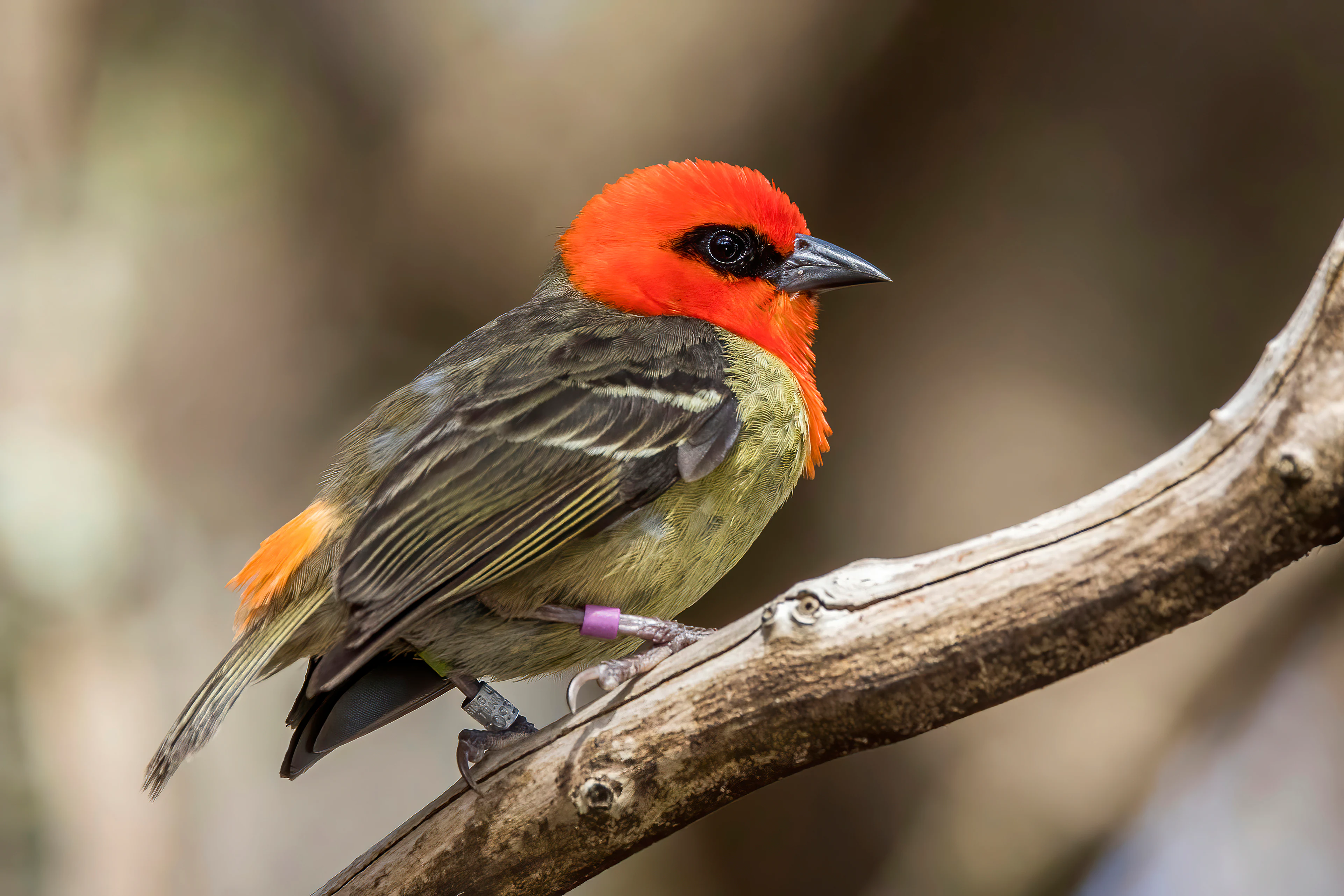
A male Mauritius fody with a bright red head, black eye mask, and olive-brown wings, perched on a rough wooden branch with a small purple leg band visible.
A male Mauritius fody, an endangered species native to the island, perched on a branch at Ile aux Aigrettes.

Île aux Aigrettes history and protected-area timeline

For most of its pre-modern history, Île aux Aigrettes would have been covered in dry coastal forest, much like neighbouring stretches of the Mauritian coast. With the arrival of European colonists and the intense transformation of Mauritius's landscape, the islet followed the wider pattern of ecological decline: indigenous vegetation was logged, and invasive animals and plants drastically altered the ecosystem. Several native species that once lived on or around the islet disappeared entirely; among the most notable losses were the dodo and the Mauritian giant tortoises of the genus Cylindraspis, both of which were extinct by the late 17th and 18th centuries.

By the 20th century, the islet had become a refuge for a shrinking population of native species clinging to survival. Recognising its conservation value, in 1965 the island was declared a nature reserve, giving it formal protection at a time when many of Mauritius's native habitats were continuing to disappear on the mainland. Decades of restoration work followed, focusing on re-establishing the native flora, removing invasive species, and rebuilding ecological functions that had been lost.

A distinctive recent chapter in the islet's history has been the reintroduction of Aldabra giant tortoises from the Seychelles, brought in to recapture the grazing and seed-dispersing role once played by Mauritian giant tortoises. Over time, this experiment has become one of the most visible rewilding efforts in the western Indian Ocean, illustrating how a single reserve can be shaped by deep human history while still acting as a forward-looking conservation laboratory.

Île aux Aigrettes landscape and geographic character

Île aux Aigrettes is a flat, low-lying islet shaped by the coastal geology of south-east Mauritius. Unlike most of the Mauritian mainland, which is built from volcanic basalt and rises into mountainous central uplands, the islet's bedrock is raised coral-limestone, giving it a pale, rocky character and relatively uniform elevation. The result is a coastal environment shaped by shallow soils, salt-influenced air, and frequent exposure to tropical sun.

Within this setting, the dominant landscape feature is the dry coastal forest itself. Rather than lush rainforest, the vegetation is composed of low, wind-shaped trees with small or tough leaves, open patches, and a partly open canopy that allows light to reach the ground. Native species such as ebony and Bois boeuf contribute to a canopy that feels distinct from the wetter forests found inland on Mauritius.

Around the islet, the turquoise waters of the Grand Port bay and the sight of the Mauritian coastline barely a kilometre away provide a strong maritime setting that frames every visit. Visitors approaching by boat cross a shallow lagoon before stepping onto the low shoreline, an experience that reinforces the sense of Île aux Aigrettes as a small, exposed outpost rather than a dense or towering landscape.
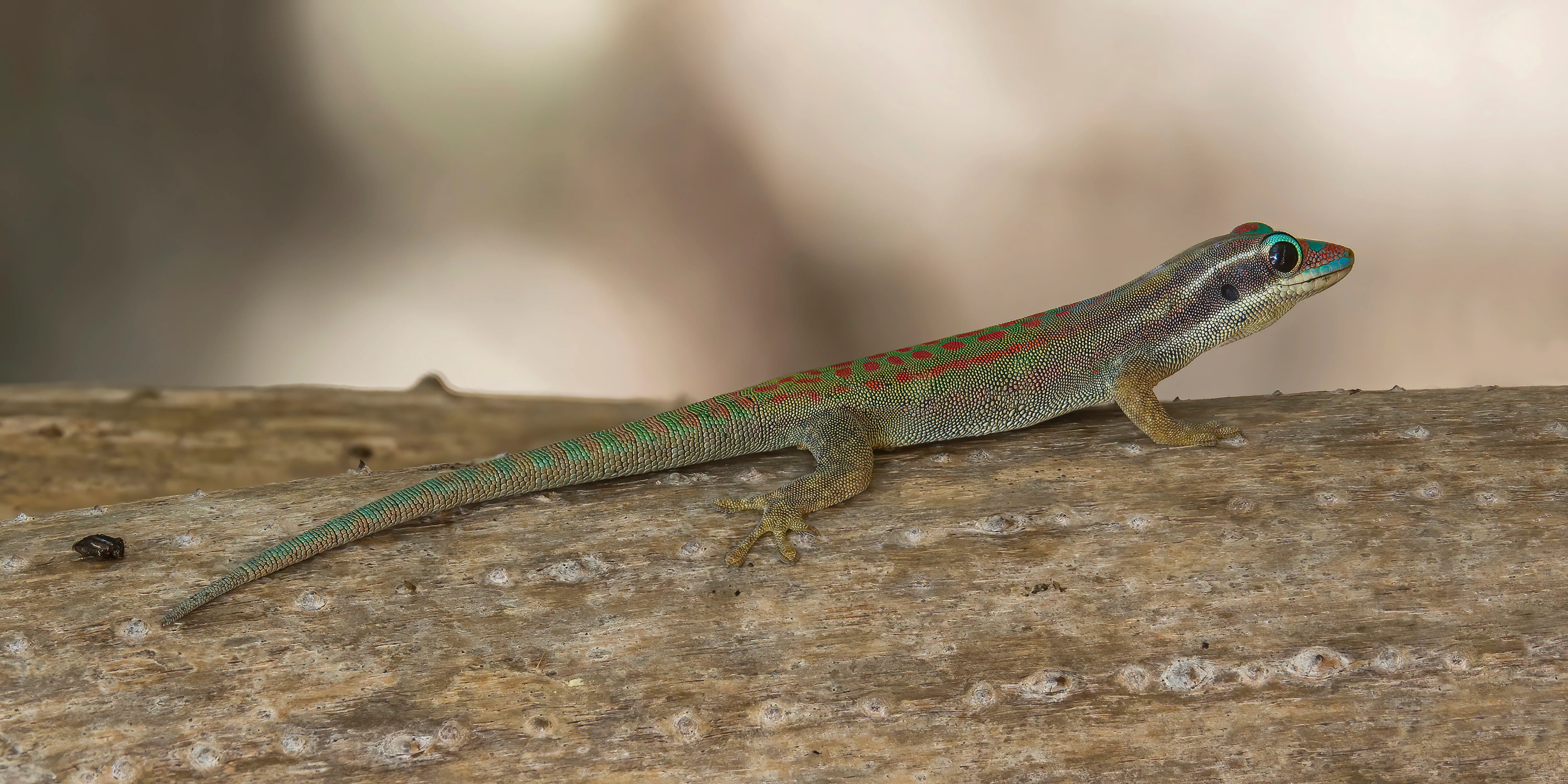
A small lizard, identified as a Mauritius ornate day gecko, resting on a brown wooden surface.
A Mauritius ornate day gecko perched on a textured tree branch.

Île aux Aigrettes ecosystems, habitats, and plant life

The natural environment of Île aux Aigrettes is defined above all by its status as the last refuge of the Mauritius Dry Coastal Forest ecosystem. This habitat is closely tied to the island's coral-limestone substrate, salt-laden coastal winds, and a rainfall pattern that dries out for significant parts of the year. Where Mauritius's inland forests are typically taller, denser, and more humid, the dry coastal forest is open, tough, and shaped by stress rather than abundance.

Native plant communities on the islet include ebony species such as Diospyros egrettarum, which is named after the islet itself and remains locally plentiful there. Other native canopy species, including Bois boeuf, help build the continuous forest cover that distinguishes this site from the surrounding sea. Underneath this canopy, a mix of native shrubs, herbs, and ground-layer plants completes an ecological community that combines drought tolerance with coastal exposure.

At a broader ecological level, the reserve has become a critical reservoir of indigenous biodiversity that has otherwise vanished from the Mauritian mainland. By stabilising populations of endemic plants and restoring ecological processes, the reserve supports species and interactions that would otherwise only exist in historical records.
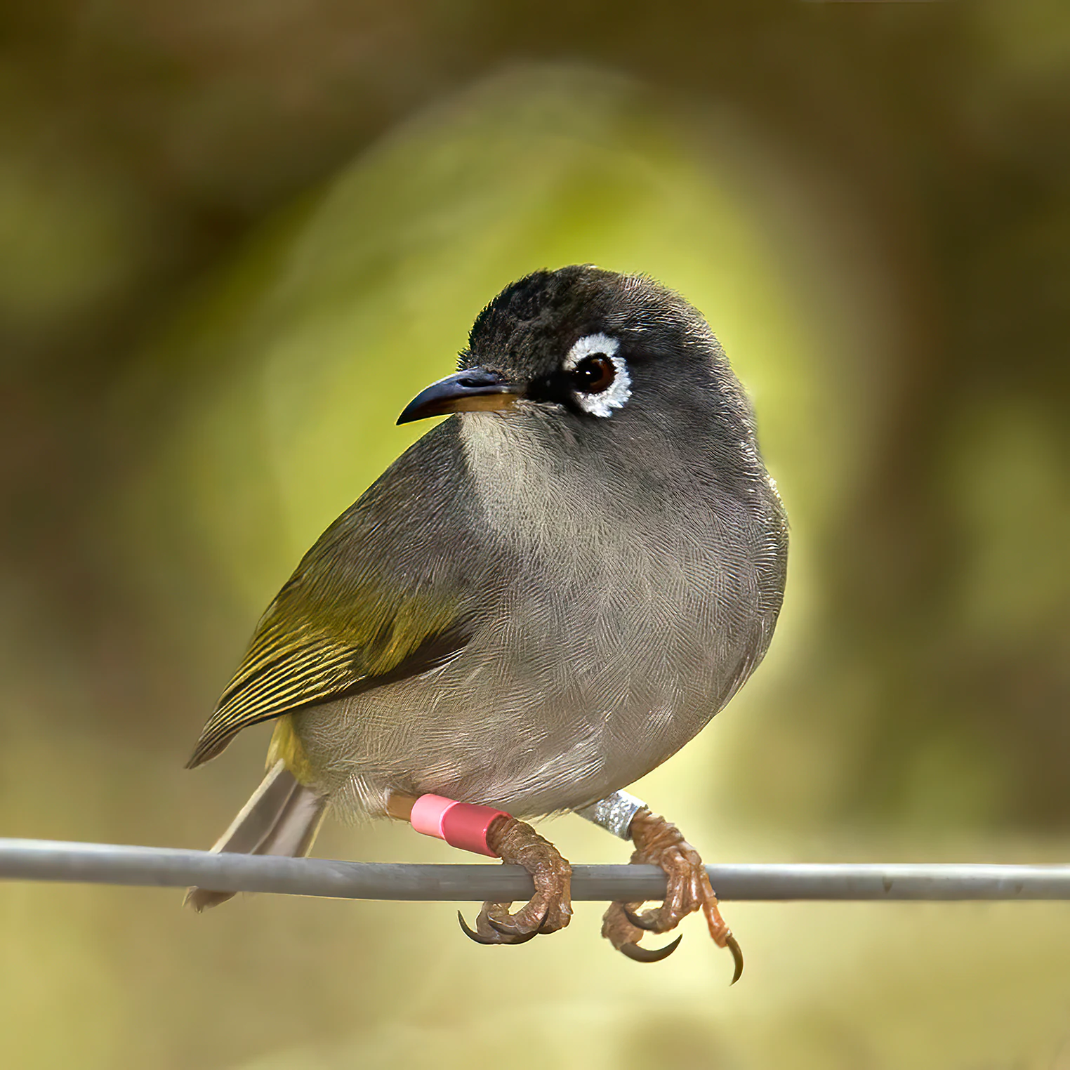
A Mauritius olive white-eye bird perched on a wire; the bird has olive-green wings, a gray head, and a distinctive white ring around its eye; it has two identification bands on its leg.
A Mauritius olive white-eye, an endemic species found on Ile aux Aigrettes.

Île aux Aigrettes wildlife and species highlights

Wildlife is at the heart of the Île aux Aigrettes experience. Because the surrounding mainland has lost much of its native fauna, the islet now hosts a dense concentration of rare endemic species that visitors would struggle to see anywhere else in Mauritius.

Among the most prominent animals are reptiles. Telfair's skink, a large and notably gentle lizard, is one of the islet's flagship species. Several strikingly coloured day gecko species add visible bursts of colour, including the Mauritius ornate day gecko. The reserve is also home to a population of Aldabra giant tortoises, originally from the Seychelles, which have been introduced to fill the ecological niche left vacant by the extinct Mauritian giant tortoises.

The birdlife is equally significant. Endemic species such as the Mauritius fody, the Mauritius olive white-eye, and the pink pigeon can be encountered on the islet, and their breeding populations form a key part of wider national conservation programmes for these birds.
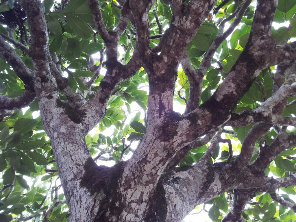
A low angle view looking up into the dense canopy of an endemic tree at Ile aux Aigrettes, showcasing its textured, mottled bark and spreading branches.
The canopy and textured trunk of an endemic tree species in Ile aux Aigrettes.

Île aux Aigrettes conservation status and protection priorities

Île aux Aigrettes is one of the most important conservation sites in Mauritius precisely because it concentrates a wide range of rare species and ecosystem functions on a very small area. Its 1965 designation as a nature reserve formalised protection for what was already recognised as the last substantial fragment of Mauritius Dry Coastal Forest, and decades of management have focused on halting further decline and rebuilding what had been lost.

Active conservation work on the islet includes invasive species control, propagation and replanting of native flora, and habitat management aimed at restoring the original structure of the dry coastal forest. Several animal species that disappeared from the islet but survived elsewhere in Mauritius have also been reintroduced, expanding the range of native wildlife supported by the reserve.

The introduction of Aldabra giant tortoises to take over the grazing and seed-dispersal role of the lost Mauritian giant tortoises is one of the most distinctive elements of the reserve's conservation strategy. By demonstrating that extinct ecological functions can sometimes be replaced using related species from elsewhere, the project has made the reserve a reference point for island restoration efforts across the Indian Ocean.

Île aux Aigrettes cultural meaning and human context

Although Île aux Aigrettes is primarily recognised for its natural values, the islet also carries layers of human history tied to the wider story of Mauritius. The transformation of the island's coastal forests, the loss of species such as the dodo, and the long decline of native ecosystems are all part of the broader colonial and post-colonial history of land use in the Mascarene archipelago, and they shape how Mauritians today relate to sites such as this.

The reserve has also become an important cultural and educational landmark. School groups, researchers, and visitors from across Mauritius and abroad use the islet as a place to engage with questions of extinction, restoration, and indigenous biodiversity. This role gives the site meaning beyond pure ecology, embedding it in national conversations about environmental heritage and the recovery of what has been lost.
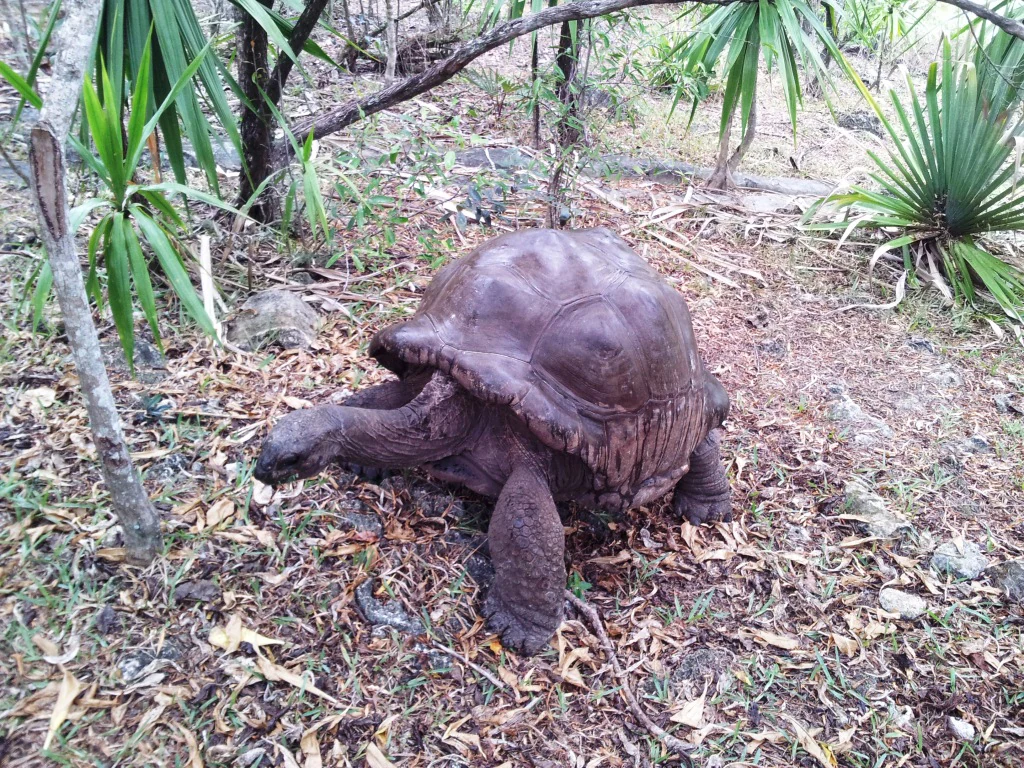
A large, dark-skinned Aldabra giant tortoise walks through a forest floor covered in dry leaves and surrounded by palm-like vegetation.
An Aldabra giant tortoise in its natural habitat on Ile aux Aigrettes.

Top sights and standout views in Île aux Aigrettes

The strongest attractions of Île aux Aigrettes are ecological rather than scenic in the conventional sense. Seeing Telfair's skink and brightly coloured day geckos, observing the rare endemic palms and ebony trees of the dry coastal forest, and watching the introduced Aldabra giant tortoises graze their way through native vegetation are key experiences that visitors remember.

Equally memorable is the contrast itself: a tiny low coral island in the lagoon, easily visible from the mainland, holding an entire ecosystem that has otherwise vanished from Mauritius. The combination of accessible location, visible restoration success, and dense endemism in a small area gives the islet a powerful sense of place.
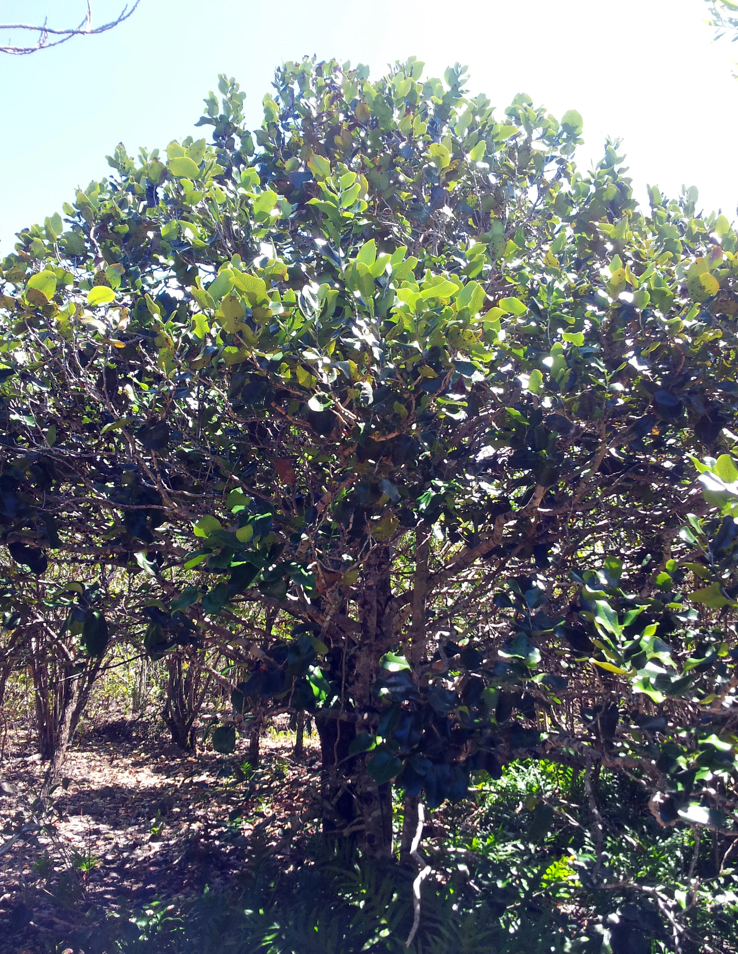
A medium-sized tree with dense, glossy green foliage and textured bark, standing in a forest clearing.
A Diospyros egrettarum tree, commonly known as bois d ebene, native to Ile aux Aigrettes.

Best time to visit Île aux Aigrettes

Île aux Aigrettes can be visited year-round, but the experience changes with the seasons. The cooler, drier months from roughly May to October generally offer the most comfortable conditions for walking the forest trails, with lower humidity, less rainfall, and less intense heat. Bird activity and reptile sightings tend to be reliable across this period, and sea conditions in Grand Port bay are typically calmer.

The warmer, wetter summer months from November to April bring higher temperatures, more rainfall, and a stronger chance of sudden tropical showers. Vegetation is at its lushest and most vigorous during this time, and breeding bird activity can be particularly visible. Visitors who prefer a more lush green landscape and don't mind the humidity may find this period rewarding, though boat crossings can occasionally be affected by rougher weather.
Monthly climate preview

Long-term temperature and precipitation cycles recorded at representative park coordinates

Ile aux Aigrettes Climate Normals and Monthly Weather Statistics

Historical averages for Ile aux Aigrettes document measured monthly temperature ranges between 21.89 and 27.06 degrees Celsius alongside varied precipitation patterns from 1991 to 2020. Comprehensive monthly breakdowns trace the complete annual climate rhythm across all twelve recorded intervals.
Annual mean25 °C
22 °C27 °C
Jan27°
Feb27°
Mar27°
Apr26°
May25°
Jun23°
Jul22°
Aug22°
Sep22°
Oct23°
Nov25°
Dec26°
Warmest month
February

27.1 °C

Coolest month
August

21.9 °C

Wettest month
February

4.2 mm/day

Driest month
July

1 mm/day

Park location guide

Geography guide, regional context, and park location map for Île aux Aigrettes

Île aux Aigrettes park geography, regions, and map view in Mauritius

Understand where Île aux Aigrettes sits in Mauritius through a broader geographic reading of the surrounding landscape, nearby location context, and its mapped position within the national park landscape.

How Île aux Aigrettes fits into Mauritius

Mauritius is an island nation in the Indian Ocean and part of the Mascarene Islands. The country gained independence from Britain in 1968 and became a republic in 1992. It is characterized by a diverse population of primarily Indian and Creole descent, with English and French as official languages and Mauritian Creole as the dominant spoken language.

Wider geography shaping Île aux Aigrettes in Mauritius

Mauritius is located in the Indian Ocean approximately 2,000 km east of Africa and east of Madagascar. The main island is volcanic in origin, and the country also includes the islands of Rodrigues, Agaléga, and St. Brandon (Cargados Carajos shoals). The territory is part of the Mascarene Islands, with nearby Réunion being a French overseas department.

Map view of Île aux Aigrettes

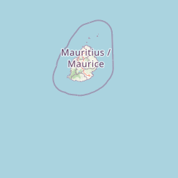
Use this park location map to pinpoint Île aux Aigrettes in Mauritius, understand its exact geographic position, and read its mapped placement within the surrounding landscape more clearly.

Pigeon | © OpenStreetMap contributors

Visual reference for dry coastal forest habitats and rare island wildlife

Ile aux Aigrettes Photos and Protected Landscape Scenery

Visual records reveal the coral limestone terrain, wind-shaped canopy, and rare endemic species defining the protected landscape of Ile aux Aigrettes. Examining these field photographs helps researchers and visitors understand the unique coastal ecology and restoration work preserved on the islet.

A male Mauritius fody with a bright red head, black eye mask, and olive-brown wings, perched on a rough wooden branch with a small purple leg band visible.

A side profile view of a pink pigeon with a light pinkish body, dark wings, and a red eye ring, perched on a metal structure against a blurred green background.

A small lizard, identified as a Mauritius ornate day gecko, resting on a brown wooden surface.

A Mauritius olive white-eye bird perched on a wire; the bird has olive-green wings, a gray head, and a distinctive white ring around its eye; it has two identification bands on its leg.

A low angle view looking up into the dense canopy of an endemic tree at Ile aux Aigrettes, showcasing its textured, mottled bark and spreading branches.

A low-lying tropical island covered in dense green vegetation sits in the middle of a turquoise ocean under a pale sky, with a small sailboat visible near the shore.

A large, dark-skinned Aldabra giant tortoise walks through a forest floor covered in dry leaves and surrounded by palm-like vegetation.

A medium-sized tree with dense, glossy green foliage and textured bark, standing in a forest clearing.

Park atlas

Compare surrounding coastal reserves and connected island landscapes across Mauritius

Explore Protected Areas and Parks Near Ile aux Aigrettes in Regional Context

Browse other protected areas and regional parks near Ile aux Aigrettes to examine broader ecological patterns across nearby coastal terrain. Comparing adjacent conservation zones provides deeper geographic context for island habitats and regional biodiversity spread.
A horizontal watercolor painting showing green coastal vegetation, a small waterway, and distant hills under a soft sky.
National parkMauritius
About 5.3 km away#1 closest

Northeast

Île aux Fouquets National Park: Coral Islet Geography and Lighthouse Heritage in Mauritius

Protected maritime landscape and offshore reef terrain

This compact coral island represents a critical piece of the national park system in Mauritius. Known for its distinct limestone geology and nineteenth-century lighthouse ruins, it provides a unique window into the maritime history and offshore reef ecosystems of the Indian Ocean, contrasting with the volcanic landforms of the mainland.

Area
0.025 km²
Established
2004
Relief
Lowland
Access
Remote access
Nature reserveGrand Port District
About 7 km away#2 closest

Northwest

Vallée de Ferney Nature Reserve: Protected Mountain Landscapes in the Grand Port District

Indigenous rainforest, volcanic terrain, and conservation refuge

Located in the Bambou mountains of southeastern Mauritius, Vallée de Ferney is a 200-hectare nature reserve known for its protected indigenous rainforest and ongoing rewilding projects. As a key conservation site in the Grand Port District, the reserve offers a look at rare endemic species and the unique moisture-loving vegetation of the island's eastern volcanic series. Explore the mapped boundaries and natural terrain of this significant protected landscape.

Area
2 km²
Established
2006
Relief
Mountain
Climate
Tropical
Nature reserveMauritius
About 24 km away#3 closest

West

Monvert Nature Park: Exploring Protected Indigenous Landscapes in Mauritius

Regenerated highland forest and endemic flora reserve

Located in the central highlands of Mauritius near Curepipe, Monvert Nature Park protects a significant portion of recovering indigenous woodland. The park functions as a major botanical conservation site, featuring an arboretum with over 150 endemic species and a network of nature trails that traverse its unique highland terrain. This reserve offers a grounded look at the island's botanical diversity and ongoing forest restoration efforts.

Relief
Upland
Climate
Subtropical
Access
Easy access
Scope
Terrestrial
Watercolor painting showing mountains in the distance, a body of water, and green vegetation in the foreground
National parkMauritius
About 27 km away#4 closest

West

Black River Gorges National Park: Key Protected Landscape and National Park in Mauritius

Explore mapped boundaries and endemic wildlife conservation in the southwest highlands.

Black River Gorges National Park is the largest protected area on Mauritius, critically preserving native rainforest and unique endemic species. This national park encompasses approximately 67.54 square kilometers, showcasing varied ecosystems from humid upland forests to marshy heathlands within its rugged highland terrain. The park's geography, characterized by deep gorges and steep slopes, provides essential habitats and plays a crucial role in the island's conservation efforts, making it a significant site for understanding Mauritius's natural heritage.

Area
67.54 km²
Established
1994
Relief
Upland
Climate
Tropical
Watercolor illustration of a forest scene with trees, ferns, and distant mountains
National parkMauritius
About 31 km away#5 closest

North

Bras d'Eau National Park: Mauritius National Park Protected Landscape Discovery

Explore coastal terrain, endemic species habitats, and wetland geography.

Bras d'Eau National Park, situated on Mauritius, offers an in-depth look at a protected coastal lowland landscape vital for conservation. This national park showcases remnant forest patches critical for endemic flora and fauna, complemented by a unique system of four mares, including the mangrove-rich Mare sarcelle. Its mapped geography provides context for island ecosystems and serves as a key location for understanding Mauritius's protected natural areas.

Area
4.97 km²
Established
2011
Relief
Lowland
Climate
Tropical
A minimalist watercolor painting showing green rolling hills and distant terrain on a white background.
Nature reserveMoka District
About 33 km away#6 closest

Northwest

Le Pouce Nature Reserve: Volcanic Geography and Protected Upland Habitat in Mauritius

A rugged basalt peak in the Moka District mountain range.

Le Pouce Nature Reserve guards a critical 0.69 square kilometer patch of upland forest on the slopes of the third highest mountain in Mauritius. This protected area is recognized for its dramatic volcanic terrain and as the rare surviving home for the critically endangered Le Pouce Mountain Screwpine, providing an essential window into the island's unique ecological and geological history within the Moka Range.

Area
0.69 km²
Established
1951
Relief
Mountain
Climate
Tropical
A soft watercolor painting of a rolling landscape with green trees and hills in the background on a white background.
Nature reserveChamarel
About 38 km away#7 closest

West

Ebony Forest Nature Reserve: A Detailed Atlas of Chamarel's Restored Protected Landscapes

Indigenous forest restoration in southwest Mauritius

Ebony Forest stands as a primary nature reserve in the Chamarel hills of Mauritius, where extensive restoration efforts have reclaimed native semi-dry forest and upland ecosystems. This site offers an essential look at the island's endemic biodiversity through its protected ebony stands and rehabilitated slopes, making it a key component of the broader southwestern Mauritian conservation network.

Established
2017
Relief
Upland
Climate
Tropical
Access
Easy access
A minimalist, flat vector illustration showing a colorful island scene with a waterfall, forest, and surrounding water.
Protected areaRivière du Rempart District
About 60 km away#8 closest

North

Île Plate: Protected Area Geography and Natural Features in Rivière du Rempart District

Island biodiversity and volcanic landscapes in northern Mauritius

Île Plate is a compact island covering approximately 2.5 square kilometres, notable for its basalt geology and status as a protected area. It anchors a wider system of islets, offering a rich study of indigenous vegetation, seabird habitats, and tangible maritime history in the Indian Ocean.

Area
2.53 km²
Relief
Lowland
Access
Moderate access
Scope
Mixed

Common questions about visiting, size, designation, and location context for Île aux Aigrettes

Île aux Aigrettes FAQs for park facts, access, geography, and protected area context

Find quick answers about Île aux Aigrettes, including protected-area facts, park geography, trail and visitor context, and how the park fits into its surrounding country and regional landscape.
MoriAtlas Explorer

Continue Your Protected Areas Search Across the Global Atlas

Deepen your exploration by continuing the structured search for national parks and protected areas worldwide. Utilize the comprehensive filtering capabilities to compare different conservation landscapes and refine your understanding of global park geography. Discover more about the distribution and characteristics of protected natural areas.

Global natural geography