Mori Atlas logo
Nature reserveIsla San Pedro Mártir

A remote and rocky island sanctuary within the productive Gulf of California waters

Isla San Pedro Mártir Nature Reserve: Geographic Profile and Protected Marine Landscape

Isla San Pedro Mártir sits as a rugged and isolated nature reserve in the central Gulf of California, serving as a critical sanctuary for seabird breeding colonies. Characterized by steep rocky cliffs and arid terrain, this island represents a significant protected landscape shaped by cold-water upwelling and deep-sea marine productivity. Gain insights into the unique geological structure and the surrounding maritime protected zones that define this essential ecological landmark off the coast of Sonora.

Gulf of California islanduninhabited islandseabird breeding colonyrocky islandarid islandSonoran Desert ecosystem

Isla San Pedro Mártir

Nature reserve

Park overview

Structured park overview, official facts, and landscape profile for Isla San Pedro Martir

Isla San Pedro Martir park facts, protected area profile, and essential visitor context

Review the core facts for Isla San Pedro Martir, including designation, size, terrain, visitor scale, habitats, and operating context in one park-focused overview.

About Isla San Pedro Martir

Isla San Pedro Martir occupies a distinctive position in the Gulf of California, sitting in the central waters of the sea roughly 50 km from both the Baja California peninsula and the Sonoran mainland. This deep central location makes it the most isolated island in the gulf, exposed on all sides to open sea rather than sheltered near-shore waters. The island itself is small, compact, and rocky, with steep shorelines that rise sharply from the sea and a terrain shaped by arid, exposed conditions typical of the Sonoran Desert region.

Although modest in size, the island plays an outsized ecological role in the Gulf of California system. The cold, upwelling-driven waters that surround it produce exceptionally high marine productivity, and the combination of vertical rocky cliffs, isolated ledges, and predator-free conditions has made Isla San Pedro Martir one of the most important seabird breeding sites in northwestern Mexico. Colonies of boobies, cormorants, pelicans, gulls, and tropicbirds use the island as a nesting ground, and the surrounding waters host a wide range of marine life attracted by the rich plankton base generated by seasonal upwelling.

Because the island has no permanent human population and is difficult to access, it has retained a relatively undisturbed character compared with islands closer to major coastal settlements. This remoteness, combined with the productivity of the surrounding waters, has given Isla San Pedro Martir lasting ecological and scientific importance. Its inclusion within the broader UNESCO-recognized protected island network of the Gulf of California underscores its place as a key natural site within one of the most biologically rich marine regions on Earth.

Quick facts and research context for Isla San Pedro Martir

Isla San Pedro Martir lies in the central Gulf of California, in Mexican waters, and is administratively associated with the state of Sonora. The island measures roughly 2 km in length and 1.5 km at its widest point, covering approximately 2.7 square kilometres of land. It is uninhabited and lies about 51 km from the Baja California peninsula and roughly 53 km from the Sonoran coast, with the nearest coastal settlement at Bahia de Kino, some 60 km away. The island is part of the UNESCO World Heritage inscribed Gulf of California islands and protected areas, recognized for its ecological and biodiversity value.

Protection and recognition

Documented protection history and official Ramsar wetland designation data

Isla San Pedro Mártir Protection Status and International Recognition

Isla San Pedro Mártir maintains a mixed protection scope established through designated conservation records originating in 2005. Official recognition sources include an accredited Ramsar wetland designation documenting the protected area framework.

International recognition

Protection details

Protection scope
Mixed
Designated year
2005
Park context

Deeper park guide and search-rich context for Isla San Pedro Martir

Isla San Pedro Martir history, landscape, wildlife, and travel context

Explore Isla San Pedro Martir through its history, landscape character, ecosystems, wildlife, conservation priorities, cultural context, and seasonal travel timing in a structured park guide built for atlas discovery and search intent.

Why Isla San Pedro Martir stands out

Isla San Pedro Martir is best known for hosting one of the most significant seabird nesting colonies in the Gulf of California. Its steep, rocky shores and the cold, nutrient-rich waters surrounding the island create ideal conditions for a diverse mix of breeding seabirds, including species such as blue-footed booby, brown booby, and red-billed tropicbird. The island's extreme isolation from the mainland and the peninsula further enhances its value as a relatively undisturbed breeding ground, and these conditions are the core reason the site stands out among the many islands of the Gulf of California.

Isla San Pedro Martir history and protected-area timeline

Isla San Pedro Martir has long been part of the broader system of islands that dot the Gulf of California, a region shaped over millennia by tectonic activity and the dynamic interaction between desert land and productive sea. While Spanish colonial-era navigators gave the island its present name, its human history has remained minimal; there is no record of sustained habitation, and the island has traditionally been used only on a transient basis by fishers and occasional scientific expeditions drawn to its unusual ecological conditions.

In the modern era, the island's significance grew through both scientific study and conservation recognition. Researchers studying Gulf of California seabird colonies identified Isla San Pedro Martir as one of the most important breeding sites in the region, highlighting the value of its isolation and the richness of its surrounding waters. In 2005, the United Nations Educational, Scientific and Cultural Organization (UNESCO) inscribed a large set of islands and protected areas of the Gulf of California as a World Heritage Site, with Isla San Pedro Martir included as part of that broader designation. This recognition consolidated the island's role within a regional framework of marine and island protection that continues to shape its management today.

Isla San Pedro Martir landscape and geographic character

The physical landscape of Isla San Pedro Martir is shaped by the harsh arid conditions characteristic of the central Gulf of California. The island is small and compact, measuring roughly 2 km in length and 1.5 km at its widest point, and it presents steep, rocky cliffs that rise sharply from the sea on most sides. The terrain is rocky and exposed, with little soil cover, and vegetation is sparse, dominated by desert-adapted plants typical of the broader Sonoran region.

Surrounding the island, the marine landscape is equally dramatic. Cold, nutrient-rich waters driven by seasonal upwellings dominate the central Gulf, producing a marine environment richer in plankton than the warmer waters closer to shore. This combination of bare, vertical rocky shorelines above the waterline and highly productive sea below makes Isla San Pedro Martir a textbook example of the geological and oceanographic contrasts that define the Gulf of California.

Isla San Pedro Martir ecosystems, habitats, and plant life

Ecologically, Isla San Pedro Martir sits at an interesting boundary between marine and terrestrial desert environments. On land, vegetation is extremely limited, with the arid, rocky terrain supporting only sparse desert vegetation adapted to salt spray, intense sun, and a near-total absence of fresh water. The lack of terrestrial cover and predators, along with the absence of human presence, makes the island's land surface ecologically specialized rather than biodiverse in volume.

The surrounding marine environment, by contrast, is exceptionally rich. Cold-water upwelling along the central Gulf fuels a dense planktonic base, which in turn supports a wide community of fish, marine invertebrates, and the seabirds that nest on the island. The ecological identity of Isla San Pedro Martir is therefore defined less by what grows on its rocky surface than by the marine biological richness that frames it and the birdlife that depends on the meeting of rock, sea, and isolation.

Isla San Pedro Martir wildlife and species highlights

Isla San Pedro Martir is most notable for its seabird colonies, which rank among the most important in the Gulf of California. The island provides breeding habitat for several seabird species that depend on cliff faces, ledges, and isolated rocky outcrops for nesting. These typically include blue-footed booby, brown booby, and red-billed tropicbird, alongside cormorants, royal terns, and other gull and tern species that use the island's vertical profiles as safe nesting sites away from mainland predators.

Beyond breeding seabirds, the waters around the island support a wide range of marine life tied to the upwelling-driven productivity of the central Gulf. Pelagic fish, sharks, rays, marine turtles, and occasional cetaceans move through the surrounding waters, while the rocky intertidal zones host their own communities of invertebrates and small reef-associated species. The island's combination of breeding birds above and rich marine fauna below gives it an unusually layered wildlife profile.

Isla San Pedro Martir conservation status and protection priorities

The conservation significance of Isla San Pedro Martir rests on its role as a near-pristine breeding ground for seabirds and as a component of one of the most biologically productive marine regions in the world. Because the island is uninhabited, difficult to access, and free of introduced terrestrial predators, its nesting colonies remain relatively undisturbed, allowing continued breeding success for species that have declined on more disturbed islands elsewhere in the Gulf of California.

The island's protection status was significantly strengthened in 2005 when, together with nearly 250 other islands and protected marine areas of the Gulf of California, it was inscribed on the UNESCO World Heritage List. This designation placed Isla San Pedro Martir within a coordinated framework of marine and island conservation aimed at preserving the exceptional biodiversity of the Gulf. The inclusion also supports broader regional conservation priorities, including the safeguarding of seabird populations and the integrity of the gulf's upwelling-based marine ecosystems.

Isla San Pedro Martir cultural meaning and human context

Isla San Pedro Martir has only a limited cultural footprint, in keeping with its uninhabited and remote character. Its name reflects the Catholic Spanish colonial naming tradition common throughout the gulf region, where islands were often given saints' names by explorers and missionaries. There is no record of an indigenous or modern settlement on the island itself, and its cultural relevance today is tied mainly to its scientific and conservation identity rather than to a history of human habitation or traditional land use.

Top sights and standout views in Isla San Pedro Martir

Isla San Pedro Martir stands out for the combination of extreme marine isolation, vertical rocky terrain, and exceptional seabird breeding colonies. The island's central and remote position in the Gulf of California places it squarely within the region of strongest cold-water upwelling, generating some of the highest marine productivity per unit area in the gulf. Its steep cliffs and boulder-strewn slopes form ideal nesting habitat for boobies, cormorants, and tropicbirds, while the absence of permanent human settlement keeps disturbance to a minimum.

Within the broader network of Gulf of California islands, Isla San Pedro Martir is recognized both for the density of its breeding colonies and for its inclusion in the UNESCO World Heritage recognition of the gulf's protected islands and marine zones. These qualities together give the island a profile that goes well beyond its small physical size.

Best time to visit Isla San Pedro Martir

Visiting Isla San Pedro Martir is closely tied to the ecological cycles of the surrounding gulf. The cooler months, generally spanning late autumn through early spring, tend to coincide with stronger upwelling, richer marine productivity, and active seabird breeding activity on the island, making this window especially appealing for ecological and bird-focused visits. Warmer months bring calmer seas and broader visibility but often coincide with reduced marine productivity and a lull in breeding behavior.

Sea conditions, distance from the mainland, and the absence of any infrastructure on the island mean that any visit depends on suitable marine weather windows. Calm seas are particularly important for landings on the steep and rocky shoreline, and wildlife viewing from nearshore boats can be productive when seabirds are actively foraging or attending nests.
Monthly climate preview

Long term monthly temperature averages and precipitation patterns for Isla San Pedro Mártir

Isla San Pedro Mártir Climate Normals, Annual Temperature and Precipitation Rhythm

Isla San Pedro Mártir exhibits a measured annual rhythm ranging from cooler winter temperatures to warmer summer peaks alongside varying monthly precipitation levels. Analyzing the complete twelve month climatology profile provides deeper insight into long term atmospheric normals across the coordinate.
Annual mean23 °C
17 °C30 °C
Jan17°
Feb17°
Mar18°
Apr20°
May23°
Jun27°
Jul30°
Aug30°
Sep29°
Oct26°
Nov21°
Dec18°
Warmest month
August

30.3 °C

Coolest month
January

16.5 °C

Wettest month
September

1.3 mm/day

Driest month
May

0 mm/day

Park location guide

Geography guide, regional context, and park location map for Isla San Pedro Martir

Isla San Pedro Martir park geography, regions, and map view in Mexico

Understand where Isla San Pedro Martir sits in Mexico through a broader geographic reading of the surrounding landscape, nearby location context, and its mapped position within the national park landscape.

How Isla San Pedro Martir fits into Mexico

Mexico, officially the United Mexican States, is a country in North America spanning the Sierra Madre mountain ranges, coastal plains, and tropical regions. It borders the United States to the north, Guatemala and Belize to the southeast, and has coastlines along the Pacific Ocean, Gulf of Mexico, and Caribbean Sea. With a population exceeding 130 million, Mexico is home to one of the world's most significant concentrations of Indigenous languages alongside Spanish.

Wider geography shaping Isla San Pedro Martir in Mexico

Mexico occupies a land area of 1,972,550 km2, making it the thirteenth-largest country in the world. The terrain is highly diverse, featuring the Sierra Madre Occidental and Sierra Madre Oriental mountain ranges, the Mexican Plateau, coastal lowlands along the Pacific and Gulf/Caribbean margins, and the Yucatan Peninsula. The country spans multiple climate zones from desert in the north to tropical rainforest in the south.

Map view of Isla San Pedro Martir

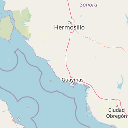
Use this park location map to pinpoint Isla San Pedro Martir in Mexico, understand its exact geographic position, and read its mapped placement within the surrounding landscape more clearly.

Pigeon | © OpenStreetMap contributors

Location context for Isla San Pedro Martir

Sonora
Park atlas

Compare marine reserves and surrounding island ecosystems across the region

Other Parks Near Isla San Pedro Mártir and Protected Areas of the Gulf

Browsing other parks near Isla San Pedro Mártir reveals connected marine habitats and arid island terrain across the central Gulf of California. Expanding regional comparison helps trace broader protected landscapes sharing similar oceanographic and ecological traits.
Marine protected areaMexico
About 52 km away#1 closest

Southeast

Gulf of California: Marine Protected Area and Volcanic Geography of the Pacific Basin

Mapping protected islands and deep-sea terrain in Mexico

The Gulf of California represents a critical marine protected area defined by its tectonic youth and biological complexity. From the northern delta zones to the tropical southern waters, this basin offers a rare look at how submarine rifting and arid coastal geography influence marine habitat development. Explore its distribution of volcanic islands, deep canyons, and tidal environments through our detailed geographic records.

Area
177,000 km²
Established
2005
Relief
Mixed relief
Climate
Subtropical
National parkBaja California
About 80 km away#2 closest

Northwest

San Lorenzo Marine Archipelago National Park: Protected Area and Mapped Landscape Geography

Explore its national park status and regional context in Baja California.

Delve into San Lorenzo Marine Archipelago National Park, a key protected area contributing to Baja California's diverse geography. As a national park, its mapped boundaries and unique landscape characteristics provide essential data for atlas exploration and understanding regional conservation efforts. This entry focuses on the park's identity as a mapped protected entity, ideal for researchers and explorers seeking structured geographic insights into natural reserves.

Area
504.42 km²
Established
2005
IUCN
II
Relief
Upland
A watercolor painting showing a coastal landscape with pale pink foreground, green vegetation, a light-colored bay, and soft-hued mountains in the background.
Biosphere reserveBaja California
About 138 km away#3 closest

Northwest

Bahía de los Ángeles Biosphere Reserve: Geography and Protected Area Atlas

Coastal desert, volcanic islands, and Sea of Cortez marine channels

Spanning 1,500 square miles, this biosphere reserve preserves the dramatic transition from the arid Baja California desert to the deep, productive waters of the Gulf of California. The protected area encompasses a diverse chain of volcanic islands, including Isla Ángel de la Guarda, and supports high biological productivity driven by deep submarine canyons and marine currents.

Area
3,879.56 km²
Established
2007
Relief
Mixed relief
Climate
Arid
Protected areaBaja California Sur
About 187 km away#4 closest

Southwest

San Ignacio Lagoon: Protected Coastal Desert Geography in Baja California Sur

Coastal lagoons, tidal channels, and desert ecosystems.

Examine the geographic boundaries and landscape features of San Ignacio Lagoon. This protected coastal nursery provides a rare desert-to-sea interface, characterized by shallow tidal flats, narrow channels, and expansive arid terrain within the Baja California Peninsula.

Area
175 km²
Established
2004
Relief
Lowland
Climate
Arid
National parkBaja California Sur
About 303 km away#5 closest

Southeast

Bahía de Loreto National Park: National Park Protected Landscape and Geographic Identity

Explore its mapped boundaries and regional context.

Bahía de Loreto National Park offers a distinct focus on its protected natural landscape and geographic features within Baja California Sur. This destination provides detailed mapping and regional context, enabling a focused exploration of its boundaries and natural environment. It is ideal for users seeking to understand the specific protected area identity and its geographical placement as part of a broader atlas of conservation landscapes.

Area
2,065.81 km²
Established
1996
IUCN
II
Relief
Mixed relief
Nature reserveSonora
About 329 km away#6 closest

East

Northern Jaguar Reserve: Geography and Protected Landscape Atlas of Sonora

Foothill bushland between the Aros and Bavispe River valleys

Northern Jaguar Reserve represents a key protected block of dry tropical bushland in the Sierra Madre foothills of Sonora. This map-focused profile examines the topography, drainage systems, and structural habitat corridors that support one of the northernmost wild jaguar populations within a transition zone of mountain slopes and river-fed canyons.

Area
222 km²
Relief
Mountain
Climate
Subtropical
Access
Remote access
Wildlife reserveBaja California
About 333 km away#7 closest

Northwest

Valle de los Cirios Wildlife Reserve: Mapped Geography and Protected Desert Landscapes

Exploring the diverse arid terrain of the Baja California peninsula

Valle de los Cirios represents a premier protected landscape in Mexico, characterized by its iconic cirio cactus woodlands and deep mountain sierras. The reserve connects vast stretches of desert habitat from the Pacific coast to the Gulf of California, creating a unique geographic corridor for endemic species and wide-ranging desert mammals.

Area
25,217.8 km²
Established
1980
Relief
Mountain
Climate
Arid
Wildlife reserveSonora
About 344 km away#8 closest

Northeast

Bavispe Flora and Fauna Protection Area: Sierra Madre Occidental Mountain Geography

Mapped protected forest tracts across Sonora ranges

Spanning five distinct mountain tracts in Sonora, this wildlife reserve preserves rare pine-oak forest communities within the Sierra Madre Occidental. Learn how these ridges and basins act as a vital hydrological anchor for the Yaqui River and provide critical corridors for wildlife through the diverse, transition-heavy terrain of northern Mexico.

Area
2,009 km²
Established
1936
IUCN
VI
Relief
Mountain

Common questions about visiting, size, designation, and location context for Isla San Pedro Martir

Isla San Pedro Martir FAQs for park facts, access, geography, and protected area context

Find quick answers about Isla San Pedro Martir, including protected-area facts, park geography, trail and visitor context, and how the park fits into its surrounding country and regional landscape.
MoriAtlas Explorer

Continue Your Protected Areas Search Across the Global Atlas

Deepen your exploration by continuing the structured search for national parks and protected areas worldwide. Utilize the comprehensive filtering capabilities to compare different conservation landscapes and refine your understanding of global park geography. Discover more about the distribution and characteristics of protected natural areas.

Global natural geography