
Mori Atlas logo
Nature reserveJebel Akhdar Mountains

Analyzing the protected limestone terrain and unique Mediterranean mountain climate of the Ad Dakhiliyah region

Jebel Akhdar Mountains Nature Reserve: Exploring the Geography of Oman's Central Highland Massif

The Jebel Akhdar Mountains constitute a major limestone massif and nature reserve within Oman's Ad Dakhiliyah Governorate, characterized by deep wadi networks and elevated plateaus. This region supports a distinct montane ecosystem and traditional terraced agricultural landscapes that contrast sharply with the surrounding arid environment. Mapping the massif reveals complex vertical terrain, spanning from high-altitude juniper woodlands to ancient cliffside settlements that define this significant protected area.

mountain rangehigh-altitude oasesterraced agriculturefalaj irrigationAl Hajar montane woodlandsjuniper woodlands
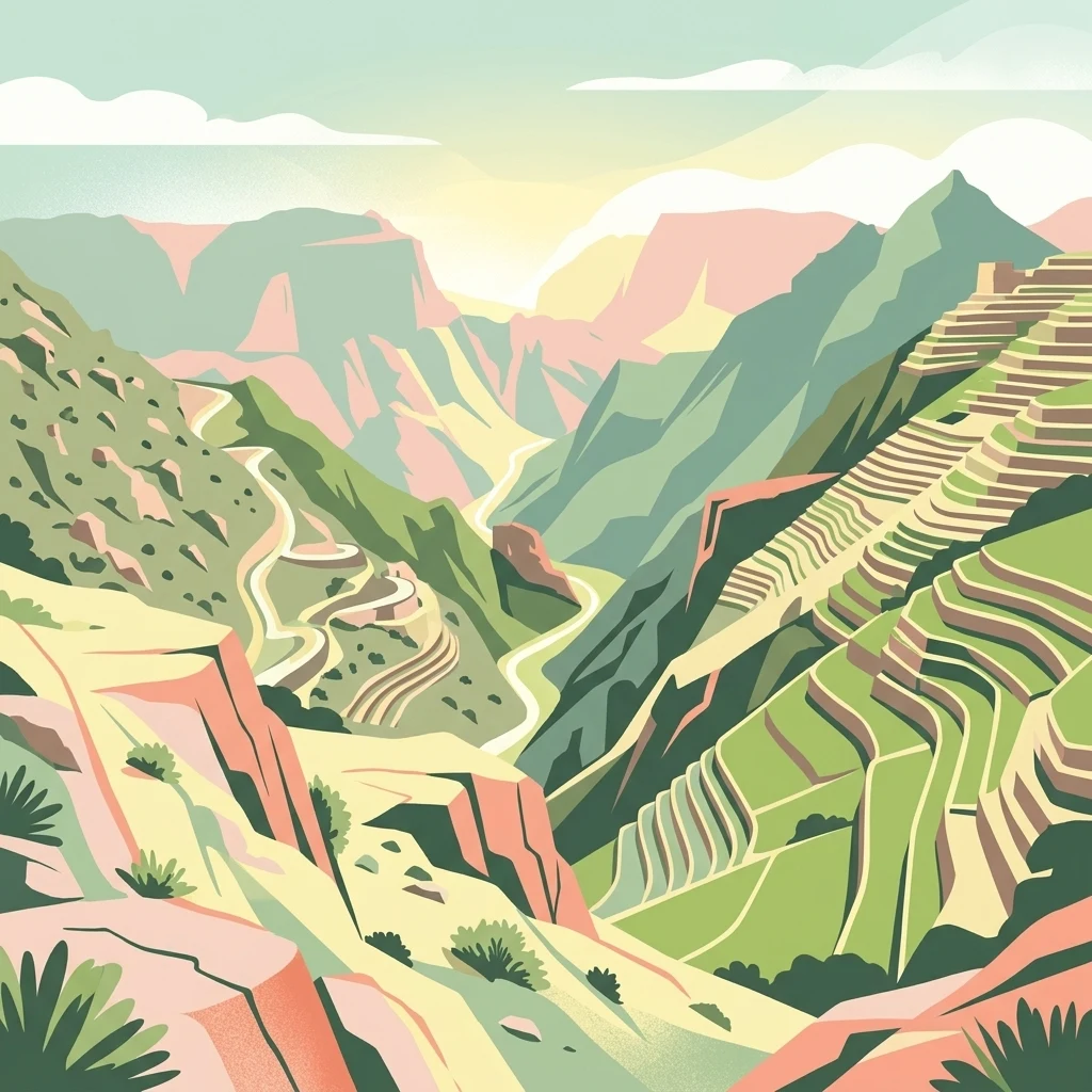
A stylized digital illustration of mountainous terrain featuring agricultural terraces, a winding valley, and steep rocky ridges.

Jebel Akhdar Mountains

Nature reserve

Park overview

Structured park overview, official facts, and landscape profile for Jebel Akhdar Mountains

Jebel Akhdar Mountains park facts, protected area profile, and essential visitor context

Review the core facts for Jebel Akhdar Mountains, including designation, size, terrain, visitor scale, habitats, and operating context in one park-focused overview.

About Jebel Akhdar Mountains

Jebel Akhdar is one of the defining geographical and cultural landmarks of Oman, representing the high-altitude counterpoint to the country's more familiar desert and coastal images. The range stretches roughly 80 kilometers in length and about 32 kilometers across, forming a dominant stretch of the central Hajar Mountains and bordering the interior town of Nizwa, from which it is typically approached.

Despite sitting within the broader Arabian Peninsula, Jebel Akhdar develops a notably cooler and wetter microclimate than the lowlands around it. At higher altitudes, annual rainfall reaches around 300 millimeters, enough to sustain Mediterranean-style sclerophyll woodlands and an unusual belt of juniper above roughly 2,300 meters. This combination of elevation and moisture allows species and habitats that are otherwise absent from eastern Arabia to persist, and it is this green character that gives the mountains their name, Al-Jabal Al-Akhḍar, or The Green Mountain.

Just as important to the park's identity is its human landscape. For centuries, the Bani Riyam tribe and other communities have built terraced orchards connected by falaj irrigation channels, producing pomegranates, apricots, walnuts, black grapes, peaches, roses, and honey in quantities that supply much of Oman. The Saiq Plateau, perched at roughly 2,000 meters, is the heart of this agricultural system, and villages such as Birkat al-Mawz and Al Sogara reflect a long mountain heritage tied to fortress culture, traditional crops, and careful water management.

In modern conservation terms, the landscape has moved from being an agricultural working environment to a formally protected one. Sultan Qaboos designated the mountains as a nature reserve in August 2011, creating the Jebel Akhdar Sanctuary for Natural Sceneries and granting the Minister of Environment and Climate Affairs authority over access and development rules. In 2025, UNESCO elevated this recognition further by designating Jebel Akhdar a biosphere reserve, marking it as an area of international ecological and cultural significance.

Quick facts and research context for Jebel Akhdar Mountains

Jebel Akhdar is a limestone massif in the Al Hajar range of Oman, located in Ad Dakhiliyah Governorate roughly 150 kilometers inland from Muscat. It reaches Oman’s highest elevation at Jebel Shams (3,018 meters) and includes the elevated Saiq Plateau at about 2,000 meters. The mountains stand out in eastern Arabia for their relatively cool, moist microclimate that supports Mediterranean-type woodlands and traditional high-altitude agriculture, and the area has been a nature reserve since 2011 and a UNESCO biosphere reserve since 2025.

Protection and recognition

Examine the terrestrial protected area designation established in 2011.

Jebel Akhdar Mountains Protection Status and Designated Conservation History

Terrestrial protected area designation records for Jebel Akhdar Mountains establish official conservation timelines starting from 2011. Verified administrative metrics outline the management scope and designation history for this mountain landscape.

Protection details

Protection scope
Terrestrial
Designated year
2011
Transboundary protection
No
Park context

Deeper park guide and search-rich context for Jebel Akhdar Mountains

Jebel Akhdar Mountains history, landscape, wildlife, and travel context

Explore Jebel Akhdar Mountains through its history, landscape character, ecosystems, wildlife, conservation priorities, cultural context, and seasonal travel timing in a structured park guide built for atlas discovery and search intent.

Why Jebel Akhdar Mountains stands out

Jebel Akhdar is best known for combining dramatic high-mountain scenery with a living, terraced agricultural landscape that feels far removed from the deserts below. The Saiq Plateau and its surrounding slopes produce pomegranates, apricots, walnuts, grapes, peaches, rose water, and honey, made possible by the traditional falaj irrigation systems engineered into the mountains over generations. At the same time, the range is ecologically important for its Al Hajar montane woodlands, a rare ecoregion where juniper, wild olive, and aromatic shrubs survive at elevations uncommon in the Arabian Peninsula. The mountains are also famous visually for their deep wadi networks and cliff edges, including the country's highest peak, Jebel Shams.
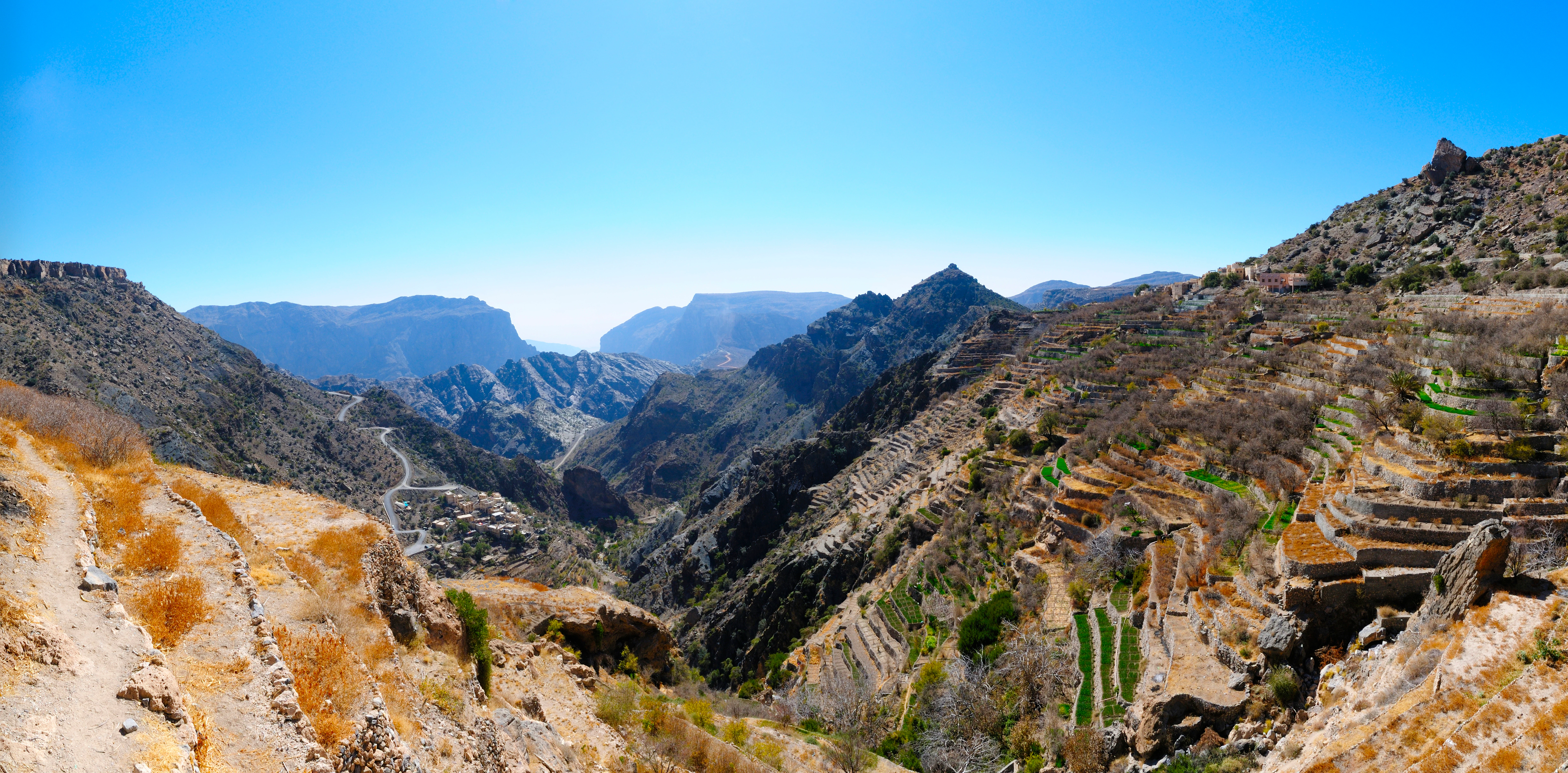
A wide landscape view of terraced mountains in the Hajar range, featuring stone-walled fields built into steep, rocky terrain with a deep valley between peaks under a clear blue sky.
Agricultural terraces carved into the slopes of the Jebel Akhdar mountains.

Jebel Akhdar Mountains history and protected-area timeline

The mountains have a layered human history, beginning with rock art sites in the region that contain figures estimated to be up to around 6,000 years old, indicating early human presence in the highland landscape. For centuries, the range has been the heartland of the Bani Riyam tribe, which controlled key passes and built strongholds such as the mud-brick fortress of Birkat al-Mawz, perched above the inland approach to the plateau.

Between 1954 and 1959, Jebel Akhdar became the site of the Jebel Akhdar War, a conflict in which Omani forces loyal to the Sultan, supported by British personnel including the Special Air Service, fought against rebels of the inland Imamate of Oman who were backed by Saudi Arabia. The war left a deep imprint on the region's history, transforming the mountains from a remote agricultural heartland into a militarily significant frontier.

The modern conservation era began in August 2011, when Sultan Qaboos declared Jebel Akhdar a nature reserve under the name Jebel Akhdar Sanctuary for Natural Sceneries, with regulatory authority assigned to the Ministry of Environment and Climate Affairs. The designation reflected concern about biodiversity loss, climate impacts, and the need to manage tourism alongside traditional agriculture. In 2025, this national protection was extended to international status when UNESCO designated Jebel Akhdar as a biosphere reserve, recognizing the area's combined ecological, cultural, and scenic value.

Jebel Akhdar Mountains landscape and geographic character

Jebel Akhdar forms a long, elevated spine through the central section of the Hajar Mountains, built largely of limestone and shaped into a mosaic of cliffs, plateaus, deep wadis, and terraced slopes. Its highest point, Jebel Shams, reaches 3,018 meters, making it not only the tallest peak in the massif but also the highest in all of Oman and the Hajar range. A second summit to the south, slightly lower at around 2,997 meters, is publicly accessible through the W4 trekking trail and offers a more attainable viewpoint into the surrounding scenery.

At the core of the range sits the Saiq Plateau, an elevated agricultural bench around 2,000 meters above sea level. From this plateau, dramatic slopes fall away into the network of wadis that gives the mountains their distinctive labyrinthine character. Around 150 kilometers inland from Muscat, and reached typically by four-wheel drive from Nizwa some 45 minutes away, the massif is geographically isolated enough to feel like a distinct world, yet intimately connected to the towns of the Omani interior.

The cliffs and valleys also carry strong cultural depth. Birkat al-Mawz, the historic Pool of the Plantains, sits at the inland mouth of a major pass and reflects the legacy of the Bani Riyam tribe that long controlled the mountain interior, while villages such as Al Sogara are carved directly into the mountainside, illustrating centuries of human adaptation to vertical terrain.

Jebel Akhdar Mountains ecosystems, habitats, and plant life

Ecologically, Jebel Akhdar falls within the Al Hajar montane woodlands ecoregion, a rare and geographically narrow zone that supports plant communities noticeably different from the deserts below. Plant cover changes with elevation in clear, visible bands: between roughly 450 and 1,300 meters, the slopes carry shrublands and dry grasslands dominated by drought-adapted, often succulent species, while between 1,350 and 2,350 meters the mountains support semi-evergreen woodlands of small-leaved, hardy sclerophyllous trees and shrubs.

Among the characteristic species are wild olive (Olea europaea), Dodonaea viscosa, Sideroxylon mascatense, Moringa peregrina, Grewia species, and Euphorbia larica, alongside aromatic shrubs typical of Mediterranean climates. Above about 2,350 meters, the vegetation opens into juniper-dominated woodlands built around Juniperus seravschanica, with associated shrubs such as Cotoneaster nummularius, Daphne mucronata, Ephedra pachyclada, and Euryops arabicus forming an upper flora that is exceptionally distinctive for the Arabian Peninsula.

The microclimate that supports these communities relies on roughly 300 millimeters of annual precipitation at higher altitudes, enough to transform an otherwise arid mountain into a refugium of green. Climate change has already begun to reduce annual rainfall and raise nighttime temperatures in the mountains, putting additional pressure on both natural vegetation and the falaj-fed terraces that traditional agriculture depends upon.

Jebel Akhdar Mountains wildlife and species highlights

While Jebel Akhdar is more commonly described through its plants, terraces, and geology, its ecological significance as a habitat for wildlife in eastern Arabia is substantial. The range's elevation, moisture, and structural diversity of woodland, shrubland, cliff, and wadi create conditions favorable to birdlife, insects, and small mammals that are scarce or absent in the surrounding arid plains.

The mountains are particularly important for honey production, with traditional apiculture on the Saiq Plateau supplying a significant share of Oman's honey. Wild pollinators and the fragrant rose fields also support insect communities tied to the flowering season. In the cliffs and wadis surrounding the plateau, raptor species typical of Arabian mountain habitats use the thermals and rock faces, while juniper woodlands above 2,300 meters provide refuge for a narrower set of high-altitude specialists. The 2011 nature reserve designation and the 2025 UNESCO biosphere status both reflect concern about preserving these assemblages alongside the area's cultural farming systems, rather than treating wildlife as separate from the agricultural landscape that defines the mountains.

Jebel Akhdar Mountains conservation status and protection priorities

Jebel Akhdar's conservation value lies in its unusual combination of high-elevation Mediterranean microclimate, ancient agricultural heritage, and rare Al Hajar montane woodlands within an otherwise arid region. The mountains act as a refugium for plant species that would not survive in the surrounding lowlands, including wild olive, juniper, sclerophyllous shrubs, and aromatic species characteristic of Mediterranean climates, making the massif disproportionately important for eastern Arabia's biodiversity.

The formal conservation framework began in August 2011, when Sultan Qaboos issued a decree establishing the Jebel Akhdar Sanctuary for Natural Sceneries and granting the Minister of Environment and Climate Affairs authority to regulate access, land use, and developmental activity within the reserve. This was designed to balance the area's growing tourism appeal, especially with road access improvements and the Tour of Oman cycling event featuring its climbs, against the risks of erosion, water depletion, and habitat disturbance.

Climate change is now a central concern, with declining annual rainfall and warmer nights placing stress on both the natural vegetation zones and the falaj irrigation that sustains terraced agriculture. In 2025, UNESCO designated Jebel Akhdar as a biosphere reserve, reflecting growing international recognition of the area as a place where ecological preservation, climate adaptation, and long-standing human land use must be managed together rather than in isolation.

Jebel Akhdar Mountains cultural meaning and human context

The mountains are deeply tied to the cultural identity of Oman's interior, having served for centuries as the heartland of the Bani Riyam tribe, which controlled key passes and built prominent strongholds such as the mud-brick fortress of Birkat al-Mawz, noted for its painted ceilings and restoration work. The tribe's descendants remain distributed across nearby lowland and highland communities, including Nizwa, Izki, and Ibra, sustaining ties between the mountains and the surrounding towns.

Equally central to the cultural landscape is the falaj irrigation system, a centuries-old method of channeling mountain spring water into terraced fields. This engineering tradition has shaped both the visible character of the Saiq Plateau and the agricultural rhythm of life there, enabling the cultivation of pomegranates, apricots, walnuts, black grapes, peaches, and the Damask roses used for rose water, one of Oman's signature products. Honey production on the mountain also supplies a meaningful share of the country's output, reinforcing the link between cultural heritage and local biodiversity. Rock art sites in the broader range, with figures dating back about 6,000 years, add a deeper prehistoric dimension to the cultural significance of Jebel Akhdar.

Top sights and standout views in Jebel Akhdar Mountains

Jebel Akhdar's standout qualities cluster around three themes. First, its dramatic physical geography: Oman's highest peak (Jebel Shams at 3,018 meters), the elevated Saiq Plateau, and a labyrinth of deep wadis and cliff edges. Second, its living agricultural landscape: a centuries-old system of falaj-fed terraces producing pomegranates, apricots, walnuts, grapes, peaches, roses, and honey in a Mediterranean climate unusually high for the Arabian Peninsula. Third, its growing conservation profile: a 2011 Sultan Qaboos nature reserve decree and 2025 UNESCO biosphere reserve designation, both aimed at protecting habitats and a cultural landscape now under increasing climate pressure.

Best time to visit Jebel Akhdar Mountains

The cooler months of late autumn through early spring are widely considered the most comfortable period for experiencing the high elevations of Jebel Akhdar, when daytime temperatures on the Saiq Plateau are mild and the greenery of terraces and woodlands is most visible. Winter and spring also offer a chance to witness the rose harvest and associated rose-water production, an important cultural and seasonal event in the mountains.

Summers bring higher temperatures at lower elevations around the range, but the high plateaus retain a noticeably cooler microclimate than the surrounding deserts, which can still make them a refuge in hotter months. Seasonal rainfall, which feeds the falaj irrigation system, is concentrated in cooler periods, and reduced rainfall and warmer nights linked to climate change have made timing visits around the cooler, greener season increasingly important for appreciating the area's full ecological and agricultural character.
Monthly climate preview

Long-term representative point measurements tracking monthly averages

Jebel Akhdar Mountains Climate Normals and Annual Temperature Rhythm

Representative coordinate records show measured variations in monthly mean temperature and precipitation across the Jebel Akhdar Mountains terrain. Examining the complete twelve-month profile provides deeper insight into long-term climate normals and regional weather patterns.
Annual mean27 °C
18 °C35 °C
Jan18°
Feb20°
Mar23°
Apr28°
May32°
Jun35°
Jul35°
Aug34°
Sep32°
Oct28°
Nov23°
Dec19°
Warmest month
July

35 °C

Coolest month
January

17.5 °C

Wettest month
March

0.8 mm/day

Driest month
September

0.3 mm/day

Park location guide

Geography guide, regional context, and park location map for Jebel Akhdar Mountains

Jebel Akhdar Mountains park geography, regions, and map view in Oman

Understand where Jebel Akhdar Mountains sits in Oman through a broader geographic reading of the surrounding landscape, nearby location context, and its mapped position within the national park landscape.

How Jebel Akhdar Mountains fits into Oman

Oman, officially the Sultanate of Oman, is a country in the southeastern Arabian Peninsula. It borders Saudi Arabia, the UAE, and Yemen, and has coastline along the Arabian Sea and Gulf of Oman. Ruled by the Al Bu Said dynasty since 1744, it is the oldest independent state in the Arab world and was historically a regional power controlling territory across the Persian Gulf to East Africa.

Wider geography shaping Jebel Akhdar Mountains in Oman

Oman occupies the southeastern Arabian Peninsula in West Asia. It shares land borders with Saudi Arabia, the UAE, and Yemen. The country has coastal access to the Arabian Sea to the southeast and the Gulf of Oman to the northeast. The Hajar Mountains run through the northern region, while the interior consists of desert plains and rocky plateaus. The Musandam Peninsula is an exclave separated from the rest of Oman by UAE territory.

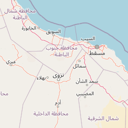
Map view of Jebel Akhdar Mountains

Use this park location map to pinpoint Jebel Akhdar Mountains in Oman, understand its exact geographic position, and read its mapped placement within the surrounding landscape more clearly.

Pigeon | © OpenStreetMap contributors

Location context for Jebel Akhdar Mountains

Ad Dakhiliyah Governorate

Explore high altitude scenery, terraced plateaus, and protected mountain habitats.

Jebel Akhdar Mountains Photos and Visual Landscapes

Visual records capture the rugged limestone cliffs, deep wadis, and ancient agricultural terraces defining the Jebel Akhdar Mountains. Photographic documentation reveals the high altitude terrain and rare montane woodland habitats protected across the regional reserve.

A wide landscape view of terraced mountains in the Hajar range, featuring stone-walled fields built into steep, rocky terrain with a deep valley between peaks under a clear blue sky.

Park atlas

Compare regional mountain ranges, wadi networks, and highland reserves

Explore Other Parks Near Jebel Akhdar Mountains And Protected Landscapes

Browsing other parks near Jebel Akhdar Mountains reveals wider patterns of regional geography and highland protected areas. Expanding the protected-area comparison connects isolated limestone massifs with adjacent conservation zones across the wider terrain.
A watercolor painting showing a wide coastal scene with green low-lying hills in the distance, a calm body of water in the middle, and varied vegetation in the foreground.
Nature reserveMuscat Governorate
About 108 km away#1 closest

Northeast

Ad Dimaniyat Islands Nature Reserve: Protected Archipelago and Marine Biodiversity Map

Archipelago landscape and marine protected area in Muscat Governorate.

The Ad Dimaniyat Islands represent a critical nature reserve composed of nine distinct islands in the Gulf of Oman. The archipelago is known for its rare coral formations, nesting beaches for endangered sea turtles, and its role as a breeding site for various seabird species. This protected landscape combines complex underwater reef habitats with rocky and sandy terrain, forming a significant ecological zone within the Muscat Governorate.

Area
1 km²
Relief
Lowland
Access
Moderate access
Scope
Marine
A soft watercolor painting of a tropical coastal landscape featuring a calm bay, low rolling hills in the background, and clusters of palm trees.
Nature reserveMuscat Governorate
About 123 km away#2 closest

Northeast

Qurm Nature Reserve: Protected Mangrove Ecosystems and Coastal Geography in Muscat

Coastal wetlands and avian habitats of the Gulf of Oman

Qurm Nature Reserve serves as a critical protected landscape within the Muscat Governorate, preserving expansive mangrove forests and intricate tidal channels. The reserve functions as a hub for coastal biodiversity, supporting numerous migratory bird species and maintaining ecological health within a major urban center. Explore the mapped boundaries and natural features of this significant wetland protected area.

Area
1.72 km²
Established
1975
IUCN
IV
Relief
Lowland
Wildlife reserveOman
About 202 km away#3 closest

Southeast

Al Saleel National Park: A Protected Acacia Forest Wildlife Reserve in Oman

Explore its unique landscape and protected area geography.

Al Saleel National Park in Oman is distinguished by its exceptional acacia forest ecosystem, a scarce habitat type across the Arabian Peninsula. Covering 220 square kilometers, this wildlife reserve serves as a crucial sanctuary for at-risk species like the Arabian gazelle and the endemic Omani wild cat. Its landscape offers a compelling study of arid zone forest ecology and protected area management, providing valuable context for understanding Oman's commitment to natural heritage and conservation within its regional geography.

Area
220 km²
Climate
Arid
Scope
Terrestrial
Water
No major water
Nature reserveUnited Arab Emirates
About 235 km away#4 closest

Northwest

Khor Kalba Nature Reserve: UAE Coastal Wetland and Mangrove Ecosystem Discovery

Mapped boundaries and regional landscape context for this Sharjah nature reserve.

Khor Kalba Nature Reserve showcases a rare and ecologically significant mangrove ecosystem on the eastern coast of the United Arab Emirates. This protected area features a dynamic intertidal landscape of creeks and lagoons vital for coastal conservation. Understanding its unique halophytic vegetation and bird habitats provides critical insight into the UAE's efforts to preserve its limited natural wetland environments and their distinctive geography.

IUCN
IV
Scope
Terrestrial
Nature reserveDubai
About 262 km away#5 closest

Northwest

Dubai Desert Conservation Reserve: Nature Reserve, Mapped Geography, and Protected Landscape Context

Explore the natural terrain and conservation atlas of this UAE protected area.

This page details the Dubai Desert Conservation Reserve, a designated nature reserve situated within the geographic scope of Dubai, United Arab Emirates. Dive into its mapped boundaries, understand its role as a protected landscape, and gain insight into its unique natural terrain. MoriAtlas provides structured data to explore the park's place within regional geography and the broader atlas of protected areas.

Area
225 km²
Established
2003
Relief
Lowland
Climate
Arid
National parkUnited Arab Emirates
About 280 km away#6 closest

Northwest

Wadi Wurayah National Park National Park: Mapped Protected Landscape and Geographic Context

Explore the mapped boundaries and regional geography of Wadi Wurayah National Park.

Wadi Wurayah National Park stands as a significant national park, offering a focused area for exploring protected lands. This page provides essential details about its landscape characteristics and geographic positioning, framed for atlas-driven discovery. Understand the park's protected-area identity and its contribution to regional geographic context, making it a valuable entry for anyone mapping natural landscapes or investigating conservation areas.

Nature reserveDubai
About 282 km away#7 closest

Northwest

Al Marmoom Desert Conservation Reserve: Nature Reserve and Desert Landscape in Dubai

Mapped Geography and Protected Area Context

Explore the Al Marmoom Desert Conservation Reserve, a designated nature reserve located near Dubai. This protected area is crucial for understanding the region's desert geography and landscape. MoriAtlas provides detailed mapping and geographic context, allowing for in-depth study of its protected boundaries and its significance within the UAE's conservation landscape.

Area
0.4 km²
Established
2018
Relief
Lowland
Climate
Arid
Nature reserveEmirate of Dubai
About 287 km away#8 closest

Northwest

Al Wohoosh Desert Conservation Reserve Nature Reserve: Mapped Protected Landscape

Desert terrain and geographic context in the Emirate of Dubai.

Delve into the Al Wohoosh Desert Conservation Reserve, a key protected natural area situated in the Emirate of Dubai. This entry focuses on its mapped geography, showcasing the desert landscape and its protected boundaries. Gain structured insights into its role as a nature reserve and its contribution to understanding regional conservation landscapes and mapped terrain.

Area
15.06 km²
Established
2014
Relief
Lowland
Climate
Arid

Common questions about visiting, size, designation, and location context for Jebel Akhdar Mountains

Jebel Akhdar Mountains FAQs for park facts, access, geography, and protected area context

Find quick answers about Jebel Akhdar Mountains, including protected-area facts, park geography, trail and visitor context, and how the park fits into its surrounding country and regional landscape.
MoriAtlas Explorer

Continue Your Protected Areas Search Across the Global Atlas

Deepen your exploration by continuing the structured search for national parks and protected areas worldwide. Utilize the comprehensive filtering capabilities to compare different conservation landscapes and refine your understanding of global park geography. Discover more about the distribution and characteristics of protected natural areas.

Global natural geography