
Mori Atlas logo
Protected landscapeJurassic Coast

Mapping 185 million years of Earth history through coastal erosion and sedimentary terrain

Jurassic Coast Protected Landscape: An Atlas of Geological Heritage and Coastal Geography

(Dorset and East Devon Coast)

The Jurassic Coast serves as a foundational site for geological study, exposing a continuous sequence of Triassic, Jurassic, and Cretaceous rock formations along the southern shoreline of the United Kingdom. This protected landscape documents deep time through active coastal erosion, revealing an exceptional fossil record and iconic landforms such as Durdle Door and Lulworth Cove. Our geographic dataset traces these boundaries to illustrate how sediment layers and wave action continually reshape this globally significant terrain.

coastal scenerygeological heritagefossil sitesworld heritage sitemesozoic rockstriassic
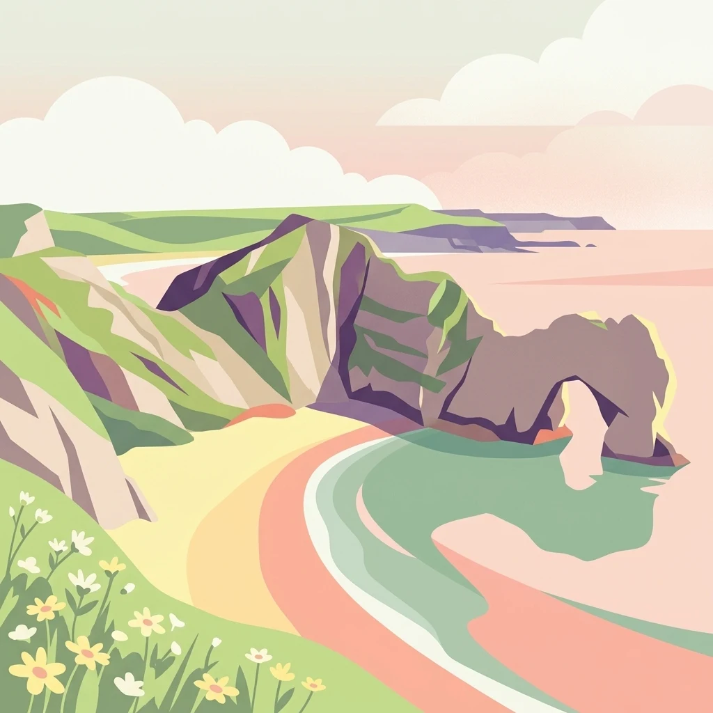
A digital illustration of the iconic Durdle Door natural limestone arch on the Jurassic Coast, featuring soft pastel colors, grassy cliff tops with wildflowers in the foreground, and the beach and ocean below.

Jurassic Coast

Protected landscape

Park overview

Structured park overview, official facts, and landscape profile for Jurassic Coast

Jurassic Coast park facts, protected area profile, and essential visitor context

Review the core facts for Jurassic Coast, including designation, size, terrain, visitor scale, habitats, and operating context in one park-focused overview.

About Jurassic Coast

The Jurassic Coast is a stretch of southern English coastline that has achieved international recognition for the way it lays bare deep geological time. Running between East Devon and Dorset along the English Channel, it was inscribed on the UNESCO World Heritage List in 2001 as the first wholly natural World Heritage Site in the United Kingdom. Its significance lies in the combination of a near-continuous sequence of Mesozoic rocks, a dynamic eroding coastline, and a fossil record that has played a formative role in the development of earth sciences.

The cliffs along the Jurassic Coast expose layered sedimentary rocks spanning the Triassic, Jurassic, and Cretaceous periods, collectively documenting about 185 million years of Earth history. At various points in geological time, this part of what is now southwest England was a hot desert, a warm shallow sea, and a swampy coastal plain. The fossils preserved in these rocks include ammonites, belemnites, bivalves, crinoids, fish, insects, and the spectacular marine reptiles for which the region is best known, including ichthyosaurs and plesiosaurs.

The coastline is also a textbook example of active coastal geomorphology. Ongoing erosion by the sea has produced arches, sea stacks, pinnacles, coves, barrier beaches, and landslides, each illustrating different erosional and depositional processes. At Lulworth Cove, waves have cut through resistant Portland limestone to erode the softer material behind, creating a near-circular bay. Chesil Beach, an 18-mile-long barrier beach, links the Isle of Portland to the mainland and encloses the Fleet Lagoon, a protected intertidal area recognized internationally for its biodiversity.

The Jurassic Coast is more than a geological showcase; it is also a place of strong cultural and scientific heritage. The fossil collector Mary Anning, working from Lyme Regis in the early nineteenth century, made pivotal discoveries that helped establish paleontology as a modern science. Today the entire coastline can be walked via the South West Coast Path, and a series of visitor centers, museums, and heritage sites support public engagement with the landscape, from the Charmouth Heritage Coast Centre to the Jurassic Coast visitor programs. At the western end of the site, the Geoneedle at Orcombe Point symbolizes the sequence of rocks encountered along the way, marking both the geographic and conceptual start of the Jurassic Coast.

The site is also a working landscape. Fishing villages, holiday resorts, quarries on Portland, military ranges near Lulworth and Bovington, and modern coastal defenses all coexist with the geological resource. Management policy is largely one of allowing natural erosion to continue, while protecting people and infrastructure in vulnerable settlements such as Charmouth and Weymouth.

Quick facts and research context for Jurassic Coast

The Jurassic Coast was inscribed as a World Heritage Site in December 2001 under natural criterion viii, recognizing its outstanding geological value. It is the first wholly natural World Heritage Site in the United Kingdom.

The site spans Triassic, Jurassic, and Cretaceous rocks along about 96 miles of English Channel coastline between East Devon and Dorset, exposing roughly 185 million years of Earth history in an almost continuous rock sequence.

Protection and recognition

Documented conservation history and official UNESCO World Heritage designation details

Jurassic Coast Protection Status and International Recognition Data

Examine the recorded protection status and designation history established for the Jurassic Coast since 2001. Review the official Dorset and East Devon Coast UNESCO World Heritage recognition alongside structured management scope facts.

International recognition

Protection details

Protection scope
Mixed
Designated year
2001
Transboundary protection
No
Park context

Deeper park guide and search-rich context for Jurassic Coast

Jurassic Coast history, landscape, wildlife, and travel context

Explore Jurassic Coast through its history, landscape character, ecosystems, wildlife, conservation priorities, cultural context, and seasonal travel timing in a structured park guide built for atlas discovery and search intent.

Why Jurassic Coast stands out

The Jurassic Coast is most famous for its unique combination of accessible, continuously exposed Mesozoic geology and rich fossil heritage. The coastal cliffs reveal successive layers of Triassic, Jurassic, and Cretaceous rock in a single traverse, providing an unusually complete record of changing environments, from arid deserts to tropical seas to swampy lowlands. It is equally renowned for its iconic landforms, including the natural arch at Durdle Door, the almost perfectly circular Lulworth Cove cut through Portland stone, the tombolo and storm beach of Chesil Beach, the tied island of Portland, and the chalk sea stacks of Old Harry Rocks. Together, these features make the site a globally important outdoor laboratory for geomorphology and earth science education.
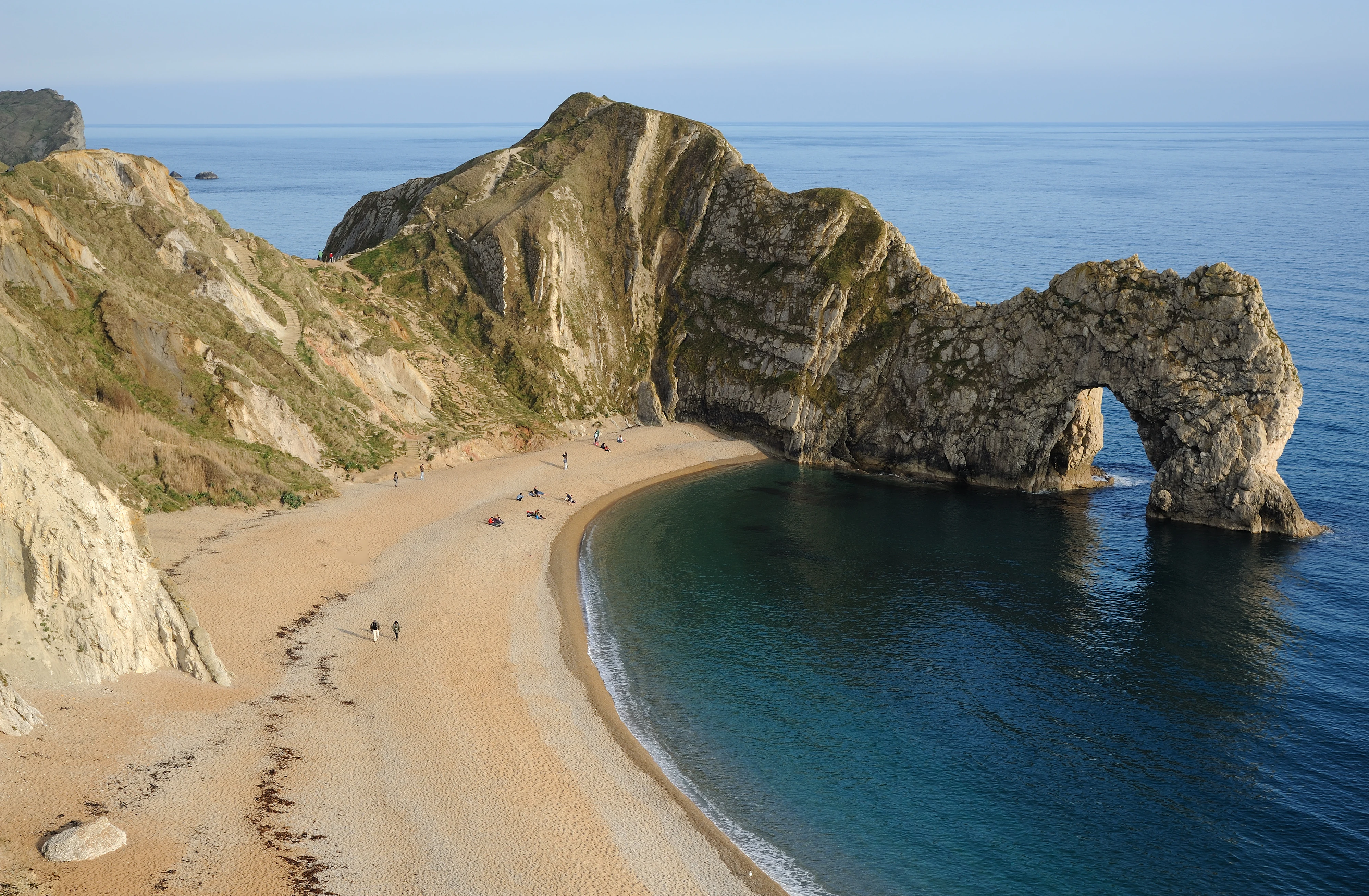
High angle shot of the natural limestone arch known as Durdle Door standing in the blue water off a curved pebble and sand beach.
Durdle Door, a natural limestone arch located along the Jurassic Coast in Dorset.

Jurassic Coast history and protected-area timeline

The scientific history of the Jurassic Coast is inseparable from the broader emergence of paleontology as a discipline. At the end of the eighteenth century, Georges Cuvier demonstrated that some fossil animals resembled no living species, establishing the concept of extinction and laying the groundwork for the systematic study of fossils. The richly fossiliferous cliffs of eastern Devon and western Dorset had long attracted local collectors who sold curios to visitors, but it was only in the early nineteenth century that the region began to contribute seriously to this new science.

Mary Anning, working from Lyme Regis between the late 1790s and the 1840s, became the most celebrated figure associated with the Jurassic Coast. Following her father as a fossil collector, she identified and prepared the first complete ichthyosaur skeleton at The Spittles and went on to discover important specimens of plesiosaurs and a pterosaur, alongside numerous invertebrate fossils including cephalopods preserved with their ink sacs. Her work helped transform the local fossil beds into a globally significant reference sequence for the Jurassic period.

In the twentieth century the coast acquired a significant military history. During World War II, Portland Harbour became one of the Royal Navy's largest bases, and an army base at Bovington remains in use. Large sections of coast between Lulworth Cove and Kimmeridge are still partially restricted because of ongoing military training, and the evacuated ghost village of Tyneham stands as a reminder of wartime requisition. Sections of coast near Exmouth, the Fleet Lagoon, and Studland were also used for training before being returned to civilian use.

Recognition of the coast's international geological importance culminated in 2001, when the site was inscribed on the UNESCO World Heritage List under natural criterion viii. Two years later in 2002, the Geoneedle sculpture was erected at Orcombe Point to mark the western end of the heritage site and to symbolize the rock types encountered along its 96-mile length. Since then, major erosion events have continued to shape the coast, including a substantial landslip in 2008, a fatal rockfall at Burton Bradstock in 2012, further collapses in 2016 and 2020, and the largest UK rockfall in 60 years in April 2021, all of which illustrate the dynamic, ongoing geological processes that make the site scientifically valuable.

Jurassic Coast landscape and geographic character

The landscape of the Jurassic Coast is defined by erosion acting on a sequence of varied sedimentary rocks. In East Devon, near Orcombe Point, Budleigh Salterton, and Ladram Bay, the cliffs consist largely of red Triassic sandstone, sometimes forming dramatic isolated stacks such as those at Ladram Bay. Along the gravel cliffs at Budleigh Salterton, distinctive red quartzite pebbles accumulate on the beach, locally protected features in their own right.

Further east, around Lyme Regis and Charmouth, the cliffs become softer Jurassic clays and shales, where landslips and slow coastal retreat are common. This softer material contrasts sharply with more resistant limestones and chalk farther east. Chesil Beach, an 18-mile-long barrier beach stretching from Burton Bradstock to the Isle of Portland, forms one of the most distinctive depositional landforms in Britain; it is both a tombolo connecting Portland to the mainland and a storm beach shaped by powerful wave action. Behind it lies the Fleet Lagoon, an intertidal saltwater lagoon of recognized international ecological importance.

The stretch around Lulworth Cove and Durdle Door is the geomorphological heart of the coast. At Lulworth, the sea has cut through tough Portland stone and eroded the softer sands and clays behind, producing a near-circular cove. Nearby, the natural arch of Durdle Door illustrates the erosion of a particularly resistant rock band, with the softer beds behind it being cut back into a sheltered bay. The Isle of Portland itself is a tied island, connected to the mainland only by Chesil Beach.

East of Peveril Point and around Handfast Point, the chalk beds reappear and have been sculpted into sea stacks and pinnacles, most famously at Old Harry Rocks. The highest point on the entire south coast of Britain lies within the Jurassic Coast at Golden Cap, which rises to about 627 feet between Bridport and Charmouth. Throughout its length, the coast alternates between concordant stretches, where rock layers run parallel to the shore, and discordant stretches, where they cross it at an angle, producing the varied bays, headlands, and cliffs that give the site its remarkable geological storytelling.
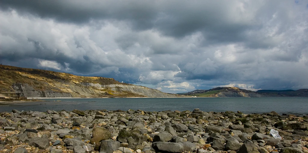
A wide view of a bay with a rocky foreground shoreline and distant coastal cliffs under a cloudy, dramatic sky.
A view of the rocky shoreline and bay along the Jurassic Coast in Dorset.

Jurassic Coast ecosystems, habitats, and plant life

From an ecological perspective, the Jurassic Coast is shaped by the interaction of varied rock types, active erosion, and maritime climate. Each rock layer weathers differently and supports its own characteristic soils, plant communities, and animal habitats. This creates a mosaic of cliff-top grasslands, heathland patches, scrub, woodland valleys, and exposed shore environments over a relatively short distance.

The cliffs themselves host seabird colonies and specialized cliff vegetation adapted to salt-laden winds, thin soils, and periodic rockfall. Inland combes and river valleys carved into the softer Jurassic rocks support mixed deciduous woodland, while the older, harder formations host more open, exposed communities. The habitats of the coast are tightly tied to its geological character: where landslides expose new surfaces, successional vegetation quickly colonizes, and older, more stable slopes develop into richer plant communities.

A particularly important ecological feature is the Fleet Lagoon, the intertidal saltwater lagoon enclosed behind Chesil Beach. The Fleet is recognized as a Ramsar site for its international biodiversity significance, supporting rich populations of wetland plants, invertebrates, and waterbirds, as well as beds of seagrass and other marine vegetation. Saltmarsh and mudflat habitats along this sheltered shoreline contrast sharply with the more exposed cliffs and beaches elsewhere on the coast, contributing to the ecological diversity that accompanies the geological diversity of the site.
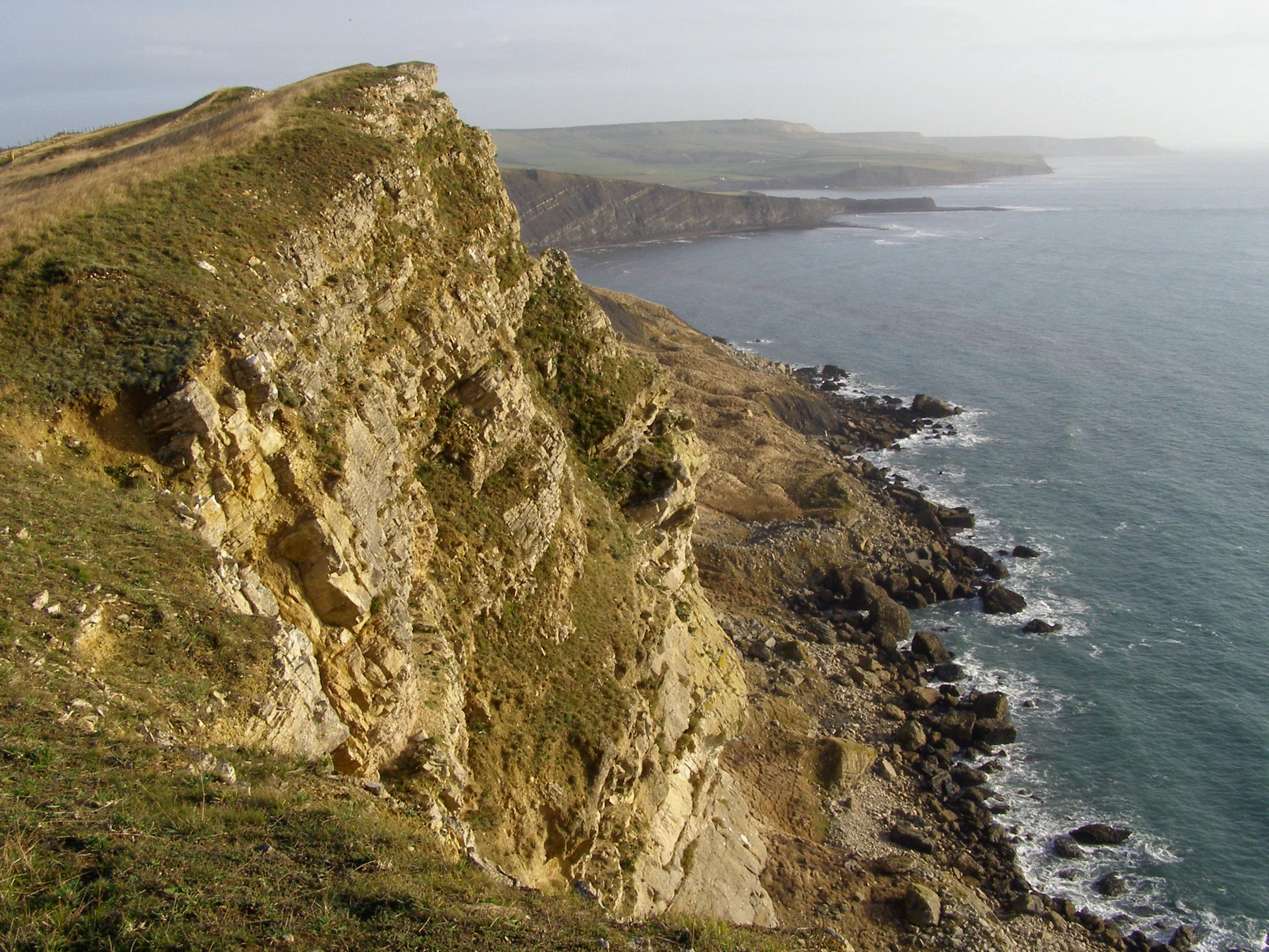
A high-angle view looking down at a steep, golden-hued rocky coastal cliff that drops sharply into the dark blue English Channel, with a distant headland stretching out into the water.
The rugged coastal cliffs of Gad Cliff along the Jurassic Coast in Dorset, England.

Jurassic Coast wildlife and species highlights

Because the Jurassic Coast is primarily a geological rather than a wildlife-focused site, its fauna is mainly notable for what it reveals about ancient life rather than contemporary species richness. Fossil remains recovered from the cliffs include marine reptiles such as ichthyosaurs and plesiosaurs, pterosaurs, fish, amphibians, cephalopods including ammonites and belemnites, crustaceans, insects, echinoderms, molluscs, and a few early mammals. At Lyme Regis, 71 distinct rock layers have been identified, each with its own ammonite fauna, providing an unusually fine-grained record of changing marine life through the Jurassic.

Around Lulworth Cove, a fossil forest preserves the remains of ancient conifers, tree ferns, and cycads, offering a glimpse of the terrestrial plant communities that once occupied the area. The diversity of fossil groups found across the coast, from invertebrates to vertebrates, has been central to understanding how marine and terrestrial ecosystems evolved in this part of the world.

Among present-day wildlife, the intertidal and marine environments support typical English Channel species, including shore crabs, molluscs, seaweeds, and fish, while the cliff tops and hedgerows host common southern English birds, small mammals, and invertebrates. The Fleet Lagoon stands out for its contemporary biodiversity, providing habitat and feeding grounds for wildfowl, waders, and migratory waterbirds in a setting that complements the site's geological importance.
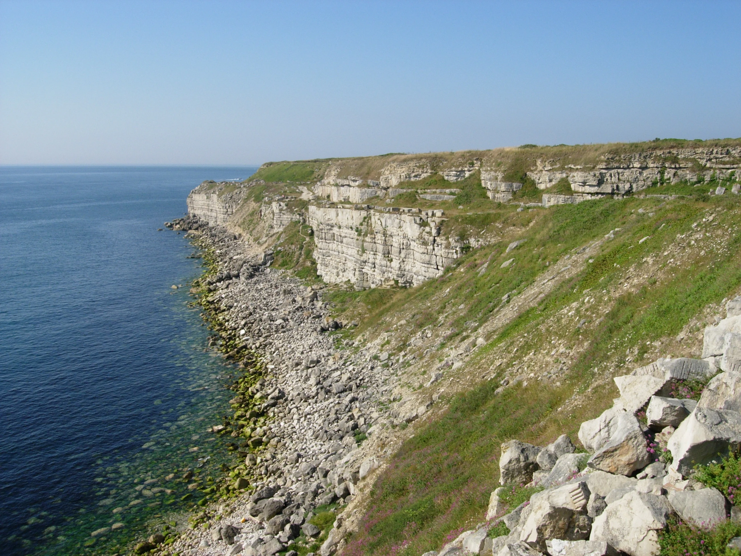
A wide angle view of rocky limestone cliffs meeting the sea, with a boulder-strewn shoreline at the base and sparse grassy vegetation.
Coastal cliffs and rocky shoreline at the Isle of Portland on the Jurassic Coast.

Jurassic Coast conservation status and protection priorities

The Jurassic Coast's conservation significance lies in the international importance of its geology and the way that significance is actively protected through partnership-based management. Inscribed under UNESCO natural criterion viii, the site is recognized for earth science value: its exposed rock sequence, fossil record, and continuing geomorphological processes make it one of the most important places in the world for studying Mesozoic history.

Management of the site is largely guided by the principle of working with natural processes rather than against them. Erosion is seen as the geological engine that exposes new fossils and fresh rock faces, so where there is no immediate threat to life or property, a deliberate decision is taken to allow erosion to continue. Coastal defenses have been installed only in vulnerable settlements such as Charmouth and Weymouth; elsewhere, the cliffs are allowed to evolve freely, even though this means occasional landslips, rockfalls, and displacement of footpaths.

Beyond the geological resource, the Fleet Lagoon behind Chesil Beach is protected under the Ramsar Convention as a wetland of international importance, adding an ecological layer to the conservation framework. Voluntary, educational, and community-led conservation also play a major role, with institutions such as the Charmouth Heritage Coast Centre providing interpretation, organized fossil hunting, and public engagement that help visitors interact responsibly with an actively eroding and legally protected coastline. The Jurassic Coast Trust and partner organizations support ongoing monitoring, education, and conservation action across the entire 96-mile site.

Jurassic Coast cultural meaning and human context

The cultural identity of the Jurassic Coast is woven into the long-standing relationship between local communities and the fossils and stones beneath their feet. For centuries before fossils became scientifically important, they were collected as curios and sold to visitors, particularly along the Lyme Regis and Charmouth shores. Mary Anning's work in the early nineteenth century turned this local activity into a globally significant scientific endeavor and made the coast a foundational place in the history of paleontology.

Coastal communities from Exmouth and Sidmouth in the west, through Lyme Regis, Charmouth, West Bay, Weymouth, and Swanage in the east, have economies and identities closely tied to the sea, to fishing, to quarrying (notably the famous Portland stone), and more recently to tourism and heritage. The Jurassic Coast World Heritage status has reinforced a shared sense of place and pride in the geological heritage, with local museums, heritage centers, festivals, and educational programs drawing on this identity.

The coast also carries more somber cultural memories. The ghost village of Tyneham, evacuated in 1943 after wartime requisition, remains an evocative reminder of the impact of military activity on rural coastal communities, and the scars of training areas near Lulworth and Kimmeridge continue to shape the human geography of the site. Wrecks such as that of the MSC Napoli in 2007 have added modern chapters to a long tradition of maritime incidents along this sometimes treacherous coast.

Top sights and standout views in Jurassic Coast

Among the standout features of the Jurassic Coast, the rock sequence itself is the headline attraction: a 96-mile traverse through Triassic, Jurassic, and Cretaceous rocks that documents about 185 million years of Earth history in unparalleled detail along an actively eroding shoreline.

Equally distinctive are the iconic landforms that illustrate this geology in vivid form: the natural arch of Durdle Door, the almost circular Lulworth Cove, the tombolo and storm beach of Chesil Beach, the tied island of Portland, the chalk sea stacks of Old Harry Rocks, and the towering cliffs at Golden Cap, the highest point on the south coast of Britain. The fossil heritage, from ammonite zones at Lyme Regis to the marine reptile discoveries of Mary Anning, rounds out a site that is simultaneously a working landscape, a scientific reference section, and a cultural landmark of global importance.

Best time to visit Jurassic Coast

The Jurassic Coast is a year-round landscape, but the experience of visiting shifts significantly with the seasons. Late spring and early summer often offer the most comfortable conditions for walking the South West Coast Path, with longer daylight hours, relatively stable weather, and active seabird and cliff-top vegetation that bring the mosaic of habitats to life.

Summer brings the busiest atmosphere, with peak visitor numbers in towns such as Lyme Regis, Weymouth, and Swanage, and crowded beaches at Studland and along Chesil Beach. Winter and early spring, by contrast, bring stormier seas and more dramatic wave action, which can intensify erosion and occasionally prompt cliff closures following rockfalls. These stormy conditions, however, also reveal fresh fossil exposures on beaches such as Charmouth and are favored by many dedicated fossil hunters willing to watch the tides carefully.

For those interested in fossils and geology, low-tide walks along the foreshore after winter storms are widely regarded as especially rewarding, though visitors should always follow official guidance about unstable cliffs and tide times.
Monthly climate preview

Monthly precipitation records and average temperatures measured from 1991 to 2020 at a representative coordinate

Jurassic Coast Climate Normals and Long Term Temperature Patterns

Long term NASA POWER measurements reveal the annual temperature and precipitation rhythm sampled at a representative coordinate within Jurassic Coast. Examining the complete twelve month climate profile provides detailed historical normals across changing monthly cycles.
Annual mean11 °C
7 °C17 °C
Jan
Feb
Mar
Apr
May12°
Jun14°
Jul16°
Aug17°
Sep15°
Oct13°
Nov10°
Dec
Warmest month
August

16.7 °C

Coolest month
February

6.9 °C

Wettest month
November

3.8 mm/day

Driest month
July

1.9 mm/day

Park location guide

Geography guide, regional context, and park location map for Jurassic Coast

Jurassic Coast park geography, regions, and map view in United Kingdom

Understand where Jurassic Coast sits in United Kingdom through a broader geographic reading of the surrounding landscape, nearby location context, and its mapped position within the national park landscape.

How Jurassic Coast fits into United Kingdom

The United Kingdom is a parliamentary constitutional monarchy located in northwestern Europe, consisting of four constituent countries: England, Scotland, Wales, and Northern Ireland. As a major global power with over 69 million residents, it maintains significant international influence in politics, economics, and culture.

Wider geography shaping Jurassic Coast in United Kingdom

The United Kingdom is an island nation located in northwestern Europe, surrounded by the Atlantic Ocean, North Sea, English Channel, Celtic Sea, and Irish Sea. It shares a land border with the Republic of Ireland to the west. The territory includes the island of Great Britain, the northeastern portion of Ireland, and most of the smaller British Isles islands.

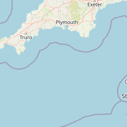
Map view of Jurassic Coast

Use this park location map to pinpoint Jurassic Coast in United Kingdom, understand its exact geographic position, and read its mapped placement within the surrounding landscape more clearly.

Pigeon | © OpenStreetMap contributors

Location context for Jurassic Coast

Dorset
Natural feature types

Explore the Named Natural Features and Geological Landscapes of the Jurassic Coast

Dive into the detailed collection of natural landforms defining the Jurassic Coast. This MoriAtlas index supports systematic exploration of the varied coastal cliffs, coves, and sea stacks, offering deeper context on the geological terrain that shapes this world-renowned protected area.
Recorded earthquake history

Explore Historical Earthquake Records Associated with the Jurassic Coast

Review recorded seismic activity in the vicinity of this world-renowned geological landscape. MoriAtlas provides a clear, data-driven catalogue of historical events, offering insight into the registered earthquake history associated with the rock formations of the Jurassic Coast.

Jurassic Coast Earthquake Records

Catalogued events

8 events

Strongest magnitude

Magnitude 3.8

Most recent event

Dec 5, 2019

This history includes earthquakes recorded inside the park or within 50 km of its borders

Visualizing geological formations, sea stacks, and coastal habitats

Jurassic Coast Photos and Protected Landscape Scenery

Photographic collections reveal the exposed rock layers, dramatic landforms, and erosional terrain that define the protected coastline. Visual records provide essential context for understanding the geological evolution and marine habitats spanning millions of years of earth history.

High angle shot of the natural limestone arch known as Durdle Door standing in the blue water off a curved pebble and sand beach.

A wide coastal landscape with yellow wildflowers in the foreground, looking out over a calm bay towards distant layered limestone cliffs and rolling green hills under a blue sky with thin clouds.

A wide view of a bay with a rocky foreground shoreline and distant coastal cliffs under a cloudy, dramatic sky.

A high-angle view looking down at a steep, golden-hued rocky coastal cliff that drops sharply into the dark blue English Channel, with a distant headland stretching out into the water.

A wide angle view of rocky limestone cliffs meeting the sea, with a boulder-strewn shoreline at the base and sparse grassy vegetation.

A wide angle view of white chalk cliffs towering over a pebble beach and the sea on a clear day.

Park atlas

Compare regional geology, coastal reserves, and connected conservation areas

Explore Other Parks Near Jurassic Coast and Surrounding Protected Landscapes

Visitors exploring the Jurassic Coast can browse adjacent protected areas and regional reserves to compare coastal geomorphology and protected habitats. Extending the journey beyond southern England reveals diverse natural landscapes and contextualizes regional conservation priorities.
Protected areaEngland
1.7 km away#1 closest

East

Dorset Heaths: Protected Lowland Landscapes and Regional Geography in Southern England

A comprehensive look at the Poole Basin heathland mosaic.

Spanning the Poole Basin, the Dorset Heaths offer a distinct geographic profile of acidic sands and diverse ecological mosaics. This protected area includes rare valley mires and coastal dunes, providing a clear window into the natural landscape history and ongoing conservation efforts within southern England's coastal regions.

Area
616.62 km²
Established
1998
Relief
Lowland
Water
Major water bodies
A watercolor painting of a wide, soft-focus coastal scene with rolling green hills, distant islands, and calm water, depicted in muted pastel tones.
Protected areaDorset
2 km away#2 closest

East

Poole Harbour: Protected Area Geography and Coastal Map of Dorset

Coastal ria landscape and wetland habitat mapping

Poole Harbour stands as a prominent natural feature of the Dorset coast, defined by its shallow waters and varied estuarine terrain. This profile maps the protected landscape, including its salt marshes, seagrass meadows, and islands, offering deep geographic context for this significant southern England wetland.

Area
36 km²
Relief
Lowland
Climate
Temperate
Access
Easy access
Watercolor illustration of Dartmoor moorland landscape with rolling hills, grassy vegetation, a stream, and distant mountains.
National parkDevon
17 km away#3 closest

West

Dartmoor National Park: Granite Tors and Prehistoric Landscape in Devon

Mapped protected area with significant Bronze Age remains.

Dartmoor National Park represents a distinctive granite upland in Devon, England, characterized by its dramatic tors and expansive moorland. This protected landscape is globally significant for its dense concentration of prehistoric archaeological sites, including stone circles, standing stones, and ancient settlements. Exploring Dartmoor offers a unique insight into Britain's regional geography, mapped terrain, and enduring connection to ancient human history.

Area
954 km²
Established
1951
IUCN
V
Visitors
11M annual
Watercolor painting showing a landscape with green and purple vegetation, a body of water, and distant hills.
National parkEngland
19 km away#4 closest

East

New Forest National Park: Historic Protected Landscape and Regional Geography in England

Mapped heathland, ancient woodlands, and pastoral traditions.

Explore New Forest National Park, a nationally significant protected area in England renowned for its unique blend of ancient royal forest history, traditional pastoral practices, and biologically rich lowland habitats. This page provides an atlas-focused view of its mapped boundaries, distinctive terrain, and geographic context within England, highlighting its value as a living landscape shaped by centuries of common grazing rights and supporting rare wildlife.

Area
566 km²
Established
2005
IUCN
V
Visitors
14.8M annual
Natural monumentIsle of Wight
About 24 km away#5 closest

East

The Needles Natural Monument: Coastal Chalk Geography and Protected Marine Landscapes

Geological formations and chalk headland terrain on the Isle of Wight

The Needles represents a unique geological intersection of vertical chalk strata and maritime history at the edge of the Isle of Wight. This protected area encompasses dramatic sea stacks, clifftop heathland, and critical marine habitats, offering a window into the complex coastal landscape of the English Channel and the regional geology of southern England.

Relief
Upland
Climate
Temperate
Access
Easy access
Scope
Mixed
Watercolor painting of a wetland landscape featuring a winding river, rolling green hills, and soft-focus trees under a light sky.
Protected landscapeSomerset
28 km away#6 closest

North

Somerset Levels Protected Landscape: Geographic Mapping and Wetland Terrain Analysis

A low-lying coastal plain and historic wetland basin in Somerset

Examine the distinct topography of the Somerset Levels, where flat horizons, pollarded willows, and ancient drainage channels create a unique English landscape. This protected area offers deep insight into prehistoric archaeology, including preserved Neolithic trackways, alongside modern wetland conservation of international significance within a rural basin.

Area
650 km²
Established
1997
Relief
Lowland
Climate
Temperate
Watercolor painting depicting a landscape with rolling hills, a winding road, and distant mountains
National parkUnited Kingdom
43 km away#7 closest

Northwest

Exmoor National Park: A Premier Protected Landscape in South West England for Atlas Exploration

Mapped terrain, moorland, and dramatic coastal geography.

Discover Exmoor National Park, a vast protected area in South West England celebrated for its sweeping heather moorland, dramatic coastline with the highest sea cliffs on mainland Britain, and deep, ancient wooded valleys. This national park offers a unique landscape for atlas-based exploration, revealing its distinct geography, mapped boundaries, and rich terrain shaped by centuries of natural processes and human activity.

Area
692 km²
Established
1954
IUCN
V
Visitors
1.4M annual
Watercolor illustration of a coastal landscape featuring green hills, white cliffs, and a body of water
National parkSouth East England
57 km away#8 closest

East

South Downs National Park: A Distinctive Chalk Landscape in South East England's Atlas

Iconic chalk downland, coastal cliffs, and mapped terrain.

South Downs National Park is a premier protected landscape in South East England, celebrated for its unique chalk downland terrain and dramatic coastal formations. This page provides detailed geographic context for the park, highlighting its rolling hills, dry valleys, and ancient woodlands. Discover the park's mapped boundaries and its significance within England's protected areas, offering a structured atlas view for landscape exploration.

Area
1,627 km²
Established
2010
IUCN
V
Visitors
18M annual

Common questions about visiting, size, designation, and location context for Jurassic Coast

Jurassic Coast FAQs for park facts, access, geography, and protected area context

Find quick answers about Jurassic Coast, including protected-area facts, park geography, trail and visitor context, and how the park fits into its surrounding country and regional landscape.
MoriAtlas Explorer

Continue Your Protected Areas Search Across the Global Atlas

Deepen your exploration by continuing the structured search for national parks and protected areas worldwide. Utilize the comprehensive filtering capabilities to compare different conservation landscapes and refine your understanding of global park geography. Discover more about the distribution and characteristics of protected natural areas.

Global natural geography