
Viewpoints
Park geography
A comprehensive geographic analysis of the Potaro-Siparuni protected landscape and interior river systems.
Kaieteur National Park Geography: Regional Context, Mapped Boundaries, and Natural Landscapes
Kaieteur National Park occupies 630 square kilometers within the Potaro-Siparuni region of Guyana. The protected area encompasses diverse natural features including the Potaro River, waterfall systems, and dense forest habitats that define the local terrain and regional geography.
Related tags
WaterfallTropical RainforestSouth AmericaGuiana ShieldEndemic Species
Home to the world's largest single-drop waterfall by volume
Kaieteur National Park
Kaieteur National Park is Guyana's premier protected wilderness area, established in 1929 and significantly expanded in 1999 to encompass 242 square miles of pristine tropical forest in the country's interior. The park is centered around Kaieteur Falls, a spectacular 741-foot single-drop waterfall widely regarded as the largest of its kind on Earth by volume of water. Located in the Potaro-Siparuni Region approximately 633 kilometers south of Georgetown, the park lies closer to the Brazilian border than to the Caribbean coast, placing it deep within the Guianan moist forests ecoregion. The protected area serves as a critical refuge for Amazonian biodiversity and supports several Amerindian communities who have inhabited these forests for millennia. The park is administered under the Kaieteur National Park Act by the Kaieteur National Park Commission, with governance oversight from the Protected Areas Trust.
- Location
- Guyana
- Park type
- National park
- Established
- 1929
- Area
- 630 km²
Location overview
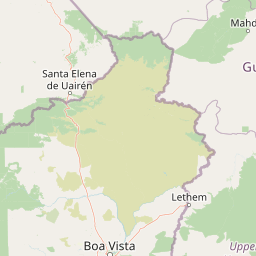
Protected area location within the Potaro-Siparuni region of Guyana
Geographic Location and Regional Profile of Kaieteur National Park
Kaieteur National Park is situated entirely within the Potaro-Siparuni region of Guyana. The protected landscape operates as an inland, non-coastal reserve with completely interior administrative boundaries.
- Countries
- Guyana
- Regions
- Potaro-Siparuni
- Primary location
- Potaro-Siparuni
- Geographic setting
- Inland
Boundary and coordinates
Analyzing the 630 square kilometer extent of the protected reserve
Kaieteur National Park Boundary Map and Spatial Dimensions
Interactive boundary mapping provides essential spatial context for the protected terrain of Kaieteur National Park. Geographic data highlights the estimated area, coordinate limits, and center point for regional analysis.
- Boundary area
- 613.8 km²
- Boundary perimeter
- 145 km
- Northernmost point
- 5.3152° N
- Southernmost point
- 5.0302° N
- Easternmost point
- 59.3638° W
- Westernmost point
- 59.6364° W
- Geographic centre
- 5.1667° N, 59.4882° W
- North–south span
- 31.5 km
- East–west span
- 30.2 km
Terrain and natural features
Mixed relief classifications and recorded natural features within the park
Kaieteur National Park Terrain and Named Natural Features Atlas
Recorded terrain classifications encompass mixed relief and documented natural features located within the park boundary. Linked feature cards supply names, types, measurements, and spatial relationships where recorded.
Selected named natural features
Rivers
Potaro River
Waterfalls
Kaieteur Falls
Viewpoints
Rainbow Viewpoint
Viewpoints
Johnson's Viewpoint
Environmental setting
Interpreting tropical forest cover, water features, and mixed relief types
Kaieteur National Park Environmental and Landscape Classifications
Recorded habitat types and landscape features serve as broad interpretive categories for reading the physical setting of Kaieteur National Park. Stored classifications connect structured environmental properties to relevant protected area destinations.
- Relief
- Mixed relief
- Climate
- Tropical
- Water
- Major water bodies
- Forest cover
- Mostly forested
Landscape features
Waterfalls · Forest · Rivers
Habitat types
Temperate broadleaf forest · Montane forest
Park atlas
Browse neighboring protected landscapes across the Guiana Shield and compare similar conservation areas in South America.
Discover Other National Parks and Protected Areas Near Kaieteur National Park
Explore additional national parks and protected areas within the Guianan moist forests ecoregion, tracing other wilderness reserves and biodiversity hotspots across South America. Compare the unique geographic features and conservation landscapes surrounding Kaieteur National Park, providing deeper atlas context for the region's diverse protected terrain.
National parkBolívar State
116 km away#1 closest
West

Canaima National Park: Detailed Geographic Atlas and Protected Landscape Overview
Explore mapped boundaries and natural terrain in Bolívar State.
Delve into the protected landscape of Canaima National Park, a significant natural area located in the expansive Bolívar State of Venezuela. This page provides a focused view on the park's geography, mapped terrain, and its position within the Guiana Highlands, offering critical context for understanding protected areas. Users can investigate the park's boundaries and its contribution to the regional geographic atlas, appreciating its distinct natural characteristics.
- Area
- 30,000 km²
- Established
- 1962
- IUCN
- II
- Visitors
- 100K annual
Nature reserveEstado Bolívar
199 km away#2 closest
Northwest
Reserva forestal de Imataca: Geographic Overview of a Major Venezuelan Nature Reserve
Mapping the Sierra de Imataca and regional forest ecosystems
Reserva forestal de Imataca serves as a key conservation zone, characterized by the Sierra de Imataca and a dense network of major rivers. This large-scale protected area provides an essential look at the tropical wilderness and upland forest terrain found within Estado Bolivar, mapping out a significant slice of the Venezuelan Guayana region.
- Area
- 38,219 km²
- Established
- 1961
- Relief
- Mountain
- Climate
- Tropical
Nature reserveSipaliwini District
283 km away#3 closest
East

Central Suriname Nature Reserve: Protected Nature Reserve with Mapped Geographic Context
Explore the landscape boundaries within Sipaliwini District's protected areas.
Central Suriname Nature Reserve is a significant protected area situated in Suriname's Sipaliwini District. As a designated nature reserve, it offers critical insights into regional geography and conservation landscapes. This page provides focused information on its mapped boundaries and its contribution to the broader atlas of protected lands, enabling detailed geographic discovery.
- Area
- 16,000 km²
- Established
- 1998
- Relief
- Mixed relief
- Climate
- Tropical
Protected areaBarima-Waini
About 330 km away#4 closest
North

Shell Beach: Coastal Protected Area Geography and Barima-Waini Map Context
Atlantic shoreline nesting habitats and regional ecological boundaries.
Spanning 120 kilometers of Guyana's northern coast, Shell Beach represents a significant protected area dedicated to marine conservation. Its geography features a continuous chain of sandy beaches, offshore foraging waters, and adjacent coastal forest ecosystems, all managed through a community-based model within the Barima-Waini Region.
- Area
- 31.77 km²
- Established
- 2011
- IUCN
- VI
- Relief
- Lowland
Protected areaGuyana
About 387 km away#5 closest
South
Kanashen Protected Area: Geographic Identity and Mapped Boundaries in Guyana
Explore the mapped landscape and protected land context.
Kanashen Protected Area serves as a critical point of geographic discovery within Guyana, offering detailed insights into its protected boundaries and natural landscape. This entry focuses on providing a structured, atlas-driven understanding of Kanashen, emphasizing its role within the regional geography of South America. Users can explore how this protected area fits into the larger mapped context, appreciating its specific terrain and conservation significance.
- Area
- 6,485.67 km²
- IUCN
- VI
- Relief
- Mixed relief
- Climate
- Tropical
National parkSuriname
About 465 km away#6 closest
East
Brownsberg Nature Park: Suriname National Park with Tropical Forest and Waterfall Landscapes
Mapped geography and protected landscape context.
Brownsberg Nature Park stands as a vital protected landscape within Suriname, distinguished by its central mountain, tropical forest ecosystems, and scenic waterfalls such as Leo Waterfall. The park's location overlooking the vast Brokopondo Reservoir provides a unique geographic setting, making it an important destination for atlas and map-based exploration of Suriname's natural heritage. Understanding Brownsberg Nature Park offers insight into the Neotropical biodiversity and terrain characteristic of the Guianan moist forests.
- Area
- 122 km²
- Established
- 1969
- IUCN
- II
- Visitors
- 20K annual
National parkDelta Amacuro
468 km away#7 closest
Northwest
Parque nacional Mariusa: A Detailed Geographic Study of Orinoco Delta Wetlands
Mapped tidal channels and protected wetland geography
Located in Delta Amacuro, Parque nacional Mariusa represents a key protected area where the Orinoco River meets the Atlantic. Its geography is defined by a dynamic system of caños, seasonally flooded rainforests, and mangrove forests that support high ecological complexity. This atlas entry provides an overview of the park boundaries and the physical terrain that shapes this critical Venezuelan protected landscape.
- Area
- 3,310 km²
- Established
- 1991
- IUCN
- II
- Water
- Water-dominated
National parkBolívar
495 km away#8 closest
West
Parque nacional Jaua-Sarisariñama: Protected Tepui Landscapes in Bolívar
Mapping the sandstone mesas and remote wilderness of the Venezuelan Guiana Shield.
Parque nacional Jaua-Sarisariñama stands as one of the most secluded protected areas in Venezuela, defined by its massive tepuis and dramatic vertical sinkholes. This geography encompasses critical headwaters and ancient Precambrian rock formations that rise abruptly from surrounding lowland forests, providing a stable habitat for isolated species across the Guiana Shield.
- Area
- 3,300 km²
- Established
- 1978
- IUCN
- II
- Relief
- Highland
MoriAtlas Explorer
Continue Exploring Kaieteur National Park's Geographic and Landscape Context
Delve deeper into the atlas of Kaieteur National Park to understand its unique topographic features, mapped park boundaries, and the regional geography of the Potaro-Siparuni area. Discover the extensive tropical forest ecosystem that supports unique biodiversity, providing a richer context for this extraordinary protected landscape and its place within the Guiana Shield.
Browse next
Global natural geography
Explore related park routes
Explore MoriAtlas Global ParksBrowse All MoriAtlas ParksGlobal Park Map DiscoveryMoriAtlas: Browse All CountriesBrowse All MoriAtlas ContinentsNational Park Environment AtlasGrand Canyon National Park AtlasYellowstone National Park AtlasYosemite National Park Atlas and GeographySerengeti National Park AtlasGalápagos National Park Protected LandscapeBanff National Park Geography and AtlasKruger National Park Atlas EntryUluṟu-Kata Tjuṯa National Park AtlasExplore Uluru-Kata Tjuta National Park GeographyPlitvice Lakes National Park AtlasFiordland National Park Protected LandscapeGreat Smoky Mountains National Park AtlasAfghanistan National Parks and Protected AreasAlbania National Parks and Protected AreasAlgeria National Parks and Protected AreasAmerican Samoa National Parks and Protected AreasAndorra National Parks and Protected AreasAngola National Parks and Protected AreasAntarctica National Parks and Protected AreasAntigua and Barbuda Park List