
Mori Atlas logo
Nature reserveKaraburun Peninsula

A rugged karst ridgeline defining the meeting of the Adriatic and Ionian seas

Karaburun Peninsula Nature Reserve and Protected Coastal Landscape in Vlorë County, Albania

Karaburun Peninsula represents a dramatic limestone spine extending into the Mediterranean, serving as a critical nature reserve within Vlorë County. This protected landscape is defined by sheer cliffs, deeply incised sea caves, and a series of rugged mountain peaks that form the seaward continuation of the Ceraunian range. Detailed mapping reveals the complex karst topography of its western shore, where hidden bays and historic sites offer insight into the wild geography of the Albanian coastline.

peninsulaMediterranean coastlinekarst landscapesea caveslimestone cliffshidden bays
Digital vector-style illustration of a river winding through a deep canyon with a waterfall cascading from a cliff on the right, surrounded by pine forests.

Karaburun Peninsula

Nature reserve

Park overview

Structured park overview, official facts, and landscape profile for Karaburun Peninsula

Karaburun Peninsula park facts, protected area profile, and essential visitor context

Review the core facts for Karaburun Peninsula, including designation, size, terrain, visitor scale, habitats, and operating context in one park-focused overview.

About Karaburun Peninsula

Karaburun Peninsula is a compact but dramatically varied landform on the southwestern edge of Albania, where the country's interior highlands meet the open Mediterranean. Stretching roughly fifteen kilometers in length and reaching widths of up to four and a half kilometers, the peninsula curves outward like the thumb of an outstretched hand, dividing the calmer waters of the Bay of Vlorë from the open channel leading toward the Strait of Otranto. Geologically, it represents the terminal, seaward portion of the Ceraunian Mountains, with limestone ridges and peaks forming a clear northwestern to southeastern axis. The highest elevations include Maja Çaderës and several other named summits clustered along the spine of the range.

The western side of the peninsula dominates its overall character. There, the terrain is steep, rocky, and deeply fractured, producing long cliff faces, vertical drops to the sea, and a string of small bays, coves, and sea caves. Notable features include the Cave of Haxhi Ali near Cape Gjuhëz, the very tip of the peninsula, as well as the Bay of Grama, the Bay of Skaloma, the Bay of Arushë, and the Bay of Dafinë. The eastern side, facing the Bay of Vlorë, is generally gentler and more continuous, allowing for small plateaus such as the highland pasture of Ravena that has historically been used for seasonal grazing by herders from nearby villages.

Because the peninsula has long lacked surface freshwater and is characterized by arid karst soils, it has remained almost entirely uninhabited, which has helped preserve its wild coastal scenery. The combination of Mediterranean climate, complex relief, and largely untouched shorelines has produced a rich mosaic of marine and terrestrial habitats. Today, the terrestrial portion of Karaburun is formally designated as a nature reserve, and its surrounding waters belong to the Karaburun Sazan National Marine Park, placing the entire peninsula within a coordinated framework of conservation that emphasizes both landscape integrity and marine biodiversity.

Quick facts and research context for Karaburun Peninsula

Karaburun Peninsula lies in southwestern Albania within Vlorë County, forming the western arm of the Bay of Vlorë and reaching toward the Strait of Otranto. Geologically it is a continuation of the Ceraunian Mountains, built primarily of Cretaceous and Paleogene limestones that have been quarried as marble since antiquity. Its land area has been designated as a nature reserve, while the surrounding sea is part of the Karaburun Sazan National Marine Park, giving the peninsula a dual terrestrial and marine protection status.

Protection and recognition

Review documented terrestrial protection scope and official designation records for Karaburun Peninsula.

Karaburun Peninsula Protection Status and International Recognition Data

Karaburun Peninsula maintains a documented terrestrial protection scope detailing its official conservation framework and management boundaries. Factual records outline international recognition status and administrative classifications associated with the protected landscape.

Protection details

Protection scope
Terrestrial
Transboundary protection
No
Park context

Deeper park guide and search-rich context for Karaburun Peninsula

Karaburun Peninsula history, landscape, wildlife, and travel context

Explore Karaburun Peninsula through its history, landscape character, ecosystems, wildlife, conservation priorities, cultural context, and seasonal travel timing in a structured park guide built for atlas discovery and search intent.

Why Karaburun Peninsula stands out

Karaburun is best known for its strikingly indented western coastline, where high limestone cliffs drop into a maze of sea caves, hidden bays, and small isolated beaches. The peninsula's identity is closely tied to the classically named Akrokeraunian headland, the historical port of refuge at the Bay of Grama with its ancient rock inscriptions, and the presence of rare marine wildlife such as the Mediterranean monk seal and threatened sea turtles. Its near total lack of permanent population, combined with its formal protection as part of a regional marine park, makes it one of the wildest and least developed stretches of the Albanian coast.
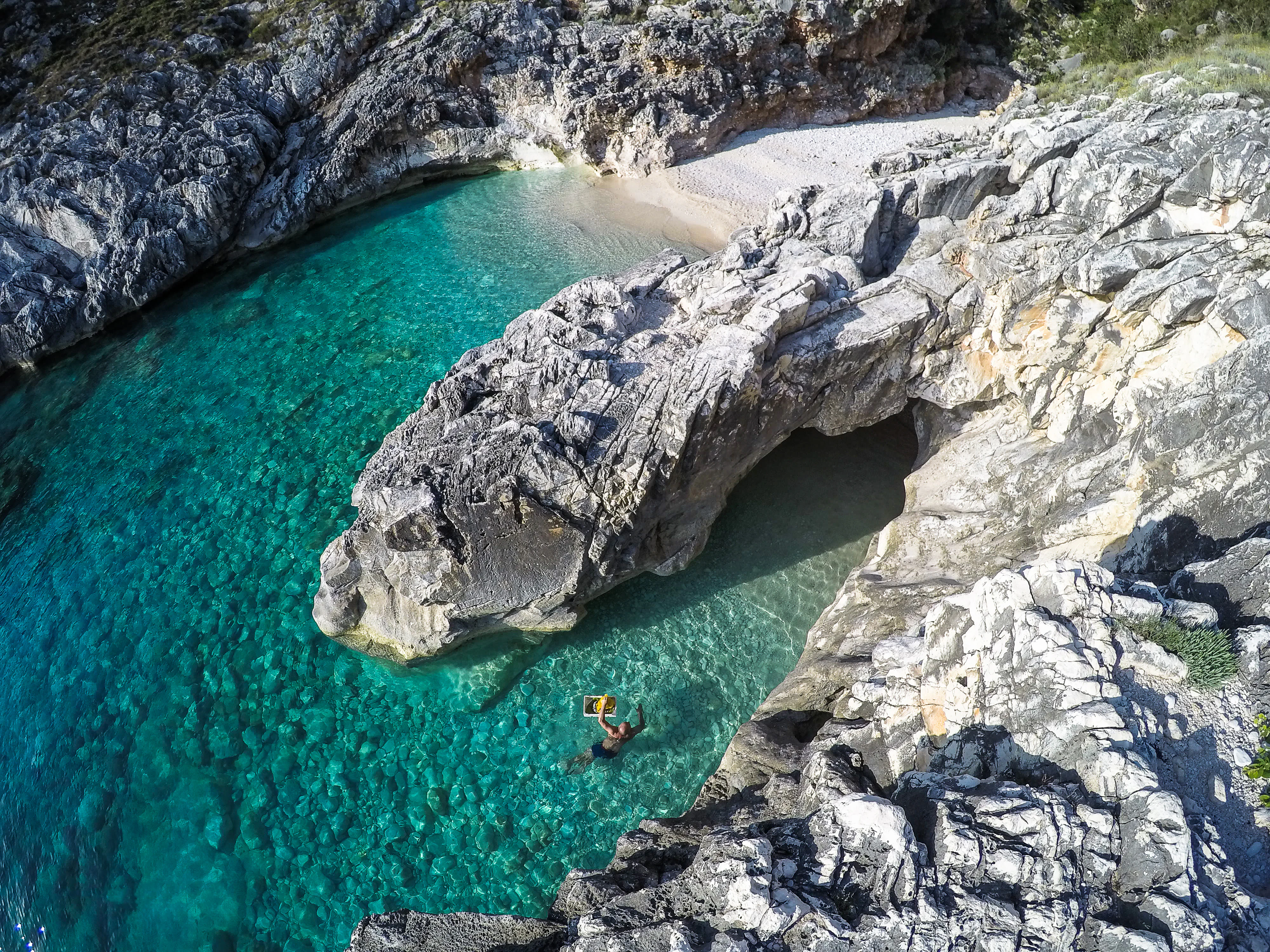
A high-angle view looking down into a small, rocky cove with clear, turquoise water, where a person is swimming; rocky cliffs frame the inlet.
A person swimming in the clear turquoise waters of Skaloma Bay on the Karaburun Peninsula.

Karaburun Peninsula history and protected-area timeline

The Karaburun Peninsula has been known to Mediterranean seafarers since classical antiquity, when it was referred to as the Akrokeraunian Peninsula and recognized as the maritime terminal of the Akrokeraunian, or Ceraunian, mountain chain. The Bay of Grama, tucked into its western coast, served as a natural harbor for ships and vessels in the ancient world and has long been valued as a sheltered anchorage. The high rock faces surrounding the bay also functioned as a marble quarry, and on their surfaces survive hundreds of rock inscriptions dating back to the fourth century BC, including later Latin inscriptions from the first century AD that reference figures such as Mark Antony and Pompey, along with carvings of ships, crosses, anchors, and shields.

The peninsula's limestone has shaped its modern history as well. Karst topography dominates the interior, limiting surface water, preventing permanent settlement, and producing the same kind of metamorphosed limestone that was quarried here in antiquity and continues to be exploited as marble. In the modern era, the peninsula's uninhabited character has led to its designation as a nature reserve on land and its inclusion in the Karaburun Sazan National Marine Park at sea, formalizing its long-standing role as both a historical maritime landmark and an ecologically important coastal zone.

The name Karaburun itself reflects the peninsula's layered cultural history. It derives from a Turkish term meaning black cape, applied during the period of Ottoman influence in the region, while the older European designation Cape Linguetta underscores its enduring importance as a navigation landmark on the approach to the Adriatic from the Ionian Sea.

Karaburun Peninsula landscape and geographic character

The landscape of Karaburun is defined by the meeting of high, broken limestone ridges with the open sea. The interior of the peninsula is shaped by the continuation of the Ceraunian Mountains, with a series of distinct peaks arranged along a northwest to southeast line. Maja Çaderës is the highest point, with Maja e Flamurit, Maja e Koretës, and Maja e Ilqes forming a substantial ridgeline that drops sharply toward both coasts. Because the ridges are composed primarily of Mesozoic and Paleogene limestones that have been heavily reshaped by karst processes, the terrain is rocky, deeply fissured, and largely devoid of soil cover capable of holding surface water.

The western coastline is where the peninsula's most distinctive scenery appears. Long stretches of vertical cliff face descend abruptly into the sea, broken by sea caves, narrow inlets, and small pocket beaches. The Cave of Haxhi Ali, located near the northwestern tip at Cape Gjuhëz, is among the largest sea caves along the Albanian coast and contains multiple recessed chambers. Nearby, capes such as Galloveci and Kepi i Gjuhëzës form prominent headlands, while bays such as Skaloma, Arushë, Dafinë, and Grama create sheltered pockets that alternate with exposed rocky promontories. About twenty sea caves are distributed along the entire coastline, reinforcing the sense of a deeply sculpted karst landscape meeting the Mediterranean.

The eastern flank, by contrast, is comparatively calmer. Facing the Bay of Vlorë, the shoreline there is less broken, and the interior slopes are interrupted by small plateaus such as the highland pasture of Ravena, which broadens the local relief into softer pastureland. Vegetation across the peninsula is sparse, with limited tree cover and more extensive low scrub and seasonal grazing land, giving much of the terrain an exposed, almost arid appearance despite the surrounding sea.
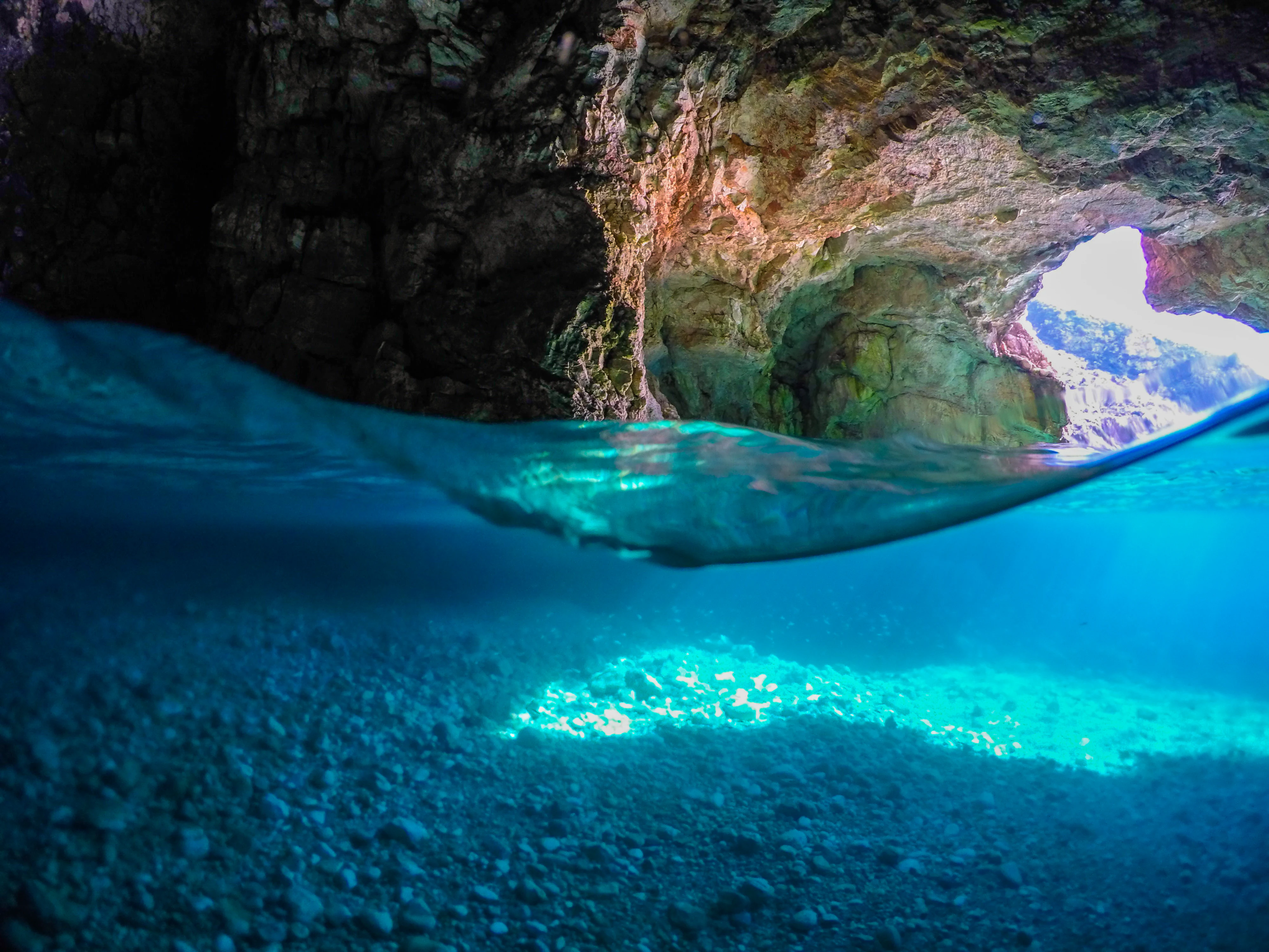
A split-level underwater view of a sea cave. Above the water line, rugged rock formations are visible. Below the water line, the seafloor consists of light-colored pebbles illuminated by blue light.
A split shot showing the rocky ceiling of Dafina Cave and the clear Ionian Sea waters below on the Karaburun Peninsula.

Karaburun Peninsula ecosystems, habitats, and plant life

The natural character of Karaburun is shaped by the interaction of Mediterranean climate, dramatic relief, and the absence of permanent human settlement. Hot, dry summers and mild winters produce conditions typical of Mediterranean ecosystems, but the fractured karst terrain, thin soils, and limited freshwater availability create an unusually harsh environment for plants. As a result, vegetation is generally sparse, with scrubland, low grasses, and Mediterranean maquis dominating much of the surface. In the narrower and slightly more sheltered interior zones, small highland pastures such as Ravena provide grazing areas that contrast with the otherwise dry landscape.

Along the coast, the habitat mosaic becomes richer. The alternation of vertical cliffs, sea caves, sheltered bays, and small beaches produces a layered environment where terrestrial, littoral, and marine ecosystems meet within very short distances. The contrast between exposed rocky shores and quieter inlets supports varied communities of coastal plants, invertebrates, and fish, while the underwater karst formations and submerged cave systems contribute to the ecological complexity of the surrounding waters. This gradient from arid upland to sheltered marine habitat is one of the peninsula's defining ecological features, and it underpins the formal protection of both the land and sea around Karaburun.
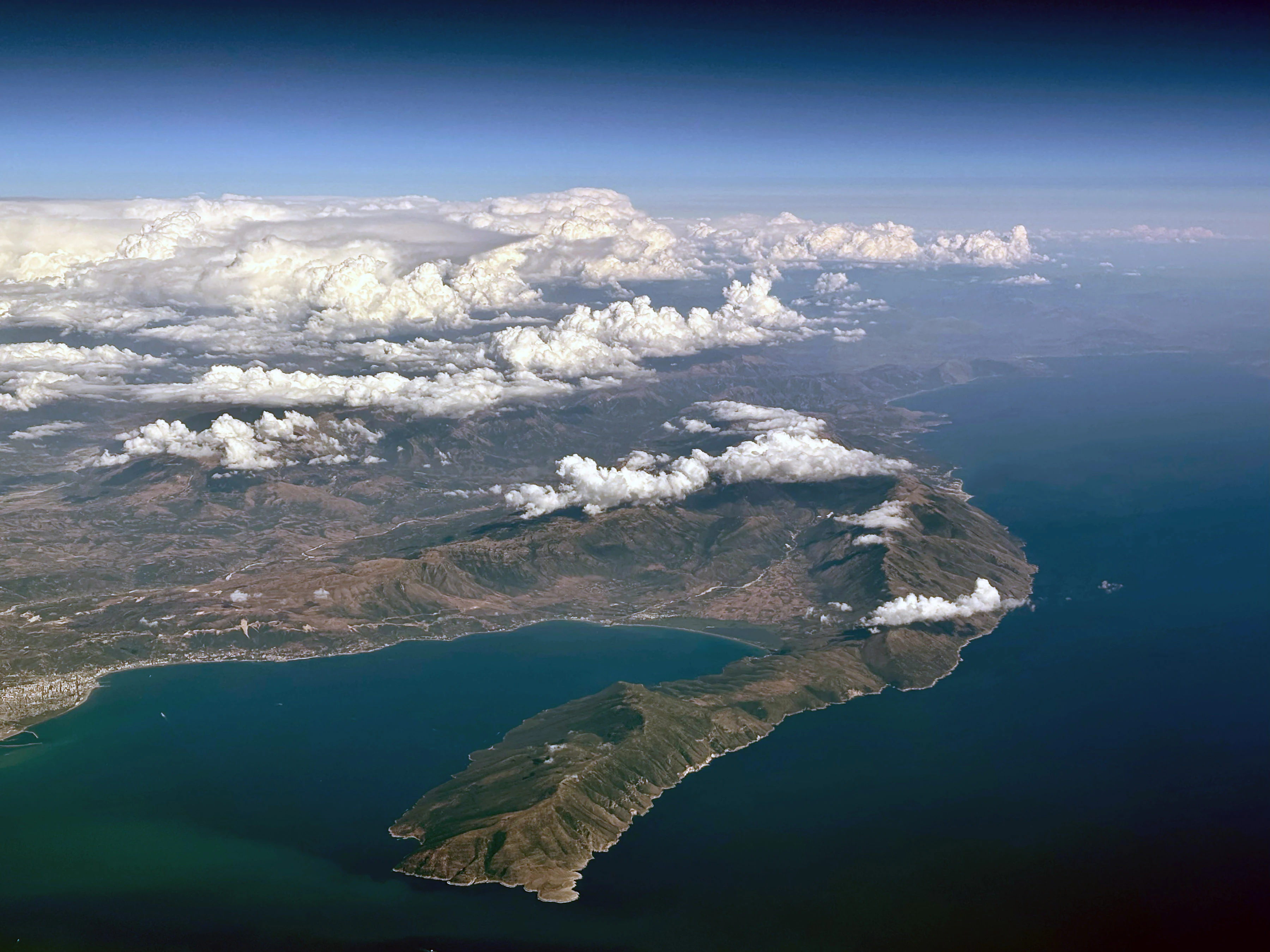
An aerial photograph of the mountainous Karaburun Peninsula projecting into the deep blue Ionian Sea under a sky with scattered clouds.
Aerial view of the rugged Karaburun Peninsula extending into the Ionian Sea in Albania.

Karaburun Peninsula wildlife and species highlights

The wildlife profile of Karaburun is dominated by its marine and coastal species, supported by the largely undisturbed shoreline and the protected waters of the Karaburun Sazan National Marine Park. Among the most notable inhabitants are threatened and endangered marine species, including the loggerhead sea turtle and the green sea turtle, both of which rely on the peninsula's beaches and nearshore waters for nesting and foraging. The Mediterranean monk seal, the rarest seal species in the world, has also been documented in the area, giving Karaburun significant international importance for marine mammal conservation.

On land, the relative dryness and lack of permanent water limit large mammal populations, but the peninsula's isolation and absence of human disturbance favor smaller, more elusive fauna adapted to Mediterranean scrub and rocky terrain. Seabirds and coastal birds are prominent along the cliffs and bays, while coastal caves such as the Cave of Haxhi Ali and the caves of the Bay of Grama provide shelter for bat colonies and other cave dwelling species. The combined presence of endangered marine turtles, monk seals, and rich coastal birdlife makes the peninsula an important node for conservation in the broader Adriatic Ionian region.
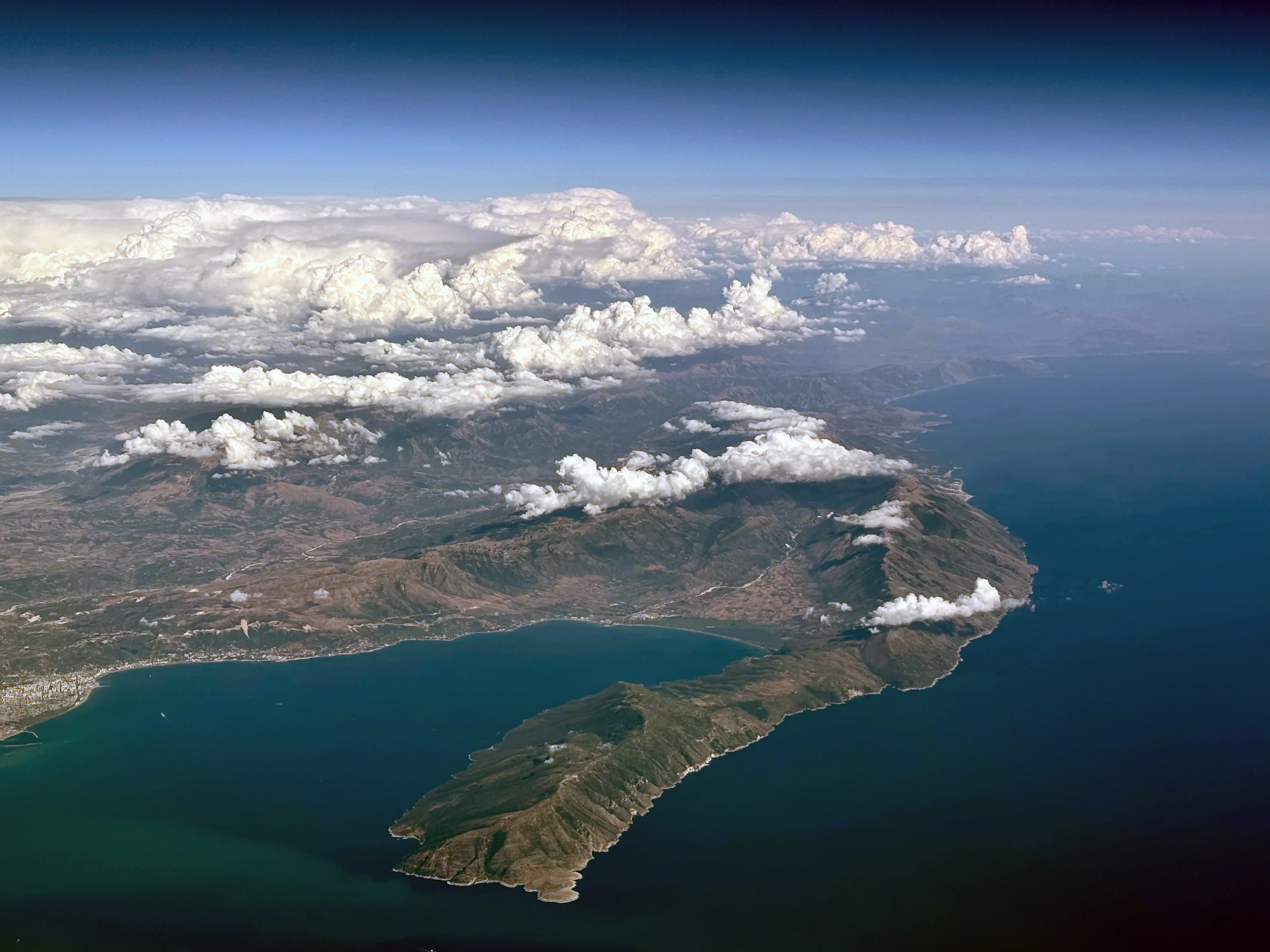
High-altitude aerial view of a large, rugged peninsula extending into deep blue sea, with scattered white clouds over land and mountains.
An aerial view of the rugged Karaburun Peninsula in southwestern Albania, extending into the Ionian Sea.

Karaburun Peninsula conservation status and protection priorities

Karaburun Peninsula occupies a central place in Albania's system of coastal and marine protection. Its landmass has been formally designated as a nature reserve, recognizing its largely undisturbed state, its arid karst landscape, and its ecological value as one of the few remaining uninhabited stretches of the Albanian coast. At the same time, the surrounding sea waters are incorporated into the Karaburun Sazan National Marine Park, which extends protection offshore and links the peninsula ecologically with the nearby Sazan Island.

This dual designation reflects the importance of protecting the habitat continuum between land and sea. The peninsula's sea caves, cliff faces, and small bays are critical for the nesting and shelter of endangered marine turtles and for the survival of the extremely rare Mediterranean monk seal. Protecting both the terrestrial reserve and the marine park helps preserve the foraging grounds, breeding areas, and migration corridors that these species depend on, while also maintaining the integrity of the broader Adriatic Ionian ecosystem.

Karaburun Peninsula cultural meaning and human context

Karaburun is most clearly a cultural landmark of the sea rather than of settled land. Because the karst landscape cannot reliably hold surface freshwater, the peninsula has never supported permanent communities, and its identity is tied instead to navigation, quarrying, and encounter. The Bay of Grama functions almost as an open-air historical archive, its cliffs carrying inscriptions from Greek and Roman sailors who anchored there in antiquity. Latin-era carvings referencing Mark Antony and Pompey sit alongside drawings of ships, anchors, and shields, turning the rocks themselves into a record of Mediterranean seafaring life.

Onshore cultural connections are more indirect but still meaningful. The eastern interior of the peninsula, particularly the pastoral plateau of Ravena, has historically been used for seasonal grazing by herders from the nearby village of Dukat, embedding Karaburun into the broader rural life of the Vlorë region without producing permanent settlement. The peninsula's toponymy itself is a layer of cultural history: the name Karaburun comes from the Turkish term for black cape, while older European references such as Cape Linguetta and the classical Akrokeraunian name preserve a much longer tradition of viewing this headland as a defining landmark of the Adriatic.
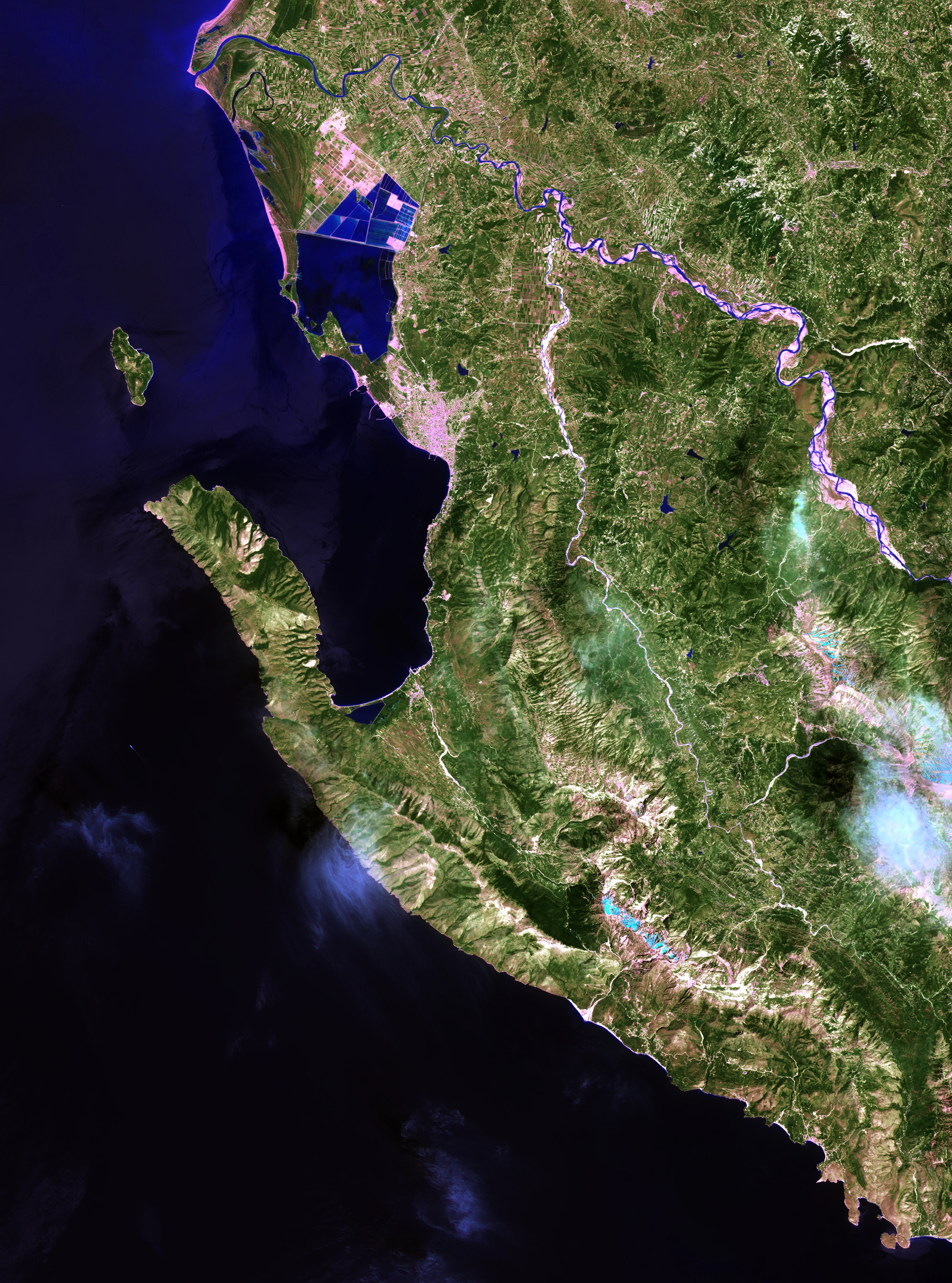
Satellite imagery showing the rugged coastline of the Karaburun Peninsula extending into the Ionian Sea, with the Bay of Vlorë visible to the north.
Satellite view of the Karaburun Peninsula and the surrounding Bay of Vlorë coastline.

Top sights and standout views in Karaburun Peninsula

Karaburun's strongest features are its western cliffscape of sea caves and hidden bays, the classical heritage of the Bay of Grama with its ancient inscriptions, and the rare marine wildlife that lives along its protected shores. The peninsula's near total lack of permanent population, combined with its formal status as a nature reserve on land and part of a national marine park at sea, gives it a rare combination of archaeological depth, ecological richness, and visual wildness in a Mediterranean setting that remains relatively undeveloped.
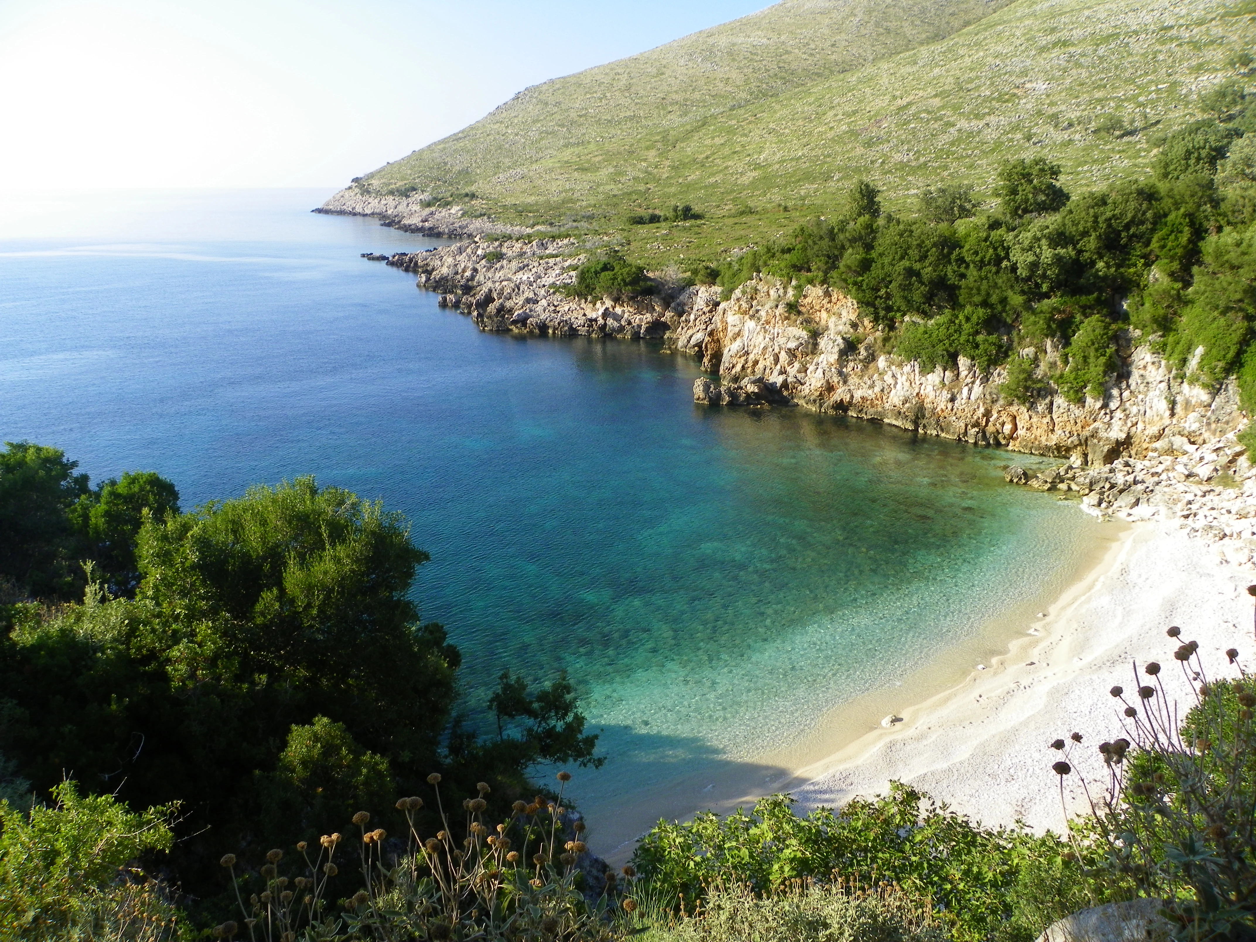
A high-angle view of a secluded cove with a turquoise beach bordered by rocky cliffs and green Mediterranean shrubs.
The secluded Gjiri i Ariut cove along the rugged coast of the Karaburun Peninsula.

Best time to visit Karaburun Peninsula

The Mediterranean climate of Karaburun shapes its year-round character, with hot, dry summers and milder, generally dry winters. Summer brings the warmest sea conditions and the clearest access to the peninsula's beaches and bays, when daylight hours are long and the rugged coastal scenery is at its most accessible for boat based exploration. Spring and early autumn tend to be more comfortable for walking and viewing the landscape, with cooler temperatures and softer light that emphasize the textures of the limestone cliffs and sea caves. Winters are mild but can be wetter and more exposed, particularly along the western cliffs, and are generally less favorable for coastal recreation but still valuable for observing the peninsula's quieter, more austere character.
Monthly climate preview

Long term monthly temperature ranges and precipitation rhythm from NASA Power data

Karaburun Peninsula Climate Normals, Average Temperature and Precipitation Profiles

Karaburun Peninsula exhibits a recorded annual temperature progression from mean values of 9.52 degrees Celsius up to 25.74 degrees Celsius alongside varying monthly precipitation rates. Reviewing the complete twelve month profile clarifies the underlying long term climate normals and multi month averages.
Annual mean17 °C
10 °C26 °C
Jan10°
Feb10°
Mar12°
Apr14°
May18°
Jun23°
Jul25°
Aug26°
Sep22°
Oct19°
Nov15°
Dec11°
Warmest month
August

25.7 °C

Coolest month
January

9.5 °C

Wettest month
November

4.4 mm/day

Driest month
July

0.7 mm/day

Park location guide

Geography guide, regional context, and park location map for Karaburun Peninsula

Karaburun Peninsula park geography, regions, and map view in Albania

Understand where Karaburun Peninsula sits in Albania through a broader geographic reading of the surrounding landscape, nearby location context, and its mapped position within the national park landscape.

How Karaburun Peninsula fits into Albania

Albania is a unitary parliamentary republic in Southeast Europe, situated on the Balkan Peninsula along the Adriatic and Ionian coastal regions. With a population of approximately 2.4 million people, it borders Montenegro, Kosovo, North Macedonia, and Greece. The country features varied landscapes ranging from the Albanian Alps to fertile coastal plains, with Tirana as its capital and largest city.

Wider geography shaping Karaburun Peninsula in Albania

Albania occupies the western part of the Balkan Peninsula in Southeast Europe. The country features a varied terrain with rugged mountain ranges including the Albanian Alps (Accursed Mountains), Korab, Skanderbeg Mountains, Pindus, and Ceraunian Mountains. Fertile lowland plains extend along the Adriatic and Ionian coastal regions. The country borders Montenegro to the northwest, Kosovo to the northeast, North Macedonia to the east, and Greece to the south.

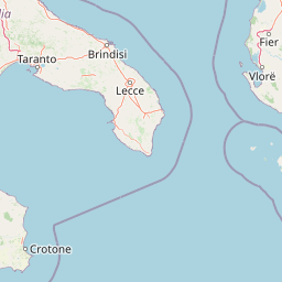
Map view of Karaburun Peninsula

Use this park location map to pinpoint Karaburun Peninsula in Albania, understand its exact geographic position, and read its mapped placement within the surrounding landscape more clearly.

Pigeon | © OpenStreetMap contributors

Location context for Karaburun Peninsula

Vlorë County

Visual reference for rugged limestone cliffs and protected marine habitats

Karaburun Peninsula Photos: Landscapes, Sea Caves, and Coastal Scenery

Visual records capture the striking topography of Karaburun Peninsula, revealing vertical limestone cliffs and carved sea caves along the Mediterranean shore. Photographic documentation provides direct insight into the protected terrain, remote coastal bays, and rare marine environments shaping the region.

A high-angle view looking down into a small, rocky cove with clear, turquoise water, where a person is swimming; rocky cliffs frame the inlet.

An aerial view of a secluded cove with turquoise water, a pebble beach, and surrounding rocky cliffs covered in green shrubs.

A split-level underwater view of a sea cave. Above the water line, rugged rock formations are visible. Below the water line, the seafloor consists of light-colored pebbles illuminated by blue light.

An aerial photograph of the mountainous Karaburun Peninsula projecting into the deep blue Ionian Sea under a sky with scattered clouds.

High-altitude aerial view of a large, rugged peninsula extending into deep blue sea, with scattered white clouds over land and mountains.

High-angle view of a secluded white pebble beach at Grama Bay, nestled between steep limestone cliffs and turquoise water.

Satellite imagery showing the rugged coastline of the Karaburun Peninsula extending into the Ionian Sea, with the Bay of Vlorë visible to the north.

A high-angle view of a secluded cove with a turquoise beach bordered by rocky cliffs and green Mediterranean shrubs.

A large, dark cave entrance set into tall, sheer limestone cliffs rising directly out of deep blue sea water.

Park atlas

Compare regional protected areas and connected Mediterranean marine reserves

Explore Other Parks Near Karaburun Peninsula and Protected Coastal Landscapes

Visitors leaving the dramatic limestone cliffs of Karaburun Peninsula can browse adjacent protected areas to examine similar coastal topography and marine habitats. Extending geographic comparison across the surrounding region reveals broader patterns in Mediterranean wilderness preservation.
Watercolor scene featuring a blue lake, green trees, and mountains under a yellow-pink sky
National parkAlbania
About 3.7 km away#1 closest

North

Karaburun-Sazan Marine Park: A National Park with Dramatic Limestone Cliffs and Island Ecosystems

Explore Albania's protected coastline and marine geography.

Karaburun-Sazan Marine Park, Albania's sole national park, offers a profound exploration of a unique protected landscape. This marine protected area combines the rugged Karaburun Peninsula, characterized by high limestone cliffs, with Sazan Island, Albania's largest island, known for its distinct geology and subtropical climate. The park's waters are critical habitats for endangered species, making it a significant site for marine biodiversity and regional geographic study. Discover the mapped boundaries and ecological context of this vital protected area.

Area
124.377 km²
Established
2010
IUCN
II
Relief
Mixed relief
Protected landscapeAlbania
About 15 km away#2 closest

North

Vjosa-Nartë Protected Landscape: Geographic Boundaries and Wetland Atlas of Albania

Coastal lagoons, saltpans, and Adriatic delta systems

Vjosa-Nartë Protected Landscape offers a deep look into Albania's coastal geography. The area features a striking interplay between the Vjosa River delta and the Narta Lagoon, framed by Mediterranean pine forests and shifting sand dunes. This atlas-focused resource maps the diverse terrain and ecological zones that characterize one of the most vital wetland corridors along the Adriatic Sea.

Area
161.246 km²
Established
2004
Relief
Lowland
Climate
Mediterranean
Watercolor painting depicting mountains, forests, and valleys
National parkVlorë County
About 22 km away#3 closest

Southeast

Llogara National Park: Vlorë County's Dramatic Ceraunian Mountain Protected Landscape

Explore Albania's rugged national park geography and mapped terrain.

Llogara National Park stands as a vital protected area within Vlorë County, Albania, renowned for its spectacular Ceraunian Mountain topography. This page provides access to detailed geographic information, highlighting the park's unique landscape characteristics, from alpine peaks to coastal vistas. Discover the mapped extent of this national park and its significance within the regional geography, perfect for structured atlas exploration.

Area
17.69 km²
Established
1966
IUCN
II
Relief
Mountain
Watercolor painting showing hills, green fields, a body of water, and vegetation under a soft sky
National parkAlbania
About 54 km away#4 closest

North

Divjakë-Karavasta National Park: Albania's Expansive Coastal Wetland and Pelican Breeding Site

Mapping Albania's largest Mediterranean lagoon and its vital bird sanctuaries.

Divjakë-Karavasta National Park is a key protected coastal wetland in western Albania, centered around Karavasta Lagoon, one of the largest in the Mediterranean. This Ramsar site provides critical habitats for numerous bird species, including a globally significant population of the endangered Dalmatian pelican, making it a premier destination for understanding regional wetland geography and protected area dynamics.

Area
222.3 km²
Established
2007
IUCN
II
Relief
Lowland
Watercolor painting showing a river valley with mountain ranges in the background and green fields
National parkGjirokastër County
About 62 km away#5 closest

East

Vjosa Wild River National Park: Europe's Pioneer Free-Flowing River Protected Area

Mapping dynamic canyons and vital river ecosystems in Gjirokastër County.

Vjosa Wild River National Park is recognized as Europe's first Wild River National Park, a groundbreaking designation protecting an entire river system from source to sea. This protected area in Gjirokastër County preserves remarkable topography, including dramatic canyons, natural rapids, and meandering islands, all shaped by the free flow of the Vjosa River and its tributaries. Explore the mapped boundaries and unique landscape context of this significant biodiversity hotspot, offering a crucial case study for river conservation and atlas discovery.

Area
127.27 km²
Established
2023
IUCN
II
Relief
Mixed relief
Watercolor painting showing mountains, a river, and vegetation
National parkAlbania
About 69 km away#6 closest

Northeast

Tomorr Mountain National Park: Sacred Peak & Karst Protected Landscape in Albania

Explore Albania's dramatic mountain geography and protected areas.

Tomorr Mountain National Park offers a unique exploration of southern Albania's dramatic limestone anticline. Dominated by the sacred Mount Tomorr and featuring the spectacular Osum Canyon, this national park provides insight into karst terrain, old-growth forests, and significant biodiversity. Discover its mapped boundaries and regional geographic context within the Pindus Mountains for structured atlas exploration.

Area
271.855 km²
Established
1956
IUCN
II
Relief
Mountain
A pale, soft-hued watercolor illustration of a natural landscape featuring rolling hills, a small waterfall, and sparse trees on a white background.
Protected areaAlbania
About 70 km away#7 closest

East

Bogovë Nature Park: Protected Limestone Hills and Waterfall Geography in Southern Albania

Regional protected area within the Balkan forest ecoregion

Bogovë Nature Park protects 330 hectares of diverse Mediterranean forest and dramatic limestone ravines. Central to its identity are the cascading waterfalls and karst topography that characterize this portion of the Pindus Mountains mixed forests ecoregion in southern Albania, providing a significant example of Balkan woodland preservation.

Area
3.3 km²
Established
1977
IUCN
IV
Relief
Mountain
Watercolor landscape painting showing a lake, distant mountains, and vegetation
National parkVlorë County
About 79 km away#8 closest

Southeast

Butrint National Park: Archaeological Heritage and Mediterranean Wetland Landscape

Explore its unique geography and protected park boundaries.

Butrint National Park presents a singular opportunity for geographic and protected-area discovery, showcasing an unparalleled fusion of ancient history and ecological richness. Located in Albania's Vlorë County, this national park encompasses Lake Butrint, coastal lagoons, and vital wetland habitats, recognized internationally for their biodiversity. Through MoriAtlas, users can explore the mapped extent of this unique landscape, understand its role within regional geography, and uncover the interplay between its preserved archaeological sites and the surrounding Mediterranean environment.

Area
94.244 km²
Established
2000
IUCN
II
Relief
Lowland

Common questions about visiting, size, designation, and location context for Karaburun Peninsula

Karaburun Peninsula FAQs for park facts, access, geography, and protected area context

Find quick answers about Karaburun Peninsula, including protected-area facts, park geography, trail and visitor context, and how the park fits into its surrounding country and regional landscape.
MoriAtlas Explorer

Continue Your Protected Areas Search Across the Global Atlas

Deepen your exploration by continuing the structured search for national parks and protected areas worldwide. Utilize the comprehensive filtering capabilities to compare different conservation landscapes and refine your understanding of global park geography. Discover more about the distribution and characteristics of protected natural areas.

Global natural geography