
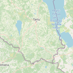
Wetlands
Park geography
A comprehensive analysis of terrain, regional administrative context, and natural features
Karula National Park: Detailed Geographic Profile and Mapped Protected Area Boundaries
Karula National Park covers a recorded area of 123.64 square kilometers within Estonia, spanning across Võru and Valga counties. This geography profile details the upland relief and diverse natural features, including significant hills, river systems, and lake complexes found within the protected boundaries.
Estonia's smallest national park protecting the hilly Karula Uplands and its network of lakes
Karula National Park
Karula National Park is the smallest national park in Estonia, located in the southern part of the country across Võru County and Valga County. Established originally as a protected area in 1979 and redesignated as a national park in 1993, the park encompasses approximately 123.6 square kilometers of the Karula Uplands, covering nearly a third of this elevated terrain. The landscape is characterized by rolling hills, numerous lakes, and a rich mosaic of forests and wetlands that together create one of Estonia's most ecologically diverse protected areas. The park straddles the administrative boundaries of Antsla and Rõuge parishes in Võru County and Valga Parish in Valga County, representing a transition zone between Estonia's core territories and its southeastern border regions. The ecological character of Karula National Park stands out for its exceptional biodiversity and the variety of habitats compressed into a relatively small area. The park contains approximately 40 lakes, most featuring marshy or boggy shores, alongside numerous small wetlands and streams that drain the upland terrain. Over 70 percent of the park's territory is covered by forest, creating extensive woodland habitat that supports populations of large mammals and provides breeding grounds for numerous bird species. The combination of hilly terrain, lake-rich valleys, and traditional cultural landscapes that have been shaped by centuries of human use makes this park distinctive within Estonia's protected area network. The park holds particular conservation significance in Estonia due to the presence of several rare and protected species. The flora includes species such as the Baltic orchid, mezereon, and the daisyleaf grape fern, the last of which is found in only three locations throughout Estonia. The fauna features species of European conservation concern including the pond bat, lesser spotted eagle, and black stork, while larger mammals such as elk, Eurasian lynx, and European polecat maintain stable populations within the park boundaries.
- Location
- Estonia
- Park type
- National park
- Established
- 1979
- Area
- 123.6 km²
- Highest point
- 137 m
Location overview
Administrative boundaries across Valga County and Võru County
Karula National Park Geographic Location and Regional Placement
Karula National Park is located in Estonia, spanning both Võru County and Valga County. Administrative data marks the inland reserve as entirely domestic, with no marine or transboundary sectors.
- Countries
- Estonia
- Regions
- Valga County, Võru County
- Primary location
- Estonia
- Geographic setting
- Inland
Boundary and coordinates
Visualizing the spatial envelope and extent across 123.64 square kilometers
Interactive Boundary Map for Karula National Park Geographic Limits
The mapped boundary outline of Karula National Park defines the spatial context of its protected landscape. Analyze key geographic metrics including its total area of 123.64 square kilometers, center coordinates, and spatial limits.
- Boundary area
- 123.6 km²
- Boundary perimeter
- 90.1 km
- Northernmost point
- 57.7736° N
- Southernmost point
- 57.6427° N
- Easternmost point
- 26.6367° E
- Westernmost point
- 26.3795° E
- Geographic centre
- 57.7126° N, 26.4898° E
- North–south span
- 14.6 km
- East–west span
- 15.3 km
Elevation and terrain
Upland topography profile featuring recorded natural features
Karula National Park Elevation and Terrain Geography
Explore the recorded elevation summary and upland relief metrics for Karula National Park. Examine the linked feature cards for names, types, and spatial relationships of recorded natural entities.
- Highest point
- 137 m
Selected named natural features
Lakes
Kallõtõ järv
Hills
Lossimägi
110.8 m
Lakes
Väiku-Kuikli järv
Hills
Tornimägi
138 m
Lakes
Viitka järv
Environmental setting
Temperate upland terrain, forest cover, and major water systems
Karula National Park Environmental Classifications and Physical Setting
Recorded classifications frame the physical setting through complementary upland relief, temperate forest, and major water features. Stored categories link directly to relevant atlas destinations for broader regional exploration.
- Relief
- Upland
- Climate
- Temperate
- Water
- Major water bodies
- Forest cover
- Mostly forested
- Seasonality
- Year-round
Landscape features
Hills · Forest · Wetland · Lakes · Rivers
Habitat types
Temperate broadleaf forest · Wetland · Riverine habitat · Lacustrine habitat
Park atlas
Expand your park discovery by tracing the geographic context and connected protected landscapes surrounding Karula National Park.
Explore Other National Parks and Protected Areas Near Karula National Park in Southern Estonia
After exploring Karula National Park, continue your geographic journey by browsing other national parks and protected areas located across southern Estonia and its adjacent regions. Comparing these conservation landscapes provides valuable context on regional biodiversity, varied terrain, and broader protected area networks within a consistent atlas framework.
National parkLatvia
61 km away#1 closest
Southwest

Gauja National Park: Latvia's Largest National Park Atlas and Protected Landscape
Mapped terrain and diverse natural heritage in Vidzeme.
As Latvia's largest national park, Gauja offers a deep dive into a protected landscape defined by the ancient Gauja River valley and its spectacular Devonian sandstone cliffs. This page provides essential geographic context and atlas-style information, detailing the park's mapped boundaries, unique geological formations, and the rich tapestry of natural and cultural heritage that makes it a cornerstone of the region's protected lands. Explore the varied terrain, from river valleys to rolling uplands, all within a meticulously mapped conservation area.
- Area
- 917.87 km²
- Established
- 1973
- IUCN
- II
- Relief
- Mixed relief
National parkViljandi County
95 km away#2 closest
Northwest

Soomaa National Park: Estonia's Wilderness Wetland Landscape Atlas
Explore mapped protected peat bogs and dynamic floodplains in Viljandi County.
Soomaa National Park is a protected wilderness area in Estonia renowned for its extensive peat bog systems and unique floodplains. This national park, located primarily in Viljandi County, showcases some of Europe's largest intact wetland landscapes, characterized by seasonal floods that transform the terrain into vast aquatic environments. MoriAtlas provides detailed geographic context for Soomaa, allowing for exploration of its protected boundaries and landscape features within the broader atlas of European natural areas.
- Area
- 359 km²
- Established
- 1993
- IUCN
- II
- Relief
- Lowland
National parkLatgale
144 km away#3 closest
South
Rāzna National Park: Protected Landscape and Regional Geography in Latgale
Explore the mapped terrain of Latvia's largest lake region.
Rāzna National Park, situated in the Latgale region, provides an essential focal point for understanding eastern Latvia's protected landscapes. This national park, recognized for its extensive glacial terrain and the significant Lake Rāzna, offers a distinct geographic profile. Users can explore its mapped boundaries, discover its role as a vital protected area, and understand its landscape context within the broader atlas of Latvia's natural heritage.
- Area
- 596.14 km²
- Established
- 2007
- IUCN
- II
- Relief
- Highland
National parkEstonia
About 154 km away#4 closest
North
Alutaguse National Park: Eastern Estonia's Vast Peat Bog and Forest Protected Landscape
Mapping Protected Wetlands and Boreal Ecosystems in Estonia
Alutaguse National Park, a newly established national park in eastern Estonia, offers a unique atlas perspective on extensive peat bog ecosystems and boreal forests. Covering over 443 square kilometers, it represents some of the most intact wetland landscapes in the country. The park's creation unified eleven protected areas, safeguarding a critical habitat for rare species and showcasing the distinctive geography of the Alutaguse Lowland.
- Area
- 443.31 km²
- Established
- 2018
- IUCN
- II
- Relief
- Lowland
National parkLääne County
178 km away#5 closest
Northwest
Matsalu National Park: Explore Estonia's Premier Wetland National Park Geography and Protected Area
Discover mapped landscapes and bird migration routes in Lääne County.
Matsalu National Park, located in Lääne County, Estonia, is a prime example of a protected wetland ecosystem of international significance. This page delves into the park's unique geographic features, including the shallow brackish Matsalu Bay, the expansive Kasari River delta, and the numerous islands that form its coastal mosaic. Users can explore the park's protected boundaries and understand its critical function as a major staging area for migratory birds, offering a detailed atlas-level view of this important natural landscape.
- Area
- 486.1 km²
- Established
- 1957
- IUCN
- II
- Relief
- Lowland
National parkLatvia
185 km away#6 closest
Southwest
Ķemeri National Park: Discover Latvia's Iconic Protected Bog and Wetland Geography
Explore a unique protected landscape with mapped bog ecosystems and regional natural terrain.
Ķemeri National Park in Latvia is a remarkable protected area, celebrated for its expansive and ecologically significant raised bog systems, particularly the Great Ķemeri Bog. This national park showcases a unique geographical character, featuring natural sulfur springs, therapeutic muds, and a series of ancient lagoon lakes that support rich birdlife. Its diverse wetland habitats and distinct peatland landscapes offer a compelling focus for atlas-based discovery and understanding the regional geography of the Latvian coast.
- Area
- 381.65 km²
- Established
- 1997
- IUCN
- II
- Relief
- Lowland
National parkEstonia
190 km away#7 closest
North
Lahemaa National Park: Explore Estonia's Coastal Geography and Protected Landscape Atlas
Mapped terrain, bogs, and coastal peninsulas of a major protected area.
Delve into the detailed geography of Lahemaa National Park, Estonia's largest national park situated on the southern coast of the Gulf of Finland. This protected landscape encompasses a diverse range of terrain, from the deeply indented coastline and ancient glacial boulders to expansive raised bogs and rolling boreal forests. Understand the park's mapped boundaries and its significance as a premier destination for exploring distinct Baltic natural environments and historical coastal villages. The park's unique blend of natural features and cultural heritage makes it a key point of reference in any protected-area atlas.
- Area
- 747 km²
- Established
- 1971
- IUCN
- II
- Relief
- Lowland
National parkPskov Oblast
About 194 km away#8 closest
Southeast

Sebezhsky National Park: National Park within Pskov Oblast's Regional Geography
Mapped protected landscape and regional context
Sebezhsky National Park is a designated national park offering a distinct protected landscape within the Pskov Oblast of northwestern Russia. This page provides essential details for atlas exploration, focusing on the park's mapped boundaries, its role as a protected area, and its contribution to the regional geography of the Pskov Oblast. Users can understand its place within a broader mapping of Russia's natural territories and protected lands.
- Area
- 500.21 km²
- Established
- 1996
- IUCN
- II
- Relief
- Highland
MoriAtlas Explorer
Continue Exploring Karula National Park's Mapped Geography and Protected Terrain
Deepen your understanding of Karula National Park by navigating its specific geographic features, mapped protected boundaries, and diverse landscapes. MoriAtlas provides the tools to explore this unique corner of Estonia, allowing for detailed study of its conservation significance and regional context. Discover how the rolling hills, numerous lakes, and extensive forests contribute to its distinctive natural identity and its place within the Estonian atlas of protected areas.
Browse next
Global natural geography
Explore related park routes
Explore MoriAtlas Global ParksBrowse All MoriAtlas ParksGlobal Park Map DiscoveryMoriAtlas: Browse All CountriesBrowse All MoriAtlas ContinentsNational Park Environment AtlasGrand Canyon National Park AtlasYellowstone National Park AtlasYosemite National Park Atlas and GeographySerengeti National Park AtlasGalápagos National Park Protected LandscapeBanff National Park Geography and AtlasKruger National Park Atlas EntryUluṟu-Kata Tjuṯa National Park AtlasExplore Uluru-Kata Tjuta National Park GeographyPlitvice Lakes National Park AtlasFiordland National Park Protected LandscapeGreat Smoky Mountains National Park AtlasAfghanistan National Parks and Protected AreasAlbania National Parks and Protected AreasAlgeria National Parks and Protected AreasAmerican Samoa National Parks and Protected AreasAndorra National Parks and Protected AreasAngola National Parks and Protected AreasAntarctica National Parks and Protected AreasAntigua and Barbuda Park List