Mori Atlas logo
National parkKhogno Khan National Park

Trace the geographic boundaries and mapped terrain of this protected national park in East Asia.

Khogno Khan National Park: National Park Protected Landscape within Mongolia's Geography

Khogno Khan National Park represents a significant protected landscape within the vast geographic expanse of Mongolia. As a national park, its designation underscores its importance for regional conservation and atlas-based exploration. This entry facilitates a detailed understanding of its specific mapped boundaries and its place within the broader context of East Asian natural terrain, offering a clear geographic identity for dedicated map exploration.

Mountain Protected AreaHistorical Buddhist SitesCentral MongoliaSemi-Arid GrasslandSteppe EcosystemCultural Heritage Site

Khogno Khan National Park

National park

Park overview

Structured park overview, official facts, and landscape profile for Khogno Khan National Park

Khogno Khan National Park park facts, protected area profile, and essential visitor context

Review the core facts for Khogno Khan National Park, including designation, size, terrain, visitor scale, habitats, and operating context in one park-focused overview.

About Khogno Khan National Park

Khogno Khan National Park represents a protected landscape where Mongolia's natural and cultural heritage intersect within a semi-mountainous setting. The park's central feature, Khogno Khan mountain, serves as both an ecological anchor and a cultural landmark for the surrounding region. Located in Gurvanbulag District of Bulgan Province, the protected area was officially established in 2003 as part of Mongolia's expanding network of national parks designed to preserve representative examples of the country's diverse landscapes and ecosystems. The park's establishment reflects Mongolia's commitment to balancing conservation with sustainable use of natural resources, particularly in regions where human history and ecological systems have developed together over centuries. The mountain and surrounding area have long held significance for local communities, with the 17th-century monastic ruins serving as physical evidence of the region's historical importance as a center of Buddhist practice and learning.

Quick facts and research context for Khogno Khan National Park

Khogno Khan National Park covers 841 square kilometers in Bulgan Province, making it a substantial protected area in central Mongolia. The park was established in 2003 and is governed by the Ministry of Environment and Green Development of Mongolia. It is categorized as an IUCN Category II protected area, representing national park status. The park lies approximately 60 kilometers east of Kharakoram and sits about 240 kilometers west of Ulaanbaatar, positioning it as a relatively accessible protected area from the capital. The landscape is characterized by the prominent Khogno Khan mountain rising from the surrounding steppe, creating a distinctive visual landmark in the region.

Protection and recognition

Verifying terrestrial boundaries and national protection history established in 2003

Khogno Khan National Park Protected Area Status and Designation History

Documented data records the terrestrial protection framework of Khogno Khan National Park established under national legislation in 2003. Atlas users can verify the terrestrial scope and official designation timeline of the designated park terrain to understand its regional conservation context.

Protection details

Protection scope
Terrestrial
Designated year
2003
Transboundary protection
No
Park context

Deeper park guide and search-rich context for Khogno Khan National Park

Khogno Khan National Park history, landscape, wildlife, and travel context

Explore Khogno Khan National Park through its history, landscape character, ecosystems, wildlife, conservation priorities, cultural context, and seasonal travel timing in a structured park guide built for atlas discovery and search intent.

Why Khogno Khan National Park stands out

Khogno Khan National Park is best known for its dramatic mountain landscape rising abruptly from the Mongolian steppe, creating a striking geological contrast that defines the region's visual character. The park is particularly notable for its cultural heritage, containing the ruins of a 17th-century monastery that represents significant historical and religious context for the area. The combination of natural mountain terrain with well-preserved archaeological sites makes this park distinctive among Mongolia's protected areas, offering visitors both scenic natural landscapes and meaningful historical exploration opportunities.

Khogno Khan National Park history and protected-area timeline

Khogno Khan National Park was established in 2003 as part of Mongolia's systematic expansion of its protected areas network during the early 2000s. The creation of the park reflected growing recognition among Mongolian conservation authorities that the Khogno Khan mountain region warranted formal protection both for its natural values and its cultural significance. The park falls under the governance of the Ministry of Environment and Green Development of Mongolia, which administers protected areas according to national legislation and international conservation frameworks. The historical presence of a 17th-century monastery on the mountain indicates that the area held religious and spiritual significance well before formal protected area status was established, with monastic communities likely drawn to the mountain's prominent position and the natural environment it provided. The designation of the area as a national park in 2003 codified existing protections while providing a framework for sustainable management and visitor access.

Khogno Khan National Park landscape and geographic character

The landscape of Khogno Khan National Park is characterized by the prominent Khogno Khan mountain, which rises dramatically from the surrounding flat steppe terrain of central Mongolia. This geological setting creates a distinctive visual contrast between the mountainous core of the park and the rolling grasslands that extend outward from its base. The semi-mountainous terrain within the park boundaries includes rocky outcrops, slopes, and valleys that support vegetation communities distinct from the surrounding plains. The mountain's elevation and varied topography create microhabitats that support plant and animal communities adapted to more rugged conditions than the typical steppe environment. The overall landscape character combines the visual drama of an isolated mountain massif with the expansive horizontal character of Mongolia's grassland ecosystems, creating a park of significant scenic value.

Khogno Khan National Park ecosystems, habitats, and plant life

The natural environment of Khogno Khan National Park reflects the transition between Mongolia's central steppe ecosystems and more specialized mountain habitats. The park's semi-mountainous terrain supports vegetation communities adapted to the varied topography, including grasses, shrubs, and山地 plants that colonize the slopes and rocky areas. The mountain environment provides habitat for wildlife species adapted to the rugged terrain, while the surrounding steppe areas support the broader fauna characteristic of Mongolia's grasslands. The protected status of the area helps maintain ecological processes and species populations within a region where traditional pastoral activities and other land uses continue to influence the landscape. The combination of protected status and relative accessibility makes the park significant for conservation of both representative steppe ecosystems and the more localized mountain habitats.

Khogno Khan National Park wildlife and species highlights

Khogno Khan National Park provides habitat for wildlife species adapted to Mongolia's semi-arid grassland environments and the more specialized mountain terrain found within the park. The steppe regions surrounding the mountain support species typical of Mongolia's extensive grasslands, including various small mammals, birds, and reptiles that have evolved to survive in the region's extreme seasonal temperature variations. The rocky terrain and slopes of Khogno Khan mountain provide shelter and foraging opportunities for species that utilize the more rugged microhabitats. While the source material does not provide detailed species inventories, the park's protected status helps maintain habitat connectivity for wildlife movements across this section of central Mongolia, supporting ecological communities that depend on intact grassland and mountain ecosystems.

Khogno Khan National Park conservation status and protection priorities

Khogno Khan National Park serves as an important protected area within Mongolia's national park system, representing conservation of both natural landscapes and cultural heritage. The park's designation as IUCN Category II status indicates management focused on ecosystem protection while allowing for visitor use and enjoyment of the area's natural and cultural values. The protection of Khogno Khan mountain and its surrounding terrain helps preserve representative examples of Mongolia's semi-mountainous landscapes and the ecological communities they support. The inclusion of historical monastic ruins within the park boundaries reflects Mongolia's approach to integrated conservation that recognizes the inseparable connection between cultural and natural heritage in many landscapes. This dual-focus conservation model helps ensure that both the natural environment and the historical legacy of the region receive appropriate protection and management attention.

Khogno Khan National Park cultural meaning and human context

Khogno Khan National Park contains significant cultural heritage in the form of ruins from a 17th-century Buddhist monastery, reflecting the deep historical connection between Mongolia's landscapes and religious practice. The presence of monastic establishments on the mountain indicates its historical importance as a spiritual center and pilgrimage destination for Buddhist communities in the region. The monastery ruins represent tangible evidence of the cultural significance this mountain has held for local populations over several centuries, continuing to serve as important heritage assets within the protected area. The cultural context of the park extends beyond the religious significance to include the broader relationship between Mongolia's nomadic pastoral communities and the distinctive landscapes they inhabit, with Khogno Khan mountain serving as a recognizable landmark in the cultural geography of central Mongolia.

Top sights and standout views in Khogno Khan National Park

The defining highlight of Khogno Khan National Park is the dramatic Khogno Khan mountain itself, rising prominently from the Mongolian steppe and creating a striking natural landmark visible across considerable distances. The park's cultural highlight is the ruins of the 17th-century monastery, which provide meaningful historical context and represent the region's religious heritage within a protected landscape setting. The accessibility of the park, situated approximately 240 kilometers from Ulaanbaatar, makes it one of the more reachable national parks for visitors traveling from the capital. The combination of natural mountain scenery, historical sites, and protected grassland ecosystems creates a park that offers diverse experiences within a relatively compact area.

Best time to visit Khogno Khan National Park

The best time to visit Khogno Khan National Park aligns with Mongolia's short summer season, typically from June through August, when temperatures are warmest and conditions most favorable for outdoor exploration. During these months, the steppe landscape is at its most verdant and wildlife activity is most observable, while temperatures allow for comfortable hiking and exploration of the mountain trails. Spring and autumn offer alternative visitation windows with their own seasonal characteristics, though visitors should prepare for more variable weather conditions. Winter visits are possible but present significant challenges due to extreme cold and reduced access to some areas of the park. The shoulder seasons of late spring and early autumn may offer favorable conditions for those seeking fewer crowds while still experiencing comfortable weather for park exploration.
Monthly climate preview

Decadal climate averages and monthly precipitation patterns at 1308 meters elevation

Khogno Khan National Park Climate and Long-Term Weather by Month

Long-term meteorological data from a representative coordinate at 1308 meters reveals a climate of wide temperature ranges and concentrated mid-year precipitation within Khogno Khan National Park. Accessing the complete twelve-month profile provides detailed weather-by-month parameters to trace the severe sub-zero winters and warm summers characteristic of the Mongolian steppe landscape.
Annual mean2 °C
-17 °C20 °C
Jan-17°
Feb-13°
Mar-5°
Apr
May11°
Jun17°
Jul20°
Aug17°
Sep10°
Oct
Nov-8°
Dec-15°
Warmest month
July

19.5 °C

Coolest month
January

-17.4 °C

Wettest month
July

2.2 mm/day

Driest month
January

0.1 mm/day

Park location guide

Geography guide, regional context, and park location map for Khogno Khan National Park

Khogno Khan National Park park geography, regions, and map view in Mongolia

Understand where Khogno Khan National Park sits in Mongolia through a broader geographic reading of the surrounding landscape, nearby location context, and its mapped position within the national park landscape.

How Khogno Khan National Park fits into Mongolia

Mongolia is a landlocked sovereign state in East Asia, known for its vast steppe landscapes, nomadic culture, and historical significance as the heartland of the Mongol Empire founded by Genghis Khan in 1206. The country has a population of approximately 3.5 million people and is the world's most sparsely populated sovereign state. Ulaanbaatar is the capital and largest city, home to roughly half the population.

Wider geography shaping Khogno Khan National Park in Mongolia

Mongolia is located in East Asia, landlocked between Russia to the north and China to the south. The country occupies the Mongolian Plateau and features diverse terrain including grassy steppe, mountains in the north and west, and the Gobi Desert in the south. It covers 1,564,116 km2, making it the second largest landlocked country in the world.

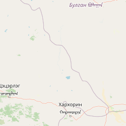
Map view of Khogno Khan National Park

Use this park location map to pinpoint Khogno Khan National Park in Mongolia, understand its exact geographic position, and read its mapped placement within the surrounding landscape more clearly.

Pigeon | © OpenStreetMap contributors

Location context for Khogno Khan National Park

Bulgan Province
Park atlas

Explore the regional park geography and conservation landscapes surrounding Khogno Khan National Park in central Mongolia.

Explore Related National Parks and Protected Areas Near Khogno Khan National Park

Expand your protected area discovery beyond Khogno Khan National Park by browsing other national parks and conservation landscapes situated within central Mongolia's geographic context. Compare the varied terrain, ecological features, and cultural heritage sites across adjacent protected areas, gaining a comprehensive atlas view of the region's unique natural wealth.
Protected areaArkhangai Province
About 74 km away#1 closest

Northwest

Ögii Lake Protected Area: A Comprehensive Geographic Overview of the Mongolian Steppe

Freshwater basin and wetland geography in Arkhangai Province

Ögii Lake represents a pivotal protected landscape in central Mongolia, defined by its 25 square kilometer surface area and gentle, shallow underwater topography. This site functions as an ecological nexus for migratory waterbirds and is essential for understanding the transition between open grassland and the mountainous terrain of the Khangai region.

Area
25.7 km²
Established
2006
Relief
Lowland
Access
Access unknown
National parkTöv Province
About 159 km away#2 closest

East

Hustai National Park: Geographic and Protected Landscape Profile in Töv Province

Steppe, mountain, and riverine ecosystem mapping

Hustai National Park serves as a landmark conservation site in Töv Province, protecting a distinct gradient between the Khustai mountain ridges and the surrounding Mongolian plains. The area is defined by its role in steppe ecology, featuring varied slopes, riverine woodlands, and expansive grasslands that support a unique assembly of wildlife within the broader central Mongolian region.

Area
506 km²
Established
2003
IUCN
II
Relief
Mountain
National parkMongolia
About 171 km away#3 closest

East

Khustain Nuruu National Park: Mongolia's Steppe Wilderness & Przewalski's Horse Conservation Area

Explore its mapped protected landscape and regional geography.

Khustain Nuruu National Park is a protected area in Mongolia celebrated for its pivotal role in the conservation and reintroduction of the Przewalski's horse, the last truly wild horse species. This national park preserves the unique steppe terrain and rolling hills characteristic of the Mongolian Plateau, serving as a crucial habitat for native wildlife. Understanding Khustain Nuruu National Park provides a focused look into successful wildlife recovery efforts and the geographic context of Central Asian protected lands.

Established
1993
IUCN
II
Relief
Mountain
Scope
Terrestrial
National parkMongolia
About 172 km away#4 closest

West

Khangai Nuruu National Park: Discover Mongolia's Protected Mountain Landscape and Atlas Context

Explore mapped boundaries and diverse ecosystems across its terrain.

Khangai Nuruu National Park stands as a vast national park in central Mongolia, characterized by its diverse protected landscapes and significant geographic scope. Spanning the Khangai Mountains, it presents a remarkable ecological transition from alpine meadows and taiga forests to steppe and riparian environments. This park offers a rich atlas exploration opportunity, highlighting its mapped boundaries and the unique regional geography that defines its protected status, making it a key point of discovery for understanding Mongolian conservation areas.

Area
8,885 km²
Established
1996
IUCN
II
Relief
Mountain
Biosphere reserveUlaanbaatar
About 254 km away#5 closest

East

Bogd Khan Uul Biosphere Reserve: Mapped Protected Landscapes and Geographic Overview

Highland ecosystems and forest steppe in the Khentii Mountains.

Rising directly south of Ulaanbaatar, Bogd Khan Uul Biosphere Reserve protects a compact mosaic of habitats including larch forests, Siberian pine stands, and alpine rock. The reserve serves as a critical geographic marker, illustrating the rapid shift from urban fringes to subalpine wilderness while maintaining a history of sacred environmental protection that informs its current status as a biosphere reserve.

Area
673 km²
Established
1996
Relief
Mountain
Climate
Boreal
National parkMongolia
About 299 km away#6 closest

West

Khorgo-Terkhiin Tsagaan Nuur National Park: A Volcanic Landscape and Wetland Atlas

Mapping volcanic terrain and migratory bird habitats in the Khangai Mountains.

This protected area features the dramatic remnants of the Taryatu-Chulutu volcanic field, centered on the extinct Khorgo volcano and the deep waters of Terkhiin Tsagaan Lake. The park provides an essential refuge for avian populations in its western marshlands, contrasting with the surrounding forest steppe. Explore the unique topography and ecological boundaries of this significant Mongolian conservation landscape.

Area
8 km²
Established
1965
IUCN
II
Relief
Mountain
National parkArkhangai Province
About 304 km away#7 closest

West

Khorgo-Terkhiin Tsagaan Nuur National Park: Volcanic Terrain and Lake Geography

A protected highland landscape in Arkhangai Province

Explore the distinct physical geography of Khorgo-Terkhiin Tsagaan Nuur National Park, where the extinct Khorgo volcano borders a vast freshwater lake. This protected area offers a look at the mosaic of birch forest and alpine slopes within the Khangai range. The mapping of this central Mongolian site reveals how volcanic activity and mountain hydrology converge to shape its unique natural horizon.

Relief
Mountain
Climate
Alpine
Scope
Terrestrial
Water
Water-dominated
National parkTöv Province
About 304 km away#8 closest

East

Gorkhi-Terelj National Park: Mapped Protected Landscape in Töv Province

Explore the geographic context and park boundaries.

Gorkhi-Terelj National Park is a designated national park offering rich opportunities for geographic exploration and protected landscape discovery. This entity page provides detailed insights into its mapped boundaries and its position within the regional geography of Töv Province. Understand the specific landform and terrain characteristics that define this protected natural area, central to understanding Mongolia's conservation landscapes.

Area
2,920 km²
Established
1993
IUCN
II
Relief
Mountain

Common questions about visiting, size, designation, and location context for Khogno Khan National Park

Khogno Khan National Park FAQs for park facts, access, geography, and protected area context

Find quick answers about Khogno Khan National Park, including protected-area facts, park geography, trail and visitor context, and how the park fits into its surrounding country and regional landscape.
MoriAtlas Explorer

Continue Your Protected Areas Search Across the Global Atlas

Deepen your exploration by continuing the structured search for national parks and protected areas worldwide. Utilize the comprehensive filtering capabilities to compare different conservation landscapes and refine your understanding of global park geography. Discover more about the distribution and characteristics of protected natural areas.

Global natural geography