Mori Atlas logo
National parkLake Khövsgöl National Park

Tracing the tectonic basin, mountain ranges, and boreal forests of this ancient hydrological sanctuary

Lake Khövsgöl National Park: A Comprehensive Atlas of Mongolia's Pristine Freshwater Protected Landscape

Lake Khövsgöl National Park preserves a critical freshwater ecosystem over two million years old, serving as a primary hydrological reservoir in the high-elevation terrain of northern Mongolia. The protected landscape bridges the Siberian taiga and the Central Asian steppe, featuring dramatic mountain ridges of the Sayan range and vast larch forests. This mapped territory offers a deep look into an ultraoligotrophic lake system that remains one of the most pristine natural environments in the world.

ancient lakefreshwater reservetaigasteppe transitionSiberian larch forestmountain lake
A flat-style digital illustration depicting a calm mountain lake nestled between high rocky cliffs and pine forests under a soft sun.

Lake Khövsgöl National Park

National park

Park overview

Structured park overview, official facts, and landscape profile for Lake Khövsgöl National Park

Lake Khövsgöl National Park park facts, protected area profile, and essential visitor context

Review the core facts for Lake Khövsgöl National Park, including designation, size, terrain, visitor scale, habitats, and operating context in one park-focused overview.

About Lake Khövsgöl National Park

Lake Khövsgöl National Park is one of Mongolia's most significant protected areas, defined by a single dominant feature: an exceptionally pure, ancient freshwater lake set among mountains near the southern edge of Siberia. The park lies in the northwestern corner of Mongolia in Khövsgöl Province, where the steppes of Central Asia meet the boreal forests of the taiga. The body of water at its heart, Lake Khövsgöl, has existed for more than two million years and ranks among the oldest lakes in the world.

The lake itself is a major hydrological landmark. It is the largest freshwater lake in Mongolia by volume and the second largest by surface area, holding almost 70 percent of the country's entire freshwater reserve and a measurable fraction of all the unfrozen fresh water on the planet. Despite sitting in a generally dry region, its waters are ultraoligotrophic, meaning low in nutrients and extremely clear, and they are considered pure enough to drink without any treatment. From the southern shore, the lake drains via the Egiin Gol into the Selenge river system and ultimately into Lake Baikal, linking two of Asia's most important freshwater systems across more than a thousand kilometers of flow.

The surrounding landscape is as dramatic as the lake itself. The eastern Sayan Mountains frame the basin to the north, and the highest peak in the area, Mönkh Saridag, reaches nearly 3,500 meters and straddles the Mongolian-Russian border. Dense stands of Siberian larch dominate the forested slopes, marking this region as the southern edge of the great Siberian taiga. The transition between taiga forest and open steppe grasslands is unusually abrupt here, making the national park an important ecological boundary zone.

Culturally, the lake holds deep meaning for Mongolians, who have long regarded it as a sacred site. It is often referred to as the 'Mother Sea', in contrast to the country's many salty endorheic lakes, and is closely tied to the identity of local herding communities around the southern town of Khatgal. Contemporary management combines strict national park protection with long-term scientific monitoring through the Hövsgöl Long-Term Ecological Research Site, established in 1997, which has turned the park into a major center for climate and water research in northern Asia.

Quick facts and research context for Lake Khövsgöl National Park

Lake Khövsgöl National Park is situated in Khövsgöl Province in northwestern Mongolia, at the foot of the eastern Sayan Mountains and near the border with Russia. The centerpiece of the park is Lake Khövsgöl, sitting at roughly 1,645 meters above sea level and stretching about 136 kilometers in length, making it a large, deep, cold-water body in an otherwise arid country.

The park is classified as a transition zone between Central Asian steppe and Siberian taiga, with Siberian larch dominating the surrounding forests. It is one of roughly twenty ancient lakes in the world, more than two million years old, and serves as Mongolia's most important drinking water reserve. Recognized as an Important Bird Area and larger than Yellowstone in extent, it is a flagship protected area in northern Mongolia's geographic and ecological identity.

Protection and recognition

Documented terrestrial protection scope and administrative designation details

Lake Khövsgöl National Park Protection Status and Conservation Profile

Lake Khövsgöl National Park maintains a documented terrestrial protection scope within the regional conservation network. Administrative records outline the official status, management framework, and recognized boundary designations for the protected area.

Protection details

Protection scope
Terrestrial
Transboundary protection
No
Park context

Deeper park guide and search-rich context for Lake Khövsgöl National Park

Lake Khövsgöl National Park history, landscape, wildlife, and travel context

Explore Lake Khövsgöl National Park through its history, landscape character, ecosystems, wildlife, conservation priorities, cultural context, and seasonal travel timing in a structured park guide built for atlas discovery and search intent.

Why Lake Khövsgöl National Park stands out

Lake Khövsgöl National Park is best known for its extraordinary freshwater reserve, an ancient oligotrophic lake whose water is so clean it can be consumed without treatment. The lake is nicknamed the 'Mother Sea' in Mongolian culture, reflecting its near-sacred status in a country where most lakes are saline. The park also stands out as one of the clearest transitions on Earth between the Central Asian steppe and the Siberian taiga, creating a meeting point of two great Eurasian biomes. It is recognized internationally as an Important Bird Area, contains the endemic Hovsgol grayling, and surrounds a body of water more than two million years old, one of the most pristine ancient lakes on the planet after Lake Vostok.
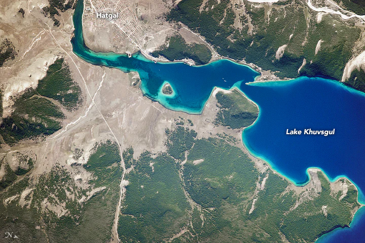
Satellite image showing the deep blue water of Lake Khövsgöl, the village of Hatgal at the shoreline, and surrounding dense boreal forests and rocky terrain.
Satellite view of the southern tip of Lake Khövsgöl, highlighting the shoreline geography and the settlement of Hatgal.

Lake Khövsgöl National Park history and protected-area timeline

Mongolia has long recognized Lake Khövsgöl as a place of exceptional natural and cultural value, and the surrounding region has traditionally been the homeland of herding communities whose livelihoods are closely tied to the lake and its watershed. The lake's status as a sacred site, often referred to as the 'Mother Sea', predates modern conservation efforts and reflects its importance in a country where most large lakes are saline.

Formal protection came with the establishment of Lake Khövsgöl National Park, a protected area noted for being larger than Yellowstone in extent. The park was designed to safeguard both the lake itself and the broader transition zone between the Central Asian steppe and the Siberian taiga. Since then it has functioned not just as a nature reserve but as a critical buffer for Mongolia's freshwater security.

In 1997 the Hövsgöl Long-Term Ecological Research Site was founded, anchoring the park within an international network of long-term ecological study sites. The research program has supported studies of climate change, watershed dynamics, and biodiversity, and has helped build Mongolia's scientific capacity for environmental monitoring. Alongside this scientific role, the park has faced ongoing conservation challenges, including illegal fishing pressure on native species such as the endemic Hovsgol grayling and emerging concerns about microplastic pollution reaching even this remote waterbody.

Lake Khövsgöl National Park landscape and geographic character

The landscape of Lake Khövsgöl National Park is shaped by a deep tectonic lake basin framed by high mountain ranges. The lake itself stretches roughly 136 kilometers from south to north and reaches depths of more than 250 meters, with an average depth exceeding 100 meters. Its waters sit at about 1,645 meters above sea level, placing the entire park in a high-elevation setting characteristic of northern Mongolia.

Surrounding the lake is a dramatic ring of mountains. The eastern Sayan Mountains rise to the north, with the border-straddling peak of Mönkh Saridag at approximately 3,492 meters being the highest point in the area. Steep slopes descend from these ridges toward the lake, giving way to dense forests of Siberian larch along the northern shore and more open steppe-influenced terrain toward the south.

The lake includes a handful of small islands, the most prominent being Wooden Boy Island, an elliptical landmass in the middle of the lake measuring roughly 3 kilometers by 2 kilometers. The southern shore is the most populated part of the park, anchored by the town of Khatgal, while the broader watershed is relatively small and dominated by modest tributaries. In winter, the lake freezes into a thick, stable ice sheet that historically supported heavy vehicle crossings, though this practice is now prohibited to prevent pollution and accidents on the ice.
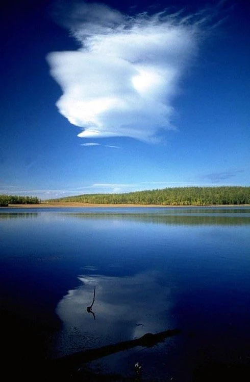
A wide, vertical shot of a calm, deep blue lake under a clear blue sky, featuring a large, singular white lenticular cloud near the top and its reflection in the water below. A distant treelined shore borders the lake, and a dark, partially submerged branch is visible in the foreground water.
A serene view of Lake Khövsgöl with a lenticular cloud reflecting in the calm waters.

Lake Khövsgöl National Park ecosystems, habitats, and plant life

The ecological character of Lake Khövsgöl National Park is defined by the convergence of two major Eurasian biomes: the Central Asian steppe and the Siberian taiga. This transition zone is unusually sharp here, producing a landscape that shifts between open grasslands, subarctic forests, alpine ridges, and a cold ultraoligotrophic lake within a relatively compact area.

Forests in the park are dominated by Siberian larch, a hardy conifer well adapted to the long, severe winters of northern Mongolia. These larch woodlands form part of the southern margin of the great Siberian taiga and are among the most ecologically important boreal stands in the country. Above the treeline, mountain slopes transition into alpine tundra and exposed rock, supporting cold-adapted plant communities.

The lake itself is classified as ultraoligotrophic, meaning very low nutrient levels, primary productivity, and exceptionally high water clarity, with Secchi depths regularly exceeding 18 meters. This combination of low productivity, great age, and minimal disturbance makes its ecosystem especially sensitive to changes in nutrient input, pollution, and fishing pressure, while also giving it exceptional scientific and conservation value.
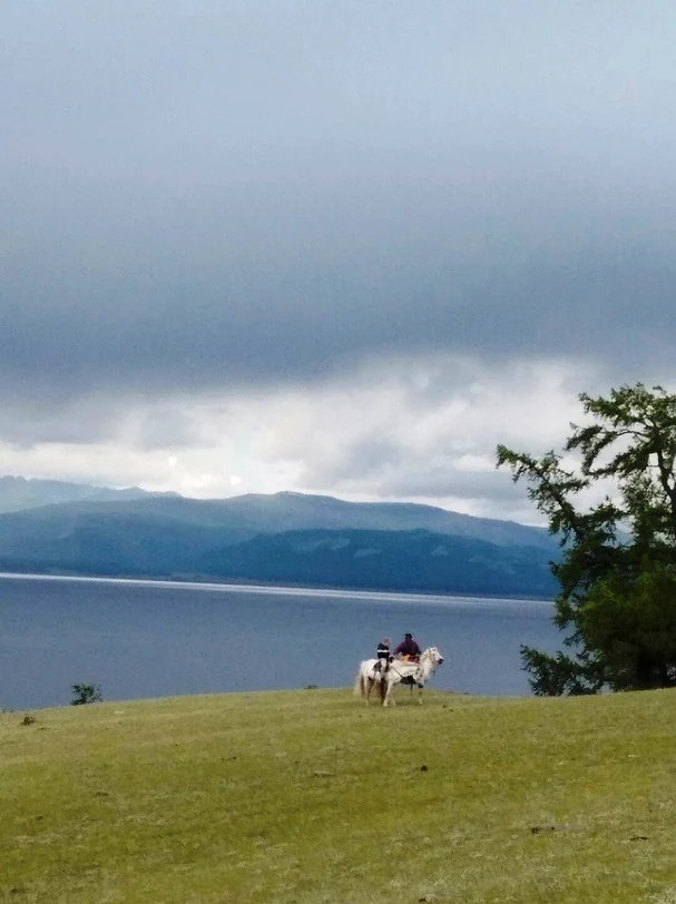
A wide view of a grassy hillside overlooking a large lake and distant mountains under a cloudy sky, with a person riding a white horse in the foreground.
A herder on horseback overlooking Lake Khövsgöl in Mongolia.

Lake Khövsgöl National Park wildlife and species highlights

Lake Khövsgöl National Park supports a rich assemblage of large mammals characteristic of the taiga-steppe borderlands of northern Asia. The forested mountains and adjacent slopes are home to species such as the brown bear, Siberian moose, elk, musk deer, sable, wolverine, and wolf, along with mountain ungulates like the ibex and argali that move across the higher ridges and rocky terrain near the Russian border.

The park's birdlife is also notable. It has been formally recognized as an Important Bird Area by BirdLife International, reflecting its importance for both resident and migratory species across the taiga-steppe transition. The combination of intact forest, open steppe, and a major waterbody creates habitat diversity that supports a broad spectrum of bird communities.

The lake's fish fauna is comparatively species-poor but includes ecologically and culturally significant species. Eurasian perch, burbot, and lenok are of interest for local fishing traditions, while the Hovsgol grayling is an endemic species found only in this region. Although the grayling faces pressure from poaching during spawning runs, it remains a key conservation focus within the park.
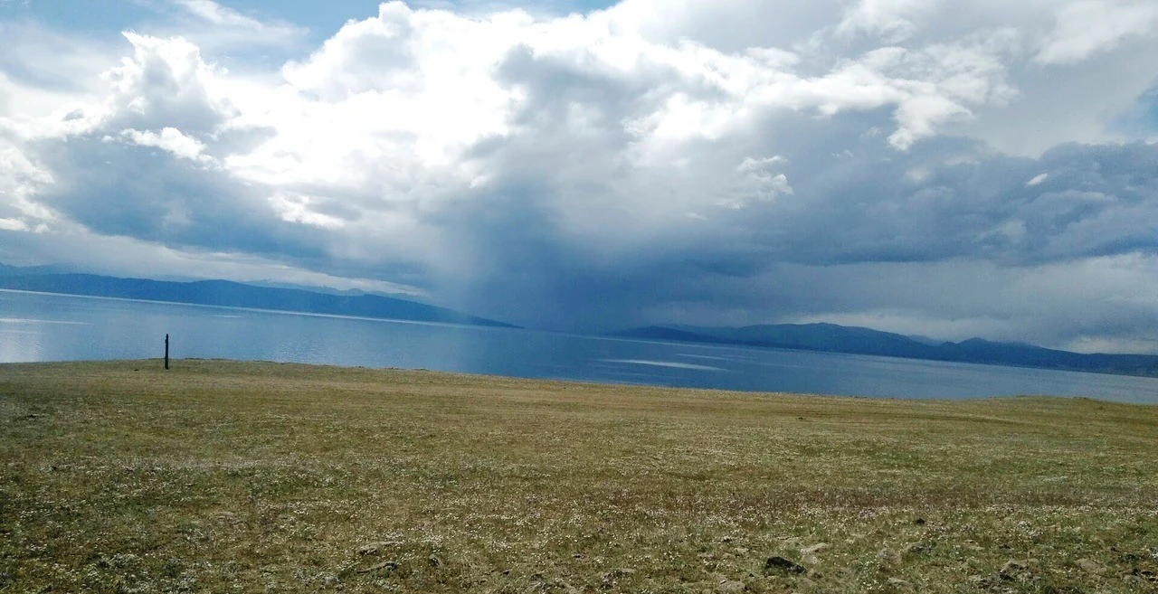
A wide view of a large blue lake under a sky filled with heavy, dark rain clouds; the foreground is a grassy, sloping field.
Rain clouds gather over the expansive waters of Lake Khövsgöl.

Lake Khövsgöl National Park conservation status and protection priorities

Lake Khövsgöl National Park holds exceptional conservation importance because it protects one of the world's oldest and most pristine freshwater lakes, a body of water holding nearly 70 percent of Mongolia's total freshwater reserves. As an ultraoligotrophic system whose waters are pure enough to drink untreated, the lake serves as both a national strategic water reserve and a benchmark site for studying near-pristine aquatic ecosystems.

The park is also ecologically significant as a protected transition zone between the Central Asian steppe and the Siberian taiga, a boundary that is increasingly rare in unmodified form across Eurasia. Its forests of Siberian larch represent the southern edge of the great taiga belt, while the surrounding steppes maintain traditional Mongolian pastoral landscapes. Together, these features make the park a key area for ecological connectivity in northern Asia.

Conservation challenges remain significant. Illegal fishing, including the use of gillnets, continues to pressure native fish populations, especially the endemic Hovsgol grayling. Recent research has documented rising microplastic pollution in the lake, demonstrating that even remote watersheds can accumulate plastic waste from small surrounding human populations. The Hövsgöl Long-Term Ecological Research Site, established in 1997, plays a central role in monitoring water quality, biodiversity, and climate-related changes, helping to inform management of this nationally important protected area.

Lake Khövsgöl National Park cultural meaning and human context

Lake Khövsgöl carries deep cultural meaning in Mongolia, where it is traditionally known as the 'Mother Sea', a nickname that reflects both its sacred status and its role as a vital freshwater source in a predominantly arid country. Unlike most Mongolian lakes, which are saline endorheic basins, Lake Khövsgöl provides abundant clean fresh water, giving it a unique place in the cultural and spiritual landscape of the region.

The southern shore, near the town of Khatgal, has historically been a focal point for local herding communities who rely on the lake and its surrounding pastures. Herders and visitors have long treated the lake with reverence, and traditional practices around the water remain an important dimension of regional identity. This cultural framing reinforces the lake's protected status and adds a human heritage dimension to the park beyond its ecological significance.

Top sights and standout views in Lake Khövsgöl National Park

Lake Khövsgöl National Park's most distinctive feature is its ancient, pristine freshwater lake, a rare ultraoligotrophic system over two million years old whose water is pure enough to drink without treatment. The park protects nearly 70 percent of Mongolia's freshwater resources and acts as a hydrological bridge connecting the Mongolian north with the broader Lake Baikal watershed via the Selenge river system.

It is also one of the clearest and most ecologically significant meeting points between the Central Asian steppe and the Siberian taiga anywhere in the world. The surrounding Sayan Mountains, the border-straddling Mönkh Saridag peak, and iconic species such as the Hovsgol grayling and brown bear give the park a character that combines highland wilderness, boreal forest, and sacred lake in a single protected landscape.

Best time to visit Lake Khövsgöl National Park

The character of a visit to Lake Khövsgöl National Park shifts dramatically with the seasons. Summer, from roughly June through August, is the most accessible period, when the lake is free of ice, roads are open, and the surrounding larch forests and steppes are at their most vibrant. This is also the peak season for birdwatching and general wildlife observation, and for experiencing the lake as a navigable, reflective body of water surrounded by green mountain slopes.

Winter transforms the park into a hard-frozen, snow-covered landscape. The lake develops a thick, durable ice cover that historically supported heavy vehicle traffic, and the surrounding taiga becomes a true subarctic environment with extreme cold. Winter visits offer a dramatically different perspective on the region, though they require preparation for severe conditions. Shoulder seasons in late spring and early autumn can offer quieter conditions and shifting scenic character, though weather becomes less predictable.

Monthly climate preview

Long-term representative temperature and monthly precipitation records across the protected landscape

Lake Khövsgöl National Park Climate Normals and Annual Weather Patterns

Temperature readings at the representative coordinate span severe sub-zero winter minimums and moderate summer maximums alongside measured precipitation rates. Reviewing the complete twelve-month climatology profile reveals detailed long-term averages for annual temperature progression and moisture distribution.
Annual mean-5 °C
-25 °C14 °C
Jan-25°
Feb-21°
Mar-14°
Apr-3°
May
Jun11°
Jul14°
Aug11°
Sep
Oct-4°
Nov-15°
Dec-22°
Warmest month
July

13.8 °C

Coolest month
January

-24.9 °C

Wettest month
July

3.4 mm/day

Driest month
January

0.1 mm/day

Park location guide

Geography guide, regional context, and park location map for Lake Khövsgöl National Park

Lake Khövsgöl National Park park geography, regions, and map view in Mongolia

Understand where Lake Khövsgöl National Park sits in Mongolia through a broader geographic reading of the surrounding landscape, nearby location context, and its mapped position within the national park landscape.

How Lake Khövsgöl National Park fits into Mongolia

Mongolia is a landlocked sovereign state in East Asia, known for its vast steppe landscapes, nomadic culture, and historical significance as the heartland of the Mongol Empire founded by Genghis Khan in 1206. The country has a population of approximately 3.5 million people and is the world's most sparsely populated sovereign state. Ulaanbaatar is the capital and largest city, home to roughly half the population.

Wider geography shaping Lake Khövsgöl National Park in Mongolia

Mongolia is located in East Asia, landlocked between Russia to the north and China to the south. The country occupies the Mongolian Plateau and features diverse terrain including grassy steppe, mountains in the north and west, and the Gobi Desert in the south. It covers 1,564,116 km2, making it the second largest landlocked country in the world.

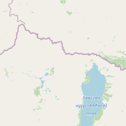
Map view of Lake Khövsgöl National Park

Use this park location map to pinpoint Lake Khövsgöl National Park in Mongolia, understand its exact geographic position, and read its mapped placement within the surrounding landscape more clearly.

Pigeon | © OpenStreetMap contributors

Location context for Lake Khövsgöl National Park

Khövsgöl Province

Visual reference guide to the protected terrain, larch forests, and ancient freshwater ecosystems

Lake Khövsgöl National Park Photos and Landscape Scenery

Visual documentation reveals the rugged mountain ranges, dense Siberian larch forests, and pristine waters defining Lake Khövsgöl National Park. Examining photographic evidence helps researchers interpret the rare ecological transition zone between the Central Asian steppe and the northern taiga.

Satellite image showing the deep blue water of Lake Khövsgöl, the village of Hatgal at the shoreline, and surrounding dense boreal forests and rocky terrain.

Panoramic landscape view from a high mountain ridge looking down into a forested valley towards a large, expansive blue lake under a sky with scattered white clouds.

A wide, vertical shot of a calm, deep blue lake under a clear blue sky, featuring a large, singular white lenticular cloud near the top and its reflection in the water below. A distant treelined shore borders the lake, and a dark, partially submerged branch is visible in the foreground water.

A wide view of a grassy hillside overlooking a large lake and distant mountains under a cloudy sky, with a person riding a white horse in the foreground.

A wide view of a large blue lake under a sky filled with heavy, dark rain clouds; the foreground is a grassy, sloping field.

Park atlas

Compare regional park geography, taiga borders, and connected mountain reserves

Other Parks Near Lake Khövsgöl National Park and Surrounding Protected Areas

Continue exploring regional park geography, high mountain reserves, and connected protected landscapes beyond Lake Khövsgöl National Park. Comparing adjacent protected areas reveals broader ecological patterns across the taiga and steppe borderlands.
National parkBuryatia
About 131 km away#1 closest

Northeast

Tunkinsky National Park National Park: Protected Landscape and Geographic Context in Buryatia

Discover mapped park boundaries and regional terrain.

Delve into Tunkinsky National Park, a significant protected national park situated in the Buryatia region of Russia. This detail page provides a geographic overview, highlighting the park's mapped boundaries and its place within the surrounding natural landscape. Understand its designation as a protected area, offering a focused entry point for atlas-based discovery of its specific terrain and regional importance.

Area
11,837 km²
IUCN
II
Relief
Mountain
Climate
Boreal
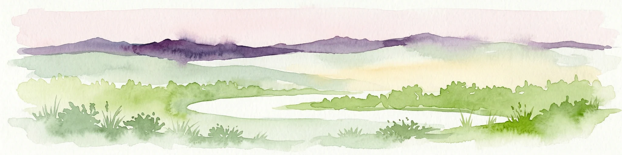
Watercolor illustration showing a lake, green vegetation, and mountains under a light sky
National parkIrkutsk Oblast
About 236 km away#2 closest

East

Pribaikalsky National Park: Geographic Context and Protected Landscape Boundaries

Coastal mountain terrain and the freshwater ecosystems of Irkutsk Oblast.

Located in Russia, Pribaikalsky National Park represents a primary protected area within the Lake Baikal basin. The region features dramatic topographical transitions from the Primorsky Range to the inland expanse of Olkhon Island. This record provides a detailed look at the park's physical geography, including its forest cover, coastal cliffs, and the significant role of the Angara River outflow in shaping the surrounding Siberian terrain.

Area
4,173 km²
Established
1986
IUCN
II
Visitors
400K annual
National parkMongolia
About 326 km away#3 closest

South

Khorgo-Terkhiin Tsagaan Nuur National Park: A Volcanic Landscape and Wetland Atlas

Mapping volcanic terrain and migratory bird habitats in the Khangai Mountains.

This protected area features the dramatic remnants of the Taryatu-Chulutu volcanic field, centered on the extinct Khorgo volcano and the deep waters of Terkhiin Tsagaan Lake. The park provides an essential refuge for avian populations in its western marshlands, contrasting with the surrounding forest steppe. Explore the unique topography and ecological boundaries of this significant Mongolian conservation landscape.

Area
8 km²
Established
1965
IUCN
II
Relief
Mountain
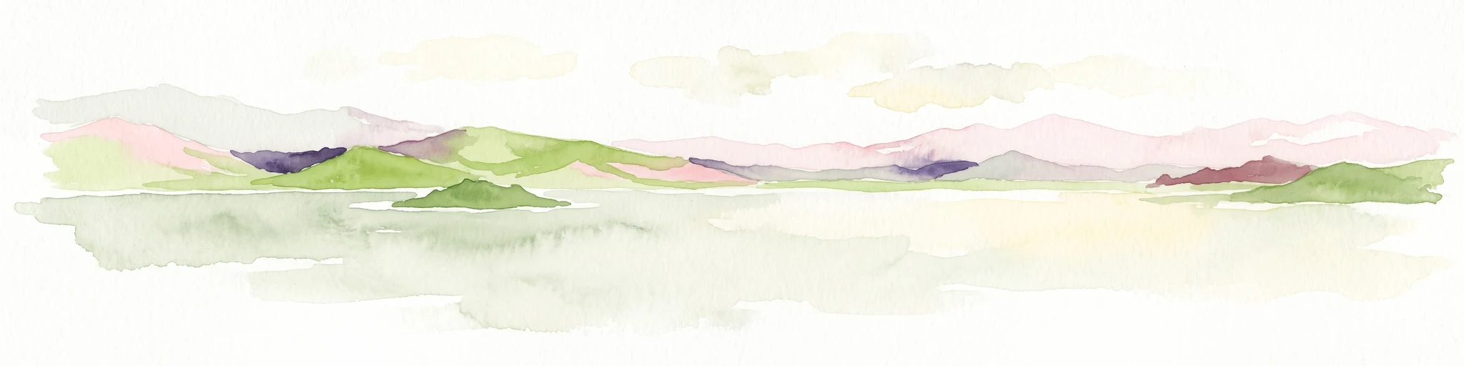
A minimalist watercolor painting showing a soft, hazy landscape of green rolling hills and distant mountains bordering a light-colored lake.
National parkArkhangai Province
About 331 km away#4 closest

South

Khorgo-Terkhiin Tsagaan Nuur National Park: Volcanic Terrain and Lake Geography

A protected highland landscape in Arkhangai Province

Explore the distinct physical geography of Khorgo-Terkhiin Tsagaan Nuur National Park, where the extinct Khorgo volcano borders a vast freshwater lake. This protected area offers a look at the mosaic of birch forest and alpine slopes within the Khangai range. The mapping of this central Mongolian site reveals how volcanic activity and mountain hydrology converge to shape its unique natural horizon.

Relief
Mountain
Climate
Alpine
Scope
Terrestrial
Water
Water-dominated
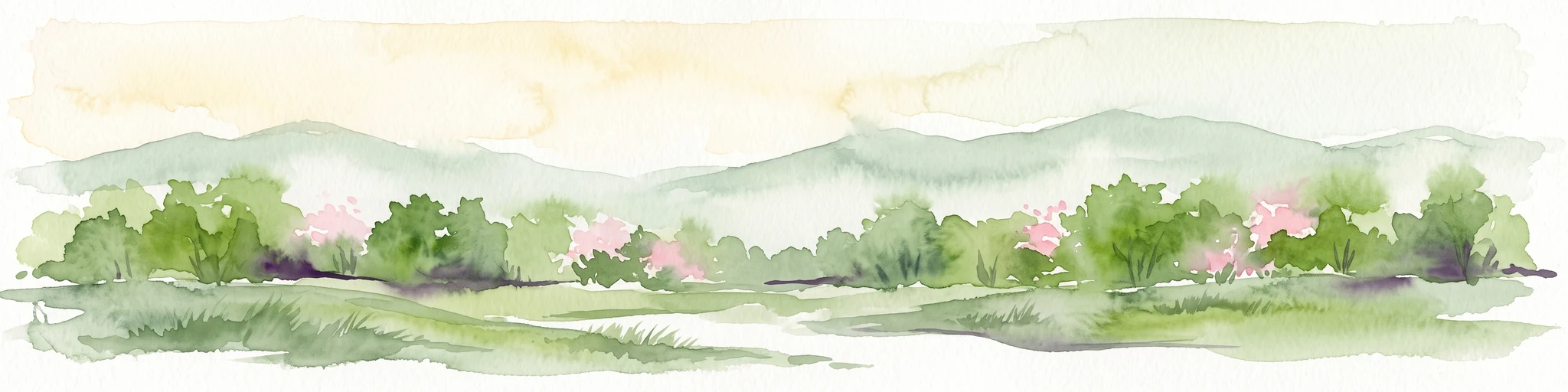
A horizontal watercolor illustration depicting a soft, green landscape with distant rolling hills, foreground meadows, and flowering bushes under a pale sky.
Protected areaArkhangai Province
About 405 km away#5 closest

Southeast

Ögii Lake Protected Area: A Comprehensive Geographic Overview of the Mongolian Steppe

Freshwater basin and wetland geography in Arkhangai Province

Ögii Lake represents a pivotal protected landscape in central Mongolia, defined by its 25 square kilometer surface area and gentle, shallow underwater topography. This site functions as an ecological nexus for migratory waterbirds and is essential for understanding the transition between open grassland and the mountainous terrain of the Khangai region.

Area
25.7 km²
Established
2006
Relief
Lowland
Access
Access unknown
National parkZavkhan Province
About 407 km away#6 closest

Southwest

Tarvagatai Nuruu National Park: Zavkhan Province Protected Landscape Atlas

Unique steppe-to-forest transition and mountainous terrain.

Tarvagatai Nuruu National Park represents a critical protected area within Mongolia's Zavkhan Province, noted for its expansive mountainous terrain and significant ecological diversity. The park's landscape is defined by the Tarvagatai Range, featuring flat-topped ridges, glacial valleys, and dramatic elevation changes. It masterfully showcases the transition from semi-arid steppe to dense coniferous forests, highlighting a visually striking ecological boundary anchored by the prominence of Mount Otgontenger, the highest peak in the Khangai Mountains.

Area
5,467 km²
Established
2000
IUCN
II
Relief
Mountain
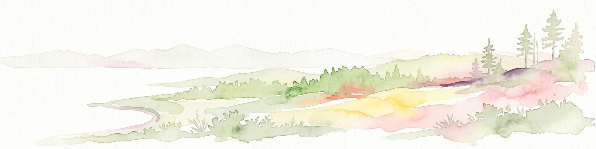
Soft watercolor painting of a lakeshore with rolling hills, coniferous trees, and a distant mountain horizon.
National parkIrkutsk Oblast
About 434 km away#7 closest

Northeast

Pribaikalsky National Park: Atlas and Geographic Overview of Lake Baikal Shoreline

Protected taiga, rift valleys, and Olkhon Island topography

Pribaikalsky National Park serves as a critical protected landscape featuring 470 kilometers of western shoreline along Lake Baikal. Its geography is defined by the steep scarps of the Obruchev fault, the dense taiga of the Primorsky Range, and the unique steppe environments of Olkhon Island. This atlas entry provides essential context on the physical relief and regional characteristics of this landmark Siberian protected area.

Area
4,173 km²
Established
1986
IUCN
II
Visitors
400K annual
National parkMongolia
About 439 km away#8 closest

South

Khangai Nuruu National Park: Discover Mongolia's Protected Mountain Landscape and Atlas Context

Explore mapped boundaries and diverse ecosystems across its terrain.

Khangai Nuruu National Park stands as a vast national park in central Mongolia, characterized by its diverse protected landscapes and significant geographic scope. Spanning the Khangai Mountains, it presents a remarkable ecological transition from alpine meadows and taiga forests to steppe and riparian environments. This park offers a rich atlas exploration opportunity, highlighting its mapped boundaries and the unique regional geography that defines its protected status, making it a key point of discovery for understanding Mongolian conservation areas.

Area
8,885 km²
Established
1996
IUCN
II
Relief
Mountain

Common questions about visiting, size, designation, and location context for Lake Khövsgöl National Park

Lake Khövsgöl National Park FAQs for park facts, access, geography, and protected area context

Find quick answers about Lake Khövsgöl National Park, including protected-area facts, park geography, trail and visitor context, and how the park fits into its surrounding country and regional landscape.
MoriAtlas Explorer

Continue Your Protected Areas Search Across the Global Atlas

Deepen your exploration by continuing the structured search for national parks and protected areas worldwide. Utilize the comprehensive filtering capabilities to compare different conservation landscapes and refine your understanding of global park geography. Discover more about the distribution and characteristics of protected natural areas.

Global natural geography