Mori Atlas logo
National parkKings Plains National Park

Discover the mapped geography and protected area context of Kings Plains National Park.

Kings Plains National Park: National Park, New South Wales Protected Landscape Atlas

Kings Plains National Park stands as a key protected area within New South Wales, Australia. This national park offers a focused point for exploring geographic boundaries and understanding its role in the broader landscape context. Users can delve into the specific atlas features and mapped terrain that define this significant natural landscape, providing essential context for regional geography and conservation understanding.

National parksNew South WalesProtected areasAustralian woodlandRiparian ecosystemsNorthern Tablelands

Kings Plains National Park

National park

Park overview

Structured park overview, official facts, and landscape profile for Kings Plains National Park

Kings Plains National Park park facts, protected area profile, and essential visitor context

Review the core facts for Kings Plains National Park, including designation, size, terrain, visitor scale, habitats, and operating context in one park-focused overview.

About Kings Plains National Park

Kings Plains National Park occupies a distinctive position in the protected area network of New South Wales, preserving a representative sample of Northern Tablelands woodland and riparian ecosystems. The park's central feature, Kings Plains Creek, provides year-round water flow that sustains a corridor of enhanced fertility through an otherwise sandy, shrub-dominated landscape. This waterways system supports the park's most appealing natural features, from permanent pools to cascading waterfalls that drop into a gorge formation. The surrounding woodland supports iron-bark, cypress pine, stringybarks, yellow box, and apple box trees, creating a diverse canopy structure. The park remains relatively undiscovered compared to more famous Australian national parks, offering visitors a more remote and tranquil experience. The NSW National Parks and Wildlife Service manages the area, which provides basic facilities including walking tracks, camping areas, and picnic spots. The park represents an important conservation outcome from 1988, when the area was formally protected to preserve its array of wild animals, plants, and the unique water feature system.

Quick facts and research context for Kings Plains National Park

Kings Plains National Park covers approximately 57 square kilometres in the Northern Tablelands of New South Wales, situated about 48 kilometres from Inverell and 50 kilometres from Glen Innes. The park was formally established in 1988 and is managed by the NSW National Parks and Wildlife Service. The centerpiece of the park is Kings Plains Creek, which features permanent water pools, rapids, and waterfalls that descend into a gorge. The woodland supports iron-bark, cypress pine, yellow box, and stringybark eucalyptus trees, with the creek area supporting more fertile soils. The park hosts eastern grey kangaroos, wallaroos, wallabies, koalas, and platypus, alongside over 80 bird species including endangered glossy black cockatoos and regent honeyeaters.

Protection and recognition

Documenting terrestrial conservation frameworks and geographic reserve classification.

Kings Plains National Park Protection Status and Official Designation

Geographic records outline the official terrestrial designation of Kings Plains National Park, established in 1988 to safeguard the regional landscape. National park databases organize structured conservation frameworks to support global environmental tracking, management scope, and verified protection history.

Protection details

Protection scope
Terrestrial
Designated year
1988
Transboundary protection
No
Park context

Deeper park guide and search-rich context for Kings Plains National Park

Kings Plains National Park history, landscape, wildlife, and travel context

Explore Kings Plains National Park through its history, landscape character, ecosystems, wildlife, conservation priorities, cultural context, and seasonal travel timing in a structured park guide built for atlas discovery and search intent.

Why Kings Plains National Park stands out

Kings Plains National Park is best known for its dramatic waterway system along Kings Plains Creek, which features permanent pools, cascading rapids, and waterfalls that descend into a gorge. The park is distinguished by its relatively untouched creek-side environment and the contrast between sandy woodland soils and the more fertile riparian zones. The area is particularly notable for its biodiversity, supporting a wide range of Australian marsupials, monotremes, and avifauna, including several endangered bird species. The spring wildflower display and the presence of the rare brush-tailed wallaby add to the park's ecological significance.

Kings Plains National Park history and protected-area timeline

Kings Plains National Park was established in January 1988, created specifically to preserve and protect the natural values of the Kings Plains area. The founding purpose centred on safeguarding the diverse array of wild animals and plants found within the area, as well as protecting the Kings Plains creek system with its distinctive water features. The decision to declare the area a national park reflected recognition of the ecological significance of the creek corridor and the surrounding woodland habitats. Since its establishment, the park has been managed by the NSW National Parks and Wildlife Service, which maintains the walking tracks, camping facilities, and manages the conservation program for the area.

Kings Plains National Park landscape and geographic character

The landscape of Kings Plains National Park is defined by the Kings Plains Creek corridor, which cuts through the terrain creating a sequence of water features including non-drying pools, rapids, and waterfalls that descend into a gorge. The surrounding land is characterised by sandy soils supporting shrubland vegetation, with more fertile soils concentrated in the creek vicinity. The woodland landscape features a canopy of iron-bark, cypress pine, stringybarks, yellow box, and apple box eucalypts. The terrain provides a natural contrast between the more arid sandy uplands and the lush riparian zone along the watercourse. The creek system serves as the visual and ecological focal point of the park, with the falls and gorge representing the most dramatic geological features.

Kings Plains National Park ecosystems, habitats, and plant life

The nature of Kings Plains National Park encompasses a diverse woodland ecosystem on the Northern Tablelands, characterised by iron-bark and cypress pine woodland with understorey shrubs. The riparian zone along Kings Plains Creek supports more lush vegetation where soil fertility is higher, creating a distinct habitat contrast within the park. During spring, the park comes alive with colourful wildflowers, enhancing the natural appeal of the woodland. The permanent water in the creek system supports ecological processes year-round, sustaining both aquatic and terrestrial species. The park's vegetation includes several rare shrub species such as the grey guinea flower, folded leaf waxflower, and Rodd's star-hair, indicating the ecological significance of the area.

Kings Plains National Park wildlife and species highlights

The wildlife of Kings Plains National Park encompasses a notable variety of Australian fauna, with the creek system and fertile riparian zones providing critical habitat. Large marsupials including eastern grey kangaroos, wallaroos, and wallabies inhabit the park, particularly near water sources and the more fertile creek areas. Koalas are present in the park, resting in the eucalypt trees that dominate the woodland. The rare brush-tailed wallaby has been recorded within the park boundaries. The creek supports platypus populations, though habitat above the waterfalls is considered fragile. The avian diversity is particularly impressive, with 82 bird species recorded in the area. Common species include eastern and crimson rosellas, king parrots, yellow-tailed black cockatoos, currawongs, wattle birds, and various honeyeaters. Endangered species present include glossy black cockatoos, turquoise parrots, and regent honeyeaters. The creek harbours straw-necked ibis, while the skies support birds of prey including wedge-tailed eagles and peregrine falcons.

Kings Plains National Park conservation status and protection priorities

Kings Plains National Park was created specifically for conservation purposes, protecting the natural values of the Kings Plains creek system and surrounding woodland. The park preserves habitat for several endangered bird species including the glossy black cockatoo, turquoise parrot, and regent honeyeater, all of which are listed as threatened. The permanent water features of the creek provide critical refuge for wildlife, with the fragile habitat above the falls receiving particular attention for protection. The diverse vegetation communities, including rare shrub species, are maintained through the protected area status. The park contributes to the conservation of representative Northern Tablelands ecosystems, preserving both the woodland and riparian environments for ongoing ecological processes.

Kings Plains National Park cultural meaning and human context

Kings Plains National Park is situated in the Northern Tablelands of New South Wales, a region with historical associations with Aboriginal communities. While the Wikipedia source does not provide specific cultural heritage details, the area would have been part of the traditional lands of local Indigenous peoples. The park is accessible from the nearby towns of Inverell and Glen Innes, both of which are regional centres in the New England area. The park's relatively low profile compared to other Australian national parks reflects its location in a less populated regional area rather than any lack of natural significance.

Top sights and standout views in Kings Plains National Park

The primary highlight of Kings Plains National Park is the Kings Plains Creek system with its sequence of permanent pools, rapids, and waterfalls descending into a gorge. The walking track to Kings Plains Falls, taking approximately 2.5 hours, represents the main visitor activity. The park offers a more remote and less crowded experience compared to better-known Australian national parks. The spring wildflower display provides a seasonal highlight, while the diversity of wildlife, particularly the presence of endangered bird species and the opportunity to spot platypus in the creek, adds to the park's appeal. Basic facilities including camping areas and picnic spots allow visitors to experience this protected landscape.

Best time to visit Kings Plains National Park

The best time to visit Kings Plains National Park is during the spring months when wildflowers are at their most colourful and the park's vegetation is at its most vibrant. The mild temperatures of spring and autumn generally provide the most comfortable conditions for bushwalking and outdoor activities. Summer months can bring warmer conditions, though the creek provides some relief. The permanent water in Kings Plains Creek means that the park's water features are accessible year-round, though winter temperatures in the Northern Tablelands can be cold. Visitors planning activities should consider the seasonal conditions and check with park management regarding any access considerations.
Monthly climate preview

Analyze historical temperature spans and precipitation averages based on long term observation data.

Kings Plains National Park Climate and Long Term Weather by Month

Long term climatology data at a representative elevation of 662 meters reveals warm summers with higher daily rainfall alongside cooler winters that feature sub zero minimum temperatures. Exploring the complete twelve month profile provides detailed insights into monthly climate normals, helping you compare seasonal temperature ranges and precipitation trends.
Annual mean17 °C
9 °C24 °C
Jan24°
Feb23°
Mar21°
Apr17°
May13°
Jun10°
Jul
Aug10°
Sep14°
Oct18°
Nov20°
Dec22°
Warmest month
January

24 °C

Coolest month
July

8.9 °C

Wettest month
January

3.2 mm/day

Driest month
April

1 mm/day

Park location guide

Geography guide, regional context, and park location map for Kings Plains National Park

Kings Plains National Park park geography, regions, and map view in Australia

Understand where Kings Plains National Park sits in Australia through a broader geographic reading of the surrounding landscape, nearby location context, and its mapped position within the national park landscape.

How Kings Plains National Park fits into Australia

Australia is a constitutional monarchy and federal parliamentary democracy comprising six states and ten territories. With a population of nearly 28 million, it is one of the world's most urbanised countries, with most people concentrated on the eastern seaboard. The country has a high Human Development Index and is known for its cultural diversity, ancient Aboriginal heritage, and unique wildlife.

Wider geography shaping Kings Plains National Park in Australia

Australia occupies the entire Australian continent, the island of Tasmania, and numerous smaller islands. It is the world's flattest and driest inhabited continent, featuring vast deserts in the interior (the Outback), tropical rainforests along the eastern coast, and a coastline bordering the Indian and Pacific Oceans.

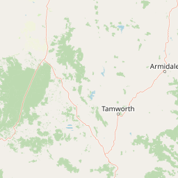
Map view of Kings Plains National Park

Use this park location map to pinpoint Kings Plains National Park in Australia, understand its exact geographic position, and read its mapped placement within the surrounding landscape more clearly.

Pigeon | © OpenStreetMap contributors

Location context for Kings Plains National Park

New South Wales
Recorded earthquake history

Examine the Seismic and Earthquake History of Kings Plains National Park

Access a comprehensive catalogue of recorded seismic activity located near Kings Plains National Park. MoriAtlas provides these historical event logs to assist in mapping regional geographic trends and past seismic occurrences relative to the park landscape.

Kings Plains National Park Earthquake History

Catalogued events

1 event

Strongest magnitude

Magnitude 3.3

Most recent event

Oct 11, 1981

This history includes earthquakes recorded inside the park or within 50 km of its borders

Park atlas

Compare park geography and protected landscapes across the Northern Tablelands region and surrounding areas of Australia

Explore Nearby National Parks and Protected Areas Beyond Kings Plains National Park in New South Wales

Discover other national parks and protected areas near Kings Plains National Park, exploring diverse natural waterways, woodland ecosystems, and unique wildlife habitats across regional New South Wales. Deepen your atlas exploration to compare conservation landscapes, understand regional ecological patterns, and map the spread of protected terrain within Australia's Northern Tablelands.
National parkNew South Wales
About 38 km away#1 closest

South

Single National Park National Park: A Protected Landscape within New South Wales

Explore mapped boundaries and regional geography.

Single National Park represents a vital protected area, contributing significantly to the natural landscape of New South Wales. This entry offers a deep dive into its geographic scope, detailing mapped park boundaries and the surrounding regional context. It serves as a foundational piece for understanding the park's identity as a protected natural asset and its place within Australia's broader conservation geography.

Area
25.63 km²
Established
1999
IUCN
II
Relief
Mixed relief
National parkNew South Wales
46 km away#2 closest

South

Indwarra National Park: New South Wales National Park Protected Landscape and Geographic Context

Explore mapped park boundaries and regional geography.

Indwarra National Park is identified as a significant protected area within New South Wales, Australia, offering a unique focus for geographic exploration. As a national park, its mapped boundaries define a distinct natural landscape. This page provides detailed atlas-style information, enabling a deeper understanding of its terrain, regional context, and protected-area significance for structured discovery.

Area
9 km²
Established
1999
IUCN
Ia
Relief
Mountain
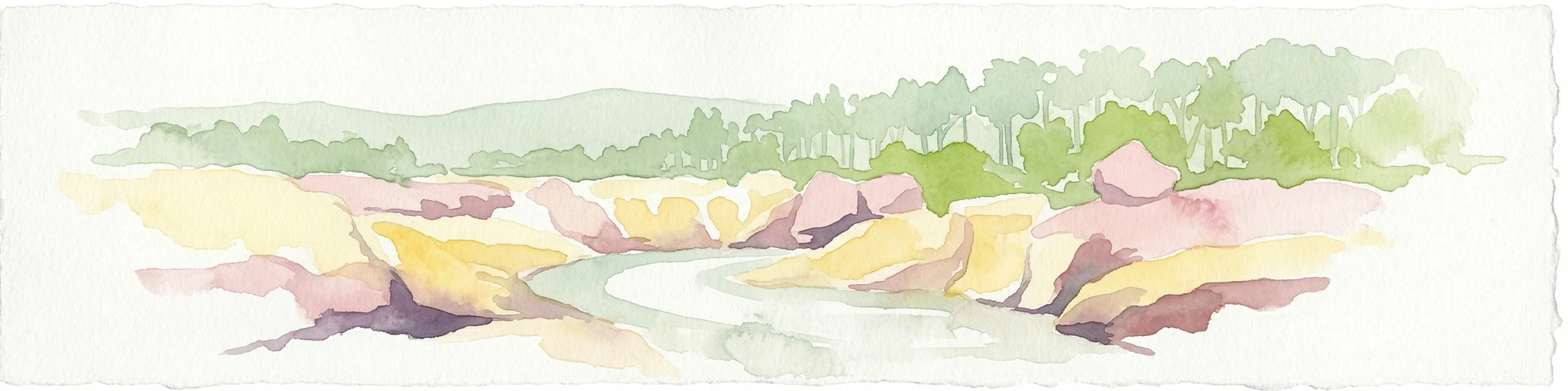
Watercolor painting of a river flowing between rocky cliffs with forest in the background
National parkNew South Wales
47 km away#3 closest

Northwest

Kwiambal National Park: New South Wales National Park with Granite Landscapes and River Confluence

Explore the dramatic scenery of MacIntyre Falls and surrounding protected terrain.

Kwiambal National Park is a significant protected area in New South Wales, Australia, celebrated for its unique granite outcrops and the spectacular confluence of the Severn and Macintyre Rivers at MacIntyre Falls. This national park provides a clear example of regional protected landscape identity, offering valuable context for atlas-driven discovery of Australia's natural geography and mapped terrain. The park's distinctive features contribute to its importance as a conservation reserve within the New England region.

Area
65.17 km²
Established
2000
IUCN
II
Scope
Terrestrial
National parkNew South Wales
52 km away#4 closest

East

Butterleaf National Park: National Park Protected Landscape with Regional Geographic Context

Mapped boundaries and terrain within New South Wales.

Butterleaf National Park represents a distinct national park entity within the geographic landscape of New South Wales. This resource provides a focused atlas view, detailing the park's protected boundaries and its specific contribution to the regional terrain. Users can explore the mapped geography and understand the park's identity as a significant protected natural area, offering foundational data for landscape context and conservation analysis.

Area
30 km²
Established
1999
IUCN
II
Scope
Terrestrial
National parkNew South Wales
55 km away#5 closest

East

Capoompeta National Park National Park: Protected Landscape and Regional Geography

Explore mapped boundaries and natural terrain in New South Wales.

Capoompeta National Park represents a key protected landscape entity within New South Wales, Australia. This detail page provides focused geographic information, emphasizing its status as a national park and its contribution to the regional atlas. Users can investigate the park's mapped terrain, understand its protected land characteristics, and grasp its geographical setting within the Australian context.

Area
39 km²
Established
1999
IUCN
II
Relief
Mountain
Nature reserveNew South Wales
63 km away#6 closest

Southeast

Little Llangothlin Nature Reserve: Exploring the New England Plateau Wetlands and Landscape

High-elevation freshwater lagoons and basalt landscapes in New South Wales

Little Llangothlin Nature Reserve stands as a preserved fragment of the New England Tablelands. This high-elevation wetland habitat provides essential refuge for diverse species, showcasing rare sedgeland, herbland, and woodland communities within a landscape dominated by agricultural development.

Area
2.57 km²
Established
1979
IUCN
IV
Relief
Upland
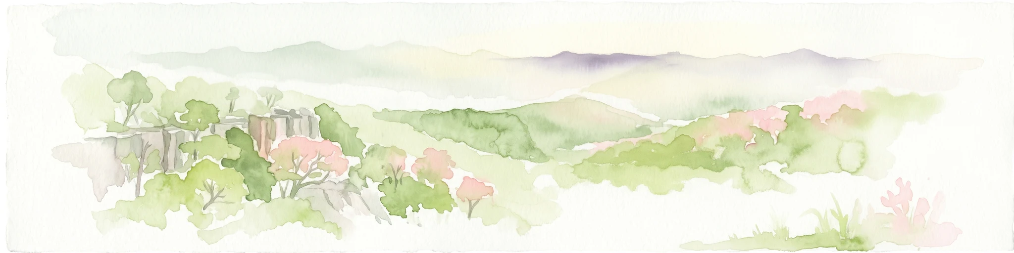
Watercolor illustration of rolling hills, green forests, and pink flowering trees
National parkNew South Wales
63 km away#7 closest

Southeast

Guy Fawkes River National Park: National Park Geographic Context and Mapped Boundaries

Explore the protected landscape and regional geography of this New South Wales national park.

Gain a structured understanding of Guy Fawkes River National Park, a key national park in New South Wales, Australia. This entry provides detailed insights into its mapped geographic boundaries, its role as a protected landscape, and its contribution to the broader regional context for atlas exploration. Examine the park's place within the natural terrain of New South Wales for a clearer picture of conservation lands.

Area
1,005.9 km²
Established
1972
IUCN
Ib
Relief
Highland
Nature reserveNew South Wales
About 63 km away#8 closest

East

Mann River Nature Reserve: Geography and Protected Forest Terrain in New South Wales

Highland river valleys and Great Dividing Range landscapes

Spanning over 7,000 hectares of rugged highland terrain, Mann River Nature Reserve provides a vital protected habitat within the Northern Tablelands. The landscape is defined by the incision of the Mann River through deep, forested gorges and sharp mountain ridges, creating a distinct physical setting that serves as a sanctuary for native Australian wildlife.

Area
71.28 km²
Established
1985
IUCN
II
Relief
Mountain

Common questions about visiting, size, designation, and location context for Kings Plains National Park

Kings Plains National Park FAQs for park facts, access, geography, and protected area context

Find quick answers about Kings Plains National Park, including protected-area facts, park geography, trail and visitor context, and how the park fits into its surrounding country and regional landscape.
MoriAtlas Explorer

Continue Your Protected Areas Search Across the Global Atlas

Deepen your exploration by continuing the structured search for national parks and protected areas worldwide. Utilize the comprehensive filtering capabilities to compare different conservation landscapes and refine your understanding of global park geography. Discover more about the distribution and characteristics of protected natural areas.

Global natural geography