Mori Atlas logo
National parkKishtwar National Park

Discover the mapped boundaries and diverse terrain of this significant Indian national park.

Kishtwar National Park: Explore Protected Landscape & Himalayan Geography

Kishtwar National Park represents a crucial protected area within the dramatic mountainous terrain of India's Kishtwar district. Spanning a vast expanse of the Great Himalayas, this national park offers a unique geographic perspective on high-altitude wilderness, characterized by rugged valleys, glacial catchments, and diverse ecological zones. Explore the park's mapped landscape, understanding its role as a significant protected territory within the regional geography.

National ParkHimalayan WildernessProtected AreaJammu and KashmirHigh-Altitude ForestConiferous Forest

Kishtwar National Park

National park

Park overview

Structured park overview, official facts, and landscape profile for Kishtwar National Park

Kishtwar National Park park facts, protected area profile, and essential visitor context

Review the core facts for Kishtwar National Park, including designation, size, terrain, visitor scale, habitats, and operating context in one park-focused overview.

About Kishtwar National Park

Kishtwar National Park represents a substantial protected area in the western Himalayan region of India, established in 1981 to preserve the ecological and scenic values of the Kishtwar district's mountainous terrain. The park's 2,190.5 square kilometer expanse encompasses a complex system of catchments fed by the Kiar, Nath, and Kibar Nala streams, which collectively drain southwest into the Marwah River, also known as the Marusudar River. This river system ultimately joins the Chenab River at Bhandarkoot village, just below the town of Kishtwar. The landscape is defined by its dramatic topographical character, with generally rugged and steep terrain featuring narrow valleys bounded by high ridges that open into broader glacial valleys at upper elevations. Geologically, the area lies within the Central Crystalline belt of the Great Himalayas, where rocks have been strongly folded in places and consist primarily of granite, gneiss, and schist, with occasional marble beds. The soils are predominantly alluvial with gravel deposits, tending toward being shallow and slightly alkaline. The park supports thirteen distinct vegetation types according to the revised Champion and Seth classification system, reflecting the significant ecological diversity across its elevation range. Beyond its ecological significance, the park holds cultural importance, with the local population comprising various ethnic groups including Kashmiris, Thakurs, Gujars, Rajputs, Brahmans, and Bhagats, who maintain traditional relationships with the landscape through grazing and agriculture.

Quick facts and research context for Kishtwar National Park

Kishtwar National Park covers 2,190.5 square kilometers in the mountainous Kishtwar district of Jammu and Kashmir, India. The park was formally designated on February 4, 1981, under Notification No. 21/FST of 1980-1981. It sits within the Central Crystalline belt of the Great Himalayas, with elevations ranging from 1,700 to 4,800 meters. The terrain is predominantly rugged and steep, with narrow valleys bounded by high ridges that open into glacial valleys at higher elevations. The park is bounded by the Rinnay River to the north, the Kibar Nala catchment to the south, the Great Himalayan main divide to the east, and the Marwah River to the west. The geological foundation consists mainly of granite, gneiss, and schist, with occasional marble beds.

Protection and recognition

Verifying terrestrial boundaries and conservation framework data within the regional atlas.

Kishtwar National Park Protection Status and Documented Conservation Designations

Factual records outline the terrestrial protection status and management scope established for Kishtwar National Park. Analyzing documented conservation frameworks provides essential geographic context for evaluating regional wilderness protection and environmental boundaries.

Protection details

Protection scope
Terrestrial
Transboundary protection
No
Park context

Deeper park guide and search-rich context for Kishtwar National Park

Kishtwar National Park history, landscape, wildlife, and travel context

Explore Kishtwar National Park through its history, landscape character, ecosystems, wildlife, conservation priorities, cultural context, and seasonal travel timing in a structured park guide built for atlas discovery and search intent.

Why Kishtwar National Park stands out

Kishtwar National Park is renowned for its spectacular Himalayan mountain landscape and ecological diversity across dramatic elevation gradients. The park preserves one of the most extensive tracts of relatively intact high-altitude Himalayan wilderness in Jammu and Kashmir, featuring characteristic cedar and blue pine forests in the lower temperate zones, transitioning through sub-alpine silver fir and birch forests into rhododendron shrubland and alpine pastures at higher elevations. The unique chilgoza pine expanse in the Dachan Range represents a notable botanical feature. The park also provides important habitat for the Himalayan snowcock and brown bear, making it significant for mountain fauna conservation.

Kishtwar National Park history and protected-area timeline

Kishtwar National Park was formally declared a national park on February 4, 1981, through Notification No. 21/FST of 1980-1981, establishing it as a protected area under Indian law with IUCN Category II designation. The park's establishment reflected India's commitment to preserving representative Himalayan ecosystems, with the state government securing the land under state tenure. The declaration came during a period of growing environmental awareness in India and recognition of the need to protect significant mountain ecosystems. Prior to formal protection, the area had been subject to traditional pastoral use and limited human activity, and the establishment of the park created a framework for managing the competing interests of conservation and local community needs. The park encompasses catchments that had long been recognized for their ecological and scenic value, with the designation providing formal recognition of the area's significance within the broader Himalayan conservation landscape.

Kishtwar National Park landscape and geographic character

The physical landscape of Kishtwar National Park is defined by its position within the Central Crystalline belt of the Great Himalayas, creating a terrain of exceptional mountainous character. The park encompasses the catchments of three major watercourses: the Kiar, Nath, and Kibar Nalas, all of which flow southwestward into the Marwah River, also known as the Marusudar River. This river system joins the Chenab River at Bhandarkoot village, creating an important hydrological connection within the larger Himalayan river network. The terrain is predominantly rugged and steep, characterized by narrow valleys bounded by high ridges that open into broader glacial valleys in their upper reaches. The elevation range from 1,700 meters to 4,800 meters creates dramatic topographical variation across the park. The geological substrate consists primarily of granite, gneiss, and schist, with occasional beds of marble, reflecting the complex metamorphic history of the Central Crystalline zone. These rocks have been strongly folded in places, contributing to the complex terrain. The soils are predominantly alluvial in nature with gravel deposits, tending to be shallow and slightly alkaline, reflecting the active erosion and deposition processes characteristic of high mountain environments.

Kishtwar National Park ecosystems, habitats, and plant life

The ecological character of Kishtwar National Park is defined by the remarkable diversity of vegetation types across its steep elevation gradient, with Champion and Seth's revised classification system identifying some thirteen distinct vegetation types within the park. From elevations of 2,400 to 3,000 meters, silver fir and spruce predominate, mixed with deodar cedar and blue pine, creating dense coniferous forest cover. A notable botanical feature is the small expanse of chilgoza pine found in the Dachan Range, representing a distinctive element of the park's forest composition. At lower elevations between 1,700 and 2,400 meters, nearly pure stands of cedar and blue pine occur alongside moist temperate deciduous forests featuring horsechestnut, walnut, maple, poplar, hazel, bird cherry, ash, and yew species. The sub-alpine zone extends from 3,000 meters up to the tree line at approximately 3,700 meters, where silver fir and birch forests dominate before merging into birch-rhododendron scrub, above which lies alpine pasture. The climate is characterized by weak monsoon influence, with mean annual rainfall of 827 millimeters at Palmar and 741 millimeters at Sirshi, with precipitation maximal during March-April and July-August periods. Most snowfall occurs in December and January, when the entire area becomes snowbound, creating distinct seasonal character.

Kishtwar National Park wildlife and species highlights

Kishtwar National Park provides habitat for several notable wildlife species adapted to the high-altitude Himalayan environment. The Himalayan snowcock, a specialized bird species of the mountainous regions, makes its home within the park's diverse habitats, particularly in the rocky terrain and alpine zones. The brown bear also inhabits the area, representing a significant presence of this large mammalian predator within the protected landscape. While the Wikipedia source provides limited specific wildlife documentation, the park's diverse habitats spanning from temperate forests through sub-alpine zones to alpine meadows would support a range of species adapted to different ecological niches. The elevation range from 1,700 to 4,800 meters creates multiple habitat zones that would support both forest-dwelling and open-country species, with the relatively intact nature of the protected area providing important refuge for wildlife in a region where habitat fragmentation is a concern.

Kishtwar National Park conservation status and protection priorities

Kishtwar National Park holds significant conservation value as one of the larger protected areas in the Jammu and Kashmir region, providing protection to a relatively pristine tract of Himalayan wilderness. The IUCN Category II designation reflects its status as a national park focused on ecosystem conservation and protection. The park preserves the catchments of three major stream systems that drain into the Marwah River, contributing to watershed protection and downstream hydrological function. The thirteen vegetation types represented within the park include important forest communities ranging from moist temperate deciduous forest through coniferous forest to sub-alpine and alpine ecosystems, representing a significant diversity of Himalayan habitat types. The elevation gradient from 1,700 to 4,800 meters creates a continuum of habitats that supports ecological processes across altitudinal zones. The protection of this area also conserves geological features of the Central Crystalline belt, with its distinctive granite, gneiss, schist, and marble formations. The presence of species such as the Himalayan snowcock and brown bear indicates the park's role in maintaining viable populations of species that require large, relatively undisturbed habitat areas.

Kishtwar National Park cultural meaning and human context

The human dimension of Kishtwar National Park reflects the traditional relationship between local communities and the Himalayan landscape. The region is home to multiple ethnic groups including Kashmiris, Thakurs, Gujars, Rajputs, Brahmans, and Bhagats, each contributing to the cultural fabric of the area. Approximately 1,115 families of nomadic graziers maintain traditional pastoral activities within the park boundaries, with around 25,000 head of livestock utilizing the high-altitude pastures. Additionally, an unspecified number of families from nearby villages, with approximately 10,000 head of livestock, hold grazing rights within the national park. This traditional pastoral use represents a long-established relationship between human communities and the mountain environment, though it creates ongoing management considerations for park authorities. Some agriculture is practiced in peripheral areas of the park. The proximity to Kishtwar town, approximately 40 kilometers away, and the historical significance of Bhandarkoot village at the confluence of the Marusudar and Chenab rivers further connects the protected area to the region's cultural heritage.

Top sights and standout views in Kishtwar National Park

Kishtwar National Park offers visitors access to one of the most extensive high-altitude wilderness areas in the Jammu and Kashmir region. The dramatic elevation range from 1,700 to 4,800 meters creates remarkable ecological diversity, with thirteen vegetation types supporting distinct forest communities from temperate through sub-alpine zones. The Dachan Range's chilgoza pine represents a particularly distinctive botanical feature within the park. The mountainous landscape features narrow valleys opening into glacial upper reaches, with the catchments of Kiar, Nath, and Kibar Nalas providing hydrological backbone. The park's position within the Central Crystalline belt of the Great Himalayas exposes visitors to impressive geological formations including folded granite, gneiss, schist, and marble. Wildlife viewing opportunities include the Himalayan snowcock and brown bear in their natural mountain habitat. The traditional pastoral culture, with nomadic graziers and their livestock, adds cultural dimension to the wilderness experience.

Best time to visit Kishtwar National Park

The optimal visiting period for Kishtwar National Park depends on the experience sought, with each season offering distinct characteristics. The summer months from May through September generally offer the most accessible conditions for exploration, with warmer temperatures and relatively clear trails through the lower elevation forests and valleys. The monsoon season, typically July and August, brings significant precipitation, which while creating lush vegetation and flowing streams, may present access challenges and increased landslide risk on mountain trails. For those interested in witnessing the dramatic winter landscape, December and January bring heavy snowfall that blankets the area, creating a completely different character but requiring specialized equipment and preparation for the high-altitude conditions. Spring months of March and April also experience significant precipitation, with maximal rainfall during these months contributing to the vibrant vegetation and waterfalls throughout the park. The climate data indicates that temperatures at the park's lower elevations range from approximately -7°C in January to around 35°C in July, reflecting the extreme seasonal variation that visitors should prepare for accordingly.

Monthly climate preview

Analyze the long-term temperature patterns and precipitation trends in Kishtwar district

Monthly Climate Normals and Average Temperatures in Kishtwar National Park

Based on long-term data at a representative high-altitude point, Kishtwar National Park experiences sub-zero average temperatures for most months with light precipitation peaking during warmer periods. Comparing the complete month-by-month metrics reveals the precise transition from freezing alpine winters to milder summer cycles.
Annual mean-3 °C
-14 °C8 °C
Jan-14°
Feb-13°
Mar-9°
Apr-4°
May
Jun
Jul
Aug
Sep
Oct-2°
Nov-7°
Dec-12°
Warmest month
July

7.8 °C

Coolest month
January

-14.4 °C

Wettest month
August

2.5 mm/day

Driest month
October

0.5 mm/day

Park location guide

Geography guide, regional context, and park location map for Kishtwar National Park

Kishtwar National Park park geography, regions, and map view in India

Understand where Kishtwar National Park sits in India through a broader geographic reading of the surrounding landscape, nearby location context, and its mapped position within the national park landscape.

How Kishtwar National Park fits into India

India is a South Asian country bordered by the Indian Ocean, Arabian Sea, and Bay of Bengal. It shares land borders with Pakistan, China, Nepal, Bhutan, Bangladesh, and Myanmar. The country has a population of over 1.4 billion people and operates as a federal parliamentary republic with its capital in New Delhi.

Wider geography shaping Kishtwar National Park in India

India occupies the Indian subcontinent in South Asia, bordered by the Arabian Sea to the southwest, the Bay of Bengal to the southeast, and the Indian Ocean to the south. It shares land borders with Pakistan to the west, China, Nepal, and Bhutan to the north, and Bangladesh and Myanmar to the east. The territory also includes the Andaman and Nicobar Islands in the Indian Ocean.

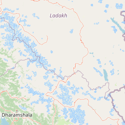
Map view of Kishtwar National Park

Use this park location map to pinpoint Kishtwar National Park in India, understand its exact geographic position, and read its mapped placement within the surrounding landscape more clearly.

Pigeon | © OpenStreetMap contributors

Location context for Kishtwar National Park

Jammu and KashmirKishtwar district
Park atlas

Trace the mapped geography of protected landscapes and compare diverse Himalayan terrain across the wider region around Kishtwar National Park.

Explore Nearby National Parks and Protected Areas Across the Central Himalayas Near Kishtwar National Park

Explore a curated selection of national parks and protected areas situated within the broader Himalayan region, offering geographic context around Kishtwar National Park. Compare high-altitude landscapes, diverse mountain ecosystems, and conservation efforts across similar protected areas for a comprehensive atlas-style discovery.
National parkSrinagar district
About 106 km away#1 closest

Northwest

Dachigam National Park: Protected Landscape Atlas and Geographic Context in Srinagar District

Mapped boundaries and natural terrain within India's national park system.

Gain insight into Dachigam National Park, a significant protected area located in the Srinagar district. This page provides detailed geographic context and an atlas-style view of its protected landscape. Understand its specific role as a national park and explore its mapped features, contributing to a comprehensive understanding of India's natural territories.

Area
141 km²
Established
1910
IUCN
II
Relief
Mountain
National parkJammu and Kashmir
About 122 km away#2 closest

Northwest

Salim Ali National Park: Mapped Protected Landscape in Jammu and Kashmir

National Park with distinct geographic and regional atlas context.

Salim Ali National Park is a recognized national park situated in the Jammu and Kashmir region. This entry provides specific insights into its designation as a protected area, focusing on its mapped geographic footprint and its contribution to the regional atlas of conservation lands. Understand the park's landscape context and its place within the broader geography of northern India, offering a detailed perspective for geographic exploration.

Area
9.07 km²
Established
1986
IUCN
II
Climate
Temperate
Wildlife reserveIndia
About 128 km away#3 closest

Southwest

Surinsar-Mansar Lakes Wildlife Reserve: Protected Landscapes and Geography in India

Paired wetland ecosystems within the Jammu foothills.

Surinsar-Mansar Lakes, a designated wildlife reserve, provides a unique geographic study of paired wetland basins set in the low-lying hills of Jammu. This protected area supports a variety of migratory waterfowl and native turtle species within its forested borders, bridging the landscape between agricultural lowlands and the sub-Himalayan foothill environment.

Area
0.59 km²
Water
Water-dominated
Protected areaJammu and Kashmir
About 130 km away#4 closest

Northwest

Hokersar Protected Area: Wetland Geography and Map Context in Jammu and Kashmir

Migratory bird sanctuary and critical Jhelum basin wetland

Hokersar encompasses a distinct wetland landscape in northwestern India, characterized by shallow water, reed beds, and marshy pastures. As a key node for Palearctic waterbirds in the Kashmir Valley, the reserve provides essential flood-buffering services through its perennial stream network and seasonal snowmelt cycles, making it a focal point for regional ecological study.

Area
13.75 km²
Visitors
500K annual
Relief
Lowland
Climate
Temperate
National parkGilgit-Baltistan
About 134 km away#5 closest

North

Deosai National Park: A Premier High-Altitude Alpine Wilderness and Protected Landscape in Pakistan

Mapped boundaries and unique terrain within Gilgit-Baltistan's geography.

Deosai National Park is a key protected area in Pakistan's Gilgit-Baltistan region, characterized by its high-altitude alpine meadows and expansive plateau terrain. As a national park, it offers crucial insights into mapped landscapes and regional geography, particularly for understanding conservation efforts in extreme environments. The park's setting provides a unique lens through which to explore the distribution and characteristics of protected lands within the broader atlas of natural landscapes.

Area
3,584 km²
Established
1993
IUCN
Ib
Relief
Highland
National parkLeh district
About 140 km away#6 closest

East

Hemis National Park: Exploring India's Protected National Park Geography

Mapped boundaries and landscape context in Leh district.

Hemis National Park represents a distinct protected national park within the Leh district of India, offering unique geographic and landscape attributes for atlas exploration. This detailed entry focuses on the park's role as a conservation area, detailing its mapped extent and its contribution to the regional geography. Understand how Hemis National Park fits into the broader picture of protected lands, providing valuable context for those studying natural landscapes and territorial conservation across India.

Area
4,400 km²
Established
1981
IUCN
II
Relief
Mountain
National parkGilgit-Baltistan
About 155 km away#7 closest

Northwest

Himalaya National Park: Exploring Its Protected Boundaries and Mountainous Landscape in Gilgit-Baltistan

Mapped protected area within Pakistan's northern mountain region.

Himalaya National Park serves as a significant protected entity within the dramatic geography of Gilgit-Baltistan, Pakistan. This national park offers a focused view of its specific natural terrain and mapped boundaries, contributing to a broader atlas of conservation lands. Users can discover the park's role as a protected landscape, examining its integration within the regional context and understanding its unique geographic characteristics. The focus here is on the park's protected status and its place in the mapped natural environment of Northern Pakistan.

Area
2,263 km²
Established
2021
IUCN
II
Relief
Mountain
Nature reserveJammu and Kashmir
About 157 km away#8 closest

Northwest

Wular Lake Nature Reserve: Protected Wetland and Freshwater Geography in the Kashmir Valley

Tectonic freshwater lake and Ramsar-recognized protected area.

Wular Lake stands as one of the largest freshwater bodies in South Asia, characterized by its tectonic origin and its role as a critical component of the Jhelum River catchment. The protected nature reserve landscape currently encompasses a mosaic of open water, reed beds, and muddy shallows that provide habitat for endemic snowtrout and migratory bird populations throughout the Kashmir Valley.

Established
1990
Relief
Lowland
Climate
Temperate
Scope
Terrestrial

Common questions about visiting, size, designation, and location context for Kishtwar National Park

Kishtwar National Park FAQs for park facts, access, geography, and protected area context

Find quick answers about Kishtwar National Park, including protected-area facts, park geography, trail and visitor context, and how the park fits into its surrounding country and regional landscape.
MoriAtlas Explorer

Continue Your Protected Areas Search Across the Global Atlas

Deepen your exploration by continuing the structured search for national parks and protected areas worldwide. Utilize the comprehensive filtering capabilities to compare different conservation landscapes and refine your understanding of global park geography. Discover more about the distribution and characteristics of protected natural areas.

Global natural geography