Mori Atlas logo
National parkKluane National Park and Reserve

Discover the mapped protected area boundaries and regional context of this Yukon national park.

Kluane National Park and Reserve: Yukon's Protected National Park Landscape and Geography

Kluane National Park and Reserve stands as a significant protected national park within Yukon, Canada. This page offers an atlas-driven perspective, detailing the park's geographic scope and mapped boundaries. Explore its place within the regional landscape and understand its identity as a protected natural area, crucial for understanding the broader geography of Yukon.

Glacial landscapesAlpine environmentsWorld Heritage SiteCanadian Heritage RiverFirst Nations heritageMountain wilderness

Kluane National Park and Reserve

National park

Park overview

Structured park overview, official facts, and landscape profile for Kluane National Park and Reserve

Kluane National Park and Reserve park facts, protected area profile, and essential visitor context
Review the core facts for Kluane National Park and Reserve, including designation, size, terrain, visitor scale, habitats, and operating context in one park-focused overview.

About Kluane National Park and Reserve

Kluane National Park and Reserve represents one of Canada's most significant protected wilderness areas, encompassing a landscape of exceptional geological and ecological importance. The Saint Elias Mountains, which form the backbone of the park, rise abruptly from the surrounding terrain, creating a dramatic skyline of sharp peaks, extensive icefields, and descending glaciers that have shaped the land over millions of years. The park's location at the convergence of several distinct ecological zones creates remarkable biodiversity, with species adapted to alpine tundra, boreal forest, and aquatic environments all finding habitat within the protected landscape. The cultural history of the region spans millennia, with the Champagne and Aishihik First Nations and Kluane First Nation maintaining deep connections to these lands long before European exploration. The park's dual designation as both national park and reserve reflects the complex process of reconciliation between federal protection and indigenous land rights, a model for cooperative management that continues to evolve.

Quick facts and research context for Kluane National Park and Reserve

Kluane National Park and Reserve is located in the southwestern Yukon, bordering Alaska and British Columbia. It protects the Saint Elias Mountains, home to Mount Logan, Canada's highest peak at 5,959 metres. The park was established as a National Park Reserve in 1972, with the eastern portion achieving full national park status in 1993 following land claim agreements with the Champagne and Aishihik First Nations. The reserve remains partially unresolved pending final settlement with the Kluane First Nation. The area forms part of a UNESCO World Heritage Site recognized for its outstanding glacier landscapes and critical habitat for grizzly bears, caribou, and Dall sheep.

Park context

Deeper park guide and search-rich context for Kluane National Park and Reserve

Kluane National Park and Reserve history, landscape, wildlife, and travel context
Explore Kluane National Park and Reserve through its history, landscape character, ecosystems, wildlife, conservation priorities, cultural context, and seasonal travel timing in a structured park guide built for atlas discovery and search intent.

Why Kluane National Park and Reserve stands out

Kluane is best known for its extraordinary alpine and glacial landscape, representing the most extensive icefield complex in Canada outside the polar regions. The park contains the country's highest mountains and serves as critical habitat for significant populations of grizzly bears, Dall sheep, and mountain caribou. The Kluane icefields and glaciers form the source of major river systems and support ecological processes that extend across international boundaries. The Alsek River, designated as a Canadian Heritage River, flows through the park and provides one of North America's premier wilderness rafting experiences.

Kluane National Park and Reserve history and protected-area timeline

Kluane was designated as a National Park Reserve in 1972, establishing protection for this remote Yukon landscape pending resolution of outstanding First Nations land claims. The original reserve encompassed the full 22,013 square kilometre territory, reflecting the intent to protect the complete ecological unit of the Saint Elias Mountains and associated glacial systems. In 1993, after negotiation of a Final Agreement with the Champagne and Aishihik First Nations, the eastern portion of approximately 5,900 square kilometres achieved full national park status, becoming a fully administered unit of Canada's national park system managed cooperatively with Parks Canada. The western portion continues as a reserve while discussions proceed with the Kluane First Nation regarding their outstanding claims. The park was recognized internationally in 1979 when it became a founding component of the Kluane, Wrangell-St. Elias, Glacier Bay, Tatshenshini-Alsek World Heritage Site, later expanded in 1992 and 1994 to include additional protected areas across the Canada-United States border.

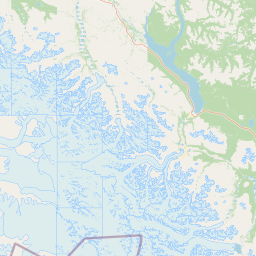
Kluane National Park and Reserve landscape and geographic character

The landscape of Kluane National Park and Reserve is defined by the towering presence of the Saint Elias Mountains, a mountain system that contains the highest peaks in Canada. Mount Logan dominates the northern skyline at 5,959 metres, while a succession of major glaciers including the Donjek Glacier and numerous other ice masses descend through glaciated valleys, carving the terrain over millennia. The glacial coverage is extensive, with ice and snow occupying approximately 83 percent of the park's extent, creating a stark white and blue environment against the dark rock exposures of peaks and ridges. At lower elevations, the terrain transitions to boreal forest and tundra, with white spruce, balsam poplar, and trembling aspen occupying the valley bottoms and lower slopes. The Slims River Valley and other glacial outwash plains provide distinctive flat terrain amidst the mountainous relief, while the Alsek River corridor offers a relatively gentle passage through the otherwise rugged landscape.

Kluane National Park and Reserve ecosystems, habitats, and plant life

The ecological character of Kluane reflects its position at the interface of several environmental zones, creating a mosaic of habitats that support remarkable biodiversity. The boreal forest communities at lower elevations are dominated by white spruce, with混交林 occasionally including balsam poplar and trembling aspen in more moist sites. Above the tree line, alpine tundra prevails with specialized vegetation adapted to harsh conditions, including cushion plants, dwarf shrubs, and associated alpine flora. The extensive glacial systems, while appearing barren, influence downstream ecosystems by providing consistent water flow and creating specialized habitats along river corridors. The combination of high elevation, latitude, and continental climate creates conditions that support unique assemblages of species at the southern edge of their range or isolated in alpine refugia.

Kluane National Park and Reserve wildlife and species highlights

Kluane supports a remarkable diversity of wildlife adapted to its varied habitats, from valley floors to alpine zones. The park contains significant populations of large mammals including grizzly bears, which utilize the full range of elevations and habitat types, Yukon moose occupying wetland and forest edges, Dall sheep concentrated on alpine cliffs and ridgelines, and woodland caribou of the northern mountain ecotype, with the Kluane herd numbering approximately 181 individuals according to the most recent census. Predatory species include wolves, coyotes, lynx, and wolverine, while smaller mammals such as beaver, river otter, snowshoe hare, and arctic ground squirrel complete the mammalian community. The avian fauna includes approximately 120 bird species, with notable populations of golden eagles and bald eagles, rock ptarmigan in alpine habitats, and numerous waterfowl species associated with the park's lakes and river systems.

Kluane National Park and Reserve conservation status and protection priorities

Kluane National Park and Reserve represents one of North America's most significant conservation areas, recognized internationally for both its outstanding natural values and the complexity of its management framework. The UNESCO World Heritage Site designation highlights the global significance of the glacier and icefield landscapes, which serve as critical indicators of climate change and are studied extensively by researchers. The park provides essential habitat for species of conservation concern, particularly the northern mountain caribou population and significant grizzly bear habitat that extends across international boundaries. The cooperative management approach developed with the Champagne and Aishihik First Nations represents an important model for integrating indigenous knowledge and rights into protected area governance, while ongoing negotiations with the Kluane First Nation continue to refine the relationship between conservation protection and indigenous self-determination.

Kluane National Park and Reserve cultural meaning and human context

The lands comprising Kluane National Park and Reserve have been inhabited by Indigenous peoples for thousands of years, with the Champagne and Aishihik First Nations and Kluane First Nation maintaining deep connections to this landscape. These nations have exercised rights to harvest and use the resources of the region throughout their histories, and these rights have been formalized through contemporary Final Agreements with the Canadian government. The park management operates under a cooperative framework that recognizes these indigenous rights and incorporates traditional knowledge into planning and decision-making processes. The region's cultural significance extends beyond the indigenous context to include the later phases of exploration and development, with historical routes such as the Alsek Pass serving as pathways for travel and trade that connected coastal and interior communities.

Top sights and standout views in Kluane National Park and Reserve

The Kluane experience centers on encounters with one of North America's most spectacular mountain environments, where vast glaciers descend from icefields visible from space and Canada's highest peaks rise above surrounding terrain. Visitors can explore the Kathleen Lake area with its day-use facilities, hike through diverse landscapes on trails ranging from valley bottom walks to alpine routes, or experience the wilderness by paddling the Alsek River, which has been designated as a Canadian Heritage River. The park provides habitat for iconic species including grizzly bears, Dall sheep, and mountain caribou, while the skyward gaze reveals a landscape where ice and rock dominate and ecological processes operate at a scale rarely found elsewhere on the continent.

Best time to visit Kluane National Park and Reserve

The most favorable conditions for visiting Kluane occur during the summer months, when the Kathleen Lake area operates from approximately mid-May through mid-September and trail systems become accessible. Summer brings relatively mild conditions in the valleys, though alpine zones remain cool, and offers extended daylight hours for exploration. Autumn can provide spectacular fall colors in the subalpine forest and reduced insect activity, though conditions become increasingly variable and some facilities close for the season. Winter transforms the park into a dramatically different landscape suitable for backcountry travel by experienced visitors, though access and services are severely limited. Spring arrives late in this northern environment and brings changing conditions as snowfields begin to melt and wildlife becomes more active.

Park location guide

Geography guide, regional context, and park location map for Kluane National Park and Reserve

Kluane National Park and Reserve park geography, regions, and map view in Canada
Understand where Kluane National Park and Reserve sits in Canada through a broader geographic reading of the surrounding landscape, nearby location context, and its mapped position within the national park landscape.

How Kluane National Park and Reserve fits into Canada

Canada is a federal parliamentary constitutional monarchy spanning North America from the Atlantic to the Pacific and Arctic Oceans. With a population of over 41 million, it is officially bilingual in English and French at the federal level. The country gained independence from the United Kingdom through a gradual process culminating in 1982.

Wider geography shaping Kluane National Park and Reserve in Canada

Canada occupies the northern portion of North America, sharing its longest international border with the United States. The country extends from the Atlantic Ocean to the Pacific Ocean and northward into the Arctic Ocean, giving it the longest coastline of any nation.

Map view of Kluane National Park and Reserve

Use this park location map to pinpoint Kluane National Park and Reserve in Canada, understand its exact geographic position, and read its mapped placement within the surrounding landscape more clearly.

Pigeon | © OpenStreetMap contributors

Location context for Kluane National Park and Reserve

Yukon
Park atlas

Compare vast glacial landscapes and alpine wilderness, extending Kluane National Park and Reserve's geographic context.

Explore National Parks and Protected Areas Near Kluane National Park and Reserve
Explore beyond Kluane National Park and Reserve by browsing other national parks and protected areas with comparable glacial landscapes, high mountain environments, and significant wildlife. This comparison highlights the interconnected geography of the Saint Elias Mountains and reveals the broader protected-area network spanning the Yukon, Alaska, and British Columbia.
National parkAlaska

Glacier Bay National Park and Preserve: Alaska National Park Geographic Atlas

Mapped protected area context within Alaska's natural landscapes.

Glacier Bay National Park and Preserve serves as a vital protected landscape in Alaska, offering deep insights into regional geography and park boundaries. This detail page provides an atlas-centric view of the park, focusing on its role as a protected natural area and its unique position within the geographic tapestry of Alaska. Engage with structured data that illuminates the park's mapped terrain and its significance as a conservation landscape.

Area
13,045 km²
Established
1980
IUCN
V
Visitors
545.8K annual
National parkAlaska

Wrangell, St. Elias National Park and Preserve: Alaska's Expansive National Park Geography

Mapped protected lands and regional landscape context.

Dive into the detailed geography of Wrangell, St. Elias National Park and Preserve, a prominent national park located in Alaska. This resource focuses on its extensive mapped boundaries and its role as a protected landscape, offering insights valuable for understanding regional geography and the distribution of natural areas.

Area
53,320.6 km²
Established
1980
IUCN
II
Visitors
79.5K annual
National parkNorthwest Territories

Nááts'ihch'oh National Park Reserve: Mapped Protected Landscape in Northwest Territories

Explore its geographic boundaries and regional context.

Gain a structured understanding of Nááts'ihch'oh National Park Reserve, a significant protected national park within the Northwest Territories. This detail provides context for its geographical placement and the extent of its protected landscape, vital for anyone exploring the region's natural areas through maps and atlas data.

Area
4,850 km²
Established
2014
IUCN
II
Visitors
109 annual
National parkAlaska

Kenai Fjords National Park: Alaskan National Park & Protected Area Geographic Context

Mapped protected landscape and regional terrain discovery.

Kenai Fjords National Park serves as a key national park entity for understanding Alaska's protected lands. This destination focuses on the park's specific geographic identity and its role as a mapped protected landscape. Users can explore its protected area boundaries and gain insights into the regional geography it occupies, enriching an atlas-based view of natural terrains across Alaska.

Area
2,711.33 km²
Established
1980
IUCN
II
Visitors
425.4K annual
National parkNorthwest Territories

Nahanni National Park Reserve National Park: Protected Landscape and Geographic Mapping

Explore the mapped terrain and protected area boundaries in Northwest Territories.

Navigate the protected landscape of Nahanni National Park Reserve, a designated national park within the Northwest Territories. This entry provides detailed insight into the park's mapped geographic boundaries and its role as a significant protected area. Understanding its place within the regional atlas allows for a deeper appreciation of its natural terrain and conservation significance, offering factual context for geographic exploration.

Area
30,050 km²
Established
1972
IUCN
II
Visitors
1.1K annual
National parkAlaska

Denali National Park and Preserve: Detailed Protected Landscape and Map Exploration in Alaska

Explore its mapped boundaries and Alaskan regional geography.

Understand Denali National Park and Preserve as a distinct protected landscape within Alaska's vast geography. This park detail page offers insights into its mapped boundaries, natural terrain, and its contribution to the regional atlas of protected areas. Discover the geographic context that defines this significant national park, providing a foundation for detailed map-based exploration and understanding of its conservation significance.

Area
24,464 km²
Established
1917
IUCN
V
Visitors
427.6K annual
National parkAlaska

Lake Clark National Park and Preserve National Park: Alaska's Protected Landscape Discovery

Mapping the geographic context and protected park boundaries.

Lake Clark National Park and Preserve stands as a protected national park in Alaska, offering a distinct geographic identity for atlas exploration. Delve into its role as a protected landscape, examining its mapped presence within the Alaskan region. This resource provides structured insights into the park's protected area status and its contribution to the understanding of natural terrain and regional geography.

Area
16,308.9 km²
Established
1980
IUCN
V
Visitors
19.8K annual
National parkYukon

Vuntut National Park: Yukon National Park Protected Area Map Exploration

Understanding its mapped protected boundaries and regional geography.

Delve into the specifics of Vuntut National Park, a designated national park situated within the Yukon region. This detail offers a focused look at its protected landscape identity, providing critical context for its geographic boundaries and role as a mapped natural area. Users can explore the core attributes of Vuntut National Park to enrich their understanding of its contribution to the protected lands atlas and regional geography.

Area
4,345 km²
Established
1995
IUCN
II
Relief
Lowland

Common questions about visiting, size, designation, and location context for Kluane National Park and Reserve

Kluane National Park and Reserve FAQs for park facts, access, geography, and protected area context
Find quick answers about Kluane National Park and Reserve, including protected-area facts, park geography, trail and visitor context, and how the park fits into its surrounding country and regional landscape.
MoriAtlas Explorer

Continue Your Protected Areas Search Across the Global Atlas

Deepen your exploration by continuing the structured search for national parks and protected areas worldwide. Utilize the comprehensive filtering capabilities to compare different conservation landscapes and refine your understanding of global park geography. Discover more about the distribution and characteristics of protected natural areas.

Global natural geography