Mori Atlas logo
National parkKoli National Park

Discover the geographic identity and natural terrain of this protected national park.

Koli National Park: Mapped Protected Landscape in Eastern Finland's North Karelia Region

Koli National Park serves as a key protected landscape within the eastern Finnish region of North Karelia. As a designated national park, its mapped boundaries define a significant area for atlas-based discovery. This page provides geographic context and landscape information, situating Koli National Park within the broader natural terrain and regional geography of Finland for structured exploration.

National parksForested landscapesLake landscapesEastern FinlandCultural heritage sitesScenic viewpoints
Illustration of green hills, forest, and lake with pink sky at sunset

Koli National Park

National park

Park overview

Structured park overview, official facts, and landscape profile for Koli National Park

Koli National Park park facts, protected area profile, and essential visitor context
Review the core facts for Koli National Park, including designation, size, terrain, visitor scale, habitats, and operating context in one park-focused overview.

About Koli National Park

Koli National Park represents a remarkable intersection of natural beauty, cultural heritage, and ecological diversity in eastern Finland. The park's landscape is defined by forested hills rising sharply from the western shore of Lake Pielinen, creating a terrain that varies dramatically within a small area. This topographical diversity supports an exceptional variety of biotopes and species, from rocky hilltops to shaded spruce forests and moist valley woodlands. The park preserves not only natural ecosystems but also the traditional agricultural heritage of the region, maintaining hay meadows and pastures where historic Finnish cattle and sheep breeds graze. This continuation of slash-and-burn agriculture traditions, though no longer using fire, creates a cultural landscape that reflects centuries of human interaction with the land. The area holds additional historical significance as a former pagan sacrificial site, adding spiritual dimension to its natural and cultural value. Visitors are drawn to the combination of outdoor recreation opportunities, scenic vistas, and the living cultural landscape that makes Koli uniquely representative of Finnish natural heritage.

Quick facts and research context for Koli National Park

Koli National Park occupies 30 square kilometers of diverse terrain in eastern Finland's North Karelia region. The park features forested hills rising from the western shore of Lake Pielinen, creating dramatic elevation changes within a relatively compact area. Established in 1991, it was originally managed by the Finnish Forest Research Institute before passing to Metsähallitus. The park is divided into three management zones: a mountaintop zone focusing on natural landscape and geological preservation, a culture zone maintaining traditional agricultural landscapes through grazing and mowing, and a nature zone protecting the forest ecosystems of the hills. This zonal approach allows for both nature protection and the continuation of traditional land-use practices that have shaped the landscape for centuries.

Park context

Deeper park guide and search-rich context for Koli National Park

Koli National Park history, landscape, wildlife, and travel context
Explore Koli National Park through its history, landscape character, ecosystems, wildlife, conservation priorities, cultural context, and seasonal travel timing in a structured park guide built for atlas discovery and search intent.

Why Koli National Park stands out

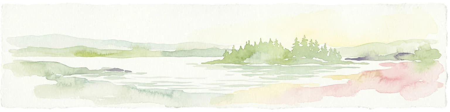
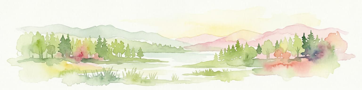
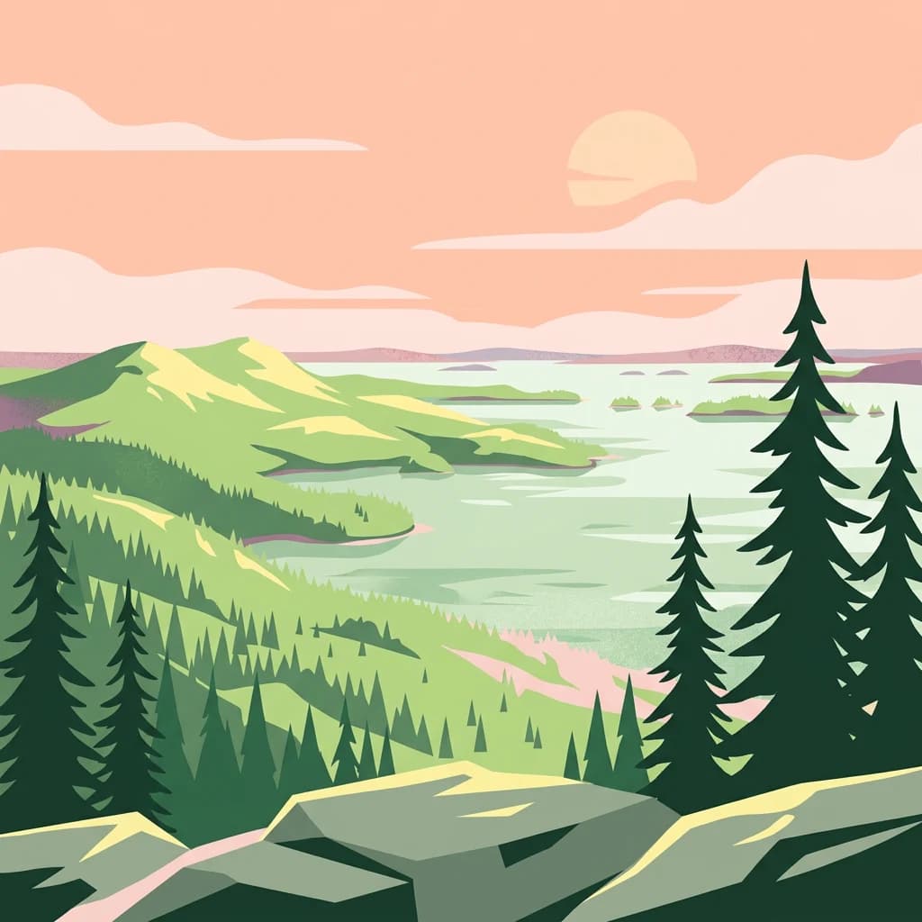
Koli National Park is best known for its sweeping views from Ukko-Koli hill, which offers a grand panorama across Lake Pielinen to the east. This view has been celebrated as one of Finland's finest natural landscapes and has inspired countless artists, including composer Jean Sibelius and painters Eero Järnefelt and Juhani Aho. The park is also renowned for its cultural landscape, where traditional Finnish breeds of cattle and sheep continue to graze in meadows maintained through historic practices like hay cutting and controlled grazing. The area's caves, such as Pirunkirkko, add geological interest to the scenic hills and forests.

Panoramic view of Lake Pielinen surrounded by forested hills under a partly cloudy sky.
Panorama of Lake Pielinen from a hill in Koli National Park, Finland.

Koli National Park history and protected-area timeline

Koli National Park was established in 1991 through legislation passed on April 10, 1991, and was expanded in 1996. The park was originally governed by the Finnish Forest Research Institute, known as Metla, before management transferred to Metsähallitus, Finland's state-owned enterprise for natural resource management. The area has ancient human history, having served as a pagan sacrificial site in pre-Christian times. Later, the landscape was shaped by slash-and-burn agriculture, a traditional Finnish farming practice that created the open meadows and cultural landscapes still maintained today. While the practice of burning fields has ceased, the tradition of hay cutting and livestock grazing continues in the park's meadows, preserving the ecological and cultural character that developed over centuries. The area's artistic heritage began in the 19th century when painters discovered Koli's scenic beauty, leading to its recognition as one of Finland's premier natural landscapes and a source of national artistic inspiration.

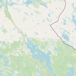
Koli National Park landscape and geographic character

The landscape of Koli National Park is characterized by forested hills rising from the western shoreline of Lake Pielinen, creating a dramatic backdrop of varying elevation and terrain. The terrain is relatively rugged, with rocky outcrops and steep slopes contrasting with sheltered valleys and wetlands. Despite the park's modest size of 30 square kilometers, the topography supports remarkable diversity, with exposed rocky summits, shaded slopes covered in old-growth spruce and birch forests, and moist valley bottoms harboring rich deciduous woodlands. The park borders two small lakes, Jero and Herajärvi, to the west, adding aquatic habitat diversity to the landscape. The western shore of Lake Pielinen provides the eastern boundary, with the lake's vast waters creating a scenic foreground to the forested hills. The varied terrain allows multiple distinct biotopes to coexist in close proximity, from exposed cliff faces to dense forest and open meadow.

Panoramic view of Lake Pielinen surrounded by forested hills under a partly cloudy sky
Panoramic view of Koli National Park showcasing forested hills and Lake Pielinen

Koli National Park ecosystems, habitats, and plant life

The nature of Koli National Park exhibits remarkable diversity due to the varied terrain and microclimates created by the hilly topography. The park is organized into three distinct zones reflecting different ecological and cultural values. The mountaintop zone prioritizes natural landscape and geological features, while the culture zone immediately adjacent to the village maintains traditional landscapes through practices including burn-beating, grazing, and rotating open fields. The nature zone protects the forest ecosystems of the hills themselves. Vegetation ranges from relatively barren rocky summits to dense old-growth spruce forests and birch woodlands on shaded slopes, with rich herbaceous communities in the moist valley bottoms. The diverse habitats support a correspondingly diverse species community, with the varied biotopes creating conditions for both common Finnish forest species and more specialized organisms adapted to specific microhabitats within this compact area.

Koli National Park wildlife and species highlights

Koli National Park supports diverse wildlife populations across its range of habitats, from forest-dwelling species to those associated with the park's traditional cultural meadows. The varied terrain creates multiple ecological niches supporting different species groups, though the Wikipedia sources provide limited specific detail on wildlife species. The maintenance of open meadows through traditional grazing practices supports species associated with cultural landscapes, while the forested hills provide habitat for typical Finnish forest fauna. The diverse biotopes created by the park's topography, from rocky exposures to dense woodlands and wetland areas, support corresponding diversity in animal life.

Koli National Park conservation status and protection priorities

Koli National Park serves important conservation functions through its protection of both natural ecosystems and cultural landscapes. The park's zonal management approach reflects different conservation priorities: strict protection of natural landscape and geological features in the mountaintop zone, preservation of traditional agricultural landscapes through active management in the culture zone, and forest ecosystem protection in the nature zone. This integrated approach recognizes that the cultural landscape itself, shaped by centuries of traditional practices like slash-and-burn agriculture and grazing, constitutes a form of nature that warrants preservation alongside unmodified ecosystems. The park protects representative samples of eastern Finnish forest and hill ecosystems while maintaining the traditional land-use practices that created the distinctive cultural landscape recognized as a national scenic view.

Koli National Park cultural meaning and human context

Koli National Park holds significant cultural value as a living landscape where traditional Finnish agricultural practices continue alongside nature conservation. The area was historically a pagan sacrificial site, giving it spiritual significance in pre-Christian Finnish culture. The subsequent development of slash-and-burn agriculture shaped the landscape over centuries, creating the open meadows and cultural landscapes that remain characteristic of the area today. Traditional Finnish breeds of cattle and sheep continue to graze in the park's meadows, maintained through annual hay cutting and controlled grazing that preserves both the agricultural traditions and the ecological diversity of the open fields. The park has been an important source of artistic inspiration, with painters discovering Koli in the 19th century and composers including Jean Sibelius drawing creative influence from its landscapes. The view from Ukko-Koli is considered one of Finland's most important national landscapes, representing a quintessentially Finnish combination of natural beauty and cultural meaning.

Top sights and standout views in Koli National Park

Koli National Park offers visitors dramatic scenic views from Ukko-Koli hill overlooking Lake Pielinen, recognized as one of Finland's most iconic vistas. The park maintains living cultural landscapes where traditional Finnish farming practices continue, with historic breeds of cattle and sheep grazing in meadows maintained by annual hay cutting. The area's artistic legacy includes inspiration for national composers and painters, with works created in Koli now displayed in Helsinki. Two ski resorts, Loma-Koli and Ukko-Koli, provide downhill skiing and snowboarding opportunities with varying difficulty levels. The park contains several caves of geological interest, including Pirunkirkko, a cave approximately 34 meters in length. Scenic lifts operate during summer months, providing access to the popular viewpoint.

Best time to visit Koli National Park

Koli National Park can be enjoyed throughout the year, with each season offering distinct experiences. The summer months bring the opportunity to use the scenic lifts to reach Ukko-Koli for the classic lake views, explore the hiking trails through varied terrain, and witness the maintained cultural landscapes with grazing livestock. Autumn brings forest color changes in the mixed woodlands, while winter transforms the landscape for skiing activities at the two resort areas. The park's popularity in 2024, with nearly 250,000 visitors, demonstrates its year-round appeal as one of Finland's premier protected areas.

Park location guide

Geography guide, regional context, and park location map for Koli National Park

Koli National Park park geography, regions, and map view in Finland
Understand where Koli National Park sits in Finland through a broader geographic reading of the surrounding landscape, nearby location context, and its mapped position within the national park landscape.

How Koli National Park fits into Finland

Finland, officially the Republic of Finland, is a Nordic country in Northern Europe with a population of 5.6 million. It borders Sweden, Norway, and Russia, with the Gulf of Bothnia to the west and the Gulf of Finland to the south. The country gained independence from Russia in 1917 and is a unitary parliamentary republic. Its landscape is characterized by extensive boreal forests and over 180,000 lakes.

Wider geography shaping Koli National Park in Finland

Finland is located in Northern Europe, occupying a peninsula bordered by the Gulf of Bothnia to the west and the Gulf of Finland to the south. It shares land borders with Sweden to the northwest, Norway to the north, and Russia to the east. The terrain is predominantly flat with extensive forest coverage and numerous lakes.

Map view of Koli National Park

Use this park location map to pinpoint Koli National Park in Finland, understand its exact geographic position, and read its mapped placement within the surrounding landscape more clearly.

Pigeon | © OpenStreetMap contributors

Location context for Koli National Park

North Karelia

Immersive imagery reveals the distinct protected-area character and diverse habitats of Eastern Finland.

Koli National Park Photos: Explore Finland's Iconic Lake Pielinen Landscapes and Forest Scenery
Visually explore the diverse landscapes of Koli National Park, from its iconic Ukko-Koli hill panoramas over Lake Pielinen to its ancient forests and rugged terrain. These images offer a detailed understanding of the park's distinct protected-area environment, revealing its unique blend of natural beauty and cultural heritage across Eastern Finland.

Panoramic view of Lake Pielinen surrounded by forested hills under a partly cloudy sky.

Wide landscape view showing dense coniferous forest, rolling hills, and a large lake under a partly cloudy sky

Panoramic view of Lake Pielinen surrounded by forested hills under a partly cloudy sky

Park atlas

Map the regional spread of protected areas and compare the diverse forested and lake landscapes.

National Parks and Protected Areas Near Koli National Park: Eastern Finland Discoveries
Continue your exploration from Koli National Park to browse other national parks and protected areas across Eastern Finland and its surrounding Nordic regions. Compare diverse forested landscapes, cultural heritage sites, and lake vistas, gaining broader geographic context and insights into regional conservation.
National parkNorth Karelia

Patvinsuo National Park: Protected Landscape Geography and Map Context

National park exploration in North Karelia, Finland.

Patvinsuo National Park stands as a vital protected area within North Karelia, Finland. This page serves as an atlas entry point, detailing the park's geographic scope, mapped boundaries, and its significance as a protected landscape. Users can explore the regional context and understand the natural terrain that characterizes this important Finnish national park, facilitating structured geographic discovery.

Area
105 km²
Established
1982
IUCN
II
Visitors
18.6K annual
National parkNorth Karelia

Petkeljärvi National Park: Distinct Protected Landscape and Esker Formations in North Karelia

Discover Finland's unique esker ridges and boreal forests.

Petkeljärvi National Park represents a distinctive protected landscape in North Karelia, Finland, celebrated for its prominent esker formations that define its topography. The park showcases light Scots pine forests growing on sandy soils, creating an open forest character that sets it apart. Visitors can explore the mapped geography, including winding ridges, wetlands, and lake scenery, alongside preserved historical fortifications from the Continuation War, offering a rich blend of natural and cultural heritage within this compact national park.

Area
7 km²
Established
1956
IUCN
II
Visitors
17.3K annual
National parkKainuu

Hiidenportti National Park: Kainuu Protected Area and Geographic Landscape Context

Explore mapped boundaries and regional geography in eastern Finland.

This MoriAtlas entry details Hiidenportti National Park, a designated national park situated in the Kainuu region of Finland. It serves as a vital hub for understanding the protected area's mapped landscape, its specific geographic characteristics, and its position within the regional atlas of eastern Finland's natural terrain. Dive into the structured details that define Hiidenportti National Park's protected identity and its contribution to the geographic understanding of the taiga-forested regions.

Area
45 km²
Established
1982
IUCN
II
Visitors
11.3K annual
Watercolor painting of a lake surrounded by forests with mountains in the background and a sunset sky
National parkFinland

Tiilikkajärvi National Park: Finland's Unique Protected Landscape with Sandy Shores and Eskers

Mapped geography of a distinctive Finnish national park.

Tiilikkajärvi National Park showcases a unique combination of natural features within Finland's protected lands. The park's core is the Tiilikkajärvi lake, almost entirely encircled by expansive sandy beaches and dramatic esker peninsulas. These glacial landforms create a striking visual contrast with the surrounding boreal forests and rare undrained aapa bogs. Explore the mapped landscape context and protected area identity of this significant Finnish natural environment.

Area
72 km²
Established
1982
IUCN
II
Visitors
26.1K annual
National parkEtelä-Savo

Kolovesi National Park: Mapped Protected Landscape in Etelä-Savo, Finland

Explore its geographic identity and mapped park boundaries.

Kolovesi National Park is a significant protected area located in the Etelä-Savo region of Finland, characterized by its presence within the Finnish lake district. This detailed page provides an atlas-centric view, emphasizing the park's mapped geographic features and its status as a protected natural landscape. Users engaging with MoriAtlas can understand Kolovesi National Park's unique landscape context and its precise location within the regional geography of southeastern Finland.

Area
61 km²
Established
1990
IUCN
II
Visitors
17.2K annual
Watercolor illustration showing a lake with islands and forested shores, distant hills, and soft pastel colors
National parkSouth Savo

Linnansaari National Park: South Savo's Protected Landscape and Geography

Explore the mapped boundaries of this Finnish national park.

Discover Linnansaari National Park, a distinct national park located in South Savo, Finland. This page provides detailed information focused on its protected landscape identity, mapped geography, and atlas context. Understand its significance as a conservation area and how its boundaries contribute to the regional natural landscape. Explore the geographic positioning of Linnansaari National Park within South Savo, offering insights for structured map-based discovery.

Area
38 km²
Established
1956
IUCN
II
Visitors
31.6K annual
Natural monumentRepublic of Karelia

Mount Vottovaara Natural Monument: Explore Protected Landscape and Geographic Context in Karelia

Mapped protected area boundaries and regional terrain in the Republic of Karelia.

Mount Vottovaara represents a significant natural monument within the Republic of Karelia, offering a focal point for structured geographic exploration. This protected landscape's mapped boundaries and its setting within the region's broader geography are key to understanding its atlas value. MoriAtlas provides the framework to examine the specific identity of Mount Vottovaara as a protected area, encouraging detailed study of its natural features and regional context.

Area
15 km²
Established
2011
Relief
Mixed relief
Climate
Boreal
Watercolor illustration showing a lake with forested shores and mountains in the background
National parkRepublic of Karelia

Ladoga Skerries National Park: National Park Protected Landscape & Geography

Mapped boundaries and regional context in the Republic of Karelia.

Discover Ladoga Skerries National Park, a key protected area recognized as a national park within the Republic of Karelia. This page provides essential context for understanding its mapped boundaries, the natural terrain it encompasses, and its geographical significance within the broader regional landscape. Utilize this information for structured atlas exploration of protected natural environments, focusing on the distinct identity of Ladoga Skerries National Park.

Area
1,220 km²
Established
2017
IUCN
II
Relief
Lowland

Common questions about visiting, size, designation, and location context for Koli National Park

Koli National Park FAQs for park facts, access, geography, and protected area context
Find quick answers about Koli National Park, including protected-area facts, park geography, trail and visitor context, and how the park fits into its surrounding country and regional landscape.
MoriAtlas Explorer

Continue Your Protected Areas Search Across the Global Atlas

Deepen your exploration by continuing the structured search for national parks and protected areas worldwide. Utilize the comprehensive filtering capabilities to compare different conservation landscapes and refine your understanding of global park geography. Discover more about the distribution and characteristics of protected natural areas.

Global natural geography