
Mori Atlas logo
National parkКрасноярские Столбы

A vast protected landscape featuring distinctive rock formations and expansive Siberian fir taiga

Красноярские Столбы National Park: Syenite Rock Pillars and Eastern Sayan Mountain Geography

(Krasnoyarsk Stolby National Park)

Красноярские Столбы National Park represents a significant protected area on the northwestern spurs of the Eastern Sayan Mountains. This Siberian wilderness is defined by towering syenite pillars that rise abruptly from dark coniferous taiga and deep river valleys. The park preserves a mosaic of forest-steppe interfaces and mountain ecosystems, maintaining natural boundaries along the Bazaikha and Mana river systems.

syenite pillarsrock formationsSiberian taigafir forestEastern Sayanrock climbing heritage
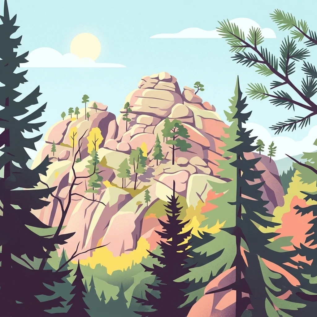
A digital illustration showing tall, layered rock pillars rising above a surrounding taiga forest under a light blue sky.

Красноярские Столбы

National park

Park overview

Structured park overview, official facts, and landscape profile for Krasnoyarsk Stolby National Park

Krasnoyarsk Stolby National Park park facts, protected area profile, and essential visitor context

Review the core facts for Krasnoyarsk Stolby National Park, including designation, size, terrain, visitor scale, habitats, and operating context in one park-focused overview.

About Krasnoyarsk Stolby National Park

Krasnoyarsk Stolby is a Siberian national park that sits literally next door to Krasnoyarsk, one of the largest cities in central Russia. The park stretches across the northwestern outliers of the Eastern Sayan mountain system, where the rugged uplands meet the western edge of the Central Siberian Plateau. Although the protected area feels remote, its northeastern edge is connected to the urban fabric of Krasnoyarsk by public transport, making it an unusually accessible example of a large wilderness landscape in the middle of Siberia.

The defining character of Stolby lies in its geology. Across the forested ridges and valleys, isolated cliffs, columns, and walls rise above the canopy. Formed from syenite, an intrusive igneous rock, these outcrops are erosional remnants, relics of a once-continuous bedrock that has been differentially weathered to leave dramatic isolated towers of stone. Some are simple pillars giving the park its name; others are complex multi-peaked formations with named routes, crevices, and ledges that have been mapped by generations of local climbers. Major rock groupings include the Takmak District near the Bazaikha valley, the Central Stolby area closer to the city, and the more remote Wild Stolby in the southern reaches of the park.

Ecologically, the park preserves extensive middle-mountain fir taiga, with Siberian fir at the heart of a dark coniferous forest that climbs the slopes above the river valleys. Along with this taiga, vegetation patterns shift toward forest-steppe elements on drier slopes and at lower elevations, creating gradients of habitat across the protected area. Rivers such as the Bazaikha, Bolshaya Slizneva, and Mana carve the landscape into ridges and valleys, and their valleys support vegetation communities that differ from the higher slopes, particularly along streams and tributary ravines.

Culturally, the park is inseparable from stolbism, the local rock-exploration tradition in which residents of Krasnoyarsk have been visiting the rocks for more than 150 years. Over time, individual formations acquired evocative proper names, climbing routes acquired their own folklore, and an entire informal subculture of so-called stolbisty grew up around the rocks. The rocks themselves became the reason that the area was first protected in 1925, when local residents successfully argued for the formal creation of the Stolby reserve. Today, the park is managed through a tiered system of zones: a small recreational zone near the city, a limited special-protection zone requiring permission, and a vast strictly protected core that covers the majority of the park's territory.

Quick facts and research context for Krasnoyarsk Stolby National Park

Krasnoyarsk Stolby National Park lies in Krasnoyarsk Krai in central Siberia, adjacent to the city of Krasnoyarsk on the northwestern slopes of the Eastern Sayan Mountains where they meet the Central Siberian Plateau. The park's natural boundaries are formed by right-bank tributaries of the Yenisei River, including the Bazaikha to the northeast and the Mana and Bolshaya Slizneva rivers to the south and southwest.

The park covers a large protected area of middle-mountain terrain dominated by fir taiga typical of the Eastern Sayan system. It was established in 1925 as a nature reserve at the initiative of Krasnoyarsk residents to safeguard the scenic syenite outcrops and their surrounding ecosystems, and it was formally re-designated as a national park in 2019. It is classified as an IUCN Category II national park, is a candidate for UNESCO World Heritage recognition, and forms part of the network of protected areas in the Altai-Sayan ecoregion.

Protection and recognition

Examine the terrestrial protection scope and documented designation year for Красноярские Столбы

Красноярские Столбы Protection Status and Designated Area History

Terrestrial protection status records outline the established designation history and management framework for Красноярские Столбы. Documented facts provide verified administrative parameters and conservation context without external international recognition sources.

Protection details

Protection scope
Terrestrial
Designated year
2019
Transboundary protection
No
Park context

Deeper park guide and search-rich context for Krasnoyarsk Stolby National Park

Krasnoyarsk Stolby National Park history, landscape, wildlife, and travel context

Explore Krasnoyarsk Stolby National Park through its history, landscape character, ecosystems, wildlife, conservation priorities, cultural context, and seasonal travel timing in a structured park guide built for atlas discovery and search intent.

Why Krasnoyarsk Stolby National Park stands out

The park is most famous for its unique assemblage of tall syenite rock outcrops, isolated pillars, rock walls, and sculpted boulders that emerge abruptly from the surrounding fir taiga. These formations give the park its name, Stolby, meaning "pillars," and they have become inseparable from the local cultural phenomenon of stolbism, a tradition of informal rock climbing and exploration that has shaped the park's recreational identity for well over a century. Beyond the rocks themselves, the park is recognized for its middle-mountain Eastern Sayan fir taiga, its deep river-cut valleys such as those of the Bazaikha and Mana, and the juxtaposition of taiga and forest-steppe habitats at relatively low elevations near a major Siberian city. This combination of dramatic geology, accessible wilderness, and cultural heritage makes Stolby one of the most distinctive natural landmarks in central Russia.
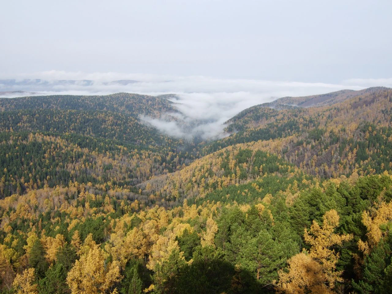
High-angle view of a dense coniferous and deciduous forest during autumn, with patches of mist or low clouds resting in the mountain valley.
A wide view of the taiga forest in Krasnoyarsk Stolby, featuring fall colors and low-hanging clouds in the valley.

Krasnoyarsk Stolby National Park history and protected-area timeline

The rock outcrops of Stolby have a long pre-reserve history. German naturalist Daniel Gottlieb Messerschmidt stopped in the area during his seven-year Siberian expedition between 1720 and 1727, Vitus Bering is recorded as having visited the rocks in 1733 to 1734, and members of the academic detachments of the Second Kamchatka expedition, including Johann Georg Gmelin and Stepan Krasheninnikov, followed in 1735. The professor-naturalist Peter Simon Pallas spent nearly a year around Krasnoyarsk between 1771 and 1773, working on his monographs on Russian natural history.

In the 1830s, gold prospecting reached the Stolby hills, and small-scale mining left traces such as the name Roev Ruchey, derived from the Russian verb to dig. A local 1833 fur inventory records animals taken in the area, including dozens of sables and foxes. During the 1870s and 1880s, Krasnoyarsk gymnasium teacher Ivan Savenkov organized school excursions to Stolby and produced early topographical and geological studies of the area, laying groundwork for later Siberian geologists.

By the early twentieth century, the area already had a flourishing stolbist culture and a strong sense of local attachment to the rocks. Industrial pressures grew during the construction of the Trans-Siberian Railway, when syenite from Stolby was quarried for various purposes and logging threatened the forests around the Central Stolby. In response, the Yenisei Governor's Revolutionary Committee in 1920 banned tree cutting and stone quarrying within a radius around the central rocks. In 1923, the stolbists issued their own informal code for the protection of Stolby, and in 1924 the Krasnoyarsk department of the Russian Geographical Society petitioned for formal protection. The area was declared a reserve in September 1924, and the binding regulation establishing the Stolby reserve was issued on 30 June 1925.

The reserve continued to expand its scientific work through the Soviet period. In 1947, Elena Krutovskaya and James Dulkeit created a Live Corner at the Tourist Excursion District to care for animals injured by poaching. Sixteen collections of scientific papers on the reserve were published from the late 1940s onward, addressing topics such as the effects of air pollution and recreation on taiga ecosystems. In 2000, the Live Corner became the foundation of the Roev Ruchey zoo, one of the major zoological institutions in Siberia. After nearly a century as a strict nature reserve, Stolby was formally converted into Krasnoyarsk Stolby National Park by decision of the Government of the Russian Federation on 28 November 2019, retaining its boundaries while reframing its mission as a multi-use protected landscape. In 2025, Russia Post issued a commemorative stamp block to mark the park's centenary.

Krasnoyarsk Stolby National Park landscape and geographic character

The landscape of Krasnoyarsk Stolby is shaped by the meeting of two large geomorphic systems: the rugged uplands of the northwestern Eastern Sayan Mountains and the worn edge of the Central Siberian Plateau. The terrain consists of forested ridges and river-cut valleys, with elevations rising from river valleys to forested slopes above. The park's natural boundaries are largely hydrological, defined by the Yenisei's right-bank tributaries: the Bazaikha River along the northeast, and the Mana and Bolshaya Slizneva to the south and southwest.

The most visually striking feature of the landscape is its syenite rock architecture. Across the taiga, isolated towers, columns, and walls of syenite rise abruptly from the forest. These outcrops are erosional remnants, the most resistant remnants of a once-continuous bedrock that has been carved away by long-term weathering. The forms are extraordinarily varied, ranging from singular pillars, including the famous Stob I through Stob IV, to complex multi-peak formations such as Ded, Vnuk, Babka, Vnuchka, Perya, and L'vinyye Vorota, and the massif of Takmak. Many rocks are large enough to have individual sub-features named after parts of the climbing routes, with cultural references embedded in the rock names themselves.

Vegetation patterns closely track this topography. Higher and cooler slopes are dominated by dark coniferous fir taiga, while lower slopes, drier aspects, and openings host forest-steppe vegetation with grassland openings. River and stream corridors, including the Bazaikha, Mana, and their tributaries, create ribbon-like habitat complexes that contrast with the surrounding ridges. The result is a landscape where, within relatively short distances, a visitor can move between dense fir forest, dry grassland openings, rocky cliffs, and shaded river valleys, all within a protected area of substantial scale.
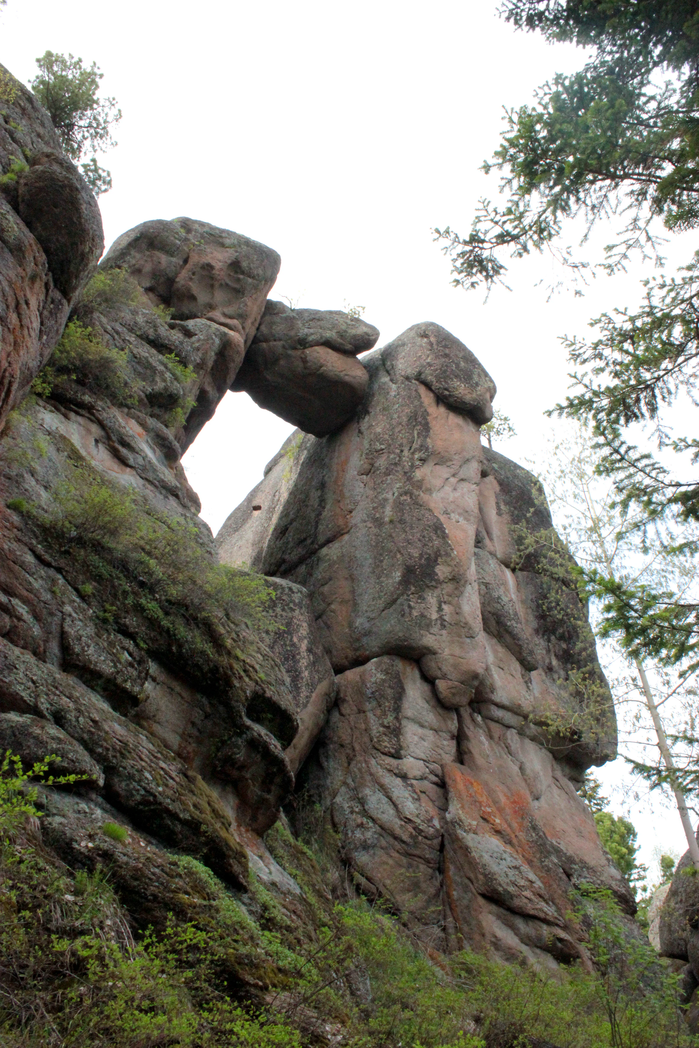
A low angle view of a large natural rock pillar formation with a smaller stone wedged between two larger columns, creating a gate-like arch, set against a bright sky with pine branches.
The Lion Gate rock formation in Krasnoyarsk Stolby National Park.

Krasnoyarsk Stolby National Park ecosystems, habitats, and plant life

The park's ecology is fundamentally middle-mountain Siberian taiga, with fir as the dominant tree species across most of the protected area. This is the classic dark coniferous forest of the Eastern Sayan foothills, layered with characteristic associated conifers, understory shrubs, mosses, and a rich ground flora. Botanical surveys have documented hundreds of higher vascular plants and a substantial moss flora within the park, reflecting both the diversity of habitats and the long history of scientific research in the reserve.

Beyond the core fir taiga, the park includes ecological gradients that create habitat diversity. Drier, warmer slopes and openings support forest-steppe communities, including feather-grass steppe elements that show up only locally in the otherwise forested terrain. Steep rocky outcrops and cliffs harbor specialized vegetation adapted to thin soils and high exposure. River valleys, floodplains, and streams contribute riparian habitats. Together, these patterns generate a mosaic of micro-habitats for plants and animals.

Several plant species of conservation concern are recorded within the park, including various orchids and other rare vascular plants listed in the Red Book of Russia. Threats to biodiversity include the impact of stray dogs on ungulates, atmospheric pollution affecting taiga ecosystems, and the cumulative effects of high public visitation in the recreational zone, all of which are subjects of long-running scientific monitoring.
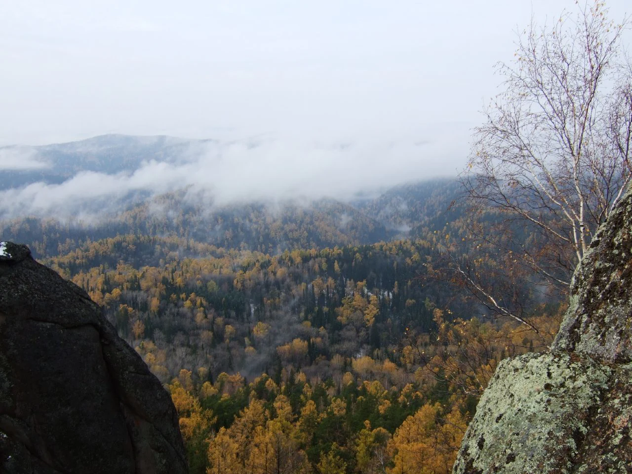
A wide view of a densely forested valley in autumn with golden yellow and dark green trees, framed by dark rocky outcrops in the foreground and patches of low cloud or mist in the distance.
Autumn landscape looking over the forested foothills of Krasnoyarsk Stolby.

Krasnoyarsk Stolby National Park wildlife and species highlights

Stolby has a fauna strongly characteristic of Siberian middle-mountain taiga, with a secondary influence of forest-steppe species where habitats meet. Surveys have recorded a substantial list of vertebrate species across the park, reflecting the diversity of taiga, forest-steppe, rocky, and riparian habitats. Among mammals, the fauna includes both small taiga species like chipmunks, red squirrels, and forest voles, and larger mammals such as brown bears, wolves, lynx, elk, Siberian red deer, Siberian roe deer, and the unique hornless musk deer. Active populations of red fox, badger, Eurasian beaver, and mountain hare occupy various niches across the park.

Large predators play a key ecological role in the park. Wolves help regulate ungulate populations, brown bears are a familiar presence with seasonal migrations and winter hibernation, and lynx are the sole wild cat in the area, preying on smaller ungulates. Ungulates, including Siberian roe deer, Siberian red deer, and musk deer, follow seasonal patterns tied to antler cycles, rutting, and visits to natural salt licks.

The park's birdlife is rich, with more than two hundred bird species documented over more than a century of observation. The avifauna combines year-round taiga residents adapted to harsh Siberian winters, such as nuthatches, tits, woodpeckers, and hazel grouse, and migratory species that arrive in spring to breed, including pipits, wagtails, flycatchers, thrushes, and cuckoos that travel from Africa and Asia. Forest raptors such as the golden eagle, saker falcon, and peregrine falcon have been recorded, along with specialist woodland birds like the Eurasian pygmy owl and the long-tailed rosefinch. Programs using camera traps continue to expand knowledge of even the most secretive mammals, reinforcing the park's role as an important long-term observation site for central Siberian fauna.
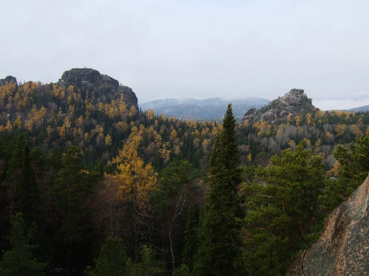
A wide view of the Krasnoyarsk Stolby landscape, showing two prominent dark rocky pillars rising above a forest canopy displaying autumn colors of yellow and green, under a hazy overcast sky.
Autumn landscape featuring the iconic rock formations and dense taiga forest of Krasnoyarsk Stolby.

Krasnoyarsk Stolby National Park conservation status and protection priorities

Krasnoyarsk Stolby is a long-established protected area with significant conservation importance for central Siberia. Originally created in 1925 as a strict nature reserve and re-designated as a national park in 2019, the park operates under a tiered zoning system: a small recreational zone near Krasnoyarsk, a restricted special-protection zone accessible only by permission, and a vast strictly protected core that covers the great majority of the park's total area. The strict core approach reflects the site's function not only as a recreational landscape but as an intact reference ecosystem for middle-mountain Eastern Sayan fir taiga and its associated fauna.

Conservation values include preservation of syenite rock ecosystems with their specialized cliff flora, protection of large tracts of relatively unfragmented fir taiga, and safeguarding of wildlife populations of regional importance. The park contributes to the network of protected areas in the broader Altai-Sayan ecoregion and is a candidate for UNESCO World Heritage inscription, indicating recognition of its natural values at the international level. Scientific monitoring within the park has run for more than a century, providing a rare long-term dataset on taiga ecosystem dynamics.

Conservation challenges include pressures from very high visitor numbers concentrated near the city, the long-running impact of stray dog packs on ungulate populations, atmospheric pollution affecting forest health, and historical legacies of small-scale quarrying and logging. Management responses, including zoning, wildlife monitoring with camera traps, targeted ungulate protection, and public education, reflect the ongoing effort to balance recreation, science, and ecological integrity in a park that sits on the edge of a major Siberian city.

Krasnoyarsk Stolby National Park cultural meaning and human context

Stolby occupies a uniquely central place in the cultural identity of Krasnoyarsk. For more than 150 years, residents of the city have visited the rocks for recreation, training, and sport, giving rise to the informal tradition known as stolbism, which blends outdoor exploration, climbing, and a deeply local code of respect for the rocks and forest. The rocks themselves carry personal and collective meaning: many formations have proper names, climbing routes have their own folklore, and traditions like the inscription of the word "Svoboda" (Freedom) on the face of Stob II are part of the park's living heritage.

The park's image also features in Russian literature. Vladimir Obruchev's novella "At Stolby" draws on the stolbist tradition, while Yuri Korotkov's novella "Abrek" is set in the Stolby area. Local scientists and writers have documented the rocks and reserve across more than a century, contributing to the broader picture of Krasnoyarsk as a city with a strong outdoor identity. In 2025, a Russian Post stamp block depicting the park was issued to mark its centenary, indicating the site's continuing cultural resonance.
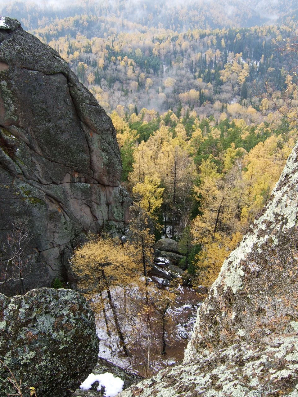
A high-angle view looking down between two large, weathered grey rock pillars into a dense forest valley with yellow autumn trees and patches of early snow.
A high vantage point view overlooking the forested valley of Krasnoyarsk Stolby, characterized by iconic syenite rock formations and autumn foliage.

Top sights and standout views in Krasnoyarsk Stolby National Park

The defining highlights of Krasnoyarsk Stolby are its dramatic syenite pillars, walls, and sculpted rock formations rising from the middle-mountain fir taiga, and the unique stolbist culture that grew up around them over more than a century. Whether viewed as scenery, as climbing terrain, or as cultural landmarks, the rocks are the single element that gives the park its identity and its name.

Beyond the rocks, the park offers fully realized examples of Eastern Sayan fir taiga with associated forest-steppe pockets, river-valley ecosystems along the Bazaikha, Mana, and Bolshaya Slizneva, and a rich assemblage of taiga mammals and birds typical of central Siberia, including brown bear, lynx, Siberian musk deer, and golden eagle. Combined with more than a century of scientific research, a tiered zoning system with a large strictly protected core, and a candidate listing for UNESCO World Heritage status, these elements make Stolby one of the most distinctive protected natural areas in Russia.
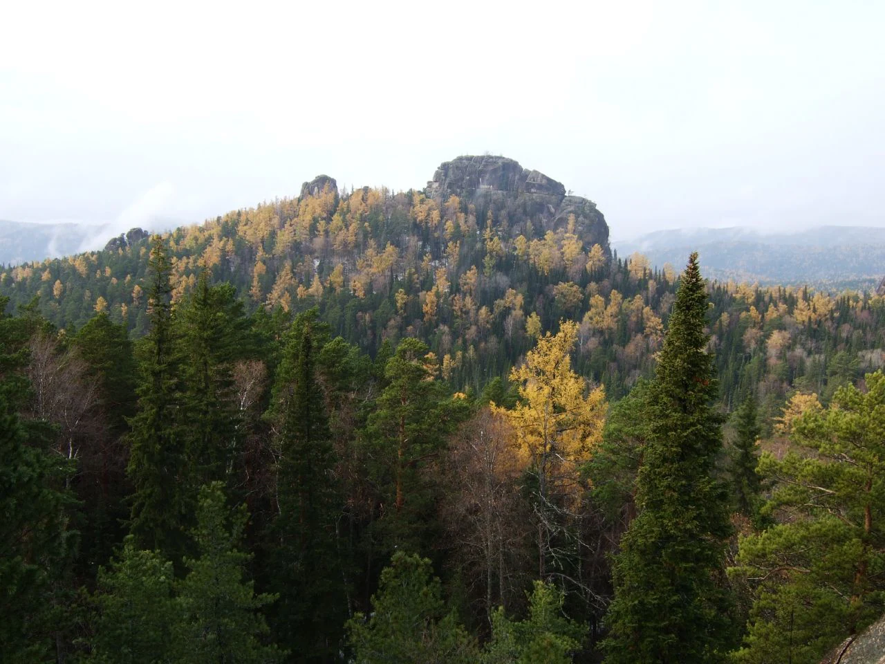
A wide view of a forested hillside with golden and dark green trees, featuring a prominent, craggy rock pillar at the summit under an overcast sky.
A view of the distinctive syenite rock formations rising above the autumn-colored taiga forest in Krasnoyarsk Stolby.

Best time to visit Krasnoyarsk Stolby National Park

Stolby lies in the temperate climate zone with cold winters and mild summers, and the character of the natural area shifts strongly with the seasons. In deep winter, the rocks and forest are typically blanketed in heavy snow and temperatures drop well below freezing, giving the park a dramatic but demanding atmosphere best suited to experienced visitors prepared for Siberian winter conditions.

Spring and early summer are periods when migratory birds return to breed, rivers swell with snowmelt, and the fir taiga begins to green up. This is a particularly rewarding time for observing the rich birdlife of the park and for experiencing flowing water and waterfalls along streams such as those near the Eastern Entrance. Summer and early autumn offer the most accessible conditions for general outdoor recreation, with milder temperatures and stable weather for exploring both the recreational zone near Krasnoyarsk and the more remote rock areas of the park.

Monthly climate preview

Long-term representative point measurements of monthly temperature and precipitation values

Красноярские Столбы Climate Normals and Annual Temperature Rhythm

Representative coordinate records show wide annual temperature swings and distinct precipitation variations across the twelve-month cycle. Examining the complete monthly climate profile provides deeper context for the long-term environmental patterns recorded at this location.
Annual mean0 °C
-20 °C19 °C
Jan-20°
Feb-16°
Mar-9°
Apr
May
Jun16°
Jul19°
Aug16°
Sep
Oct
Nov-10°
Dec-17°
Warmest month
July

18.8 °C

Coolest month
January

-19.9 °C

Wettest month
June

2.5 mm/day

Driest month
January

0.7 mm/day

Park location guide

Geography guide, regional context, and park location map for Krasnoyarsk Stolby National Park

Krasnoyarsk Stolby National Park park geography, regions, and map view in Russia

Understand where Krasnoyarsk Stolby National Park sits in Russia through a broader geographic reading of the surrounding landscape, nearby location context, and its mapped position within the national park landscape.

How Krasnoyarsk Stolby National Park fits into Russia

Russia is a transcontinental nation spanning eleven time zones, bordered by fourteen countries. It is the world's largest country by area, covering 17,098,246 km². Moscow is the capital and largest city, while Saint Petersburg is the second-largest and a major cultural centre.

Wider geography shaping Krasnoyarsk Stolby National Park in Russia

Russia spans Eastern Europe and North Asia, covering 17,098,246 km². It shares land borders with fourteen countries, more than any other nation, and spans eleven time zones. The landscape includes vast plains, mountain ranges such as the Urals and Caucasus, and extensive coastlines along the Arctic Ocean, Pacific Ocean, Baltic Sea, Black Sea, and Caspian Sea.

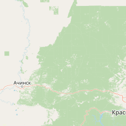
Map view of Krasnoyarsk Stolby National Park

Use this park location map to pinpoint Krasnoyarsk Stolby National Park in Russia, understand its exact geographic position, and read its mapped placement within the surrounding landscape more clearly.

Pigeon | © OpenStreetMap contributors

Location context for Krasnoyarsk Stolby National Park

Ямало-Ненецкий автономный округ

Visual exploration of towering pillar geology and Eastern Sayan mountain habitats

Красноярские Столбы Photos: Syenite Rock Formations and Taiga Scenery

Visual records capture the rugged topography of dramatic syenite rock formations rising above dense fir-dominated middle-mountain taiga. Examination of these protected landscapes reveals the unique terrain, diverse forest habitats, and towering geological pillars that define the region.

High-angle view of a dense coniferous and deciduous forest during autumn, with patches of mist or low clouds resting in the mountain valley.

A jagged, rocky mountain formation known as Takmak rising above a dense green pine forest under a bright clear blue sky.

A low angle view of a large natural rock pillar formation with a smaller stone wedged between two larger columns, creating a gate-like arch, set against a bright sky with pine branches.

A wide view of a densely forested valley in autumn with golden yellow and dark green trees, framed by dark rocky outcrops in the foreground and patches of low cloud or mist in the distance.

A wide view of the Krasnoyarsk Stolby landscape, showing two prominent dark rocky pillars rising above a forest canopy displaying autumn colors of yellow and green, under a hazy overcast sky.

An elevated view of a vast forest featuring a mix of green conifers and golden autumn deciduous trees, with misty mountain ridges in the distance under a pale sky.

A high-angle view looking down between two large, weathered grey rock pillars into a dense forest valley with yellow autumn trees and patches of early snow.

A wide view of a forested hillside with golden and dark green trees, featuring a prominent, craggy rock pillar at the summit under an overcast sky.

A high vantage point looking out over a dense, hilly forest in autumn, with golden and green trees stretching to the horizon, framed by pine branches in the foreground.

A large, smooth, rounded syenite rock formation towers against a clear blue sky, partially framed by coniferous trees with small patches of snow visible in the rocky crevices.

A close up view of tall, vertical syenite rock pillars in a forest environment, with dark lichen and weathered surfaces visible on the stone faces.

An expansive aerial view of a dense, multi-colored autumn forest covering rolling hills, with low clouds clinging to the distant mountain ridges.

A low angle view of the massive Ded syenite rock pillar rising above coniferous trees under a clear blue sky.

An elevated, panoramic view of a dense, autumn-colored forest with golden and green trees, partially obscured by low-hanging clouds and mist in a mountainous region.

A close-up view of a large, weathered, grey syenite rock pillar with small patches of snow, overlooking a forested valley partially obscured by mist.

A close up view of a sheer, weathered rock pillar with a person climbing near the top, overlooking a vast, dense forest canopy showing autumn foliage colors.

Park atlas

Discover adjacent Siberian taiga reserves and regional protected landscapes

Other Parks Like Красноярские Столбы and Nearby Protected Areas to Compare

Compare other parks near Красноярские Столбы to examine similar middle mountain taiga ecosystems and dramatic rock formations. Broaden your protected area research by evaluating connected regional geography and adjacent natural landmarks across central Siberia.
Watercolor painting showing pinkish rock pillars, green forests, and distant mountains in a landscape
National parkKrasnoyarsk Krai
Park boundaries overlap#1 closest

Southwest

Krasnoyarsk Pillars National Park: Geographic Atlas and Protected Landscape Exploration

Discover mapped terrain and regional park context in Siberia.

This detailed entry for Krasnoyarsk Pillars National Park offers an in-depth look at its identity as a protected landscape within Krasnoyarsk Krai. It provides structured geographic information, focusing on mapped boundaries and the park's position within the vast Siberian terrain. Users can leverage this data for atlas exploration, gaining a clear understanding of the park's physical dimensions and its role in the regional geography of Russia. Explore the unique landscape character and mapped context of this significant national park.

Area
471.54 km²
Established
2019
IUCN
II
Visitors
200K annual
Watercolor painting of green trees, rolling hills, a pink and yellow sunset sky, and a single tree on the right
National parkKrasnoyarsk Krai
About 346 km away#2 closest

South

Shushensky Bor National Park: Mapped Geography of a Siberian Protected Forest

Explore the protected landscape and regional context of Krasnoyarsk Krai.

Shushensky Bor National Park serves as a critical protected area within the vast geography of Krasnoyarsk Krai, Russia, offering detailed insights into Siberia's ecological transition zones. This national park meticulously maps the shift from the Minusinsk basin forest-steppe to the dramatic mountain taiga of the Western Sayan range. Users can explore its varied terrain, from gentler northern steppe-influenced lands to the rugged slopes of the Borus Massive, all within a defined protected landscape. The proximity to the Sayano-Shushenskoye Reservoir further defines its unique geographic setting, providing context for its conservation importance and natural beauty.

Area
392 km²
Established
1995
IUCN
II
Relief
Mountain
National parkKemerovo Oblast
About 454 km away#3 closest

Southwest

Shorsky National Park: Mapping Mountain Taiga and Protected Forest Landscapes

A comprehensive look at Gornaya Shoria geography

Shorsky National Park protects the rugged wilderness of the Altai-Sayan mountain system. Its territory showcases a dramatic topography shaped by the Mras-Su river and thick forests of Siberian stone pine and fir, offering an essential view into the biodiversity and environmental character of the southern Siberian landscape.

Area
4,138.43 km²
Established
1989
IUCN
II
Relief
Mountain
Watercolor painting of a river flowing through a valley with forested hills and distant mountains
National parkTashtagolsky District
About 454 km away#4 closest

Southwest

Shorsky National Park: Protected Taiga and Karst Landscapes in Tashtagolsky District

Mapping the mountainous wilderness of southern Siberia

Shorsky National Park protects vast swathes of dark taiga forest and dramatic karst features across 4,180 square kilometers of rugged mountain terrain. Explore the geography of this Siberian region, featuring over 60 named caves, deep river valleys, and significant rock formations that define the natural character of the Tashtagolsky District.

Area
4,180 km²
Established
1989
IUCN
II
Relief
Mountain
Watercolor painting showing a river flowing through a forested area with distant hills, using soft green, blue, and yellow tones
National parkAltai Krai
About 480 km away#5 closest

Southwest

Salair National Park: Mapped Protected Landscape and Geographic Features in Altai Krai

Discover the unique dark taiga terrain and relict flora.

Salair National Park is a significant protected area in Altai Krai, Russia, renowned for its exceptionally biodiverse dark taiga forests, often called the "rainforest of Siberia." Established in 2020, the park spans the western slopes of the Salair Ridge, covering about 161,000 hectares of gentle low mountain terrain. Its landscape is characterized by rounded mountains, a network of ravines, and the preservation of pre-glacial relict plant species. This national park offers a vital contrast to the surrounding agricultural areas, highlighting its role in conserving unique Siberian forest ecosystems and their historic flora.

Area
1,612 km²
Established
2020
IUCN
II
Relief
Upland
National parkUvs Province
About 711 km away#6 closest

South

Khan-Khokhi Khyargas Mountain National Park: Mapped Boundaries and Protected Landscape

Uvs Province National Park Geography

Khan-Khokhi Khyargas Mountain National Park is a designated national park offering critical insights into Mongolia's protected natural landscapes. This entry supports structured geographic discovery, detailing the park's mapped boundaries and its environmental context within Uvs Province. Engage with the park's identity as a protected area, uncovering its role in the regional atlas and its unique contribution to the mapped terrain.

Area
3,413 km²
Established
2000
IUCN
II
Relief
Mountain
A horizontal watercolor painting showing a soft landscape with distant purple mountains, a calm lake in the midground, and green grassy shores in the foreground.
National parkKhövsgöl Province
About 715 km away#7 closest

Southeast

Lake Khövsgöl National Park: Geography and Protected Area Landscape Analysis

Highland taiga and ancient freshwater basin in Khövsgöl Province

Analyze the complex geography of Lake Khövsgöl National Park, which protects a massive, ultraoligotrophic waterbody surrounded by the rugged Sayan Mountains. The area serves as a vital ecological transition zone, containing diverse alpine, forest, and aquatic terrains that form a central part of Mongolia's natural heritage.

Area
2,760 km²
Relief
Mountain
Climate
Alpine
Access
Remote access
A watercolor painting of a serene lakeshore with soft green grass in the foreground, a still lake reflecting soft pink and beige tones, and light green hills in the distance.
National parkUvs Province
About 732 km away#8 closest

South

Khyargas Lake National Park: Geography and Protected Area Mapping in Western Mongolia

A comprehensive look at saline and freshwater steppe ecosystems.

Khyargas Lake National Park, situated in Uvs Province, offers a rare glimpse into the saline and freshwater lake systems of the Mongolian steppe. This protected area encompasses an endorheic basin characterized by its wide, open shoreline and unique ecological contrast. Use our atlas to analyze the mapped terrain and the expansive, undisturbed wetlands that define this notable region of western Mongolia.

Area
3,328 km²
Established
2000
Relief
Lowland
Climate
Arid

Common questions about visiting, size, designation, and location context for Krasnoyarsk Stolby National Park

Krasnoyarsk Stolby National Park FAQs for park facts, access, geography, and protected area context

Find quick answers about Krasnoyarsk Stolby National Park, including protected-area facts, park geography, trail and visitor context, and how the park fits into its surrounding country and regional landscape.
MoriAtlas Explorer

Continue Your Protected Areas Search Across the Global Atlas

Deepen your exploration by continuing the structured search for national parks and protected areas worldwide. Utilize the comprehensive filtering capabilities to compare different conservation landscapes and refine your understanding of global park geography. Discover more about the distribution and characteristics of protected natural areas.

Global natural geography