Why Laguna San Rafael National Park stands out
Laguna San Rafael National Park is best known for the dramatic San Rafael Glacier, a tidewater glacier that calves directly into San Rafael Lagoon, creating a spectacular landscape of floating icebergs and active glacial calving. The park's inclusion of the Northern Patagonian Ice Field makes it a premier destination for understanding glacial processes and Patagonian ice field dynamics. The more than 16-kilometer-long fjord system leading to the lagoon provides one of the most iconic maritime approaches in southern Chile. The park's designation as a UNESCO Biosphere Reserve recognizes its outstanding biodiversity value, particularly the presence of critically endangered southern right whales that use the Gulf of Penas as a wintering and calving ground.
Laguna San Rafael National Park history and protected-area timeline
The area now protected within Laguna San Rafael National Park was first explored by non-indigenous people in 1675, at which time the San Rafael Glacier existed as a land-terminating glacier rather than reaching into the lagoon. Historical records suggest the glacier advanced to rejoin the lagoon sometime between 1741 and 1766, transforming into a tidewater glacier that has calved into the lagoon since that time. The park was formally established in 1959, creating protected status for this significant Patagonian landscape. In 1979, UNESCO recognized the park's exceptional ecological values by designating it a World Biosphere Reserve, acknowledging both the glacial systems and the diverse ecosystems the park protects. The park is managed by Chile's Corporación Nacional Forestal (CONAF), the national forestry authority responsible for protected area management across the country. The designation as a Biosphere Reserve reflects the park's role in protecting representative examples of Patagonian ecosystems while allowing for sustainable use of natural resources in surrounding areas.
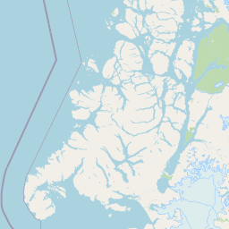
Laguna San Rafael National Park landscape and geographic character
The landscape of Laguna San Rafael National Park is defined by the intersection of the Andes mountains with the Pacific coast, creating a terrain of extraordinary diversity and dramatic scenery. The Northern Patagonian Ice Field occupies the higher elevations, a vast expanse of glacial ice that feeds glaciers descending into the lower valleys and fjords. Peak elevations include Monte San Valentín, which rises to over 4,000 meters, and Cerro Arenales, both prominent landmarks visible from the coastal waters. The fjord system that leads to San Rafael Lagoon extends more than 16 kilometers inland, with steep walls carved by glacial action and now filled with seawater. San Rafael Lagoon itself occupies a glacial valley, its waters colored by glacial flour and frequently dotted with icebergs that have calved from the active glacier at its eastern end. The lower terrain features river valleys, wetlands, and coastal areas where the mountains meet the sea. The Isthmus of Ofqui creates a land connection in the northern part of the park, while the Baker River and Exploradores River form important boundaries or near-boundaries to the protected area.
Laguna San Rafael National Park ecosystems, habitats, and plant life
The nature of Laguna San Rafael National Park reflects the extreme precipitation and transitional biogeographic position of this Patagonian landscape. The extremely high annual rainfall, exceeding 4,400 millimeters at the lagoon and surpassing 6,000 millimeters at higher elevations, supports lush vegetation communities despite the cold temperatures. The park occupies a transition zone between the Mediterranean-influenced climate of central Chile and the more extreme conditions of southern Patagonia, creating a unique set of ecological communities. The Northern Patagonian Ice Field represents a critical freshwater storage system, with meltwater feeding rivers and streams throughout the park. The marine environment of the Gulf of Penas and Moraleda Channel supports productive waters where upwelling and oceanographic conditions create rich feeding grounds for marine species. The combination of terrestrial, freshwater, and marine ecosystems within a single protected area creates exceptional ecological coherence.
Laguna San Rafael National Park wildlife and species highlights
Laguna San Rafael National Park supports diverse wildlife across its terrestrial, freshwater, and marine environments. The avifauna includes several species that find shelter in the park's varied habitats, with black-browed albatrosses, great grebes, black-necked swans, and cormorants among the notable bird species present. Terrestrial mammals include the South American gray fox and South Andean deer, which inhabit the forest and steppe environments within the park boundaries. The marine environment is particularly significant, with Chilean dolphins, South American sea lions, marine otters, and southern elephant seals regularly present in coastal waters. Perhaps most significantly, baleen whales migrate into the Gulf of Penas, and scientific observations suggest this gulf may serve as a wintering and calving ground for the critically endangered Southern Right Whale population, adding exceptional conservation importance to the park's marine values.
Laguna San Rafael National Park conservation status and protection priorities
Laguna San Rafael National Park holds significant conservation value at multiple levels, from national protected area status to international recognition as a UNESCO Biosphere Reserve. The park's designation as IUCN Category II reflects its primary purpose of protecting natural ecosystems while allowing for sustainable visitor use and scientific research. The inclusion of the Northern Patagonian Ice Field ensures protection of one of the Southern Hemisphere's significant temperate ice fields, which serves as a climate archive and freshwater reservoir. The potential role of the Gulf of Penas as a calving ground for critically endangered southern right whales elevates the park's marine conservation significance, as this population faces serious threats throughout its range. The UNESCO Biosphere Reserve designation in 1979 recognized both the outstanding natural values and the park's potential to serve as a model for sustainable development in the surrounding region. The extreme precipitation and intact ecosystems represent relatively unmodified natural conditions that are increasingly rare in inhabited regions of Chile.
Laguna San Rafael National Park cultural meaning and human context
Laguna San Rafael National Park occupies territory traditionally associated with indigenous peoples of Patagonia, though the historical record of human presence in this remote coastal area is less extensively documented than in more accessible regions of Chile. The non-indigenous exploration beginning in 1675 marked the start of a period of European contact that would eventually lead to the region's incorporation into the Chilean state and the establishment of protected area status. The park remains in a region of very low population density, with the nearby town of Puerto Chacabuco serving as the primary gateway for park visitors. The cultural context of the park is primarily one of wilderness and natural landscape rather than concentrated human heritage sites, reflecting the extreme conditions and remote location that have limited permanent human settlement in this part of Patagonia.
Top sights and standout views in Laguna San Rafael National Park
The flagship attraction of Laguna San Rafael National Park is the San Rafael Glacier, an active tidewater glacier that calves spectacular icebergs into the lagoon, creating one of the most accessible glacial viewing experiences in Patagonia. The fjord approach to the lagoon, spanning more than 16 kilometers, provides an iconic maritime journey through steep-walled channels. The Northern Patagonian Ice Field offers a rare opportunity to experience one of the world's significant temperate ice fields within a protected area. The possibility of observing southern right whales in the Gulf of Penas represents exceptional wildlife viewing potential. The dramatic mountain peaks of Monte San Valentín and Cerro Arenales provide stunning backdrop views from both land and water. The UNESCO Biosphere Reserve designation reflects the park's importance as a conservation model.
Best time to visit Laguna San Rafael National Park
The optimal time to visit Laguna San Rafael National Park corresponds with the Patagonian spring and summer months, from roughly November through March, when temperatures are milder and daylight hours are longest. During this period, the weather is generally more stable, though the region remains prone to rapid changes and heavy precipitation can occur in any season. The summer months offer the best conditions for boat trips into the fjord and lagoon to view the glacier and floating icebergs. Wildlife viewing opportunities, including marine mammals and birds, aregood throughout the warmer months. The winter months bring shorter days, colder temperatures, and more frequent storms, though the dramatic landscapes under winter conditions have their own appeal for experienced visitors prepared for challenging weather.