
Mori Atlas logo
Protected areaLake Balaton

A detailed geographic study of tectonic basins, reed-fringed shores, and volcanic witness mountains

Lake Balaton: Mapping the Protected Landscapes and Volcanic Terrain of Western Hungary

Lake Balaton serves as a primary geographic feature of Transdanubia, functioning as a shallow tectonic basin framed by the Bakony-Balaton uplands. This protected landscape reveals a sharp contrast between the steep, vineyard-terraced volcanic peaks of the northern shore and the flat, marshy plains of the southern basin. Our mapped analysis traces the geological evolution of the region, from its Pleistocene origins to the Ramsar-protected wetland mosaic that defines the lake ecosystem.

freshwater lakerift lakeshallow lakeCentral EuropeHungaryTransdanubia

Lake Balaton

Protected area

Park overview

Structured park overview, official facts, and landscape profile for Lake Balaton

Lake Balaton park facts, protected area profile, and essential visitor context

Review the core facts for Lake Balaton, including designation, size, terrain, visitor scale, habitats, and operating context in one park-focused overview.

About Lake Balaton

Lake Balaton is the largest lake in Central Europe and the defining natural landmark of western Hungary. It occupies a tectonic depression formed within the broader Transdanubian basin, resting on Mesozoic sedimentary rocks that connect it geologically to the Alpine formations to the west. The lake is approximately 77 kilometers long and averages only a few meters in depth, with its deepest point, often called the Tihany well, lying near the Tihany strait where the peninsula narrows the basin. This extreme shallowness shapes nearly every aspect of the lake's behavior, from the rapid warming of its waters in summer to the way wind produces steep, short waves. The Tihany Peninsula effectively divides the lake into a larger western basin and a smaller, narrower eastern basin.

The surrounding landscape is sharply asymmetrical. To the north rises the Balaton-felvidék, a foothill belt of the Bakony Mountains composed of volcanic remnants, basalt flows, and forested ridges. These hills include the famous witness mountains, buttes such as Badacsony, Szigliget, and Gulács, each carrying layers of basalt and tuff above softer sedimentary rock. Their sun-facing slopes have been cultivated with vineyards since Roman times and remain the core of the Badacsony and Balaton-felvidék wine regions. To the south, the land flattens into a sandy plain that was historically a mosaic of marshes and reed-fringed bays before nineteenth-century water management lowered the lake's level and opened the area to agriculture and, later, large-scale resort development. The Tihany Peninsula itself is a geological showcase, exposing fossil-bearing sediments, geothermal features, and the iconic geyser cones that give Tihany its distinctive silhouette.

Balaton is also a deeply protected natural system. The lake is listed as a Ramsar wetland and forms part of a wider protected framework that includes the Balaton-felvidéki National Park on the northern shore and the Bakony-Balaton UNESCO Global Geopark across the broader hills. Beyond formal protection, the lake functions as a critical inland habitat for waterbirds, fish, and aquatic vegetation. Reedbeds fringe large sections of the shore, particularly along the quieter northern coast, while the open water hosts one of Europe's most significant waterbird populations outside the great lowland wetlands. Research carried out at the Balaton Limnological Research Institute in Tihany has shaped modern understanding of the ecology of shallow eutrophic lakes and continues to guide restoration efforts against algae blooms and invasive species.

Culturally, the lake operates on multiple scales. It is a working agricultural and fishing environment, with vineyards on the hills, fish populations in the water, and reed harvesting along the margins. It is also a national leisure landscape, where Hungarian families have spent summer holidays for over a century, first at the aristocratic resorts of Balatonfüred and Hévíz in the late nineteenth century, then as mass middle-class and working-class tourism expanded with the railways and later with state-organized holidays. Literature, painting, music, and film have repeatedly used Balaton as a setting, from Jókai's novels and Krúdy's short stories to twentieth-century painters and contemporary pop songs, embedding the lake in Hungarian cultural identity as unmistakably as the Danube.

Quick facts and research context for Lake Balaton

Lake Balaton lies in the Transdanubian region of Hungary and is fed primarily by the Zala River, with the regulated Sió canal as its only outflow toward the Danube. It is a tectonic rift lake of exceptional shallowness, with an average depth of only a few meters, and it sits below the Balaton Uplands, a landscape of volcanic buttes and wine-growing slopes. Designated as a Ramsar wetland in March 1989, the lake is also flanked by the Bakony-Balaton Geopark and the Balaton-felvidéki National Park, giving the wider region a layered protection status beyond the lake itself.

Protection and recognition

Documented terrestrial protection scope, designation history, and Ramsar site records

Lake Balaton Protection Status and International Recognition Record

Lake Balaton maintains an established terrestrial protection status originating from its designated year in 1989. Official records include documented Ramsar site recognition providing structured conservation data for this landscape.

International recognition

Protection details

Protection scope
Terrestrial
Designated year
1989
Transboundary protection
No
Park context

Deeper park guide and search-rich context for Lake Balaton

Lake Balaton history, landscape, wildlife, and travel context

Explore Lake Balaton through its history, landscape character, ecosystems, wildlife, conservation priorities, cultural context, and seasonal travel timing in a structured park guide built for atlas discovery and search intent.

Why Lake Balaton stands out

Lake Balaton is best known as the shallow, warm-water playground at the heart of Hungarian summer life. Its defining traits are the abrupt contrast between the gentle, sandy southern shoreline and the steep, vineyard-covered northern hills; the volcanic witness buttes such as Badacsony that rise directly above the water; the unusually mild, lake-driven microclimate that produces warm swimming conditions; and the centuries-old viticulture along the north shore, which the Romans already practiced on the same slopes.
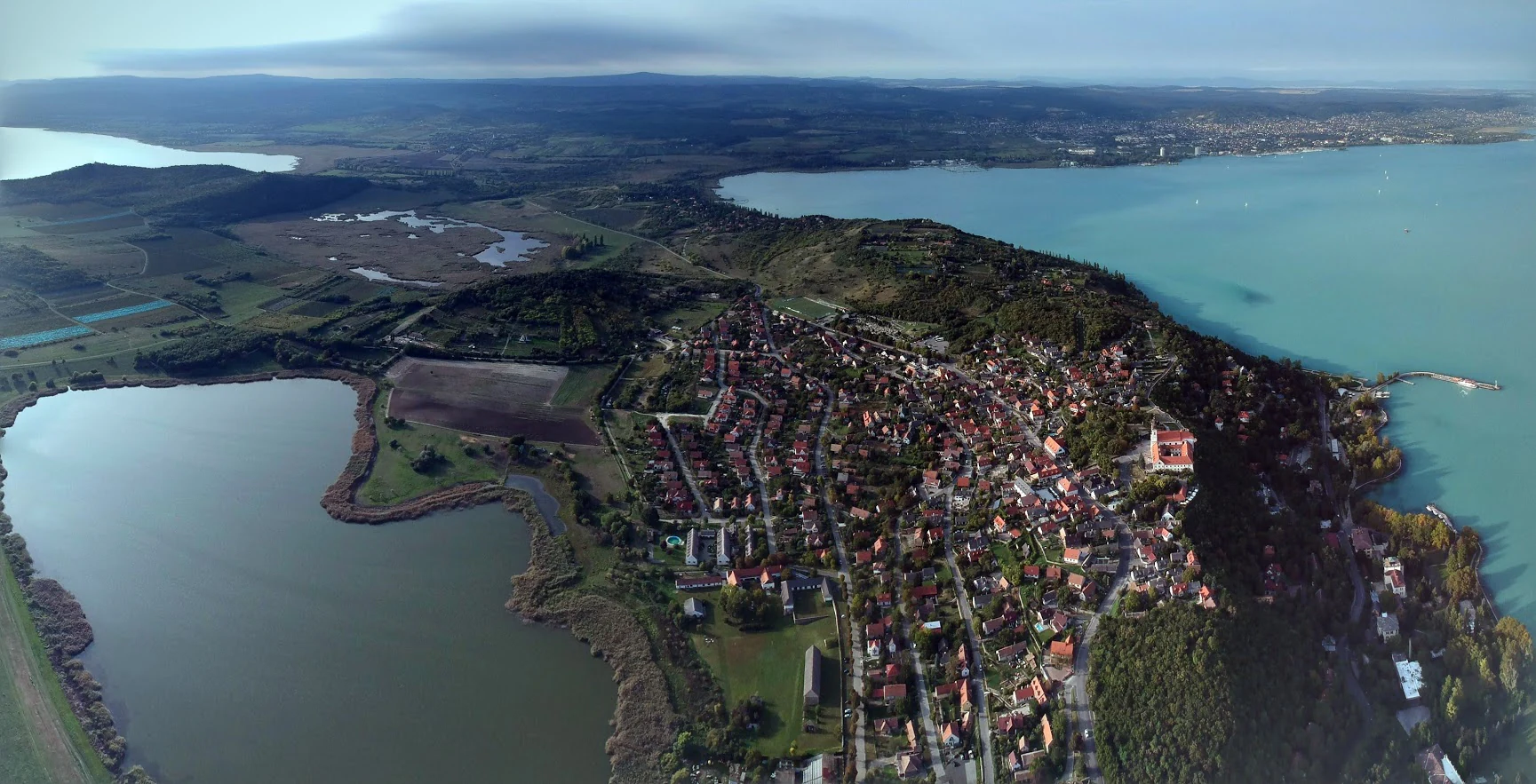
Tihany Peninsula
View of the Tihany Peninsula on Lake Balaton

Lake Balaton history and protected-area timeline

Lake Balaton has been a focal point of human settlement and activity for at least two millennia. The Romans knew the lake as Pelso or Peiso and referred to it as the largest inland water of Pannonia; a silver plate from the later Seuso Treasure carries the inscription PELSO as evidence of the lake's prominence in late antiquity. Local tradition also associates Roman-era drainage with the emperor Galerius, who reportedly cut a sluice into the reed-choked margins in the late third century, although this history is debated. The northern shore preserves remnants of Roman roads and cemeteries, and several ancient cult sites and burial mounds line the hills.

During the early medieval period, the lake sat at the interface of Slavic, Frank, and later Hungarian power. In 846 the Slavic prince Pribina established a fortified center known as Blatnohrad, or Moosburg, on the Zala River near the lake's southwestern shore, building churches and a stronghold that served as a bulwark against Bulgarians and Moravians. From the era of the Árpád-era Kingdom of Hungary through the Ottoman wars, the lake remained strategically significant; Royal Hungary used its waters as a defensive barrier, and chroniclers recorded battles fought on and around it. The Habsburg era brought the first scientific mapping, notably Sámuel Krieger's 1776 chart of the lake, and Bél Mátyás and the engineer Sámuel Mikoviny contributed early descriptions.

The nineteenth century transformed Balaton into a modern landscape. The 1827 flood-control act set the stage for regulation of the Sió outflow; the demolition of the Kiliti mill dam in 1847 and the opening of the Siófok sluice in 1863 lowered the lake's level, drained large marshes on the southern shore, and made the southern plain available for settlement and farming. The arrival of the southern railway in 1861 and the northern railway in 1909 opened the lake to mass tourism. Phylloxera devastated the northern vineyards in the late nineteenth century, and ruined landowners turned their properties into summer lodgings for a growing middle class. By the turn of the twentieth century, Lajos Lóczy's monumental scientific survey of the lake, published in 32 volumes between 1897 and 1920, established Balaton as one of the most thoroughly studied lakes in the world.

The twentieth century made Balaton the social lake of Hungary. The first biological research institute on its shore opened at Tihany in 1927, and after the Second World War the lake's role expanded through state-organized holidays, trade-union resorts, and East-West family reunions across the Iron Curtain. Operation Spring Awakening, the last major German offensive of the war in March 1945, was fought in the region and is still referred to in many British accounts as the Lake Balaton Offensive, while subsequent mass tourism in the 1960s and 1970s transformed Siófok, Keszthely, and Balatonfüred into nationally known resort towns. The Ramsar designation in March 1989 anchored modern conservation efforts that continue today.

Lake Balaton landscape and geographic character

Lake Balaton lies in a shallow tectonic depression at the southwestern edge of the Carpathian Basin, framed by the Balaton-felvidék uplands to the north and the gentler Zala and Somogy hill country beyond the southern shore. The northern horizon is defined by forested ridges and isolated volcanic peaks, while the southern margin is a flat plain shaped by long-standing reed marshes that were later drained for farmland and resort development. This contrast between volcanic hills and former marshland is the most immediate visual feature of the lake's setting.

The geology of the basin reflects multiple phases of subsidence during the Pleistocene, when successive drops in the floor created a polygenetic basin that eventually filled with water as the Zala River was captured and climatic conditions became wetter. At its peak during the late Pleistocene the lake stood several meters higher than today, leaving high shorelines, wave-cut cliff edges, and the famous 'goat's hoof' Congeria-shell pebbles along the older shore.

The northern volcanic landscape is the lake's most photogenic landform. Witness mountains such as Badacsony, Szigliget, Gulács, Haláp, and Csobánc rise several hundred meters above the water as eroded remnants of basalt and tuff deposited during Tertiary volcanism. The Tihany Peninsula, a horst block connecting to the northern shore, exposes fossil-rich sediments and the geothermally formed geyrite cones that give Tihany its distinctive shape, while to its eastern foot lies the lake's deepest point in the Tihany strait.

The southern shore is shaped by erosion and deposition. Persistent northwest winds drive waves that undercut high bluffs at Balatonvilágos, Balatonkenese, and along the Keszthely plateau, while depositional spits and tombolos parallel the southern coast. The lake's modern level is maintained artificially through the Siófoki sluice system; before regulation, the southern plain was a mosaic of marshland, reedbeds, and the morass called Nagy-Berek. The Kis-Balaton wetland to the southwest, connected to the main lake through the Zala River, retains a closer resemblance to this older landscape.
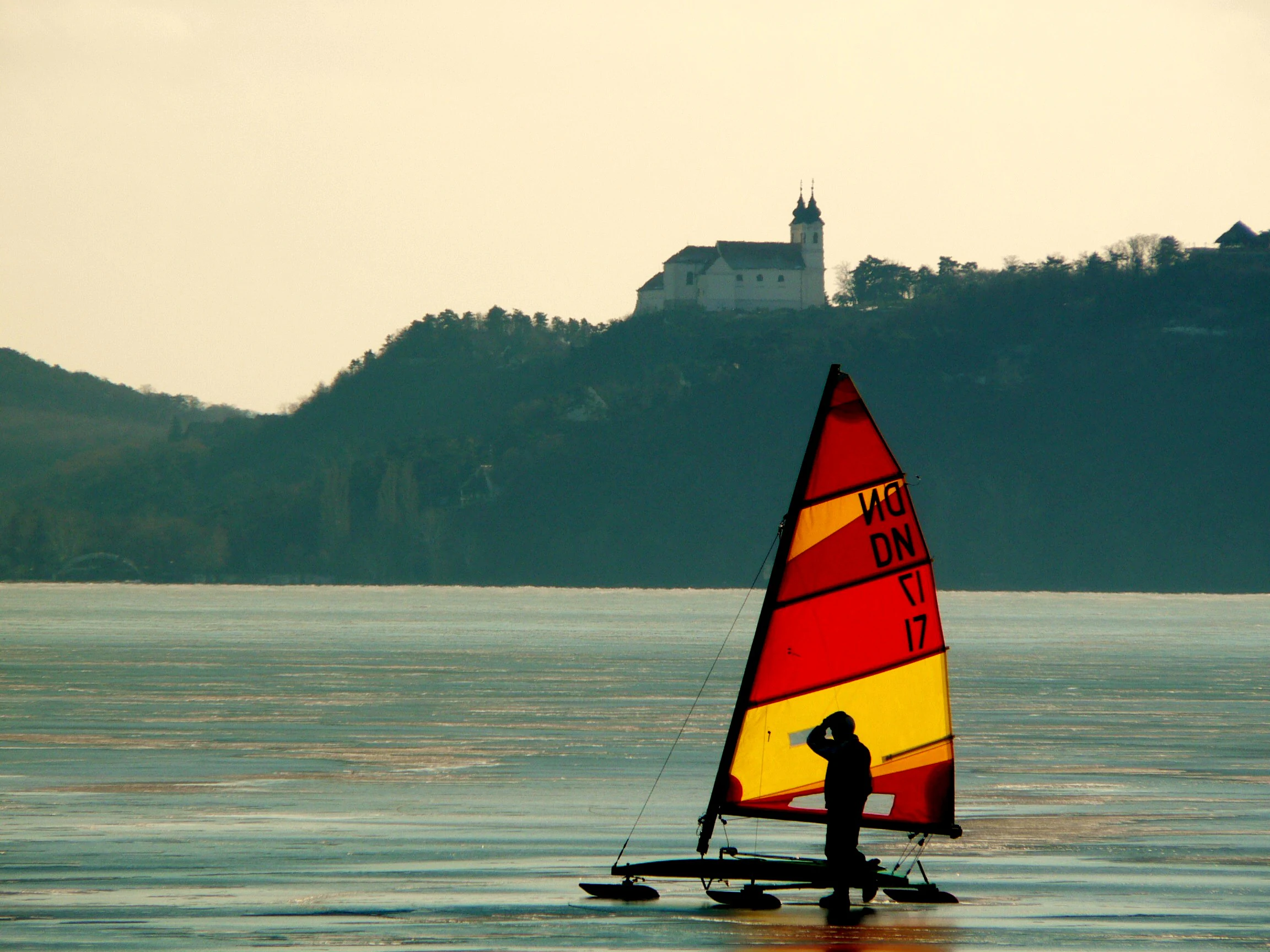
Iceboat on Lake Balaton
An iceboat sailing on the frozen surface of Lake Balaton

Lake Balaton ecosystems, habitats, and plant life

Lake Balaton is a shallow, warm, alkaline freshwater ecosystem whose biology is shaped as much by its depth and chemistry as by its climatic setting. Its mildly alkaline, calcium-carbonate-rich water supports large populations of microorganisms, with around two thousand recorded algal species contributing to its characteristic green-blue to emerald surface color. Algal dynamics have dominated the lake's ecological narrative through the twentieth and twenty-first centuries, with eutrophication peaking in the 1980s before a long restoration effort brought clearer water in following decades.

Reedbeds are the most visible living structure on the lake. Reed communities, joined by narrow-leaved bulrush, common club-rush, and tufted sedge, fringe about twelve square kilometers of shore, with roughly three-quarters concentrated along the quieter northern coast. These reeds stabilize sediments, filter nutrients, and shelter spawning grounds for fish and nesting habitat for birds. Aquatic vegetation in the open water includes pondweed and watermilfoil species growing along sandy and rocky beaches and in sheltered bays.

The wider terrestrial ecosystem is equally distinctive. The Balaton-felvidék uplands support a mosaic of downy oak and Turkey oak woodlands with patches of beech and planted pine forests, while grasslands on higher slopes harbor rare flowers such as the bird's-eye primrose, spring pheasant's eye, and large-flowered self-heal. The Bakony foothills and Tapolca basin connect the lake's immediate surroundings to broader forest and hill habitats that sustain populations of deer, wild boar, and a wide range of smaller mammals and reptiles. Soils derived from volcanic rock, especially on the north-facing slopes, are a defining element of the region's agricultural character.
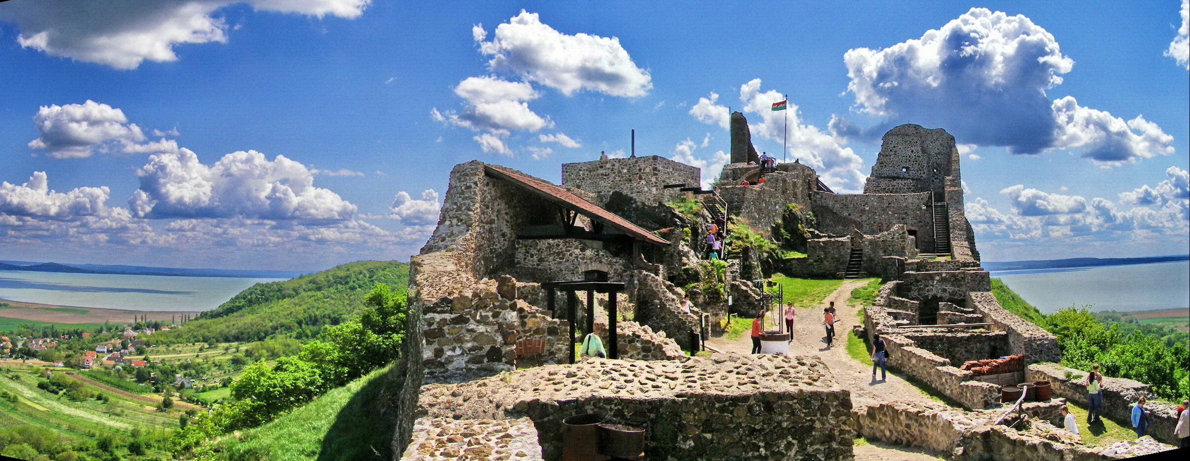
Szigliget Castle ruins
View of the Szigliget Castle ruins overlooking Lake Balaton

Lake Balaton wildlife and species highlights

The lake is recognized as one of Europe's most important inland waterbird habitats, particularly for species that depend on large, shallow reed-fringed lakes. Mute swans are the lake's most emblematic species, nesting in floating reed nests and frequently raising their cygnets near bathing beaches where tourists feed them; surveys of breeding pairs have consistently concentrated activity on the northern shore. Mallard ducks share the same tolerance for human presence, while great crested grebes, little grebes, coots, and several gull species feed along the shore and over open water. In winter, cormorants aggregate over fish shoals moving into deeper areas, and during cold spells the partially frozen lake attracts raptors and gathers mixed flocks of ducks and gulls along ice edges.

Fish dominate the lake's open-water fauna. Cyprinids such as bream, white bream, roach, and rudd make up roughly eighty percent of the fish community, while predatory species like pikeperch (the famous 'fogas'), pike, catfish, and asp are widespread. The asp population, centered on the Tihany region, is the lake's most distinctive inland fishery; the pikeperch remains culturally iconic despite the closure of commercial fishing in 2015. Introduced and invasive species, including silver carp, bighead carp, black bullhead, Chinese false gudgeon, and Amur sleeper, have reshaped local ecology and complicate restoration.

Terrestrial wildlife around the lake is shaped by the mosaic of vineyards, oak forests, scrub, and wetlands. Red and fallow deer, wild boar, and fox occur throughout the Balaton-felvidék, while reptiles such as grass snake, dice snake, and smooth snake inhabit marsh edges and woodland clearings. The wider national park and forest reserves host protected raptors including the saker falcon, alongside woodland birds such as the raven, the dunnock, and the coal tit. Amphibians are particularly diverse in the wetlands around Kis-Balaton and along the marshy margins of the main lake, where most native frog species are present.

Invertebrate communities are abundant and tightly linked to water quality. Chironomid midges emerge in synchronized mass hatches that occasionally create shoreline foam and visible surface activity along popular beaches; their larvae play an important role in recycling sediment. Native mussels such as the swan mussel share the lake with invasive bivalves, most notably the quagga mussel and the Chinese pond mussel, whose spread has altered benthic habitats and filtration in recent decades.
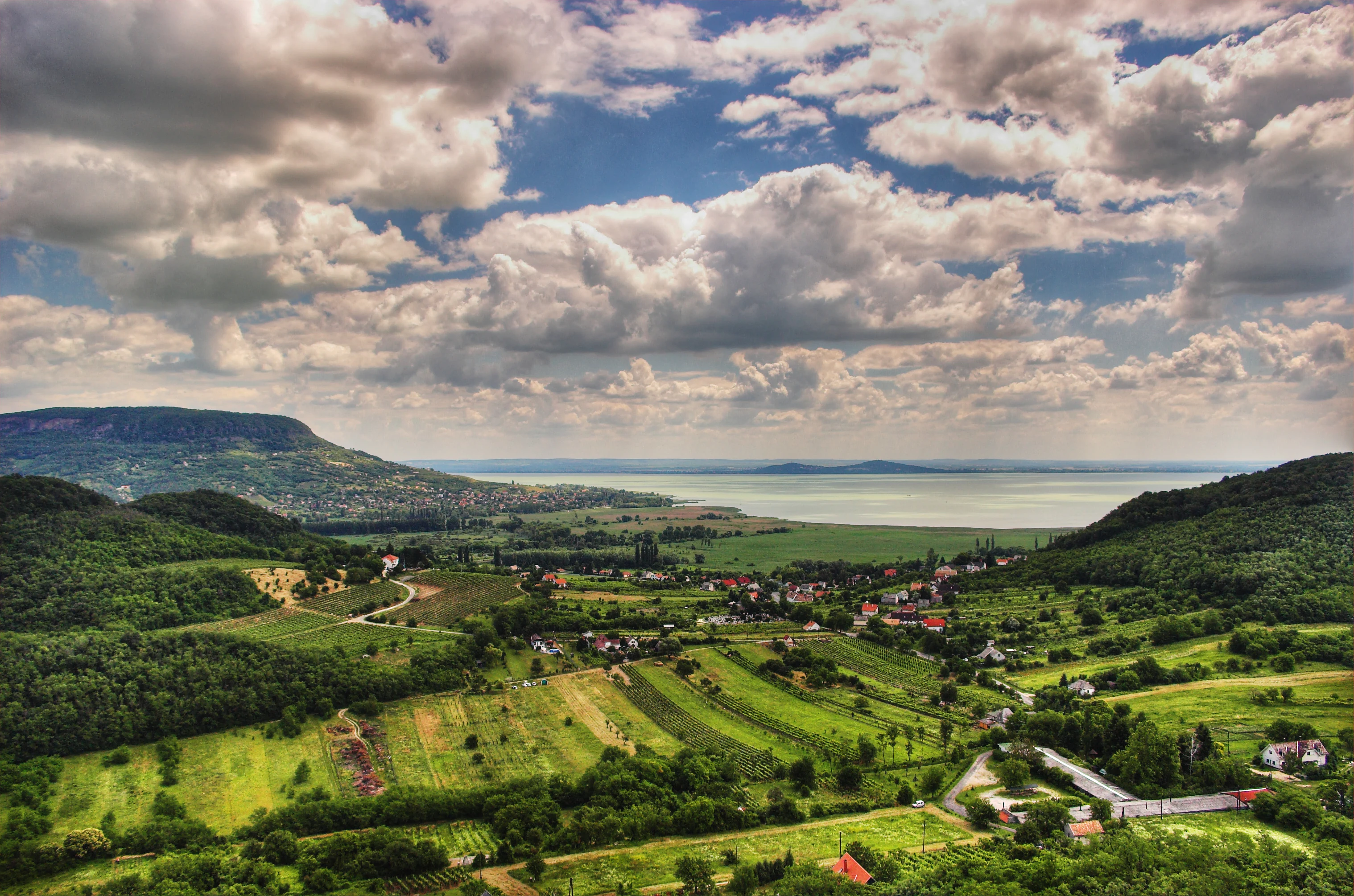
Lake Balaton landscape
Landscape view of Lake Balaton in Hungary.

Lake Balaton conservation status and protection priorities

Lake Balaton sits inside a layered network of national and international protections. It was designated a Ramsar wetland in March 1989, recognizing its significance for waterbirds and its role as a representative example of Central European shallow lake and reedbed habitat. On land, the Balaton-felvidéki National Park, established along the northern uplands in 1997, protects a corridor of volcanic hills, oak forest, and calcareous grassland. Together with the Bakony-Balaton UNESCO Global Geopark and several landscape protection areas around Somló and the High-Bakony, the lake sits at the center of one of Hungary's most important contiguous conservation landscapes.

Water quality has been the central environmental issue. From the 1970s onward, nutrient loading from agriculture, particularly phosphorus delivered through the Zala River, drove recurring algal blooms that damaged the lake's appeal for tourism and threatened ecological balance. Coordinated monitoring by the Balaton Limnological Research Institute in Tihany, combined with treatment of inflowing waters and decades of bath-level management, has produced a sustained recovery, and recent years have shown chlorophyll levels well below twentieth-century peaks. In 2018 the lake's water surface was officially declared a special-purpose water area, ending commercial fishing and placing the fishery under a strictly regulated angling regime.

Ongoing conservation concerns mirror the lake's main pressures. Alien invasive mussels, fish, and plants continue to reshape food webs and shoreline vegetation; reedbeds have declined in some areas due to shoreline development, ports, and angling platforms; and drying summers linked to climate change place increasing strain on water levels. Sediment accumulation, particularly in ports and shallow bays, requires regular dredging and careful disposal planning. Conservation planning now extends beyond the lakeshore to the Kis-Balaton wetland to the southwest and to the broader catchment, where reforestation, water retention, and the protection of feeding rivers are seen as essential to the lake's long-term resilience.

Lake Balaton cultural meaning and human context

Lake Balaton carries a deep, multi-layered cultural significance in Hungary, often invoked as the 'Hungarian Sea' to underscore its symbolic and practical importance to life far from any ocean. Its imagery runs through folk songs, nineteenth-century novels, twentieth-century painting, popular music, and film, making it one of the most photographed and most written-about landscapes in Hungarian culture. Even before the tourism era, the lake carried strong symbolic weight: the Seuso Treasure, a hoard of late-Roman silver from the region, includes a plate inscribed PELSO, while the Balaton-felvidéki tradition of folk ballads and literary prose reaches back to the Romantic era.

Historical figures rooted in Balaton's social history still shape how the lake is understood. The writer Mór Jókai, who summered at Balatonfüred, set scenes there; Gyula Krúdy evoked its salons and fishermen; and the scientist Lajos Lóczy built his career on the lake's geology and hydrology. In the modern era, Balaton became the playground of ordinary Hungarians during the decades of state-run holiday trade unions, when workers' families were bused to resorts, and at the same time one of the few places where families and friends separated by the Berlin Wall could meet. This layered history of high-culture tourism, working-class holiday, and transnational reunion gives the lake a distinctive cultural profile that links rural viticulture, aristocratic resort tradition, and contemporary leisure.
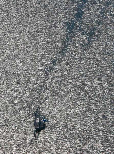
Aerial view of Lake Balaton
An aerial photograph of Lake Balaton in Hungary.

Top sights and standout views in Lake Balaton

Lake Balaton stands out for the rare combination of a very shallow, easily warmed lake lying below a dramatic volcanic coastline. The north shore's witness mountains, the Tihany Peninsula with its Benedictine Abbey and geological heritage, the elegant nineteenth-century villa culture of Balatonfüred and Keszthely, and the busy south-shore beach life at Siófok together form a single landscape of contrasts. The lake is also rare among European inland waters in supporting both intensive recreational use and a Ramsar-level conservation framework operating in the same place, with a long history of scientific study at Tihany and active management of invasive species, algal balance, and water levels.

The surrounding Bakony-Balaton Geopark adds a further dimension, highlighting fossils, basalt columns, geyser cones, and an internationally significant Late Cretaceous dinosaur site at Iharkút. The result is one lake paired with a complete upland-wetland mosaic: volcanic peaks, oak forests, vineyard terraces, reed-fringed bays, and open water that has shaped Hungarian identity for centuries.
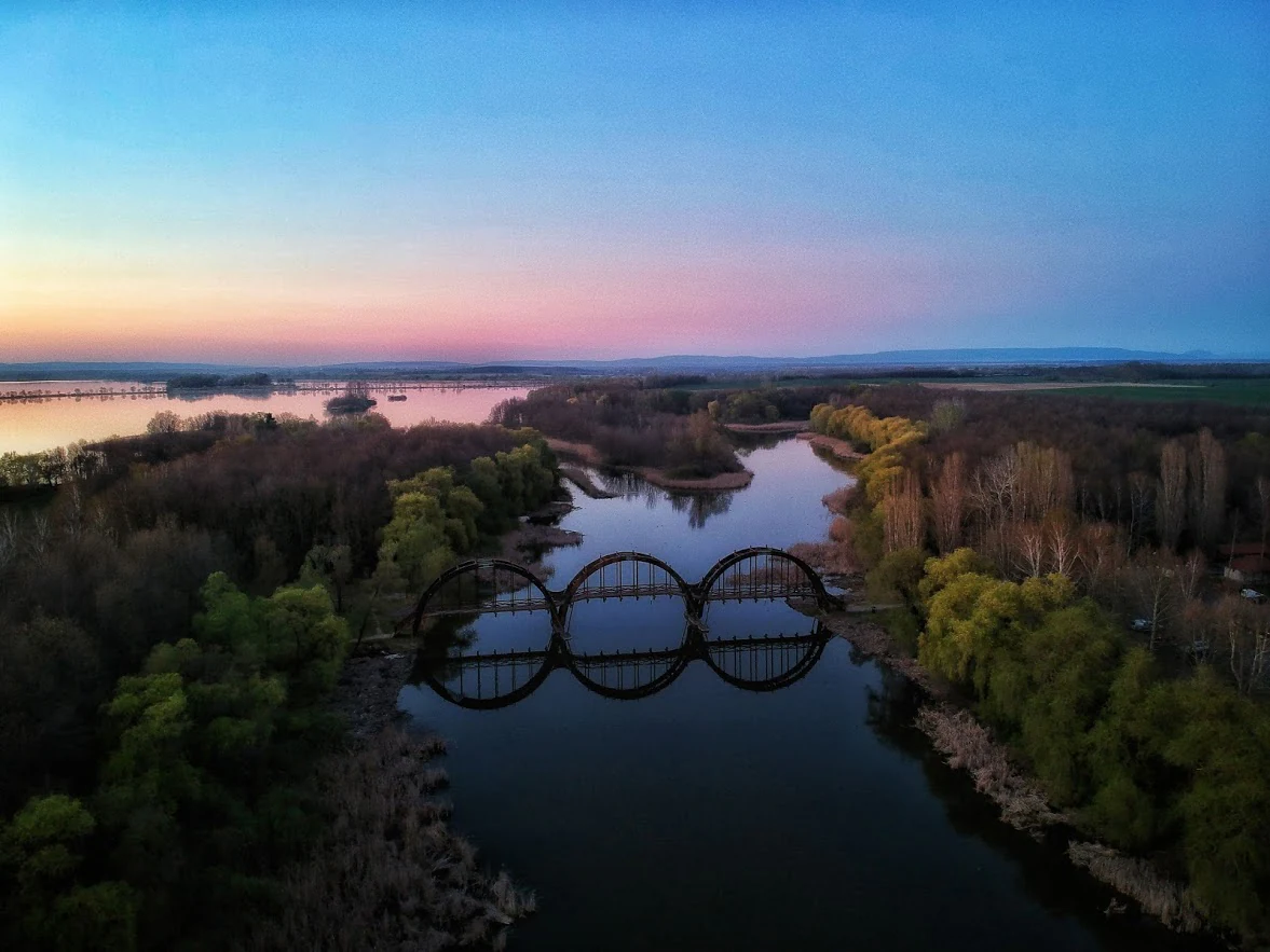
Kanyavari Bridge
The Kanyavari Bridge at twilight

Best time to visit Lake Balaton

The lake is most active from late spring through early autumn, when warm shallow water, long daylight hours, and steady breezes shape the typical Balaton experience. June through August brings the warmest water and the fullest resort atmosphere, with swimming, sailing, and beach events at their peak; July is the sunniest and driest month of the year. Late spring and early autumn tend to offer quieter conditions, milder temperatures, and good birdwatching in the Kis-Balaton wetland and along the reedbeds, especially during migration.

Winter transforms the lake into a different setting. When ice covers form, the frozen surface supports ice skating, ice sailing, ice fishing, and other traditional winter activities, with the lake taking on a colder, more austere beauty. Harsh winters can allow crossings on foot between the two shores, though such conditions are not annual. The transition seasons are the best times for hiking, cycling the lakeshore paths, exploring the volcanic buttes, and visiting vineyards during harvest festivals.
Park guides

Essential reference materials for planning seasonal visits and understanding regional geography

Lake Balaton Published Guides and Focused Regional Research

Focused reference guides provide structured answers for readers exploring regional geography and seasonal conditions at Lake Balaton. Published materials examine optimal timing for summer resort visits and shoulder season harvest exploration.
Monthly climate preview

Long-term representative point measurements tracking monthly weather variations across Transdanubia

Lake Balaton Climate Normals, Annual Temperature and Precipitation Rhythms

Historical climate records for Lake Balaton trace a measured annual cycle of shifting temperatures and precipitation rates from representative coordinate sampling between 1991 and 2020. Examining complete monthly climate normals illuminates broader meteorological patterns and long-term environmental averages across the protected terrain.
Annual mean11 °C
-2 °C22 °C
Jan-2°
Feb
Mar
Apr11°
May16°
Jun20°
Jul22°
Aug22°
Sep17°
Oct11°
Nov
Dec-1°
Warmest month
July

22.5 °C

Coolest month
January

-1.6 °C

Wettest month
June

2.3 mm/day

Driest month
January

1.1 mm/day

Park location guide

Geography guide, regional context, and park location map for Lake Balaton

Lake Balaton park geography, regions, and map view in Hungary

Understand where Lake Balaton sits in Hungary through a broader geographic reading of the surrounding landscape, nearby location context, and its mapped position within the national park landscape.

How Lake Balaton fits into Hungary

Hungary is a landlocked Central European country occupying the Carpathian Basin, also known as the Pannonian Basin. It borders Slovakia, Ukraine, Romania, Serbia, Croatia, Slovenia, and Austria. Budapest serves as both the capital and largest city. The population is predominantly ethnic Hungarians (Magyars), with Hungarian as the official language.

Wider geography shaping Lake Balaton in Hungary

Hungary occupies the Carpathian Basin in Central Europe, a large lowland plain surrounded by the Carpathian Mountains. It is bordered by Slovakia to the north, Ukraine to the northeast, Romania to the east and southeast, Serbia to the south, Croatia and Slovenia to the southwest, and Austria to the west. The Danube River flows through the country, providing its primary drainage.

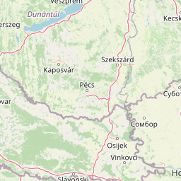
Map view of Lake Balaton

Use this park location map to pinpoint Lake Balaton in Hungary, understand its exact geographic position, and read its mapped placement within the surrounding landscape more clearly.

Pigeon | © OpenStreetMap contributors

Location context for Lake Balaton

Transdanubia
Recorded earthquake history

Examine the Recorded Earthquake History Associated With Lake Balaton

Access a structured collection of historical earthquake records tied to the geography of Lake Balaton. Review event data such as magnitudes and epicentre proximity within this specialized MoriAtlas catalogue of regional seismic activity.

Lake Balaton Earthquake History

Catalogued events

30 events

Strongest magnitude

Magnitude 5.2

Most recent event

Mar 7, 2019

This history includes earthquakes recorded inside the park or within 50 km of its borders

Explore volcanic witness mountains, wetland habitats, and shoreline topography through field photography.

Lake Balaton Photos and Landscape Scenery: Visualizing Central Europe's Protected Basin

Examine high-resolution photography documenting the volcanic witness mountains, steep northern vineyards, and extensive southern reed beds of Lake Balaton. Visual records provide essential context for understanding the unique geological formations and protected wetland habitats defining this shallow Central European basin.

Tihany Peninsula

Lake Balaton Landscape

Iceboat on Lake Balaton

Szigliget Castle ruins

Lake Balaton landscape

Lake Balaton

Aerial view of Lake Balaton

Kanyavari Bridge

Lake Balaton from Fonyod

Tihany Abbey Church

Sunrise at Balatonalmadi

Siofok Marina Panorama

Balatongyorok

Revfulop sailing port

Port of Fonyod

Balaton in winter

Park atlas

Compare regional protected areas and connected natural habitats across Transdanubia

Explore Parks Near Lake Balaton and Surrounding Protected Landscapes

Continue exploring regional protected areas and volcanic uplands after viewing Lake Balaton to compare surrounding natural landscapes. Broader geographic discovery links wetland reserves and upland parks across the wider Transdanubian terrain.
National parkHungary
About 0.8 km away#1 closest

Northeast

Balaton Uplands National Park: Mapped Volcanic Terrain and Protected Landscape Atlas

Explore Hungary's protected volcanic landscape and its regional geography.

Balaton Uplands National Park presents a compelling study in volcanic geography, showcasing dramatic 'witness mountains' and diverse terrains. As a protected national park in Hungary, it offers rich opportunities for atlas-style exploration of its mapped boundaries, unique basalt formations, and significant wetland areas. Discover the distinct geological narrative and landscape context of this protected region, providing a clear point of reference for understanding Hungary's natural heritage through structured geographic data.

Area
569.97 km²
Established
1997
IUCN
II
Relief
Highland
Watercolor illustration of green fields, trees, and distant hills
National parkHungary
48 km away#2 closest

West

Őrség National Park: A Protected Landscape Explored Through Geographic Atlas Context

Mapped terrain, peat bogs, and ancient forests in Hungary.

As Hungary's youngest national park, Őrség National Park offers a distinctive protected landscape defined by rolling hills, ancient woodlands, and rare peat bogs. This entry provides detailed geographic context, mapping its boundaries and showcasing its natural terrain. Discover the unique ecosystem, shaped by centuries of traditional land use and its subalpine climate, presented within MoriAtlas for structured exploration and regional geographic understanding.

Area
440 km²
Established
2002
IUCN
II
Relief
Highland
Watercolor painting of rolling hills, green fields, and a winding path
National parkHungary
71 km away#3 closest

East

Kiskunság National Park: Explore Hungary's Puszta Grassland and Unique Sand Dune Terrain

Discover protected landscapes, alkaline lakes, and bird habitats.

Kiskunság National Park in Hungary offers a rare glimpse into the traditional puszta grassland ecosystem, featuring dynamic sand dunes and numerous alkaline lakes. This protected area is vital for migratory bird populations and showcases a distinctive lowland geography shaped by natural processes and pastoral heritage. Explore its scattered territorial units to understand the unique landscape context of the Great Hungarian Plain.

Area
530 km²
Established
1975
IUCN
II
Relief
Lowland
Nature reserveHungary
75 km away#4 closest

Southeast

Gemenc Nature Reserve, A Protected Danube Floodplain Landscape in Hungary

Explore the geography of alluvial forests and river-fed wetlands

Gemenc stands as a testament to natural floodplain dynamics, stretching along the Danube in southern Hungary as a vast corridor of alluvial woodland. The protected area encompasses a rich variety of riverine terrain, including meandering oxbows, islands, and diverse forest mosaics that host significant animal populations. Utilize this geographic reference to understand the landscape context and natural boundaries of one of the most prominent wetland reserves in the Carpathian Basin.

Area
340 km²
Established
1977
Relief
Lowland
Climate
Temperate
Watercolor illustration of a landscape with green hills, a body of water, and trees under a soft sky
National parkGyőr-Moson-Sopron
78 km away#5 closest

Northwest

Fertő-Hanság National Park: Central European Wetland and Salt Lake Protected Area

Mapped Geographic Boundaries and Landscape Context

Fertő-Hanság National Park, situated in Győr-Moson-Sopron, Hungary, is a vital protected landscape renowned for its shallow salt lake and expansive marshlands. This page provides an atlas-focused discovery of its protected area, highlighting the unique interplay of reed beds and alkaline grasslands. Understand the park's geographic setting and its role as a significant wetland ecosystem for bird populations and specialized flora.

Area
235.88 km²
Established
1991
IUCN
II
Relief
Lowland
National parkPest County
90 km away#6 closest

Northeast

Danube-Ipoly National Park: Protected Landscape and Geographic Atlas

Mapping Hungary's diverse terrain and protected natural areas.

Delve into Danube-Ipoly National Park, a significant protected area renowned for its extraordinary ecological diversity. This page explores the park's distinct landscapes, from the volcanic formations of the Börzsöny Mountains to the deep karst cave systems of the Pilis, set against the backdrop of the Danube and Ipoly river floodplains. Understand its geographic placement within Pest County and its role as a vital protected landscape for conservation and atlas-based discovery.

Area
603.14 km²
Established
1997
IUCN
V
Relief
Mixed relief
Watercolor illustration of a river landscape with grassy banks, trees, and hills in the background
National parkHungary
About 96 km away#7 closest

Southeast

Danube-Drava National Park: Hungary's Premier Riverine Protected Area and Floodplain Landscape

Mapping the protected river corridors and vital wetland ecosystems

Danube-Drava National Park showcases the dynamic geography of Central Europe's largest riverine protected area, integrating floodplains, riparian woodlands, and extensive marshes along the Danube and Drava rivers. As a National Park and a Ramsar site, it protects crucial habitats like the Gemenc forest and supports exceptional biodiversity, including significant populations of white-tailed eagles. This page provides a structured overview of its mapped boundaries and ecological importance within the European protected lands atlas.

Area
490 km²
Established
1996
IUCN
II
Relief
Lowland
Watercolor painting showing a landscape with rolling terrain, water features, and distant mountains
National parkBurgenland
106 km away#8 closest

Northwest

Neusiedler See-Seewinkel National Park: Protected Steppe Lake Landscape in Burgenland

Explore mapped wetland geography and birdwatching significance.

Neusiedler See-Seewinkel National Park showcases a rare steppe lake environment and extensive wetland habitats at the eastern edge of Austria, within the Burgenland region. This protected area is globally recognized for its exceptional avian diversity and the unique ecological mosaic formed by reed beds, salt marshes, and seasonal pools. Explore its mapped boundaries and distinctive Pannonian geography for a deep understanding of this vital European protected landscape.

Area
97 km²
Established
1993
IUCN
II
Relief
Lowland

Common questions about visiting, size, designation, and location context for Lake Balaton

Lake Balaton FAQs for park facts, access, geography, and protected area context

Find quick answers about Lake Balaton, including protected-area facts, park geography, trail and visitor context, and how the park fits into its surrounding country and regional landscape.
MoriAtlas Explorer

Continue Your Protected Areas Search Across the Global Atlas

Deepen your exploration by continuing the structured search for national parks and protected areas worldwide. Utilize the comprehensive filtering capabilities to compare different conservation landscapes and refine your understanding of global park geography. Discover more about the distribution and characteristics of protected natural areas.

Global natural geography