

Mori Atlas logo
National parkLantoto National Park

Understand the mapped boundaries and regional geography of this significant national park.

Lantoto National Park: South Sudan's Protected Landscape and Geographic Identity

Lantoto National Park stands as a key protected area within the geography of South Sudan, offering a unique lens for exploring its natural landscapes and regional context. Situated in East Africa, this national park provides a distinct point of reference for understanding protected land distribution and the broader atlas of conservation areas. Its mapped boundaries and geographic identity contribute to a structured exploration of South Sudan's natural heritage.

National ParkWoodland EcosystemsElephant ConservationCentral EquatoriaForest HabitatLarge Mammals

Lantoto National Park

National park

Park overview

Structured park overview, official facts, and landscape profile for Lantoto National Park

Lantoto National Park park facts, protected area profile, and essential visitor context
Review the core facts for Lantoto National Park, including designation, size, terrain, visitor scale, habitats, and operating context in one park-focused overview.

About Lantoto National Park

Lantoto National Park represents one of South Sudan's designated protected areas, established to preserve the country's wildlife heritage and natural ecosystems. The park's location in Central Equatoria places it within one of the more densely populated regions of South Sudan, though the protected area itself maintains substantial natural cover. The predominant woodland and forest character distinguishes Lantoto from other protected areas in the region, creatinghabitats that support both forest-dwelling and savanna-adapted species. The open glades within the park provide important foraging areas for large herbivores and create scenic landscape variation. Despite its protected status, the park faces significant challenges from poaching activities that increasingly threaten the survival of elephant populations, one of the park's most notable wildlife resources.

Quick facts and research context for Lantoto National Park

Lantoto National Park covers approximately 760 square kilometers in Central Equatoria, South Sudan, positioned at coordinates 4.5°N, 29.9°E. The protected area is classified under IUCN Category II as a national park. The landscape consists primarily of woodland and forest habitats with scattered open glades. The park's most prominent geographic feature is Jabal Mbangi, the highest mountain in the area. The park was established through national wildlife legislation in 1986 and 2003, though boundary demarcation remains incomplete.

Park context

Deeper park guide and search-rich context for Lantoto National Park

Lantoto National Park history, landscape, wildlife, and travel context
Explore Lantoto National Park through its history, landscape character, ecosystems, wildlife, conservation priorities, cultural context, and seasonal travel timing in a structured park guide built for atlas discovery and search intent.

Why Lantoto National Park stands out

Lantoto National Park is best known for its substantial elephant populations and diverse woodland ecosystems. The park supports significant herds of elephants alongside buffalo, antelope, baboon, and ostrich populations. The combination of forest, woodland, and open glade habitats creates a varied landscape that supports multiple species groups. The presence of elephants as a keystone species defines much of the park's ecological identity and conservation significance.

Lantoto National Park history and protected-area timeline

Lantoto National Park was officially named as a protected area through Sudan's Wildlife Act of 1986, establishing the foundational legal framework for its conservation status. The park's protection was reinforced through the Wildlife Conservation and National Parks Act of 2003, which updated and strengthened the legislative basis for wildlife protection in Sudan. However, despite these legal designations, the practical implementation of park protection has faced considerable challenges. As of 2012, the boundaries of the park had not been formally demarcated on the ground, which complicates enforcement efforts and creates uncertainty about the exact extent of protected territory. This situation reflects the broader challenges of establishing and maintaining protected areas in South Sudan, a country that has experienced significant political instability and conflict.

Lantoto National Park landscape and geographic character

The landscape of Lantoto National Park is characterized by a mixture of woodland and forest habitats with interspersed open glades. The terrain is dominated by the prominent Jabal Mbangi, the highest and most notable mountain within the park's boundaries. The woodland areas consist of scattered trees and denser forest patches that provide cover and habitat for various species. The open glades create natural clearings within the forested landscape, offering contrast and diversity in the overall scenery. The Central Equatoria location places the park in a region of South Sudan that experiences typical tropical climatic conditions, though the specific microclimate within the park is influenced by its varied topography and vegetation cover.

Lantoto National Park ecosystems, habitats, and plant life

The nature of Lantoto National Park centers on its woodland and forest ecosystems, which form the primary vegetation types within the protected area. These habitats support a diverse array of plant and animal life, with the vegetation structure providing important resources for multiple species. The combination of forest cover and open areas creates an ecological mosaic that supports both woodland-dependent species and those that prefer more open habitats. The park's ecosystems represent important examples of Central African woodland environments, maintaining biological diversity despite the surrounding region's political instability.

Lantoto National Park wildlife and species highlights

Lantoto National Park supports significant wildlife populations, with elephants representing the most notable large mammal species present in the park. The elephant population faces considerable pressure from poaching activities, which threaten the survival of these animals. Beyond elephants, the park supports substantial populations of buffalo, various antelope species, baboons, and ostriches. This combination of large mammals and smaller primates creates a diverse wildlife community. The presence of ostriches indicates the existence of suitable open habitat areas within the park, as these large flightless birds prefer more open terrain.

Lantoto National Park conservation status and protection priorities

Lantoto National Park holds significance as one of South Sudan's legally protected areas, designated under national wildlife legislation to preserve natural ecosystems and wildlife populations. The park's conservation value is particularly tied to its elephant populations, which represent important large mammal fauna for the region. However, the park faces significant conservation challenges. Poaching activities pose an increasing threat to elephant survival, and the lack of boundary demarcation complicates effective protection and management. The incomplete establishment of park boundaries represents a fundamental challenge to implementing meaningful conservation measures and enforcing protection regulations.

Top sights and standout views in Lantoto National Park

Lantoto National Park offers a substantial protected area of woodland and forest ecosystems in South Sudan, with Jabal Mbangi providing a notable topographic feature. The park supports significant elephant populations alongside buffalo, antelope, and ostrich, making it an important area for large mammal conservation in Central Equatoria. The combination of forested areas and open glades creates varied habitats within a single protected landscape. However, the park's conservation effectiveness is compromised by poaching threats and the absence of formal boundary demarcation.

Park location guide

Geography guide, regional context, and park location map for Lantoto National Park

Lantoto National Park park geography, regions, and map view in South Sudan
Understand where Lantoto National Park sits in South Sudan through a broader geographic reading of the surrounding landscape, nearby location context, and its mapped position within the national park landscape.

How Lantoto National Park fits into South Sudan

South Sudan is a landlocked sovereign state in East Africa, the most recent country to achieve independence (2011). It occupies an area of 644,329 km² and shares borders with six countries. The Nile River flows through the country, feeding the extensive Sudd wetland. With a population of approximately 12.7 million, South Sudan is linguistically diverse with English as its official language and numerous recognized national languages including Dinka, Nuer, and Bari.

Wider geography shaping Lantoto National Park in South Sudan

South Sudan is located in East Africa, landlocked between six countries: Sudan to the north, Ethiopia to the east, Uganda to the south, Kenya to the southeast, the Democratic Republic of the Congo to the southwest, and the Central African Republic to the west. The terrain consists primarily of vast plains and plateaus, with diverse environments ranging from dry savannah to tropical savannah and inland floodplains. The Nile River system runs south to north through the country's center.

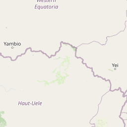
Map view of Lantoto National Park

Use this park location map to pinpoint Lantoto National Park in South Sudan, understand its exact geographic position, and read its mapped placement within the surrounding landscape more clearly.

Pigeon | © OpenStreetMap contributors

Location context for Lantoto National Park

Central Equatoria
Park atlas

Explore the Surrounding Regional Protected Landscapes and Compare Elephant Conservation Areas in Central Equatoria

Discover More National Parks and Protected Areas Near Lantoto National Park
Continue your exploration of South Sudan's diverse protected areas by browsing other national parks and reserves situated within or near the Central Equatoria region. Compare the varied woodland ecosystems, significant elephant habitats, and unique geographical features found across these important conservation landscapes, expanding your understanding of regional biodiversity.
National parkDemocratic Republic of the Congo

Garamba National Park: Protected Landscape Atlas and Geographic Context in DRC

Explore Mapped Boundaries of Africa's Historic Savanna Sanctuary

Garamba National Park is a foundational protected area within the Democratic Republic of the Congo, spanning nearly 5,200 square kilometers of distinctive tropical savanna. Established in 1938, this national park is recognized globally as a UNESCO World Heritage Site due to its exceptional biodiversity and role as a critical habitat. The park's landscape is characterized by rolling grasslands, scattered woodlands, and a unique ecological position that supports a rich variety of wildlife, including significant populations of elephants and the DRC's last giraffes. Exploring Garamba National Park through MoriAtlas provides insight into its mapped boundaries, regional geography, and its status as a vital sanctuary for endangered species.

Area
5,200 km²
Established
1938
IUCN
II
Relief
Lowland
National parkSouth Sudan

Nimule National Park: South Sudan's National Park Geography and Protected Boundaries

Explore the terrain and mapped context of this protected landscape.

Nimule National Park represents a key protected area in South Sudan, providing essential geographic data for atlas exploration. This detail page focuses on the park's mapped boundaries, its role as a national park, and its contribution to the regional landscape context of East Africa. Understand the specific terrain and protected land identity that defines this important natural area within the country.

Area
410 km²
Established
1954
IUCN
II
Scope
Terrestrial
National parkSouth Sudan

Bandingilo National Park: South Sudan's Protected National Park Identity

Explore its mapped boundaries and East African landscape.

Bandingilo National Park stands as a distinct protected area within South Sudan, contributing to the nation's catalog of national parks. This entry offers a focused atlas perspective, detailing the park's geographic setting and its mapped features. Understand the landscape context and its relation to the surrounding regional geography of East Africa, providing a foundation for structured discovery of protected lands.

Area
10,000 km²
Established
1992
IUCN
II
Relief
Lowland
National parkSouth Sudan

Southern National Park National Park: An Extensive Protected Landscape in South Sudan's Nile Basin

Mapped floodplains, savanna woodlands, and large mammal conservation.

Southern National Park stands as a significant protected area within South Sudan, celebrated for its immense scale and rich ecological tapestry. This national park features a complex mosaic of savanna woodlands, extensive seasonal floodplains carved by the Gel and Ibba rivers, and gallery forests lining river corridors. Its designation as a protected landscape highlights its importance for conserving large mammal populations and preserving the unique wetland ecosystems characteristic of the Nile basin's western reaches, offering a prime focus for geographic and atlas exploration.

Area
23,000 km²
Established
1939
IUCN
II
Relief
Lowland
National parkUganda

Murchison Falls National Park: Uganda's Largest Protected Landscape with Dramatic Nile Gorge

Explore mapped boundaries and diverse savanna terrain.

Murchison Falls National Park represents a significant protected landscape in Uganda, renowned for the powerful cascade of the Victoria Nile through a narrow gorge. This expansive national park encompasses varied terrain, from savanna woodlands to riparian forests, offering a rich geographic context. Understanding its mapped distribution within the region is key to appreciating its conservation importance and unique natural features, providing a compelling atlas-style entry point for exploration.

Area
3,893 km²
Established
1952
IUCN
II
Relief
Lowland
National parkBundibugyo District

Semuliki National Park: Discover Uganda's Protected Landscape and Regional Geography

Explore mapped boundaries and protected area context.

Semuliki National Park serves as a vital protected area within Uganda, located in the Bundibugyo District. This entry focuses on its identity as a mapped landscape, detailing its protected boundaries and regional geographic significance for users interested in structured atlas exploration and understanding the distribution of conservation lands.

Area
219 km²
Established
1993
IUCN
II
Relief
Lowland
National parkUganda

Kibale National Park: National Park Atlas and Protected Landscape in Uganda

Explore mapped boundaries and regional geographic context.

Kibale National Park represents a key protected landscape within Uganda, identified by its national park designation. This entity offers a focused lens for understanding regional geography and the distribution of protected areas across East Africa. Delve into the mapped boundaries and specific landscape character that define Kibale National Park, providing a concrete point of reference for atlas exploration and geographic discovery.

Area
776 km²
Established
1993
IUCN
II
Relief
Mixed relief
National parkUganda

Rwenzori Mountains National Park: Uganda's Distinctive Glacial National Park Landscape

Mapped terrain and Afro-alpine ecosystems of this East African protected area.

Rwenzori Mountains National Park represents a unique protected landscape in Uganda, known for its iconic glacial peaks and endemic Afro-alpine vegetation. As a UNESCO World Heritage Site, it showcases dramatic terrain ranging from montane forests to permanent glaciers, with Margherita Peak standing as the crown jewel. This park offers a rich geographic context for understanding East African mountain ecosystems and the mapped boundaries of significant conservation areas, providing valuable data for atlas-style exploration.

Area
996 km²
Established
1991
IUCN
VI
Relief
Mountain

Common questions about visiting, size, designation, and location context for Lantoto National Park

Lantoto National Park FAQs for park facts, access, geography, and protected area context
Find quick answers about Lantoto National Park, including protected-area facts, park geography, trail and visitor context, and how the park fits into its surrounding country and regional landscape.
MoriAtlas Explorer

Continue Your Protected Areas Search Across the Global Atlas

Deepen your exploration by continuing the structured search for national parks and protected areas worldwide. Utilize the comprehensive filtering capabilities to compare different conservation landscapes and refine your understanding of global park geography. Discover more about the distribution and characteristics of protected natural areas.

Global natural geography

