Why Llanganates National Park stands out
Llanganates National Park is best known for its extraordinary ecological diversity, spanning from windswept páramo grasslands to cloud-covered Amazonian montane forests. The park is famous for the legend of the Treasure of the Llanganatis, an Incan treasure hoard that Spanish conquistadors allegedly hid in the mountains during the 16th century, and which has inspired countless expeditions over centuries. The towering peak of Cerro Hermoso draws hikers seeking high-altitude Andean challenges, while the western páramo zone provides habitat for vicuñas, llamas, and alpacas in a landscape that feels remote and primordial. The eastern forest zone remains among Ecuador's most biologically unexplored regions, where recent botanical discoveries have uncovered new species of Andean magnolia.
Llanganates National Park history and protected-area timeline
Llanganates National Park was officially established on January 18, 1996, creating a formal protected boundary around a region that had long capture the Ecuadorian imagination. The establishment of the park came after decades of growing recognition that the unique ecosystems of the Llanganati mountains warranted formal conservation status, particularly as logging, agriculture, and development pressures increased throughout the central Ecuadorian highlands. The park's creation also served to protect the region's cultural heritage, as the area had become inextricably linked to the legend of the Treasure of the Llanganatis. According to local tradition, when Spanish conquistadors conquered the Incan Empire, they seized enormous quantities of gold and silver, including a renowned statue of the Incan sun god. Rather than surrender this treasure, Incan priests allegedly transported it into the remote mountains of Llanganates, where it was hidden in caves and never recovered. This legend has inspired numerous expeditions over the centuries, and while no major treasure caches have been confirmed, the myth continues to lend the region an air of mystery and adventure. In 2013, a team of international explorers discovered a significant stone structure in the remote forest zone, adding new intrigue to the region's archaeological potential.
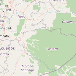
Llanganates National Park landscape and geographic character
The physical landscape of Llanganates National Park is defined by the dramatic topography of the central Ecuadorian Andes, where锋锐的山峰和深邃的山谷相交,创造出令人敬畏的地形。西部区域呈现典型的帕拉莫景观特征,高耸的山峰与狭窄的山谷交织,草甸在寒冷的高山气候中顽强生长。向东,地面急剧下降到安第斯东坡,形成植被茂密的雾气林,山坡被密集的树木和藤本植物覆盖。公园内最高的山峰Cerro Hermoso海拔4,570米,是徒步旅行者的热门目的地,其山顶可俯瞰周围山脉的全景。众多河流发源于公园的高地,向东流向亚马逊盆地,形成深邃的峡谷和湍急的瀑布,为这个多样化的景观增添了动态的水文特征。
Llanganates National Park ecosystems, habitats, and plant life
Llanganates National Park contains two fundamentally different ecological zones that reflect the dramatic altitudinal and climatic transition across the Andean divide. The western zone occupies the high-elevation páramo, a unique ecosystem found only in the tropical high Andes, where constant winds, low temperatures, and intense ultraviolet radiation shape a distinctive community of tough grasses, cushion plants, and shrubby vegetation adapted to survive in this harsh environment. The páramo acts as a natural water reservoir, with its spongy soils absorbing moisture from clouds and releasing it slowly to feed rivers below, making this ecosystem critical for water supply throughout the region. The eastern zone presents a stark contrast, hosting lush montane forests that represent the upper reaches of the Amazon basin. These forests feature incredibly twisted and distorted trees, their trunks often draped in epiphytes, mosses, and ferns, creating a fantastical atmosphere as clouds pass through the canopy. The park's relative inaccessibility has allowed botanical exploration to continue revealing new species, including several rareMagnolia species discovered in recent years, underscoring how much of this forest remains scientifically unexplored.
Llanganates National Park wildlife and species highlights
The wildlife of Llanganates National Park reflects the park's position at a critical ecological crossroads between high Andean and Amazonian environments. In the western páramo zone, South American camelids thrive in the open grasslands, with vicuñas, llamas, and alpacas all present in significant numbers. These animals have been historically important to local communities and represent some of the few large mammals adapted to the harsh alpine conditions above the tree line. The eastern montane forest supports a much richer diversity of species, though the region's remoteness has limited comprehensive wildlife surveys. Birds are particularly abundant in the forest canopy, where mixed-species flocks move through the epiphyte-laden branches. The discovery of new plant species in the eastern zone suggests that the faunal diversity may also be underappreciated, with many species likely still awaiting scientific description. The park's rivers provide habitat for various aquatic species and serve as wildlife corridors through the mountainous terrain.
Llanganates National Park conservation status and protection priorities
Llanganates National Park holds IUCN Category II protected area status, recognizing its significance as a national park that protects both natural ecosystems and outstanding natural features. The park's conservation value is amplified by its role in protecting the páramo ecosystem, which functions as a critical water catchments for surrounding lowland communities and agricultural areas throughout central Ecuador. The páramo's ability to store water and regulate downstream flow makes it an essential service provider beyond its borders, justifying protection as a national priority. The eastern montane forest zone represents a biodiversity hotspot where new species continue to be discovered, underscoring the importance of maintaining intact forest cover to preserve the evolutionary processes that produce such diversity. The park also protects cultural heritage values associated with the Treasure of the Llanganatis legend, creating a layered conservation mandate that addresses both biological and cultural significance.
Llanganates National Park cultural meaning and human context
The cultural significance of Llanganates National Park extends far beyond its ecological value, rooted in one of Ecuador's most persistent historical legends. The Treasure of the Llanganatis has captured the imagination of explorers, adventurers, and treasure hunters since the Spanish colonial period, when tradition holds that Incan priests hid vast quantities of gold, silver, and sacred objects in the remote mountain caves rather than allow them to fall into conquistador hands. This legend has shaped regional identity and created a cultural landscape where history and mythology intertwine. The discovery of a significant stone structure by international explorers in 2013, featuring hundreds of two-ton stone blocks arranged in a roughly square mile area at 8,500 feet elevation in cloud forest, suggests that the region may hold archaeological significance beyond the treasure legend. Access to the park traditionally comes through Andean communities including Salcedo, Patate, Pillaro, Baños de Agua Santa, and Rio Verde, each offering different approaches to this mountainous wilderness.
Top sights and standout views in Llanganates National Park
Llanganates National Park offers visitors a rare combination of high-altitude adventure, ecological diversity, and cultural mystery. The ascent to Cerro Hermoso peak provides hikers with a challenging but rewarding experience through páramo terrain to views spanning multiple provinces. The park's dual personality, with windswept alpine grasslands contrasting against misty Amazonian forests, allows visitors to experience radically different ecosystems within a single trip. The legend of the Incan treasure adds an element of adventure and speculation that few other protected areas can match, inspiring curiosity about what might remain hidden in the remote valleys. The relatively low visitation compared to Ecuador's more famous parks offers a wilder experience, where the sense of exploration remains genuine and the landscapes feel genuinely remote.
Best time to visit Llanganates National Park
The best time to visit Llanganates National Park depends on which zone visitors plan to explore and what weather conditions they prefer. The páramo zone can be visited year-round, though the dry season from June to September typically offers clearer skies and more comfortable conditions for hiking. The eastern montane forest receives higher rainfall throughout the year, with the wettest months generally falling between April and August. Visitors should be prepared for rapid weather changes in the mountains, as fog and rain can descend suddenly regardless of the season. The dry months often provide more stable conditions for attempting the climb to Cerro Hermoso, while the green season may offer lusher scenery in the lower forest zones. Temperature decreases significantly with elevation, and visitors to the páramo should prepare for cold, windy conditions even when sunny.