Why Lokobe National Park stands out
Lokobe National Park is best known for its populations of black lemurs and the strikingly colored Nosy Be panther chameleon. The black lemur represents one of the most visually distinctive lemur species, with pronounced sexual dichromatism where males display dark brown to black coloration while females exhibit reddish-brown to orange tones. The park provides critical habitat for multiple lemur species including the Nosy Be mouse lemur and the Nosy Be sportive lemur, both endemic to the island. The panther chameleon, with its vivid greens, blues, and oranges, exemplifies the reptile diversity found within the park's forest layers. These species, particularly the lemurs, serve as flagship attractions for visitors seeking encounters with Madagascar's unique fauna.
Lokobe National Park history and protected-area timeline
Lokobe National Park traces its origins to 1927, when it was established as a protected reserve during Madagascar's colonial period under French administration. This early designation places it among the oldest of Madagascar's national parks, reflecting a period when colonial naturalists and administrators were beginning to recognize the island's extraordinary biological distinctiveness. The park's creation represented one of the first formal conservation efforts in the region, predating modern conservation frameworks but establishing a foundation for ongoing protection. Over the decades since its establishment, the park has maintained its protected status through various management transitions as Madagascar gained independence and developed its own conservation policies. The continuity of protection, spanning nearly a century, has allowed the forest ecosystem and its endemic species to persist despite increasing pressures on Madagascar's natural environments from population growth and economic development.
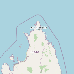
Lokobe National Park landscape and geographic character
Lokobe National Park occupies the southeastern landscape of Nosy Be, an island of volcanic origin rising from the waters of the Mozambique Channel. The park's terrain rises from coastal lowlands through intermediate slopes to elevated areas, creating a topographical gradient that influences vegetation patterns and wildlife distribution. The island's volcanic bedrock contributes to fertile soils that support dense tropical forest growth, contrasting with the more arid conditions typical of much of Madagascar's western coast. Forest vegetation dominates the park's interior, with canopy trees reaching considerable heights and creating shaded understory conditions favorable for shade-tolerant species. Coastal sections transition to more open vegetation where forest gives way to shoreline habitats influenced by ocean proximity. The combination of island isolation, volcanic soils, and topographic variation has produced a landscape that supports ecological communities distinct from those found on the adjacent mainland.
Lokobe National Park ecosystems, habitats, and plant life
The ecological character of Lokobe National Park reflects its position within one of the world's most biodiverse regions, amplified by the island isolation that has driven speciation on Nosy Be. The park's primary forest habitat supports a complex plant community that provides food, shelter, and nesting resources for diverse animal species. Forest structure includes emergent trees, a dense canopy layer, and understory vegetation that creates vertical stratification exploited by different wildlife species. The moist tropical conditions support high plant productivity, which translates into abundant resources for herbivores and, in turn, predators throughout the food web. The park's conservation value derives not just from individual species but from the functional ecosystem that maintains ecological processes essential for biodiversity persistence. Endemic species have evolved in isolation here, developing unique adaptations that distinguish them from mainland relatives and which require the specific conditions found within this protected area.
Lokobe National Park wildlife and species highlights
Lokobe National Park provides critical habitat for several lemur species that occur nowhere else on Earth, making it a destination of exceptional importance for observing Madagascar's endemic primates. The black lemur represents the park's most recognizable species, with males displaying dark fur and females showing distinctive reddish-brown coloration, a pattern that makes viewing both sexes particularly rewarding. The Nosy Be mouse lemur, one of the smallest primates in the world, occupies the park's forest understory where it forages for fruits, nectar, and insects during nocturnal hours. The Nosy Be sportive lemur adds another element to the lemur diversity, representing a different ecological niche within the park's vertical forest structure. Beyond lemurs, the park supports notable reptile diversity, with the Nosy Be panther chameleon standing out for its vibrant coloration and remarkable cryptic behavior. The chameleon's ability to change color and its distinctive casque make it a particularly sought-after species for wildlife observation. Birdlife and smaller mammals also contribute to the park's vertebrate diversity, though lemurs and reptiles form the core of its wildlife appeal.
Lokobe National Park conservation status and protection priorities
Lokobe National Park serves as a crucial refuge within Madagascar's protected area network, preserving a sample of the island's unique biodiversity in the face of widespread habitat transformation across the mainland. The park's long-established protection status has maintained forest cover that might otherwise have been converted to agricultural or settlement use, particularly on an island with growing tourism and development pressures. Conservation significance extends beyond individual species to ecosystem-level protection, maintaining ecological processes that sustain biodiversity and provide services to both wildlife and human communities. The presence of multiple endemic species within a relatively small area demonstrates the concentration of biodiversity value that protected areas like Lokobe preserve. Island ecosystems face particular vulnerability to introduced species, disease, and stochastic events, making the continued protection of areas like Lokobe essential for maintaining viable populations of endemic species. The park also contributes to Madagascar's commitments to international conservation frameworks and serves as an educational resource for understanding island conservation challenges.
Lokobe National Park cultural meaning and human context
Lokobe National Park exists within the cultural landscape of Nosy Be, an island with a history of human habitation that predates its formal protection. The local community on Nosy Be has historical connections to the land now encompassed by the park, with traditional land use patterns that preceded conservation designation. The island's name, Nosy Be, means "big island" in Malagasy, reflecting its significance within the regional geography. Local communities maintain connections to the island's natural resources, and the park's management involves considerations of how conservation relates to local livelihoods and cultural practices. The relationship between the park and surrounding communities continues to evolve as conservation approaches increasingly recognize the importance of engaging local stakeholders in protected area management.
Top sights and standout views in Lokobe National Park
Lokobe National Park offers exceptional opportunities to observe multiple endemic lemur species within a compact and accessible forest environment. The black lemur's distinctive appearance and the mouse lemur's diminutive size provide contrasting wildlife viewing experiences within the same protected area. The Nosy Be panther chameleon's vivid coloration exemplifies the reptile diversity found in Madagascar's forests and represents a visually striking species for nature enthusiasts. The park's status as one of Madagascar's oldest protected areas, combined with its island setting, creates a conservation legacy that preserves evolutionary processes and endemic species in a rapidly changing world.
Best time to visit Lokobe National Park
Lokobe National Park can be visited year-round given Madagascar's tropical climate, though the dry season from April through October generally offers more comfortable conditions for forest exploration. During the dry season, lower humidity and reduced rainfall make trail conditions more favorable and wildlife easier to locate as animals congreg near remaining water sources. The wet season from November through March brings higher rainfall and humidity but also supports lusher vegetation and may offer different wildlife viewing opportunities as animals respond to seasonal resource availability. Temperature variations are minimal throughout the year given the island's equatorial position, though coastal breezes provide some moderation. Visitors should prepare for tropical conditions regardless of season, including appropriate footwear for forest trails and protection from sun and insects.