Mori Atlas logo
National parkLos Volcanes National Park

Discover the mapped geography and protected land boundaries of this national park.

Los Volcanes National Park: El Salvador's Protected Volcanic Landscape Identity and Map Context

(Parque Nacional Los Volcanes)

Los Volcanes National Park in El Salvador represents a key protected landscape within Central America's distinctive volcanic region. This page serves as an atlas entry point, detailing the park's geographic setting and its role as a mapped natural area. Explore the protected boundaries and understand the regional terrain that defines this significant national park.

Volcanic landscapeCloud forestNational parkThree volcanoesMountain protectionHighland ecosystem

Los Volcanes National Park

National park

Park overview

Structured park overview, official facts, and landscape profile for Los Volcanes National Park

Los Volcanes National Park park facts, protected area profile, and essential visitor context

Review the core facts for Los Volcanes National Park, including designation, size, terrain, visitor scale, habitats, and operating context in one park-focused overview.

About Los Volcanes National Park

Los Volcanes National Park represents one of El Salvador's most important protected areas, encompassing a remarkable volcanic landscape in the country's western highlands. The park's three volcanoes form a roughly north-south aligned chain that has profoundly influenced the region's geography, ecology, and human history. Cerro Verde, the central and most massive of the three peaks, rises as a complex volcanic structure that supports montane forest on its upper slopes and represents a critical water catchment for the surrounding agricultural lowlands. The volcano's name, meaning green mountain, reflects the vegetative cover that distinguishes it from its neighbors. Izalco, to the north, is one of the most active volcanoes in Central America, having erupted nearly continuously from its formation in the 18th century until a period of relative quiet in the late 20th century, earning it the nickname lighthouse of the Pacific for the glowing lava visible from the sea. Santa Ana, the southernmost and highest peak, reaches elevations exceeding 2,300 meters and contains within its summit crater a beautiful crater lake that adds to the volcano's dramatic character. The protected area connects these volcanic landmarks and preserves the transitional environments between their slopes, creating a corridor of natural habitat in a landscape where agricultural conversion has been extensive.

Quick facts and research context for Los Volcanes National Park

Los Volcanes National Park is located in the department of Santa Ana in western El Salvador, protecting a cluster of three major volcanic peaks that form a north-south volcanic chain. The park's centerpiece is Cerro Verde, a massive volcanic edifice that supports diverse cloud forest vegetation on its upper slopes. Izalco volcano, known historically as the lighthouse of the Pacific due to its frequent eruptions, forms a perfect volcanic cone that has become an iconic visual landmark of the region. Santa Ana volcano, the highest point in El Salvador, rises to over 2,300 meters and contains a striking crater lake within its summit caldera. The protected area serves important watershed functions for communities downstream and provides habitat for species adapted to highland volcanic environments.

Protection and recognition

Documented territorial conservation boundaries and international recognition profile

Los Volcanes National Park Protection Status and Conservation Profile

National park data records provide official insights into the terrestrial protection status and documented geographic boundaries of Los Volcanes National Park. Analyzing verified conservation frameworks and designation history helps cartographers clarify the formal environmental standing of regional volcanic landscapes.

Protection details

Protection scope
Terrestrial
Park context

Deeper park guide and search-rich context for Los Volcanes National Park

Los Volcanes National Park history, landscape, wildlife, and travel context

Explore Los Volcanes National Park through its history, landscape character, ecosystems, wildlife, conservation priorities, cultural context, and seasonal travel timing in a structured park guide built for atlas discovery and search intent.

Why Los Volcanes National Park stands out

Los Volcanes National Park is best known for protecting a remarkable volcanic trio that represents some of the most significant geological features in Central America. The park's three volcanoes, arranged in a dramatic linear pattern, offer visitors the opportunity to experience diverse volcanic landscapes within a single protected area. Cerro Verde's cloud-covered summit supports unique highland ecosystems, while Izalco's perfectly preserved conical form exemplifies the power of volcanic forces that shaped the region. Santa Ana's summit crater lake represents a rare volcanic feature, and its commanding presence dominates the western El Salvador landscape. Together, these volcanoes create a protected landscape of extraordinary geological and ecological significance.

Los Volcanes National Park history and protected-area timeline

The Los Volcanes area has been a protected area since the early 20th century, with formal national park status established to preserve the volcanic landscape and its ecological values. The park's creation reflected growing recognition of the scientific and scenic importance of El Salvador's volcanic heritage. Cerro Verde was declared a protected area in 1921, with subsequent expansion to encompass the adjacent volcanic peaks. The park has weathered various management changes and has been a focus of conservation efforts to preserve remaining natural habitat in this heavily populated region of El Salvador. The volcanic landscape has been shaped by centuries of human activity in the surrounding areas, and the park represents one of the few significant remnants of natural vegetation in the western highlands.

Los Volcanes National Park landscape and geographic character

The landscape of Los Volcanes National Park is defined by volcanic geomorphology, with the three major volcanic peaks creating a dramatic skyline of rugged cones and steep slopes. The terrain ranges from the lower agricultural zones surrounding the park boundaries to the rocky summit zones of each volcano, with elevation changes of over 1,500 meters from base to peak. The volcanic soils, despite their youth in geological terms, support forest vegetation that contrasts sharply with the deforested agricultural lands below. Lava flows, volcanic ash deposits, and the remnants of ancient eruptions are visible throughout the park, providing a tangible record of the geological processes that continue to shape the region. The varied aspects of the volcanoes create diverse microclimates, with the windward slopes supporting moisture-loving vegetation while the leeward sides experience drier conditions. The summit of Santa Ana features a crater lake that represents a unique hydrological feature within the volcanic system.

Los Volcanes National Park ecosystems, habitats, and plant life

The nature of Los Volcanes National Park reflects the interplay between volcanic soils, elevation gradients, and moisture patterns to create diverse ecological communities. The lower slopes support transitional dry forest and agricultural edge communities, while ascending the volcanoes reveals successive vegetation zones. Cerro Verde's upper reaches support cloud forest, where persistent mist and moisture support epiphytes, ferns, and a distinctive highland flora adapted to the humid conditions. The volcanic slopes provide habitat for bird species associated with highland environments, and the protected area serves as a stepping stone for species moving between larger protected areas in the region. The conservation of this volcanic landscape is particularly important given the heavily altered nature of the surrounding land, making the park a critical refuge for native species in western El Salvador.

Los Volcanes National Park wildlife and species highlights

The wildlife of Los Volcanes National Park reflects the park's role as a refuge in a heavily populated landscape. Bird species are the most commonly observed wildlife, with highland species found in the cloud forest zones and species associated with more open volcanic slopes in the lower areas. The forest patches within the park provide habitat for small mammals and other fauna displaced from surrounding agricultural areas. The importance of the park as a protected corridor is particularly significant for migratory bird species that use the volcanic ridge as a navigation feature and resting point during their seasonal movements.

Los Volcanes National Park conservation status and protection priorities

Los Volcanes National Park serves as a critical conservation refuge in one of Central America's most heavily modified landscapes. The park preserves the last significant remnants of natural vegetation in western El Salvador and protects the watersheds that supply water to downstream communities. The volcanic landscape, while seemingly inhospitable, contains specialized species adapted to highland volcanic environments that occur nowhere else. Conservation of the park is essential for maintaining ecological connectivity in a region where natural habitat has been largely eliminated by agricultural expansion. The park's protected status helps ensure that these volcanic ecosystems persist for future generations.

Los Volcanes National Park cultural meaning and human context

The Los Volcanes landscape has been shaped by centuries of human presence, with indigenous communities and later colonial settlements having developed relationships with the volcanic environment. The volcanoes have cultural significance as landmarks that have guided navigation and defined regional identity. The town of Cerro Verde at the park's edge reflects the long connection between human settlement and this volcanic landscape. The names of the volcanoes carry historical significance, with Santa Ana named for the saint whose feast day coincides with the volcano's most significant historical eruption.

Top sights and standout views in Los Volcanes National Park

The defining highlight of Los Volcanes National Park is the opportunity to experience three distinct volcanic environments within a single protected area. Visitors can explore the cloud forests of Cerro Verde, photograph the perfect cone of Izalco rising above the landscape, and summit Santa Ana to witness its crater lake. The visual drama of this volcanic trio, particularly when viewed from the surrounding highlands, creates one of Central America's most iconic landscapes. The park represents a rare opportunity to protect and experience active volcanic terrain within a national park setting.

Best time to visit Los Volcanes National Park

The dry season from November through April generally offers the most favorable conditions for visiting Los Volcanes National Park, with clearer skies providing better visibility of the volcanic peaks. The months of December through March typically feature the clearest weather, though morning clouds are common on the higher peaks. The wet season from May through October brings more dramatic cloud formations around the volcano summits, which can create atmospheric conditions prized by photographers. Regardless of season, the highland environment means that temperatures are moderate and visitors should be prepared for cool conditions at higher elevations.
Monthly climate preview

Long-term representative temperature and precipitation patterns across the year

Los Volcanes National Park Climate Normals and Weather by Month

Los Volcanes National Park records monthly mean temperatures spanning from 22.41 °C to 26.82 °C alongside distinct shifts in daily precipitation rates. Reviewing the complete twelve-month profile provides detailed meteorological context across the representative coordinate.
Annual mean24 °C
22 °C27 °C
Jan23°
Feb24°
Mar26°
Apr27°
May26°
Jun25°
Jul25°
Aug24°
Sep24°
Oct23°
Nov23°
Dec22°
Warmest month
April

26.8 °C

Coolest month
December

22.4 °C

Wettest month
September

6.8 mm/day

Driest month
March

0.3 mm/day

Park location guide

Geography guide, regional context, and park location map for Los Volcanes National Park

Los Volcanes National Park park geography, regions, and map view in El Salvador

Understand where Los Volcanes National Park sits in El Salvador through a broader geographic reading of the surrounding landscape, nearby location context, and its mapped position within the national park landscape.

How Los Volcanes National Park fits into El Salvador

El Salvador is a presidential republic in Central America. It gained independence from Spain in 1821 and has since experienced periods of political instability, including a civil war from 1979 to 1992. The country uses the US dollar as its currency and is known for its Pacific coastline and volcanic terrain.

Wider geography shaping Los Volcanes National Park in El Salvador

El Salvador is located in Central America, bordered by Honduras to the northeast, Guatemala to the northwest, and the Pacific Ocean to the south. The country sits along the Pacific Ring of Fire and has volcanic terrain.

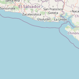
Map view of Los Volcanes National Park

Use this park location map to pinpoint Los Volcanes National Park in El Salvador, understand its exact geographic position, and read its mapped placement within the surrounding landscape more clearly.

Pigeon | © OpenStreetMap contributors
Park atlas

Browse comparable protected landscapes across El Salvador, tracing the spread of volcanic terrain and highland ecosystems.

Explore Nearby National Parks and Protected Areas: Los Volcanes and Surrounding Geography

After exploring Los Volcanes National Park, browse other national parks and protected areas within El Salvador and the broader region. This expanded view offers geographic context, allowing you to compare diverse conservation landscapes, map regional ecological patterns, and trace the spread of protected zones.
Stylized illustration of a mountain valley with waterfall, dense forest, and trees
National parkAhuachapán Department
About 36 km away#1 closest

West

El Imposible National Park: National Park Protected Landscape and Regional Geography Exploration

Atlas context and mapped boundaries for El Imposible National Park.

Delve into the protected landscape of El Imposible National Park, a key national park located within Ahuachapán Department, El Salvador. This resource provides detailed information on its geographic setting, mapped park boundaries, and its role within the regional natural context. Understand the essence of this protected natural area through structured atlas data, offering a unique lens for exploring its conservation significance and landscape features.

Area
38.2 km²
Established
1989
IUCN
II
Relief
Mountain
National parkEl Salvador
About 38 km away#2 closest

East

El Boquerón National Park: National Park Atlas, Mapped Boundaries, and Regional Geography

Explore El Salvador's protected volcanic terrain and landscape.

Delve into the protected landscape of El Boquerón National Park, a significant national park in El Salvador. This resource provides detailed map context, focusing on the park's geographic boundaries and its position within the country's volcanic region. Understand the atlas-driven discovery value and unique regional setting of this protected area.

Area
2.05 km²
Established
2008
IUCN
II
Relief
Mountain
National parkHonduras
About 72 km away#3 closest

Northeast

Montecristo Trifinio National Park: Honduras National Park and Protected Landscape Atlas

Explore its mapped boundaries and regional geographic context.

Delve into the protected landscape of Montecristo Trifinio National Park, a designated national park within Honduras. This resource provides critical atlas-level information, detailing the park's geographic scope, mapped boundaries, and its significance as a protected natural area. Understand the terrain and landscape context to appreciate its unique role in the region's conservation framework and its place within the structured exploration of national parks.

Area
54 km²
Established
1987
IUCN
II
Relief
Mountain
Biosphere reserveChiquimula Department
About 72 km away#4 closest

Northeast

Trifinio Biosphere Reserve: A Transboundary Protected Landscape in Chiquimula Department

Highland cloud forests and tri-national mountain terrain exploration

Trifinio Biosphere Reserve represents a significant protected area within Chiquimula Department, featuring the mist-cloaked Montecristo massif. As a foundational transboundary landscape, it preserves critical highland oak and laurel forests that span the borderlands of Guatemala, Honduras, and El Salvador. Access detailed geographic context and map-based insights into this essential Central American mountain refuge.

Area
221.79 km²
Established
1987
IUCN
VI
Relief
Mountain
National parkEl Salvador
About 75 km away#5 closest

Northeast

Montecristo National Park: El Salvador's Protected Landscape and Geographic Identity

Explore its mapped boundaries and regional terrain.

Montecristo National Park is a vital protected area that anchors a specific geographic identity within El Salvador. This MoriAtlas entry provides an atlas-driven view of the park, highlighting its mapped boundaries and the characteristics of its natural terrain. Understanding Montecristo National Park's protected status offers insight into the region's geography and its place within Central America's broader landscape.

Area
19.73 km²
Established
2008
IUCN
II
Relief
Mixed relief
National parkLempira Department
About 115 km away#6 closest

Northeast

Celaque National Park: Mapped Protected Landscape within Lempira Department

National Park Protected Area & Geographic Context

Celaque National Park represents a key protected landscape situated in the Lempira Department of Honduras. This entry offers detailed atlas information, focusing on the park's identity as a national park and its mapped geographic extent. Users can explore the protected boundaries and understand its place within the regional terrain, providing essential context for geographic discovery.

Area
266.31 km²
Established
1987
IUCN
II
Relief
Mountain
National parkGuatemala
About 130 km away#7 closest

Northwest

Naciones Unidas National Park: Guatemala's National Park Geographic Identity

Explore protected landscape and mapped terrain within Guatemala.

Naciones Unidas National Park represents a key protected area within Guatemala, offering a distinct geographic identity for atlas exploration. This page focuses on its mapped boundaries and its significance as a national park, providing insight into its landscape context and regional setting. Users can delve into its specific geography for structured understanding of protected natural areas.

Area
4.91 km²
Established
1955
IUCN
II
Relief
Mixed relief
National parkHonduras
About 152 km away#8 closest

Northeast

Cerro Azul de Copán National Park: Honduras's Highland Cloud Forest Protected Area

Explore mapped geography and montane landscape context.

Cerro Azul de Copán National Park, located in the highlands of western Honduras, is a national park defined by its mountainous terrain and distinctive cloud forest environment. Rising to elevations of over 2,200 meters, the park preserves a crucial highland ecosystem known for its biodiversity and role in watershed protection. Its mapped geography offers insight into the unique montane forest structures and the broader natural landscape of Central America. Discover the protected land's specific environmental characteristics and its place within the region's atlas.

Area
154.6 km²
Established
1987
IUCN
II
Relief
Mountain

Common questions about visiting, size, designation, and location context for Los Volcanes National Park

Los Volcanes National Park FAQs for park facts, access, geography, and protected area context

Find quick answers about Los Volcanes National Park, including protected-area facts, park geography, trail and visitor context, and how the park fits into its surrounding country and regional landscape.
MoriAtlas Explorer

Continue Your Protected Areas Search Across the Global Atlas

Deepen your exploration by continuing the structured search for national parks and protected areas worldwide. Utilize the comprehensive filtering capabilities to compare different conservation landscapes and refine your understanding of global park geography. Discover more about the distribution and characteristics of protected natural areas.

Global natural geography

