Mori Atlas logo
National parkManu National Park

Discover the geographic boundaries and mapped terrain of this critical protected area.

Manu National Park: Peru's National Park and Protected Landscape in Madre de Dios Region

(Parque Nacional del Manu)

Manu National Park stands as a significant protected natural area within Peru's Madre de Dios Region. This page provides detailed geographic context, focusing on the park's mapped boundaries and the surrounding natural landscape. Explore its identity as a national park within a structured atlas framework, offering a factual basis for understanding its unique protected-area significance and regional placement.

Amazon rainforestCloud forestUNESCO World Heritage SiteBiosphere reserveBiodiversity hotspotTropical wilderness

Manu National Park

National park

Park overview

Structured park overview, official facts, and landscape profile for Manu National Park

Manu National Park park facts, protected area profile, and essential visitor context

Review the core facts for Manu National Park, including designation, size, terrain, visitor scale, habitats, and operating context in one park-focused overview.

About Manu National Park

Manu National Park represents a cornerstone of global conservation, protecting an unparalleled spectrum of life in southeastern Peru. The park's enormous extent and minimal human disturbance have allowed ecological processes to continue largely uninterrupted, creating a reference point for understanding intact Amazon and Andean ecosystems. The Manu River, the park's central waterway, flows from highland origins through the reserve, shaping the landscapes it traverses and providing habitat for aquatic species including the giant otter and both spectacled and black caimans. The park's zoning system reflects careful management priorities, with core areas preserving old-growth forest and indigenous territories while allowing carefully regulated access to specific visitor zones. Scientific research has been conducted within Manu since its establishment, with numerous research facilities supporting long-term ecological studies that have contributed substantially to understanding tropical biodiversity and forest dynamics.

Quick facts and research context for Manu National Park

Manu National Park occupies roughly 1.7 million hectares across two Peruvian regions, spanning from high Andean puna grasslands through cloud forest zones into lowland Amazon rainforest. The park protects over 4,300 plant species, more than 1,000 bird species, 160 mammal species, and significant populations of reptiles, amphibians, and fish. Several indigenous peoples, including the Yora, Mashco-Piro, Matsiguenka, Harakmbut, and Yine, inhabit the park's territory, with some groups living in voluntary isolation. Access is managed through distinct zones including a restricted research zone, reserved recreation areas, recuperation zones, and a cultural zone open to tourism.

Protection and recognition

Exploring documented terrestrial conservation status and global ecological designations.

Manu National Park Protection Status and International Recognition

Researchers can verify the official protection status, terrestrial management scope, and designation history established for Manu National Park in 1987. Map-based data highlights official global recognition including its status as a UNESCO World Heritage site and UNESCO Biosphere Reserve.

International recognition

Protection details

Protection scope
Terrestrial
Designated year
1987
Transboundary protection
No
Core area
17,162.95 km²
Buffer area
2,693.85 km²
Park context

Deeper park guide and search-rich context for Manu National Park

Manu National Park history, landscape, wildlife, and travel context

Explore Manu National Park through its history, landscape character, ecosystems, wildlife, conservation priorities, cultural context, and seasonal travel timing in a structured park guide built for atlas discovery and search intent.

Why Manu National Park stands out

Manu is celebrated as one of the most biodiverse places on the planet, protecting the complete ecological transition from Andean highlands to Amazonian lowlands within a single protected area. The park harbors extraordinary concentrations of wildlife including jaguar, giant otter, harpy eagle, and Andean cock-of-the-rock, alongside rare and endemic species found nowhere else. Its pristine river systems, oxbow lakes, and intact forest corridors provide critical habitat for endangered species and function as a living laboratory for scientific research. The park's canopy walkway and network of trails offer visitors rare access to witness this wilderness in its most untouched state.

Manu National Park history and protected-area timeline

Manu National Park was established by governmental decree on May 29, 1973, during the administration of General Juan Velasco Alvarado. The park's creation represented a bold commitment to preserving one of the most biologically rich regions in the Americas, recognizing that the area's ecological significance transcended national boundaries. In 1977, UNESCO designated Manu as a Biosphere Reserve, acknowledging its exceptional value for both conservation and scientific research. The park achieved World Heritage status in 1987, becoming recognized as a site of outstanding universal value. A significant expansion occurred in 2002 when the Peruvian government increased the park's extension to its current area, strengthening protection for ecological corridors and wilderness zones. The park is governed by SERNANP, Peru's national protected areas service, which manages access and conservation activities.

Manu National Park landscape and geographic character

The topography of Manu National Park encompasses dramatic elevation changes that shape distinct landscape zones throughout the reserve. The southern and eastern portions feature mountainous terrain with deep valleys and rushing creeks rising to elevations near 4,000 meters above sea level, characterized by steep slopes and rugged terrain. These highland areas transition through a middle elevation zone of cloud forest, where persistent mist and moisture support specialized vegetation adapted to this humid environment. The northwestern and lower reaches of the park consist of flat Amazon basin plains, where the terrain flattens and rivers meander through extensive forest. The Manu Road, stretching approximately 190 kilometers, provides the sole vehicle access connecting the highland and lowland sections of the park. Throughout the reserve, rivers have carved diverse habitats including oxbow lakes, swamps, and riparian corridors that add ecological variety to the landscape.

Manu National Park ecosystems, habitats, and plant life

The vegetation within Manu National Park represents one of the most comprehensive ecological gradients in protected areas worldwide. The park contains distinct vegetation zones including puna grassland at the highest elevations above 4,000 meters, high Andean forests dominated by species such as Polylepis and Podocarpus, cloud forests with their characteristic epiphyte-laden canopies, and extensive lowland Amazon rainforest in the lower elevations. Botanical surveys have documented plant species distributed across 162 families, 1,191 genera, and 4,385 identified species, with some forest plots recording as many as 250 tree species per hectare. The lowland rainforest features iconic Amazonian species including Brazil nut trees, ceiba, and diverse emergents that create the multi-layered canopy structure typical of healthy tropical forests. This botanical diversity supports the animal communities that make Manu a global conservation priority.

Manu National Park wildlife and species highlights

Manu National Park supports extraordinary wildlife populations across multiple taxonomic groups, reflecting the protected area's diverse habitats and minimal human disturbance. The mammal fauna includes apex predators such as jaguar and puma, alongside smaller carnivores like tayra, ocelot, and jaguarundi. Large herbivores including South American tapir, white-lipped and collared peccaries, and capybara inhabit the forest floors, while arboreal species such as Peruvian spider monkey, tufted capuchin, and various other primates traverse the canopy. The bird community exceeds 1,000 species and includes spectacular representatives like harpy eagle, scarlet and blue-and-yellow macaws, Amazonian pygmy owl, and the Andean cock-of-the-rock which inhabits the cloud forest zones. Reptile diversity includes both spectacled and black caimans, green anaconda, and numerous snake species, while the amphibian fauna features 155 documented species. Aquatic ecosystems support approximately 210 fish species and provide habitat for giant otters.

Manu National Park conservation status and protection priorities

Manu National Park's designation as both a World Heritage Site and Biosphere Reserve reflects its exceptional conservation significance at multiple scales. The protected area serves as a critical reservoir of biodiversity, preserving genetic resources and ecological processes that have been lost or degraded throughout much of the Amazon region. Its strict protection zones maintain old-growth forests and allow natural population dynamics to continue without significant human interference. The park's indigenous communities, including groups in voluntary isolation, are integral to the conservation framework, as their traditional territories function as de facto protection zones with minimal human impact. Climate regulation, carbon storage, and watershed protection are among the ecosystem services this vast forest tract provides to both local communities and the global environment. The 2009 extension of the World Heritage boundary strengthened protection for areas supporting critical ecological processes.

Manu National Park cultural meaning and human context

Several indigenous peoples inhabit the territory of Manu National Park, maintaining cultural practices and relationships with the land that predate modern conservation frameworks. The Yora, Mashco-Piro, Matsiguenka, Harakmbut, and Yine peoples have inhabited these lands for generations, with some groups, particularly the Mashco-Piro, continuing to live in voluntary isolation. These communities practice traditional land use patterns that have shaped, and in many cases maintained, the ecological characteristics of the area. The park's cultural zone allows for human settlement and nature tourism, while the restricted use zone preserves areas of particular significance to indigenous communities and grants access primarily to researchers. This approach recognizes that indigenous peoples and their knowledge systems are essential partners in long-term conservation of this landscape.

Top sights and standout views in Manu National Park

Manu National Park stands as one of the world's premier wilderness areas, protecting an intact Amazon ecosystem of extraordinary scope and biodiversity. The transition from Andean puna through cloud forest to Amazon lowland within a single protected area creates unparalleled opportunities to experience ecological change across dramatic elevation gradients. Wildlife viewing opportunities include encounters with jaguar, giant otter, harpy eagle, and numerous monkey species in their natural habitats. The park's network of trails, viewing platforms including an 18-meter tower, and canopy walkway provide access to forest layers that remain hidden in most wilderness areas. Research facilities support ongoing scientific discovery, making Manu a living laboratory where new species continue to be documented. The presence of indigenous communities in voluntary isolation underscores the park's ecological integrity and represents some of the last truly isolated human populations on Earth.

Best time to visit Manu National Park

The optimal period to visit Manu National Park spans from May through September, which represents the drier season in this region of Peru. During these months, rainfall decreases substantially, trails become more accessible, and wildlife becomes more concentrated around remaining water sources, enhancing observation opportunities. Temperatures in the lowland areas remain warm throughout the year, typically around 25°C, while the Andean zones experience cooler conditions that can drop to around 8°C. The wetter months from October through April bring higher water levels to rivers and increased precipitation, particularly in the northwestern sections where annual rainfall can exceed 8,000 millimeters. The wet season creates lush conditions but can restrict access to some areas and make wildlife viewing more challenging. Visitors should note that access to certain zones requires special permits and advance arrangements through the governing body SERNANP.
Monthly climate preview

Analyzing annual precipitation rhythms and temperature ranges across the protected landscape

Manu National Park Weather by Month and Long-Term Climate Normals

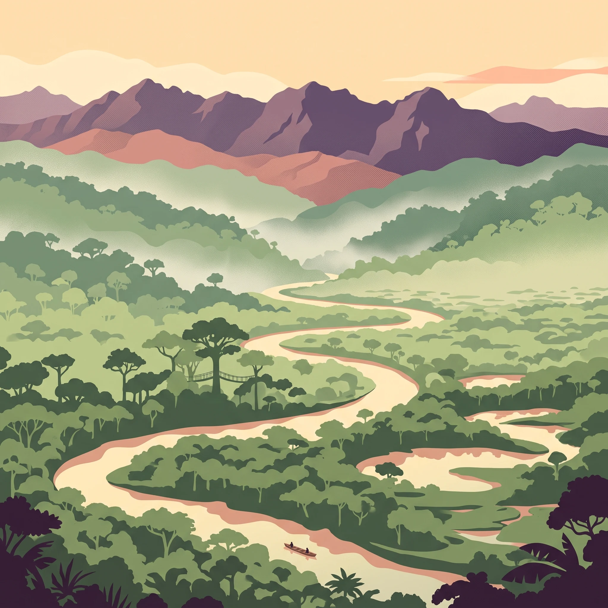
Long-term records at a representative elevation of 829.69 meters show a clear cycle of wet and dry phases, with average temperatures remaining between 22 and 26 degrees Celsius. Comparing the full twelve-month sequence reveals historical temperature limits and daily precipitation averages over a thirty-year climatology period.
Annual mean24 °C
23 °C26 °C
Jan23°
Feb23°
Mar23°
Apr23°
May24°
Jun24°
Jul24°
Aug25°
Sep26°
Oct26°
Nov25°
Dec24°
Warmest month
September

26.4 °C

Coolest month
February

22.8 °C

Wettest month
February

4.8 mm/day

Driest month
June

0.3 mm/day

Park location guide

Geography guide, regional context, and park location map for Manu National Park

Manu National Park park geography, regions, and map view in Peru

Understand where Manu National Park sits in Peru through a broader geographic reading of the surrounding landscape, nearby location context, and its mapped position within the national park landscape.

How Manu National Park fits into Peru

Peru is a megadiverse country in western South America with a population of over 34 million. It spans three distinct geographic regions: the Pacific coastal desert in the west, the Andes mountains running north to south, and the Amazon rainforest in the east. The country has one of the longest histories of civilization in the world, tracing back to the Caral-Supe civilization of the 10th millennium BCE, and was home to the Inca Empire before Spanish colonization in the 16th century.

Wider geography shaping Manu National Park in Peru

Peru is located in western South America along the Pacific coast. The country encompasses three major geographic regions: the coastal desert plains along the Pacific, the Andes mountain range extending from north to southeast, and the Amazon basin rainforest in the eastern interior. It shares borders with Ecuador and Colombia to the north, Brazil to the east, Bolivia to the southeast, and Chile to the south.

Map view of Manu National Park

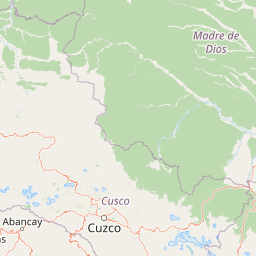
Use this park location map to pinpoint Manu National Park in Peru, understand its exact geographic position, and read its mapped placement within the surrounding landscape more clearly.

Pigeon | © OpenStreetMap contributors

Location context for Manu National Park

Cusco RegionMadre de Dios Region
Natural feature types

Explore the Named Natural Features and Geography of Manu National Park

Navigate the diverse natural landforms and water systems captured in the MoriAtlas collection for Manu National Park. Examine the connection between Andean highland terrain and lowland Amazonian basins through this structured geographic overview.
Recorded earthquake history

Review the Historical Earthquake Catalogue for Manu National Park

Access a structured collection of recorded earthquakes associated with the geography of Manu National Park. MoriAtlas provides this historical data to assist in reviewing past seismic activity patterns near the park boundaries through a simplified, easy to browse interface.

Manu National Park Earthquake History

Catalogued events

56 events

Strongest magnitude

Magnitude 7

Most recent event

Jun 23, 2025

This history includes earthquakes recorded inside the park or within 50 km of its borders

Park atlas

Discover additional protected landscapes, tracing geographic connections across Peru's Amazon basin and Andean cloud forest regions.

Explore Other National Parks and Protected Areas Near Manu National Park in Peru

Browse a curated list of other national parks and protected areas located geographically close to Manu National Park, encompassing adjacent Amazonian lowlands and high-altitude Andean cloud forest ecosystems. This comparison offers a broader understanding of Peru's diverse conservation landscapes and the regional spread of protected areas surrounding this biodiversity hotspot.
National parkPeru
Park boundaries overlap#1 closest

North

Alto Purús National Park: Peru's Protected National Park Landscape

Mapped boundaries and regional geographic context.

Investigate Alto Purús National Park, a designated national park within Peru. This detailed page provides essential context for understanding the park's geographic location, its protected status, and its role within the broader landscape of western South America. Explore the mapped features and regional setting that define this important conservation area.

Area
25,106.9 km²
Established
2004
IUCN
II
Relief
Mixed relief
Wildlife reserveMadre de Dios Region
4.9 km away#2 closest

Southeast

Amarakaeri Communal Reserve: Protected Geography and Amazonian Forest Mapping

Wildlife reserve in the Madre de Dios Region of Peru

Covering a large block of Amazonian forest, the Amarakaeri Communal Reserve marks the transition between flat lowland drainage basins and the rising slopes of the Peruvian Yungas. This protected area stands as a hallmark of indigenous-led conservation within the Madre de Dios Region, preserving natural terrain that ranges from dense riverine forests to Andean cloud forest vegetation. The reserve is also anchored by the Harakbut Face, a unique natural landmark formed by centuries of regional erosion.

Relief
Mixed relief
Climate
Tropical
Access
Access unknown
Scope
Terrestrial
National parkPeru
102 km away#3 closest

West

Otishi National Park: A Protected National Park Landscape in Peru's Geography

Explore the mapped boundaries and regional landscape of Otishi National Park.

Otishi National Park represents a significant protected area within Peru, offering a unique lens through which to explore regional geography and conservation landscapes. As a designated national park, it highlights the mapped boundaries and the natural terrain that defines this part of South America. Understanding Otishi National Park provides essential context for regional park discovery and the broader atlas of protected lands in Peru.

Area
3,059.73 km²
Established
2003
IUCN
II
Relief
Mountain
National parkPeru
111 km away#4 closest

Southeast

Bahuaja-Sonene National Park: A Major Amazon Frontier National Park in Peru's Geography

Explore its mapped protected landscape and diverse terrain.

Bahuaja-Sonene National Park is an extensive national park situated on the Amazon frontier in southern Peru, encompassing a crucial transition zone between lowland rainforest and higher-elevation forest ecosystems. Its diverse topography, from river valleys to mountainous slopes, creates varied natural landscapes. The park's protected boundaries are integral to the regional conservation strategy, offering a unique lens through which to study the mapped geography and ecological significance of this vast Amazonian protected area.

Area
10,914.2 km²
Established
1996
IUCN
II
Relief
Mixed relief
Wildlife reservePando Department
207 km away#5 closest

East

Reserva nacional de vida silvestre amazónica Manuripi: Protected Amazonian Wilderness

Map and geographic context of Pando Department wildlife reserves

Spanning over 700,000 hectares, this wildlife reserve safeguards representative Amazonian ecosystems. Explore the hydrological network of the Madre de Dios and Manuripi river basins, ancient Brazil nut stands, and diverse wetland formations that define this significant regional protected area.

Area
7,470 km²
Established
1973
Relief
Lowland
Climate
Tropical
Wildlife reservePeru
217 km away#6 closest

Northwest

El Sira Communal Reserve: Geographic Profile and Protected Landscape Context in Peru

Analyzing the Sira Mountain range and regional watershed boundaries

El Sira Communal Reserve sits at the intersection of the Andes and the Amazon, protecting a vast mosaic of habitats across Huánuco, Pasco, and Ucayali. Its geography is defined by deep river valleys, mountain ridges, and a significant altitudinal range that supports diverse wildlife communities. This resource provides a detailed look at the boundaries, terrain, and ecological importance of this major Peruvian protected area.

Area
6,164.13 km²
Established
2001
IUCN
VI
Relief
Mountain
National parkLa Paz Department
227 km away#7 closest

Southeast

Madidi National Park: National Park Protected Landscape and Geographic Atlas Entry

Explore mapped boundaries and regional context in La Paz Department.

Madidi National Park is a designated national park situated in Bolivia's La Paz Department. This detail entry offers a focused perspective on its protected landscape, its specific geographic setting, and its role within the larger atlas of natural areas. Understand the park's mapped boundaries and its contribution to the regional geography, providing a foundation for structured discovery of Bolivia's protected lands.

Area
18,957.5 km²
Established
1995
IUCN
II
Relief
Mixed relief
Protected areaPasco Region
259 km away#8 closest

West

San Matías, San Carlos Protection Forest: Geographic Boundaries and Protected Landscape Context

A vital watershed corridor in the Pasco Region of central Peru.

San Matías, San Carlos Protection Forest protects fragile mountain soils and downstream infrastructure from erosion and flooding. Stretching from 300 to 2,250 metres in elevation, the reserve supports a continuous block of highland habitat that serves as a bridge between the Peruvian Yungas and Ucayali moist forest ecoregions, while acting as a cornerstone of the Oxapampa-Asháninka-Yánesha Biosphere Reserve.

Area
1,458 km²
Established
1987
IUCN
VI
Relief
Mountain

Common questions about visiting, size, designation, and location context for Manu National Park

Manu National Park FAQs for park facts, access, geography, and protected area context

Find quick answers about Manu National Park, including protected-area facts, park geography, trail and visitor context, and how the park fits into its surrounding country and regional landscape.
MoriAtlas Explorer

Continue Your Protected Areas Search Across the Global Atlas

Deepen your exploration by continuing the structured search for national parks and protected areas worldwide. Utilize the comprehensive filtering capabilities to compare different conservation landscapes and refine your understanding of global park geography. Discover more about the distribution and characteristics of protected natural areas.

Global natural geography