
Why Manuripi Amazonian Wildlife National Reserve stands out
Manuripi is best known as Bolivia's principal national stronghold of representative southwestern Amazonian rainforest, a vast lowland wilderness where extensive stands of Brazil nut trees, rubber trees, ceiba, and countless palm species grow alongside one of the country's most complete assemblages of large Amazonian mammals and birds. The reserve is also distinguished for the exceptional diversity of its surface waters: a network of whitewater rivers descending from the Andes, blackwater streams draining local terra firme forests, oxbow lakes such as Lake Bay, and extensive palm-dominated wetlands that together host a remarkable fish fauna, including commercially important species like surubí, pacú, and paiche. Combined with its rarity as a protected block of the Bolivian Amazon, this ecological richness is what defines the reserve's identity at national and regional scales.
Manuripi Amazonian Wildlife National Reserve history and protected-area timeline
The Manuripi Reserve was established on December 20, 1973, through Supreme Decree 11252, originally under the name Reserva Nacional Amazónica del Manuripi-Heath. From its inception, the area's purpose was the permanent protection of the Amazonian tropical moist forest ecosystem, its watersheds, and the species they sustain, along with the promotion of sustainable use of wild resources for the benefit of the local population.
For more than two decades after its creation, however, the reserve was not actively administered. The first comprehensive attempt to rethink its management came in 1992, when an integral study for the restructuring of the area was financed through the PL-480 program. This study, carried out by Liga de Defensa del Medio Ambiente (LIDEMA) for the Corporación Regional de Desarrollo de Pando (CORDEPANDO), included a first development and reorganization plan for the protected area.
The decisive shift came in the late 1990s. Following the formulation of the Land Use Plan (PLUS) for the department of Pando in 1996, which recommended reducing the reserve's extent from its original approximately 1.892 million hectares, the National Directorate of Biodiversity Conservation commissioned a new limits and recategorization study in 1997. In April 1998, HERENCIA and the Universidad Amazónica de Pando presented the results, proposing that the reserve be delimited between the Manuripi-Orthon rivers to the north and the Madre de Dios River to the south, with a surface of approximately 1.2 million hectares, and suggesting the recategorized name Reserva Nacional de Vida Silvestre Amazónica Manuripi.
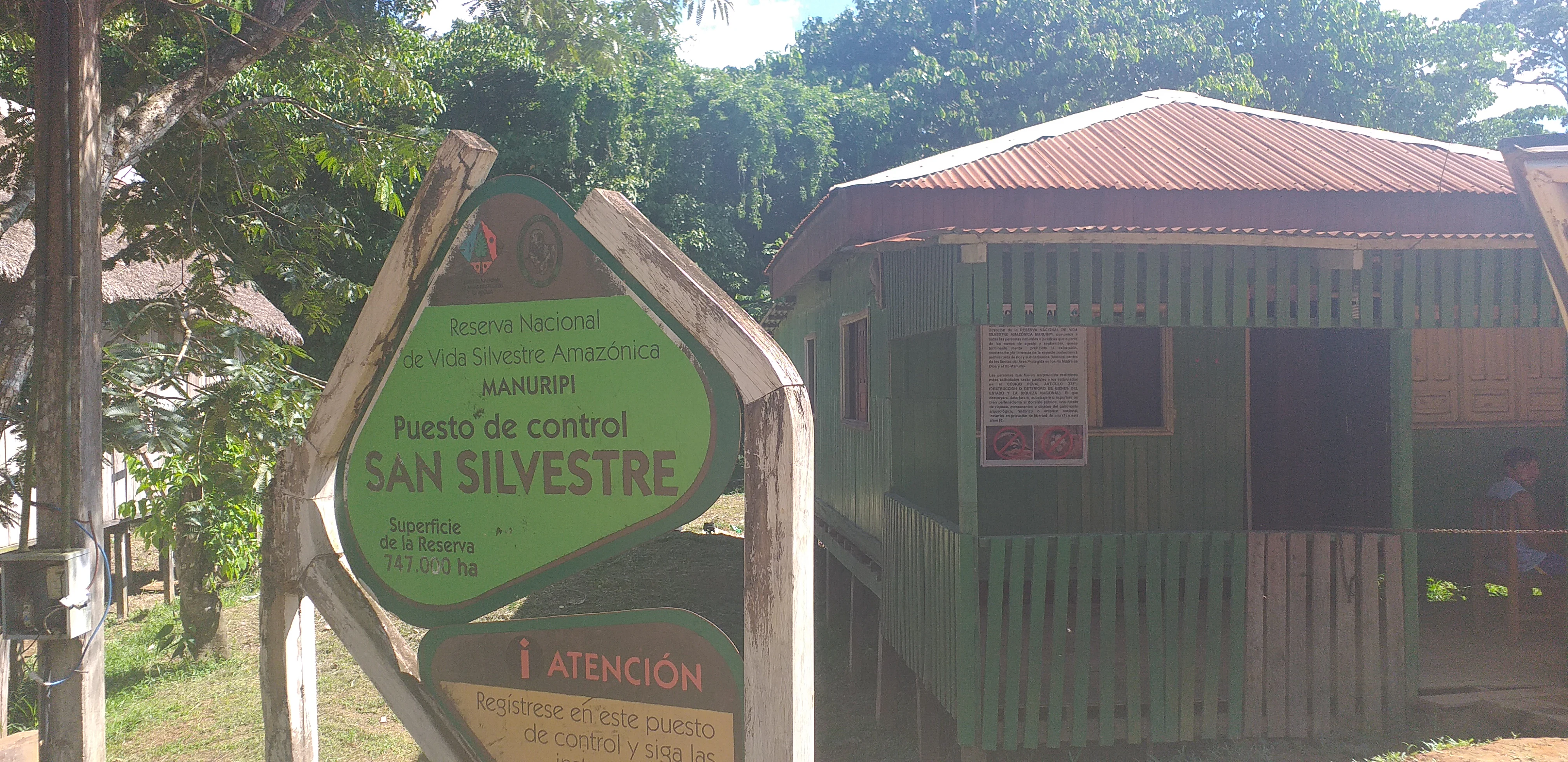
In July 1999, SERNAP formally initiated administrative and technical management of the area, almost 26 years after its creation. The process of adjusting the legal framework was completed in September 2000 with the promulgation of Supreme Decree 25906, which both renamed the reserve and reduced its size to about 747,000 hectares. In December 2001, WWF-Bolivia and HERENCIA signed an agreement to support the formulation of the reserve's management plan, leading to the presentation of a draft plan in November 2002 and a series of revisions by SERNAP between 2003 and 2004. The first Management Committee of the Reserve was established in 2008, at the request of local communities, fulfilling one of the long-standing objectives of SERNAP's institutional model.
Manuripi Amazonian Wildlife National Reserve landscape and geographic character
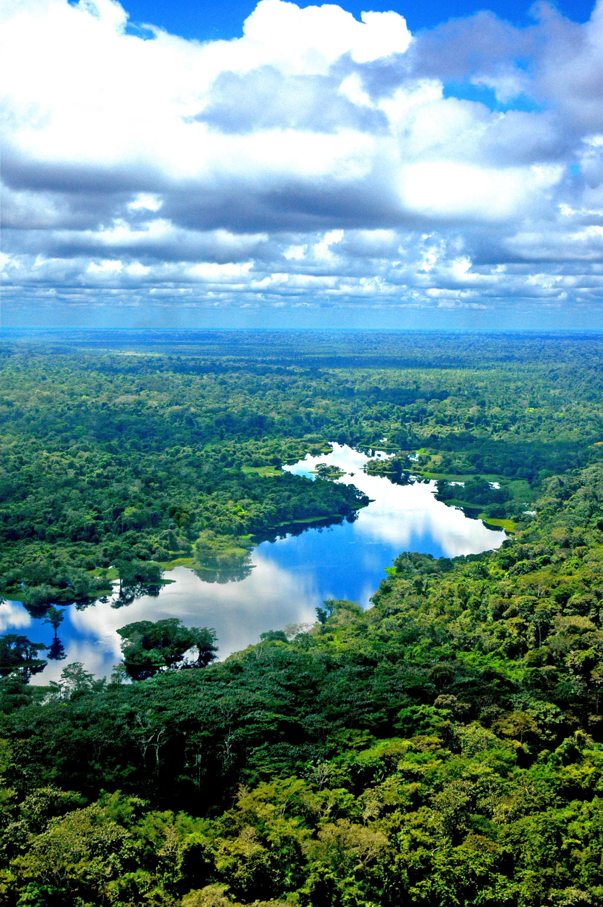
The Manuripi Reserve occupies a vast, largely flat stretch of the southwestern Amazon basin, where the low gradient of the terrain and the influence of sedimentary materials have produced a landscape dominated by terra firme forest, floodplains, oxbow lakes, and palm-rich wetlands. From a morphotectonic standpoint, the reserve sits between the Amazonian Craton and the Andean geosyncline, in a pericratonic basin unit shaped by Holocene sediments carried down from the Peruvian and Bolivian Andes.
This geological substrate gives rise to gently undulating to flat relief, occasionally rolling, and to a mosaic of soils ranging from compacted tertiary clays of the Cobija formation to the highly plastic clays and friable sands of the Candelaria formation on the right bank of the Madre de Dios, and finally to broad alluvial deposits of unconsolidated sands, silts, and clays along the floodplains of the Madre de Dios and Manuripi. The interplay of these substrates and the slow-moving rivers produces the deep, fertile soils that support some of the most impressive continuous Amazonian forest stands in Bolivia.
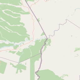
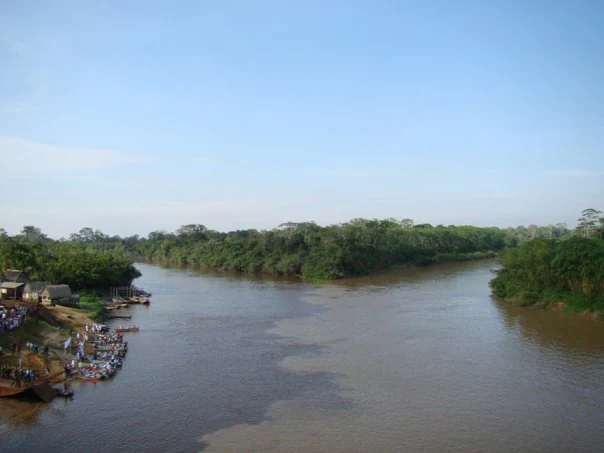
The surface hydrology is one of the reserve's most striking features. The Madre de Dios, Manuripi, Tahuamanu, and Orthon rivers form the principal drainage, supplemented by tributaries such as the Malecón, Bay, Florida, and Tulapa streams. Lake Bay, an oxbow lake of fluvial origin, is the largest lacustrine body in the reserve, while a wide array of curichis, yomomales, swamps, bajíos, and palm bogs extends across the floodplain. Two distinct water types characterize this network: dark, acidic, low-sediment blackwaters from local terra firme streams, and sediment-rich whitewaters descending from the Andes, with the Manuripi itself shifting between the two regimes depending on the season.
Manuripi Amazonian Wildlife National Reserve ecosystems, habitats, and plant life
The ecosystems protected within Manuripi belong to the southwestern Amazonian moist tropical forest biome, organized into two principal formations: terra firme forests on well-drained uplands and alluvial plain forests along the major rivers. These formations are further divided into four main structural groups: low forest without emergents, low forest with emergents, medium forest, and tall forest, encompassing eleven distinct plant community types.
Terra firme forests dominate much of the reserve and harbor characteristic species such as Brazil nut (Bertholletia excelsa), isigigo, pacay, the sandbox tree (Hura crepitans), arrayán, ceiba or mapajo, almendrillo amarillo, goma (Hevea brasiliensis), mara macho (Cedrelinga catenaeformis), miso amarillo, and a variety of other timber and non-timber species. The palm component is especially notable: the reserve hosts extensive palmares of Mauritia flexuosa, multiple species of chonta (Astrocaryum), majo, the vegetable ivory palm (Phytelephas macrocarpa), motacú, and the asaí palm, which faces pressure from commercial palm-heart exploitation.
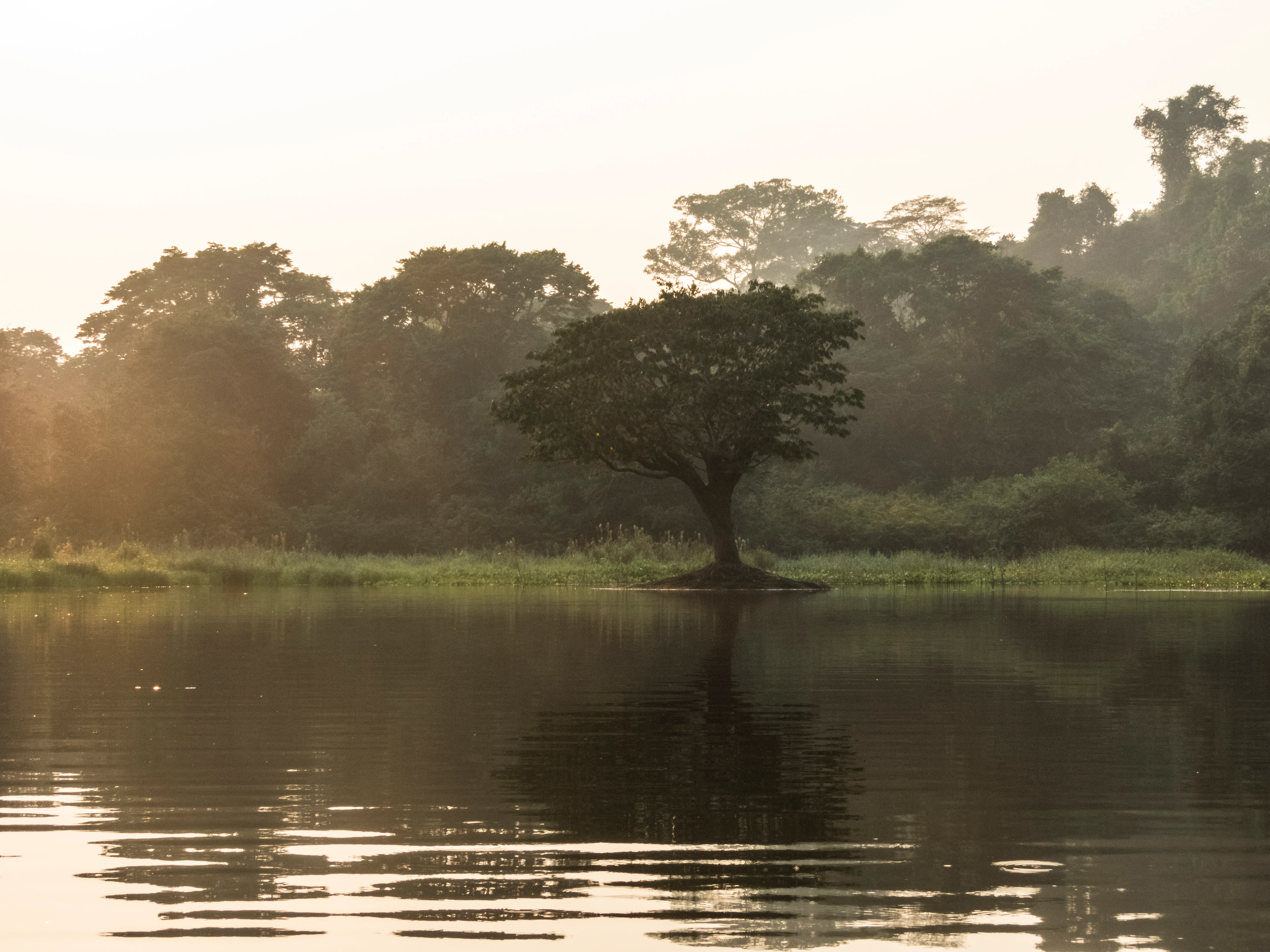
The forested wetlands that fringe the rivers and lakes create a second ecological dimension of equal importance. Palm swamps dominated by Mauritia flexuosa, riverine margins flooded during the rainy season, and the curichis and bajíos associated with poor drainage support a distinct set of plant communities, while functioning as critical habitats for fish, amphibians, and aquatic birds. Together, these formations sustain one of the most complete representations of the southwestern Amazonian ecosystem at a national level in Bolivia.
Manuripi Amazonian Wildlife National Reserve wildlife and species highlights
The fauna of the Manuripi Reserve is exceptionally rich by Bolivian standards. The most comprehensive biodiversity inventory, conducted by HERENCIA in 2003 as part of the management plan preparation, recorded approximately 150 mammal species, 501 bird species, 160 herpetofauna species (83 amphibians and 77 reptiles), and 112 fish species, placing the area among the most diverse regions for wildlife in the country and on par with renowned sites such as Alto Madidi and Tambopata.
The avifauna is particularly notable. Some 501 species distributed across 62 families have been documented, with Tyrannidae, Thamnophilidae, Thraupinae, and Furnariidae together accounting for roughly 37 percent of the records, alongside iconic raptors and large forest birds. Mammals include the full suite of characteristic Amazonian species: jaguar, puma, ocelot, margay, the short-eared fox (Atelocynus microtis), giant otter, giant armadillo, tapir, tamandua, white-lipped and collared peccaries, several deer species, capybara, paca, and agouti. Primates are well represented by spider monkeys, red howler monkeys, Goeldi's monkey, and a variety of callitrichids.
The herpetofauna is among the most diverse in Bolivia. Amphibians dominate the records, with numerous frogs, alongside snakes, lizards, turtles, and caimans including the black caiman (Melanosuchus niger). The reserve's rivers harbor important commercial fish species such as surubí, pacú, and the giant paiche, the latter subject to particular attention due to its ecological impact, its potential for controlled use, and the contamination risks associated with gold mining activity in the Madre de Dios basin. Invertebrates, although less studied, follow typical Amazonian patterns with notable diversity among butterflies, beetles, hymenopterans, and dragonflies.
Manuripi Amazonian Wildlife National Reserve conservation status and protection priorities
The Manuripi Reserve is, in conservation terms, the single nationally protected area that best represents Bolivia's southwestern Amazonian moist tropical forest ecosystem. Its designation recognizes both the extraordinary biological richness of the region and the irreplaceable role it plays in maintaining the ecological and evolutionary processes of one of the world's most important forest biomes.
The reserve safeguards an enormous block of contiguous forest, protecting watersheds that feed the Madre de Dios and ultimately the Amazon basin, conserving genetic resources of high-value commercial species such as the Brazil nut and rubber tree, and maintaining habitat connectivity for wide-ranging species such as the jaguar, the giant otter, the tapir, and the harpy eagle. Its location, integrated into the broader Madre de Dios, Acre, and Pando landscape, makes it a key node in transboundary conservation efforts across the southwestern Amazon.
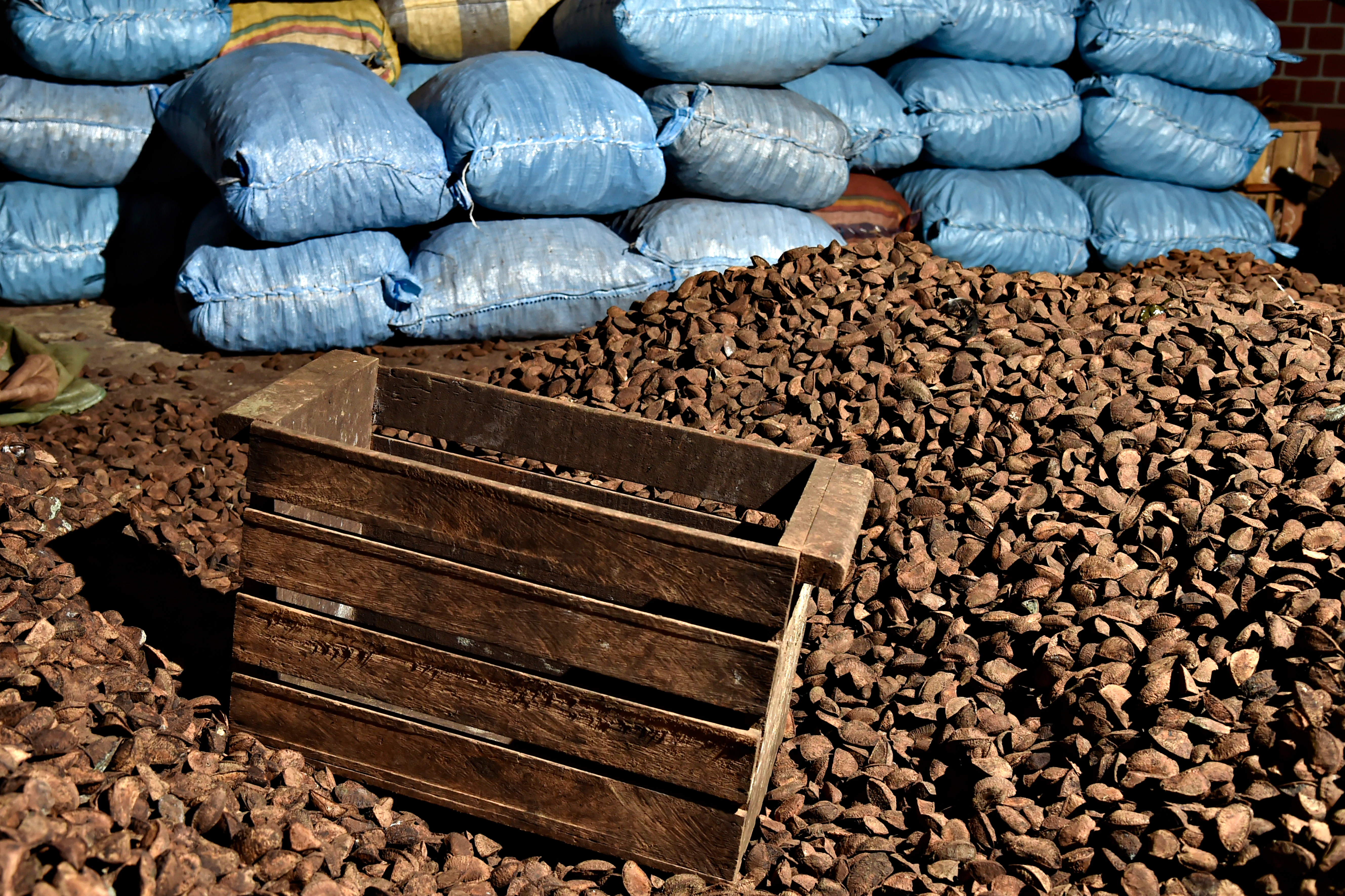
Beyond strict biodiversity protection, Manuripi's conservation model is notable for integrating sustainable use. The reserve's founding decree explicitly promotes the long-term productive use of wild resources in ways that improve local livelihoods, supporting the traditional Brazil nut harvest as a stabilizing economic activity that gives the local population a direct stake in keeping the forest standing. The reserve has also been the focus of capacity-building partnerships with organizations such as WWF-Bolivia and HERENCIA, and was the subject of Bolivia's first locally requested Management Committee in 2008, reflecting an evolving model of participatory protection.
Manuripi Amazonian Wildlife National Reserve cultural meaning and human context
Although no indigenous communities are today permanently settled within the boundaries of the Manuripi Reserve, the territory carries a layered human history. Until roughly 1970, the forests and rivers of the area, especially the Madre de Dios basin, were periodically visited and used by Ese'ejja, Araona, Cavineño, and Chácobo peoples, whose livelihoods revolved around hunting, fishing, gathering, and riverine navigation.
The contemporary population of the reserve is largely descended from settlers who arrived during the rubber boom at the turn of the 20th century and, after its collapse, were drawn to the area by the Brazil nut economy. Many families retain indigenous ancestry two or three generations back, a legacy of the forced displacements that fed rubber-tapping labor in Pando. The present settlement pattern reflects this history: barracas, or privately operated Brazil nut extraction centers hosting seasonal workers, coexist with established communities of peasant families with small plots for subsistence agriculture.
The annual castaña harvest, the zafra, which runs roughly from December through March, remains the single most important cultural and economic event in the reserve. During these months the population swells dramatically, as seasonal workers migrate from places such as Riberalta into the forests to harvest Brazil nuts, continuing a tradition that defines both regional identity and the relationship between human communities and the forest.
Top sights and standout views in Manuripi Amazonian Wildlife National Reserve
The Manuripi Reserve stands out for the sheer scale and representativeness of the Amazonian forest it protects. Few protected areas in Bolivia offer such a complete example of the southwestern Amazonian ecosystem at landscape level, and the reserve's combination of extensive terra firme forest, large rivers, oxbow lakes, and palm wetlands produces a wilderness of rare continuity.
Equally distinctive is the cultural-economic bond between the reserve and the Brazil nut economy. Manuripi's forests harbor some of the country's most productive castaña stands, and the seasonal rhythm of the zafra has shaped both the settlement pattern inside the area and the broader identity of Pando. The reserve also serves as a regional hub for transboundary conservation, linking Bolivia to the protected area networks of Peru's Madre de Dios and Brazil's Acre, and providing a foundation for joint efforts to safeguard the southwestern Amazon under increasing pressure from infrastructure, mining, and climate change.
Best time to visit Manuripi Amazonian Wildlife National Reserve
The character of any visit to the Manuripi Reserve is shaped strongly by the alternation between the dry season and the rainy season. The dry months, generally falling between roughly May and September, offer easier navigation on the rivers and trails, lower water levels that expose riverbanks and beaches, and more comfortable conditions for overland movement, though they also coincide with the coolest period of the year, when surazos, or southern cold fronts, can bring sudden drops in temperature.
The rainy season, roughly from November through April, transforms the landscape: rivers swell, the flooded forests and palm bogs expand, and the forest is at its most lush and biologically active. These months align with the castaña harvest season, when the reserve is busy and access remains primarily via river and through the barracas and communities. The transitional months, including the August to November window at Lake Bay, are particularly known for visible fish schools and heightened wildlife observation opportunities, making them a focal point for visitors interested in aquatic fauna and birdlife.