Why Manusela National Park stands out
Manusela National Park is best known for its extraordinary bird endemism, particularly the salmon-crested cockatoo which uses the park as its last stronghold. The park protects significant populations of endemic bird species including the eclectus parrot, purple-naped lory, Moluccan king parrot, and the Seram masked owl. Seram island's montane forests support the greatest concentration of endemic mammals of any island in the region, with nine species found nowhere else. The park also protects extensive karst landscapes and Indonesia's deepest cave system.
Manusela National Park history and protected-area timeline
The conservation history of Manusela National Park began in 1972 when two areas in central Seram were designated as nature reserves. Wae Nua covered 20,000 hectares while Wae Mual encompassed 17,500 hectares. Following a comprehensive survey in 1978, a proposal emerged to unite these protected areas into a single national park that would better protect the island's biodiversity. This proposal took nearly two decades to realize, with Manusela National Park finally established in 1997. The park now represents approximately 11 percent of Seram island's total land area. The establishment came at a critical time as the island faced increasing pressure from logging activities. The park remains relatively young in conservation terms, and its management continues to address the challenges of protecting endemic species while supporting local communities.
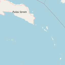
Manusela National Park landscape and geographic character
Manusela National Park encompasses remarkable topographic and ecological diversity across Seram island. The park protects six mountain peaks, with Mount Binaiya standing at 3,027 meters as the highest point on the island. The landscape transitions from coastal areas through extensive lowland forests to montane zones at higher elevations. The park contains significant karst terrain featuring dramatic limestone formations. Near the coast at Saleman-Sawai, the Goa Hatusaka cave system extends to become the deepest cave in Indonesia. Swamp forests occupy low-lying areas while seasonal variation in precipitation creates distinct wet and dry season characteristics. The island's mountainous interior has produced deep valleys and steep ridges that contribute to the park's scenic complexity and ecological zonation.
Manusela National Park ecosystems, habitats, and plant life
The park protects a remarkable range of forest ecosystems that transition from coastal vegetation through swamp forest, lowland rainforest, to montane rainforest. The coastal zone features mangrove and beach forest communities including species of Avicennia and Bruguiera. Lowland forests contain valuable timber species such as Shorea selanica and Dryobalanops, while swamp forests develop in poorly drained areas. Montane forests occur at higher elevations and support different community compositions suited to cooler, cloudier conditions. The park contains numerous Pandanus species and various orchids across its elevation zones. The diversity of habitats supports the island's extraordinary endemism, with vegetation structure varying significantly from the coastal fringe to the montane summits.
Manusela National Park wildlife and species highlights
Manusela National Park protects one of the most significant concentrations of endemic wildlife in Indonesia. Of 118 bird species recorded on Seram island, 15 are endemic including the iconic salmon-crested cockatoo, eclectus parrot, purple-naped lory, Moluccan king parrot, lazuli kingfisher, grey-necked friarbird, bicoloured white-eye, Boano monarch, and Seram masked owl. The park supports both Asian and Australasian mammal lineages, with Seram's montane forests supporting the highest number of endemic mammals of any island in the region. Thirty-eight mammal species occur in the park, including nine endemic or near-endemic species. The Seram bandicoot, Manusela mosaic-tailed rat, spiny Ceram rat, Ceram rat, and both the Moluccan flying fox and Seram flying-fox represent significant conservation priorities.
Manusela National Park conservation status and protection priorities
Manusela National Park serves as the last stronghold for several critically threatened species, most notably the salmon-crested cockatoo. The park was established to protect the island's unique biodiversity and represents 11 percent of Seram's land area. However, significant threats challenge conservation efforts. Deforestation poses the primary danger, with logging concessions covering 48 percent of Seram's forests, and illegal logging has occurred within park boundaries. The illegal wildlife trade targeting the salmon-crested cockatoo has pushed this species to the brink of extinction. In 2006, nine confiscated cockatoos were released into the park for the first time, representing a positive development in conservation work. The park's protection of endemic species makes it globally significant for biodiversity conservation.
Manusela National Park cultural meaning and human context
Four villages exist within Manusela National Park: Manusela, Ilena Maraina, Selumena, and Kanike. The Manusela people are the local ethnic group inhabiting these lands, and their language is one of the Seram languages. The name Manusela carries cultural significance, translating to bird of freedom in the local language. This linguistic heritage reflects the region's identity and connection to the natural environment. Traditional land use practices have shaped the landscape over generations, and communities maintain cultural ties to the forests and mountains within the park. The relationship between the Manusela people and their environment represents an important dimension of the park's cultural landscape.
Top sights and standout views in Manusela National Park
The exceptional bird endemism of Manusela National Park makes it globally significant, with 15 endemic bird species including the threatened salmon-crested cockatoo. The park protects Indonesia's deepest cave at Goa Hatusaka and contains extensive karst landscapes. Mount Binaiya offers challenging climbing opportunities to the island's highest point. The montane forests support remarkable mammalian endemism with nine restricted species. The park's establishment from two earlier reserves demonstrates evolving conservation commitment. The release of confiscated cockatoos in 2006 represents successful anti-trafficking efforts.
Best time to visit Manusela National Park
The optimal time to visit Manusela National Park depends on weather patterns and specific interests. The dry season generally offers more accessible trails and clearer conditions for hiking and wildlife observation. Bird activity may be more observable during certain seasons when species are more active and visible. The wet season brings abundant rainfall that sustains the park's lush rainforest character but may restrict some trail access. Montane areas experience cooler temperatures year-round. Visitors interested in cave exploration should consider seasonal water levels that affect Goa Hatusaka.